
|
|
Mountain/Rock |
|---|---|
|
|
34.23420°N / 112.3679°W |
|
|
Yavapai |
|
|
Spring, Fall |
|
|
7628 ft / 2325 m |
|
|
Overview
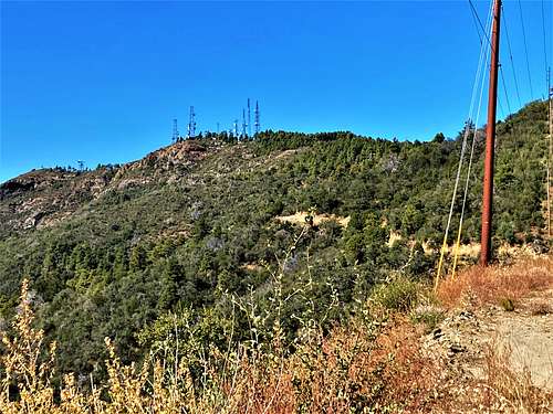
Towers Mountain is the highest peak in the southern Bradshaw Mountains, which rise above the town of Crown King. It has a prominence of over 1,900’. It has towers on its summit and a road leading all the way to the top. If hiking Towers Mountain from Crown King, it isn’t too far a walk and makes for an excellent day hike.
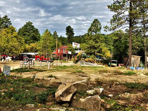
Crown King is a small town of a little over 100 people nestled in the forests between Phoenix and Prescott. A dirt road leads to the town which is curvy and not tremendously well-graded. Driving there takes a while from any direction.
Towers Mountain is best hiked in spring or fall. Even in the middle of the forest, summers are quite warm and there is a fire threat during those months.
Getting There
From the Phoenix Metro area, take I-17 to either the BumbleBee exit or the Bloody Basin exit. Theyare similar drive time, and whichever is faster depends on traffic. Once off the exit, just head west and ajunction will take you north through Bumble Bee, or if coming from BloodyBasin, you’ll head south from the junction. It is best to use GPS and follow directions to the small town of Cleator,which has a few homes and a small bar. Once in Cleator, continue for about 13 miles into Crown King. Park in the overflow lot accessed beforecrossing the bridge into town. 2WD vehiclescan make it to Crown King, but it is easier with high clearance or an SUV.
Driving to the summit is better suited for high clearanceand 4WD vehicles. The area is verypopular for ATVs.
Route
Once at the parkingarea, there are two routes, which present a loop option.
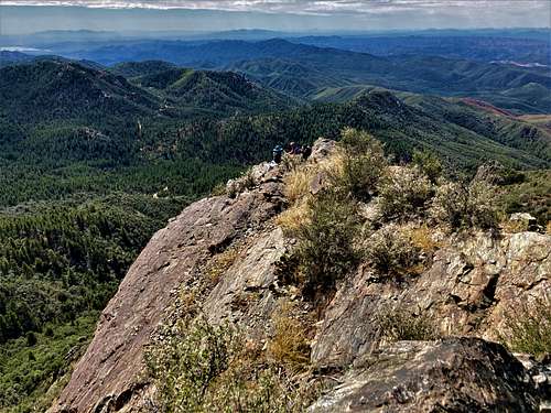
The most direct wayis to take Towers Mountain Road. Fromthe main part of town take Kings Mine Road. About 100 yards up the road there is Y-junction. The left fork goes up to Towers Mountain inabout 4.7 miles. It is useful to have aGPS to make sure you stay on the main road. The elevation gain is about 1,900’.
If taking the rightfork, you can head up to the ridge top in about 3 ½ miles from the starting point. Once there, you can take in viewpoints alongthe way and cross the entire ridge all the way to Towers Mountain. This adds distance and elevation gain but canbe done as a loop hike in about 11 ½ miles and adds another 700’.
Red Tape
There are locations on the mountain with No Trespassing signs. These signs are not preventing access to Towers Mountain, just the cabins and homes along the road. There aren’t any organized campgrounds in Crown King.
External Links
Scott Surgent Trip Report: http://www.surgent.net/highpoints/az/range/towers.html