OVERVIEW to and until HISTORY
From and since positioning Ilario Antonio GARZOTTO Point CROSS (September 29th, 1994) to and until the positioning of Gianni JUNOD Point CROSS
WARNING SIGNS & SYMPTOMS
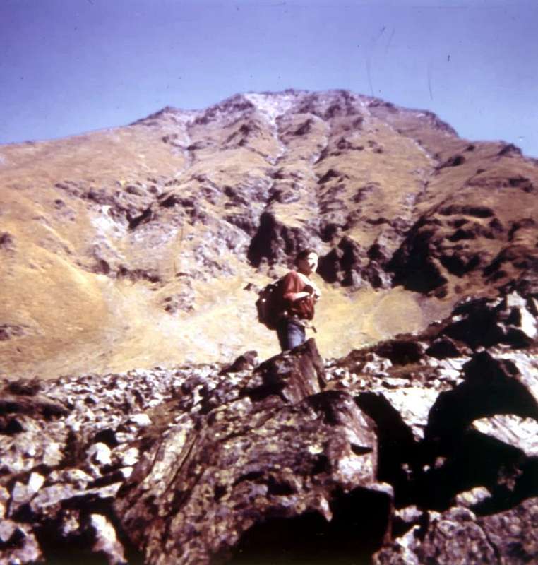
PLACE RECONNAISSANCE
1996 (Sep. 29th): Reconnaissance for
positioning of
Cross on the Gianni Junod Points,
South Summit (
dead in Aiguille Jean Joseph Croux, SE Wall, Ottoz route, with
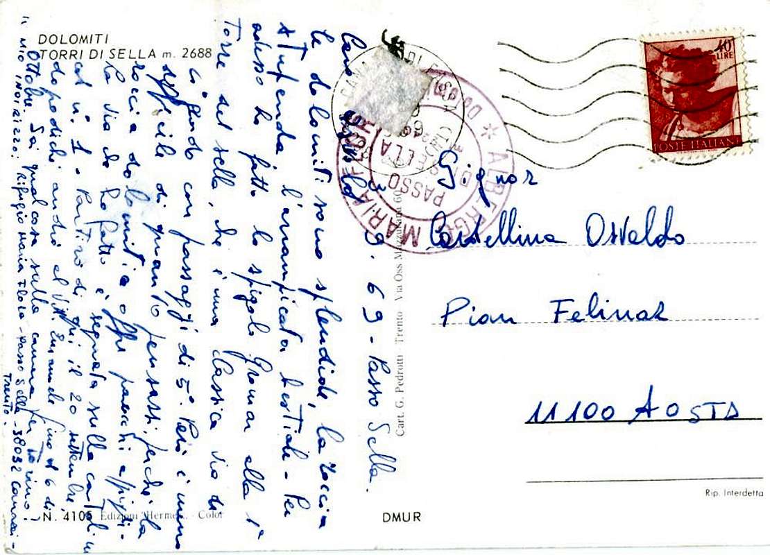
Ilario Antonio Garzotto; Sep. 29th, 1969, 9.30’~ hour); (
Osvaldo Cardellina and
Giuseppe Lamazzi from Gremonenche Alp,
Lower Laures Lake and
Ernesto Ménabreaz Hut - West Slope
Salé Pass and
Salé Becca. Descent from
Ménabreaz Refuge to be in so’s company of
Giovanni “Agostino” Zulian to Gremonenche, in day).
TRY FAILED for hard SNOWYSTORM
1996 (Oct. 05/06th): Try of positioning Cross on the
two Punte Junod,
interrupted for
violent snowstorm, in gradual increase and a sudden drop in temperature: from
Salé Pass (3008m) to take refuge - hideout under - the
Summit of
Salé Becca (3137m); hidden the
Cross in
Summit.
From Ménabreaz Shelter (2546m) to Roèses Mountain Chain up to the Salé Becca, under snowstorm (temporary place for the Cross)
![]()
Immediate return/re-entry R. A. I. Television helicopter, stagging, from
Laures Dessous Lake to
Aosta Town
Airport! (views into the clouds from
Summit); (
Osvaldo Cardellina, Camillo Roberto Ferronato and
Franco Lucianaz from
(06th) Ménabreaz Hut -
Salé Pass to
Salé Becca in ascent and in descent to
Ménabreaz Hut and Gremonenche Alp.).
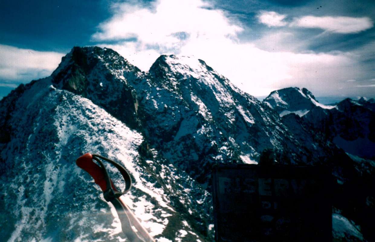
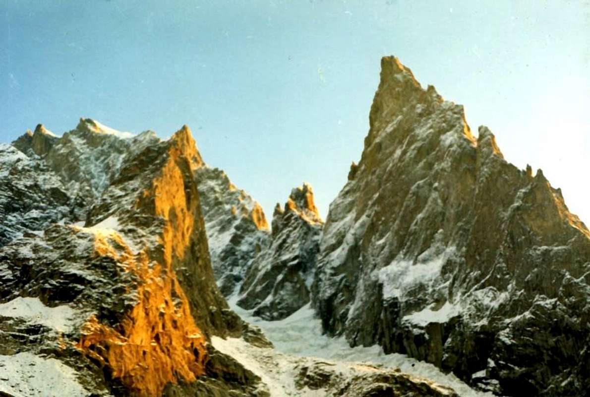
![]() Roèses Mountain Chain in darkness blue and clearness image
Roèses Mountain Chain in darkness blue and clearness image
![]()
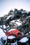
CROSS POSITIONING
POSITIONING CROSS
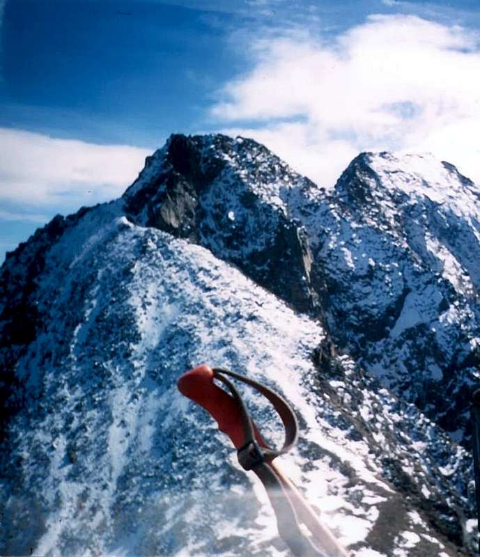
From Ménabreaz Shelter (2546m) to Roèses Mountain Chain & Positioning Cross on Northern Summit or Central Roise (3300m)
![]()
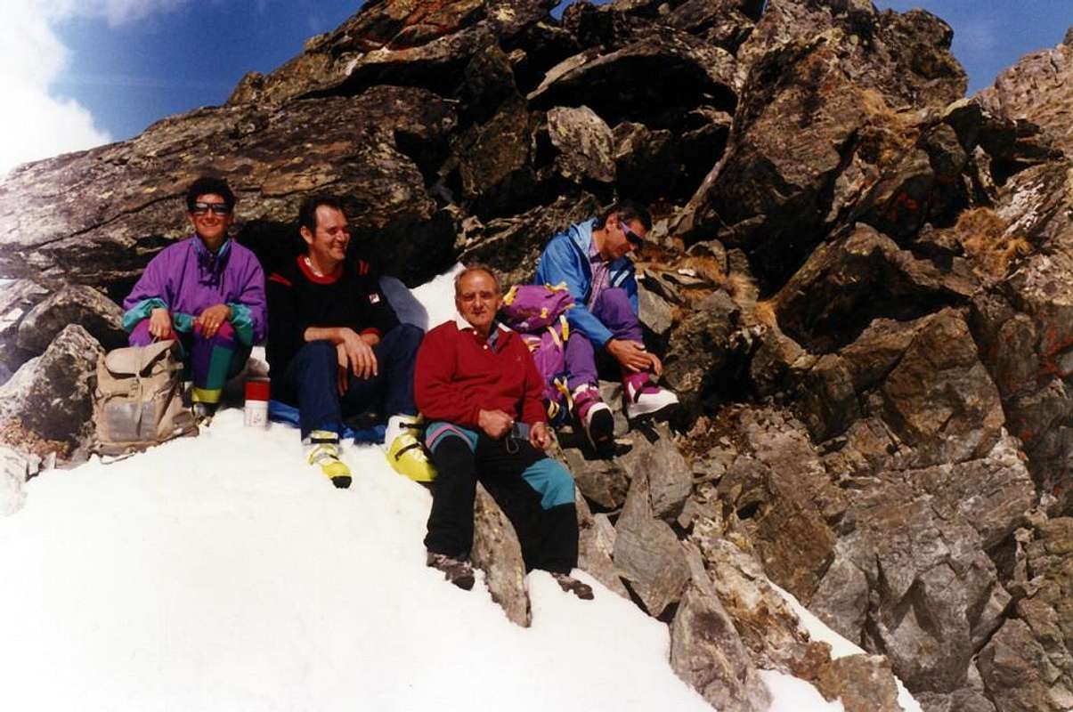
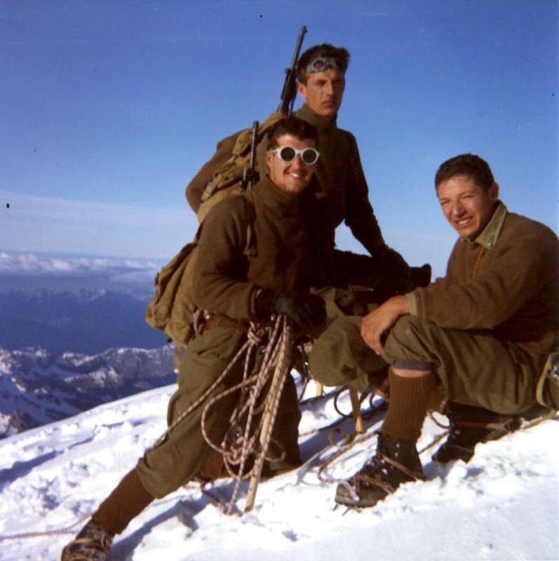
2001 (Jul. 23th):
Positioning of the
Cross on the
South Summit Junod Points:
Giovanni “Agostino” Zulian of Luin and
Ernesto Ciocchetti of Pian Felina Municipality of Charvensod Fraction. From
Ménabreaz Hut West Slope
Salé Pass and crossing to
Petite Roise, North and South
Summits -
Gianni Junod Point, round trip to
Ménabreaz Shelter.
"Agostino" a Great Protagonist
![]()
MOUNTAINEER Gianni JUNOD HISTORY
Principal Ascents:
1964: Nona Becca (3142m) September 01th, 1964, S-SW Slope or normal route;
1965: Nona Becca (3142m) August ?th, 1965, S-SW Slope;
1966: Chamolé Coastline (2580m) and Chamolé Pass (2641m) March ?th, 1966, N-NW Slope from Pila;
1967: Klein Matterhorn (3885m)June 25th, 1967, NW Ridge by New Variant Route, with II° Youth Mountaineering Course "Albert Deffeyes" of C.A.I. Aosta Section;
1967: Tour Ronde (3778m)July 02th, 1967, E Slope and S-SE Crest in terminal part or standard route from Torino Refuge, with C.A.I. Aosta Section;
1967: Sella Refuge at Grivola (2579m) July 13th, 1967, from Cogne-Valnontey;
1967: Chasseurs Pass (2771m)July 20th, 1967, W/E Slopes Traverse from Monzino Refuge, with II° Youth Mountaineering Course "Albert Deffeyes", of C.A.I. Aosta Section;
1967: Franco Spataro Bivouac (2600m)July 29th, 1967, from Dzovennoz-Bionaz/Valpelline, with C.A.I. Aosta Section;
1967: Mount Gelé Pass (3180m) and Mount Gelé (3519m) July 29th, 1967, from Franco Spataro Bivouac (2600m), with C.A.I. Aosta Section;
1967: Mount Crammont (2737m) August ?th, 1967, E-SE Slope;
1967: La Tresenta (3609m) August 19th, 1967, W Slope and W Crest, in day from Valsavarenche Pont and Vittorio Emanuele II° Refuge (2734m);
1967: The Roc of Great Paradise (4026m) August 20th, 1967, W/E Slopes and crossing from Valavarenche Pont Vittorio Emanuele II° Refuge (2734m) to Tribulation Glacier, Carlo Pol Bivouac (3183m)/Valnontey-Cogne Villages;
Becca du Lac (3396m) September 08th, 1967, N Slope from Albert Deffeyes Refuge (2500m);
1967: Icy Course with II° Youth Mountaineering Course "Albert Deffeyes", of C.A.I. Aosta Section September 16/17th, 1967,on Brouillard and Freney Glaciers, near the Guido Monzino Refuge (2561m);
1967: Ferret Pass (2731m) October 22th, 1967, S Slope from Arpnouva and Elena Refuge (2062m);
1968: in North of Dente del Gigante Quotas (3560m, 3618m, 3771m) May 19th, 1968, W Slope and crest at Aiguille of Géant base from Helbronner Point and Torino Refuge;
1968: Chamolé Pass (2641m), Garin Pass (2815m) and Garin Peak (3481m) Little Gully in ascent (new route) and N Edge; N-NE Edge in descent (first absolute) and crossing to of Red Point W Summit (3401m), by S-SW Ridge in ascent and descent from Valaisan Pass (3210m) and descent by W Slope in Arbolle Valley July 18th, 1968;
1968: Vittorio Emanuele Refuge (2732m) and Gran Paradiso (4061m) July 13th, 1967, from Valsavarenche Pont and standard route, by SW Slope;
1968: Icy Course with III° Youth Mountaineering Course "Albert Deffeyes", of C.A.I. Aosta Section August 10/18th, 1967,on Brouillard and Freney Glaciers, near the Guido Monzino Refuge (2561m);
1968: Aiguille Jean Joseph Croux (3257m) September 01th, 1968, N Ridge from Guido Monzino Refuge (2561m) and descent by W-SW Wall, "Via delle Placche" (= Rocky Plates Route), with "Albert Deffeyes" of Mountaineering Course, but in solo ascent;
1969: Testa del Rutor (3486m) Summer 1969, N Slope from Albert Deffeyes Refuge (2500m);
1969: Alps Great Traverse, with I° Platoon Athletes of Courmayeur and La Thuile II° Platoon Explorers of the Italian alpine troops since Juny 23th, 1969 until July 30th, 1969:
Mount Cristallo June 27th, 1969;
Cima Grande di Lavaredo June 28th, 1969, in solo;
Ortles between June/July 1969, normal route;
Pizzo Badile July 06th, 1969, SW Edge;
Crossing Gressoney Valley/Valtournanche and Castore (4225m);
Gonella Refuge (3072m) July 15th, 1969, from Chalets du Miage/Val Vény;
Mount Blanc (4810m) July 16th, 1969, by Bionnassay Crest from Gonella Refuge (3072m);
Boccalatte Refuge (2604m) July 17th, 1969, from Plampincieux/Val Ferret;
Great Jorasses: Whymper Point (4180m) and Walker Point (4208m) July 18th, 1969, by standard routes of S-SW Face;
1969: .Dolomites Military Campaing and Traverse: since September 03th, 1969 until September 10th, 1969:
I° Sella Tower, "Steger Edge";
II° Sella Tower, "Gluch Dyedrals";
I° Sella Tower, "Atzwanger Route";
III° Sella Tower , "Jan Route";
Cinque Dita (Five Fingers) Traverse;
I° Sella Tower, "Steger Edge";
II° Sella Tower, "Gluch Dyedrals";
Great Cyr, "Via dei Camini" (Chimneys Route) September 19th, 1969;
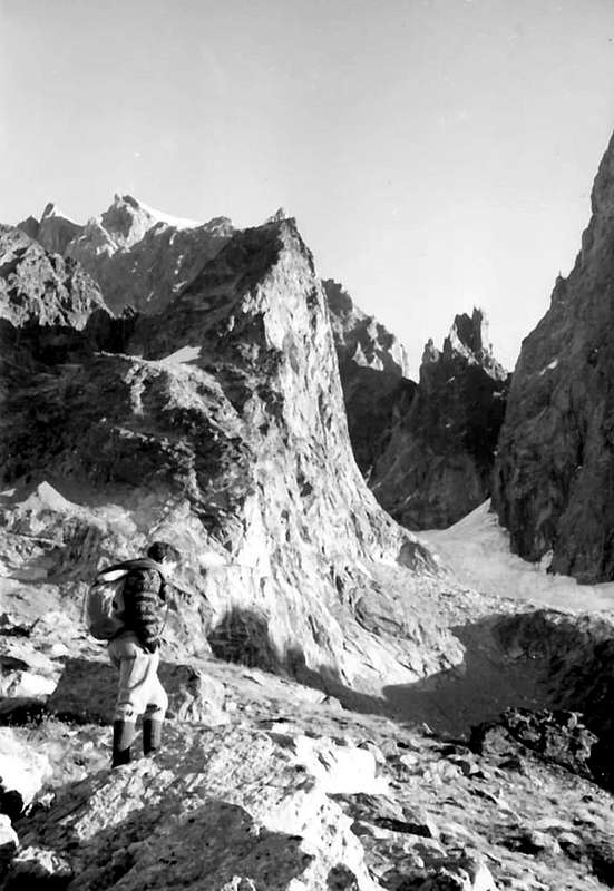
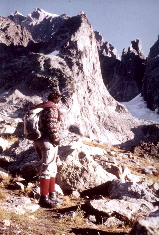
Aiguille Jean Joseph Croux, S-SE Wall, "Arthur Ottoz Route" from Guido Monzino Refuge (2561m) ; a violent death for fall. SEPTEMBER 29th, 1969; 09. '30~ Hour.
Aiguille Jean Joseph CROUX (3257m) to S-SE WALL "Arthur Ottoz Route" THE LAST DEPARTURE
*+*
Aig. J. J. CROUX (3257m)
S-SE WALL "Arthur Ottoz Route" THE LAST HOUR
*+*
From Aiguille J. J. CROUX, S-SE WALL "Arthur Ottoz Route", THE LAST MINUTE Looking the Mount BLANC Mountain Chain
*+*
Comments
No comments posted yet.