


-
 2682 Hits
-
 79.04% Score
-
 10 Votes
|
|
Area/Range |
|---|---|
|
|
45.76190°N / 7.41116°E |
|
|
Hiking |
|
|
Spring, Summer, Fall |
|
|
4603 ft / 1403 m |
|
|
Note
La montagna chiama i suoi figli, ed essi rispondono fedelmente al suo appello… Osvaldo Cardellina, Diario alpinistico, 1964-65 Page texts: @ OsvaldoCardellina "Osva", passed away on May 2, 2022. Page owners: Christian Cardellina e Osvaldo Cardellina. Any updates from September 12, 2022: Antonio Giani, page administrator, friend and climbing companion. Testi della pagina: @ OsvaldoCardellina "Osva", scomparso il 2 maggio 2022. Proprietari pagina: Christian Cardellina e Osvaldo Cardellina. Eventuali aggiornamenti dal 12 settembre 2022: Antonio Giani, amministratore della pagina, amico e compagno di salite. |
Blessed & Castellan Overview
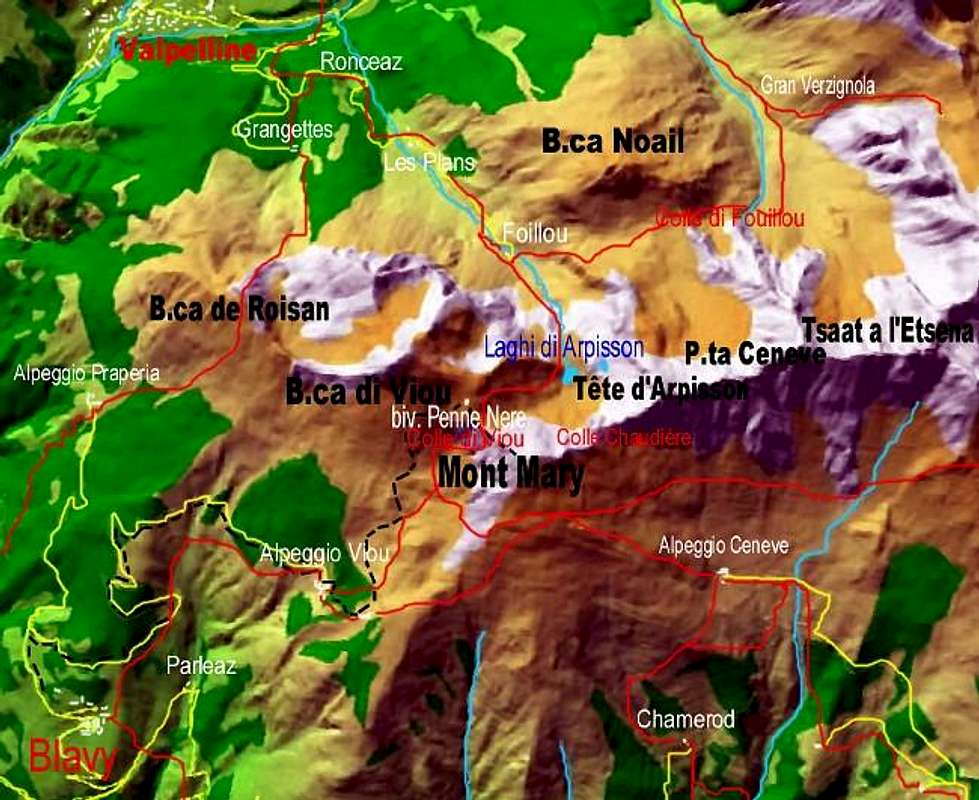
Val Sainte or Valseinte under Senevé or Cénevé Comba and at the foot of Croix de Fana. Typically we used to consider only the top of the valleys that those locations are named. So in Aosta Valley see Champorcher, Cogne, Valsavara, Rhêmes, Valgrisa, La Thuile and to the South and Val Ferret, St. Bernard, By Basin, Tournanche and Gressoney Valleys to the North. Although there is some exception (Champdepraz, Saint Marcel, Valpelline, Saint Barthélemy, Val Veny), this also applies to the Vallons or secondaries valleys, which is generally that higher than that the name such as the Vallons of Ponton, Clavalité Laures, "Conca" or Basin Pila towards the South and Sassa, Orein, Tsa de Tsan, Bella Tsa, Vermiana, Verdzignola and Arpisson to the North. A classic example is that of Arbolle which then turns into Comboé to finish as Gorge and Dard Gorgias above the Commons of Charvensod Pollein into the right-side basin or South. But also on the other side we have a similar case with the "Conca" or Basin Senevé that in bottom turns into two parts: the Western traveled by the Torrent de Florencière and in opposite that du Château, properly called and known as Valseinte.
![]()
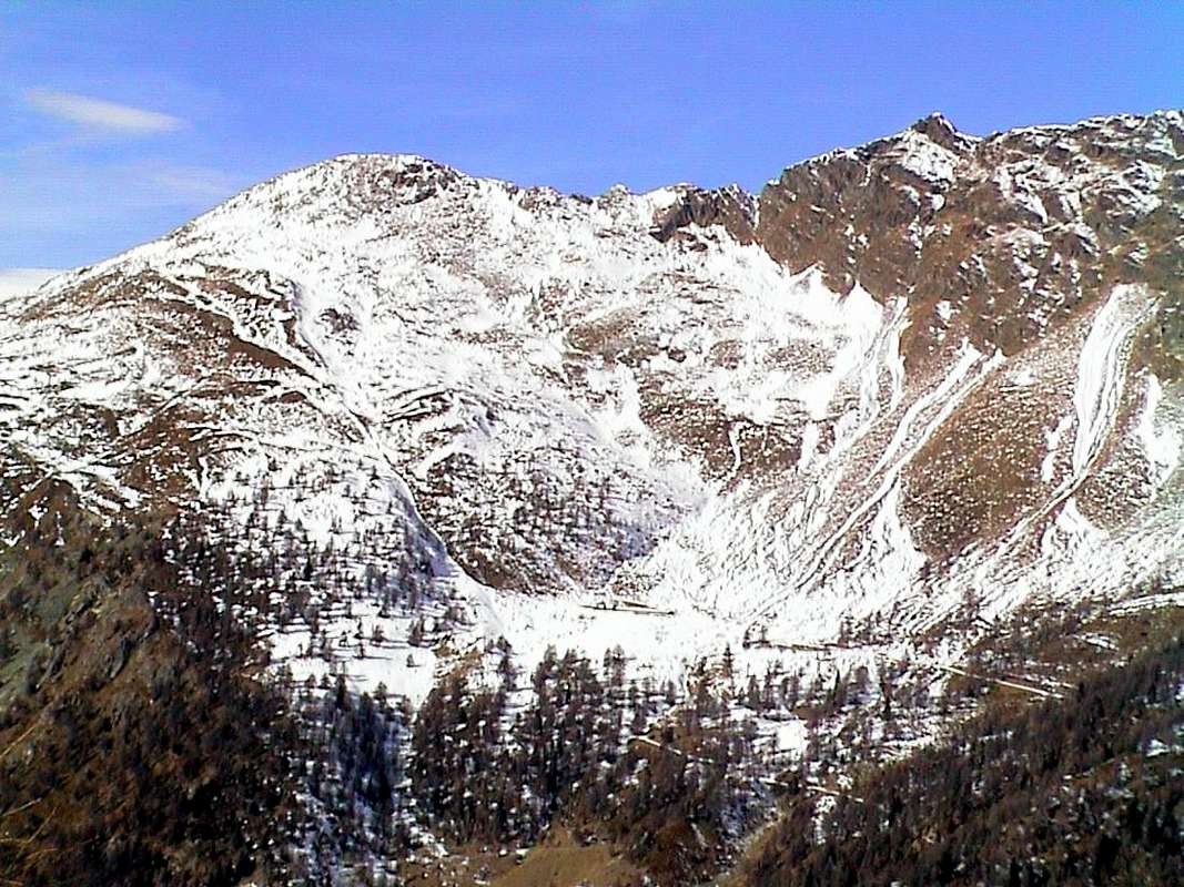
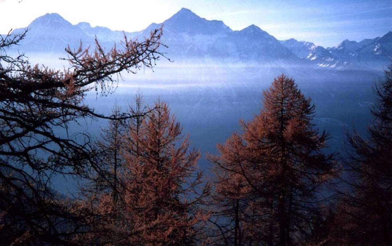
Val Sainte or Valseinte in bottom into the Gorge to the West of Croix de Fana (2.212m), by SalVal
In genere siamo abituati a considerare solo la parte superiore delle vallate che da queste località prendono il loro nome. Così in Valle di Aosta vedi Champorcher, Cogne, Valsavara, Rhêmes, Valgrisa, La Thuile a Mezzogiorno e Val Ferret, San Bernardo, Conca di By, Tournanche e Gressoney a Settentrione. Anche se esiste qualche eccezione (Champdepraz, Saint Marcel, Valpelline, Saint Barthélemy, Val Veny), questo vale anche per i Valloni, dove é in genere quello più elevato che detta il toponimo come ad esempio nei Valloni di Ponton, Clavalité, Laures, Conca di Pila a Sud e Sassa, Orein, Tsa de Tsan, Bella Tsa, Vermiana, Verdzignola ed Arpisson a Nord. Un esempio classico risulta quello dell'Arbolle che poi si trasforma in Comboé per terminare come Gorgia del Dard sopra i Comuni di Pollein e Charvensod sul lato idrografico destro o Meridionale. Pur sul versante opposto abbiamo caso similare con la Conca o Bacino di Senevé che in basso si tramuta in due parti: l'Occidentale percorsa dal Torrent de Florencière e l'opposta dal Torrent du Château de Quart, detta Val Sainte.
![]()
Valseinte lies below the Alpage of Sénevé and right (East) of the Village of Chamerod, by Antonio
In its descent, it indicated by the Stream of the Castle, deeply affects the mountain to the West leaving to fall a high rock wall and repulsive, sloping towards the valley floor, separates it from the more "gentle" slopes that form the Western Hill of Quart foothills the more rounded Mont Mary (2.815m), also called "Mont Saint Joseph" and the root of "mar" or small mountain, and the hard Tete d' Arpisson (2.856m), also known as "Pelon de Quart", divided between of their by two small Summit (Chamerod and Les Prèles or Preyes) and by the two hills of the Southwest and Northeast Chaudière. This last (2.746m) appears as the only real possible passage to transit in the Vallon of Arpisson in Valpelline, otherwise you have to get around to the West Mont Mary and use easier Viou Hill (2.696m; under "Penne Nere Bivouac". Ancient steps for livestock and for some hunter marking ancient transits not always easy between the large Basin Sénevé, the Hill of Aosta and Roisan and the beginning of the Valpelline. Otherwise from Trois Villes must, through the Alps Seyvaz Valchourda from Dèche "Comba" to reach, certainly more popular in the Centuries, Col Saint Barthélemy (2.639m) in the adjacent valley. This much wider context Val Sainte also Valseinte had an equally important role in both the civil and military or religious life. We see it immediately later.
![]()
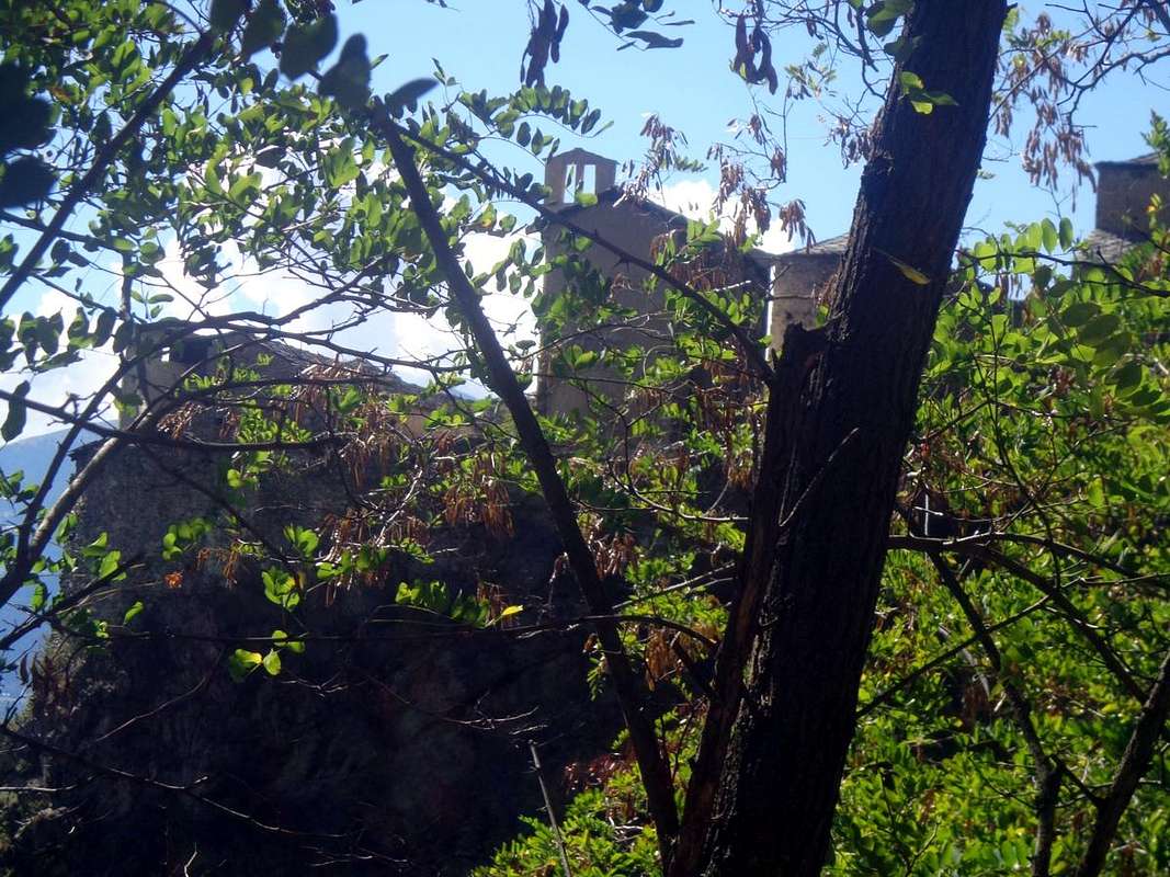
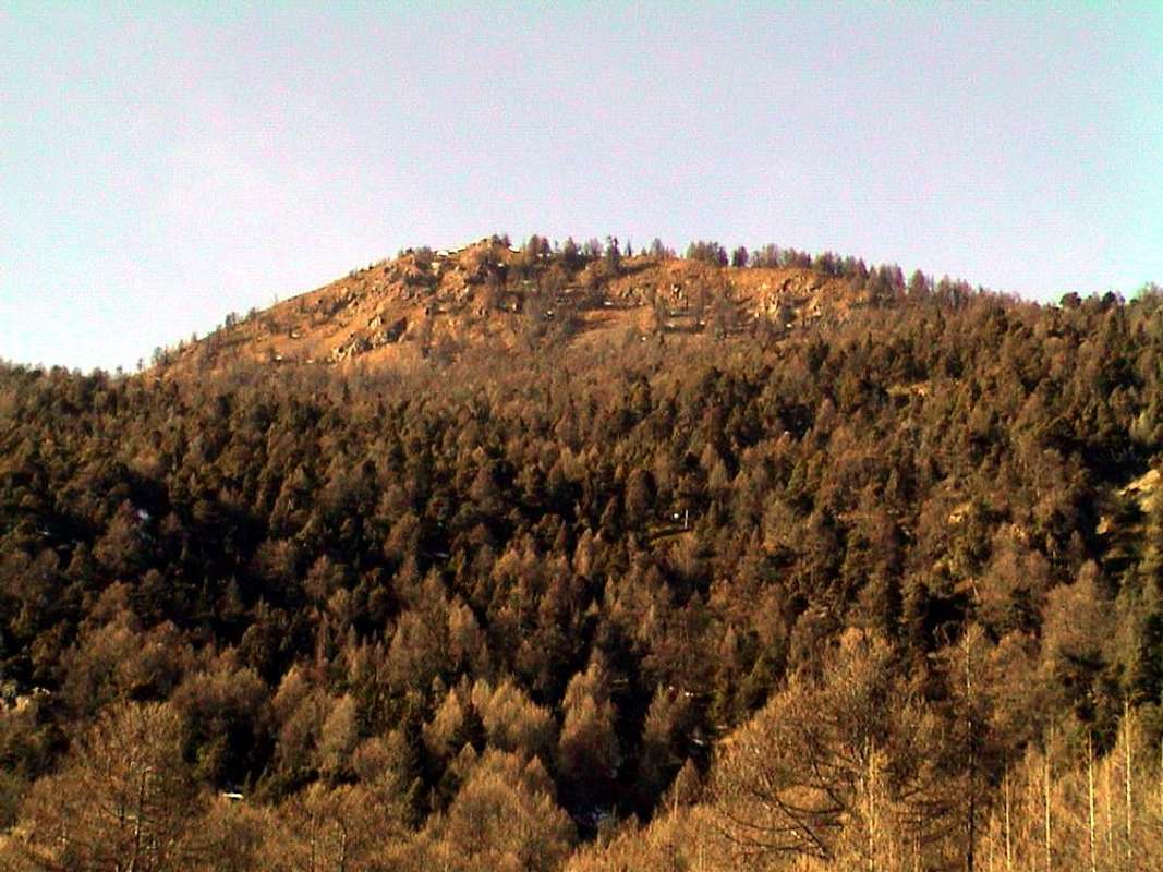
Croix de Fana above Trois Villes Area, Valseinte (left) & Tour de Chétoz from South, by Osw
![]()
Lords Bard & Savoy old property of the ancient Quart Castle (XII° Century) at the end of Val Sainte nearby Villair Hamlet, by Osw

La Val Sainte oppure Valseinte al di sotto della Conca di Senevé o Cénevé ed alle pendici della Croix de Fana.
Val Sainte, plus a deep gorge that a valley, at the foot of the Comba Cénevé dizzying drops but more specifically in the Southwestern Slope of the Croix de Fana.
La Val Sainte, più gola profonda che valle, scende vertiginosa ai piedi della Comba di Senevé ma più precisamente sotto il Versante Sudovest della Croix de Fana. Nella sua discesa, indicata dal Torrente del Castello, incide profondamente la montagna lasciando ad Occidente un'alta e repulsiva parete rocciosa che, digradando verso il fondovalle, la separa dai più "dolci" declivi che vanno a formare la Collina Ovest di Quart ai piedi del più arrotondato Mont Mary (2.815 m), detto anche "Mont Saint Joseph" e dalla radice "mar" ovvero piccolo monte, e dell'arcigna Tête d'Arpisson (2.856 m) conosciuto anche come "Pelon de Quart", divise tra di loro da due piccole Sommità (Punte di Chamerod e Les Prèles o Preyes) nonché dai due Colli Sudovest e Nordest di Chaudière. Quest'ultimo (2.746 m) risulta come l'unico vero passaggio possibile per transitare nel Vallone di Arpisson in Valpelline, altrimenti bisogna aggirare ad Ovest il Mont Mary ed utilizzare il più facile Colle di Viou (2.696 m). Antichi passaggi per il bestiame e per qualche cacciatore che segnano antichi transiti non sempre facili tra la larga Conca di Senevé, la Collina d'Aosta e Roisan e l'inizio della Valpelline. O da Trois Villes devesi, passando l'Alpi La Seyvaz e Valchourda, attraverso la Comba Dèche raggiungere il, certamente più frequentato nei Secoli, Colle di Saint Barthélemy (2.639 m) nell'adiacente omonima vallata. In questo ben più largo contesto la Val Sainte ha avuto un ruolo non meno importante sia nella vita civile che militare o religiosa. Lo vediam giusto più avanti.
Getting There
BY CAR:
- From TORINO, MILANO, etc: Motorway A5. Exit at IVREA or Quincinetto (PIEDMONT) From IVREA Town: in West towards Pont Saint Martin, Donnas, Arnad, Verrès, Bard, St. Vincent, Châtillon, Chambave, Nus, Quart, St. Christophe and Aosta Municipalities. From Courmayeur Resort: in East to Morgex, La Salle, Saint Pierre, Sarre, Aosta, Saint Chistophe, Quart, Nus, Chambave, Verrayes, Saint Denis, Châtillon, Saint Vincent, Emarese Municipalities.
- From Aosta Town towards St. Christophe and Quart Municipalities From Saint Christophe-Prevot (about 640m), reached by Regional Road from Aosta, to Sorreley Village; from this, with Municipal, towards Veynes Fraction. From subsequent alternative before Lumian (1.025m): *** in East deviation towards Cretallaz, Jeanceyaz, Morgonaz Villages at the entrance on Senevé Comba). On asphalt road in Northwest, to Parléaz Village (1.274m), Blavy Hamlet (1.475m) and, through dirt road or path, to Viou Alpages, in Blavy Viou small Basin. From Quart-Villair towards Epilaz, Argnod Villages or from SS.26 nearby La Plantaz (540m), with Regional and Municipal Roads, towards Chétoz, Vignil, Fornail, Ville sur Nus-Planeville, Buignod, Porsan Villages to Trois Villes-Avisod Village (1.398m). From this to Senevé Alps (2.206m), in Senevé Comba.
- From Quart to Fonteil with previous route; from this through dirt road, towards La Seyvaz (2.184m), Valchourda Alps (2.392m), in Comba Dèche. From Nus-La Plantaz in State Road to Ville sur Nus-Planeville (1.113m); from this, towards Buignod, Avion (1.312m) Villages. Also from Porsan through Trois Villes (1.398m), Avion, fork (1.250m) to Effraz Village (1.487m), with Municipal Roads. From this to Ronc (1.737m), Machaussy Alps, in Effraz Comba.
- From FRANCE: through the Mont Blanc Tunnel to Entrèves-crossroads to Vény/Ferret Valleys - Mountain Guides of Courmayeur - La Saxe Rock Gym - Courmayeur. By Little Saint Bernard Pass, closed since November until half May to La Thuile Valley - Pré Saint Didier - Courmayeur. It is not necessary to take Motorway A5: you can drive on SS.26, in the direction of AOSTA - IVREA - TURIN.
BY PLANE:
- Aeroporto "Corrado Gex" Saint Christophe (Aosta).
Château de Quart
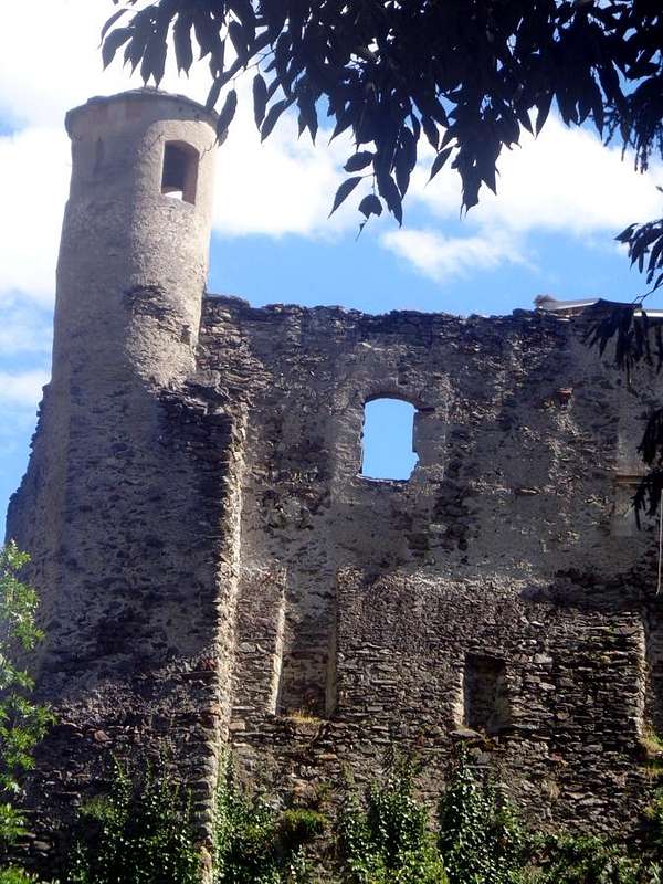
At the base of the Val Sainte and neighboring the Villair of Quart is located the Castle. Built in 1185 by the Barons of Quart in those days, to be precise by Jacques de la Porte de Saint-Ours, founder of the dynasty of the Lords of Quart. Initially it had a purpose of military defense now at the gates of the East Village of Aosta (4 Kilometres or for the Romans "Ad Quartum milium aut lapidem"). Those were the days just following in Santo Anselm of Aosta (* Aosta 1033 - * Derby 1109), Philosopher and Theologian luminary of the Catholic Church and Archbishop of Canterbury and Primate of England also with consecration of Wilhelm II° and "Doctor of the Church" by the will Pope Urban II°, in the footsteps which kept walking Emerico Quart (* Quart 1255) who became Bishop of Aosta in 1301. He granted the People's famous "Statutes Synod" and obtained the beatification by the Vatican. Then around the end of the fourteenth century (1378 to the death of Henri last Lord of the Family) the Castle passed to the Lords of Savoy who used it as a residential dwelling until 1550 when the Duke Charles II° decided to give the fief of Quart to the President Laschis in 1551that, given the high costs for the maintenance and restoration, sold it to Charles-François Balbis. In 1610 the castle was sold again, this time to Count Nicholas Coardo which two years later sold it to the Family of the Perrone of San Martino (adjacent Piedmont), which retained ownership of the castle until the year 1800 when the building was left to the Quart Common. This gave it in 1874 to a private family that he established a farm with its transformation of the building. In 1951 the latter sold it to the Autonomous Region of Valle d'Aosta, the current owners, who gave over to a modern restoration. The important and complex work, which began in 2010, are still in progress to restore the castle to its former glory. When finished, initially planned for 2013 but in fact still going to work (summer 2015), it will house the Valle d'Aosta Ethnographic Museum. In the East of the castle, after that of Vignil (946m), lies the Hamlet of Vollein (891m), located on a large area overlooking the Torrent Saint Barthélemy and above the Château de Nus, where in Vollein locality nearby the Vignil Hamlet, around 1968, were found remains of a Neolithic Burial among the oldest evidence of human settlement in Valle d'Aosta. Instead, going up along the path leading from the Castle of Quart, you may have some prehistoric stone shells: the scenic walk is accompanied by information panels on flora, fauna, geology and prehistoric finds and brings to the Chapel with votive altar of Blessed Emeric, with lawn equipped for picnics. So this castle, which over the centuries has undergone at least two major fires, alloy skills purely military, for which he was born, with to the civilian, due to human affairs, rural and pastoral, and even to a religious feelings traditionally spread throughout the Valley Aosta since the III° and IV° Century. It was definitely and abode certainly very important, as evidenced by the squared towers, with coats of arms of Savoy crusaders and painted in black and red, and cylindrical. both able to support the walls still fringed with laces, but where the weather allows visibility clearly the vicissitudes endured. Furthermore, the transition from one owner to another has meant that the entire interior has been gradually robbed and then inevitably perhaps forever lost. Despite the passage of Blessed Emeric, that was not, as you may think, a Hermit but a famous, renowned Bishop of Aosta ...
![]()
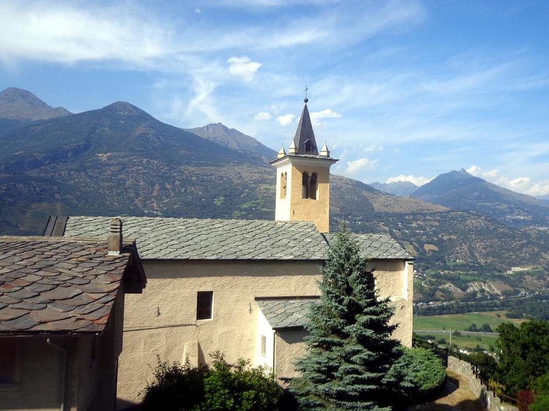
Eastern side of Quart Castle of 1185 (Quart's Barons & Savoy Lords), by Osw
![]()
Emilius by Senevé or Cénevé Comba, above Valsainte or Val Seinte, by Osw
Quart's Castle
![]()
Etollin or Etolin Fraction just above the SS.26 towards Aosta, by Osw
Château de Quart
Blessed Emerick's or Saint Americo's Hermitage
Alla base della Val Sainte e presso la Frazione del Villair é collocato il Castello di Quart. Costruito nel 1185 ad opera dei, a quei tempi, Baroni di Quart e per la precisione da parte di Jacques de la Porte de Saint-Ours, capostipite della dinastia dei Signori di Quart. Inizialmente aveva scopo esclusivo di difesa militare subito alle porte Orientali del Borgo d'Aosta (4 Kilometri, ovvero per i Romani "Ad Quartum milium aut lapidem"). Eran i tempi appena successivi a Sant'Anselmo d'Aosta (* Aosta 1033 - + Derby 1109), Filosofo e Teologo luminare della Chiesa Cattolica ed Arcivescovo di Canterbury ed anche Primate d'Inghilterra con consacrazione di Guglielmo II° e "Dottore della Chiesa" per volontà di Papa Urbano II°, sulle orme del quale continuò a camminare Emerico di Quart (* Quart 1255) che divenne Vescovo d'Aosta nel 1301. Concesse al Popolo i celebri "Statuti Sinodali" ed ottenne la Beatificazione da parte del Vaticano. Poi intorno alla fine del XIV° Secolo (1378 alla morte di Henri della Famiglia) il Castello passò ai Signori di Savoia che l'adibirono a dimora residenziale fino al 1550 quando il Duca Carlo II° decise di cedere il Feudo di Quart al Presidente Laschis che nel 1551, visti gli elevati costi per il mantenimento e restauri, lo cedette a Charles-François Balbis. Nel 1610 il castello venne nuovamente venduto, questa volta al conte Nicola Coardo il quale dopo due anni lo cedette alla Famiglia dei Perrone di San Martino (vicino Piemonte) la quale mantenne la proprietà del castello insino all'anno 1800 quando lo stabile venne lasciato al Comune di Quart. Questo nel 1874 lo riconcesse ad una famiglia privata, che v'instaurò un'azienda agricola con relativa totale trasformazione dello stabile. Nel 1951 quest'ultima lo rivendette alla Regione Autonoma della Valle d'Aosta, attuale proprietaria, che ha dato corso ad una moderna iniziativa di restauro. Gli importanti e complessi lavori, iniziati nel 2010, sono ancora in corso per riportare il castello al suo antico splendore. Al termine dell'operazioni, inizialmente previste per il 2013 ma in effetti ancora in corso d'opera (estate 2015), esso ospiterà il Museo Etnografico Valdostano. Ad Oriente del castello, dopo quello di Vignil (946 m), si trova la località di Vollein (891 m), collocata su vasta area dominante il Torrent de Saint Barthélemy ed il Château de Nus, ove intorno al 1968 sono stati ritrovati, in località Vollein presso Vignil, resti d'una Necropoli del Neolitico, costituente una delle più antiche testimonianze d'insediamenti umani in Val d'Aosta. Invece, salendo lungo il sentiero che parte dal Castello di Quart, si posson incontrare alcune coppelle preistoriche: la passeggiata panoramica è corredata da pannelli didattici su flora, fauna, geologia e ritrovamenti preistorici e porta alla Cappella con Altare votivo del Beato Emerico, con prato attrezzato per i pic nic. Quindi questo castello (nei secoli ha subito almeno due incendi importanti) lega le competenze prettamente militari, per le quali era nato, a quelle civili, dovute alle vicende umane, agresti e della pastorizia nonché al sentimento religioso tradizionalmente diffuso in tutta la Valle d'Aosta dal III° e IV° Secolo. Fù sicuramente dimora sicuramente molto importante, come testimoniano le torri sia quadrate, con stemmi sabaudi crociati e dipinti in biancorosso, che cilindriche ed entrambe atte a supportare le mura di cinta ancor oggi orlate da bei merletti, dove però il tempo lascia intravvedere nettamente le vicissitudini sopportate. Inoltre il passaggio da un proprietario allo altro ha fatto sì che tutto l'arredamento interno sia stato progressivamente defraudato e quindi forse e purtroppo per sempre inevitabilmente perduto. Nonostante il passaggio del Beato Emerico, che non era, come si può pensare, un Eremita bensì un famoso e rinomato Vescovo di Aosta ...
Come si arriva? As we come to the Castle and the Hermitage of Emerick?
As you reach the castle? Whether arriving from Aosta (West) from Turin or Milan (East) must, by a short detour to the Northeast from the SS.26, reaching, from the junction 546 meters, with a diagonal the small Fraction Etolin or Etollin (570m). From this, continuing Eastwards and passing in the middle of the neighboring Hamlets of Carné and Prebenda, it goes up to the above Villair de Quart, in locality la Balma (652m; here come respectively from the East and West also Regional Roads by Nus St. Christophe). Past the localities Charlette, Vallerod, Eghacoz you get to Fourneille with small parking lot just before the bridge over the creek (774m; signs and descriptive panels); an idyllic path leads to the castle, surrounded by a cluster of small wooden houses which was designed to reproduce the positioning of the "farmers" of different ages around the manor and an old stone house of custody. Immediately upstream it is presented, at a rudimentary water intake, a medieval bridge arched towards the above Moulin du Château.
Come si raggiunge il castello? Sia arrivando da Aosta (Ovest) che da Torino o Milano (Est) bisogna, tramite breve deviazione a Nordest dalla SS.26, raggiungere, dal bivio 546 metri con un diagonale, la piccola Frazione di Etolin od Etollin (570 m). Da questa, continuando verso Est e passando in mezzo ai vicini Villaggetti di Carné e Prebenda, si risale al soprastante Villair de Quart, in località la Balma (652 m; qui arrivano rispettivamente da Est e da Ovest anche le Regionali da Nus e Saint Christophe). Oltrepassando le località Charlette, Vallerod, Eghacoz si giunge a Fourneille con piccolo parcheggio appena prima del ponte sul Torrente del Castello (774 m; segnali e pannelli descrittivi); un sentiero idilliaco conduce al castello, circondato da un nugole di casette in legno atte a riprodurre qual fosse la dislocazione dei "castellani" delle varie epoche intorno al maniero, nonché un'antica casa di custodia in pietra. Subito a monte si presenta, presso una rudimentale presa d'acqua, un ponte medioevale ad arco verso il Moulin du Château.
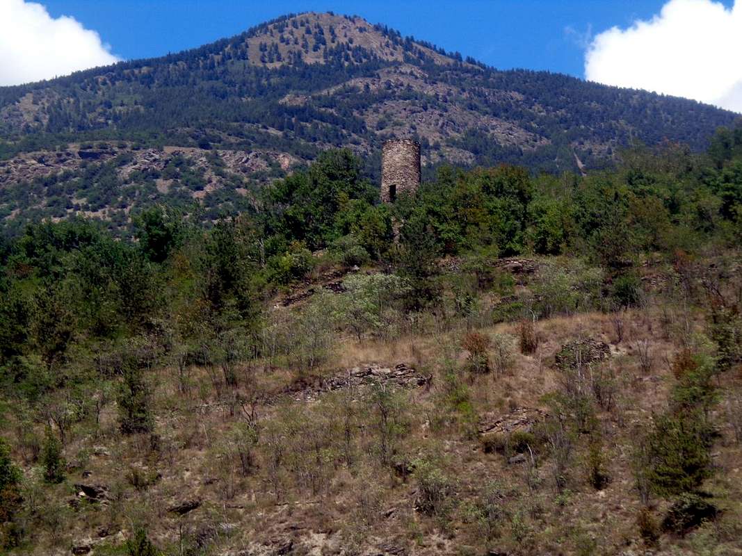
As you reach the Oratory? There are different ways of reaching the oratory of Blessed Emeric. Among the various we try to analyze some of them: By the Villair of Quart
1) - From the Château de Quart Northern side, left in the bottom right a detour with steep farm dirt road that comes from the junction 725 meters after the Village of Verney, apart from a small path marked but not numbered rising towards the Northeast. A first series of steep switchbacks, protected by a wooden fence, beyond the rocky promontory above until you reach first the hill 1.018 meters and then flexing further North, closer to a small stream dried; a successive series of hairpin bends into the forest leads to the Torrent du Château. Crossed twice the same, with a short diagonal towards the Northeast in the thick Bois (forest) of Emeric or Americo, you reach the Oratory with small altar topped by a cross (1.130/40m; T/E; 1h'00/1h'15), at the farm road that descends from the Pasture of Valseinte (1.399/40m), in West by Avisod (Trois Villes).Oratorio del Beato Emerico o di Sant'Americo
"... From crossroads nearby Chétoz towards Trois Villes Hamlet & Val Sainte or Valseinte ..." by Osw 2015
Come si raggiunge l'Hermitage? Diverse sono le possibilità per raggiungere l'oratorio del Beato Emerico. Tra le varie, proviamo ad analizzarne qualcuna: Dal Villair de Quart
1) - Dal Château de Quart lato Settentrionale, lasciata in basso a destra una deviazione con ripida strada poderale che arriva dal bivio 725 metri dopo il Villaggio di Verney, parte un sentierino segnalato ma non numerato, che sale verso Nordest. Una prima serie di ripidi tornanti, protetti da staccionate in legno, supera il soprastante promontorio roccioso fino a raggiungere dapprima il promontorio 1.018 metri e poi, flettendo più a Nord, avvicinarsi ad un torrentello essiccato; una serie successiva di stretti tornantini dentro la foresta conduce al Torrent du Château. Attraversato due volte il medesimo, con un breve diagonale verso Nordest dentro il fitto Bois (foresta) d'Emeric o Americo, si raggiunge l'Oratorio con piccolo Altare sormontato da Croce (1.130/40 m; T/E; 1h'00/1h'15), presso la strada poderale che scende dall'Alpeggio di Valseinte (1.399/40 m).
![]()
Croix de Fana and the Hill of Quart by Southwest (Brissogne Common), by Osw
From the Regional Road towards Trois Villes Hamlets
2) - From the National Road No. 26, with a small Municipal Road from the junction 537 meters to the Village of Vieille Morte, you reach the Regional Road towards the small Villages of Povil and Verney to the junction 725 meters. Here, left to the right the Regional to Trois Villes (always Quart Common), continues with two further possibilities:
a) - to the North-northwest with a small dirt road signposted but not numbered, which reaches the Château de Quart right in the starting point of the via described above; or
b) - continue on this region to the West reaching the localities of Josuè, Epilaz, Torrent, Vianoz and the previous route from Villair, Forneille location T/E; 1h'15/1h'30).
3/4) - By Verney (723m) walk up the hill to the Northeast with the path marked and numbered, through the forest, it reaches what comes from the Village of Porsod (1063m; accessible from Vignil Hamlet by dirt road); with crossing to the West, almost on a slight slope, you reach the Emerick's or Americo Oratory (T/E; 0h'50/1h'05).
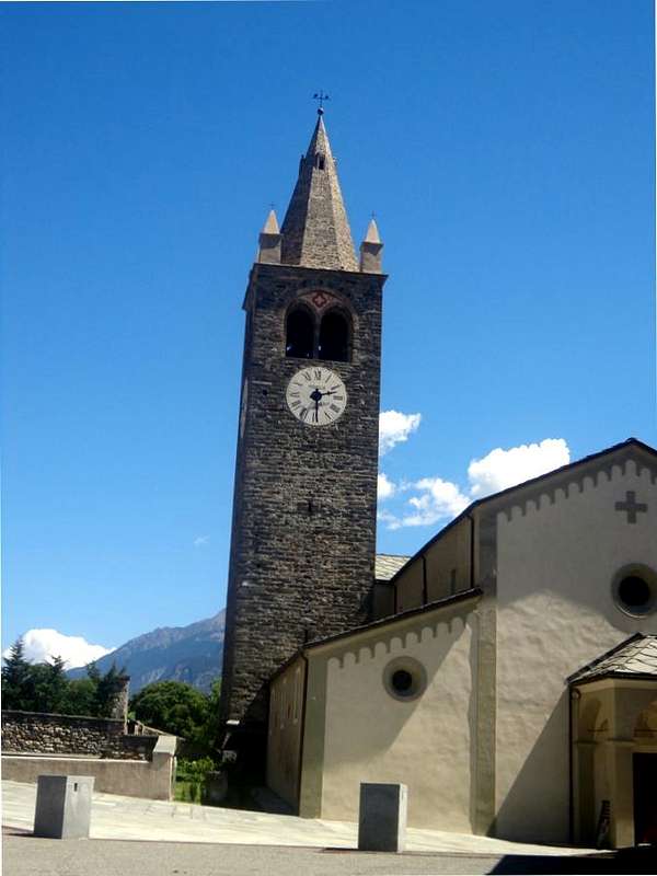
5) - From the Village of Avisod (Trois Villes) (1.398m). from the Village of Vignil (946m, near the Necropolis Neolithic Vollein) continue through the Regional Road first Eastward and slightly to the North, reaching the Village Fornail (1.082m; Chapel of Sainte Barbe); bending over in the Northeast region will then approach the Villages of Ville-sur-Nus (1.113m; beautiful Parish Church with Bell Tower lined with copper, preceded by a stone votive Chapel dedicated to Our Lady), Buignod (1.135m; "Rascard" square and wooden), Porsan (1.299m) and Avisod (1.398m, beautiful small Church dedicated to St. Margaret, Rocco and Anselme; just above beautiful fountain at the remains of the ancient Belfry of Trois Villes). Left to right continuing for the "Monument to the Partisan" (1.364m) and, above, that for the last Fonteil Village (1.423m), you cross to Avisod until the start of the private dirt road towards the Basin Sénevé. The same goes up with modest elevation West-northwest by cutting the base around the South Slope of the Croix de Fana (2.212m) to reach a crossroads approximately in 1.420/30 meters. Left to right, the branch continues to Chacotte, Champchamoussin, Latta Pastures into the Comba Cénevé also Senevé, instead you drive down to the Southwest reaching first a stable for sheep and horses and immediately then the Valseinte Alpage (1.399m; fountain). Now the private road descends steeply to the South-southwest in a small valley (the real and true Valsainte) dark and threatening with steep cliffs below the Bois d'Emeric; the same is directed towards these but not reached, but falls vertically to the South over the Oratory (EE/F; 1h'00/1h'15 from Village of Avisod; remember well and scrupulously that the return is uphill for which it almost doubled travel time). Or, organizing logistically, down through the first of the itineraries to Villair de Quart (E/T; 0h'30/0h'40).
 |
 |
 |
 |
 |
Dalla Strada regionale verso i Villaggi di Trois Villes
2) - Dalla Strada Statale n°26, con una piccola Strada Comunale dal bivio 537 metri per il Villaggio di Vieille Morte, si raggiunge la Strada Regionale verso I Villaggetti di Povil e Verney fino al bivio 725 metri. Qui, lasciata sulla destra la Strada Regionale per Trois Villes (sempre nel Comune di Quart), si continua con altre due ulteriori possibilità:
a) - verso Nord-nordovest con stradina poderale segnalata ma non numerata, che raggiunge il Château de Quart proprio nel punto di partenza della via precedentemente descritta; oppure
b) - si prosegue sulla Regionale ad Ovest raggiungendo le località Josuè, Epilaz, Torrent, Vianoz ed alla precedente via dal Villair-Forneille T/E; 1h'15/1h'30).
3/4)- Da Verney (723 m) si risale la collina verso Nordest con sentiero segnalato e numerato che, attraversando la foresta, raggiunge quello che proviene dal Villaggio di Porsod (1.063 m; raggiungibile dal Villaggio di Vignil tramite strada poderale); con traversata ad Occidente, quasi in falsopiano, si raggiunge l'Oratorio (T/E; 0h'50/1h'05).
5) - Dal Villaggio Avisod di Trois Villes (1.398 m). Dal Villaggio di Vignil (946 m; nelle vicinanze della Necropoli Neolitica di Vollein) si prosegue tramite la Strada Regionale dapprima verso Oriente e poi a Settentrione raggiungendo il Villaggio di Fornail (1.082 m; Cappella di Sainte Barbe); piegando più a Nordest la Regionale raggiunge in successione i Villaggi di Ville-sur-Nus (1.113 m; bella Chiesa Parrocchiale con Campanile foderato in rame, preceduta da Cappella votiva in pietra dedicata alla Madonna), Buignod (1.135 m; "Rascard" quadrato ed in legno), Porsan (1.299 m) ed Avisod (1.398 m; bella Chiesetta dedicata ai Santi Margherita, Rocco ed Anselmo; appena sopra bel fontanile presso i resti dell'antico Campanile di Trois Villes). Lasciata a destra la continuazione per il "Monumento al Partigiano" (1.364 m) e, sopra, quella per l'ultimo Villaggio di Fonteil (1.423 m), si attraversa quello di Avisod fino all'inizio della poderale verso la Conca di Senevé. La stessa sale con modesto dislivello verso Ovest-nordovest tagliando alla base tutto il Versante Meridionale della Croix de Fana (2.212 m) sino a raggiungere un bivio a circa 1.420/30 metri. Abbandonato a destra il ramo che prosegue verso gli Alpeggi di Chacotte, Champchamoussin, Latta nella Comba di Senevé oppure Cénevé, si scende invece a Sudovest raggiungendo dapprima una stalla per pecore e cavalli e poi l'Alpe di Valseinte (1.399 m; fontana). Ora la poderale scende decisamente verso Sud-sudovest dentro un valloncello tetro e minaccioso con ripide pareti rocciose sottostanti il Bois d'Emeric; la stessa s'indirizza a queste ma non le raggiunge, bensì scende in verticale a Sud sopra l'Oratorio (EE/F; 1h'00/1h'15 da Avisod; ricordare con scrupolo che il ritorno avviene in salita per cui quasi raddoppiare il tempo di percorrenza). Oppure, organizzandosi logisticamente, scendere col primo degli itinerari al Villair de Quart (E/T; 0h'30/0h'40).
![]()
From Avisod (Trois Villes) cross towards West (left) to the entire base of Croix, by Osw
Important Information
- REGIONE AUTONOMA VALLE D'AOSTA the official site.
- FONDAZIONE MONTAGNA SICURA Villa Cameron, località Villard de la Palud n° 1 Courmayeur (AO) Tel: 39 0165 897602 - Fax: 39 0165 897647.
- A.I.NE.VA. (Associazione Interregionale Neve e Valanghe).
Useful numbers
- Protezione Civile Valdostana località Aeroporto n° 7/A Saint Christophe (Ao) Tel. 0165-238222.
- Bollettino Meteo (weather info) Tel. 0165-44113.
- Bollettino Valanghe Tel. 0165-776300.
- Unità Operativa di Soccorso Sanitario Tel. 118.