


-
 2878 Hits
-
 77.48% Score
-
 8 Votes
|
|
Route |
|---|---|
|
|
45.58683°N / 7.39211°E |
|
|
Mountaineering, Trad Climbing |
|
|
Summer, Fall |
|
|
One to two days |
|
|
II |
|
|
Note
|
La montagna chiama i suoi figli, ed essi rispondono fedelmente al suo appello… Osvaldo Cardellina, Diario alpinistico, 1964-65 Page texts: @ OsvaldoCardellina "Osva", passed away on May 2, 2022. Page owners: Christian Cardellina e Osvaldo Cardellina. Any updates from September 12, 2022: Antonio Giani, page administrator, friend and climbing companion. Testi della pagina: @ OsvaldoCardellina "Osva", scomparso il 2 maggio 2022. Proprietari pagina: Christian Cardellina e Osvaldo Cardellina. Eventuali aggiornamenti dal 12 settembre 2022: Antonio Giani, amministratore della pagina, amico e compagno di salite. |
Overview
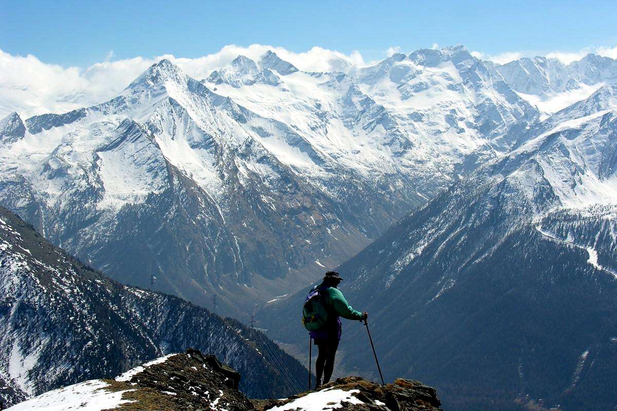
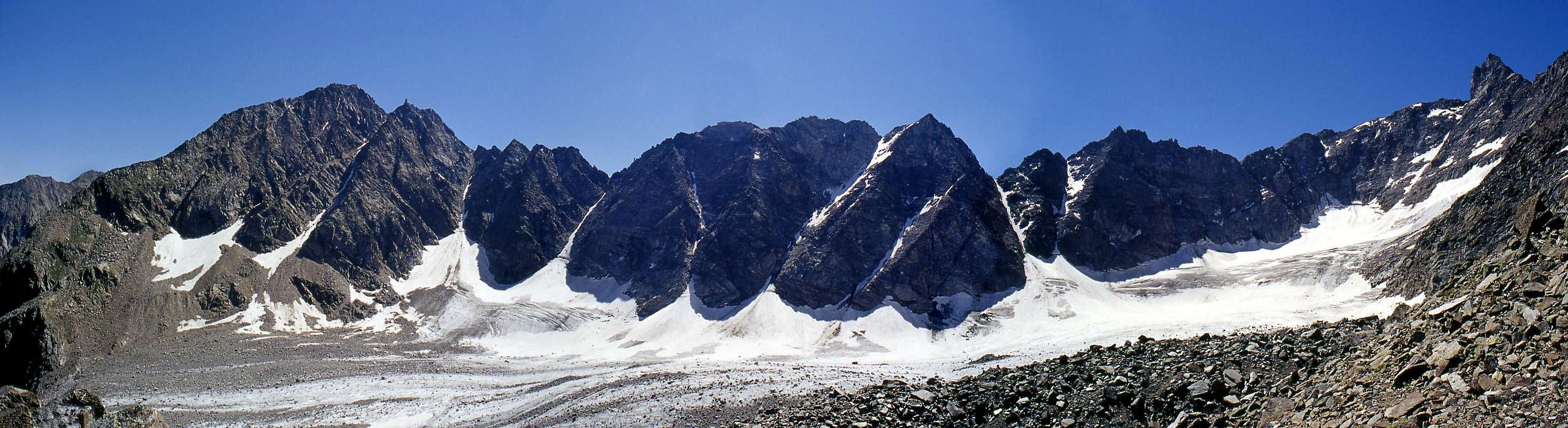
This crossing is part of the larger "Classic" of the Gran Paradiso. Very long ascent, is now reduced by the presence of the Guido Antoldi-Laura Malvezzi Bivouac at the foot of the Eastern Slope of Sant'Andrea Tower (Apostles Chain). The same runs in practice almost the entire Eastern watershed, in his mid-upper part, between the Vallons Bardoney, still further East, and Valeille reaching the Punta Ondezana and Teleccio or Telessio Pass before the crest dividing it rises in the Tower of Great St Peter (3.692m), the highest and most important elevation to the Summit of Gran Paradiso (4.061m). In fact, while the largest part of the lower-middle reaches Punta of the Loie (2.676m) in the progression towards that of Rossin and the following pyramid of the Punta Tsesère (3.117m) down to the Arolla Hill (2.892m), the only real point of transit between them, the crest of the border with Piedmont from the Tower of Lavina (3.308m) connects to the Great Arolla (3.296m), an important Summit that around with semi-circular in the Southwest goes to "bind" the Tip of Sengie (3.408m). From this last and towards South-southwest "stretches" along the partition in question here (see photos below).
![]()
Valeille (left) above Lillaz Hamlet into Cogne's Southern Valleys, by Emilio Bertona aka emilius
Questa traversata rientra nelle grandi "Classiche" del Gruppo del Gran Paradiso. Ascensione piuttosto lunga, viene oggi ridimensionata dall'odierna presenza del Bivacco Guido Antoldi-Laura Malvezzi alle pendici del versante Orientale della Torre di Sant'Andrea (Gruppo degli Apostoli). La stessa percorre in pratica quasi l'intero spartiacque Orientale, nella sua parte medio-superiore, tra i Valloni di Bardoney, ancora più ad Est, e Valeille raggiungendo la Punta di Ondezana ed il Colle di Teleccio o Telessio prima che la cresta divisoria si rialzi nella Torre del Gran San Pietro (3.692 m), la massima e più importante elevazione fino alla Sommità del Gran Paradiso (4.061 m). Infatti, mentre la più larga parte medio-bassa raggiunge dalla Punta delle Loie (2.676 m) in progressione quella del Rossin e la piramide della Punta di Tsesère (3.117 m) scendendo al Colle di Arolla (2.892 m), unico vero punto di transito tra gli stessi, la cresta di confine col Piemonte dalla Torre di Lavina (3.308 m) si collega alla Grande Arolla (3.296 m), importante Cima che con giro semicircolare a Sudovest và a "legarsi" a quella delle Sengie (3.408 m). Da questa e verso Sud-sudovest si "distende" il lungo divisorio qui in oggetto (vedi foto sotto).
![]()
Valeille Eastern watershed from neighboring Antoldi-Malvezzi Bivouac or West-northwest
Why Valeille? Where does this name is somewhat controversial but finally even simple. Why is nothing more than a derivation from the valle or vallée that indicate a valley less important than the main one, that of Cogne. We can say a little valley, but certainly here it indicates a deep valley. Widespread but with pastures reduced and limited by moraines and glaciers. But at the root of Valeille it is also the inherent meaning of a valley wild and rugged and almost "bad", surrounded by the high walls of the Great Saint Peter and the chain of the Apostles to the West and a series of daring spiers and poorly "attractive "to the East, nevertheless it leads in Piedmont in the Valley of Teleccio Telessio exclusively through the via on the eponymous pass. A transit for people bold and with surefooted, between steep moraines increasingly extended and perennial glaciers being phased withdrawal. Environment, after all, scarcely frequented even by Mountaineers and Climbers, while the bivouac invites Experts Hikers to the explorations. Despite the length of an exhausting approach.
![]()
Valeilles, Punta Scatiglion & Ondezana up to the Teleccio Pass, by Antonio
Perché Valeille? Da cosa derivi questo toponimo risulta alquanto controverso ma in fondo anche semplice. Perché altro non é che una derivazione da valle o vallée tale da indicare una vallata meno importante di quella principale, ovvero di Cogne. Possiamo dire una valletta, ma sicuramente qui si indica un vallone. Molto esteso ma con i pascoli ridotti e limitati dalle morene e dai ghiacciai. Ma in quel radicale di Valeille é insito anche il significato di un vallone aspro e selvaggio e quasi "cattivo" che, racchiuso tra le alte pareti del Gran San Pietro e dalla Catena degli Apostoli ad Occidente e da una serie di guglie ardite e scarsamente "accattivanti" ad Oriente, nonostante tutto conduce in Piemonte nel Vallone di Teleccio o Telessio tramite lo omonimo colle. Un transito per gente ardita e dal piede sicuro, tra ripide morene sempre più estese e perenni ghiacciai in fase di progressivo ritiro. Un ambiente, tutto sommato, scarsamente frequentato anche dagli Alpinisti, mentre il Bivacco invita gli Escursionisti Esperti ad un'esplorazione. Nonostante la lunghezza d'uno spossante approccio.
![]()
Traverse from Punta delle Sengie, crossing three Valeilles & Scatiglion, towards Ondezana, by Gino Bolfo
Getting There
BY CAR:
BY PLANE:
- From TORINO, MILANO, etc: Motorway A5. Exit at IVREA or Quincinetto (PIEDMONT) also Pont Saint Martin, Verrès, Chatillon, AOSTA East (Nus) and West (Aymavilles) Municipalities (AOSTA Valley).
- From IVREA Town to Hone-Bard, Pont Bozet, Champorcher, Aymavilles, Villeneuve.
Valnontey & Valeille from Tarabouc (Gimillan) ![]()
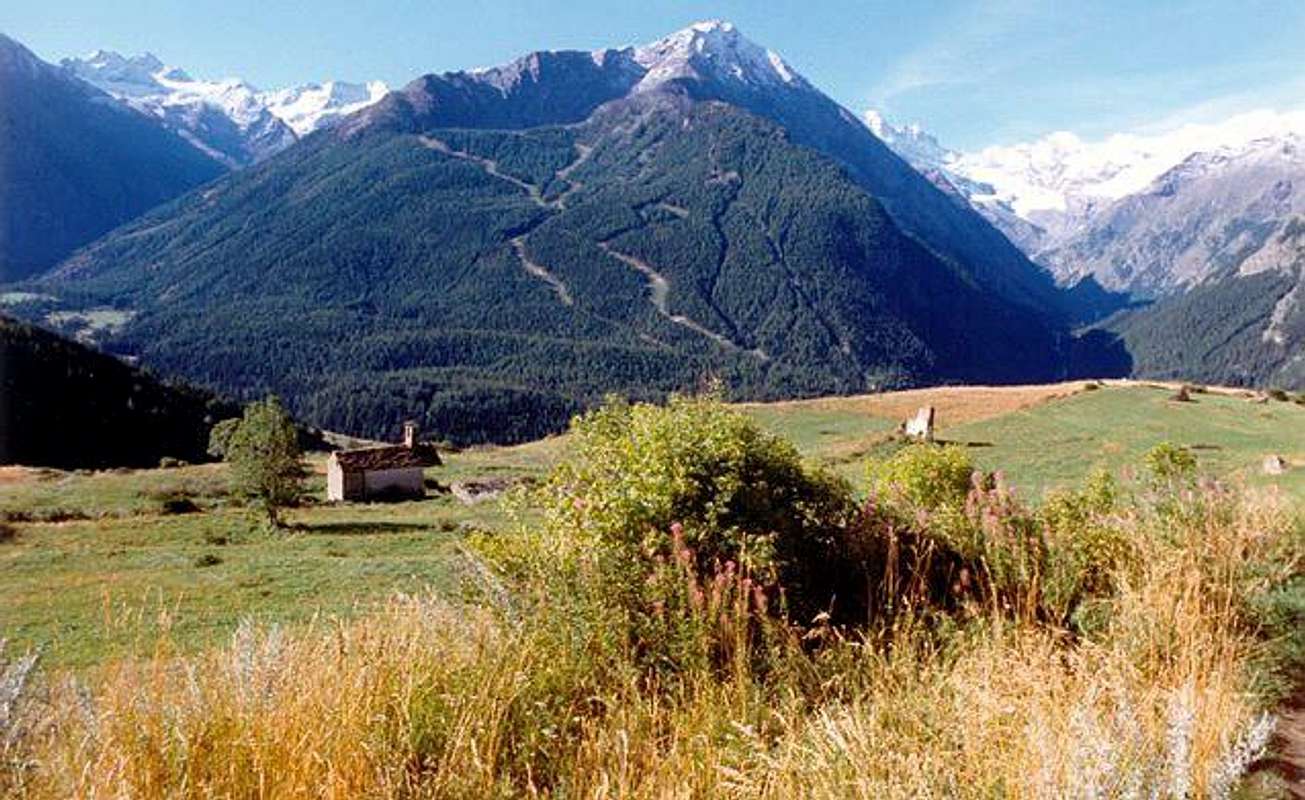
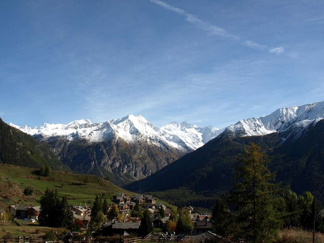
From Aymavilles towards Cogne Valley - From Aymavilles (646m) towards Cogne Valley with Regional Main Road: Vieyes (1.132m) Fraction; continue to Silvenoire, Epinel and Crétaz Hamlets, Cogne (1.534m) Resort, through Main Road. From Lillaz Fraction (1.607m) to Guido Antoldi & Laura Malvezzi Bivouac, by paths in Valeille Vallon, with traces in terminal parts. is not necessary to take Motorway A5: you can drive on SS.26, in the direction of AOSTA - IVREA - TURIN.
Valeille Vallon from Teppelonghe Dessous ![]()
BY PLANE:
- Aeroporto "Corrado Gex" Saint Christophe (Aosta).
Approach towards the Antoldi-Malvezzi Bivouac
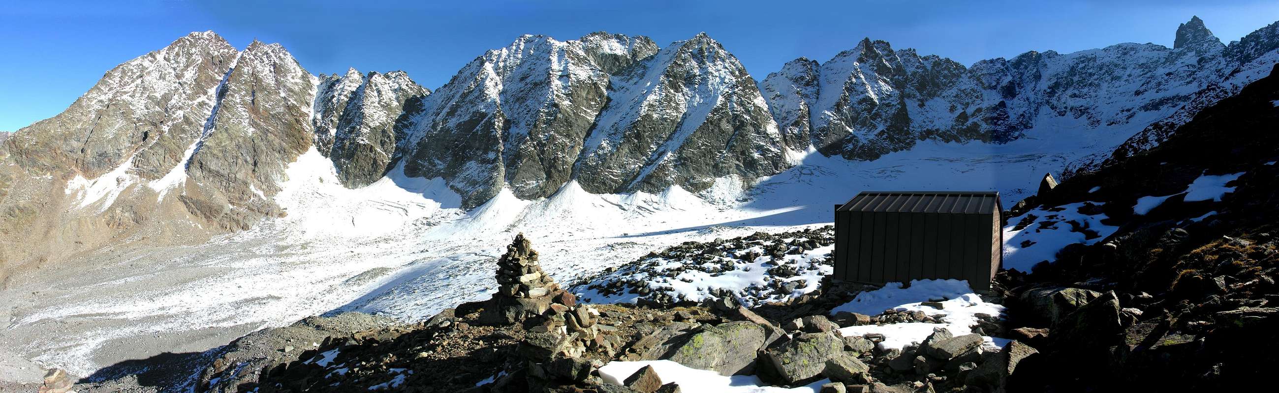
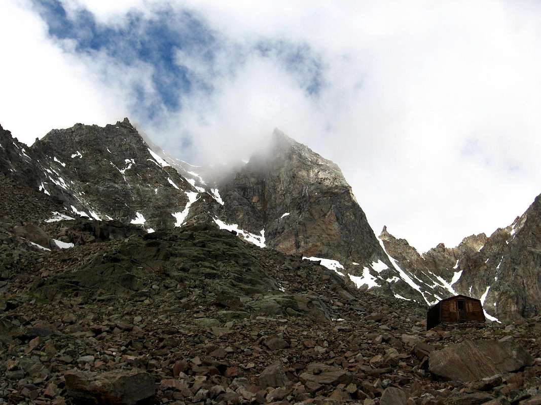
First day: Cogne (1.534m) using bus or car to nearby Lillaz Fraction (1.617m; car parking in the middle of the built up area). Start along the path n° 15 towards the Valeille Vallon, after a terrace follow to a bridge near a big and isolated boulder. Cross the bridge and follow along the path, almost a muletrack, on the left side hydrographic of Valeille reaching the alternative 1.910 meters. Leaving left (East) the deviation with path n° 15A towards in bottom Valeille last Pasture (1.902m) and towards the Arolla Pass (2.892m), continue a big landslide must be passed along tracks. Now along the track leading to the ridge of the morain on the left side (hydrographic) of Valeille Glacier. Continue, with increasingly steep and difficult path, follow the ridge till its end, once there was the old bivouac, and, on quite difficult slopes to the Guido Antoldi-Laura Malvezzi Bivouac (2.920m), collocated on the great shoulder of the Eastern Ridge of Northern Tower of Saint Andrea (3.643m). The first between the two bivouacs destroyed by avalanches in 1970/71 and 1976/77 winters, while the present is installed and opened, with association of the C.A.I. Aosta's Section, on August 20th, 1979 (EE; 4h'15/5h'00 by Lillaz).
![]()
Guido Antoldi-Laura Malvezzi Bivouac below the Apostles Chain, by andrea.it
Primo giorno: da Cogne (1.534 m) tramite bus od in auto raggiungere la viciniora Frazione di Lillaz (1.617 m), ove si parcheggia l'auto nel grande piazzale sito quasi al centro del villaggio. Iniziare la salita imboccando il sentiero n° 15, quasi una mulattiera, dirigentesi nel Vallone di Valeille; dopo aver superato un gradone si prosegue sino a un ponte sito a breve distanza d'un grande macigno. Dopo averlo attraversato, continuare lungo la mulattiera sulla sinistra orografica della Valeille e, dopo aver lasciato al bivio 1.910 m a sinistra (Est) la ramificazione per la sottostante Alpe di Valeille (1.902 m) che con il sentiero n° 15A risale verso il Colle di Arolla (2.892 m), superare su tracce di sentiero una enorme frana. Lasciare il ramo (rivolto alle pendici delle Punte Patrì) seguendo la traccia di sentiero che sale in cresta alla morena sulla sinistra orografica del Ghiacciaio di Valeille. Continuare, con percorso sempre più ripido e faticoso, sino quasi al termine la suddetta, dove sorgeva il vecchio bivacco. Da questo punto, superato un tratto su terreno abbastanza malagevole, si raggiunge il Bivacco Guido Antoldi-Laura Malvezzi (2.920 m), collocato su d'uno spallone della Cresta Orientale della Vetta Settentrionale (3.643 m) delle due Torri di Sant'Andrea. I primi due bivacchi sono risultati distrutti dalle grandi valanghe degli inverni 1970/71 e 1976/77, mentre l'attuale, non molto più in alto rispetto ai due precedenti ma forse più "sicuro", è stato inaugurato, con la compartecipazione del C.A.I. Sezione di Aosta, il 20 Agosto 1979 (EE; 4h'15/5h'00 dalla Frazione di Lillaz).
![]()
Into the Western Gully of Northeastern Summit, by Maurizio Castellan
Route Description
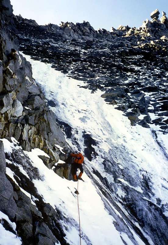
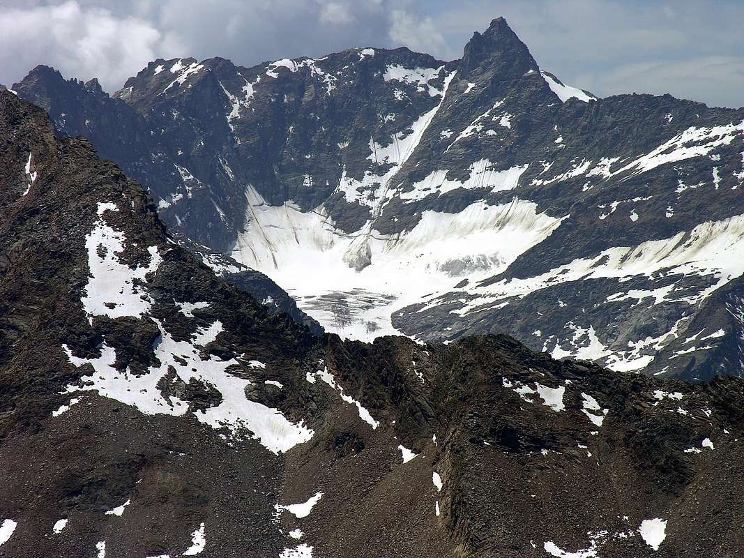
Second journey: from the bivouac, leaving on the right (South) to the Way of the Colle Teleccio (3.312m) and the Tip Ondezana, it descends on the Glacier Northeastern Valeille through the same (usually many crevasses but closed) to the base of the gully that rises between the Valeille's Needle and the Punta Northeast of Valeille. Past the terminal crevasse, that either side does not present major problems but it can be double (the upper part is more challenging), climb up the same staying on his side of the left (North). The slope may be more dangerous that difficult but often presents traits with "verglass" that lead to lean on rocky route, always on the left. This stretch, which has delicate passages but not exceeding II°+, must be accomplished in the quickest time possible and absolutely in the morning, before the sun reaches the couloir. Reached Eastern Pass, or better and precisely, Northeast of Valeille (3.188m) you start the crossing to the South first reaching the Top Eastern or, always better, Northeast Valeille through the Northeast Ridge (3.296m; A/PD/PD+; 0h'45/1h'00 from the carving; 2h'15/2h'45 from the bivouac). The descent on the opposite side occurs quite easily by means of the Crest Southwest which leads to a narrow notch between this and the Central Summit (3.319m) to which it leads with short but more challenging Crest Northeast on the ridge of the edge or by means of a small bypass to the right (West) and then return with a groove. Follow a rocky plaque with poor footings followed by a poised boulder from collapsing that overcome turning around carefully and then to the Summit (A /PD+; 0h'45/1h'00). A ridge more thinner and aerial allows to reach the large and rounded Shoulder 3.312 meters from which with less difficulty to reach the West or Southwestern Pass of Valeille (3.200m). The subsequent Northeast Ridge of the Western Summit (3.357m) is formed by a series of blocks, which lead to a first elevation followed by a small fork, to which follows a reddish plaque (III°/III°+; 0h'50/1h'00), definitely the most challenging part the entire crossing. Without further difficulties but with rather long path along the ridge, and progressively flexing in the Southwest you reach the Top Scatiglion (3.439m) and from this, via the Northeast Ridge and after passing a small rocky promontory, we arrive at Ondezana (3.492m; A/F+/PD; 1h'00 from Valeille Western; 6h'00/7h'00 total from the bivouac). The descent follows the normal route or Western Slope down for easy block with a vertical drop of about 180 meters towards the Col Teleccio; from there to Western Glacier Valeille and the bivouac or avoiding left (West) the same, directly towards Lillaz Village (11h'30/12h'30 in total with descent).
![]()
Leaving the Gulch Western of Northeastern Summit, by Sandrino "Lupetto" Casalegno
Seconda giornata: dal bivacco, lasciando a destra (Sud) la Via per il Colle di Teleccio (3.312 m) e la Punta di Ondezana, si ridiscende sul Ghiacciaio Nordorientale di Valeille attraversando il medesimo (in genere molti crepacci ma chiusi) verso la base del canalone che sale tra l'Ago di Valeille e la Punta Nordest di Valeille. Oltrepassata la terminale, che generalmente non presenta soverchi problemi ma può risultare doppia (la parte superiore risulta più impegnativa), si risale il medesimo mantenendosi sulla sua sponda di sinistra (Nord). La salita può risultare più pericolosa che difficile ma spesso presenta dei tratti con "verglass" che inducono ad appoggiarsi su rocce rotte, sempre sulla sinistra. Questo tratto, che presenta passaggi delicati ma non superiori al II°+, deve essere compiuto nel tempo più rapido possibile ed assolutamente di mattino, prima che il sole raggiunga il couloir. Raggiunto il Colle Orientale o meglio Nordest di Valeille (3.188 m) si inizia la traversata verso Mezzogiorno raggiungendo dapprima la Cima Orientale o meglio Nordest di Valeille tramite la Cresta Nordest (3.296 m; A/PD/PD+; 0h'45/1h'00 dal colle; 2h'15/2h'45 dal bivacco). La discesa sul versante opposto avviene abbastanza facilmente per mezzo della Cresta Sudovest che porta a stretto intaglio tra questa e la Cima Centrale (3.319 m) alla quale si perviene con la breve ma più impegnativa Cresta Nordest o sul filo di cresta oppure per mezzo d'un piccolo aggiramento a destra (Ovest) per poi rientrare con un canalino. Seguono una placca con scarsi appigli seguita da un masso pericolante da aggirarsi con prudenza e quindi alla Vetta (A/PD+; 0h'45/1h'00). Una cresta più sottile ed area permette di raggiungere l'arrotondato Spallone 3.312 metri dal quale con minori difficoltà si raggiunge il Colle Occidentale o Sudovest di Valeille (3.200 m). La successiva Cresta Nordest della Cima Occidentale (3.357 m) é formata da una serie di blocchi, conducenti ad una prima elevazione seguita da una forcelletta, alla quale segue una placca rossastra (III°/III°+; 0h'50/1h'00), sicuramente la parte più impegnativa dell'intera traversata. Senza ulteriori difficoltà ma con percorso piuttosto lungo sempre in cresta con piccoli saliscendi e flettendo a Sudovest si raggiunge la Cima Scatiglion (3.439 m) e da questa, tramite la Cresta Nordest e dopo aver superato un minuscolo promontorio roccioso, si perviene all'Ondezana (3.492 m; A/F+/PD-; 1h'00 dalla Valeille Occidentale; 6h'00/7h'00 in totale dal bivacco). La discesa s'effettua per la Normale o Versante Ovest scendendo per facili blocchi con dislivello di circa 180 metri verso il Colle di Teleccio; da questo al Ghiacciaio Occidentale di Valeille ed al bivacco od, evitando a sinistra (Ovest) il medesimo, direttamente a Lillaz (11h'30/12h'30 complessivamente con discesa).
This route can be considered from PD- up to the AD- (depending on mountain and ice conditions).
L'itinerario è classificato da PD- sino a AD- (dipende dalle condizioni della montagna).
![Punta Ondezana (m. 3492)]()
Equipment
For Mountaineering with rope, ice-axe and crampons.
Da Alpinismo con corda, piccozza e ramponi.
 |
 |
 |
 |
 |
Difficulties & Essential Gear
DifficultiesThis route can be considered from PD- up to the AD- (depending on mountain and ice conditions).
L'itinerario è classificato da PD- sino a AD- (dipende dalle condizioni della montagna).

Equipment
For Mountaineering with rope, ice-axe and crampons.
Da Alpinismo con corda, piccozza e ramponi.
Campings
Remember that free camping is forbidden (except for emergency reasons, over 2.500m, from darkness until dawn).Mountain Condition
- Meteo: you can find all the needed informations at the official site of the Valle d'Aosta Region:
- Valle d'Aosta Meteo
Important Information
- REGIONE AUTONOMA VALLE D'AOSTA the official site.
- FONDAZIONE MONTAGNA SICURA Villa Cameron, località Villard de la Palud n° 1 Courmayeur (AO) Tel: 39 0165 897602 - Fax: 39 0165 897647.
- A.I.NE.VA. (Associazione Interregionale Neve e Valanghe).
Useful numbers
- Protezione Civile Valdostana località Aeroporto n° 7/A Saint Christophe (Ao) Tel. 0165-238222.
- Bollettino Meteo (weather info) Tel. 0165-44113.
- Unità Operativa di Soccorso Sanitario Tel. 118.