
Comments
No comments posted yet.
|
|
Trip Report |
|---|---|
|
|
37.04780°N / 112.9442°W |
|
|
Nov 26, 2019 |
|
|
Hiking |
Canaan Mountain is flat top mesa rising to the north of the town of Hildale, Utah near Utah-Arizona border. As the good Summitpost page mentions, the mesa is surrounded by cliffs and is several miles long and wide. Its top is covered by hills, forests, slickrock formations and streams. From the town of Hildale, two different trails can take you up through weaknesses in the cliffs to the top of the mesa. These are Water Canyon Trail and Squirrel Canyon Trail.
Summitpost page mentions that Squirrel Canyon Trail is often visited by ATV riders. I was planning to do my hike on a cold late November day. I did not want to risk getting wet or deal with icy slippery slopes on Water Canyon Trail, therefore, I chose to hike Squirrel Canyon Trail. Fortunately, I did not see any people on ATVs and the only other hikers I saw were a couple whom I met at the end of my hike when I was only a mile away from trailhead.
Reaching the true summit of Canaan Mountain (7363 ft) seemed to involve a 19 mile roundtrip hike which I was not willing to attempt on a short late November day. Looking at maps, it appeared that once on top of the mesa, I could leave trail and find my way to the top of a 6982 ft high point where I could get good views of Zion National Park to the north so I selected that point as my destination.
Elevation at Trailhead: 5175 ft
Lowest Elevation: 5120 ft
Highest Elevation: 6982 ft
Roundtrip Hiking Distance: 9.75 miles
Tuesday November 26, 2019
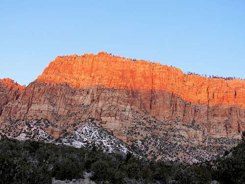
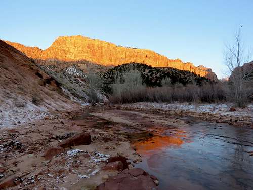
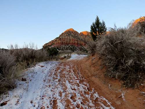
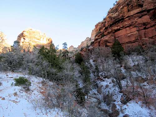
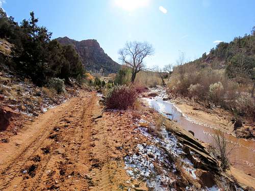
Left the vacation rental house near Hurricane, Utah at 6:45 a.m. when it was starting to light up and drove 30 miles to the town of Hildale where I got on the dirt road that went to Squirrel Canyon Trailhead. The muddy road was frozen solid and had a dust of snow on it. The road took me into a beautiful wide canyon with red colored walls on both side. I soon reached the well signed trailhead. The sun was rising on the spectacular wall to the west of me but I remained in the shade for the next hour or so. It was 26 degrees F.
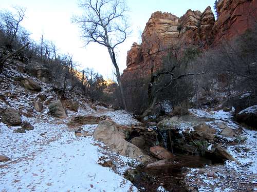
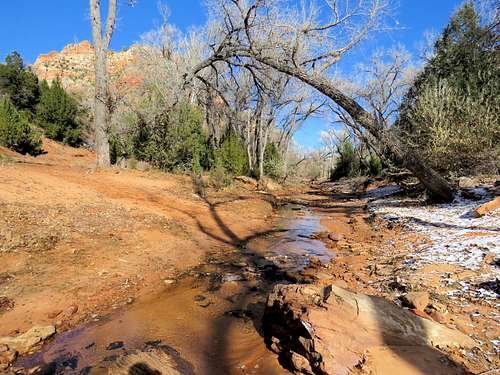
Started my hike at 7:30. I did have winter hat and coat in my backpack but I did not want to wear them thinking that they would make me sweaty walking uphill. I was wearing a thin long sleeve shirt and cowboy hat. My backpack kept me warm as long as the wind did not blow. I did however put on winter gloves, but I often had to remove them to take pictures or look at GPS. The trail went down 50 vertical feet to cross Water Canyon Stream which was shallow and partially frozen.
|
|
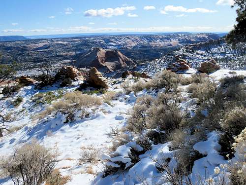
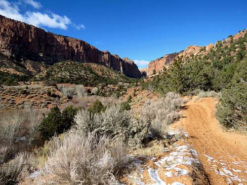
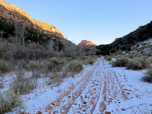
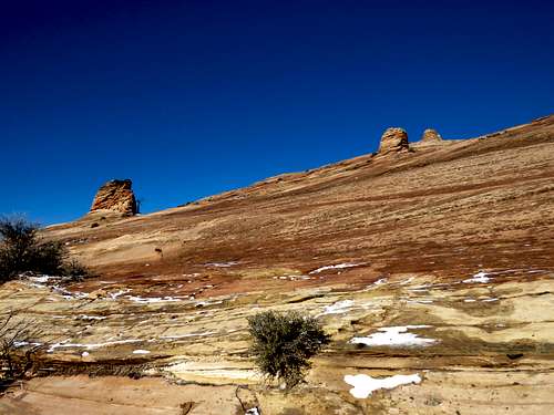
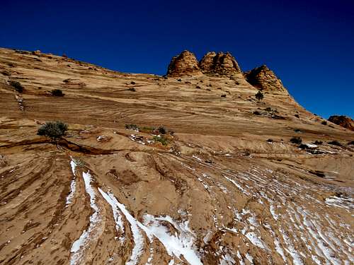
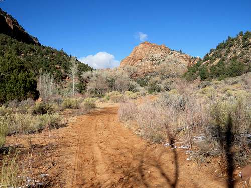
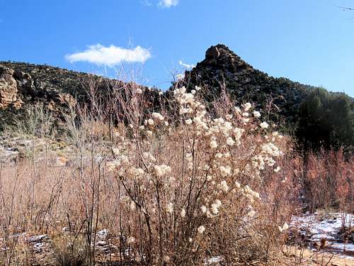
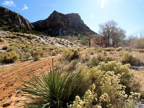
Took the trail back up parallel to a fence and then down into the Short Creek Canyon. I had entered the correct path into my GPS. It showed that I had to cross the creek which was again shallow and partially frozen. On the other side of the creek, I found only dense bushes or fenced private property. Went back and forth across the creek several times looking for the trail. I was thinking that if I were to slip and fall in the water, I would have to end my hike and run back to the car. Finally hiked up along the stream a short distance until I found the ATV path heading north at the bottom of Short Creek canyon. I was walking on snow and frozen mud. The 6476 ft slickrock formation know as Beehive came to view.
|
|
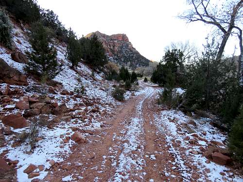
After 1.5 miles, the canyon split. I crossed to the left side of the stream and followed the trail into Squirrel Canyon.
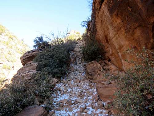
In another half mile, the trail narrowed and the real climbing began.
|
|
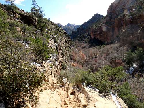
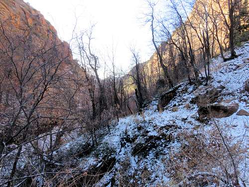
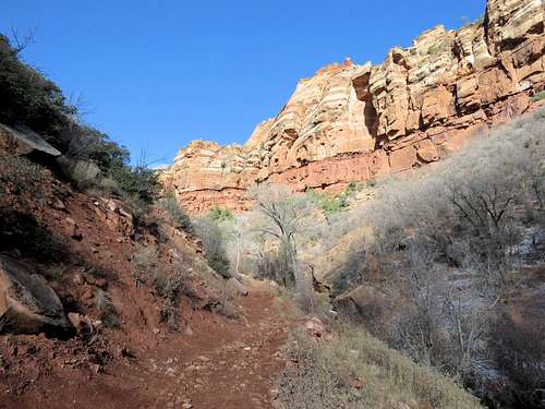
The trail crossed the stream and then began to go up a steep pathway on the wall of the canyon.
At around 5720 ft elevation, I exited the top of the canyon onto a slickrock slope. Looking back south at the canyon.
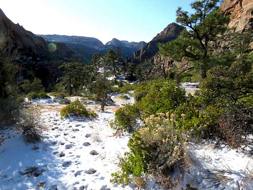
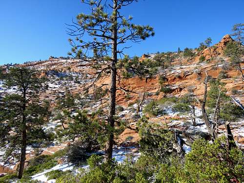
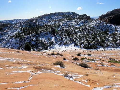
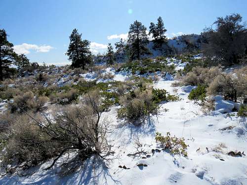
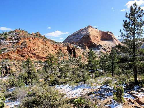
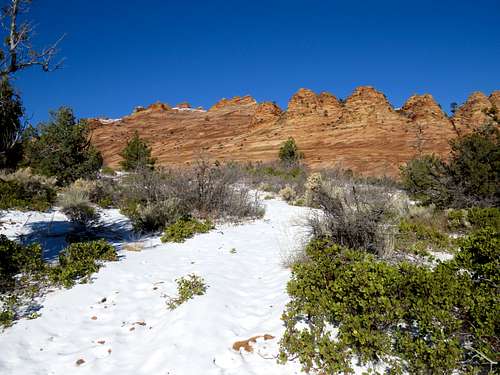
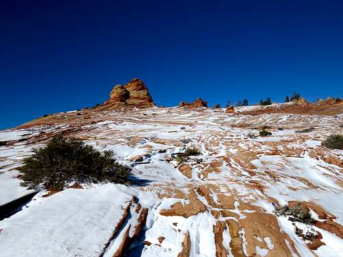
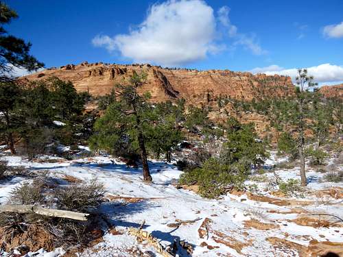
Continued up the slopes through beautiful red slickrock country covered with snow and dotted with juniper trees.
Reached a ridgetop at 6140 ft elevation.
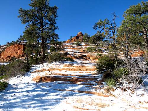
Turned left and followed the path as shown in my GPS. The slickrock was covered with a thin layer of snow and in places ice. Did not want to slip and break a bone in that cold so I was very careful where I stepped. At times, I back tracked to find a path on snow free rock.
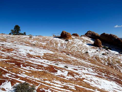
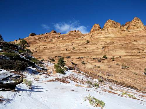
A big slickrock slope with towers rising all over it appeared to the north. I knew that Point 6982 ft was somewhere up there. The slope faced south and was free of snow. I just wanted to get away from the snow and potential for slip and fall.
|
|
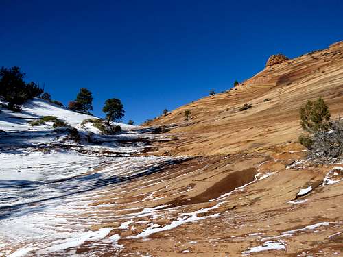
By 6300 ft elevation, I had made my way to the base of the slickrock slope. The border between the snowy north facing slope and snow free south facing slope was quite distinct.
Began walking up the red slick rock slope (Days later I measured the slope on the map at 27 degrees).
|
|
Looking down the slope.
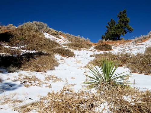
Went behind some hoodoos and found myself on a less steep slop that faced southeast and had stripes of snow. I was again worried about slip and fall.
|
|
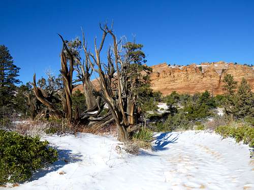
The slickrock suddenly ended and I reached a frozen sand dune with trees and bushes. That was strange.
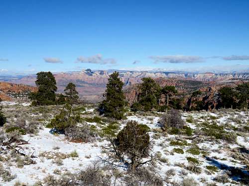
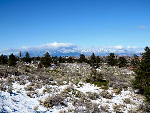
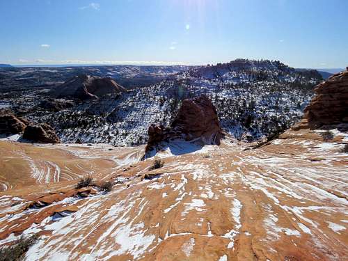
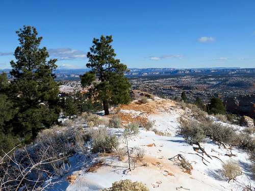
Went up the sand dune and reached the top of Point 6982 ft at 10:40 a.m. and 4.86 miles of hiking. I could see West Temple in Zion National Park to the north.
Signal Peak to the northeast.
Other views.
|
|
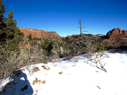
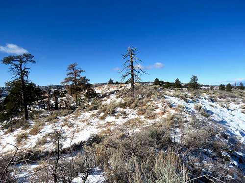
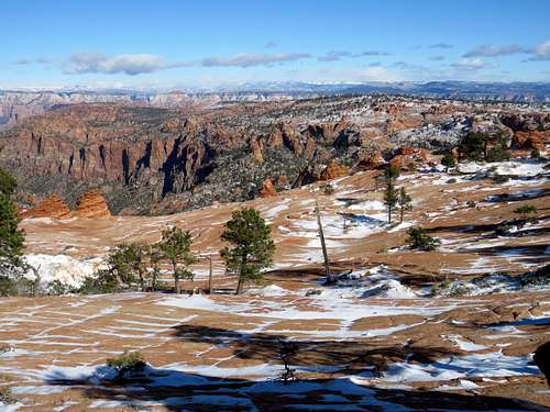
It looked like if I went down on the north side of the sand dune, I would reach a plateau with better views north. I began walking north down ankle deep snow and bushes.
At 5.04 miles and 6930 ft elevation, I reached the edge of a red slickrock plateau with good views of Zion National Park to the north. Put on the winter coat, took off the gloves and sat down to eat my cold sandwich. By the time I was done eating, my fingers had gone numb from the cold.
|
|
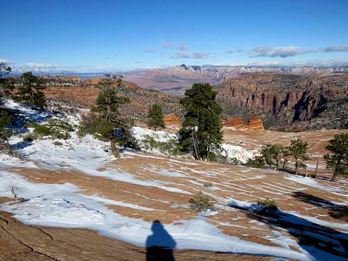
Packed my stuff and began to walk back the way I had come. I could see the Beehive far below me.
Made it down the slickrock slope. Looking back at it.
|
|
Another view of the Beehive.
The steep path into Squirrel Canyon.
Bottom of Squirrel canyon.
|
|
The junction with Short Canyon.
I was then hiking down the ATV track along Short Creek. The ice had melted but fortunately it was not very muddy. I ran into a couple hiking up the path. Those were the only people I saw all day.
|
|
|
|
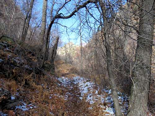
Looking up Water Canyon near Trailhead.
Reached the car at 2:00 p.m. It was 37 degrees F. Driving back, I encountered mud on the dirt road. Had it been warmer, I could have become stuck in the mud but at that point, I was very thankful for the beautiful day I had had.