Your object was successfully created.

|
|
Route |
|---|---|
|
|
40.35440°N / 106.6992°W |
|
|
Hiking |
|
|
Spring, Summer, Fall, Winter |
|
|
A long day |
|
|
Class 1 |
|
|
Getting There
From Steamboat Springs, drive south and east on Highway 40 or about 19 miles, over the west summit of Rabbit Ears Pass and to the turnoff to Dumont Lake on the north (left) and Harrison Creek on the south. A sign marks the turnoffs. In winter, you will have to park on the highway on the north side of the road.To reach the same trailhead from Kremmling, drive east and north along Highway 40 over Muddy Pass. The trailhead is something like five miles west of Muddy Pass, but check this yourself.
In summer, you can follow the Harrison Creek/FR 251 road south for about two miles before parking. The road is apparently good for 2wd’s to this point, if driven with care, but is not passable to 2wd’s beyond.
This above is the trailhead I used. Actually there is a shorter route in winter. About 1.5 miles or so west of the trailhead described above, there is a short plowed road that leads to a parking lot. This trailhead will offer a shorter route to the summit.
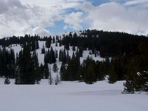 This is the very gentle and unintimidating north summit of Walton Peak.
Route Description
Winter:In winter, there are snowmobile tracks all over the place. Make sure to take a map and compass. I used the route from the turnoff off Highway 40 to Harrison Creek Road/FS 251. I followed a snowmobile track south, staying on the track the headed towards the ridge top. Once on the ridge, I continued on the track south and to a big meadow. This was too far south, and I headed more westerly to the peak once it was visible. I never did see the sign for the junction of FS 303 and FS 251, so it may be buried under snow in winter. When heading west, you will descend gradually to an open area. You then head a bit north to the Northeast spur of Walton Peak. More than likely, there will be a snowmobile track all the way to the top unless you visit just after a big storm.
I returned via a different route. Backtrack to the open area. A snowmobile track heads north and to the highway, staying not far east of the well marked snowmobile boundary (only skiers are allowed west of the boundary). This main track goes all the way to the highway and the alternate trailhead described above in the Getting There section. This is a shorter route to the peak than the one I used. Once fairly close to the highway, I headed east over the hills to join the track I used for the ascent. My route was about twelve miles round trip, but it will be a shorter hike or ski if you use the alternate trailhead.
 Walton Peak on a gloomy winter day. March 4 2006. This is the east side of the peak.
Summer:
As stated, you can drive to the junction of FS 251 and FS 303. Most people hike west along the track to the summit. This hike is eight miles round trip. This is supposedly a rough 4wd road in the summer, but I don’t know if it is open to the public (the small tower on top is for CDOT). Supposedly hikers are welcome, but apparently the road is not open to the general public. It is a popular hike in the summer, and the hike is supposed to pass through many meadows filled with wildflowers.