Toggle navigation
Mountains
Routes
Images
Trip Reports
Forum
What's New
People
Areas & Ranges
Articles
Trailheads
Canyons
Huts & Campgrounds
Albums
Logistical Centers
Fact Sheets
Lists
Custom Objects
Gear
Plans & Partners
WELCOME TO SUMMITPOST
SIGN IN
REGISTER
Hallett Peak
Additional Parents
Descent via Flattop Crags
Image
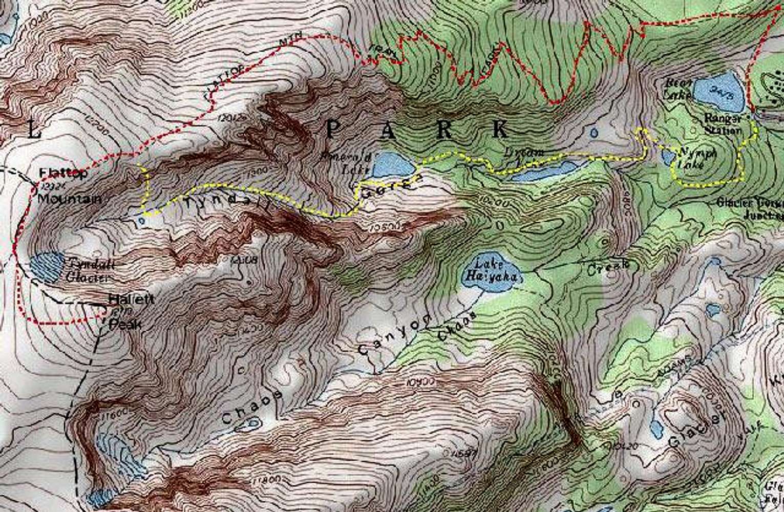
I know this isn't the best...
View High-Resolution Image
I know this isn't the best...
I know this isn't the best map, but it gives you an idea of the route.
The red line is the route of ascent.
The yellow line is the approx. route on the way down.
Route mapped using National Geographic Topos.
USGS "McHenry's Peak" Quad
« PREV
NEXT »
smudge
on
Apr 23, 2003 5:19 pm
Comments & voting
Other parents
Lat/Lon:
40.30310°N / 105.686°W
Image ID:
19809
3046 Hits
73.06
% Score
3
Votes
Log in to vote
Comments
No comments posted yet.
to post!
Don't have an account?
Hallett Peak
(Mountain/Rock)
« PREV
Viewing
#109 of 194
GALLERY
NEXT »
smudge's Image Gallery
« PREV
Viewing
#272 of 352
GALLERY
NEXT »
Descent via Flattop Crags
(Route)
Loading....
×
You need to login in order to vote!
User Name
Password
Remember me
Forgot your password?
Log me out when I close my browser.
Keep me logged in all the time.
sign in as a user
Don't have an account?
Register now for FREE
Rating available
Suggested routes for you
People who climb the same things as you
Comments Available
Create Albums
Register Here


