Shah Alborz South route

Shah Alborz South route

Page Type Page Type: Route
Location Lat/Lon: 36.31314°N / 50.75298°E
Additional Information Route Type: Hiking, Mountaineering
Seasons Season: Spring, Summer, Fall
Additional Information Time Required: A few days
Sign the Climber's Log

Overview


While the south slope of Shah-Alborz looks not steep and technicaly hard, finding a good approach to the summits may be confusing.

The reason is having to many hills, high and lows and the long distance that wont let have a good estimate how and when.
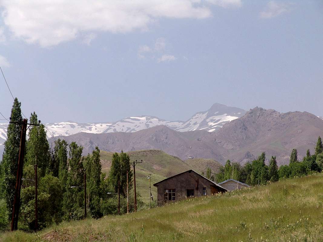
The starting points are all from Taleghan valley north villages, but Hasanjoon village is the best starting point as it has the most straight forward route to the highest peak of Shah-Alborz (this writing is exclusively for this route).


Dangers on the route :


Wild animals :


The whole south slopes of Shah-Alborz seems to be involved with the wild-life of animals like small and larg brown-bears, wolves...


Shepherd dogs :


There are a lot of shephered dogs, they wont hesitate to bite you if you get into their domination and disregard their warnings, if you can't call the owner the best way is to by pass them.


Winter conditions :


Taleghan has serious winters, the route is too easy for summer but needs a lot of care for winter, it would become a typical hard non technical winter climb.


Profile :


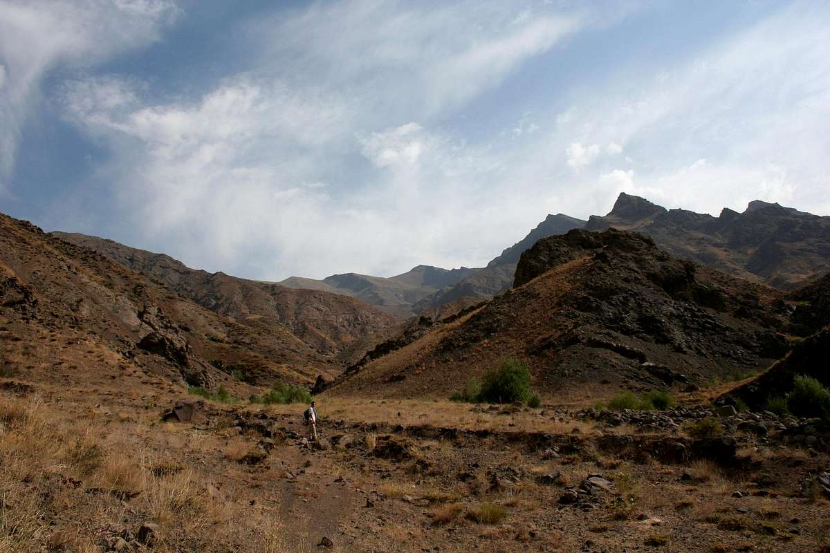
The south slopes of Shah-Alborz are not ragged, glacial and steep walled like the north face.
Instead of scree, rocks and stones the ground is mostly soil and vegetated with grass and other short plans most of the time at summer, and covered by snow the other seasons.

* Descending on this route takes a lot of time almost as long as the ascending.


There is no huts on this route, the climber sould have a tent for camping.
I would recommand camping in a safe place maybe near the shepherds capms because of the danger of wild animals.
Estimate climbing time :


Summer :

Local people and guids suggest 3 days.
I would say 2 days.
Can be done in a 15-17 hours almost a deadly, non-stop hike in one day.
Winter :
Depending on the conditions more than 3 days.

Getting There


  • Fly to Tehran-Iran (if you are not in Iran)

  • If you have a car :

    Drive 140Km west from Tehran on Tehran-Karaj-Qazvin highway until the
    Taleghan sign at the right of the highway.

    Turn right and drive until you reach inside Taleghan valley at the small
    city named Shahrak.


  • If you dont have a car :

    Hire an exclusive taxi to take you there or find a taxi to Taleghan at
    Azadi SQ of Tehran. they will take you to Shahrak center of Taleghan
    valley.


  • Reach Hasanjoon village, it would take about 15 minutes from Shahrak,
    take a taxi from shahrak or drive at the north road of the Shahrak square
    until you reach the village, there is a small place like a parking you can
    park your car and do the climbing at the end of the road.


Route Description


Part one :


Hasanjoon village to Doorban.

1-3 hours


Assume you are at Hasanjoon village, you have to hike the village upward
until you finish it it's some how steep, you can have questions form the
locals they are really helpfull, kind and cultured unlike many people who
live in big cities.

Follow the trail beside the gardens, the river should be at your right side,
and you should gain height against of the river. there is a small water
channel, don't follow the channel it would take you down the to the river
and climbing up is really hard.

after the gardens there is a wast field loose some height and go to the end.

hint : at least you will reach the river in a plane.
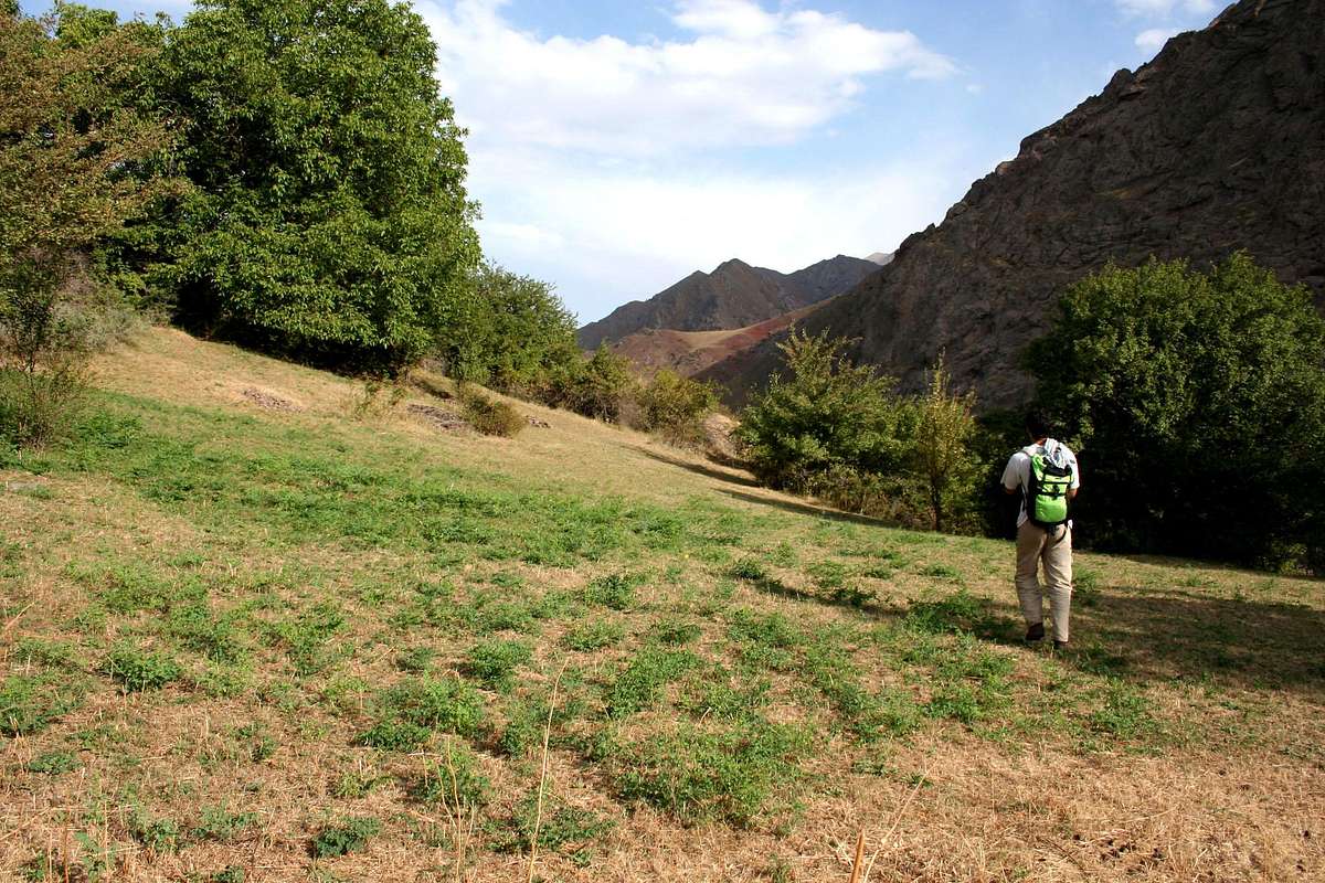


After the gardens


Hal nut trees in far.


Part two :


Doorban to the south-east ridge base.

2-3 hours


Doorban is the last place where few people live stationary.


*If you get confused at this part will go on the Alamoot peak route by
mistake that would take 4days to reach there!


the river should be at your right follow the river, keep eye on the walnut
trees at right.

before the river gets branched pass across the first branch and the second
branch, there may be a rotten wooden bridge.

after the last branch the grass field and walnut trees should be at your
right side and a rising slope, the river at your left and a narrow space
within the bushes between the river and the walnut field...

go on the narrow until you reach a small plane, the river leaves you between
the hills, there is another river at your right, and the south-east ridge
rises in front.

This place is good for camping.


Part one and two would make you tired and take a lot of time but to be
honest you havn't gained a signifable height. And now you are at 2200m.


The starting of the ridge


Part three :


The ridge base to the shepherds camp.

about 4-5 hours


Get close to the ridge base, there is a sign showind the right way to the
Shah-alborz peak. follow the sign there is a narrow trail to the shepherds
camp anyway.

The trail starts and remains steep until you reach the top of the hilly like
part (about 2560m). The soil is slippery enough at summer so the icy...

There must be a sign and the trail would be divided in two, anyway just keep
right. this was confusing for me when I saw the peak at left and the locals
told me to always keep right as a hint !

From this point the ridge would be bumpy to the top and it's not a good idea
to go on it, so the remaining part is on a narrow trail
traversing(south-north) the steep east face of the ridge.

The trail ends at a grassy plane to be followd to about 3400m while you can
see some ragged seri of peaks at right and the camps in front.


After the shepherd camps near the crest


Part four :


Shepherds camps to the peak.

2-3:30 hours


There is no trails from here but you can see the east-west shah-alborz crest
and not the peaks ! and now you are on the south-east ridge you had to
travers in the past but it's so vast now.

you have to climb up to the crest on the remaining of the south-east ridge.

it gets steeper and steeper.

When you reach the crest there is Tanoor-khan at right and Shah-alborz the
king peak at left, the last 50m to the peak gets even more steep.

until you are on the top.

as long as you are on the crest the north side falls so steeply down, you
may see the tip of the glaciers to the top.

the north and west part of the summit fall dramaticly down unlike the east
and south which are sheer.


Essential Gear

Summer :
Summer clothes for the day.
Warm clothes for the night,the night becomes dramaticly cold compared to the day.

Winter :
Crampoons and rope for safty, so you wont slip down the steep slopes when the route gets too narrow.

External Links

Add External Links text here.


Parents 

Parents

Parents refers to a larger category under which an object falls. For example, theAconcagua mountain page has the 'Aconcagua Group' and the 'Seven Summits' asparents and is a parent itself to many routes, photos, and Trip Reports.