

-
 13368 Hits
-
 74.72% Score
-
 5 Votes
|
|
Route |
|---|---|
|
|
34.20927°N / 118.29179°W |
|
|
Hiking |
|
|
Less than two hours |
|
|
Overview
A pleasant hike popular for fitness with three lower starting points off of Wildwood Canyon Road in Burbank, CA. (Access turns off from the road going up to popular Castaways restaurant). The trails from the three starting points ultimately merge at a cleared area with a picnic table and a nice view by itself. From this cleared area a ridge trail begins, which is steeper but well-maintained, that proceeds up to a communications structure. At this point there is a posted map trail and donated bench seat and from here one can proceed along a fire road, if desired, to Verdugo Peak.Getting There
From Interstate 5, exit Magnolia Blvd and head north to the end of Magnolia. Turn left on Sunset Canyon Drive. After three blocks, turn right on Harvard Road and climb a short way until you see the park entrance on the right (see map link below). The parking lot is immediately after the park entrance, on the same side of the road. Alternatively, you can drive up into the park if you want to start hiking at a higher elevation. There is another trailhead, but they lock the gates at dusk.Route Description
If you drive all the way you can up Wildwood Canyon Road, park your car, and go through a walk through gate at the end of the road, the trail begins at the wide point shown here: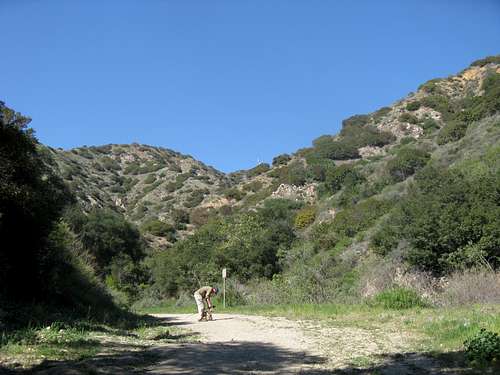
This shot was taken looking back on this trail. The beginning of the trail at the very end of the Wildwood Canyon Road can by spied near the bottom of the picture, in the middle and, moving right and up from here, along a ridge line, you will find a spot of obvious cleared area in the green where a trail up the ridge line begins.
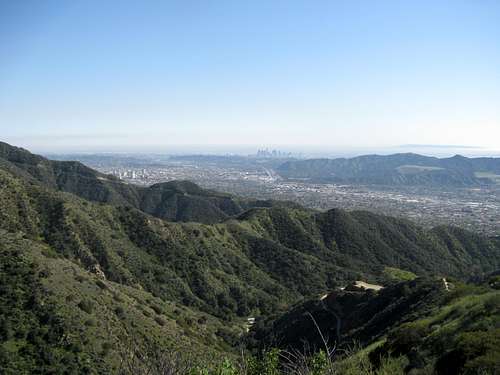
The trail on this ridge is relatively steep (with switchbacks) and offers superb views as you go up it. Looking up the mountain you can see various communication structures in the Verdugo Mountains, and Verdugo Peak. As you approach the top of this ridge trail, the following communications structure comes into view:
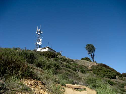 This structure is at the top portion of this trail. It is not, however, the summit. Once you are level with this structure, you still have to travel over fire roads to the summit of Verdugo Mountain, which is another 200 vertical feet and some distance away. But, if your goal is to hike this trail for exercise, once you gain this point, it is a good time to turn around.
Once you get to the top of this ridge trail there will be a leveling off and a trail map. Here is a picture taken of this point from a wonderful donated bench seat:
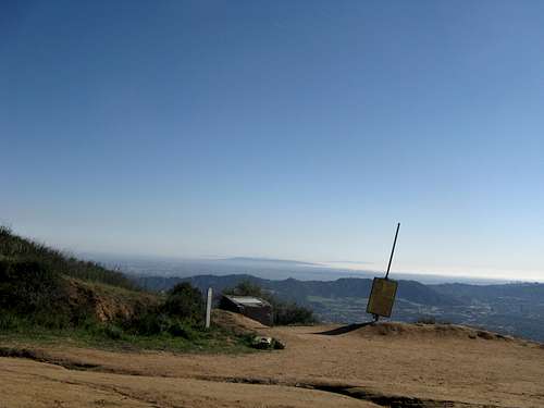
There is a chair, sort of like an Adirondack chair, that was donated in memory of somebody, located at the top of this trail. It is comfortable; too much so. This picture was shot from the chair. It looks back down toward the trail and a marker found there with a map. So the real purpose of this picture is to document this point, which is a good point to turn around if you are doing this trail for exercise and not to reach the summit.
From here, it is a fairly easy walk, if desired, to Verdugo Summit. Note that the distance from here to the actual summit is probably half a mile or so.
For local hikers, it is worth comparing this hike to the one going up to Echo Mountain, especially if you live closer to this hike. The two hikes have many similarities in terms of distance and elevation gain (this one has more); however, this hike is more enjoyable and gets more to the point quicker (meaning it is steeper).
Essential Gear
No real equipment needed except for water. Poles are useful on the ridge if you are used to them. A camera will be rewarded with good vista shots on clear days. A pair of binoculars might prove useful for looking out from the vistas and enjoying them when not hiking.External Links
Google Driving MapGoogle Satellite Image Scroll north and you can see the entire trail...