Stats
Distance: 18 miles
Elevation Gain: 9814’
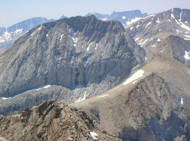
Mount Keith
I camped at the Shepherd Pass Trailhead Sunday night. Monday morning, I followed the sandy trail, crossing Symmes Creek four times, then climbing out of Symmes Creek and traversing to Shepherd Creek. I passed Mahogany Flat and Anvil Camp and reached The Pothole. I only passed eight people including two people at the first saddle with kayaks. I didn’t bother asking any questions and just continued along the trail. At the Pothole, I briefly looked for a cairn marking the Old Junction Pass Trail. Not seeing one, I left the Shepherd Pass Trail, crossed Shepherd Creek and began ascending towards the south rib of Mount Keith.
 Mount Keith
I saw a few cairns, but did not notice much of a trail. The cross country approach to the rib was not that bad: stable boulders and talus. I even passed a meadow that would make for a great campsite. Once on the rib, the ascent became more interesting. The south rib offered a lot of third class scrambling on primarily solid rock. Good route-finding was required to keep the scrambling at only third class. About 200 feet below the summit on the far west end of the rib, I encountered some great exposure.
 Junction Peak
The summit provided good views of Mount Williamson, Mount Tyndall, Mount Barnard, Trojan Peak, Mount Stanford, Junction Peak and Caltech Peak. I thought to myself that this was the first time I could see all the peaks I had remaining to finish the highest 100 peaks in the contiguous US.
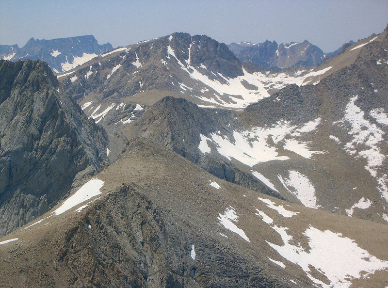 Caltech Peak
I descended the east chute. The chute was initially sandy, but soon became full of scree and loose rock causing me to be in a state of nearly constant falling for almost 5000 vertical feet. Once I could see the Shepherd Pass Trail, I thought the suffering was nearly over, but then found myself in a thorn patch. Once I extracted myself from the thorns, I began descending the drainage itself to avoid anymore thorns. The drainage led to a waterfall. Since I didn’t feel like taking a ride down the waterfall, I climbed out of the drainage, then downclimbed a nearly vertical slope full of dense bushes. Soon I found myself on a series of game trails that led back to the Shepherd Pass Trail.
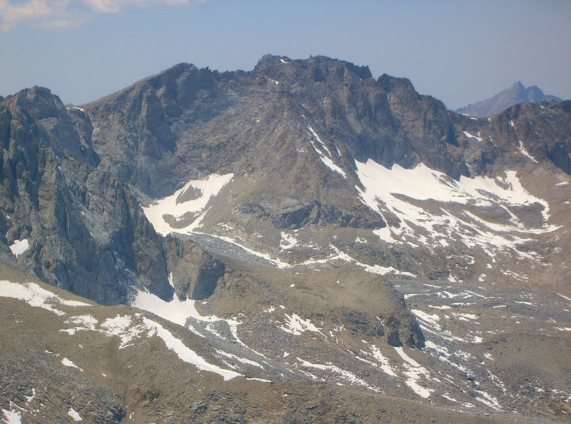 Gregorys Monument & Mount Stanford, from left to right
Despite the tedious descent in the east chute, perhaps it was a better option than the south chute just west of the rib I ascended. However, traveling due south out of the chute just before it turns southeast may be a better option to exit the chute. Once I found some shade along the trail, I took the time to empty my shoes and socks of many rocks I collected during the descent of Mount Keith’s east chute. The ascent over the three saddles during the traverse back to Symmes Creek was not particularly welcomed. The rest of the descent out to the trailhead was uneventful.
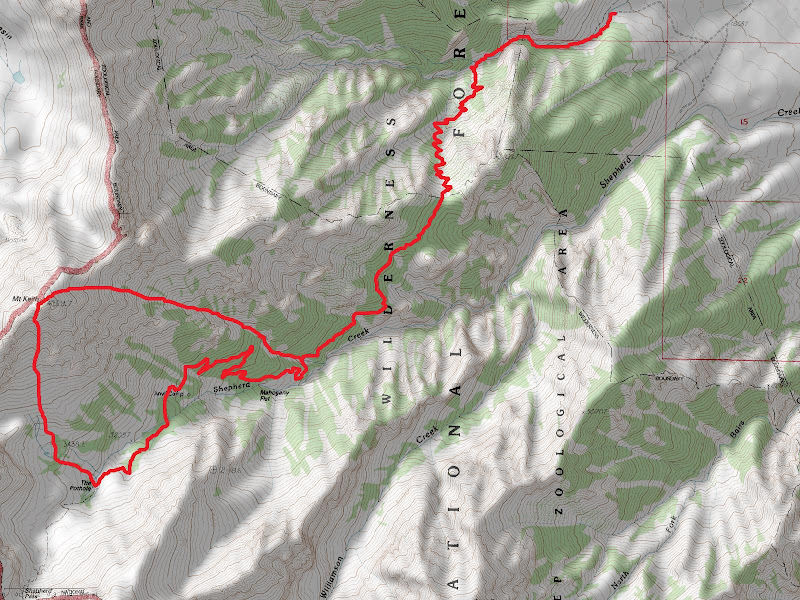 Map
Map
Comments
No comments posted yet.
