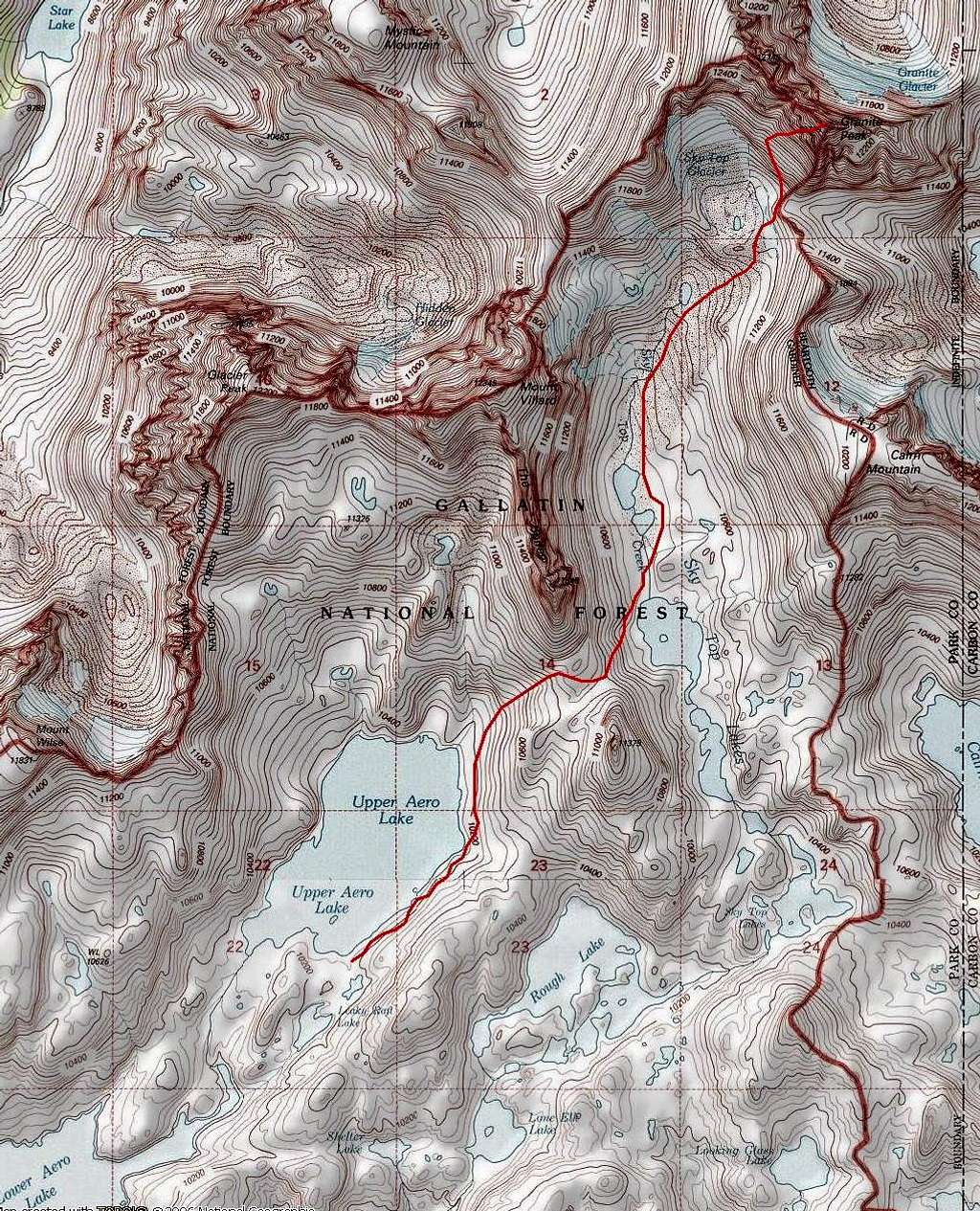
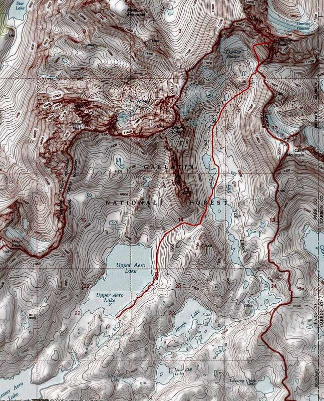
Southwest Couloir Route from Upper Aero
This Topo! image replaces my previously posted map. It shows the last four miles of the southern approach to Granite Peak (red line), beginning at the south end of Upper Aero Lake. Lower Aero Lake is at the lower left corner of the map. The Spires and Mount Villard block the view of Granite Peak from the lakes. Image is from Montana Topo! (USGS maps) www.topo.com.


