
|
|
Route |
|---|---|
|
|
40.76053°N / 110.2886°W |
|
|
Hiking |
|
|
Summer, Fall |
|
|
A long day |
|
|
Mostly class 1, but some class 2 |
|
|
Overview
This route describes a hike to the top of Val Benchmark (12516) located in the Uinta Mountains of Utah. It is over 16 miles one way to the summit. Most of the route is on a well-maintained trail or involves straightforward cross country travel. There is a 1-mile section towards the end that is class 2, possibly easy class 3, but the rest is class 1.
In brief, start at Henrys Fork Trailhead and take the trail 9.75 miles to Gunsight Pass. Drop into Painter Basin and head for Trail Rider Pass 3.6 miles away. From the pass, follow the ridge 2.85 miles east to the summit.
Stats
Length: 16.2 miles 1 way
Round trip elevation gain: 4700 feet
Start elevation: 9400 feet
Summit elevation: 12516
Getting There
The route starts at the Henrys Fork Trailhead, located on the north slope of the Uintas, about a 2.5-hour drive from Salt Lake City. See the directions in the Getting There section for the Val Benchmark page.
Route Description
Start at Henrys Fork Trailhead and take the trail 9.75 miles to Gunsight Pass. A major milestone 5.3 miles along the way is Elkhorn crossing, where you cross the Henrys Fork River on a bridge located at N40 51.277 W110 22.953. You don't want to miss this bridge as the water will be flowing fast and furious for much of the summer. After cresting the pass you get your first view of Val Benchmark. Here's what it looked like mid-morning.
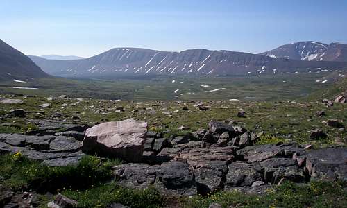 Val Benchmark ridge
Here's what it looked like late afternoon from a point a little farther from the pass.
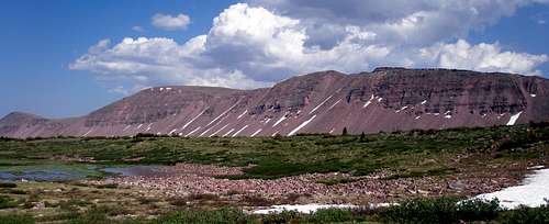 Val Benchmark ridge
From the pass, take the trail (#168) SE into Painter Basin 1.5 miles until you reach the intersection with the trail heading toward Anderson Pass at N40 46.886 W110 20.519. Leave the trail and travel cross country 1.6 miles to the base of Trail Rider Pass as shown by the red line on the map. There is a trail shown on the USGS map (#043) that you can try to pick up. However, it's either not where it's supposed to be or is not distinctive enough to notice so I just continued cross country towards the pass.
There are several small streams that require minor scouting to find a crossing. Even though several swamps are shown on the map, they can always be skirted easily. As you near the base of the pass, you will begin to see cairns marking the way, but no distinct path. As the route steepens, a distinct path appears that is followed to about 11640 feet at which point you should start veering east to attain the ridge. It is about .4 miles from the base of the pass to the pass.
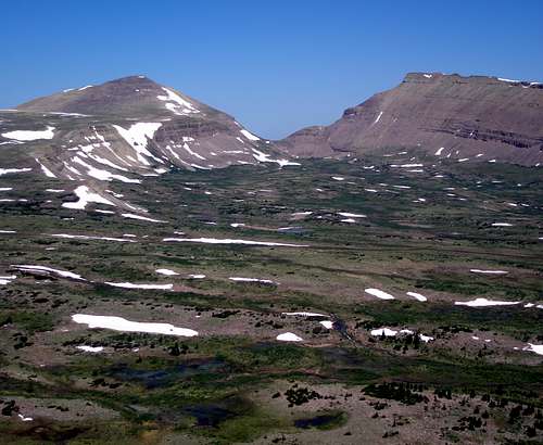 Looking back at Painter Basin and Gunsight Pass
At the top of the pass follow the ridge 1.5 miles east, until bump 12327 is reached. This portion of the ridge has a definite crest to it. The one-mile stretch preceding 12327 is rather slow going. If you stick to the top of the ridge you will find large flat shifting slabs. It's not difficult, but you have to be careful and it's time consuming. In this area I found tons of large spider webs stretching 3 feet or so from one big rock to another. This also made the going slow because I was afraid that if I plowed right through, I might get bitten. On the way back, I stayed lower and traversed to the south of the ridge. The rocks were smaller and didn't shift, but I wouldn't call them easy to walk on and progress was again slow.
From the top of 12327 it is another 1.35 miles to the top of Val Benchmark This section of the ridge is more like a plateau than a ridge and has no well-defined crest.
 The ridge leading to 12327 |
 Approaching 12327 Approaching 12327 |
 Almost at the "summit" of Val Benchmark |
Time Needed
I did this trip in one long day. It took 7 hours and 50 minutes to get to Val and 16 hours and 20 minutes round trip. Most people would prefer to set up a base camp in Painter Basin and do this and several surrounding peaks on the same trip. From Trail Rider Pass at the west end of the Val ridge, it looked as though one could scramble up the ridge to the southwest about a mile to climb Trail Rider Peak. From that summit it is less than a mile to either Roberts Peak south or Painter Peak north. All three of these peaks are seldom climbed.
 Roberts Peak |
 Trail Rider Peak Trail Rider Peak |
 Painter Peak |
When to Climb
July through early September are the best months to hike in the Uintas. June might be okay depending upon the previous winter's snowpack. In early summer, the portion of the trail through Henry's Fork Basin will likely be very muddy and in places have standing water on it. The mosquitoes will be biting all summer long. In September, the mosquitoes have dissipated but any precipitation coming down after September 1st will most likely be as snow. It will melt quickly at the beginning of the month but by the middle will stick around until next summer on shady northern slopes.
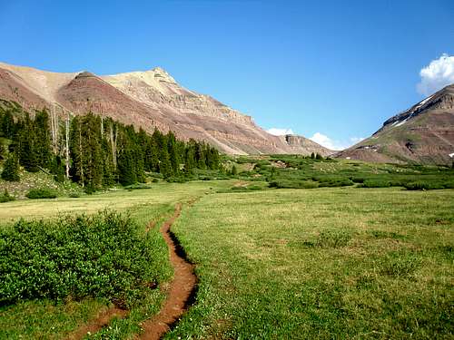 Henrys Fork Basin in early July
Essential Gear
Mosquito Repellent
Map
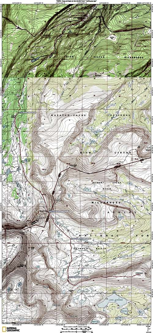 Henrys Fork route to Val Benchmark