
-
 11123 Hits
-
 77.48% Score
-
 8 Votes
|
|
Route |
|---|---|
|
|
48.38732°N / 113.33307°W |
|
|
Hiking, Mountaineering |
|
|
Spring, Summer, Fall, Winter |
|
|
Most of a day |
|
|
Class 3 |
|
|
Easy |
|
|
Overview of the Firebrand Pass Route:
Layout designed for best viewing on a "1024 x 768" screen.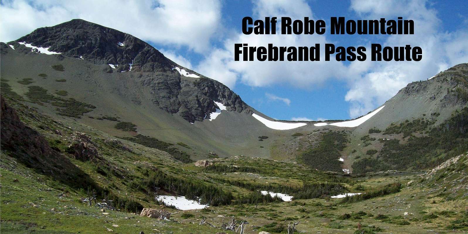
Calf Robe Mountain,The Firebrand Pass Route, Glacier Park Class 2 & 3
Calf Robe Mountain lies on the southeastern boundary of Glacier National Park near Marias Pass. For information on Calf Robe Mountain please visit the Calf Robe Mountain page.
J. Gordon Edwards does not designate names for either of the routes for Calf Robe Mountain published in his writings. They are named here for purpose of clarity only.
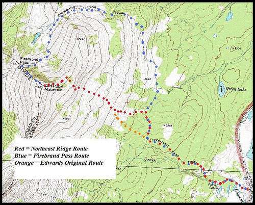 Firebrand Pass Route Map
The Firebrand Pass Route is a pleasant mostly hiking alternative to the Northeast Ridge Route and avoids nearly 1,300 feet of off trail climbing. The route, like the Northeast Ridge Route, crosses some spectacular habitat for elk, Rocky Mountain sheep, mountain goats as well as deer. This area is also home to black and grizzly bears. The bowl below Firebrand Pass is truly amazing to experience as is the wind when it is blowing.
Calf Robe Mountain is a featured peak in J. Gordon Edwards’ A Climber’s Guide to Glacier National Park and the route descriptions are located on pages 317-318. He describes an elevation gain of 2,800 feet via the Firebrand Pass (with a mileage of approximately 5.3 miles one way).
An alternate route, the Northeast Ridge Route, is also available and the gains the same elevation in approximately 3.5 miles one way.
Getting There:
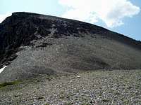
 Firebrand Pass
The Coonsa Trail (also referred to as the Firebrand Pass Trail on some maps) leaves U.S. Highway 2 at the Lubec Trailhead, which is located at mile marker #203. There is ample parking near the trailhead.
Route Statistics:
Actual elevation gain from U.S. Highway 2 = 2,836 feet
Total One-way Distance: 5.3 miles
Firebrand Pass Route Description:
 Looking to up from Firebrand Pass
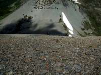 Looking to Firebrand Pass
 Calf Robe Cairn
 Summit from Calf Robe
The map in the overview section shows both featured routes as well as Edwards’ original start for the Northeast Ridge Route.
The route associated with this page generally follows Edwards’ Class 2 & 3 Firebrand Pass Route to Calf Robe Mountain.
This route adds additional distance to the trip and requires either Class 2 & 3 scrambling up the northwest flank of the mountain to the summit. This approach is particularly attractive if there are other peaks to the north included on the day’s agenda. There are 4.8 miles trail and 1,867 ft elevation gain to the pass and another 997 feet of scrambling to the summit of Calf Robe Mountain from Firebrand Pass.
Main Trail Distances and Junctions are:
Lubec Lake Trailhead - Start
Lubec Lake - Autumn Creek Trail Junction = 1.4 miles
Autumn Creek Trail - Firebrand Pass Junction = 1 mile
Firebrand Pass = 2.4 miles
Off Trail Portion = ½ mile
The beginning of the off-trail route is begins at Firebrand Pass.
From the pass begin to climb up the northwest ridge of Calf Robe. It is not difficult to navigate through the various cliffs and scree fields that make up the lower 50% of the peak. Class 2 gullies are available for those who prefer to scree slide and easy Class 3 cliffs are available as well for those who enjoy a firmer footing. There was better footing closer to the ridge.
About half way up the mountain opens up into a large scree field with above average footing. The scree is well packed and due to the low angle of the slope is not as unstable as many other peaks in the park.
The half-mile climb through the cliffs and scree slope yields to a gently rounded summit that has incredible views.
Descent Options:
Descend via the same route or climb down the northeast slope to the Autumn Creek Trail Firebrand Pass.
Make sure you do not descend into the Ole creek drainage if your goal is to return to the Lubec Lake Trailhead. At the junction of the Firebrand Pass trail and the Autumn Creek Trail turn south (right) and follow the trail back to the junction of the Lubec Lake Trail. At that junction, turn southeast (left) and follow the trail back to the trailhead.
Essential Gear
Hiking poles will aide in your ascent and descent while working through Glacier’s wonderful scree on the off trail portion of the route as well as adding stability at all times!Consider bringing scree gaiters and extra water as well. A GPS, Map and Compass will also be useful.