
-
 6752 Hits
-
 74.92% Score
-
 5 Votes
|
|
Route |
|---|---|
|
|
40.26370°N / 105.607°W |
|
|
Hiking |
|
|
Spring, Summer, Fall, Winter |
|
|
Most of a day |
|
|
Class 2 |
|
|
Overview
There are two main hiking routes up Mount Lady Washington, the East Ridge and the West Slope. Both are long exercises in boulder-hopping.The East Ridge provides the direct route from the Longs Peak Trailhead. Given that, why would you use the West Slope? I can think of three reasons:
1. Variety.
For example, we descended the West Slope after ascending the East Ridge. Or maybe you’re using one of the more technical routes up the south slopes from Chasm Lake, and you want an easier walk down.2. Boulder loathing.
Mount Lady Washington is a gigantic pile of boulders. (Lisa Foster is more moderate, calling Mount Lady Washington “a rounded pile of boulders.”) Now, I like boulder-hopping as much as the next guy, but I found her a bit much. This route gives you about 500 feet of boulder-hopping instead of 1200 feet of boulder-hopping on the East Ridge. You pay for it with an extra 1.6-2.0 miles of trail.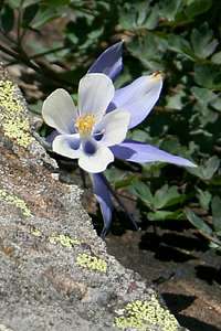 It's a flower. Shoot me.
3. Because it’s there.
You’re camping at Boulderfield and want to ascend Lady Washington before, after, or instead of Longs.No matter what your reason, it's a nice alternative.
 A lovely pile of rubble
Getting There
 View of Longs from Boulderfield
 Boulders!
The normal approach will begin at the Longs Peak Trailhead (see SP page for directions). It would also be possible to use the North Longs Peak Trail for a much longer approach. Any of the trailheads on the Bear Lake Road can get you to the North Longs Peak Trail in one way or another; consult a good map of the park.
Route Description
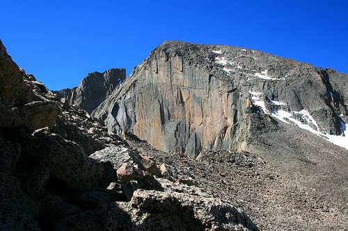
 View of Meeker and Longs
From the Longs Peak Trailhead, take the East Longs Peak Trail to where it forks with the Chasm Lake Trail. Bear right to Boulderfield campground, heading around the north side of Lady Washington and then taking long switchbacks up.
Total distance to this point is about 5.9 miles and 3,400 feet of elevation gain.
Now look back at the Lady. You could go straight up, but at this point, don’t - - it gets steep enough in places to be unhoppable, low class 3. Instead, swing in an arc to the right and then curl to the left. You could aim for the saddle between Lady Washington and Longs, but I’d recommend that you aim higher, above and to the left of the Camel Hump (the two rocks visible from the start).
Essential Gear
 Avoid the saddle, but catch the view
Usual hiking gear only in summer. If your knees are getting old, as mine are, a trekking pole or two will be appreciated.
Route Statistics
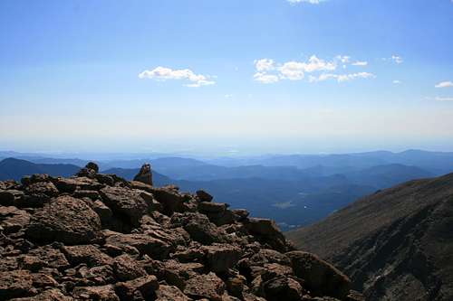 View East to the Plains
Length is 5.9 miles to Boulderfield and then 0.4-0.5 miles to the summit depending on how wide an arc you make of it.
Elevation gain: from Boulderfield (12,800 feet), it’s just under 500 feet to the summit (13,281 feet). Total gain from Longs Peak trailhead is 3881 feet.