Map of the Paratunka valley. Red underlined are the last village Termalnyj, then Nadezda base, and finally, the summit of Viljuchinskij volcano. Written in blue "gor" mean natural thermal springs. From Termalnyj a road leads to the Nadezda, and next to Viljuchinskij to the bottom of Mutnovskij voclano. Full size map is at
Viljuchinskij map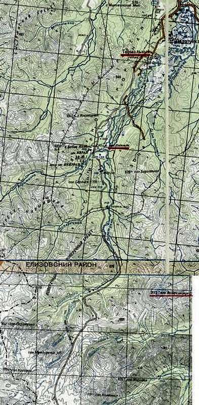


