
|
|
Route |
|---|---|
|
|
39.07818°N / 106.69868°W |
|
|
Mountaineering |
|
|
Summer |
|
|
Most of a day |
|
|
Hike & scarmble |
|
|
Getting There
From the town of Aspen, drive roughly 10 miles east on Route 82 until you see the sign for the Lincoln Gulch Road (Forest Road 106) on the right (south) side of the road.Guidebooks might say that most cars can drive up Lincoln Gulch Road but I found it to be pretty rough and will not drive it in anything less than an SUV.
Drive the pot hole ridden Lincoln Gulch Road east. After 3.3 miles, you will see the sign for New York Creek Trail on the right. This is your trailhead.
Route Description
All distances are per my GPS.Please note that Aqueduct Road is a private road that belongs to the Grizzly Reservoir facilities. You can hike on it but the general public can not drive on it.
At the trailhead, your first task is to cross Lincoln Creek. Tree logs will help you accomplish this. In early July of 2010, we noted that the creek’s water level was not high. It appeared that much of the creek’s water was diverted at the Grizzly Reservoir upstream. At times of high water, the crossing might become difficult.

After crossing the stream, follow the trail up a grassy slope with patchy forest until you reach the Aqueduct Road. A sign will direct you to follow the road for New York Creek Trail.

Aqueduct Road
Turn right (west) and hike the road on level ground. The road takes you over Brooklyn Creek and shortly after that reaches its end. Just before the end of the road, you will see a sign for New York Creek Trail.
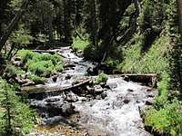
Brooklyn Creek
Leave the road and follow the trail up the valley of New York Creek. You will first go through a forest of pine trees and then cross to the west side of the creek.
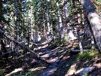
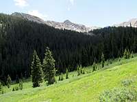
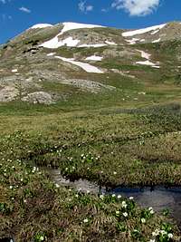
The trail then takes you through beautiful meadows and forests.
At 11600 ft elevation, the trail crosses the creek again. You will have to leave the trail here. Difficult Peak or Point 12925 ft will not be visible. A logical option might be to follow the banks of the creek up toward Point 12613 ft but these slopes seemed to be covered by a dense growth of bushes that might make the progress very slow.

Bushes
We chose to go directly up the slopes with patchy forest toward a saddle between Point 12700 ft and Point 12925 ft. Look ahead and chose a path that avoids the bushes.
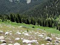
Above tree-line, you will reach a beautiful meadow. Go up to the mentioned saddle.
The western slopes of Difficult Peak and Point 12925 ft will become visible. If you go to the top of Point 12925 ft, you will then have to descend 150 vertical feet before you reach the base of the summit of Difficult Peak. I chose to traverse the slopes of 12925 ft. The scree slopes were not too bad.

scree
