Page Type Page Type: Trip Report
Location Lat/Lon: 9.48699°S / 77.23389°W
Date Date Climbed/Hiked: Jul 10, 2010
Activities Activities: Mountaineering
Seasons Season: Winter

tocllaraju 2010

User Profile Image

Our hole plan was to come to peru, do two aclimatisation peaks, and after try to climb Huascaran. Well, when it comes to mountains, the planning scheme doesn't always work that smooth. That's because when we came to Peru, more exactly to Huaraz, we found out that Huascaran is verry dangerous this year, lots of ice fall and avalanches, we heard there had been two accidents by then, so we decided to rethink our plan.

TEAM: myself and my partener Daniel

we went to Ishinca Valley first to climb Ishinca and Tocllaraju.


We left Huaraz on the 6th of july with destination Pashpa, the starting point of the trek to Ishinca Base Camp. Pashpa offers really great views upon Nevado Copa and Huascaran. I had never in my life mountains that big, and I started thinking if I was able to go all the way (the highest I’ve been at that point was Mont Blanc).

Our gear was carried by three mules. The journey to BC took three hour and a half, and as soon we got there we put up the tents, ate something and went to sleep , had to climb because the following day we had to climb Ishinca.

Next morning we left camp at 2 and a half am. We had perfect weather, clear sky and a stunning full moon that watched over us till morning. The morena walk is really long, and the level difference between starting point and summit it’s about 1200 meters… soo not being aclimatised didn’t help me very much that day. Still I didn’t suffer of headaches, but I got a bit dizzy near the top.
For those who don’t want to do all in one push there’s an intermediary refuge at about 5000 meters, on the morena, near the glacier.
We reached the glacier in two hours and a half (told you it was long) and at 9 o ‘clock in the morning we reached the summit (me and the guide Raffaelo).

Stunning views upon Ranralpaca and Tocllaraju. We descended on the other part of the mountain, on the ridge nearby Ranralpaca.
The next day we used to rest in BC, and we visited Ishinca Refuge, where we could study mountain magazines and books they have there (the people there are very nice, good prices and delicious lemonade )

On the 9th of July we went up to Camp 1 on Tocllaraju. In about 2 hours and a half we reached camp. From there you can clearly hear all the avalanches falling, and you can see a field of really deep and scarylooking crevasses.

Unfortunately, the weather was closing in, and despite our hope that “in the morning we’ll have clear skyes”, well we didn’t. Snowfall and little visibility, that’s what we had. Well, we left the camp at about three in the morning. The walk up was strenuous, lots of crevasses and exposed passages, and near the top, we had to climb a 70 meters or more passage of ice at 65-70degrees. A bit dangerous when crowded.. Daniel got hit by a piece of ice in the face that ripped his upper lip.
I felt an immense satisfaction when I got up to the top, and a bit of regret because we didn’t had the opportunity to admire the view from the top.

We came down to camp 1, packed up our gear, descended to BC, and the next day left for Huaraz. After this we left for Quitaraju, but all about this trip in another post 


Comments

Post a Comment
Viewing: 1-5 of 5
Corax

Corax - Aug 22, 2010 12:19 am - Hasn't voted

Plans

Well, when it comes to mountains, the planning scheme doesn't always work that smooth.

Tell me about it :)
Looking forward to a report about the climbs that did work out. Very interested in reports about current conditions and information about that area.

oana

oana - Aug 28, 2010 4:10 pm - Hasn't voted

Re: Plans

hi corax.
i said that because i didn't get the chance of climbing huascaran as i planned long before leaving my country(bad snow conditions, many avalanches, and some accidents in the area).

the weather was odd to say the least for that period (2-25 july). there was abundent snowfall(especially in the evening) above 5000m and below, rain.

After that we went to Quitaraju. we found out that Ferarri Route on Alpamayo couldn't be climbed due to poor condition of the ice (in fact near the summit there was NO ICE, all rock - now that was a bit sad to see) and everybody went up on the French Route.

i heard that artensonraju had the same problem as Alpamayo - due to glacier melting, a horizontal rock band apeared on the face, and that made the climb a bit more difficult.

in ranralpaca and huandoy - rockfall. chopicalqui was in good conditions, but compared to previous years it was more crevassed (like toclla).

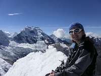
but all in all it was an amazing experience and i want to go there again.

:)

Corax

Corax - Oct 16, 2010 2:55 am - Hasn't voted

Re: Plans

Thanks for the long and detailed answer!
Appreciated.

RokIzGud

RokIzGud - Aug 25, 2010 3:24 pm - Voted 10/10

So Cool!

Still sounds like a pretty awesome trip! Do you have any more pictures?

oana

oana - Aug 28, 2010 4:16 pm - Hasn't voted

Re: So Cool!

i attached an album to the trip report.

Viewing: 1-5 of 5


Children

Children

Children refers to the set of objects that logically fall under a given object. For example, the Aconcagua mountain page is a child of the 'Aconcagua Group' and the 'Seven Summits.' The Aconcagua mountain itself has many routes, photos, and trip reports as children.