Plans Change
As heavy clouds rolled into Glacier National Park’s Two Medicine area, we discussed our options with the ranger. Our big plan – Dawson Pass and perhaps Flinsch Peak – was ‘a crap shoot’ according to the ranger, based on the rainy weather forecast and the evidence of our eyes. Our first try at a Glacier summit was looked like a no go. As I cast about for options, I noticed that it was much bluer and clearer to the south…time for Plan B.
‘What about Calf Robe Mountain?’ I asked.
While I had brought FlatheadNative’s superb Summitpost
Description of Calf Robe Mountain along as a ‘Plan B’, the ranger had not climbed it. After consulting his guidebook, he could only say ‘You’ll be lonely over there’.
It was certainly bluer over there.
Calf Robe it would ‘B’.
Sunny Arrival
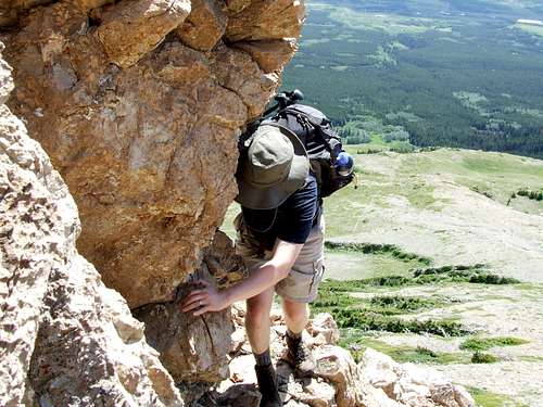
Calf Robe is only a few miles south of East Glacier, along the rampart of peaks guarding Glacier National Park from the rolling plains of Montana. Clouds partly hid the view of the flat top of Calf Robe as we parked, but this part of Glacier was looking much sunnier as we started striding through the aspens to get to the base of the mountain. Our party consisted of myself and my 13 year old son Evan, along with his crazy Uncle Dennis and our friend Roy. Dennis, Roy and I had hiked together one memorable weekend in Zion, and this was the first time we had hiked together as a group.
![Starting toward Calf Robe Mountain]() Start of Trail
Start of TrailDirect Action
![Meadows Guard the Way]() Decision Point - Directly up or Ascend around to Back Side
Decision Point - Directly up or Ascend around to Back SideVery quickly we had to make a major decision. One route is to go directly up the mountain, now fully in view and mocking our pretentions with 2800 feet of mass. The other route instead takes a slowly climbing and circuitous trail entirely around to the backside of the mountain to Firebrand Pass, and starts the off-trail portion of the route 1800 feet closer to the summit. Factors discussed included: The building clouds to the north, the state of Roy’s knees, the fun factor of scrambling the direct route, and the shorter mileage of the direct route (3 miles one way) vs. the longer mileage (5 miles one way) of the indirect trail route.
In what would be an important decision, we chose the direct route.
In the Meadow
![Up the Daunting Class 2 Meadow]() Inglorious Meadow
Inglorious MeadowAs we left the forest toward the mountain, Calf Robe was in our face, directly in front of us. As we began the gentle meadow-y ascent up the mountain, we experienced an unusual psychological reaction. The mountains looming and completely visible bulk showed us our future while in the present we struggled to breathe while stepping up the decidedly unfierce rolling meadows that sloped up toward the mountain. It seemed silly to contemplate climbing the route looming over us while our Chicago lungs labored up flowery green slopes. Indeed, Dennis’s face was starting to displaying the ‘Ain’t No Way I am Getting Up There’ look. Clouds came on and a brief rain added to the gloom.
First Set of Cliffs
![Looking Back from the First Set of Cliffs]() At First Set of Cliffs - Note road/railroad starting point in background
At First Set of Cliffs - Note road/railroad starting point in backgroundThe bleached ruins of a forest greeted us as we arrived at the first true obstacle - a broken wall of brown rock. We employed Evan as a scout liberally at this point, as we snaked and scrambled through the crumbly rock. He came through with several nice routes just compatible with the abilities of the more mature members of the group. Our success over this obstacle was capped by the sight of a herd of goats farther up the mountain.
![Heading up the Streambed in the First Set of Cliffs]() Heading Up
Heading Up![Evan Finds a Way]() Evan Scouts the Route
Evan Scouts the Route![Tight Spot]() Tight Spot for Roy
Tight Spot for Roy
This herd of mountain goats was a scruffy and suspicious bunch, totally unlike the nicely groomed and domesticated group we saw near the Logan Pass visitor’s center the day before. They gave us an evil horizontally iris-ed eye and kept their distance, eventually shuffling down the mountain.
![Disreputable Herd of Goats on Calf Robe]() Disreputable Herd of Goats
Disreputable Herd of GoatsSummit and Squalls
Up the increasingly steep slope we stumbled, interrupted by graying skies and rain. But the sky was broken, and we persevered to the ridge just north of the summit to get our first eyeful of the wilderness on the other side of the mountain. Stepping up the last brief wall of orangey brown rocks, we climbed to the top of Calf Robe.
![Dennis and Roy at the Summit]() Dennis and Roy at Summit
Dennis and Roy at Summit![Summit of Calf Robe]() Evan and Stu at Summit
Evan and Stu at Summit
Huge westerly winds, blocked by the mountain previously, greeted us, along with a smattering of rain. But there were views aplenty of the toothy peaks in this vast swath of mountains, interrupted only by scattered squalls of heavier downpours. We bundled up our coats, huddled just under the summit ridge and just over last snow packs of summer, and filled up our stomachs with lunch. Dennis, his earlier doubt vanished, now wanted to continue to Summit Mountain to the south. Not this time.
![4 in 1 Shot via Splattski Arms Length Shot]() 4 in 1 Summit 'Splattski'
4 in 1 Summit 'Splattski'
The views down the backside of Calf Robe were spectacular. Pointy peaks, streaked with snow, bracketed with pockets of heavy rain. It was like we started in the Shire and ended up in Mordor. We had to get ready to descend, as rainy squalls were all around us.
![Evan overlooking Glacier s Backcountry]() Evan Overlooking the Glacier Backcountry
Evan Overlooking the Glacier Backcountry![These Storms aren t on the Map]() Squalls not On Map
Squalls not On MapPlanet Scree
![SCREE!]() Scree
Scree
Firebrand Pass, 1000 feet below us, would be our target to gain the trail that circled back around Calf Robe to our car. But the dominant feature of descent was what I can only call Planet Scree. While our ascent on the east side of the mountain was beige, orange and brown rocks of tolerable composition, the rounded and steep descent down to Firebrand was entirely made up of grayish green scree. Lots and lots and LOTS of scree – the increasing slope appearing like the rounded horizon of a small planetoid. It looked much steeper than it had on the map.
![Scree Skiing to Firebrand Pass]() Scree Skiing down to Firebrand Pass
Scree Skiing down to Firebrand Pass
Evan could not wait and began zig zagging down the loose, shifting rock. As we followed, the steepening slope pushed us south, and Evan unleashed a veritable river of scree that snaked down the mountain and cascaded through a slot in the cliffs that overlooked the pass. On the way down we came across a pair of what I can only assume were bear ‘toilets’ – large holes about 3 feet in diameter excavated out of the scree, with a pile of bear turds in the middle of each of them. The bear sure picked a nice spot. Dennis and I finally joined Evan and Roy down at the Pass – my boots had about 50 pieces of scree each. We relaxed and snacked. The sun at this time came out and would stay out the rest of the day.
![Descending Scree to Firebrand Pass]() Planet Scree
Planet Scree
Having experienced both sides of the mountain we looked at each other and were VERY glad we had done the direct route (from Northeast) up and went down the back (west) side to the Firebrand pass route. Going up the scree would have been murderously disheartening, even with the circuit trail’s more gentle ascent for the first 1800 feet. In My Opinion: Take the NorthEast route up and go down to the west, you won’t be sorry.
One Last Surprise
The beauty of the return circuit trail in the pure bright sunlight was maximum, with a beautiful valley gradually descending through small trees and sunny valleys. But Calf Robe threw one last surprise at us.
![Surprise Snowfield beneath Firebrand Pass]() One Last Surprise
One Last Surprise
A long skinny snowfield cut across the trail just below the pass. It was safe enough to traverse – maybe 60 feet, but upon reaching the far side the snow dropped abruptly about 12 feet. ‘No we won’t need an ice axe’ I had said confidently that morning. Wrong . One at a time, we attempted to downclimb the icy drop to the trail below. One at a time, we fell, sliding to a gravelly stop at the base of the drop. My last effort was particularly stylish, as I flipped and rolled. But all were well, and we continued our scenic trip around Calf Robe.
One Great Trip
![The Return Trail around Calf Robe]() Return Trail
Return TrailThe rest of the trip passed serenely through the sunny green trail. It was warm now and a bit buggy, but the trail back through the aspens provided shade enough that Dennis and Evan ran the last mile back.
Why was this so fun? The solitude, the challenge, the wildlife and the views all came together. To me, this was the most memorable mountain of our Glacier trip.
If I come back to Glacier someday, this will go on the A list.


Comments
Post a Comment