-
 6856 Hits
-
 75.81% Score
-
 6 Votes
|
|
Route |
|---|---|
|
|
49.53713°N / 115.73882°W |
|
|
Overview and History
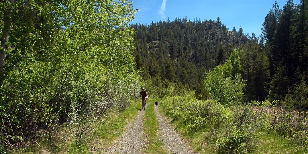
Isadore Canyon Trail is a scenic pathway connecting the communities of Cranbrook and Wardner in the East Kootenays of British Columbia. It is perfect for biking, hiking, horseback riding, and cross country skiing, with much of the trail providing great views of the Hughes Range of the Canadian Rockies to the east. In particular, there are some wonderful views of Mount Fisher (more commonly referred to as Fisher Peak) and the Steeples to be seen along the way. The trail winds its way through a variety of landscapes as you travel through meadows, marshes, grasslands, and rolling hills, under forest cover, and between rock bluffs. As you make your way east from Cranbrook, you travel through the last scarred contours of the Purcell Mountains as you head towards the Rocky Mountain Trench dividing the Purcell Mountain Range from the Rocky Mountain Range. It is in this area that the Rocky Mountain Trench is at its widest.
The Isadore Canyon Trail runs nearly parallel to highway 3/95, beginning on the NE edge of Cranbrook in the Cranbrook Community Forest and ending at a gate to some private property near Wardner. The trail is approximately 17 km long and makes for a relatively easy ride on a bike, experiencing only 40m of elevation differential along its length. A large portion of the trail is part of the Trans Canada Trail (TCT) system. There are a few picnic areas, complete with tables, found alongside the trail. A few trails diverge on both sides to hiking and biking possibilities elsewhere, but the Isadore Canyon Trail is very easy to follow along its entire length.
The history of Isadore Canyon Trail is a fascinating one. The trail lies on the original BC Southern railbed, later to become that of the Canadian Pacific Railway. Locating the railway here was due, in large part, to the efforts of Colonel James Baker. Indeed it was quite a victory for him, as this positioning of the railway cut off the more established Fort Steele to the north and carried the railway through Cranbrook, where Baker had considerable holdings. Cranbrook was now the new hub in the area and by the completion of the railway in 1898, Baker had become wealthy enough that he could retire back to England, abandoning the “colonies” altogether. This section of the railway was eventually abandoned in 1970. In 1971, the rails were removed, creating the recreational trail we know today. Along the length of the trail, you will occasionally see piles of these abandoned railway ties which were laid over 100 years ago.
The canyon and the trail are both named after Chief Isadore, a very prominent chief of the Ktunaxa people during the tumultuous times for first nations in the late 1800's. Sam Steele claimed that “Isadore was the most influential chief I have known.”

Getting There
In Cranbrook, drive north on Cranbrook Street/Highway 3 to the edge of town. Take the very last right turn (30th Ave. N) before reaching the onramp towards Kimberley. If you drive under the overpass, you have gone too far. Immediately after turning off the highway/Cranbrook Street, take a left onto the frontage road (Stahl Road). Follow this, staying left, until you reach the parking area for the Isadore Canyon Trail. There are some signs there explaining the history of the trail.

External Links
Cranbrook Community Forest
Cranbrook Community Forest Trail Descriptions
Biography on Chief Isadore
Biography on Colonel James Baker
Brief Write Up on Chief Isadore and Colonel James Baker


