
-
 4907 Hits
-
 83.1% Score
-
 16 Votes
|
|
Mountain/Rock |
|---|---|
|
|
42.85774°N / 0.13673°E |
|
|
Download GPX » View Route on Map |
|
|
Hiking |
|
|
Spring, Summer, Fall |
|
|
8717 ft / 2657 m |
|
|
Overview
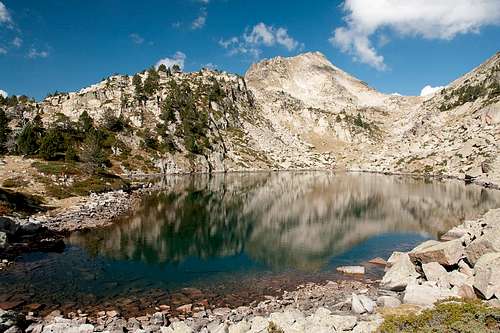 Pic de Madamète mirrored in Gourg de Rabas Pic de Madamète mirrored in Gourg de Rabas |
Pic de Madamète (old: Pic de Tracens) is one of the mountains in the central part of the Néouvielle Natural Preserve. It is located an a ridge between Hourquette d'Aumar and Col de Madamète together with two other peaks, Pic dets Coubouts and unnamed P 2580. The three of them form the northern ridgline as seen from the popular staging area near Lac d'Auumar and Lac d'Aubert.
Pic de Madamète is not a difficult mountain to get to. From Lac d'Aubert the climb takes little more than two hours, scaling 600m of elevation gain. Much of this route is part of a rather popular round tour through the Néouvielle Preserve which circles the aforementioned ridge in a wide loop and visiting a dozen lakes on the way. This round trip runs through Col de Madamète and thus leads by very close to the mountain.
 |  |  |
The last part of the ascent - between Col de Madamète and Pic de Madamète is very steep though not difficult. Route finding can be more of a challenge as too many possible paths cross the eastern slopes. The best, though also most exposed, route follows the east ridge for most of the part before taking two swings south and back to head for the summit. Pic de Madamète is a granite mountain but rather than expect the big walls you find elsewhere in the Pyrenees you have to prepare yourself for blocks and rubble, even choss. The mountain is comparatively old and much of it has been eaten away by erosion, giving it its current aspect.
 |  |  |
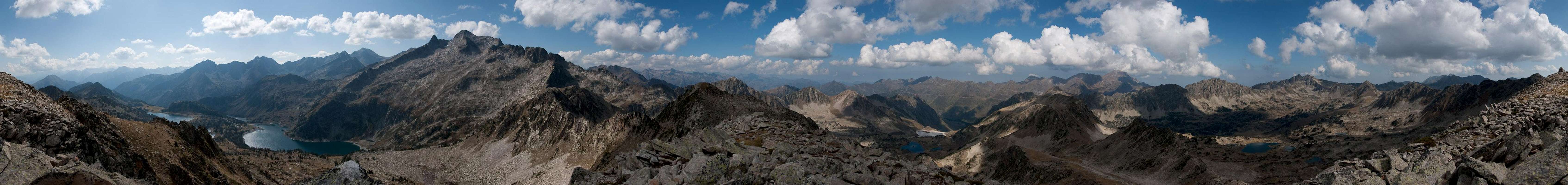
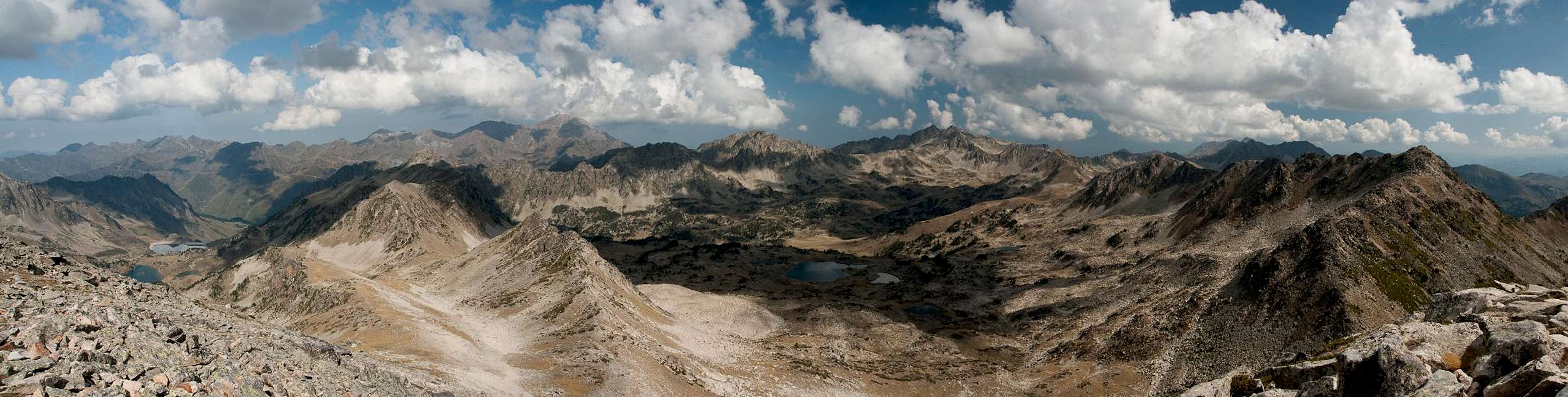
The central location of Pic de Madamète in the Néouvielle Preserve makes it a wonderful lookout mountain. All around on the glacier carved plateaus of the preserve you can see the lakes which made the area so famous. Indeed, I barely enjoyed myself more on any other Pyrenees summit taking in the vista between Pic du Midi and Pic de Néouvielle.
360° Summit Panorama
  |
Getting There
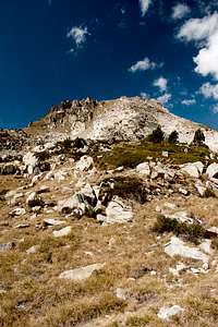
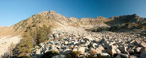 P2580 and Pic de Madamète
There are two possible trailheads, one in the south, one in the north of the mountain. The northern one, however, which starts near Tourmalet Pass (at the botanic garden west of the pass), is very long and you will certainly not use it to climb an insignificant mountain like Pic de Madamète. Therefore only the southern itinerary is described here.
- Follow the Bielsa Tunnel Road between St Lary-Soulan and Bielsa.
- At Aragnouet-Fabian the road to the Route des Lacs turns off northward
- Ignore the trailhead for Lac d'Oule at Artigusse.
- Stay on the road until you reach Refuge d'Oridon.
- Turn off right, pass the refuge and head to the parking lot at Lac d'Aubert.
Red Tape
 Gourg de Rabas with Néouvielle to the left and Madamète to the right
The mountain is part of the Réserve Naturele de Néouvielle. The reserve was created in 1936 and is one of the oldest of its kind in France. It includes an area of more than 2300ha. The usual restrictions apply.
During the high season in summer you will have to pay fees for access and parking. Currently the fees are at €4 for Adults, €2,50 for children and €5 for parking (more than 8h).
Accommodation
The Vallée d'Aure is one of the most popular ski resorts of the French Pyrenees. Thus there is lots of accommodation to be found. The closest campground is near Fabian at Le Pont du Moudang on the Bielsa Tunnel Road. The following link gives you all sorts of information about the greater area including accommodation:Office de Tourisme de la Valée d'Aure
Weather Conditions
 |
Maps & Books
- Bigorre
1:50000
Rando Editions
ISBN: 978-2-84182-413-7
- Pyrénées Centrales IV
Luz-Barèges-La Mongie-Payolle-Bagnères de Bigorre-Gèdre-Saint Lary
Guide Ollivier
Editions Cairn
ISBN: 978-2-35068-173-3
- Pyrenäen 2 / Pyrénées 2
R. Büdeler
Rother Verlag
ISBN:
978-3-7633-4308-9 (German)
978-3-7633-4918-0 (French)
978-3-7633-4826-8 (English)