
|
|
Route |
|---|---|
|
|
40.83100°N / 106.663°W |
|
|
Hiking, Mountaineering, Scrambling |
|
|
Summer, Fall |
|
|
One to two days |
|
|
Class 2 |
|
|
Overview
This is the standard and the easiest route to Mount Zirkel Basin/Red Dirt. While this route has few technical difficulties, it does have two river crossings which can be very challenging into early August.This route is class 2 in difficulty and 17.2 miles round trip with about 3800 feet elevation gain.
 The Upper Southeast Ridge of Mount Zirkel.
Getting There
From US Highway 40 at the Northwest side of Steamboat Springs, turn north on Routt County Road 129, also known as Elk River Road, north towards the towns of Clark and Hahns Peak. Drive for approximately 17-18 miles to the town of Clark.Just after the town of Clark, at Glen Eden, turn right onto County Road 64/Forest Road 400, a.k.a. Seedhouse Road. Follow the road to the trailhead at the end (about 10 miles from Glen Eden).
 Gold Creek not far from the trailhead.
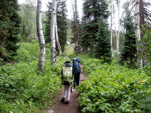
Route Description
From the trailhead, follow the trail up the hill. After just a short distance, there is a junction. Take the right fork towards Gold Creek Lake.The trail climbs rather gradually and reaches a tricky stream crossing just over half way to Gold Creek Lake. In late July 2012, there was a big log here to cross Gold Creek on. If the log is gone, this can be a really tricky stream crossing before August.
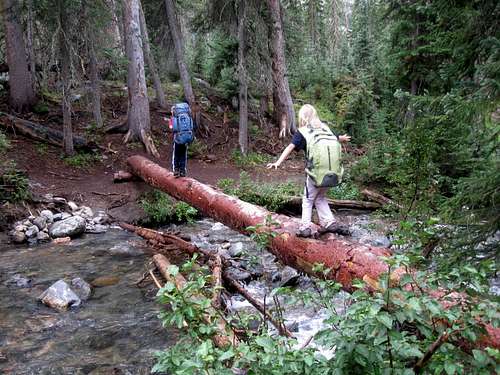 The first of the tricky stream crossings over Gold Creek.
After the first stream crossing, the trail begins climbs a little steeper and crosses a stream again. The trail then climbs steeper and switchbacks to Gold Creek Lake. Gold Creek Lake is just over three miles from the trailhead.
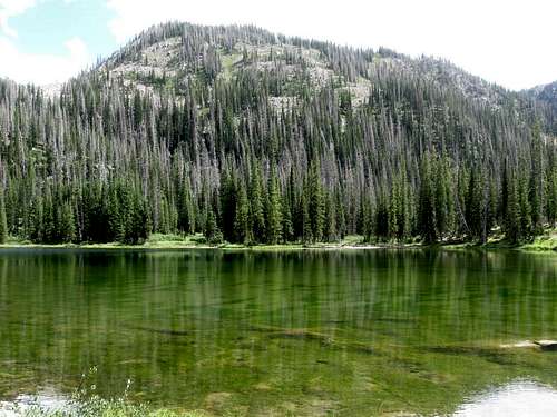 Gold Creek Lake.
From the lake, continue up the trail. After a short distance, bear left at a junction. There is another stream crossing just beyond the junction that can be tricky early season.
Not far beyond the stream crossing are some campsites. After some meadows, the trail climbs north to another junction. Keep right here and follow the trail up to the Slovenia Basin where there are more campsites. There is an old mining camp in the basin. The basin is about 7 miles from the trailhead.
 Upper Slovenia Basin.
From the basin, continue north along the trail, which becomes less used from here on. The trail switchbacks up to Red Dirt Pass after another 1.5 miles from Slovenia Basin. The pass is at 11,540 feet elevation.
 Upper Slovenia Basin and Red Dirt Pass (right).
 Approaching Red Dirt Pass.
From the pass, head northwest cross country along the ridge. The ridge eventually curves north. Continue north on a bench to the east of the ridge crest, plan on making a few side trips to the ridge horns for some fine views.
 Above Red Dirt Pass. See the red dirt on the pass (left). Flat Top Mountain is in the background.
Eventually you will climb to the ridge crest and follow it to the summit of Mount Zirkel. The route is obvious all along the way and the difficulty of the ridge never exceeds class 2.
 The final section of the route up Mount Zirkel.
After enjoying the views, either return the same way or descend the Gilpin Lake Route.
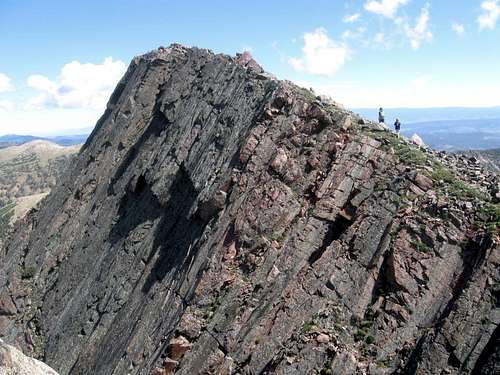
 The summit of Mount Zirkel.