Backpacking the Cordillera Huayhuash
![huayhuash]()
The last 2 weeks of August, 4 friends and I traveled to Peru with plans to backpack the Cordillera Huayhuash. Although some of the group had been to Peru, none of us had been to Huaraz, Cordillera Blanca, or the Huayhuash. Most of the group had mountaineering experience and had done plenty of backpacking trips under 5 days, however none of us had done a backpacking trip this long on such challenging terrain. If you are not familiar with Cordillera Huayhuash, there is a popular ~100km route called the
valley circuit that encircles the entire mountain range. Beyond the altitude (most of it is between 4000 and 5000 meters), it is not technically difficult. But it is long and there is a lot of elevation gain, so most groups use donkeys or horses and take between 10-15 days. There is also an
alpine circuit that is much more difficult and has some technical portions. The alpine circuit also goes around the Huayhuash but it cuts through some more technical mountain passes and therefore can be done in shorter time (although it is more difficult). We had about 7-8 days and we wanted to do something more challenging than the basic valley circuit and we were considering doing the alpine circuit. In the end we were turned off by the need to carry crampons, ropes, and other technical gear on an 8 day trip for only a few technical parts. Also, we were a little nervous about some of the technical mountain passes since none of us had been in the Huayhuash before.
After a day or two in Huaraz talking to people, we decided to hire a guide (Gladys who works for
Skyline Adventures) and do a mix of the two routes. We planned to hike around the Huayhuash in 8 days and cut through a few mountain passes beyond the valley circuit, but avoid the more technical passes of the Alpine circuit. The Huayhuash is almost entirely above treeline and there are many old trails -- although some are unclear. You can use these trails to easily cross between the valley circuit and alpine circuit at various points. Although I usually do not default to using a guide, in this case it was a good decision. Gladys had years of experience in the Huayhuash and knew the area well. She also knew and understood the local people who lived in the area. You pay fees as you enter each community, and although you don't need a guide, it was helpful that she had been to each of these communities many times before.
In the end, the Huayhuash was an amazing place to hike and backpack. But it is high (up to 5,000m / 16,400ft). It was harder than we anticipated hiking at that altitude with backpacks full of 6-days-worth of supplies and also gear to sleep at temperatures below freezing at night. Each day involved an ascent to a mountain pass (usually about 1000m gain) and then an equally steep descent down to the next valley campsite. Hiking up and down everyday was tough mentally on the group. Combine that with some illness and general physical exhaustion, and as a group we made the decision to exit early at Huayllapa and head back to Huaraz via taxi. I was disappointed to not finish the whole circuit, but I was grateful to have 6 full days in these spectacular mountains. From my experience, these trips never go as planned and you have to prepare yourself for that.
Below is a detailed description of each day.
 Our route is highlighted in purple and blue. This map was taken from the Huaraz Map - Guide (available for free in many locations in Huaraz).
We started and ended our trip in Huaraz. This was a great base-camp town! There are very nice bed and breakfast hotels (we stayed at
Olaza's), good food, supermarkets, banks, bars, and day hikes for acclimating. Huaraz is a destination climbing city because of its proximity to the Cordillera Blanca. We had the fortune of being there during the
Inkafest mountain film festival which was pretty cool and had a mix of outdoor films comparable to Banff Mountain film festival. I would certainly go back to Huaraz in the future. It was amazing having breakfast every morning looking out at the Cordillera Blanca.
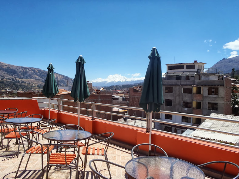 View from Olaza's in Huaraz
Day 1: Drive from Huaraz and First Pass
Since there were 6 of us, we hired a private van to take us from Huaraz to the beginning of the circuit. Traditionally the circuit starts at Llamac but it is now common for private transport to take you further in via mining roads. This cuts off a day at the beginning of the trip, which we chose to do considering our time constraints. Our van dropped us off at the Quartelhuain camp site. We arrived in the early afternoon, got our stuff together, and started hiking on the valley circuit over the first mountain pass (4690m). After sitting in the car for 5 hours, this was quite a start -- we were climbing immediately and feeling very remote as soon as the van left. After the pass, the valley circuit follows the valley down to Janca. We decided to take a little shortcut to Laguna Mitococha and skip Janca. From the top of the pass we descended a few hundred feet and then turned right off trail over a series of hills. It soon got dark and we decided to camp at a remote flat spot between Co Chincana and Laguna Mitococha.
Day 2: First Big Pass
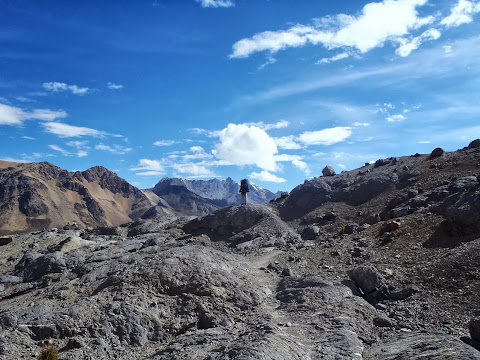
We awoke to thick fog, but it soon burnt off and we had awesome views of the northern-most peaks of the Huayhuash to our right. We had an easy hour hike to Laguna Mitococha and then spent an hour having breakfast. Mitococha is at the base of the Jirishanca Norte glacier. After breakfast, we hiked on the left side of Mitococha up to Lake Ninacocha and then followed a vague trail up to the lowest point of the mountains around the glacier.
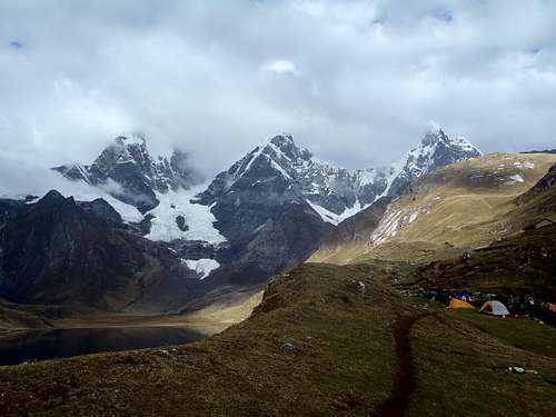
At this point the trail became a bit confusing. We descended slightly to the other side of the mountain and then followed the terrain around the right side of the valley. At the highest pass of the day we were just above 5000m. As we came down the highest point of the pass our view opened up into the next valley and we had a beautiful view of Lake Alcayocha, which we descended to for a late lunch. Afterwards we joined up back with the valley trail and followed that to the Carhuacchocha campsite, where we spent our second night. This campsite is large and has a toilet, water pump, and gorgeous views of the lake and the highest peaks of the Huayhuash, including Yerupaja. The downside is that it is heavily used and there is some trash. But honestly, the setting is absolutely gorgeous and I would stay there again to wake up with that view.
Day 3: High Altitude Storm
Day 3 we woke up and again split off from the valley trail. We followed the left side of Lake Carhuacocha through a beautiful valley. We followed the valley to the left on an obvious trail past a small village and Laguna Gangrajana, Laguna Siula, and Laguna Quesillococha. These are classic glacier lakes that reminded me of my trip to Banff and Jasper in Canada a few years ago. There were avalanches every few minutes on the steep peaks to the right of the lakes, far away from us.
The steep dramatic peaks of the Huayhuash were right in front of us and to our right. We climbed up to the left of Lake Quesillococha and eventually the terrain flattened out into bowl with higher terrain on three sides of us.
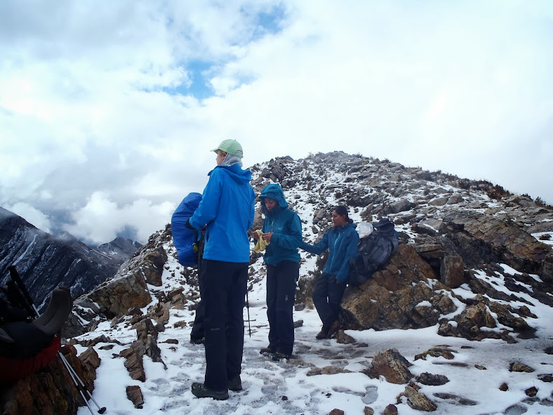
At this point we stopped to grab something to eat when it started to snow lightly. A few minutes later the snow picked up and suddenly -- BOOM -- there was a loud clap of thunder overhead. We had a tough decision to make here. We had seen similar showers and storms pass over other mountains throughout the last few days and knew that it would probably pass. But on the other hand the thunder continued and we were not in a safe place for a thunderstorm. We weren't on the top of the pass (we were in a bowl) but we certainly couldn't continue to the top of the pass during the storm. We also couldn't turn back unless it was an absolute emergency because our group had to make it to the next campsite on the other side of the pass. We decided to wait the storm out for about an hour, crouching close to the ground, and then continued up to the pass near Ciula Punta. As with all these passes, once you get to the top of the pass you are treated to a sweeping view of the next valley. In this case it was especially nice since the valley had a fresh coating of snow. We descended down wet, boggy terrain to Laguna Carnicero and then on to the Huayhuash campsite, where we spent night 3. Definitely an exciting day, and the local community at Huayhuash sold us some cooked potatoes which was a super-nice way to end the day.
Day 4: Trapecio
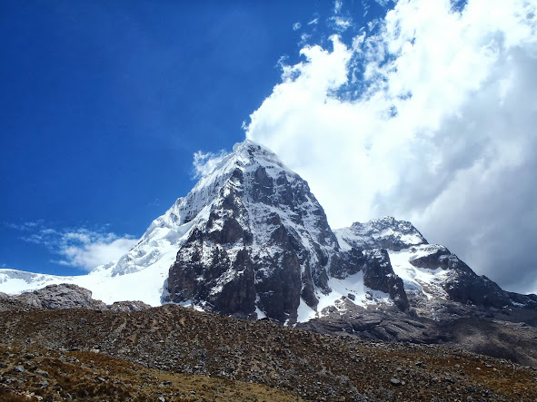
By this point our group was getting tired -- the altitude and heavy packs were affecting some of my friends more than they expected and some of them weren't feeling well. We had a feeling that our original plan was going to be tough to complete, but the best option still was to continue on slowly. We took an easy morning and then started up towards Trapecio. We had clear skies and Trapecio was heavily covered in snow and ice, giving us some real amazing views and photos. We passed to the left of Trapecio and then followed a trail down the valley to the left. This trail isn't on any map but it was clear and easy to follow. The descent was through a hot, dry valley with lakes to the left of us. In my mind what is so great about the Huayhuash is how varied the terrain is, and day 4 was a great example of that.
Even though we were descending, the terrain was rocky and jagged, and it took quite a lot of energy to get to our 4th campsite, Elefante. This was a flat, huge open space with outhouses and plentiful water.
Day 5: Touching the Void
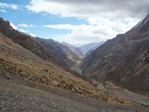
During the night, we made a group decision to exit the circuit at Huayllapa. This was a tough decision -- I would have loved to keep hiking to Llamac. But when you are hiking or climbing with a group of people, and people are not feeling well and bail-out options are limited, you have to go with what is best for the group. And it was clear that ending at Huayllapa was the best option at this point. Fortunately we still had 2 more (short) days of hiking to get to Huayllapa. Also, fortunately, day 5 had some of the best views of the entire trip. We started out from Elefante going north towards Laguna Jurau. This was another steep pass that kept going and going. But when we got to the top near Co San Antonio, Wow - what a view. One of the best views I've ever seen. Pictures don't really do it justice. You get a wide open panorama of the 'Touching the Void' valley, highlighted with views of the high peaks of Sarapo, Siula, and Yerupaja. These peaks are steep, dramatic, and their slopes descend into beautiful glacial lakes. I do some alpine climbing and these peaks looked unbelievably treacherous to me -- I have all the respect in the world to anyone who attempts to climb them. As in days past, the descent was just as dramatic as the climb. We hiked down the valley to Laguna Jurau and then continued to the campsite at Cutatambo. This was another great campsite with views of high peaks and even a waterfall where the river came down to the campsite. As we descended down to Laguna Jurau, we were able to get a look at the type of terrain the alpine circuit covers over the glacier. The route over the glacier was certainly do-able from my standpoint as a climber, but considering the condition of our group and the heavy backpacks we had, I am certainly glad we avoided it. I would come back and do these glacial passes with a daypack before I attempted to pass over them with heavy packs and a large group.
Day 6: Exit through Huayllapa
Day 6 we hiked out to meet the valley circuit at the small village of Huayllapa. From there, we planned to find a ride to the town of Cajatambo. Our guide had a satellite phone and arranged for a taxi to pick us up at Cajatambo and bring us back to Huaraz for 1500 soles. It was expensive but the best option for the group. The hike from Cutatombo, where we camped our last night, to Huayllapa is all downhill through an increasingly lush valley. As we got lower this was the first time I ever saw any bugs on our hike. It was quite a change seeing all this green - the 5 previous days were all above treeline. Huayllapa itself was a nice, friendly village with a small bodega. We had a nice lunch of eggs, rice, and french fries at the bodega, and then Gladys arranged for a local taxi to take us 2 hours to Cajatambo, where our other taxi would be waiting for us the next morning to take us to Huaraz. The 2 hours to Cajatambo were kind of insane...the road climbs up and down the side of a steep valley...if you were to go off the road, there would be no chance of survival. And the final half hour is just a big set of switchbacks descending down to Cajatambo. I won't forget this taxi ride. As was every place I visited in Peru, Cajatambo was a pleasant town with good places to eat, drink, and sleep. We had a good breakfast the next morning and then set out on an 8-10 hour drive to Huaraz.
Helpful resources that you can pick up in Huaraz:
The Huaraz Map - Guide. Available for free in many hotels in Huaraz. This little booklet has a lot of helpful maps of hikes in the area.
Cordillera Huayhuash Climbs and Treks, Topographical Map. Available for ~40 soles in Olaza's bed and breakfast and from Skyline Adventures. The best topographical map we found of the Cordillera Huayhuash.


Comments
Post a Comment