Mount Carleton - New Brunswick High Point - 2690’
Mount Carleton Provincial Park Closed! It’s ironic the park being closed would be a factor when most National Parks in the US were closed because of the government shutdown. I had done most of my research months earlier without it occurring to me this could be an issue.
We flew into Moncton Airport arriving around midnight on Saturday Oct 12. By the time we got our rental car and checked into the hotel it was past 1:00 am getting to bed. We set the alarm for 5:00 to be rolling at 6:00 am. We hoped this would put us at the trailhead at around 10:00 am. Instead it was past 11:00 am getting there to discover the closed gate.
There had been contradictory information on the internet. The summitpost page indicated the park would be open through October 15, but even when closed, the gate would be still open for access. The Provincial Park website indicated a closing date of Sept 29, but made no mention of the gate. The Friends of Mount Carleton website also had the closing date of Sept 29 and indicated the gates would be locked. But there was not specific mention of whether access was still allowed. Meanwhile the Park website said in winter the gates were open for skiing and snowshoeing. Not knowing what to expect I made sure our maps covered from the gate to the mountain.
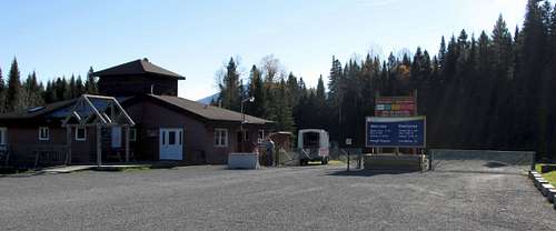
![Mount Carleton Park Entrance]() The entrance to Mount Carleton Provincial Park, October 13, 2013
The entrance to Mount Carleton Provincial Park, October 13, 2013
When we pulled up to the closed gate we saw a maintenance worker. We expected he might tell us sorry, go away. But instead Larry told us he would give us a lift to the trailhead. That saved us over 4 miles one way to the closest trailhead. Not only that, he gave us and another party who arrived around the same time, radios, so we could call in case something happened! He drove us to the farthest trailhead which allowed us to go up the Mount Carleton standard route. This saved us a lot of time.
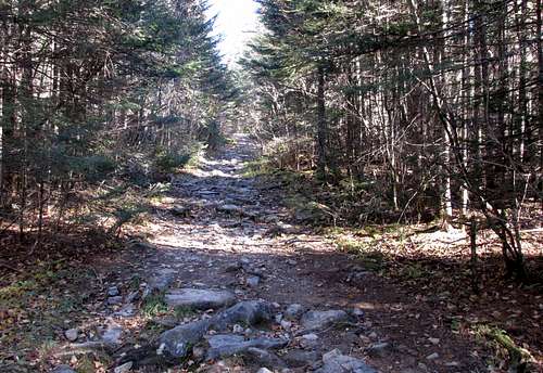
![Mount Carleton Trail]() The start of Mount Carleton Trail, Oct 13, 2013
The start of Mount Carleton Trail, Oct 13, 2013
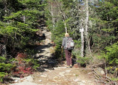
The standard Mount Carleton trail is a loop returning to the same trailhead. We took the trail on the right, which is an old road. It had a gentle grade and there signs at each intersection. Trailhead elevation is about 1350’. We got started up the trail at about 10 minutes to noon.
![Mount Carleton Trail Intersection]() Mount Carleton trail is a loop. Here is the intersection just beyond the parking lot. Oct 13, 2013
Mount Carleton trail is a loop. Here is the intersection just beyond the parking lot. Oct 13, 2013
In about 40 minutes we came to the intersection for Big Brook trail. The smaller Big Brook trail goes straight and the old road Mount Carleton trail is a left turn. The grade had been pretty gentle. At an elevation around 2000’ it now becomes a bit steeper.
![Mount Carleton Trail, Big Brook Intersection]() Mount Carleton Trail, standard route, intersection with Big Brook Trail, Oct 13, 2013
Mount Carleton Trail, standard route, intersection with Big Brook Trail, Oct 13, 2013
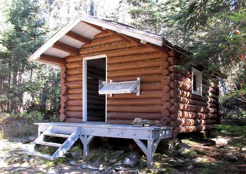
We soon came to the old towerman’s cabin. The story board in front tells how this cabin was used by those who manned the fire tower on the summit.
![Mount Carleton, Fire Towerman's Cabin]() Mount Carleton, Fire Towerman's Cabin. This cabin was use by the men who manned the fire tower on the summit of Mount Carleton. Oct 13, 2013
Mount Carleton, Fire Towerman's Cabin. This cabin was use by the men who manned the fire tower on the summit of Mount Carleton. Oct 13, 2013
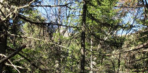
Higher up we could see the summit through the trees.
![Mount Carleton through the trees]() Mount Carleton seen through the trees on the standard route above the towerman's cabin. Oct 13, 2013
Mount Carleton seen through the trees on the standard route above the towerman's cabin. Oct 13, 2013
After almost passing the summit we came to the intersection of the Mt Head trail and the trail leading up to Mount Carleton’s summit. This is where the old road ends. The Mt Head trail continues straight, but it is now a just a path. The trail to Mount Carleton summit is to the left and obviously uphill.
![Mount Carleton, intersection below summit]() The Mount Carleton trail is an old road that comes to an end a couple hundred feet below the summit. A left turn climbs to the summit. Straight is a trail to Mount Head and Mount Sagamook. Oct 13, 2013
The Mount Carleton trail is an old road that comes to an end a couple hundred feet below the summit. A left turn climbs to the summit. Straight is a trail to Mount Head and Mount Sagamook. Oct 13, 2013
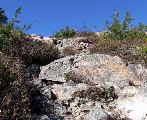
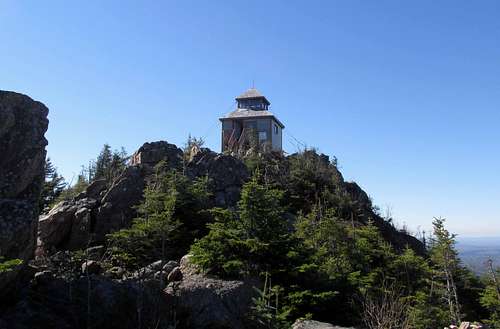
The summit trail is almost step like and mostly rock, climbing about 200’ up the side of the mountain. After topping out above the trees and bushes it is a left turn to the soon visible firetower. There’s not really a trail, but there are painted dots on the rock to follow across the rocky summit area. We got to the summit around 1:30.
![Mount Carleton near summit]() The trail near the summit of Mount Carleton is rocky and step like. Oct 13, 2013
The trail near the summit of Mount Carleton is rocky and step like. Oct 13, 2013
While the summit building is an obvious landmark to follow on the way up, the dots are really useful on the return. If it was fogged in at all, you would be really grateful for them to prevent overshooting the trail on the return.
![Mount Carleton summit]() Mount Carleton summit with the fire watchtower. Oct 13, 2013.
Mount Carleton summit with the fire watchtower. Oct 13, 2013.
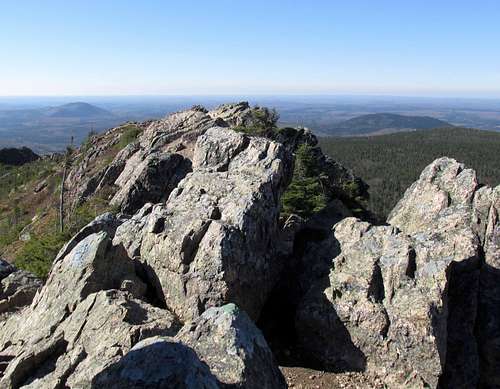
Just beyond the fire watch cabin are the highest summit rocks. I mentioned the Mount Carleton trail was a loop. We did not return to the same trailhead, so I can’t give directions on the other side of the trail which would return via Head Waters campground.
![Mount Carleton summit rock]() Mount Carleton summit rock. Oct 13, 2013
Mount Carleton summit rock. Oct 13, 2013
We descended the way we came until returning to the intersection of the Mount Carleton trail and the Mount Head trail.
![Mount Carleton, Mount Head Trail]() Mount Carleton. Intersection below summit for Mount Head trail. Oct 13, 2013.
Mount Carleton. Intersection below summit for Mount Head trail. Oct 13, 2013.Mount Carleton. Intersection below summit, Mount Head trail sign. Oct 13, 2013
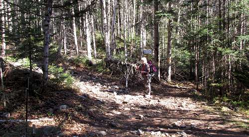
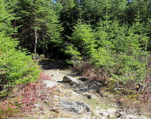
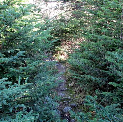
After hiking on the relatively wide old road, the Mt Head trail seemed narrow and overgrown. But then, we’re used to hiking in the west with its lack of underbrush below treeline and vast open areas above treeline. But this is the east. We soon realized we were on a pretty good trail. It just took re-calibrating our brains to a different way to watch our step.
![Mount Carleton, Mount Head trail]() Mount Carleton, Mount Head Trail traverses between Mount Carleton and Mount Sagamoot past Mount Head. Oct 13, 2013
Mount Carleton, Mount Head Trail traverses between Mount Carleton and Mount Sagamoot past Mount Head. Oct 13, 2013
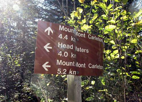
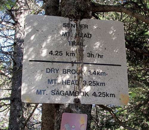
The Dry Brook Intersection shows the variety of signs typically encountered. Dry Brook is a right turn, we went straight.
![Mount Carleton, Dry Brook Intersection]() Mount Carleton, Dry Brook intersection on the Mount Head trail. Oct 13, 2013
Mount Carleton, Dry Brook intersection on the Mount Head trail. Oct 13, 2013
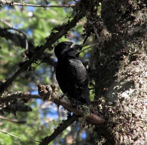
We saw this woodpecker banging away on a tree.
![Mount Carleton, woodpecker]() Mount Carleton, woodpecker on Mount Head trail. Oct 13, 2013
Mount Carleton, woodpecker on Mount Head trail. Oct 13, 2013
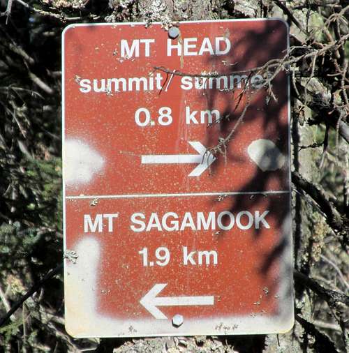
Because of our late late start, we did not climb Head or Sagamook. Mt Head is a right turn. We continued on in the direction of Sagamook.
![Mount Carleton, Mount Head Intersection]() Mount Carleton, Intersection for Mount Head, from Mount Head trail.
Mount Carleton, Intersection for Mount Head, from Mount Head trail.
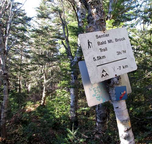
Mt Sagamook also would have been to the right. We turned left to descend the Bald Mountain Brook trail.
![Mount Carleton, Bald Mountain Brook Intersection]() Mount Carleton, intersection for returning via Bald Mountain Brook trail. Oct 13, 2013
Mount Carleton, intersection for returning via Bald Mountain Brook trail. Oct 13, 2013
At several places we saw blue diamonds blazing the trail. The fall leaves often covered the trail so the diamonds were helpful on several occasions.
![Mount Carleton, Blue Diamond Blazing]() Mount Carleton, blue diamond blazing on Bald Mountain Brook trail. Oct 13, 2013
Mount Carleton, blue diamond blazing on Bald Mountain Brook trail. Oct 13, 2013
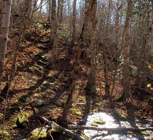
The Bald Mountain Brook trail descends a gully with several waterfalls along a brook. This log bridge is above one of the many falls.
![Mountain Carleton, log bridge]() Mount Carleton, log bridge on the Bald Mountain Brook trail. Oct 13, 2013
Mount Carleton, log bridge on the Bald Mountain Brook trail. Oct 13, 2013
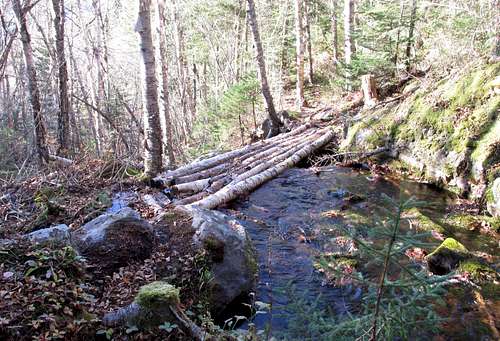
Watch your step!
![Mount Carleton, log bridge ....]() Mount Carleton, log bridge over water fall on Bald Mountain Brook trail. Oct 13, 2013.
Mount Carleton, log bridge over water fall on Bald Mountain Brook trail. Oct 13, 2013.
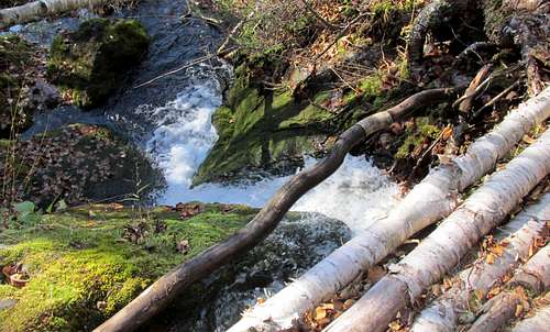
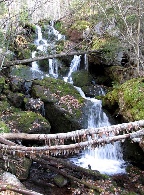
One of the many waterfalls along the Bald Mountain Brook trail.
![Mount Carleton waterfall]() Mount Carleton. One of the many waterfalls on the Bald Mountain Brook trail. Oct 13, 2013.
Mount Carleton. One of the many waterfalls on the Bald Mountain Brook trail. Oct 13, 2013.
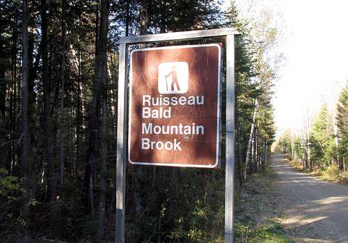
Bald Mountain Brook trailhead. This is on the same road we took to the Mount Carleton standard route trailhead. We arrived here a little after 4:20.
![Mount Carleton, Bald Mountain Brook TH]() Mount Carleton, Bald Mountain Brook Trailhead. Oct 13, 2013
Mount Carleton, Bald Mountain Brook Trailhead. Oct 13, 2013
When we got back to Bald Mountain Brook TH I called Larry on the radio to let him know we were off the mountain and hiking out the road. We had hiked about a mile when Larry came along and gave us a lift back to the closed gate!
UTM Coordinates: 19 T NAD 27 Canada,
October 13, 2013, Atlantic Time Zone (UTC - 4), on Daylight Saving Time, UTC -3.
654752 5254713 0793' 11:03:58 AM Carleton Gate Parking
658393 5246297 1332' 11:43:37 AM Carleton TH
660227 5248055 1994' 12:30:15 PM Big Brook INT
660292 5249137 2654' 01:34:51 PM Carleton Summit
660526 5249079 2415' 01:44:25 PM INT below summit
660390 5250139 2259' 02:08:19 PM Dry Brook INT3
660307 5250893 2475' 02:31:47 PM Mt Head INT4
660233 5251765 2311' 02:58:10 PM Bald Mtn Brook INT5
658304 5252319 1025' 04:28:11 PM CaretonBaldTH
Mount Carleton Provincial Park website:
Trail Map:
NTS Map: Nepisiguit Lakes 21-O/7 1:50,000


Comments
Post a Comment