
|
|
Mountain/Rock |
|---|---|
|
|
48.07991°N / 121.91258°W |
|
|
Snohomish |
|
|
Hiking |
|
|
Spring |
|
|
1480 ft / 451 m |
|
|
Overview
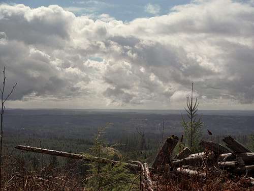
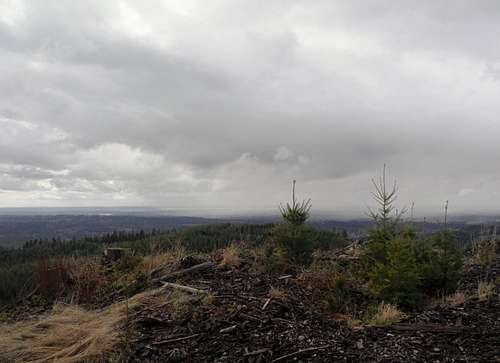
View over the plains. The best reason to head up to the summit of Chitwood Peak
Storm to the west. On a clear day you can see the Olympics!
The view through the clearcuts from the summit is quite surprising considering the summit only is 1480 feet high. From the summit you can much of Puget Sound, downtown Seattle, many of the foothills in the region and Mount Pilchuck. Once you are on the summit area you should keep on walking and touch everything that looks like a summit. The true summit is in the clear cut and the 100 foot bushwhack to it is very easy.
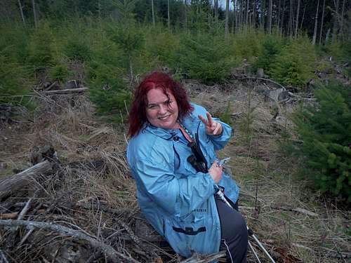
BearQueen on the summit area enjoying a snack
The actual route to this summit would have been quite easy except for the fact that the road has been covered by a group determined to turn the fire road back to nature once on the final logging road to the summit. Because of this one really needs to watch their feet as they cross. This continues to be a problem most of the way to the summit. It is a shame they did this and didn't let the road go all the way naturally because it would otherwise this would have been a pleasant walk all the way to the summit.
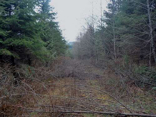
THE NOT SO NICE PART OF THE ROUTE!! Someone doesn't want you to get to the summit!!
I suspect the good views that can be seen on this summit will start to fade away in ten years. With the newly planted forest and the fact that the logging road has been covered by cut tree saplings it is only a matter of time that this peak is no longer easily accessible.
Getting There
Heading From Downtown Granite Falls: From 92 turn on Alder St and make a right. Head 3 blocks south and make a left on Menzel Lake Road. Stay on it for two miles. Make a left on Scotty Road. Take it all of the way to school bus turnaround. If the gate is open do not advance beyond or you risk being locked in. There will be many "no parking" signs located there. Don't park at the turn around but a couple feet before it.Route
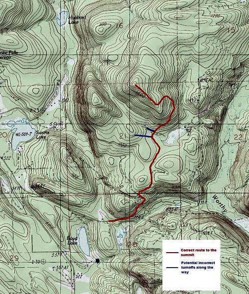
Chitwood Peak Map
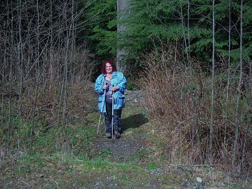
BearQueen on the entrance to the old road
As mentioned above the last older logging road to the summit is just covered by cut tree saplings from the side of the road. Slide Alder and sticker bushes are also starting to cover the road. Use caution and take it slow when going through this section. BearQueen slipped and scratched herself up a little on this section.