
|
|
Trip Report |
|---|---|
|
|
62.16980°N / 144.48701°E |
|
|
Jun 20, 2014 |
|
|
Mountaineering |
|
|
Summer |
Getting There
Plan to arrive into Anchorage, there are many conveniently located hotels. REI or Alaska Mountaineering & Hiking are close to the downtown area if you need gear. I found that using Shuttle Services of Alaska was slightly less expensive than a rental car for our two week trip. Glenallen and Chistochina are both common launching points for Mt. Sanford. My initial plan was to fly in from Gulkana using Copper Valley Air, but their pilot recently retired. Instead we drove 5 hours to Chistochina and stayed at the Red Eagle Lodge . There is a grass runway located immediately adjacent to the lodge. Forty Mile Air (Tok, AK) has a great pilot, Jake Combs, who has flown people to Mt. Sanford on both skis and flotation tires. The flight takes 20-30 minutes depending on winds and the landing zone.
Overview
The Mt. Sanford 2014 expedition started as an idea when I flew the Alaskan Highway in 2006. I remember the final leg being dotted with puffy clouds at 12,000 feet, yet as I navigated towards Anchorage I couldn't help noticing a particularly large and smooth looking cloud towering over the rest. This cloud was Mt. Sanford's summit cone, clad in perpetual snow and rising over three vertical miles into the thin Alaskan air. While I only had a few minutes to marvel at this relatively unknown peak, my thoughts would frequently drift back to its quiet immensity.
Fast forward seven years and I had the opportunity to lead my first expedition for Summit Sensations. I had a Cascades trip in my hip pocket as a backup, but wanted to aim for a more audacious destination... Mt. Sanford fit the profile nicely. The Sheep Glacier route is not technically difficult by mountaineering standards, but access to it is challenging. The club's enthusiasm for this climb was very high but actual participants diluted down from five in January to eventually just Patrick Murphy and me. We worked hard in preparation for the climb and only summited through the narrowest gap in poor weather. I could very easily see a larger team failing to take advantage of the small windows we had in June of 2014.
Expedition Log

Trip breakdown:
Interesting Stats:
- Patrick Murphy is now the oldest known person to have summited Mt. Sanford at 53 yrs, 64 days!
- Pure vertical climbed from the Sheep Creek - 11,337'
- Total miles round trip from landing spot - 34 miles
Day 1, June 18 - Flew to Dallas from Boston and endured a five hour layover, then took a seven hour flight to Anchorage. We had a beautiful view of Mt. Baker and Shuksan, as well as Mount St. Elias and Mount Fairweather on the flight...Patrick started getting ideas. Got in around 7:30 PM and took the shuttle to the Millennium Hotel. Grabbed a late dinner and went to bed.
Day 2, June 19 - Picked up right on time at 9 AM by Brian from Shuttle Services of Alaska. Found out that Brian is a mountain guide in Alaska and is about to open up a bar hopping tour in Anchorage called Big Swigs! Now I completely regret not bringing beer on this trip... Head over to do some food shopping and then pick up fuel at REI. Had a beautiful drive along the Chugach Mountains to Chistochina and our destination for the day, the Red Eagle Lodge.

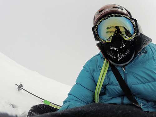
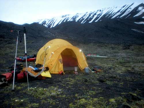
Day 3, June 20- We had breakfast with one of the owners of the Red Eagle Lodge, Richard. He has quite a story to tell and has done some mountaineering in the past, including Mt. St. Helens before it erupted. Jake Combs, our Super Cub pilot from Forty Mile Air arrived promptly at 8 AM and flew me onto the tundra about three miles from the toe of the Sheep Glacier. By 10:30 AM, Patrick and the remainder of the gear was on the ground and we began our march towards Mt. Sanford. Jake could land a plane nearly anywhere, I've never met a better bush pilot.

At first we were hoping to drag the sled along the tundra all the way to the glacier nearly three miles away. After the first pumice stones start to reveal themselves we are forced to abandon this plan as well as the sled and a duffel bag. Pat and I descend Grizzly Pass to the Sheep Creek and drop our packs. We then climb back up 1,000' to recover the remaining gear. During the next climb downhill, one of the bear spray canisters is punctured by my MSR snowshoe crampons. I notice a burning sensation on my lower back through the now saturated duffel bag. Pat and I endure Bear Spray in our eyes and skin the next 8 days....
![Route to Sheep Glacier]()
Our route from the landing site- Regardless, we do a carry up to the base of the glacier, drop our packs, and return to the Sheep Creek to grab the sled and remaining duffel bag. Finally, at 4:45pm, we don the snowshoes, attach the sled and start climbing. The toe of the glacier is too steep for skinning, it is short but steep. It started to rain as we made Camp 1 at 5,700'.
![Super Cub and Mt. Sanford]()
Super Cub and Mt. Sanford


Day 4, June 21- We began the day with heavy rain that changed to snow by wake up time. Poor weather aside, Pat and I are excited to be on the glacier and heading uphill. We spend three hours breaking down camp and we make slow progress in moderate snow. The glacier is too hard packed to take wands. Along the way we pass a section of pooling water on the surface of the glacier and ignore it..this will be a harbinger of conditions on our return through this area...
It is hard to believe how large this mountain is, we climb for an hour and the terrain looks exactly the same. As the day progresses the weather slowly improves. We reach the primary crevasse field at 7,000' feet and struggle mightily with the sled, I think I might have sworn more at this sled then at any other inanimate object, ever. I figure out that the prusik tied to the rear of the sled is what is turning it over. With the problem fixed we navigate to 7,400' with no other issues. We reach base of the cascading icefall at 7,200' and build Cache #1. We leave some fuel, wands, boots, sled and snowshoes. Shortly thereafter we work uphill, perform two belays through an eerie crevasse zone, and end the day at 8 PM with blazing sunshine after a mostly snowy day.
![Sun at Camp 2]()
Sun breaks out at Camp 2
Day 5, June 22 - We have a beautiful sunny start to the morning at 7,660', Camp 2. We manage to break camp in under two hours this time and are graced with some relatively consistent and fair weather. In fact, we hope for some clouds as we start to get baked by solar radiation reflected off of the glacier and the ice wall, commonly known as the "Nunutak" off to our left. Pat checks his thermometer and tells me it reads over 90 degrees, I'm like, "yeah right". Anyone who has been in these situations can relate to just how strange this phenomenon is.
The heat is our biggest obstacle today, we miss our goal of 11,000 feet and settle in at just over 10,000 feet as the weather starts to move in.

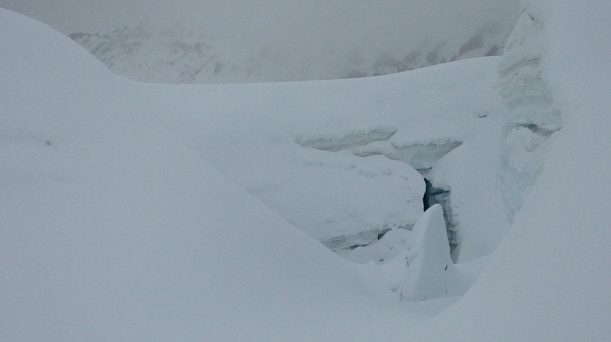
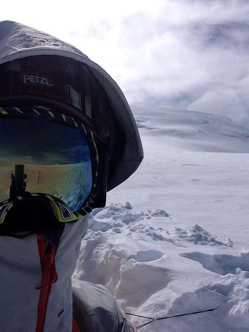
Day 6, June 23- We woke up to high overcast and ok visibility at 10,130', Camp 3. Both Pat and I are starting to develop an intuitive appreciation for "weather windows" and realize we better get our asses in gear while we have nice visibility. As always, within a couple hours, the weather started to move in, usually cumulus clouds that would cling to the mountainside. We were able to hone in on the route and steer between two crevassed zones to the left and right of our route. As we continued uphill, the visibility dropped to nearly zero and we had to stop and wait it out. Patrick and I were frequently disturbed to pass crevasses that had fat cornices on their uphill aspects that would be nearly invisible if approached from above.
By 2-3pm, at 12,000 feet, we started to break out of the cumulus clouds and into the hot sun once again. After three more hours baking, we decided to make high camp at 13,000'.


Day 7, June 24- Woke up to bad weather at 13,020'. Clouds broke at 10 AM and we made decision to attempt the summit.
Without a stubborn mindset and ability to navigate in 300 foot visibility, we would not have made the summit. This day was emblematic of the masochistic side of mountaineering - the so called "death march". Despite having only 3,200' vertical to gain from Camp 4, it still took 10+30 to reach the top and 18 hours round trip from high camp. There was no single reason as to why we were this slow, but i'll outline some of the challenges we faced heading to the top:
- Snow humps and ridges - On the benign plateau at 13,000 feet, the wind had carved out many snow ridges, moguls, and "speed bumps". The conditions consisted of a foot of loose powder over firm and serrated wind slab, which was not ideal for skinning up hill. It took us over three hours to reach 13,900 feet.
- Snow scouring and ice- At around 14,000 feet, the gradient jumped from 10 degrees to perhaps 25. Whether due to gravity or more wind exposure, it seemed like a majority of the snow was absent in this area. It was not possible to skin directly up or to get an edge into the hard packed terrain. Patrick was forced to abandon his skis and he switched to crampon/post hole mode the rest of the way up. I found a narrow zigzag of wind slab to dig my skis into and continue.
- Visibility - Maintaining the route going uphill usually involved getting a compass heading every 60 paces. We had filtered sunlight through ice crystals and intermittent snow showers, which I'd go so far as to call "good" weather for Mt. Sanford. We were lucky to have some oblique lighting to show the terrain at times. Our progress from 14,000 to 15,800 took about five hours.
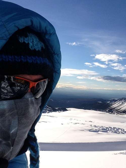
We started noticing the thinner air when we reached the plateau and instead of racing up the final stretch, we found ourselves pacing as if we were on steeper ground. Nevertheless at 9:15 PM we reached the summit! Visibility was 1/2 mile in blowing snow and a thickening snow crystal haze. We still had two hours until sunset and knew that it would not get completely dark. We did not get a beautiful panorama at the top, views were very limited and we felt the need to beat the incoming weather back down to Camp 4.


Notwithstanding my hopes for a quick dash down to Camp 4, we were in for a long descent. Progress was reasonable down to 15,500' since we were still on our wanded route. However, within a five minute period, heavy snow moved in and we lost the trail. I was forced to reduce the pace to 30 steps at a time so I could stay on course. Without fail, I would veer at least 10-30 degrees within even these short intervals, there simply was no way to tell where we were in the murk. I also knew that there were well over a dozen crevasses crisscrossing the terrain. These features could be within 50 feet of us and we would not know it.
Patrick was also being pulled off of his feet as I snowplowed downhill while he chased me in crampons through deep snow. As I feared, we veered nearly a quarter mile off course into an unfamiliar crevasse field. I still had my waypointed ascent route, so I fired up my TopoMaps app and confirmed that I was a quarter mile too far West. In order to correct this error, I turned hard right and very shortly ended up "falling" down a ridge around 100 feet high in three feet of powder, I was lucky I did not lose any gear. I tore up my down jacket at this point and I spent 30 minutes getting re-oriented. By the time we reached 14,000 feet it was 3 AM.
The very long day and poor weather was starting to have an impact on us. Patrick was out of water and was very tired from having to posthole for the last 8 hours in crampons. His hands were so cold he could not remove his crampons to switch back to skis. He could not find his headlamp and his glasses were frozen over. This is what I would call "sub-optimal". Finally, after some frustrating shouting back and forth, I had Pat climb down to me. By this point it was 4 AM and I knew we were getting close to high camp. One last check of the TopoMaps app confirmed my location and I set off for what looked like the general shape of a tent. The closer I got, the more sure I was that the tent was straight in front of me...until it wasn't. Still 100 feet away, I stared at the remains of the tent in the mouth of a huge crevasse.
For at least 5 minutes, Patrick and I were convinced that all the heavy snow had caused a new crevasse to open up in the precise location where we had placed our tent. Almost despairing at the thought of a belay into a crevasse to recover our gear, I decided to recheck our coordinates and saw that we were still 300 ft away. I looked in that general direction and could see nothing, but driven by an insane desire to be done with this day, I headed in that direction. Within 100 feet I could start to see the dim outlines of a shape and determined that it was our North Face Mtn-25 covered in 15 inches of new snow. Immensely relieved, I began digging it out. As soon as the tent was dug out, I fired up the satellite phone and called home to let everyone know we had successfully made it to the top and back. 24 hours later, we began our descent.

Sheep Glacier Route

Our 5 day ascent on Mt. Sanford
Day 8, June 25 - Pat and I spent the day recovering. We did not melt snow and did not cook any meal. I had a power bar and ate a hot chocolate packet raw. I did not see Pat move the whole day, which after 24 hours started to concern me a little. It snowed heavily.
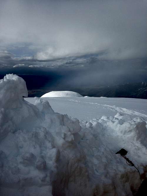
Day 9, June 26 - The weather was crummy again, but we proceeded downhill. We ended up walking into an icefall area and had to backtrack down and to the East, this put us about 1/2 mile too far East on the downhill. We opted to make camp at 5:30 PM in a whiteout at 10,100' but feeling confident we were nearly on the descent route.
Day 10, June 27 - The weather dawned with a high overcast but it was clear below 20,000'. It came to find out that the glacier we camped above was the INCORRECT one, it was the snake tongued no-name glacier that runs due North off of Sanford. With no small amount of chagrin, I informed Patrick that we had to traverse another 45 minutes along the contour to get back on course. Despite the snag it was a good day for progress downhill, even though we fought progressively stacked cloud decks as we descended. I swear that every time we broke into the clear I could see another dark gray ribbon of cloud emerging below us to block our progress. I was very frustrated as we get socked in at Camp 2, right above the most dangerous area. Luckily, after roughly an hour and a passing heavy shower, we were able to regain visibility. We ended the day off of the glacier at around 5'000 ft.
![Last camp]()
5,100' on the morraine
Day 11, June 28 - I woke up at 6 AM to a beautiful blue bird day and immediately felt as if we needed to get the hell out of dodge, weather windows and all!! We did one carry up to 5,900' ft in preparation for pickup by Forty Mile Air. I tried calling our pilot Jake but he didn't pick up the phone...I tried calling their office and same result. I started to get worried at this point that maybe they weren't working on a Saturday, bad thoughts start going through my head. We climbed a little bit longer and I decided to retry Jake, he picked up and I relayed the weather, winds were 15-20 MPH out of the ENE, very similar to our first day. Jake agreed to come get us despite the fact that it his day off, thanks Jake!!!!!!!!!!!! We hustled back downhill to collect our remaining gear, I've never walked faster in my life. I all of a sudden start to develop an abandonment complex. All is well, however, as Jake landed expertly in a dying headwind and John is picked up at 11:45, Pat by 1:15. Rest and recovery for the rest of the day at the phenomenal Red Eagle Lodge.
Day 12, June 29 - We spent some time speaking with Richard at Red Eagle Lodge, he recorded our account of the climb for a local newsletter. Brian from Shuttle Services of Alaska picked us up and we were back in Anchorage by 6 PM. I can tell we are all tired since we stop talking after about 20 minutes. Celebration dinner at Club Paris, probably the best steakhouse I've ever been to.
Day 13, June 30 - We split up and spend the day in downtown Anchorage. I spent most of it at the Bear Tooth Pub Theatre.
Day 14, July 1 - The last day in Anchorage, I watched the Belgium vs. USA World Cup match. Spent some time at Central Bowl with Patrick.
~ John Stevens
External Links
Summit Sensations website: http://summitsensations.org/mt-sanford-2014/


Comments
Post a Comment