-
 3122 Hits
-
 79.78% Score
-
 11 Votes
|
|
Area/Range |
|---|---|
|
|
45.73530°N / 7.31327°E |
|
|
Hiking, Mountaineering, Trad Climbing, Sport Climbing, Bouldering, Ice Climbing, Aid Climbing, Big Wall, Mixed, Scrambling, Via Ferrata, Canyoneering, Skiing |
|
|
Spring, Summer, Fall, Winter |
|
|
15781 ft / 4810 m |
|
|
Note
La montagna chiama i suoi figli, ed essi rispondono fedelmente al suo appello… Osvaldo Cardellina, Diario alpinistico, 1964-65 Page texts: @ OsvaldoCardellina "Osva", passed away on May 2, 2022. Page owners: Christian Cardellina e Osvaldo Cardellina. Any updates from September 12, 2022: Antonio Giani, page administrator, friend and climbing companion. Testi della pagina: @ OsvaldoCardellina "Osva", scomparso il 2 maggio 2022. Proprietari pagina: Christian Cardellina e Osvaldo Cardellina. Eventuali aggiornamenti dal 12 settembre 2022: Antonio Giani, amministratore della pagina, amico e compagno di salite. |
Synthetic plan work Overview
Clockwise and from East to West, starting from the Municipality of Pont St. Martin to get towards Valley La Thuile and adjacent Vallon of Little St. Bernard. So the whole sector bordering the Valle Orco-Locana-Ceresole Reale in Canavese Zone (Piedmont), as well as the border between Italy and France with Val d'Isere and the Tarentaise Sainte Foy has been completed; including inland areas, who do not arrive at the border, but that as intermediate zones descend to the Central Valley Dora Baltea. The timing of various publications has not complied fully with the correct sequence and the same geographical succession, because improvised as aforesaid, publish the valleys early or late compared to other; this for unavoidable reasons, often in conjunction with other works carried out in several titles (ex. My Mountain, Article, Trip Report, etc.) related to the same area. For this reason we prefer here give two different interpretations:
1) - the correct sequence in a circular 360° of valleys and secondaries walloons starting from East (Pont St. Martin Common) to return to the East on the opposite or Sector North, starting from Seigne Hill at the beginning of the Mountain Chain Mont Blanc, ends in the East with that of Monte Rosa to conclude finally coming down to the border with the three Provinces of Novara, Biella and Turin (Piedmont always) on the watershed Eastern.
2) - The table of "Déjà-vu or Already Seen" are instead described the publications in chronological order, as they have been made at the time. To complete this work still lacks the entire Northern Sector than in the course of Dora Baltea, so that you can briefly outline: the two valleys Mont Blanc (Val Vény and Ferret), the two inner areas or Northwest from Courmayeur (Mont de la Saxe) towards Aosta City (Pointe de Met) and North from Aosta (Becca of Viou) towards Châtillon (Becca d'Aver), including the Valley of Saint Barthélemy, still further North the entire Valley of the Gran San Bernardo including Conca (Basin) of By-Ollomont and Valpelline. Finally the three valleys "noble", namely: Valtournanche or Valley of Torrent Marmore and still of the Cervino also Matterhorn above Châtillon, the Ayas Valley or of Evançon also Lyskamms over Verrès and finally the Lys Valley or Gressoney with the highest part Chain Monte Rosa and the foothills to the Southern border with Piedmont up to the Mombarone. About Val d'Ayas, to note that five major small valleys of its watershed Eastern with the Lys Valley are already been edited; can be attached to complete, in the course of future description of this valley. The four main focal points of this artificial division into four specific sectors, over the course of Baltea which acts as a divider between the net everything which stands in the North compared to that which is collocated to the South, can be considered from East to West the Commons Pont Saint Martin, Saint Vincent-Châtillon, Aosta and Courmayeur. But the "heart" or, if you prefer the primary pin, is to be located in the City of Aosta, the real balance of power, as incidentally had already identified 2040 years ago the Romans, prosthesis on "Via delle Gallie", but also interested to dominate all the Valleys with its secondaries small Valleys. Southern Area in respect to Baltea: Champorcher Valley: Bard, Pont-Bozet, Champorcher Municipalities; Vertex on Mont Glacier (3.186m).
![]()
![]()
![]()
![]()
![]()
![]()
![]()
![]()
![]()
![]()
![]()
Aosta Valley Two main orographic and hydrographic divide for four principal Sector from East towards West & vice versa.
Champdepraz or of Lakes Valley-small Valley: Champdepraz Municipality; Vertex on Mont Avìc (3.006m).
Valmeriana-Bellecombe small Valleys: Pontey Municipality; Vertex on Mont Rouìc (2.922m).
Ponton small Valleys: Fénis Municipality; Vertex on Mont Avìc (3.006m).
Fénis-Clavalité-High Comba Tersiva-Savoney-Lavòdilèc Valley-small Valleys: Fénis Municipality; Vertex on Punta Tersiva (3.515m).
Saint Marcel Valley: Saint Marcel Municipality; Vertex on Punta del Tessonet (3.264m).
Les Laures small Valley: Grand Brissogne Municipality; Vertex on Monte Emilius (3.559m).
Arpisson deep Valley: Pollein Municipality; Vertex on Monte Emilius (3.559m).
Dard Gorge/Comboé Vallon: Charvensod Municipality; Vertex on Becca di Nona (3.142m).
Arbolle or Arbole Vallon: Charvensod Municipality; Vertex on Monte Emilius (3.559m).
Pila Basin: Charvensod, Gressan Municipalities; Vertex on Punta della Valletta (3.090m).
Val de Cogne: Cogne Municipality; Vertex on Gran Paradiso (4.061m).
Val Savarenche: Villeneuve, Valsavarenche Municipalities; Vertex on Gran Paradiso (4.061m).
Val di Rhêmes: Villeneuve, Introd, Rhêmes-Saint-Georges, Rhêmes-Notre-Dame Municipalities; Vertex on Pointe Tzantelèina (3601m).
Grisenche Valley: Arvier-Liverogne, Valgrisenche Municipalities; Vertex on Grande Sassière (3.751m).
La Thuile Valley: Pré Saint Didier, La Thuile Municipalities; Vertex on Tête du Rutor (3.486m).
Little Saint Bernard small Valley: Pré Saint Didier, La Thuile Municipalities; Vertex on Mont Berrio Blanc (3.252m). Northern Area than the Dora Baltea:
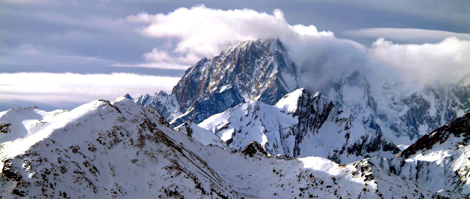
Val Vény: Coumayeur Municipality; Vertex on Mont Blanc (4.811m).
Val Ferret: Coumayeur Municipality; Vertex on Grandes Jorasses (4.208m).
Western Central Valley: Courmayeur, Pré Saint Didier, Morgex, Avise, Saint Nicolas, Arvier, La Salle, Saint Pierre, Sarre, Aosta Municipalities; Vertex on Grande Rochère (3.326m).
Gran San Bernardo Valley: Aosta, Gignod, Allein, Etroubles, Saint Rhémy en Bosses Municipalities; Vertex on Mont Velan (3.734m).
By Conca-Ollomont Valley: Aosta, Gignod, Allein, Doues, Ollomont Municipalities; Vertex on Mont Velan (3.734m).
Valpelline: Roisan, Valpelline, Oyace, Bionaz Municipalities; Vertex on Dent d'Hérens (4.172m).
Eastern Central Valley: Aosta, Saint Chistophe, Quart, Nus, Chambave, Verrayes, Saint Denis, Châtillon, Saint Vincent, Emarese Municipalities; Vertex on Monte Faroma (3.073m).
Saint Barthélemy Valley: Nus, Saint Barthélemy Municipalities; Vertex on Becca di Luseney (3.503m).
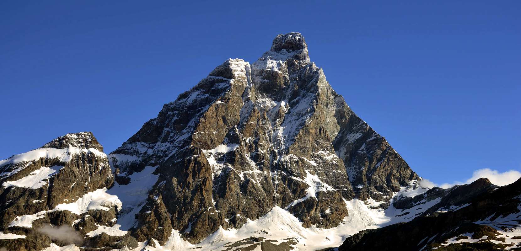
Valtournanche: Châtillon, Antey-Saint-André, La Magdeleine, Torgnon, Chamois, Valtournanche Municipalities; Vertex on Monte Cervino or Matterhorn (4.478m).
Val d'Ayas with Estoul Basin, Frudière, Chasten, Dondeuil small Valleys: Verrès, Challant Saint Victor, Challant Saint Anselme, Brusson, Antagnod-Ayas-Champoluc-Saint Jacques Municipalities; Vertex on Eastern Lyskamm (4.532m).
Lys or Gressoney Valley: Pont Saint Martin, Perloz, Lillianes, Fontainemore, Issime, Gaby, Gressoney Saint Jean, Gressoney la Trinité Municipalities; Vertex on Punta Zumstein (4.564m).
Questa pagina "intermedia" possiede lo scopo di sintetizzare il Piano di Lavoro completo rispetto ai Valloni e alle Vallate dell'intero territorio della Val d'Aosta. Nata un pò in modo improvvisato nell'ormai lontano Dicembre 2013 con "Grisenche Valley", quest'idea di analizzare le principali valli nonché i valloni esistenti in Valle di Aosta ha preso sostanza, strada facendo, con la pubblicazione di altri lavori inerenti alla stessa tematica. Ma, precedentemente, già dal Settembre dello stesso anno aveva preso inizio un'altra serie dedicata all'analisi di questo tema con "ALL PASSES from PIEDMONT to AOSTA's VALLEY into SOUTHEASTERN GRAIAN ALPS, però principalmente rivolta ai Colli e quindi al passaggio tra valli e valloni diversi. Dal Novembre invece era iniziata con "AOSTA VALLEY Southern Orographic and Hydrographic VALLEYS & small Valleys - First Part/A" una serie più mirata, nonché maggiormente specifica che in modo organico (stessa divisione topografica del recente lavoro con medesima dascrizione in rotazione oraria da Est ad Ovest e ritorno) che s'era conclusa, dopo la pubblicazione di sei distinte pagine, il 3 di Aprile del 2014 con "AOSTA VALLEY Southern Or. & Hydr. VALLEYS & small Valleys - First Part/B". Questo lavoro era più scarno e "telegrafico" dell'attuale, ma aveva il pregio di visitare proprio tutti i valloni esistenti in Valle di Aosta. Due lavori complementari ed apparentemente similari, ma tali da proporre sostanziali differenziazioni, con quest'ultimo che diventa maggiormente descrittivo, anche con l'accenno ad itinerari da percorrere, e più connesso al tessuto d'una specifica vallata. Quindi un obiettivo maggiormente maturato nel tempo che non prefissato, in rapporto alla grande mole di lavoro da svolgere e dell'impegno richiesto. All'uopo evidenziando ciò che é stato fatto e quello che ancora deve essere realizzato risulta un invito a chiunque volenteroso voglia partecipare alla stesura dei valloni e delle valli che ancora non sono state descritte e delle quali trovate chiara evidenziazione nei panneaux appena qui sotto elencati. Inoltre vi é da annotare che tutto il Settore Meridionale rispetto alla Dora Baltea é stato completato con la pubblicazione in Marzo di "Conca d'Arpy", subito precedente la Valle di La Thuile.
Questo in senso orario e da Est verso Ovest, partendo da Pont Saint Martin per arrivare alla Valle di La Thuile ed all'adiacente Vallone del Piccolo San Bernardo. Quindi tutto il settore confinante con la Valle dell'Orco-Locana-Ceresole Reale in Canavese (Piemonte), nonché il confine italo-francese con la Val d'Isère e la Tarentaise Sainte-Foy é stato completato; comprese le aree più interne, che non arrivano ai confini, ma che quali zone intermedie discendono verso la Valle Centrale. La scansione temporale delle varie pubblicazioni non ha rispettato integralmente la giusta successione geografica e topografica mentre la medesima ha visto, proprio perché improvvisata come sopraddetto, pubblicare delle vallate in anticipo od in ritardo rispetto ad altre. Questo per motivi contingenti, spesso in concomitanza di altri lavori eseguiti in diversi titoli (esempio My Mountain, Article, Trip Report ecc) inerenti alla medesima area. Per questo motivo si preferisce qui dare due diverse chiavi di lettura:
1) - la giusta successione in senso circolare a 360° di vallate e valloni partendo da Est (Comune di Pont St. Martin) per ritornare ad Est sul Settore opposto o Settentrionale che, partendo dal Colle della Seigne all'inizio della Catena del Monte Bianco, termina ad Est con quella del Monte Rosa per infine concludere scendendo al confine con le tre Province di Novara, Biella e Torino (sempre Piemonte) sull'estremo spartiacque Orientale.
2) - Nella successiva tabella di "Déjà-vu or Already Seen" vengono invece descritte le pubblicazioni in senso cronologico, così come sono state pubblicate a suo tempo. Per completare questo lavoro manca ancora tutto il Settore Settentrionale rispetto al corso della Dora Baltea, che si può così brevemente delineare: le due vallate del Monte Bianco (Val Vény e Ferret), le due aree interne o Nordovest da Courmayeur (Mont de la Saxe) ad Aosta (Punta di Met) e Nord da Aosta (Becca di Viou) a Châtillon (Becca d'Aver), compresa la Valle di Saint Barthélemy. Ancora più a Nord l'intera Valle del Gran San Bernardo, compresa la Conca di By-Ollomont, e la Valpelline, ed infine le tre valli "nobili", ovvero: la Valtournanche o Valle del Torrent Marmore ed ancora del Cervino fino a Châtillon, la Val d'Ayas o Valle dell'Evançon o dei Lyskamms fino a Verrès ed infine la Valle del Lys o di Gressoney con la parte più elevata della Catena del Monte Rosa, nonché le propaggini Meridionali al confine con il Piemonte raggiungenti il Mombarone sopra Pont Saint Martin e Carema. A proposito della Val d'Ayas, da annotare che cinque importanti valloni del suo spartiacque Orientale con la Valle del Lys sono di già stati editati; potranno essere allegati, a completamento, nel corso della futura descrizione di questa vallata. I quattro fulcri principali di questa artificiale divisione in altrettanti specifici settori, oltre al corso della Dora Baltea fungente da netto divisorio tra tutto quello che stà a Settentrione rispetto a ciò che é collocato a Sud, posson essere considerati da Est ad Ovest i Comuni di Pont Saint Martin, Saint Vincent e Châtillon, Aosta e Courmayeur. Ma il "cuore" o, se preferite il perno primario della suddivisione in quattro specifici settori, é da situare nella Città di Aosta, vero e proprio ago della bilancia, come daltronde avevano già individuato 2040 anni orsono i Romani, sì protesi sulla "Via delle Gallie" ma pur interessati a dominare su tutte le Vallate, nonché Valloni secondari.

Enlarged Getting There
BY CAR:
- From TORINO, MILANO, etc: Motorway A5. Exit at IVREA or Quincinetto (PIEDMONT)
- From IVREA Town: in West (Northern side) towards Pont Saint Martin, Donnas, Bard, Arnad, Champdepraz, Saint Vincent, Emarese, Châtillon, also in Southern side: Pontey, Fénis, Saint Marcel, Grand Brissogne, Pollein, Charvensod, Gressan, Jovençan, Aymavilles, Villeneuve and from this returning again in Northern side: Arvier, Saint Nicolas, Avise, Morgex, Pré Saint Didier and Courmayeur Municipalities. From Courmayeur Resort: in East and in Norhern side respect to Baltea towards: Morgex, La Salle, Saint Pierre, Sarre, Aosta, Saint Chistophe; Quart, Nus, Chambave, Verrayes, Saint Denis, Châtillon, Saint Vincent, Emarese, Arnad, Verrès, Arnad, Hône, Donnas, Pont Saint Martin Municipalities.

Southeastern, Southern and Southwestern Sides:
From Hône-Bard towards La Thuile Valley and Little Saint Bernard Vallon From Hône-Bard towards Pont Bozet (775m) and from this to Champorcher Valley, Château (1.427m), Petit, Grand Mont Blanc, La Cort Villages, towards Dondena Village (2.092m), Dondena & Miserin Refuges, through Royal Road and dirt roads; Barbustel Refuge, through Royal Road and path towards Champdepraz Vallon. From Champdepraz (523m) to Lakes Vallon and Voella or Raye Chevrères Village (1.307m; by Regional Road). Barbustel Refuge with path from Voella. From Fénis (537m) to Clavalité-Grand'Alpe Pastures (2.129m; through dirt road), just below E. Borroz/Rotary-Clavalité Refuge (2.156m) at Cuneu Alp. From Saint Marcel (630m) to Saint Marcel small Valley and Turati Reserve up to the Mulac & Grande Chaux Hunting Houses & Alp (1.937m, 2.370m). From Grand Brissogne (827m) to L'Arp, dirt road, Les Laures small Valley-Ernesto Ménabreaz Shelter at Lower Laures Lake (2.546m), path-muletrack. From Pollein (575m; secondary road) or from Charvensod (746m; main road and connection) to Martsaouchy Damon-Arpisson wild Valley, through dirt road, and to Arpisson Lower and Upper (2.010m) Alpages with path. To Federigo Zullo Bivouac (2.907m), through moraines on Western Arpisson Glacier. From Charvensod to Dard-Comboé-Arbolle small Valleys towards Ponteilles (1.697m) Alp/Waterfall, through dirt road, Comboé Alp/Saint Ours Shelter (2.114m), through dirt road, and Arbolle Refuge (2.516m), near Lakes (2.497m), by Chair Lift to Chamolé Station (2.309m), Lake (2.325m) and muletrack. From Charvensod (main road from Pont Suaz 567m) or from Gressan (603m; alternative road) to Tivet, Les Fleurs Hamlets (1.292m, 1.414m) Pila Basin and Pila Resort (1.800m); upper parking 1.850m). Arno Shelter (2.660m), always open but unguarded, nearby Couiss Summit on watershed Pila/Cogne Valley. From Jovençan (631m) to Pila Conca, exclusively through path-muletrack to Tourlin Dessous (1.466m) and by dirt road to Pila-Posse Tennis (1.776m). From Aymavilles (646m) to Western Pila Conca, through Main Road to Cogne Valley, alternative to Ozein/Turlin Dessus Hamlets and dirt road to Pila-Posse.
From Villeneuve to Rhêmes Valley From Villeneuve (670m) to Rhêmes Valley: Introd (880m), Rhêmes Saint Georges (1.171m), Notre Dame (1.725m) Communes, through Regional Main Road, up to the Thumel Village (1.887m) with Municipal Road and to Gian Federico Benevolo Refuge (2.280m), through dirt farms road or underlying path.
From Liverogne (Arvier) to Valgrisenche From Arvier to Liverogne Fraction (730m) and from this to Valgrisenche Valley, up to the Valgrisenche Municupality (1.664m) and Mondanges, Surier, Us(s)eliéres Villages around the artificial Beauregard Dam, through Regional Road. Mario Bezzi at Vaudet and Chalet de l'Epée Refuges through paths.
From Pré Saint Didier to La Thuile & Little Saint Bernard Valleys From Pré Saint Didier (1.010m), with State Road, to La Thuile Valley: Elévaz, Balme Villages, La Thuile Commune, 1.441m; from this to Little Saint Bernard small Valleys towards the Little Saint Bernard Hill (2.188m), through State Road. To Albert Deffeyes Refuge with muletrack from La Joux Fraction.
Internal Dora Baltea Areas from Villeneuve to Arpy Conca From Villeneuve (620m), Martignon (823m), San Bernardo through dirt road in Southeast, towards Prorayé Alp to Upper Champlong in Poignon small Valley. From Introd (873m), with Municipal or dirt road towards Buillet (1.030m)/Biolay (1.042m) small Villages to Montagne. From Arvier (776m), with Regional Road, towards Crête, Verney, Petit Haury, Scierie, Grand Haury with Municipal Road, to Combes Basin. From Avise-Runaz (786m), with Municipal Road, to forks 956, 998, 1.115 meters, Marbrière Pasture, Faveroy Alp to Monte Colombo. From Derby-Chez Les Gontiers (839m) Village, with short Municipal Road through path in South towards Créton (1.523m), Dailley (1.621m) Alpages. Through two parallel secondaries small paths, to fork 1.823 meters with dirt road and Tillac Alp (1.848m) to Faveroy Area. From Morgex (920m), with Regional Road in South, towards Liarey, Pre Villair, Mont Rotie, alternative around 1.275m just before Tirecagne Pasture (1.532m), with dirt road in Southeast, towards Costablinaz de Meitin Pasture (1.420m), after through path, towards Damon (1.445m), Champex (1.519m) Pastures, Plan Rançon Alp (2.098m) to Becca Pouignenta Northern Area. From Morgex (920m), crossing the bridge above Baltea with Regional Road in South, towards Liarey, Pre Villair, Mont Rotie small Villages, alternative around 1.275m) just before Tirecagne Pasture (1.532m) and the Main Roads to Arpy Basin. Western, Northwestern and Northern Sides:
From Courmayeur to Aosta Town From Courmayeur (1.198m) towards Pont des Chèvres, Notre Dame de la Guérison, Lassy Dèsot/Perthud Villages, Gabba, Chalets du Miage, La Visaille Cave, Plan de Lognan Alp (1.676m), with Municipal Road; from this to Lake Combal (1.950m) and to Refuge Elisabetta-Soldini (2.197m), through dirt road. From Courmayeur-Notre Dame de la Guérison Sanctuary (1.444m), through private dirt road, to Monte Bianco Refuge (1.666m). From Courmayeur-la Palud (1.370m), towards Montitaz, Planpincieux (1.593m) Villages, Tronchey (1.620m), Praz Sec du Milieu, Lavachey (1.640m), Arnouva Dèsot (1.769m) Villages, through Municipal Road, to Malatrà Vallon and Walter Bonatti Refuge. Also from Arp Nouva to Elena Refuge, through dirt road on valley floor; or from the fork after Planpincieux, small bridge, towards Leuchey Dèsott, Damon Pastures to Mont de la Saxe Hump/Giorgio Bertone Refuge. From Courmayeur-Villair Dessus (1.282m), with Municipal Road and through dirt road to fork 1.470 meters and path to Refuge Bertone in Val Sapin. From La Salle 1.001m), with Regional Road, towards Challancin (1.610m), Cheverel, Morges (1.829m), Planaval Hamlets (1.750m); from this, through dirt road in North-northeast, passing Maison Blanche Pasture, to Rantin (2.333m) and Bonalé (2.340m) Alpages, in Upper Planaval small Valleys. From La Salle, with Regional Road, towards Challancin Village, Ponteilles (1.741m), Arpilles (1.862m) Pastures to Bard Pass (2.178m) in Arpilles Conca. From Saint Pierre-Pommier (783m), Champretavy, Rumiod, alternative just after Persod (1.351m), Ravoise, Chaillod, Clavel, Cerlogne (1.580m) to Vens small Villages (1.750m), with Regional Road in West-northwest. From this last to Joux Saddle (1.930m): through short descent to Vertosan small Valley From Saint Pierre-Château Sarrod de la Tour, Rumiod, Petit and Grand Sarriod (1.444/5m), Gerbore, Vetan Dessous (1.670m) and Dessus (1.737m), with Regional Road to Vetan Basin. From this, through dirt road, towards Genevrine Pasture, Chatalanez, Toules, Grand Arpilles Alps to Chaz Creuse Alp (2.398m). From Sarre (657m), with Regional Road, towards Plèod, Vert Dessous and Dessus, Vareille, Caillod/Ville sur Sarre/Remondet, Moulin/la Cort, forks 1.225m, 1.301 meters, Salet, Chavalançon (1.426m) small Villages to Thouraz Dessous and Dessus Hamlets (1.652m); from the last to Closella and Met small Valleys.
Northern and Eastern Sides than in the course of Dora:
From Aosta Town to Verrès Municipality From Saint Christophe-Prevot (about 640m), reached by Regional Road from Aosta, to Sorreley Village; from this, with Municipal, towards Veynes Fraction. From subsequent alternative before Lumian (1.025m): *** in East deviation to Cretallaz, Jeanceyaz, Morgonaz Villages at the entrance on Senevé Comba). On asphalt road in Northwest, to Parléaz Village (1.274m), Blavy Hamlet (1.475m) and, through dirt road or path, to Viou Alpages, in Blavy Viou Basin. From Quart-Villair towards Epilaz, Argnod Villages or from State Road n°26 nearby La Plantaz (540m), with Regional and Municipal Roads, towards Chétoz, Vignil, Fornail, Ville sur Nus-Planeville, Buignod, Porsan Villages to Trois Villes-Avisod Village (1.398m). From this to Senevé Alps (2.206m), in Senevé Comba. From Quart to Fonteil with previous route; from this through dirt road, towards La Seyvaz (2.184m), Valchourda Alps (2.392m), in Comba Dèche. From Nus-La Plantaz in State Road to Ville sur Nus-Planeville (1.113m); from this, towards Buignod, Avion (1.312m) Villages. Also from Porsan through Trois Villes (1.398m), Avion, fork (1.250m) to Effraz Village (1.487m), with Municipal Roads. From this to Ronc (1.737m), Machaussy Alps, in Effraz Comba. From SS.26, nearby Chambave, to Regional Road; towards Ollières, Marseiller (801m) to Verrayes (991m). With Municipal Road towards Tessellaz, Marquis, Dorinaz (1.323m), Charrière Villages to Grand-Villa Hamlet (1.437m), in Verrayes/Saint Denis Basin and to Aver-Longhede Area. From
A) - Verrayes, with Regional Road, towards Del (1.260m), Plau (1.305m), Semon to Cheresoulaz (1.487m) Villages. Also from
B) - Saint Denis (803m; reached from Chambave, Marseiller) with Regional Road towards Gubioche, Etrobleyaz, Petit Bruson, to Del Villages. C*** Road Connection towards Roves, Lozon (1.520m), Clavon, Fontane Villages, Pastures to Bornes Alp). From Cheresoulaz, through Municipal/Regional Roads, to Saint Pantaléon Hill (1.650m). From Châtillon (549m), with Municipal Road, towards Chavod, Domianaz to Nissod Villages (1.371m); from this, through dirt road to Nuarsaz Alp (1.713m). From Saint Vincent (575m), with Regional Road, towards Moron (844m), Grun (991m), Salirod (1.102m), Amay (1.466m) Hamlets to Joux Hill (1.635m). From Saint Vincent, towards Cillian, Feilley Villages also from SS.26, towards Estaoud (595m), the both with Regional Roads, to Emarese Commune (1.048m); from this towards Erésaz (1.163m), Cuignon/Sommarèse/Longeon (1.549m, 1.536m, 1.516m) Hamlets to Zuccore Hill (1.607m). From Verrès (390m), before with Regional Road after through path, to Collegiate Church of Saint Gilles, immediately below Mount Saint Gilles (967m).
Southwestern Side of Northwestern Area:
From Aosta Town to Merdeux Basin From Gignod Commune (988m) with Great Saint Bernard SS.27 to alternative nearby Condemine Hamlet (1.137m); leaving left through Municipal Road to Grand e Petit Buthier Villages (1.302m, 1.439m) in Chaligne Comba. From this last, with private dirt farms roads and through Mendey, Roncaille, Rombason Pastures up to the Chaligne Shelter (1.936m), below Costa Tardiva (2.380m), Tardiva Hill (2.410m) and neighbor the Punta Chaligne (2.608m). From Etroubles Commune (1.270m), with dirt road and through Champ-Reclos (1.425m), Yettes (1.591m), Eteley (1.716m), fork before Praz-Gallet (1.626m), Ars (1.975m) Pastures on Arsy small Valley, up to Chaz d'Arsy (2.543mn); from this paths to Ars Pass (2.534m), Costa Labiez (2.632m). From Etroubles Commune (1.270m), with dirt road through Champex (1.411m; fork), Flassin de Meitin (1654m), Flassin (1.700m), Tsa de Flassin (2.258m) Pastures on Flassin small Valley; from this paths to Fenêtre Pass (2.729m), Flassin Hill (2.605m), Testa Cordella (2.663m) and Tête Bois de Quart (2.248m). From Saint-Oyen Commune (1.377m), with SS.27 to alternative 1.502 metres; leaving North the same to great St. Bernard Hill, continue West to St. Leonard Fraction. From this to Citrin small Valley up to the Mont Flassin (2.772m) Citrin Hill (2.484m), Punta Valletta (2.801m) and La Raye du Sodzé (2.640m). From Saint-Oyen Commune (1.377m), with previous Municipal Road to Mottes (1.660m) Fraction, Farettes (1.666m) Village; from this, with path through Arp du Bois Dèsott Pastures (1.936m), alternative 1.959 meters to Serena small Valley up to the Hill Serena (2.547m) and Testa Serena (2.830m). Variant: continue West from Farettes Village to Saint Michel (1.732m) Fraction; from this last, tourning South always with Municipal Road, to Arp du Bois Dèsott Pastures. Northwestern Side relative to the position Gran San Bernardo State Road:
From Malatrà Hill to Grand Saint Bernard Basin Basin up to the From Saint-Oyen (1.377m), with previous road to Mottes, continue West-northwest to Devies Village (1.723m) at the beginning of Merdeux Comba; from this with paths through Merdeux Dèsott (1.919m), Cotes (1.930m), Manda (1.973m), Tsa de Merdeux (2.285m) Pastures to Malatrà Hill (2.928m). From Saint Rhémy en Bosses Commune (1.619m), through Municipal Road, on Merdeux Comba to Tsa de Merdeux (2.285m) and Malatrà Hill (2.928m). From Saint Rhémy en Bosses Commune (1.619m) to Tula Comba to Saulié Pass (2.817m), Aiguille des Cengles (2.869m) and Angroniettes Pass (2.936m). From Saint Rhémy en Bosses Commune (1.619m) to Grand Saint Bernard Valley up to the Crévacol Hill and Testa (2.498m, 2.610m) Saint Rhémy Hill (2.540m), Mont Rodzo (2.632m), Pain de Sucre (2.900m), Mont Fourchon (2.902m), Fenêtre de Ferret Hill (2.600m) and Grand Saint Bernard Hill (2.469m).
Northern Side compared with the position of the Aosta City:
From Allain/Doues to Ollomont/Valpelline Communes with By Basin From Allein Commune (1.251m), with Regional and Municipal Roads, to By Basin; from the entrance of this (various alpages reached by private dirt farms roads), through paths, up to the Mont Saron Southern Antesummit (2.681m) and traverse on crest to Tete de la Praz (2.751m) and Crou de Bleintse (2.824m). From Doues Commune (1.176m), with in asphalt Municipal Road, to By Basin; from this, with paths or dirt roads, to Mont Saron (2.681m), Crou de Bleintse (2.824m), Letey Refuge below Champillon Pass (2.430m), Mont Chenaille two Summits (3.144m), Tsa d'Ansermin (2.388m) and Monte Rotondo (2.572m). From Ollomont Commune (1.356m), trhough noumerous paths and variaous upper dirt farms roads, to By Conca; from this various routes in all directions up to the Maria Cristina Rosazza at Savoie Bivouac (2.674m), Refuge Franco Chiarella-Amiante (2.979m), Filon Alp (2.478m), Bonne Mort Pass (2.646m), Fenêtre Durand Hill (2.797m), Nino Regondi Bivouac (2.599m) and Lakes, Tsa de Berrio Alp (2.165m), Cormet Hill (2.354m) and Breuson Hill (2.194m). Northeastern Side relative to the position of the City of Aosta:
From Valpelline towards Valpelline Valley From Valpelline (580m), with Regional Road, to Oyace Commune (1.316-1.377m); from this to Northern and Southern Valoons (Brison, Crête Sèche, Vertsan, Comba be la Tsa, Comba du Grand Chamin, Comba des Lacs and Comba d'Orein up to the entrance on Petite/Grande Murailles/Valpelline Hill small Valley. From Oyace (1.377m), with R.R., to Bionaz Commune (1.612m) and Places Moulin artificial Dam (1.970/80m) and Northern and Southern Vallons (Bella Tsa, Combes de Valcornière, Livourneaz, Montagnayes; Vessonaz, Verdonaz, Vieille, Verdzignolaz, Arpisson, Gran Comba and Roisan-Praperiaz Basin. Northern Sides than in the course of Baltea:
From Nus, Châtillon, Verrès, Pont Saint Martin Municipalities towards Saint Barthélemy, Valtournanche, Val d'Ayas and Gressoney Valleys From Nus (960m), with Regional Road, to Lignan-Saint Barthélemy Municipality; from this, through various dirt roads and numerous paths, (1.628m) up to the Becca de Luseney (Luca Reboulaz Bivouac (2.575m neighbor the Luseney Lake), Livourneaz Pass 2.840m and Cian Fenêtre (2.736m)). From Châtillon (549m), with Regional Road, to Valtournanche and Breuil Cervinia Municipalities (2.004m); from this, through paths in West, to Tsan Bivouac, Lake (2.489m, 2.441m), Cignana Lake (2.149m) or, through dirt road and paths more in East, to Gran Sometta (3.166m). From Verrès (549m), with Regional Road, to Champoluc and Saint Jacques Communes (1.697m); from these, path in West, to Grand Tournalin Refuge (2.544m). From shelter, through path in North, to Mont Brun (2.895m); also in valley floor to Lake Bleu (2.211m) and in East to Pinter Pass (2.776m). From Pont Saint Martin (345m), with Regional Road in Gressoney Valley, to Gressoney La Trinitè (1.468m); from this, through dirt roads and paths in East, up to the Upper Bettolina Pass (3.058m); also in West to Gabiet Loch (2.363m) and from this, with path, to Corno del Camoscio (3.026m).

- From FRANCE: through the Mont Blanc Tunnel to Entrèves-crossroads to Vény/Ferret Valleys - Mountain Guides of Courmayeur - La Saxe Rock Gym - Courmayeur. By Little Saint Bernard Pass, closed since November until half May to La Thuile Valley - Pré Saint Didier - Courmayeur. It is not necessary to take Motorway A5: you can drive on SS.26, in the direction of AOSTA - IVREA - TURIN.
BY PLANE:
- Aeroporto "Corrado Gex" Saint Christophe (Aosta).
Déjà-vu or Already Seen
This box summarizes all the valleys and gorges until now published and edited in SP. As already explained in the same Overview not follow a strict topographic scanning in Sector Southern than in the course of Dora Baltea River, which however has been completed from East to West or from the "Lower Valley" towards the "Higher Valley" with Mountain Chain of Mont Blanc. Also have already been edited five vallons on the Val d'Ayas or of Torrent Evançon to Verrès Town, which anticipate the work in the North still almost completely to play. Moreover, as already above specified, lists six previous work on Valleys and Vallons of Aosta Valley, are part of a series forerunner to this work, and more focused on the research of all the existing vallons, including the secondaries, smaller or semi unknown. Begun in September 2013, and concluded in April of the following year, offers the same features of the current and larger work but is more addressed to the "discovery" of the walloons than to a thorough scrutiny of the valleys. In any case, for all we know, can be considered an original work and unique; definitely complementary to the last of which can be seen as introductory and upon completion.
NOTEWORTY "READING ROOM" published in SUMMITPOST.org. to bring in My Areas & Ranges
Since September 2013 until February 2016:
Menouve Valley, by Maria Grazia Schiapparelli (Etroubles-Gran San Bernardo Valley); Edit. Jun 12th, 2004. ALL PASSES from PIEDMONT to AOSTA's VALLEY into SOUTHEASTERN GRAIAN ALPS, by Osvaldo Cardellina; Edit. Sep 16th, 2013. AOSTA VALLEY Southern Orographic and Hydrographic VALLEYS & VALLONS - First Part/A, by Osvaldo Cardellina; Edit. Nov 24th, 2013. Grisenche Valley (Southwestern Valley), by Osvaldo Cardellina; Edit. Dec 17th, 2013. AOSTA North Or. & VALLEYS/small Valleys (M. Blanc/Pelline) - Second Part/A, by Osvaldo Cardellina; Edit. Feb 17th, 2014. AOSTA North Or. & Hydr. VALLEYS (St. Barthélemy/Tournanche) - Second Part/B, by Osvaldo Cardellina; Edit. Mar 03th, 2014. AOSTA North Or.-Hydr VALLEYS & small Valleys (Ayas/Gressoney) - Second Part/C, by Osvaldo Cardellina; Edit. Mar 18th, 2014. AOSTA VALLEY Southern Or. & Hydr. VALLEYS & small Valleys - First Part/B, by Osvaldo Cardellina; Edit. Apr 03th, 2014. Estoul Basin First Part: Palasinaz Area /1 (Val d'Ayas), by Osvaldo Cardellina; Edit. Jul 11th, 2014. Estoul Basin & Area /2 (Val d'Ayas), by Osvaldo Cardellina; Edit. Jul 11th, 2014. Estoul Basin: Ranzola-Regina-Garda Zone /3 (Val d'Ayas), by Osvaldo Cardellina; Edit. Oct 14th, 2014. Frudière also Frudiera small Valley /4 (Val d'Ayas), by Osvaldo Cardellina; Edit. Oct 15th, 2014. Chasten small Valley /5 (Val d'Ayas), by Osvaldo Cardellina; Edit. Oct 20th, 2014. Dondeuil small Valley /6 (Val d'Ayas), by Osvaldo Cardellina; Edit. Oct 28th, 2014. Pila Basin (Southern Central Valley), by Osvaldo Cardellina; Edit. Nov 18th, 2014. Val de Cogne/Northern Area (A) (Southern Valley), by Osvaldo Cardellina; Edit. Nov 29th, 2014. Val de Cogne/Southern Area (B) (Southern Valley), by Osvaldo Cardellina; Edit. Nov 30th, 2014. Val Savarenche (Southwestern Valley), by Osvaldo Cardellina; Edit. Dec 15th, 2014. Champorcher Valley (South-southeastern Valley), by Osvaldo Cardellina; Edit. Dec 29th, 2014. Val di Rhêmes (Southwestern Valley), by Osvaldo Cardellina; Edit. Jan 15th, 2015. La Thuile Valley & Little Saint Bernard small Valley (West-southwestern Valley), by Osvaldo Cardellina; Edit. Feb 05th, 2015. Champdepraz Valley, by Osvaldo Cardellina; Edit. Feb 13th, 2015. Four small Valleys to make a Valley: Fénis-Clavalité/High Comba Tersiva/Savoney/Lavodilec (Southeastern Valley), by Osvaldo Cardellina; Edit. Mar 01th, 2015. St. Marcel small Valley with Hunting Reserve Turati (Southern Central Valley), by Osvaldo Cardellina; Edit. Mar 10th, 2015. Five Southern wild Vallons: Valmeriana/Ponton/Laures/Arpisson/Dard (South/Cent. Val.), by Osvaldo Cardellina; Edit. Mar 18th, 2015. Conca d'Arpy (Southwestern Central Valley), by Osvaldo Cardellina; Edit. Mar 30th, 2015. Val Veny (West-northwestern Central Valley), by Osvaldo Cardellina; Edit. Apr 25th, 2015. Val Ferret (Northwestern Central Valley), by Osvaldo Cardellina; Edit. Apr 25th, 2015. Western Central Valleys, by Osvaldo Cardellina; Edit. May 17th, 2015. Eastern Central Valleys, by Osvaldo Cardellina; Edit. May 19th, 2015. Gran San Bernardo Valley, by Osvaldo Cardellina; Edit. Jun 12th, 2015. Ollomont Valley & By Basin, by Osvaldo Cardellina; Edit. Jun 23th, 2015. In Aosta Valley 4 Vallons of Arpisson more 1 de l'Arp & 1 "Conca", by Osvaldo Cardellina; Edit. Jul 02th, 2015. Valpelline, by Osvaldo Cardellina; Edit. Jul 20th, 2015. Saint Barthélemy Valley, by Osvaldo Cardellina; Edit. Jul 29th, 2015. Val Sainte or Valseinte Gorge with Quart Castle & St. Emeric Oratory, by Osvaldo Cardellina; Edit. Aug 10th, 2015. Verrayes/St. Denis Basin (Ander-Longhede-Aver-St. Evence), by Osvaldo Cardellina; Edit. Aug 26th, 2015. Servette-Chuc Copper & Ironndmines and Praborna Manganese Area/ a, by Osvaldo Cardellina; Edit. Sep 09th, 2015. Grauson Vallon, by Osvaldo Cardellina; Edit. Oct 04th, 2015. Valtournanche, by Osvaldo Cardellina; Edit. Oct 17th, 2015. Arbole or Arbolle Vallon, by Osvaldo Cardellina; Edit. Oct 29th, 2015. Comboé or Combuì, by Osvaldo Cardellina; Edit. Nov 08th, 2015. Comba Dèche, by Osvaldo Cardellina; Edit. Nov 18th, 2015. Roisan Blavy Parléaz Viou Little Basin, by Osvaldo Cardellina; Edit. Dec 08th, 2015. Comba de Cénevé or Senevé Basin, by Osvaldo Cardellina; Edit. Dec 18th, 2015. Unnamed Vallon below M. Mary & above Rachaou-Valtolanaz-Cérisolaz-Valcomeille-Valenzana, by Osv. Cardellina; Edit. Dec 31th, 2015. Western Arpisson Vallon below Mount Emilius Northern Face, by Osvaldo Cardellina; Edit. Jan 17th, 2016. Valeille, by Osvaldo Cardellina; Edit. Jan 27th, 2016. Nomenon or Noumenùn, by Osvaldo Cardellina; Edit. Feb 08th, 2016. Vétan Basin, by Osvaldo Cardellina; Edit. Feb 16th, 2016. Pousset Vallon, by Osvaldo Cardellina; Edit. Feb 25th, 2016. Valnontey, by Osvaldo Cardellina; Edit. Mar 05th, 2016. Liconi Chambave Planaval: three "Combes" in an unique Valley, by Osvaldo Cardellina; Edit. Mar 14th, 2016. Vertosan Comba, by Osvaldo Cardellina; Edit. Mar 23th, 2016. Dard-Morion Gorge, by Osvaldo Cardellina; Edit. Apr 06th, 2016. Les Laures, by Osvaldo Cardellina; Edit. Apr 13th, 2016. Urtier Vallon, by Osvaldo Cardellina; Edit. Apr 14th, 2016. Val Buthier, by Osvaldo Cardellina; Edit. Apr 21th, 2016. Les Combes Basin, by Osvaldo Cardellina; Edit. Apr 30th, 2016. Traso or Trayo even Trajo or "Tradzo" Vallon, by Osvaldo Cardellina; Edit. May 10th, 2016. Vallon du Plan Varioz or Varrio else Vermiana, by Osvaldo Cardellina; Edit. May 17th, 2016. Merdeux Comba, by Osvaldo Cardellina; Edit. May 24th, 2016. Combe de Flassin, by Osvaldo Cardellina; Edit. Jun 01th, 2016. Miserino's Conca, by Osvaldo Cardellina; Edit. Jun 10th, 2016. Acque Rosse Valley, by Osvaldo Cardellina; Edit. Jun 28th, 2016. Ars or Arsy Vallon, by Osvaldo Cardellina; Edit. Jul 13th, 2016. Bardoney Vallon, by Osvaldo Cardellina; Edit. Aug 08th, 2016. Bellecombe Minerals Valley, by Osvaldo Cardellina; Edit. Sep 16th, 2016. Tsa Setze/Southern Arpisson Vallons, by Osvaldo Cardellina; Edit. Nov 04th, 2016. Clusellaz or Chiusella Vallon, by Osvaldo Cardellina; Edit. Dec 15th, 2016. Doreire/Tessonet Vallon, by Osvaldo Cardellina; Edit. Jan 28th, 2017. Barasson Vallon, by Osvaldo Cardellina; Edit. Feb 18th, 2017. Menouve or Menovy & Molline Valleys, by Osvaldo Cardellina; Edit. Mar 21th, 2017. Les Druges Area, by Osvaldo Cardellina; Edit. Apr 27th, 2017.In questo riquadro vengon riassunte tutte le valli ed i valloni fino ad ora pubblicate in SP. Come già ampiamente spiegato in Overview le stesse non seguono una scansione topografica rigorosa nel Settore Meridionale rispetto al corso della Dora, che comunque é stato completato da Est ad Ovest ovvero dalla "Bassa Valle" fino alla Catena del Monte Bianco. Inoltre son già stati editati cinque valloni concernenti la Val d'Ayas, anticipanti il lavoro nel settore Settentrionale, ancor quasi completamente da svolgere. Perdipiù, come sopra specificato, vengono elencati sei precedenti lavori concernenti Valli e Valloni della Valle d'Aosta, facenti parte di una serie antesignana a questo lavoro e maggiormente rivolta alla ricerca di tutti i valloni esistenti, compresi i secondari ed i più piccoli. Iniziata a Settembre 2013 e conclusa in Aprile dell'anno successivo, ripropone le stesse caratteristiche dell'attuale e più ampio lavoro ma é più indirizzata alla "scoperta" dei valloni che non ad una disamina approfondita delle vallate. Per quel che ne sappiamo, può essere considerato un lavoro originale e probabilmente unico; sicuramente complementare a questo del quale può essere visto come introduttivo ed a completamento.
Other Works about Valleys & small valleys
Into this panel instead disclosed all work performed and edited in "My Lists" in respect of the various valleys and vallons from May 2010 until now in SP. In these pages, however, the attention was more focused towards the summit and its hills, although there are references to the particular features of the valley floor (springs, fountains, Crosses, pastures) with a wealth of information on the routes to be served during the climbs and crossings in the direction of other valleys and, if on the border, as well towards the abroad. Signaling pathways was carried out with the red accompanied, where this exists, by the respective numeric-literary symbol (for example 10A).
NOTEWORTY "READING ROOM" published in SUMMITPOST.org.
to bring in My Lists since May 2010: B)- GREAT COMBINS / MOUNT VELAN - LEFT SIDE Second Part (Southwestern Valley), by Osvaldo Cardellina; Edit. May 05th, 2010. A)- MOUNT BLANC / GREAT JORASSES / AIGUILLE VERTE - LEFT SIDE First Part (Val d'Ayas), by Osvaldo Cardellina; Edit. May 27th, 2010. F)- GREAT PARADISE or MOUNT ISERAN/ THE GRIVOLA - RIGHT SIDE Sixth Part, by Osvaldo Cardellina; Edit. May 28th, 2010. E)- AOSTA VALLEY in SUMMITS: MOUNT ROSA or ROIZA' - LEFT SIDE Fifth Part, by Osvaldo Cardellina; Edit. Jun 14th, 2010. C)- CHARDONNEY-TSEUCCA / BLANCHEN-SENGLA / BRAOULE'-D. BOUQUETINS-T. VALPELLINE Third Part, by Osvaldo Cardellina; Edit. Aug 27th, 2010. G)- GREAT SASSIE'RE - RUTOR TESTA or HEAD Seventh Part, by Osvaldo Cardellina; Edit. Sep 04th, 2010. D)- CERVINO (MATTERHORN) / DENT D'HERENS - LEFT SIDE Fourth Part, by Osvaldo Cardellina; Edit. Sep 07th, 2010. H)- Southern RANGES Summary (Southern Central Valley), by Osvaldo Cardellina; Edit. Nov 03th, 2013. I)- Northern RANGES Summary (Southern Valley), by Osvaldo Cardellina; Edit. Jan 16th, 2014.
In questo pannello vengono invece riportati tutti i lavori effettuati nonché editati in "My Lists" a riguardo delle varie vallate dal Maggio 2010 fino ad ora in SP. In queste pagine però l'attenzione é stata maggiormente mirata verso le Sommità ed i relativi Colli, anche se non mancano riferimenti alle peculiarietà dei fondovalle (sorgenti, fontane, Croci, alpeggi) con numerose informazioni sui percorsi da effettuare durante le salite o le traversate in direzione di altre vallate e, se sul confine, pure verso l'estero.