


-
 3543 Hits
-
 81.18% Score
-
 13 Votes
|
|
Route |
|---|---|
|
|
45.87250°N / 7.65647°E |
|
|
Hiking, Mountaineering, Trad Climbing |
|
|
Spring, Summer, Fall, Winter |
|
|
One to two days |
|
|
From F to PD- |
|
|
Note
|
La montagna chiama i suoi figli, ed essi rispondono fedelmente al suo appello… Osvaldo Cardellina, Diario alpinistico, 1964-65 Page texts: @ OsvaldoCardellina "Osva", passed away on May 2, 2022. Page owners: Christian Cardellina e Osvaldo Cardellina. Any updates from September 12, 2022: Antonio Giani, page administrator, friend and climbing companion. Testi della pagina: @ OsvaldoCardellina "Osva", scomparso il 2 maggio 2022. Proprietari pagina: Christian Cardellina e Osvaldo Cardellina. Eventuali aggiornamenti dal 12 settembre 2022: Antonio Giani, amministratore della pagina, amico e compagno di salite. |
Overview
The Aosta Valley is a small Region in the size of the entire Alpine Arch from Ligurian Sea to the East and up the Adriatic Sea to the West, however, has a multitude of places where you can make beautiful and easy hikes and excursions. His thirteen Valleys and the many secondaries Vallons offer varied opportunities to attend and meet her and not cé need to climb Mont Blanc or Grandes Jorasses both into the same Mountain Chain, Matterhorn or Cervino, Monte Rosa or Gran Paradiso Group to achieve this result. Indeed these climbs, ranging over everything and everyone, often do not give a true knowledge of the same, often becoming unrealistic and out of the normality to be the Mountain and its most intrinsic particular features. In this little work, however, is meant to make known her to you completely, at least in all its main Valleys, proposing a series trips, ten for this first part, however, is meant to make known her to you completely, at least in all its main Valleys, proposing a series trips, one for each of them, with the primary objective of making you a 360° range across this Valley. On the whole, but above all, because in all the same involve the taking of the whole direct vision.
![]()
"A good break reflexive never hurts ...", by an unknown mountaineer
Can be, but is the certainty of feasibility of this arrival point, although with a single trip for each of them. For this raison this work is divided into three distinct parts or better areas that will give rise to three distinct pages and where, in this, we will visit almost a dozen major and minor valleys in Northeast of Baltea ranging then those from the Valley of Lys at the foot of Monte Rosa. This time starting from West to East these are being affected and that come down to the Baltea: Valpelline, Viou, Senevé and Dèche Basins, Saint Barthélemy Valley, Verrayes-Saint Denis Area, Valtournanche, Val d'Ayas, Lys Valley or Gressoney.
Seven are also considered the requirements for basic routes description, with the elasticity of only two factors missing for each, which can be summarized in this way:
1) - : paths or marked trails, or failing this, simply always detectable both up during descent and where possible coincident. In any case always easy to identify and to follow.
2) - : easy route with itineraries aimed at E (Walkers) or EE (Expert Hikers), with the occasional use of the upper limbs; difficulties on rock from F (Easy) At the F+ ((middle intermediate grade more), with steps not greater hardly ever than I°/I°+ (U.I.A.A. Scale or Union of the International Mountaineering and Climbing Federation).
3) - : lack of glaciers or marginal traverses on thereof; snowfields or presence of glacial-snow-capped with a slope of no more than 30/35 degrees and possibly free of crevasses.
4) - : possibility of having at not great distances good support points as camps, bivouacs or shelters, generally always well marked along the entire way.
5) - : in the absence of these, there are points of cover from the elements as natural shelters, caves in the rock, Alps or "Casotti" (Cabins) by the Parks or Forest Rangers Huts.
6) - : absence of large and more or less obvious objective dangers over the path (falling stones, landslides, avalanches, snowslides or simply collapsing scaffoldings glacial).
7) - : vantage point of first order of the entire valley visited, possibly central and still to allow the full view on the same and in distance at least over a part of the Valley of Aosta.
![]()
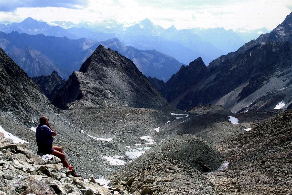
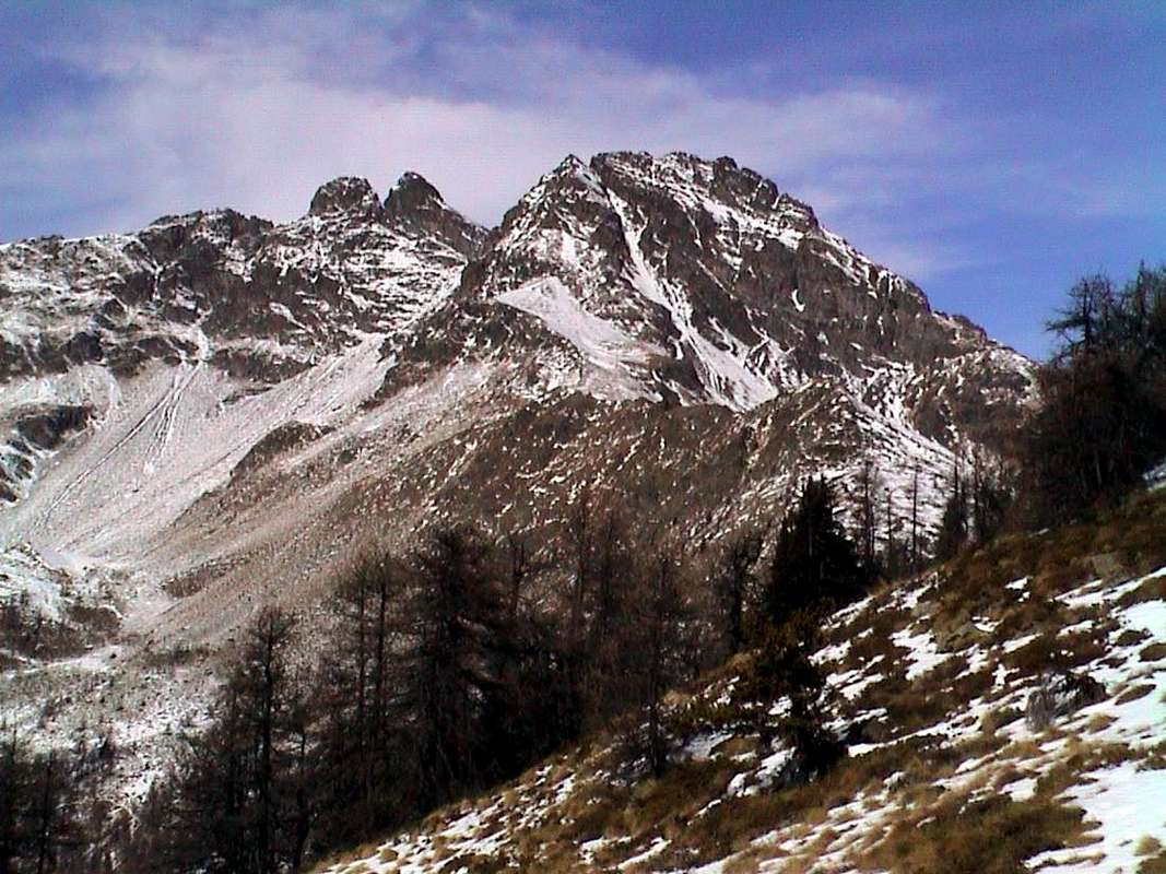
"From the trail that pass Crête Sèche towards Trouma des Boucs"by emilius

A very huge or at least exaggerated claim?
Seven are also considered the requirements for basic routes description, with the elasticity of only two factors missing for each, which can be summarized in this way:
1) - : paths or marked trails, or failing this, simply always detectable both up during descent and where possible coincident. In any case always easy to identify and to follow.
2) - : easy route with itineraries aimed at E (Walkers) or EE (Expert Hikers), with the occasional use of the upper limbs; difficulties on rock from F (Easy) At the F+ ((middle intermediate grade more), with steps not greater hardly ever than I°/I°+ (U.I.A.A. Scale or Union of the International Mountaineering and Climbing Federation).
3) - : lack of glaciers or marginal traverses on thereof; snowfields or presence of glacial-snow-capped with a slope of no more than 30/35 degrees and possibly free of crevasses.
4) - : possibility of having at not great distances good support points as camps, bivouacs or shelters, generally always well marked along the entire way.
5) - : in the absence of these, there are points of cover from the elements as natural shelters, caves in the rock, Alps or "Casotti" (Cabins) by the Parks or Forest Rangers Huts.
6) - : absence of large and more or less obvious objective dangers over the path (falling stones, landslides, avalanches, snowslides or simply collapsing scaffoldings glacial).
7) - : vantage point of first order of the entire valley visited, possibly central and still to allow the full view on the same and in distance at least over a part of the Valley of Aosta.
La Valle di Aosta é una piccola Regione nella grandezza dell'intero arco alpino dal Mare Ligure a Levante e fino all'Adriatico a Ponente, però possiede una infinità di posti dove si posson effettuare belle e facili escursioni. Le sue tredici Valli ed i molteplici Valloni offrono variegate opportunità di frequentarla e conoscerla e non cé bisogno di scalare il Monte Bianco, Grandes Jorasses, Cervino, Monte Rosa od il Gran Paradiso per raggiungere questo risultato. Anzi queste salite, che spaziano sopra tutto e tutti, spesso non danno una vera conoscenza della medesima, diventando spesso irreali e fuori dal quotidiano essere della Montagna e delle sue più intrinseche peculiarietà. In questo piccolo lavoro, invece, si ha la pretesa di farvele conoscere completamente, almeno in tutte le sue principali Vallate, proponendo una serie di gite, una per ognuna d'esse, con l'obiettivo primario di farvi spaziare a 360° su tutta la Valle di Aosta. Su tutta ma, soprattutto, in tutta perché le medesime comportano la presa in visione diretta dell'intero territorio. Una pretesa decisamente enorme o perlomeno esagerata? Può darsi, ma esiste la certezza della fattibilità di questo punto d'arrivo, anche se con una singola gita per ciascuna d'esse. Per questo il lavoro é stato suddiviso in tre distinte parti o meglio settori che daranno adito a tre distinte pagine e dove, in questa, andremo a visitare quasi una dozzina di vallate principali e secondarie a Nordest della Dora spaziando poi su quelle che dalla Valpelline raggiungono la Valle di Gressoney o del Lys ai piedi della Catena del Monte Rosa.
Partendo questa volta da Occidente e verso Oriente queste son quelle interessate e discendenti in direzione della Dora: Valpelline, le tre adiacenti Combe di Viou, Senevé e Dèche, Valle di Saint Barthélemy, il Bacino di Verrayes-Saint Denis, Valtournanche, Val d'Ayas, la Valle di Gressoney od anche conosciuta quale Valle del Lys.
Sette, inoltre, sono i requisiti per la descrizione degli itinerari di base ed altri, con l'elasticità di solo due fattori mancanti per ognuna, e così in sintesi riassumibili:
1) - : sentieri o percorsi segnalati, oppure in mancanza, sempre semplicemente individuabili sia in fase di salita che discesa, laddove possibile coincidenti ed inoltre piuttosto facili.
2) - : facilità della via con itinerari rivolti ad E (Escursionisti) oppure ad EE (Escursionisti Esperti), con l'utilizzo saltuario degli arti superiori; difficoltà su roccia da F (Facile) al massimo a F+ (Facile superiore), con passaggi che non vanno quasi mai oltre il I°/I°+ (Scala U.I.A.A. o dell'Unione Internazionale delle Associazioni Alpinistiche).
3) - : mancanza di ghiacciai od attraversamento marginale dei medesimi; presenza di nevai o glacio-nevati con pendenza non superiore ai 30°/35° e possibilmente non crepacciati.
4) - : possibilità di avere a non grandi distanze buoni punti di appoggio come accampamenti, bivacchi o rifugi, in genere sempre ben segnalati lungo l'intero percorso.
5) - : in mancanza di questi, esistenza di punti di riparo dalle intemperie come ricoveri naturali, grotte, Alpeggi o Casotti dei Parchi o della Forestale (attenzione, in genere privati).
6) - : assenza di grandi e più o meno evidenti pericoli oggettivi sovrastanti il percorso (cadute di pietre, possibilità di frane, valanghe, slavine o semplicemente crolli glaciali).
7) - : punto panoramico di primordine sull'intera vallata visitata, possibilmente centrale e comunque tale da consentire la vista completa sulla medesima nonché in lontananza.
![]()
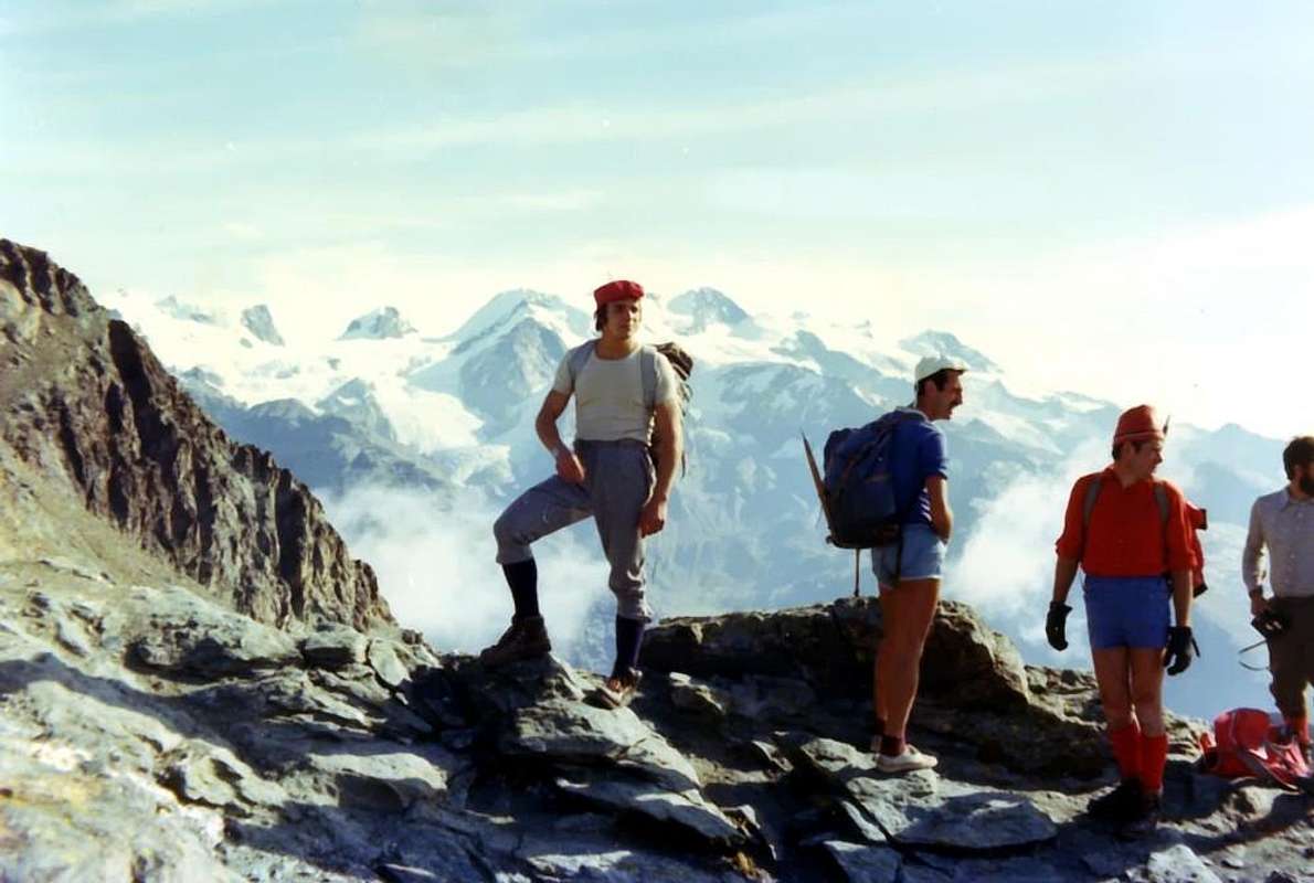
"Wandering with my Friends above the various Tournalins"by Marco Cossard
![]()
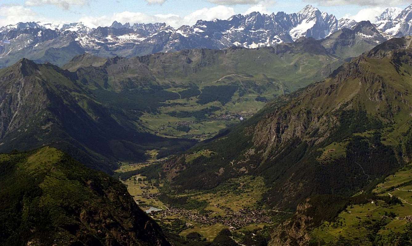
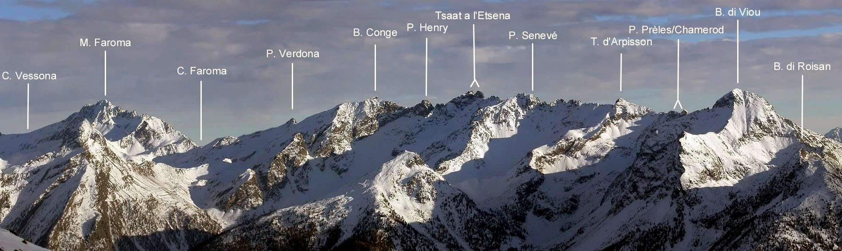
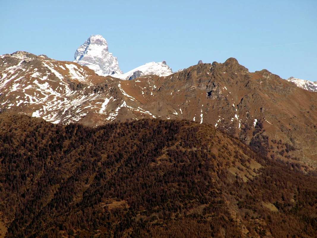
North Side Valpelline Range among Oyace, Valpelline, Roisan, Aosta, St. Christophe, Quart and Nus Commons, East(left) to West by Antonio
Partendo questa volta da Occidente e verso Oriente queste son quelle interessate e discendenti in direzione della Dora: Valpelline, le tre adiacenti Combe di Viou, Senevé e Dèche, Valle di Saint Barthélemy, il Bacino di Verrayes-Saint Denis, Valtournanche, Val d'Ayas, la Valle di Gressoney od anche conosciuta quale Valle del Lys.
Sette, inoltre, sono i requisiti per la descrizione degli itinerari di base ed altri, con l'elasticità di solo due fattori mancanti per ognuna, e così in sintesi riassumibili:
1) - : sentieri o percorsi segnalati, oppure in mancanza, sempre semplicemente individuabili sia in fase di salita che discesa, laddove possibile coincidenti ed inoltre piuttosto facili.
2) - : facilità della via con itinerari rivolti ad E (Escursionisti) oppure ad EE (Escursionisti Esperti), con l'utilizzo saltuario degli arti superiori; difficoltà su roccia da F (Facile) al massimo a F+ (Facile superiore), con passaggi che non vanno quasi mai oltre il I°/I°+ (Scala U.I.A.A. o dell'Unione Internazionale delle Associazioni Alpinistiche).
3) - : mancanza di ghiacciai od attraversamento marginale dei medesimi; presenza di nevai o glacio-nevati con pendenza non superiore ai 30°/35° e possibilmente non crepacciati.
4) - : possibilità di avere a non grandi distanze buoni punti di appoggio come accampamenti, bivacchi o rifugi, in genere sempre ben segnalati lungo l'intero percorso.
5) - : in mancanza di questi, esistenza di punti di riparo dalle intemperie come ricoveri naturali, grotte, Alpeggi o Casotti dei Parchi o della Forestale (attenzione, in genere privati).
6) - : assenza di grandi e più o meno evidenti pericoli oggettivi sovrastanti il percorso (cadute di pietre, possibilità di frane, valanghe, slavine o semplicemente crolli glaciali).
7) - : punto panoramico di primordine sull'intera vallata visitata, possibilmente centrale e comunque tale da consentire la vista completa sulla medesima nonché in lontananza.
Getting There
BY CAR:- From TORINO, MILANO, etc: Motorway A5. Exit at IVREA or Quincinetto (PIEDMONT).
- From IVREA Town: in West (Southern side) to Pont Saint Martin, Verrès, Châtillon, Nus, Aosta in West and to Gignod, Valpelline, Oyace and Bionaz Municipalities in Northeast from Aosta Town.
- From Courmayeur Resort: in East-southeast (Norheastern side) to Aosta, Gignod, Valpelline, Oyace, Bionaz Municipalities in Northeast and to Nus, Châtillon, Verrès, Pont Saint Martin Communes to South-southeast.
 |
Northeastern Side:
From Valpelline towards Valpelline Valley
- From Valpelline (580m), with Regional Road, to Oyace Commune (1.316-1.377m); from this to Northern and Southern Walloons (Brison, Crête Sèche, Vertsan, Comba be la Tsa, Comba du Grand Chamin, Comba des Lacs and Comba d'Orein up to the entrance on Petite/Grande Murailles/Valpelline Hill Vallon.
- From Oyace (1.377m), with R.R., to Bionaz Commune (1.612m) and Places Moulin artificial Dam (1.970/80m) and Northern and Southern Vallons (Bella Tsa, Combes de Valcornière, Livourneaz, Montagnayes; Vessonaz, Verdonaz, Vieille, Verdzignolaz, Arpisson, Gran Comba and Roisan-Praperiaz Basin.
 |
Southern Sides:
From Nus, Châtillon, Verrès, Pont Saint Martin Municipalities towards Saint Barthélemy, Valtournanche, Val d'Ayas and Gressoney Valleys.
- From Nus (960m), with Regional Road, to Lignan-Saint Barthélemy Municipality; from this, through various dirt roads and numerous paths, (1.628m) up to the Becca de Luseney (Luca Reboulaz Bivouac (2.575m neighbor the Luseney Lake), Livourneaz Pass 2.840m and Cian Fenêtre (2.736m).
- From Châtillon (549m), with Regional Road, to Valtournanche and Breuil Cervinia Municipalities (2.004m); from this, through paths in West, to Tsan Bivouac, Lake (2.489m, 2.441m), Cignana Lake (2.149m) or, through dirt road and paths more in East, to Gran Sometta (3.166m).
- From Verrès (549m), with Regional Road, to Champoluc and Saint Jacques Communes (1.697m); from these, path in West, to Grand Tournalin Refuge (2.544m). From shelter, through path in North, to Mont Brun (2.895m); also in valley floor to Lake Bleu (2.211m) and in East to Pinter Pass (2.776m).
- From Pont Saint Martin (345m), with Regional Road in Gressoney Valley, to Gressoney La Trinitè (1.468m); from this, through dirt roads and paths in East, up to the Upper Bettolina Pass (3.058m); also in West to Gabiet Loch (2.363m) and from this, with path, to Corno del Camoscio (3.026m).
- From FRANCE: through the Mont Blanc Tunnel to Entrèves-crossroads to Vény/Ferret Valleys - Courmayeur. By Little Saint Bernard Pass, closed since November until half May to La Thuile Valley - Pré Saint Didier - Courmayeur. It is not necessary to take Motorway A5: you can drive on SS.26, in the direction of AOSTA - IVREA - TURIN.
- Aeroporto "Corrado Gex" Saint Christophe (Aosta).
 |
30 Routes and more Description
The choice of these 30 routes is always targeted to the 7 pre above requirements.
It is designed to identify the most suitable excursion to the parameters predicted and that the best way to represent a valley, in general all the proposals are aimed at ascents ranging on average between 2.750 to 3.350 meters with a few exceptions. However it has also tried to offer alternative opportunities, presenting on the single territory other two proposals; the same are more equally synthesized but always containing all the basic information you need. Or simply to provide more tips and suggestions, with the division into three bands enough diversified.
Band One: is the basic tour designed to represent the specific valley; is described in detail, numerous annotations, timing only indicative and various suggestions.
Band Two: Excursion similar to the previous one, with the same altitude but also in less differentiated (usually) or more; viewpoint completely different from the first proposal.
Band Three: Excursion of less effort and duration and also, more suited to the path even with children or boys, also to use as "backup" in case of uncertain weather.
La scelta di questi 30 Itinerari risulta sempre mirata ai 7 prerequisiti sopra esposti.
Si é pensato di individuare la Escursione più consona ai parametri predetti e tale da rappresentare nel modo migliore una valle, in genere tutte le proposte sono rivolte ad ascensioni che vanno mediamente tra i 2.750 ai 3.350 metri con qualche eccezione. Comunque s'é cercato d'offrire anche opportunità alternative, presentando all'interno del medesimo territorio altre due proposte; le stesse sono maggiormente sintetizzate pur contenendo ugualmente tutte le indicazioni di base necessarie. Oppure semplicemente per offrir ulteriori suggerimenti e proposte maggiormente variegate, con la suddivisione in tre fasce ben diversificate.
Fascia Uno: gita di base atta a rappresentare la specifica vallata; viene descritta con dovizia di particolari, numerose annotazioni, tempistica solo indicativa e suggerimenti varii.
Fascia Due: gita similare alla precedente, con altitudine uguale o differenziata in meno (generalmente) od in più; punto panoramico completamente diverso dalla prima proposta.
Fascia Tre: Escursione di minor impegno ed anche durata, più adatta al percorso anche con bambini o ragazzi, da utilizzarsi come "riserva" in caso di tempo incerto.
![]()
Valpelline
1/A) - Mont Gelé (3.518m)
Si é pensato di individuare la Escursione più consona ai parametri predetti e tale da rappresentare nel modo migliore una valle, in genere tutte le proposte sono rivolte ad ascensioni che vanno mediamente tra i 2.750 ai 3.350 metri con qualche eccezione. Comunque s'é cercato d'offrire anche opportunità alternative, presentando all'interno del medesimo territorio altre due proposte; le stesse sono maggiormente sintetizzate pur contenendo ugualmente tutte le indicazioni di base necessarie. Oppure semplicemente per offrir ulteriori suggerimenti e proposte maggiormente variegate, con la suddivisione in tre fasce ben diversificate.
Fascia Uno: gita di base atta a rappresentare la specifica vallata; viene descritta con dovizia di particolari, numerose annotazioni, tempistica solo indicativa e suggerimenti varii.
Fascia Due: gita similare alla precedente, con altitudine uguale o differenziata in meno (generalmente) od in più; punto panoramico completamente diverso dalla prima proposta.
Fascia Tre: Escursione di minor impegno ed anche durata, più adatta al percorso anche con bambini o ragazzi, da utilizzarsi come "riserva" in caso di tempo incerto.
1/A) - Mont Gelé (3.518m)
Approach from Oyace Common, Dzovenno-Ruz Villages: by Oyace Commune to reach the Dzovenno Fraction and the above small Hamlet of Ruz near Ru Torrent; from this through path n° 2 towards Crête Sèche Refuge (2.400m; E/F; 1h'45/2h'00). Bypassing the old Franco Spataro Bivouac (2.600 m) at the entrance on characteristic and sandy "Plan de la Sabbla" and with route along the Torrent de Crête Sèche arrive in the fork 2.906 meters; from this turn left and, climbing the homonym enough steep glacier, reach the Col du Mont Gelé (3.000m). Through the quite easy South-southwestern Slope goes up to terminal part, formed by rocks very broken and debris bypassing some short distance to the left (West) reach, after a terminal crevasse, the wooden Cross of the Summit (EE/A/F+; 1h'00/1h'15 by Gelé Pass; 3h'30/4h'00 from Crête Sèche Shelter).
Valpelline
1/A) - Mont Gelé (3.518 m)
1/A) - Mont Gelé (3.518 m)
Avvicinamento da Oyace-Dzovenno-Ruz: dal Comune di Oyace raggiungere la Frazione di Dzovenno ed il soprastante Villaggetto di Ruz presso il Torrent o Ru, donde deriva il toponimo del medesimo. Da questo con sentiero n° 2 raggiungere il masso detto "lo Berrio di Governo" e subito dopo il Rifugio di Crête Sèche (2.400 m; E; 1h'45/2h'00). Oltrepassando il vecchio Bivacco Franco Spataro (2.600 m) all'ingresso del caratteristico e sabbioso "Plan de la Sabbla" e con percorso affianco al Torrent de Crête Sèche raggiungere il bivio 2.906 metri; da questo piegare a sinistra e, risalendo l'omonimo ed abbastanza ripido ghiacciaio, raggiungere il Col del Mont Gelé (3.000 m). Tramite l'abbastanza facile Versante Sud-sudovest arrivare alla parte terminale, formata da roccette rotte con detriti ed aggirando qualche breve tratto a sinistra (Occidente) raggiungere, dopo la terminale ed un pendio ghiacciato inclinato a 30°/33°, la grande Croce in legno della Cima (EE/A/F+; 1h'00/1h'15 dal colle; 3h'30/4h'00 dal rifugio).
![]()
1/B) - Trouma des Boucs (3.263m)
1/B) - Trouma des Boucs (3.263 m)
Avvicinamento dal Villaggio di Ru o Ruz: dal Rifugio di Crête Séche o dall'ex Bivacco Franco Spataro attraversare il "Plan de la Sabbla" indirizzandosi verso il Colle di Crête Séche (2.899 m), ma non raggiungere il medesimo. Superata verso destra la quota 2.906 metri ripiegare verso la parte alta della Comba de Crête Séche e senza percorso obbligato raggiungere il Col Chardoney (3.186 m), sottostante il Pic e la Becca Chardoney (3.282/3.447 m). Da questo percorrere la facile Cresta Sudest e, superato un tratto più impegnativo formato da alcune asperità, un intaglio ed una breve placca nella parte terminale, raggiungere il piccolo ometto della Sommità (EEA; 2h'45/3h'15 dal Rifugio di Crête Séche).
![]()
1/C) - Mont Blanc de Creton (3.406m)
1/C) - Mont Blanc de Creton (3.406 m)
Avvicinamento dal Comune di Bionaz : da Bionaz risalire al parcheggio di Places Moulin (1.968 m); da questo iniziare percorrendo la strada poderale a Settentrione del lago artificiale, che conduce al Rifugio di Prarayer (2.005 m), quindi per il sentiero n° 9/10/11 alle pendici del bosco di larici Bois de Grand Plan. Lasciare a Nord il bivio per il Rifugio Aosta salendo verso Oriente con sentiero n° 11 e superarndo gli Alpeggi di Gordzé (2.154 m), Deré la Vieille (2.254 m) e Bella Tsa (2.474m). Oltrepassato il torrente, proseguire alla base della morena laterale destra del Ghiacciaio del Château des Dames su sentierino non numerato o tracce. Risalire il ghiacciaio verso il Col des Dames (attenzione ai crepacci) con pendenze varianti dai 25° ai 35°. Prima del colle, lasciato a sinistra il versante Nordovest, salire direttamente il pendio che porta all'Anticima Sud (3.400 m) su terreno misto con roccette biancastre e rotte, donde in breve per la Cresta Sudovest si raggiunge la Vetta (EEA/F+; 4h'00/4h'30 da Prarayer; 5h'00/5h'30 dal parcheggio).
![]()
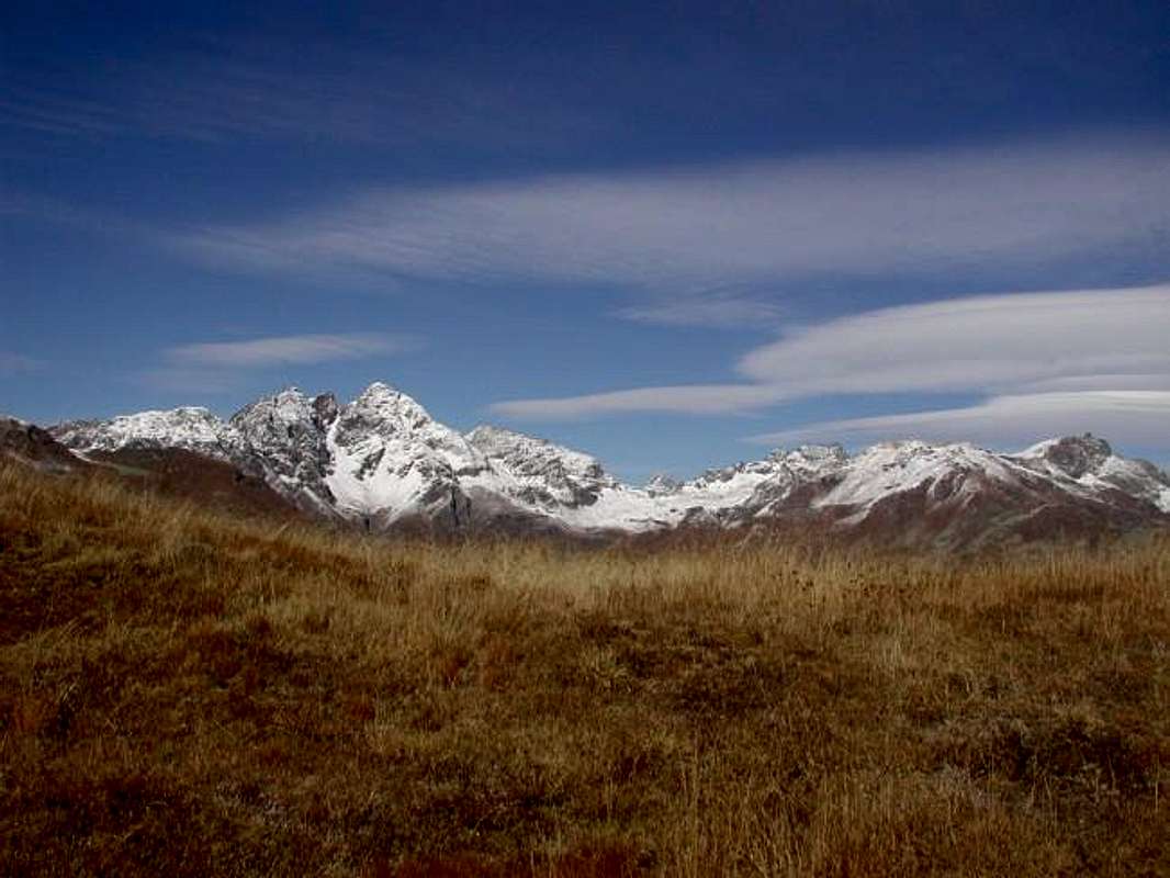
Southern Side of Valpelline Watershed among Valpelline, Roisan, Aosta, St. Christophe and Quart Communes, West (left) to East, by Antonio
Blavy/Viou Basin
2/A) - Becca di Viou (2.856m)
1/B) - Trouma des Boucs (3.263m)
Approach from Ruz Village: from Refuge Crête Séche or the former Bivouac Franco Spataro (about 2.600 meters) cross the "Plan de la Sabbla" moving towards the Crête Sèche Pass (2.899m), but not achieve the same. After passing to the right altitude 2.906 meters fall back towards the top of the Comba de Crête Sèche is no set path to Col Chardoney (3.186m), below the Pic Chardoney or Inferior (3.282m) and Becca Chardoney (3.447m). From this follow the easy and Southeast Ridge, passed a most challenging stretch formed by some roughness, a notch and a short rock plate at the end, the little cairn to reach the acute Summit (EEA; 2h'45/3h'15 from Crête Séche Shelter).
1/B) - Trouma des Boucs (3.263 m)
Avvicinamento dal Villaggio di Ru o Ruz: dal Rifugio di Crête Séche o dall'ex Bivacco Franco Spataro attraversare il "Plan de la Sabbla" indirizzandosi verso il Colle di Crête Séche (2.899 m), ma non raggiungere il medesimo. Superata verso destra la quota 2.906 metri ripiegare verso la parte alta della Comba de Crête Séche e senza percorso obbligato raggiungere il Col Chardoney (3.186 m), sottostante il Pic e la Becca Chardoney (3.282/3.447 m). Da questo percorrere la facile Cresta Sudest e, superato un tratto più impegnativo formato da alcune asperità, un intaglio ed una breve placca nella parte terminale, raggiungere il piccolo ometto della Sommità (EEA; 2h'45/3h'15 dal Rifugio di Crête Séche).
1/C) - Mont Blanc de Creton (3.406m)
Approach from Bionaz Common: from Bionaz reach the Places des Moulin (1.968m); from this walk along the dirt road on the Northern shore of the lake to get the Prarayer Refuge (2.005m), then a path n° 9/10/11 to the border of the larches wood, Bois de Grand Plan. Pass to the right of the fork for Aosta Refuge, walk on toward East with path n° 11 and pass the Pastures of Gordzé (2.154m), Deré la Vieille (2.254m) and Bella Tsa (2.474m). Cross the torrent and follow toward the lateral right moraine of Château des Dames Glacier on small unnumbered path or traces. Ascend the glacier towards the Col des Dames (beware of crevasses) along slopes whose slant is between 25°/35°. Just before the pass, leaving to the left the Northwestern side, go straight on along the slopes leading, on mixed terrain with whitish small rocks and broken, to the Southern Summit (3.400m) and, in a short time along the Southwestern Crest, to the Summit (EEA/F+; 4h'00/4h'30 from Prarayer Refuge; 5h'00/5h'30 from Place Moulin parking).
1/C) - Mont Blanc de Creton (3.406 m)
Avvicinamento dal Comune di Bionaz : da Bionaz risalire al parcheggio di Places Moulin (1.968 m); da questo iniziare percorrendo la strada poderale a Settentrione del lago artificiale, che conduce al Rifugio di Prarayer (2.005 m), quindi per il sentiero n° 9/10/11 alle pendici del bosco di larici Bois de Grand Plan. Lasciare a Nord il bivio per il Rifugio Aosta salendo verso Oriente con sentiero n° 11 e superarndo gli Alpeggi di Gordzé (2.154 m), Deré la Vieille (2.254 m) e Bella Tsa (2.474m). Oltrepassato il torrente, proseguire alla base della morena laterale destra del Ghiacciaio del Château des Dames su sentierino non numerato o tracce. Risalire il ghiacciaio verso il Col des Dames (attenzione ai crepacci) con pendenze varianti dai 25° ai 35°. Prima del colle, lasciato a sinistra il versante Nordovest, salire direttamente il pendio che porta all'Anticima Sud (3.400 m) su terreno misto con roccette biancastre e rotte, donde in breve per la Cresta Sudovest si raggiunge la Vetta (EEA/F+; 4h'00/4h'30 da Prarayer; 5h'00/5h'30 dal parcheggio).

2/A) - Becca di Viou (2.856m)
Approach from Blavy Village: park at the beginning of the dirt road (which is accessible only to authorized vehicles). Before with hike along the farm road that leads to the Praperia Pastures (1.737m). After short time the dirt private road forks; keep right (East) and reach the Viou Lower and Upper Pastures (2.078m, 2.202m; E/F; 1h'30/1h'45). Right behind the pastures starts the well-marked trail 25/105 for Colle di Viou (2.716m) nearby a comfortable fixed Bivouac "Penne Nere" (2.730m) was opened recently (Jul 16th, 2005) near the wide saddle just below a Summit called "Mont Trembloz". From this climb by small unnumbered and unreported path followed by traces on the short and easy East-southeast Crest up to the grat Cross of the Summit (E/F; 0h'40 from Viou Hill; 4h'00/4h'30 by Blavy Village). Direct Variant by Blavy: from Blavy goes up along the forest through path 25/105 reaching the private dirt road on Eastern diagonal route immediately before the Viou Lower Alpage (E/F; in less than half an hour).
![]()
Bacino di Blavy/Viou
2/A) - Becca di Viou (2.856 m)
2/B) - Becca di Roisan (2.546m)
![]()
2/B) - Becca di Roisan (2.546 m)
Avvicinamento da Blavy verso l'Alpe Praperia: all'inizio della strada sterrata (oltre il traffico è consentito solamente ai mezzi autorizzati) lasciare l'auto e iniziare la salita a piedi lungo la strada sterrata poderale conducente all'Alpeggio di Praperia(z) (1.737 m). Risalire subito dopo dietro l'Alpe, prendendo un sentiero non numerato dapprima verso Sudest, attraverso i prati in direzione di una recinzione, e poi percorrente il bosco verso Est-nordest. Seguire il medesimo per un poco di tempo ma, appena al di sopra di un rudimentale e minuscolo "chiosco" attrezzato ad area Pic Nic dagli abitanti del posto, abbandonarlo spostandosi maggiormente sulla sinistra (Est e poi Nordest). Gradualmente dirigersi verso una grande fascia di rocce oblique dirigentesi verso un'appena accentuata crestina, che risale in fin dell'estremità inferiore della corta Cresta Ovest della Becca di Roisan. Proseguire per un valloncello-canalone molto ripido su grandi blocchi e "clapeys", formanti una naturale ed altresì ripida scalinata, raggiungendo una piccola conca di grandi macigni ed alcuni nevati, proprio ai piedi della piccola nonché ripida parete rocciosa, che la montagna lascia cadere verso Sud. Da questa, e tramite un pendio di roccette rotte, erba e detriti, risalire alla Crestina Sudest finale, sullo spartiacque tra i Comuni di Roisan e Valpelline, e percorrerla fino in Vetta (E/F; 2h'30/3h'00 dall'Alpe Praperia(z).
2/C) - Becca de Blavy (2.508m)
Approach from Blavy Hamlet: directly departing from the Village of Blavy (1.475m) through the path n° 1/25/105 and therefore through a more start in more low level (1.475 meters against 1.737 precedents), but surely more forehand and express, at least towards the Quota (2.508 meters), and surely through path of best quality up to the meeting with the private dirt road "poderale". For the conclusive part, or in the small basin among the Becca of Roisan and the aforesaid quota, the characteristics of the anticipated one they are similar entirely (EE/F+; 3h'30/4h'15). The same one, therefore, can constitute a Variation of Approach, diversified by the departure by Praperia(z).
![]()
2/C) - Becca de Blavy (2.508 m)
Avvicinamento dal Villaggio di Blavy: partendo direttamente dal Villaggio di Blavy (1.475 m), tramite il sentiero n° 1/25/105, e quindi tramite un avvio più in basso come livello (1.475 metri contro 1.737 precedenti), ma sicuramente più diretto e rapido, almeno nei confronti della Quota (2.508 metri), e sicuramente tramite sentiero di migliore qualità fino all'incontro con la strada sterrata poderale nonché privata. Per la parte conclusiva, ovvero nel piccolo bacino tra la Becca di Roisan e la quota predetta, le caratteristiche del precorso sono del tutto similari (EE/F+; 3h'30/4h'15). Il medesimo, quindi, può costituire una Variante di Avvicinamento, diversificata dalla partenza dall'Alpe Praperia(z).
![]()
Comba di Senevé o Cénevé
3/A) - Mont Mary (2.815m)

2/A) - Becca di Viou (2.856 m)
Avvicinamento dal Villaggio di Blavy: parcheggiare all'inizio della strada sterrata (che è accessibile solo ai veicoli autorizzati). Dapprima con escursione lungo la strada poderale che conduce agli Alpeggi Praperia (1.737 m). Dopo breve tempo la strada si biforca; prenderne il ramo di destra (Est) e raggiungere le Alpi di Viou Inferiore e Superiore (2.078 m, 2.202 m; E/F; 1h'30/1h'45). Subito dietro entrambe le alpi inizia il sentiero 25/105 ben segnalato verso il Colle di Viou (2.716 m) vicino al comodo bivacco fisso "Penne Nere" (2.730 m), inaugurato recentemente (16 luglio 2005) in prossimità della larga sella ed appena al di sotto della Sommità chiamata "Mont Trembloz". Da questo risalire su sentierucolo non numerato né segnalato seguito da tracce la breve e facile Cresta Est-sudest sino alla grande Croce della Cima (E/F; 0h'40 dal Colle di Viou; 4h'00/4h'30 da Blavy). Variante diretta da Blavy: da Blavy salire verso Settentrione in mezzo alla foresta con il sentiero 25/105 raggiungendo la poderale (E/F; 3h'30).
2/B) - Becca di Roisan (2.546m)
Approach from Blavy Village and Praperiaz Alp:
Park at the beginning of the dirt road (which is accessible only to authorized vehicles). Hike along the farm road that leads to the Praperia Pastures (1.737m). To go back immediately through the prairies to Southeast and after behind l'alpine Pasture to an enclosure, taking a small not numbered path that travels the East-northeast verse forest. To follow the same one for some time but, as soon as above a rudimentary and minuscule "kiosk" equipped to area Pic Nic from the inhabitants of the place, to abandon mostly moving him to it on the left (East and then Northeast). Gradually to go himself toward a great band of oblique rocks that you direct him toward an a little accented crest, that goes up again up to the inferior extremity of the short West Ridge of the Becca of Roisan. To continue for a little vallon-very steep gorge on large blocks and "clapeys", in the shape of natural always steep stairway, reaching a small basin of large rocks and some snowcapped, just to the feet of the small as well as steep rocky wall that the mountain allows to fall toward Midday. From the same, and through rotten rocks with grassy and debris slope, easily to go back the final small and short Crest Southeast, on the watershed between Roisan and Valpelline Municipalities, and to travel it until in peak (E/F; 2h'30/3h'00 Praperia(z) Alp).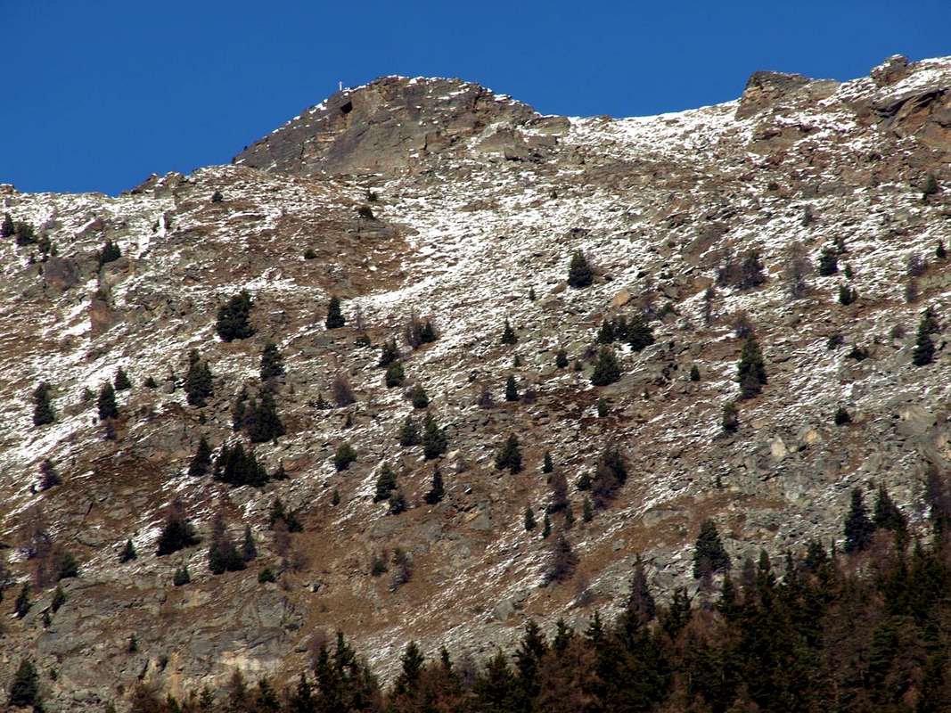
2/B) - Becca di Roisan (2.546 m)
Avvicinamento da Blavy verso l'Alpe Praperia: all'inizio della strada sterrata (oltre il traffico è consentito solamente ai mezzi autorizzati) lasciare l'auto e iniziare la salita a piedi lungo la strada sterrata poderale conducente all'Alpeggio di Praperia(z) (1.737 m). Risalire subito dopo dietro l'Alpe, prendendo un sentiero non numerato dapprima verso Sudest, attraverso i prati in direzione di una recinzione, e poi percorrente il bosco verso Est-nordest. Seguire il medesimo per un poco di tempo ma, appena al di sopra di un rudimentale e minuscolo "chiosco" attrezzato ad area Pic Nic dagli abitanti del posto, abbandonarlo spostandosi maggiormente sulla sinistra (Est e poi Nordest). Gradualmente dirigersi verso una grande fascia di rocce oblique dirigentesi verso un'appena accentuata crestina, che risale in fin dell'estremità inferiore della corta Cresta Ovest della Becca di Roisan. Proseguire per un valloncello-canalone molto ripido su grandi blocchi e "clapeys", formanti una naturale ed altresì ripida scalinata, raggiungendo una piccola conca di grandi macigni ed alcuni nevati, proprio ai piedi della piccola nonché ripida parete rocciosa, che la montagna lascia cadere verso Sud. Da questa, e tramite un pendio di roccette rotte, erba e detriti, risalire alla Crestina Sudest finale, sullo spartiacque tra i Comuni di Roisan e Valpelline, e percorrerla fino in Vetta (E/F; 2h'30/3h'00 dall'Alpe Praperia(z).
2/C) - Becca de Blavy (2.508m)
Approach from Blavy Hamlet: directly departing from the Village of Blavy (1.475m) through the path n° 1/25/105 and therefore through a more start in more low level (1.475 meters against 1.737 precedents), but surely more forehand and express, at least towards the Quota (2.508 meters), and surely through path of best quality up to the meeting with the private dirt road "poderale". For the conclusive part, or in the small basin among the Becca of Roisan and the aforesaid quota, the characteristics of the anticipated one they are similar entirely (EE/F+; 3h'30/4h'15). The same one, therefore, can constitute a Variation of Approach, diversified by the departure by Praperia(z).

2/C) - Becca de Blavy (2.508 m)
Avvicinamento dal Villaggio di Blavy: partendo direttamente dal Villaggio di Blavy (1.475 m), tramite il sentiero n° 1/25/105, e quindi tramite un avvio più in basso come livello (1.475 metri contro 1.737 precedenti), ma sicuramente più diretto e rapido, almeno nei confronti della Quota (2.508 metri), e sicuramente tramite sentiero di migliore qualità fino all'incontro con la strada sterrata poderale nonché privata. Per la parte conclusiva, ovvero nel piccolo bacino tra la Becca di Roisan e la quota predetta, le caratteristiche del precorso sono del tutto similari (EE/F+; 3h'30/4h'15). Il medesimo, quindi, può costituire una Variante di Avvicinamento, diversificata dalla partenza dall'Alpe Praperia(z).
3/A) - Mont Mary (2.815m)
Approach from Praillon isolated and small Village: from Praillon small Village (1.350m), before through dirt road, after with the muletrack-path not numbered towards Chamerod Village (1.624 m) and Alp of Senevé or Cènevé (2.206 m). From this last through Southeastern easy slope (E/F; 3h'30/4h'00). Approach Variant by Trois-Villes Hamlet: Seiser Sénevé can also be reached via Avisod with the farm private dirt road (see below routes towards Beaks of Fana and Croix; more or less with same time).
![]()
Comba di Senevé o Cénevé
3/A) - Mont Mary (2.815 m)
3/B) - Becchi di Fana (2.951m)
Approach and route from Trois-Villes-Avisod Hamlet through Senevé Comba and "Passo Alto": from the Village of Avisod (1.390m; beautiful small church in the meadow back (1.398 meters), immediately to East) to take toward West the dirt road "poderale", leaving on the left the alternative for Valseinte shortly after (1.399m; attainable with beautiful walk through the path that from the beautiful one and restructured Castle of Quart (740m) it transits for the Oratoire de Saint E'meric (1.140m) with a slendid walk/escursion); to continue instead more toward Northwest progressively inserting himself in the Basin of Senevé, leaving in low the Alps Chacotte (1.426m) and Séchot (1.409m). To revolve the wooded strata of the Slope Southwest of the Croix de Fana (2.212m and, crossing some small torrential furrows, to reach the Champchamoussin Pasture than Above (1.856m); from this, always with slope in diagonal but more toward Northwest, to reach the Latta or Lattaz Pasture (1.930m; currently almost in downfall), underlying to the Cornet Pass (2.272m), and the following double and wide hairpin bend to altitude of 2.036 meters. To continue, same direction, toward the Alpage of Chavod (2.038m) and the following hairpin bend in form of acute angle to quota 2.097 meters; from this the dirt road changes direction in Northeast reaching the altitude of 2.148 meters, where the path n° 1 arrive that it goes down from the aforesaid hill. From here the road it decidedly turns to West and it reaches shortly time the important Alp, recently restructured, of Senevé (2.206m; E/F; 2h'00/2h'30; other possibilities of run don't exist, since the path has been "eaten" from the road); if he is not wanted to reach the alpage to continue, from this conjunction, decidedly toward North going up again, without forced run and in absence of path, a small vallon-mountain range at the base of the forest-rocky promontory 2.440/50 meters around; from the Cénevé Alp or from this point he take beginning the route to "Passo Alto" and following Southern crest.
From Senevé Alp towards the "Passo Alto" and through the South-southeast Great Crest or Standard Route: from the Senevè Upper Alpage with direction toward Northeast, or from the intersection among the dirt road and the path n° 1 to altitude of 2.148 meters with direction North, to reach and to double on the left (North) the promontory above quoted exploiting a small trace of pasture; with a long diagonal among the stony ground at the base of the Southern Slope of the Great South-southeast Crest of the West Antetop of Becchi di Fana to reach at times the small saddle with residual of snowy frame of the "Passo Alto" (2.540 meters about; good panoramic point and profit as splendid "salle à manger" (1h'00 from the Alp and 0h'50 from the junction; EEA/F+; 3h'30/4h'00 altogether; to pay attention in case of fresh snow or tall and soft snow, because the same is lent to form small snowlides). From the "Passo Alto" to go up again toward North the first part of the great Crest South-southeast reaching, after a hump elongated, small balcony in the shape of tiny rocky promontory, presenting a partition wall in the Southwest of Sénevé paid to Comba, beyond which, after a small depression comma-shaped (in the beginning of the season usually snowy), the crest mostly feathers him; with linear slope, to the border of the Slope Southwest of the West Antesummit of the Beaks of Fana, to go up again through mixed rocky steps to grassy and brief lines debris small couloirs that brings to the West Antecima or Western Ante Summit (2.945 meters around). From this, come down to a small and very narrow carving 2.930/2 meters about, to go up again with non difficult climb (II°/II°+ and I°+) but delicate for the bad quality of the rock (much brocken and sometimes rotten) to the Central Beak, the the highest of the seven little Summits (EEA/F+; 1h'15/1h'30).
![]()
3/B) - Becchi di Fana (2.951 m)
3/C) - Croix de Fana (2.212m)
Approach and route from Trois-Villes-Avisod Village to Senevé or Cénevé Alp: from Avisod (1.390m; beautiful small church in the meadow back 1.398 meters, immediately to East) to take toward West the dirt road "poderale", leaving on the left the alternative for the Valseinte Alp shortly after (1.399m; attainable with beautiful walk through the path that from the beautiful one and restructured Castle of Quart of 1185 (740m) it transits for the Oratoire de Saint E'meric (1.140m) with a slendid walk/escursion); to continue instead more toward Northwest progressively inserting himself in the Basin of Senevé, leaving in low the Alps Chacotte (1.426m) and Séchot (1.409m). To revolve the wooded strata of the Slope Southwest of the Croix de Fana (2.211/2m; beautiful walk with departure from Trois Villes of which we will report in expectancy) and, crossing some small torrential furrows, to reach the Champchamoussin's Pasture than Above (1856m); from this, always with slope in diagonal but more toward Northwest, to reach the Alpe of Latta or Lattaz (1.930m; currently almost in downfall), underlying to the With the Cornet (2.272m), and the following double and wide hairpin bend to quota 2.036 meters. To continue, same direction, toward the Alpage of Chavod (2.038m) and the following "tornante" (hairpin bend) in form of acute angle to quota 2.097 meters; from this the private dirt road changes direction in Northeast reaching the quota 2.148 meters, where the path n° 1 arrive that it goes down from the aforesaid hill. From here the dirt road it decidedly turns to West and it reaches shortly time the important Alpage, recently restructured, of Senevé (2.199m; 2h'00/2h'30; other possibilities of run don't exist, since the path has been progressively "eaten" by vegetation, from the road built in the 70s). If you do not want to Pasture continue by the conjunction a 2.148m, leaving West-northwest the farms road that continues to this, definitely at first and then to Southeast going back more to the East, through the path n° 1 , which with three large bends leads to the Col Cornet (2.280m); from the collar, along the dividing ridge (between Senevé Basin and the parallel and adjacent Comba or Vallon Dèche) to the South and overcoming or circumventing some bumps generally in the East grassy-rocky, quite easily and with short descent leads to a small "bowl" and immediately after the Summit great and wooden Cross, set on a tiny promontory (2.212m; 0h '45 from the collar; F; 1h'30/1h'45 from Alp; 3h'30/4h'00 by Avisod).
Variant Lower: instead of reaching the crossroads 2.148 meters to the Alp of Sénevé, follow the path, which coincides with a private dirt road, which starts from the Alp Champchamoussin Upper (1.851m) is directed towards the South-southeast; reached the same wide hairpin turns to the North-northeast ending below the Western slopes of the Croix de Fana. From this point turns exclusively on a small path through the upper part of the forest and some rock outcrops, reached the Summit just off the Cross.
This way increases of nearly 300 meters, the altitude to go, but then avoid having to go back North/South on the watershed (practically the same time and difficulty).
![]()
3/C) - Croix de Fana (2.212 m)
Avvicinamento e Via da Trois Villes-Avisod verso la Comba di Senevé o Cénevé: al Villaggio di Avisod (1.390 m; bella chiesetta nel dosso prativo (1.398 m), subito ad Est) prendere verso Occidente la strada poderale, lasciando poco dopo sulla sinistra il bivio per Valseinte (1.399 m; raggiungibile con bella passeggiata tramite il sentiero che dal bel e recentemente ristrutturato Castello di Quart (740 m) transita per l'Oratoire de Saint E'meric (1.140 m) con una splendida passeggiata/escursione); continuare invece più verso Nordovest inserendosi progressivamente nella Conca di Senevé, lasciandosi in basso le Alpi Chacotte (1.426 m) e Séchot (1.409 m). Aggirare le falde boschive del Versante Sudovest della Croix de Fana (2.211/2 m; bella passeggiata con partenza da Trois Villes della quale relazioneremo in futuro) ed, attraversando alcuni piccoli solchi torrentizi, raggiungere l'Alpe Champchamoussin di Sopra (1.856 m); da questa, sempre con salita in diagonale ma più verso Nordovest, raggiungere l'Alpe di Latta o Lattaz (1.930 m; attualmente pressocché in rovina), sottostante al Col Cornet (2.272 m), ed il successivo doppio e largo tornante a quota (2.036 metri). Proseguire, stessa direzione, verso l'Alpe di Chavod (2.038 m), che si lascia dabbasso, ed il successivo tornante in forma di angolo acuto a quota (2.097 metri); da questo la strada poderale cambia direzione in Nordest raggiungendo la quota (2.148 metri), ove arriva il sentiero n° 1 discendente dal predetto colle. Da qui la medesima volge decisamente ancor più ad Occidente raggiungendo in breve tempo l'importante Alpe, da poco tempo ristrutturata, di Senevé (2.199 m; 2h'00/2h'30; non esiston altre possibilità di percorso, poiché il sentiero è stato nel tempo ricoperto dalla vegetazione, dopo la costruzione della strada poderale avvenuta nel corso degli anni '70). Se non si vuol raggiungere l'alpe proseguire dalla congiunzione a (2.148 metri), abbandonando ad Ovest-nordovest la strada poderale che prosegue verso questa, decisamente dapprima verso Sudest e quindi maggiormente ad Est risalendo, tramite il sentiero n° 1, che con tre larghi tornanti conduce al Col Cornet (2.280 m); dal questo, seguendo la cresta spartiacque tra le Combe di Senevé e Dèche) verso Meridione e superando oppure aggirando in genere ad Oriente alcune asperità rocciose-erbose, abbastanza agevolmente e con corta discesina si raggiunge una piccola conca e subito dopo la grande e lignea Croce, posta su d'un minuscolo promontorio (2.212m; 0h'45 dal colletto; F; 1h'30/1h'45 dall'alpe; 3h'30/4h'00 dal Villaggetto di Trois Villes-Avisod).
Variante Bassa: invece di raggiungere il bivio (2.148 metri) a l'Alpe di Senevé, seguire il sentiero, coincidente con una strada poderale, che partendo dall'Alpe Champchamoussin Superiore (1.851 m) si indirizza verso Sud-sudest; raggiunto un largo tornante il medesimo volge a Nord-nordest terminando sotto le pendici Occidentali della Croix de Fana. Da questo punto si tramuta esclusivamente in sentierino che, attraversando la parte superiore del bosco ed alcune costole rocciose, raggiunge la Sommità proprio presso la Croce. Questa via aumenta di quasi 300 metri il dislivello da percorrere, però evita di dover successivamente tornare indietro sullo spartiacque (in pratica stesso tempo e difficoltà).
![]()
Comba Dèche
4/A) - Becca Conge (2.954m)
3/A) - Mont Mary (2.815 m)
Avvicinamento dal piccolo Villaggio di Praillon: dal Villaggio di Praillon (1.350 m), dapprima tramite la poderale, indi con il sentiero-mulattiera non numerato verso il Villaggio di Chamerod (1.624 m) e l'Alpe di Senevé o Cènevé (2.206 m); da quest'ultima tramite il facile Versante Sudorientale E/F; 3h'30/4h'00). Variante d'approccio da Trois Villes: l'Alpe di Senevé può essere raggiunta anche dal Villaggio di Avisod tramite la strada poderale (vedi sotto Becchi e Croix de Fana; più o meno con lo stesso tempo).
3/B) - Becchi di Fana (2.951m)
Approach and route from Trois-Villes-Avisod Hamlet through Senevé Comba and "Passo Alto": from the Village of Avisod (1.390m; beautiful small church in the meadow back (1.398 meters), immediately to East) to take toward West the dirt road "poderale", leaving on the left the alternative for Valseinte shortly after (1.399m; attainable with beautiful walk through the path that from the beautiful one and restructured Castle of Quart (740m) it transits for the Oratoire de Saint E'meric (1.140m) with a slendid walk/escursion); to continue instead more toward Northwest progressively inserting himself in the Basin of Senevé, leaving in low the Alps Chacotte (1.426m) and Séchot (1.409m). To revolve the wooded strata of the Slope Southwest of the Croix de Fana (2.212m and, crossing some small torrential furrows, to reach the Champchamoussin Pasture than Above (1.856m); from this, always with slope in diagonal but more toward Northwest, to reach the Latta or Lattaz Pasture (1.930m; currently almost in downfall), underlying to the Cornet Pass (2.272m), and the following double and wide hairpin bend to altitude of 2.036 meters. To continue, same direction, toward the Alpage of Chavod (2.038m) and the following hairpin bend in form of acute angle to quota 2.097 meters; from this the dirt road changes direction in Northeast reaching the altitude of 2.148 meters, where the path n° 1 arrive that it goes down from the aforesaid hill. From here the road it decidedly turns to West and it reaches shortly time the important Alp, recently restructured, of Senevé (2.206m; E/F; 2h'00/2h'30; other possibilities of run don't exist, since the path has been "eaten" from the road); if he is not wanted to reach the alpage to continue, from this conjunction, decidedly toward North going up again, without forced run and in absence of path, a small vallon-mountain range at the base of the forest-rocky promontory 2.440/50 meters around; from the Cénevé Alp or from this point he take beginning the route to "Passo Alto" and following Southern crest.
From Senevé Alp towards the "Passo Alto" and through the South-southeast Great Crest or Standard Route: from the Senevè Upper Alpage with direction toward Northeast, or from the intersection among the dirt road and the path n° 1 to altitude of 2.148 meters with direction North, to reach and to double on the left (North) the promontory above quoted exploiting a small trace of pasture; with a long diagonal among the stony ground at the base of the Southern Slope of the Great South-southeast Crest of the West Antetop of Becchi di Fana to reach at times the small saddle with residual of snowy frame of the "Passo Alto" (2.540 meters about; good panoramic point and profit as splendid "salle à manger" (1h'00 from the Alp and 0h'50 from the junction; EEA/F+; 3h'30/4h'00 altogether; to pay attention in case of fresh snow or tall and soft snow, because the same is lent to form small snowlides). From the "Passo Alto" to go up again toward North the first part of the great Crest South-southeast reaching, after a hump elongated, small balcony in the shape of tiny rocky promontory, presenting a partition wall in the Southwest of Sénevé paid to Comba, beyond which, after a small depression comma-shaped (in the beginning of the season usually snowy), the crest mostly feathers him; with linear slope, to the border of the Slope Southwest of the West Antesummit of the Beaks of Fana, to go up again through mixed rocky steps to grassy and brief lines debris small couloirs that brings to the West Antecima or Western Ante Summit (2.945 meters around). From this, come down to a small and very narrow carving 2.930/2 meters about, to go up again with non difficult climb (II°/II°+ and I°+) but delicate for the bad quality of the rock (much brocken and sometimes rotten) to the Central Beak, the the highest of the seven little Summits (EEA/F+; 1h'15/1h'30).

3/B) - Becchi di Fana (2.951 m)
Avvicinamento dal Villaggio di Trois-Villes-Avisod: Dal Villaggio di Avisod (1.390 m; bella chiesetta nel dosso prativo (1.398 metri), subito ad Est) prendere verso Occidente la strada poderale, lasciando poco dopo sulla sinistra il bivio per l'Alpeggio di Valseinte (1.399 m; raggiungibile con bella passeggiata tramite il sentiero che dal bel e recentemente ristrutturato Castello di Quart (740 m) transita per l'Oratoire de Saint E'meric (1.140 m) con una splendida passeggiata/escursione); continuare invece più verso Nordovest inserendosi progressivamente nella Conca di Senevé, lasciandosi in basso le Alpi Chacotte (1.426 m) e Séchot (1.409 m). Aggirare le falde boschive del Versante Sudovest della Croix de Fana (2.212 m) ed, attraversando alcuni piccoli solchi torrentizi, raggiungere l'Alpe Champchamoussin di Sopra (1.856 m); da questa, sempre con salita in diagonale ma più verso Nordovest, raggiungere l'Alpe di Latta o Lattaz (1.930 m; attualmente pressocché in rovina), sottostante al Col Cornet (2.272 m), ed il successivo doppio e largo tornante a quota (2.036 metri). Proseguire, stessa direzione, verso l'Alpe di Chavod (2.038 m) ed il successivo tornante in forma di angolo acuto a quota (2.097 metri); da questo la strada poderale cambia direzione in Nordest raggiungendo l'altitudine di 2.148 metri, ove arriva il sentiero n° 1 discendente dal predetto colle. Da qui la medesima volge decisamente ad Occidente e raggiunge in breve tempo l'importante Alpe, da poco tempo ristrutturata, di Senevé (2.206 m; E/F; 2h'00/2h'30; non esistono altre possibilità di percorso, poiché il sentiero è stato sostituito dalla poderale); se non si vuole raggiungere l'alpe proseguire, da questa congiunzione, decisamente verso Settentrione risalendo, senza percorso obbligato ed in assenza di sentiero, un valloncello-giogaia alla base del promontorio roccioso-boschivo (2.440/50 metri circa); dall'alpe o da qui s'inizia la via.
Dall'Alpeggio di Senevé attraverso il "Passo Alto" e per il Crestone Sud-sudest o Via Normale: dall'Alpe di Senevè con direzione verso Nordest, o dall'intersecazione tra la strada poderale ed il sentiero n° 1 a quota (2.148 metri) con direzione Nord, raggiungere e doppiare sulla sinistra (Nord) il promontorio sopraccitato sfruttando una piccola traccia da pascolo; con un lungo diagonale tra la pietraia alla base del Versante Meridionale del Crestone Sud dell'Antecima Ovest dei Becchi di Fana raggiungere la selletta con a volte residui di cornice nevosa del "Passo Alto" (2.540 metri circa; ottimo punto panoramico ed utile come splendida "salle à manger" (1h'00 dall'Alpe e 0h'50 dal bivio; EE/F; 3h'30/4h'00 in totale; prestare attenzione in caso di neve fresca o di neve alta e molle, perché lo stesso si presta a formare piccole slavine). Dal "Passo Alto" risalire verso Settentrione la prima parte della grande Cresta Sud-sudest raggiungendo, dopo una gobba allungata, un piccolo balcone roccioso a forma di minuscolo promontorio, presentante a Sudovest una paretina rivolta alla Comba di Senevé; oltre il quale, dopo un piccolo avvallamento a forma di virgola (in inizio di stagione in genere innevata), la cresta si impenna maggiormente. Con salita lineare, al margine del Versante Sudovest dell'Antecima Ovest dei Becchi di Fana, risalire per mezzo di gradini rocciosi misti a tratti erbosi e brevi canalini detritici adducenti alla minuscola Antecima Ovest (2945 metri circa). Da questa, discesi ad un piccolo intaglio roccioso (2.930/2 metri), risalire con arrampicata non difficile (II°/II°+ e I°+) ma delicata per la cattiva qualità della roccia (alquanto rotta ed a volte marcia) al Becco Centrale, il più elevato (EEA/F+; 1h'15/1h'30).3/C) - Croix de Fana (2.212m)
Approach and route from Trois-Villes-Avisod Village to Senevé or Cénevé Alp: from Avisod (1.390m; beautiful small church in the meadow back 1.398 meters, immediately to East) to take toward West the dirt road "poderale", leaving on the left the alternative for the Valseinte Alp shortly after (1.399m; attainable with beautiful walk through the path that from the beautiful one and restructured Castle of Quart of 1185 (740m) it transits for the Oratoire de Saint E'meric (1.140m) with a slendid walk/escursion); to continue instead more toward Northwest progressively inserting himself in the Basin of Senevé, leaving in low the Alps Chacotte (1.426m) and Séchot (1.409m). To revolve the wooded strata of the Slope Southwest of the Croix de Fana (2.211/2m; beautiful walk with departure from Trois Villes of which we will report in expectancy) and, crossing some small torrential furrows, to reach the Champchamoussin's Pasture than Above (1856m); from this, always with slope in diagonal but more toward Northwest, to reach the Alpe of Latta or Lattaz (1.930m; currently almost in downfall), underlying to the With the Cornet (2.272m), and the following double and wide hairpin bend to quota 2.036 meters. To continue, same direction, toward the Alpage of Chavod (2.038m) and the following "tornante" (hairpin bend) in form of acute angle to quota 2.097 meters; from this the private dirt road changes direction in Northeast reaching the quota 2.148 meters, where the path n° 1 arrive that it goes down from the aforesaid hill. From here the dirt road it decidedly turns to West and it reaches shortly time the important Alpage, recently restructured, of Senevé (2.199m; 2h'00/2h'30; other possibilities of run don't exist, since the path has been progressively "eaten" by vegetation, from the road built in the 70s). If you do not want to Pasture continue by the conjunction a 2.148m, leaving West-northwest the farms road that continues to this, definitely at first and then to Southeast going back more to the East, through the path n° 1 , which with three large bends leads to the Col Cornet (2.280m); from the collar, along the dividing ridge (between Senevé Basin and the parallel and adjacent Comba or Vallon Dèche) to the South and overcoming or circumventing some bumps generally in the East grassy-rocky, quite easily and with short descent leads to a small "bowl" and immediately after the Summit great and wooden Cross, set on a tiny promontory (2.212m; 0h '45 from the collar; F; 1h'30/1h'45 from Alp; 3h'30/4h'00 by Avisod).
Variant Lower: instead of reaching the crossroads 2.148 meters to the Alp of Sénevé, follow the path, which coincides with a private dirt road, which starts from the Alp Champchamoussin Upper (1.851m) is directed towards the South-southeast; reached the same wide hairpin turns to the North-northeast ending below the Western slopes of the Croix de Fana. From this point turns exclusively on a small path through the upper part of the forest and some rock outcrops, reached the Summit just off the Cross.
This way increases of nearly 300 meters, the altitude to go, but then avoid having to go back North/South on the watershed (practically the same time and difficulty).
3/C) - Croix de Fana (2.212 m)
Avvicinamento e Via da Trois Villes-Avisod verso la Comba di Senevé o Cénevé: al Villaggio di Avisod (1.390 m; bella chiesetta nel dosso prativo (1.398 m), subito ad Est) prendere verso Occidente la strada poderale, lasciando poco dopo sulla sinistra il bivio per Valseinte (1.399 m; raggiungibile con bella passeggiata tramite il sentiero che dal bel e recentemente ristrutturato Castello di Quart (740 m) transita per l'Oratoire de Saint E'meric (1.140 m) con una splendida passeggiata/escursione); continuare invece più verso Nordovest inserendosi progressivamente nella Conca di Senevé, lasciandosi in basso le Alpi Chacotte (1.426 m) e Séchot (1.409 m). Aggirare le falde boschive del Versante Sudovest della Croix de Fana (2.211/2 m; bella passeggiata con partenza da Trois Villes della quale relazioneremo in futuro) ed, attraversando alcuni piccoli solchi torrentizi, raggiungere l'Alpe Champchamoussin di Sopra (1.856 m); da questa, sempre con salita in diagonale ma più verso Nordovest, raggiungere l'Alpe di Latta o Lattaz (1.930 m; attualmente pressocché in rovina), sottostante al Col Cornet (2.272 m), ed il successivo doppio e largo tornante a quota (2.036 metri). Proseguire, stessa direzione, verso l'Alpe di Chavod (2.038 m), che si lascia dabbasso, ed il successivo tornante in forma di angolo acuto a quota (2.097 metri); da questo la strada poderale cambia direzione in Nordest raggiungendo la quota (2.148 metri), ove arriva il sentiero n° 1 discendente dal predetto colle. Da qui la medesima volge decisamente ancor più ad Occidente raggiungendo in breve tempo l'importante Alpe, da poco tempo ristrutturata, di Senevé (2.199 m; 2h'00/2h'30; non esiston altre possibilità di percorso, poiché il sentiero è stato nel tempo ricoperto dalla vegetazione, dopo la costruzione della strada poderale avvenuta nel corso degli anni '70). Se non si vuol raggiungere l'alpe proseguire dalla congiunzione a (2.148 metri), abbandonando ad Ovest-nordovest la strada poderale che prosegue verso questa, decisamente dapprima verso Sudest e quindi maggiormente ad Est risalendo, tramite il sentiero n° 1, che con tre larghi tornanti conduce al Col Cornet (2.280 m); dal questo, seguendo la cresta spartiacque tra le Combe di Senevé e Dèche) verso Meridione e superando oppure aggirando in genere ad Oriente alcune asperità rocciose-erbose, abbastanza agevolmente e con corta discesina si raggiunge una piccola conca e subito dopo la grande e lignea Croce, posta su d'un minuscolo promontorio (2.212m; 0h'45 dal colletto; F; 1h'30/1h'45 dall'alpe; 3h'30/4h'00 dal Villaggetto di Trois Villes-Avisod).
Variante Bassa: invece di raggiungere il bivio (2.148 metri) a l'Alpe di Senevé, seguire il sentiero, coincidente con una strada poderale, che partendo dall'Alpe Champchamoussin Superiore (1.851 m) si indirizza verso Sud-sudest; raggiunto un largo tornante il medesimo volge a Nord-nordest terminando sotto le pendici Occidentali della Croix de Fana. Da questo punto si tramuta esclusivamente in sentierino che, attraversando la parte superiore del bosco ed alcune costole rocciose, raggiunge la Sommità proprio presso la Croce. Questa via aumenta di quasi 300 metri il dislivello da percorrere, però evita di dover successivamente tornare indietro sullo spartiacque (in pratica stesso tempo e difficoltà).

4/A) - Becca Conge (2.954m)
Approach Trois Villes-Fonteil Village: over the triple Village of Trois Villes, and now the interior of St. Barthélemy Valley, opens the Comba Dèche, that has a vertical depth reaching the hill with the same name. As well as very important Pass (2.639m) towards the Valpelline, between Becca Conge (2.954m) and Punta Verdona (2.868m) and just before the beautiful pyramid of Mount Faroma (3.073m), now belonging fully to this valley. An aggregation perhaps, for this comba, somewhat arbitrary but certainly practical for even the farm private dirt road that runs, concomitant with the trail n° 3/4 on valley floor, reaching in succession the mountain Pastures of Nouva, Flemagne, Salé, Cré, Brunier, Clavel towards upper La Seyvaz and Valchourda Alpages (2.184m, 2.392m) and finally the St. Barthélemy Hill (2.639m; E/; 4h'00/4h'30 by Fonteil) leave just from Trois Villes beginning on top of Fonteil Village (1.423m). (EEA/F+/PD-; 4h'00/4h'30). From the hill turn in the Southwest and perform the divide with the Comba Verdona (above Oyace in Valpelline) through easy rocks and some traces spread up to a first altitude 2.826 meters, outflanked on the right (North) and then the Antesummit Northeast (2.914m); from this point becomes the same partition with the Comba Verdzignola (above Valpelline) and exceeding a cut of about 15 metres (II°/II°+ on edge of the ridge) ends with the Northeast Ridge, formed by blocks easy but dangerously stacked (EEA/F+/PD-; 1h'30/1h'45 from hill; 2h'20/2h'40 by Valchourda Alp; 5h'30/6h'00 overall by Fonteil).
Comba Dèche
4/A) - Becca Conge (2.954 m)
4/B) - Grand Pays (2.726m)
4/B) - Grand Pays (2.726 m)
![]()
4/C) - Becca d'Aveille o Avouille (2.623m)
4/C) - Becca d'Aveille o Avouille (2.623 m)
![]()
Saint Barthélemy Valley
5/A) - Cima Franco Nebbia and Mont Pisonet (3.194m, 3.206m)
4/A) - Becca Conge (2.954 m)
Avvicinamento dal Villaggio di Trois Villes-Fonteil Village: oltre il triplice Villaggio di Trois Villes (Porsan, Avisod e Fonteil), ed ormai internamente alla Valle di Saint Barthélemy, si allunga la Comba Dèche, che possiede una profondità in verticale raggiungendo lo omonimo nonché molto importante Colle verso la Valpelline (2.639 m), collocato tra la Becca Conge (2.954 m) e la Punta di Verdona (2.868 m) ed appena prima della bella piramide del Monte Faroma (3.073 m), ormai appartenente in modo completo a questa valle. Una aggregazione forse, quella di questa comba, un poco arbitraria ma sicuramente pratica poiché anche la strada poderale ed il concomitante sentiero n° 3/4 che la percorrono raggiungendo in successione le Alpi di Nouva, Flemagne, Salé, Cré, Brunier, Clavel, la Seyvaz e Valchourda (2.184 m, 2.392 m) ed infine il Colle di St. Barthélemy (2.639 m; E/; 4h'00/4h'30 da Fonteil) partono proprio da Trois Villes con inizio al Villaggio superiore di Fonteil (1.423 m). Dal colle volgere a Sudovest e seguire lo spartiacue con la Comba di Verdona (sopra Oyace in Valpelline) tramite faccili rocce e qualche traccia sparsa fino a raggiungere dapprima la Quota 2.826 metri, aggirabile sulla destra (Nord) e poi l'Antecima Nordest (2.914 m); da questo punto il medesimo diventa divisorio con la Comba Verdzignola (sopra Valpelline) e superando un intaglio di 15 metri circa (II°/II°+ sul filo di cresta) si conclude con la Cresta Nordest, formata da blocchi facili ma pericolosamente accatastati (EEA/F+/PD-; 1h'30/1h'45 dal colle; 5h'30/6h'00 da Fonteil).
4/B) - Grand Pays (2.726m)
Approach from Fonteil Village: with the same previous route towards St. Barthélemy Hill up to the Valchourda upper Alpage (2.392 m; E/F; 3h'15/3h'30). So, abandoning the path to the Northwest towards the hill, completely change direction to Southeast and with the diagonal path n° 4/105 into a very small valley reach the Col de Lechy or Léché (2.585/8m; E/F; 0h'40). From this last continue to the South through small path and traces n° 4 climbing on the more than easy North Crest shaped of a debris-grassy rounded hump to the Summit (E/F; 0h'30 from hill; 4h'30/5h'00 in total). This excursion, as on the other side of St. Barthélemy, is very popular in the Ski-Mountaineering.
4/B) - Grand Pays (2.726 m)
Avvicinamewnto dal Villaggio di Fonteil: con l'identica precedente via al Colle di St. Barthélemy insino all'Alpe di Valchourda (2.392 m; E/F; 3h'15/3h'30). Quindi, abbandonando a Nordovest il sentiero al colle, cambiare completamente direzione a Sudest e col sentiero n° 4/105 in diagonale dentro un valloncello raggiungere il Col de Lechy o Léché (2.585/8 m; E/F; 0h'40). Da quest'ultimo continuare a Sud col sentierino n° 4 e tracce percorrendo la più che facile Cresta Settentrionale a forma di dosso detritico-erboso fino alla Cima (E/F; 0h'30 dal colle; 4h'30/5h'00 in totale). Quest'escursione, come sul versante opposto di St. Barthélemy, é molto frequentata nello Sci-Alpinismo.
4/C) - Becca d'Aveille o Avouille (2.623m)
Approach from Fonteil or Effraz Villages: always with previous routes in Comba Dèche to Alpe La Seyvaz (2.184m; E/F; 2h'45/3h'00 from Fonteil). Since leaving North the path n° 3/4 towards the Alp Valchourda, instead taking the diagonal via towards Southeast n° 5 and tracks that, with a long diagonal trail, goes through steep grassy cliffs just below the Col Collet, accessible to the East with two large hairpin bends (2.500m; E/F; 1h'15/1h'30 from alpe). From this trace, at first rather easily, via the North Ridge-northwest to an Antesummit in plain sight; shortly after getting off to a clear and evident carving start climbing through rocks demanding that become very delicate in case of fresh snow or ice (EEA/F+/PD-; 0h'45/1h'00 by Collet;3h'45/4h'15 overall). b) - starting instead from the Village of Effraz (1.487m), the Southern slopes of the Becca and now at the border between Comba Deche Valley St. Barthélemy, you can reach the route of before climbing along the private dirt road to Alp Bruson (1.662m) and from this cross with unnumbered path to the next of Frachey (1.660m). This last you can reach Doyan Pasture (1.584m), connecting with the previous way in Comba Dèche (more or less the same time that Fonteil). c) - it is also possible from the Alps Frachey, rounding left the Crest Southwest at its base, reach an unnumbered path, even unreported that, starting from Alp Clavel (1.931m), reaches the middle of the same edge; crossed this with a diagonal on steep moraine you reach the Collet. This route, though very rarely, is covered for the descent without having to return to Alp La Seyvaz; in any case requires a good knowledge of the area, otherwise it is completely unadvisable; 1h'00 less.
4/C) - Becca d'Aveille o Avouille (2.623 m)
Avvicinamento dai Villaggi di Fonteil o di Effraz: sempre con le precedenti vie in Comba Dèche fino all'Alpe di La Seyvaz (2.184 m; E/F; 2h45/3h'00 da Fonteil). Da questa lasciando a Settentrione il sentiero n° 3/4 per l'Alpe di Valchourda, prendere invece quello diagonale verso Sudest n° 5 e tracce che, tramite un lungo diagonale, si porta attraverso ripide balze erbose appena al di sotto del Col Collet, raggiungibile verso Est con due larghi tornanti (2.500 m; E/F; 1h'15/1h'30 dall'alpe). Da questo risalire, dapprima piuttosto facilmente, tramite la Cresta Nord-nordovest fino ad una Antecima bene in vista; dopo essere scesi in breve ad un intaglio evidente riprendere a salire tramite rocce più impegnative, che diventano alquanto delicate in caso di neve fresca o ghiaccio (EEA/F+/PD-; 0h'45/1h'00 dal Collet;3h'45/4h'15 in totale). b) - partendo invece dal Villaggio di Effraz (1.487 m), alle pendici Meridionali della Becca ed ormai al confine tra Comba Dèche e Valle di St. Barthélemy, si può raggiungere la via precedente salendo lungo la strada poderale fino all'alpe Bruson (1.662 m) e da questa attraversare con sentiero non numerato a quella successiva di Frachey (1.660 m). Da questa si raggiunge l'Alpe Doyan (1.584 m) ricollegandosi alla precedente via in Comba Dèche (più o meno lo stesso tempo che da Fonteil). c) - Inoltre é possibile dall'Alpe Frachey, doppiando a sinistra la Cresta Sudovest alla sua base, raggiungere un sentiero non numerato e neppur segnalato che, partendo dall'Alpe Clavel (1.931 m), si porta a metà della medesima; attraversato questo con un diagonale su ripida morena si raggiunge il Col Collet. Questa via, anche se assai raramente, viene percorsa per affrettare la discesa senza dovere rientrare verso l'Alpe La Seyvaz; in ogni caso richiede una più che buona conoscenza del territorio, altrimenti risulta del tutto sconsigliabile; calcolare circa 1h'00 in meno.
5/A) - Cima Franco Nebbia and Mont Pisonet (3.194m, 3.206m)
Approach from Lignan Hamlet: from Lignan (1.633m) with Municipal Road in asphalt towards Porliod with the Picnic Area (1.879m), neighbor Larset Villages, through dirt road concomitant with the trail n° 14 (cross-country skiing run) in Northeast towards fork just before Praz de Verney (1.870m) and below Barbonce, La Nouva Pastures, towards Champcombre (1.930m) Alp, Champlaisant Sanctuary (+; 1.906m), Veyoux Alp (1.987m), Refuge La Servaz (+; 2.070m), near homonym alp (2.005m); from this with path n° 12 towards La Reche Alp (2.388m) and Cuney Sanctuary (+; Refuge Oratory; 2.653m; EE/F; 2h'45/3h'15), below the semi circular range amongst Becca Fontaney (2.972m), Mont Pisonet (3.207m), Franco Nebbia (3.205m), Becca of Merlo (3.231m), Cuney Pass (2.917m) and Montagnayes Summit (3.049m), into Cuney Comba or Basin. (EE/F; 2h'45/3h'15 from Lignan). From Refuge-Sanctuary of Cuney crossings to the West through bumps and rocky meadows with large boulders that increase progressively in steepness and sometimes with snowfields residues; go up to the Eastern Wall in direction of the gully that runs through the middle. Overcome relatively easily the same, formed by fine debris or hard snow, until reaching a bottleneck characterized by a large boulder that occludes; around this stretch almost vertically just to the left (South; II°+/ III°-) then continue on the edge, always left, of the channel reaching a marked fork just to the South of the Cima. From this climb through the Southern Ridge up to the summital turret coming to a block, which is won by an exposed pass on its Northern Edge (III°/III°+; A/PD+; 2h'15/2h'45 from Sanctuary). Downhill, after returning to the fork, it passes easily the next big rounded shoulder and, after half a dozen elevations not important, easily you reach on Mont Pisonet through its Ridge North-northwest. Back in Cuney through the final part of the same crest and then on its Northeastern Slope by moderate slope (EEA/F+; 1h'00/1h'15 for the entire crossing; 3h'30/4h'00 in total).
![]()
Valle di Saint Barthélemy
5/A) - Cima Franco Nebbia e Mont Pisonet (3.194 m, 3.206 m)
5/B) - Mont Morion (2.710m)
5/B) - Mont Morion (2.710 m)
![]()
5/C) - Becca Fontaney (2.972m)
5/C) - Becca Fontaney (2.972 m)
Avvicinamento A e via da Lignan tramite il Vallone di Brévaz al Colle di Chaleby (2.653 m) con Via Normale tramite la Cresta Sudest: dall'Uscita dell'Autostrada Aosta Est seguire la Strada Regionale che, attraverso la Valle di Saint Barthélemy, risale fino alla Frazione di Lignan (+; 1633 m; parcheggio). Dal parcheggio di questo villaggio salire verso Nord tramite il sentiero n° 10B/11 fino all'Alpe Place Damon (1.910 m); qui, abbandonando la ramificazione a destra (Est) per l'Alpe Fontane, continuare più verso Nord-nordovest raggiungendo dapprima la strada poderale proveniente dall'Alpe Chaleby (1.952 m) per raggiungere quella successiva di Champanement (2.330 m). Continuando nella direzione primaria raggiungere il sentiero dell'Alta Via numero 1 a quota (2.650 metri circa) e con questa, volgendo decisamente ad Est-sudest, arrivare a Plan Piscina (2.544 m; sorgenti varie) ed in breve tempo al subito soprastante Colle di Chaleby (2.653 m; E/F; 2h'15/2h'30). Avvicinamento B e via da Lignan tramite il Vallone di Fontaney al Col du Salvé (2.569 m): dal bivio di Place Damon, abbandonato a sinistra (Ovest) il precedente sentiero verso Champanement, continuare invece a destra con il sentiero n°11 verso l'Alpe Fontane (2.088 m); * strada poderale da Lignan-Plaisance-Larset) e da questa, sempre con direzione continuamente a Nord dopo un breve giro semicircolare, raggiungere la successiva Tsa di Fontaney (2.307 m). Lasciando ad Est l'Alpe di Chavalary (2.160 m; ** strada poderale da Lignan-Larset), entrare in un valloncello alle pendici Ovest del Mont Morion e, tramite una breve salita appen più ripida, arrivare al Col du Salvé, col quale rapidamente collegarsi a quello di Chalaby (2.569 m; E/F; 2h'30/2h'45).
*** Da questi due colli, inoltre, si può discendere ed attraversare (facile sentiero con un passaggio attrezzato) al'Alpe ed al viciniore Santuario del Cuney (+; 2.653 m).
Via Normale: dal Colle di Chaleby (2.683 m), facilmente raggiungibile sia da Sud ovvero dal Villaggio di Lignan attraverso Plan Piscina quanto da Nord con più lungo percorso arrivando dall'alpe presso il Santuario del Cuney, salire tramite la facile Cresta Sud-sudest; dapprima doppiare un muretto roccioso di colore sulfureo sulla sua sinistra (Sud; (2.755 metri circa) per mezzo di rocce più facili, ma ricoperte da molta erba. Subito dopo un successivo, con le medesime caratteristiche e costituito, inoltre, da buone fasce rocciose sulle quali bisogna saper trovare la via migliore, conduce alla parte terminale che progressivamente diventa sempre più facile e lineare fino al raggiungimento della Cima. Non lasciarsi sedurre da invitanti aggiramenti su di entrambi i lati, poiché il percorso sul filo di cresta risulta sicuramente più semplice, sicuro, migliore ed anche panoramico. (F+; 1h'15/1h'30 dal Colle di Chaleby; 2h'30/2h'45 dall'Alpe Champanement; 3h'40/3h'50 da Lignan, tramite breve connessione ad Ovest-nordovest con il Col du Salvé).
![]()
Verrayes/Saint Denis Basin
6/A) - Becca d'Aver (2.469m)
5/A) - Cima Franco Nebbia e Mont Pisonet (3.194 m, 3.206 m)
Avvicinamento e Via da Lignan: dal Villaggio di Lignan (1.633 m) con la Strada Municipale in asfalto verso quello di Porliod con la sua Pic Nic Area (1.879 m), nelle vicinanze del Villaggio appena soprastante di Larset che si raggiunge con poderale concomitante al sentiero n° 14 (pista per il fondo) in direzione Nordest verso il bivio appena prima degli Alpeggi di Praz de Verney (1.870 m) nonché sotto quelli di Barbonce, La Nouva Pastures, verso le Alpi di Champcombre (1.930 m) e Champlaisant Sanctuario (+; 1.906 m), l'Alpe Veyoux (1.987 m), ed il Rifugio La Servaz (+; 2.070 m), presso l'omonima alpe (2.005 m). Da quest'ultima tramite sentiero n° 12 verso l'Alpe La Reche (2.388 m) ed il soprastante Santuario del Cuney (+; Rifugio Oratorio; 2.653 m; EE/F; 2h'45/3h'15), al di sotto della catena montuosa con forma semicirculare tra le Cime Becca Fontaney (2.972 m), Mont Pisonet (3.207 m), Franco Nebbia (3.205 m), Becca del Merlo (3.231 m), Colle del Cuney (2.917 m) e Punta di Montagnayes (3.049 m), internamente alla Comba o Bacino del Cuney. Dal Rifugio-Santuario del Cuney traversare verso Occidente tramite dossi prativi e pietraie con grandi massi che aumentano progressivamente in ripidezza ed a volte con nevai residui; salire verso la Parete Orientale in direzione del canalone solcantela nel mezzo. Superare abbastanza agevolmente il medesimo, formato da fini detriti o neve, fino a raggiungere una strettoia caratterizzata da un grande masso che l'occlude; aggirare questo tratto quasi verticale subito sulla sinistra (Sud; II°+/III°-) continuando poi sulla sponda, sempre sinistra, del canale raggiungendo una marcata forcella appena a Sud della Cima. Da questa salire tramite la cresta Meridionale fino alla torretta sommitale arrivando ad un blocco, che si vince tramite un esposto passaggio sul suo spigolo Settentrionale (III°/III°+; A/PD+; 2h'15/2h'45 dal Santuario). In discesa, dopo essere rientrati alla forcella, s'oltrepassa facilmente il successivo spallone arrotondato e dopo una mezza dozzina di elevazioni non importanti, si raggiunge il Mont Pisonet tramite la sua Cresta Nord-nordovest. Rientrare nel Cuney per mezzo della parte finale della stessa e quindi sul suo Versante Nordest (EEA/F+; 1h'00/1h'15 per l'intera traversata).
5/B) - Mont Morion (2.710m)
Approach and Route through the Southern Slope and Crest East-northeast: from Lignan Fraction to Larset near Porliod small Hamlets (1.879m; tiny Chapel), through the Municipal Road, and towards Praz de l'Arp Alpage and alternative 2.023 meters, through the private dirt road and with the subsequent path n° 11C crossing a secondary torrent in altitude 2.023 meters and an other following, to Le Sarreun Alp (2.380m); from this to Mont Morion on East-northeast easy and small Crest (E/F/F+; 3h'00/3h'15).
5/B) - Mont Morion (2.710 m)
Avvicinamento e Via tramite il Versante Sud e la Cresta Est-nordest: alla Frazione di Lignan al Villaggetto di Larset nei pressi di quello di Porliod (1.879 m; Cappelletta), con la Strada Municipale, indi verso Praz de l'Arp, il bivio 2.023 metri e tramite la poderale e con successivo sentiero n° 11C attraversando un torrentello secondario a quota 2.023 metri nonché un altro subito appresso verso l'Alpeggio Le Sarreun (2.380 m); da quest'ultimo al Mont Morion con la facile Crestina Est-nordest (E/F/F+; 3h'00/3h'15).
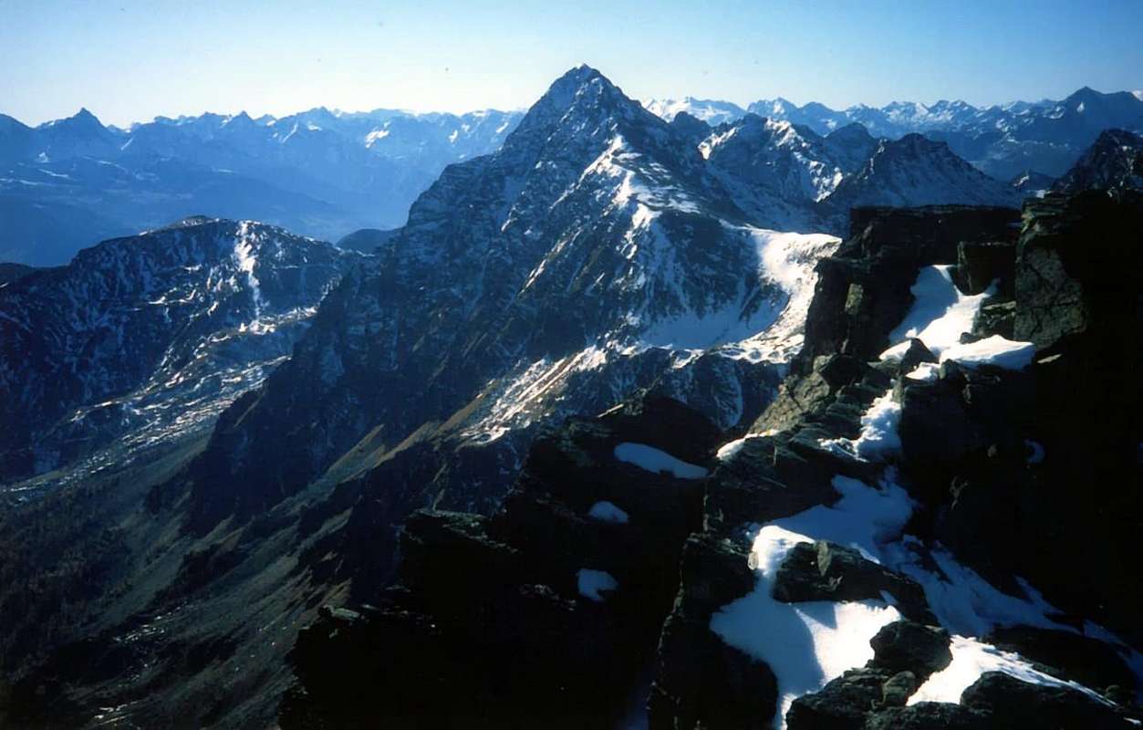
5/C) - Becca Fontaney (2.972m)
Approaches A and B ( Brévaz Fontaney Vallons) with Route through Southeast Crest: from Aosta East exit of the motorway, follow along the Regional Road towards Saint Barthélemy Valley up to the Lignan Village (+; 1.633m; parking). Approach A through Brévaz Vallon to Chaleby Hill (2.653m): from parking by this hamlet (Astronomical Observatory), climb towards the North through the path n° 10B/11 to Place Damon Pasture (1.910 m); here, leaving the branching to the right (East) to the Alp Fontane, most continue to the North-northwest, reaching first the private dirt road that comes from Alp Chaleby (1.952m) to reach the next Champanement (2.330m). Continuing in the primary direction to reach the path of Alta Via number 1 in altitude 2.650 meters around and with this, turning decidedly to the East-southeast, to get to Plan Piscina (2.544m; numerous sources) and in a short time to the immediately overlying Chaleby Hill (2.653m; E/F; 2h'15/2h'30). Approach B through Fontaney Vallon to Salvé Hill (2.569m): from the junction at Place Damon, abandoning in left (West) towards Champanement Pasture through the previous path, instead continue to the right path n ° 11 to Alp Fontane (2.088m); * arrival of dirt road from Lignan-Plaisance-Larset) and from this, always with direction to the North after a brief tour of seeds round, reach the next Tsa Fontaney Alpage (2.307m). Leaving to the East Alpage of Chavalary (2.160m; ** the same comes a farm private dirt road from Lignan-Larset), into a small vallon at the foot of Western Slope of Mount Morion and, via a short steep climb a little more, get to the Col du Salvé, with whom he quickly connect to the Chalaby Hill (2.569m; E/F; 2h'30/2h'45).
*** From these two hills, also, you can get off and walk (easy trail with a passage-equipped) through the alp and neighbor Cuney's Sanctuary (+; 2.653m).
Normal Route: from Chaleby Hill (2.683m), easily to reach from South to North from Plan de Piscina with the longer route coming from the Sanctuary of Cuney, climb through on the simple Ridge South-southeast; first dub a small rock wall color of sulfur on his left (South; about 2.755m) through the rocks easier, but covered with grass. Immediately after the next, with the same characteristics and constituted also by good rock bands on which you have to find the best path leads to the end that gradually becomes more and more easy and straight until reaching the Top. Do not be seduced by inviting workarounds on both sides, because the path on the ridge is certainly easier, safer and better. (F +; 1h'15/1h'30 from the Chaleby Hill; 2h'30/2h'45 from Champanement Pasture; 3h'40/3h'50 Lignan, by short connection in West-northwest through Salvé Hill).5/C) - Becca Fontaney (2.972 m)
Avvicinamento A e via da Lignan tramite il Vallone di Brévaz al Colle di Chaleby (2.653 m) con Via Normale tramite la Cresta Sudest: dall'Uscita dell'Autostrada Aosta Est seguire la Strada Regionale che, attraverso la Valle di Saint Barthélemy, risale fino alla Frazione di Lignan (+; 1633 m; parcheggio). Dal parcheggio di questo villaggio salire verso Nord tramite il sentiero n° 10B/11 fino all'Alpe Place Damon (1.910 m); qui, abbandonando la ramificazione a destra (Est) per l'Alpe Fontane, continuare più verso Nord-nordovest raggiungendo dapprima la strada poderale proveniente dall'Alpe Chaleby (1.952 m) per raggiungere quella successiva di Champanement (2.330 m). Continuando nella direzione primaria raggiungere il sentiero dell'Alta Via numero 1 a quota (2.650 metri circa) e con questa, volgendo decisamente ad Est-sudest, arrivare a Plan Piscina (2.544 m; sorgenti varie) ed in breve tempo al subito soprastante Colle di Chaleby (2.653 m; E/F; 2h'15/2h'30). Avvicinamento B e via da Lignan tramite il Vallone di Fontaney al Col du Salvé (2.569 m): dal bivio di Place Damon, abbandonato a sinistra (Ovest) il precedente sentiero verso Champanement, continuare invece a destra con il sentiero n°11 verso l'Alpe Fontane (2.088 m); * strada poderale da Lignan-Plaisance-Larset) e da questa, sempre con direzione continuamente a Nord dopo un breve giro semicircolare, raggiungere la successiva Tsa di Fontaney (2.307 m). Lasciando ad Est l'Alpe di Chavalary (2.160 m; ** strada poderale da Lignan-Larset), entrare in un valloncello alle pendici Ovest del Mont Morion e, tramite una breve salita appen più ripida, arrivare al Col du Salvé, col quale rapidamente collegarsi a quello di Chalaby (2.569 m; E/F; 2h'30/2h'45).
*** Da questi due colli, inoltre, si può discendere ed attraversare (facile sentiero con un passaggio attrezzato) al'Alpe ed al viciniore Santuario del Cuney (+; 2.653 m).
Via Normale: dal Colle di Chaleby (2.683 m), facilmente raggiungibile sia da Sud ovvero dal Villaggio di Lignan attraverso Plan Piscina quanto da Nord con più lungo percorso arrivando dall'alpe presso il Santuario del Cuney, salire tramite la facile Cresta Sud-sudest; dapprima doppiare un muretto roccioso di colore sulfureo sulla sua sinistra (Sud; (2.755 metri circa) per mezzo di rocce più facili, ma ricoperte da molta erba. Subito dopo un successivo, con le medesime caratteristiche e costituito, inoltre, da buone fasce rocciose sulle quali bisogna saper trovare la via migliore, conduce alla parte terminale che progressivamente diventa sempre più facile e lineare fino al raggiungimento della Cima. Non lasciarsi sedurre da invitanti aggiramenti su di entrambi i lati, poiché il percorso sul filo di cresta risulta sicuramente più semplice, sicuro, migliore ed anche panoramico. (F+; 1h'15/1h'30 dal Colle di Chaleby; 2h'30/2h'45 dall'Alpe Champanement; 3h'40/3h'50 da Lignan, tramite breve connessione ad Ovest-nordovest con il Col du Salvé).
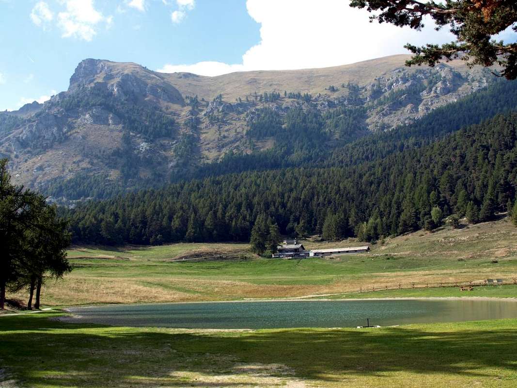
6/A) - Becca d'Aver (2.469m)
Approach from Petit Loson Hamlet neighbor the Champlong Area: from the alternative as soon as preceding Clavon Village (1.644m) to take the path n° 1 concomitant with the dirt road by Petit Loson (1.545m) that climbs at first toward Northwest and then decidedly to North reaching the Alp of Champlong Damon (1.659/82m) dominating from high the beautiful Picnic Area with pond. Changing completely direction toward towards Northeast reach Les Bornes Pasture (1.787m), near a small brook to the limit of the wood. Hardly behind the same one him part the path always n° 1 (reporting to Becca d'Aver in yellow) that, left to the right the nearby and homonym hill towards Torgnon in Valtournanche (1.781m), goes up to Aver Pass (2.330m) immediately under the Becca of Aver (2.469m). Actually follow it to go out about fifty metres to West-southwest about the same one. To continue in the same sense on the comfortable path n° 16 (EE/F/F+; 00h'45/1h'00 from Les Bornes Alp; 2h'30/3h'00 by the departure near the pond).
Conca di Verrayes/Saint Denis
6/A) - Becca d'Aver (2.469 m)
![]()
6/B) - Mont Andèr (1.931m)
Approach from Vencorère Hamlet: by Grand Villa (1.437m), above Verrayes Common, through the asphalt road reach the Vencorère small Village (1.563m) with the trail not numbered concomitant with the dirt road to Prelaz Alpage (1.712m). This last with path not reported but reduced to very poor track to the Summit (E/F; 1h'15/1h'30).
6/B) - Mont Andèr (1.931 m)
6/C) - Evence (1.750m)
Approach in the Verrayes/St. Denis Basin with departure by the small Villages of Semon, Plau or Del below St. Pantaleon Hill: 1) - Starting from Semon (1.359m) or Plau (1.305m) with private dirt road up to the Hostel Nature of Lavesé (1.500m) and then on path n° 2 or directly from one of Plau always and completely with trail n° 2, reaching the Chapel St. Evence and its crossing on the watershed with Torgnon to Colle St. Pantaleon; down from this through the path n° 1, which starts from the homonymous Chapel reaches Semon and Plau tiny Hamlets and then continue to the below Village Sessina (781 m), at the beautiful Castle of Cly. 2) - Or, wanting a little stretch of the route, from rhe adjacent of Del (1.260m) and from these go up the hill immediately making the circular path as in the first case above described (E/F; 1h'00/1h'30).
6/C) - Evence (1.750 m)
Avvicinamento dai Villaggetti di Semon, Plau o Del sotto al Colle di Saint Pantaleon e sopra il Comune di Saint Denis: 1) - iniziando da Semon (1.359 m) o Plau (1.305 m) con poderale fino all'Ostello Ecosostenibile di Lavesé (1.500 m) per poi inserirsi sul sentiero n° 2, oppure direttamente da quello di Plau sempre e completamente con sentiero n° 2, raggiungendo la Cappella di St. Evence e relativa traversata sullo spartiacque con Torgnon fino al Colle St. Pantaleon; discesa da questo tramite il sentierino n° 1, che partendo dall'omonima Cappella raggiunge i Villaggi Semon e Plau ed indi continuare fino al Villaggio Sessina (781 m), al Castello di Cly. 2) - Oppure, volendo allungare d'un poco il percorso, dall'attiguo Villaggetto di Del (1.260 m) e da questi salire subito al colle compiendo il percorso circolare come nel primo sovradescritto (E/F; 1h'00/1h'30).
![]()
Châtillon-Saint Vincent-Emarese Area
7/A) - Mont Zerbion (2.720m)
6/A) - Becca d'Aver (2.469 m)
Avvicinamento partendo dal Villaggio di Petit Loson presso l'Area di Champlong: dal bivio appena precedente il Villaggio di Clavon (1.644 m) prendere da Petit Loson (1.545 m) il sentiero n° 1 concomitante alla poderale, che sale dapprima verso Nordovest e poi decisamente a Nord raggiungendo l'Alpe di Champlong Damon (1.659/82 m) dominando dall'alto la bella Area Pic-Nic con laghetto. Cambiando completamente direzione verso Nordest raggiungere l'Alpe Les Bornes (1.787 m), presso un torrentello al limitare del bosco. Appena dietro la stessa si diparte il sentiero sempre n° 1 (segnalazione per la Becca d'Aver in giallo) che, lasciato a destra il vicino ed omonimo colle verso Torgnon e la Valtournanche (1.781 m), sale al Col d'Aver (2.330) immediatamente al di sotto della Becca d'Aver. Seguirlo sino ad uscire una cinquantina di metri ad Ovest-sudovest della stessa. Continuare nello stesso senso sul comodo sentiero n° 16 (EE/F/F+; 00h'45/1h'00 dall'Alpe di Les Bornes; 2h'30/3h'00 dalla partenza al laghetto).
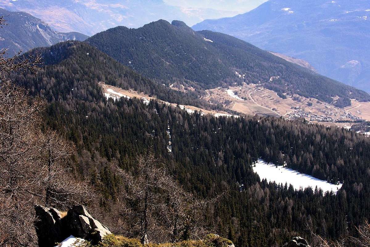
6/B) - Mont Andèr (1.931m)
Approach from Vencorère Hamlet: by Grand Villa (1.437m), above Verrayes Common, through the asphalt road reach the Vencorère small Village (1.563m) with the trail not numbered concomitant with the dirt road to Prelaz Alpage (1.712m). This last with path not reported but reduced to very poor track to the Summit (E/F; 1h'15/1h'30).
6/B) - Mont Andèr (1.931 m)
Avvicinamento dal Villaggio di Vencorère: da Grand Villa (1.437 m), sopra a Verrayes, con la strada in asfalto raggiungere quello di Vencorère (1.563 m) con sentiero non numerato e concomitante con poderale per l'Alpe Prelaz (1.712 m). Da Questa con sentiero non segnalato ma ridotto a ben misera traccia alla Cima (E/F; 1h'15/1h'30).
6/C) - Evence (1.750m)
Approach in the Verrayes/St. Denis Basin with departure by the small Villages of Semon, Plau or Del below St. Pantaleon Hill: 1) - Starting from Semon (1.359m) or Plau (1.305m) with private dirt road up to the Hostel Nature of Lavesé (1.500m) and then on path n° 2 or directly from one of Plau always and completely with trail n° 2, reaching the Chapel St. Evence and its crossing on the watershed with Torgnon to Colle St. Pantaleon; down from this through the path n° 1, which starts from the homonymous Chapel reaches Semon and Plau tiny Hamlets and then continue to the below Village Sessina (781 m), at the beautiful Castle of Cly. 2) - Or, wanting a little stretch of the route, from rhe adjacent of Del (1.260m) and from these go up the hill immediately making the circular path as in the first case above described (E/F; 1h'00/1h'30).
6/C) - Evence (1.750 m)
Avvicinamento dai Villaggetti di Semon, Plau o Del sotto al Colle di Saint Pantaleon e sopra il Comune di Saint Denis: 1) - iniziando da Semon (1.359 m) o Plau (1.305 m) con poderale fino all'Ostello Ecosostenibile di Lavesé (1.500 m) per poi inserirsi sul sentiero n° 2, oppure direttamente da quello di Plau sempre e completamente con sentiero n° 2, raggiungendo la Cappella di St. Evence e relativa traversata sullo spartiacque con Torgnon fino al Colle St. Pantaleon; discesa da questo tramite il sentierino n° 1, che partendo dall'omonima Cappella raggiunge i Villaggi Semon e Plau ed indi continuare fino al Villaggio Sessina (781 m), al Castello di Cly. 2) - Oppure, volendo allungare d'un poco il percorso, dall'attiguo Villaggetto di Del (1.260 m) e da questi salire subito al colle compiendo il percorso circolare come nel primo sovradescritto (E/F; 1h'00/1h'30).
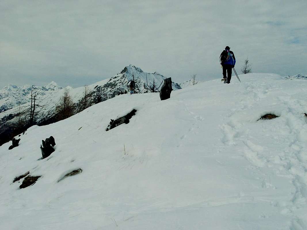
7/A) - Mont Zerbion (2.720m)
Approach from Nissod Village: from Châtillon Municipality, with Municipal Road in Northeast on Châtillon High Hill, towards Merlin, Cret Blanc, Chavod, Pissin, Albard, Closel, Domianaz to Nissod Villages (1.371m); from this, through dirt farms road in North-northeast, to Nuarsaz Alp (1.713m; T/E; 0h'45/1h'15), below Southern slopes of Mount Zerbion (2.720m). From Nuarsaz Alp, with dirt road concomitant with the trail n° 12 in West, to Chesalet (1.735m), Jacquémin-Giacomet (1.777m) Alpages. From this, always through path n° 12 but in North, to Shoulder 1.991 meters (wooden benches on a grassy flat promontory) between Franquin/Varé Woods at the beginning of Western easy and grassy Crest Mount Zerbion. Through small path n° 7 or tracks towards the Summit (2.720m; F; 2h'30/3h'00 from Nuarsaz Alp; 4h'00/4h'15 from Nissod Village).
![]()
Area tra Châtillon-Saint Vincent-Emarese
7/A) - Mont Zerbion (2.720 m)
7/B) - Cima Botta (2.042m)
Approach from St. Vincent Town through the Regional Road towards Col de Joux: by Col de Joux (1.623m), reached by St. Vincent-Emarese or from Torgnon, head North with the path n° 12 that passes just above the Alpe Fromy is directed towards that of Nuarsaz below Monte Zerbion. Where this turn to the West, leave the same and go for traces quite steep on the other side to reach the Collar Botta, located between Mont Jetire (2.146m) and Cima Botta and both on the Southeast Ridge that descends from Zerbion; seventy metres fairly steep between blocks whitish and easy rocks in the forest and flexing more towards East leading to the Summit (EE/F; 1h'30/2h'00).
![]()
7/B) - Cima Botta (2.042 m)
7/C) - Testa di Comagna (2.106m)
Approach from Emarese Common towards the Hills of Joux or Zuccore or Tzecore with Regional Road: from Saint Vincent Municipality, with Regional Road to Brusson in Val d'Ayas, towards the Joux Hill (1.635m); from this in ascent through small path n° 6 into rhe forest on Northern Slope to Western Shoulder (around 1.930m) and following traverse, through West Crest, to Tête de Comagne (2.106m; great cairn with altar and Cross in Summit; E; 1h'30/1h'45). Or, through the opposite slope, from Col Zuccore (1.607m), reached with Regional Road by Emarese Common (1.048 m), on North Crest into forest and crossing Monte Zuccore (1.882m) with path n° 5 (E/F; 1h'00/1h'15).
![]()
7/C) - Testa di Comagna (2.608 m)
![]()
Valtournanche
8/A) - Motta or Motte de Pleté and Gran Sometta (2.840m, 2.870m, 3.018m, 3.166m)
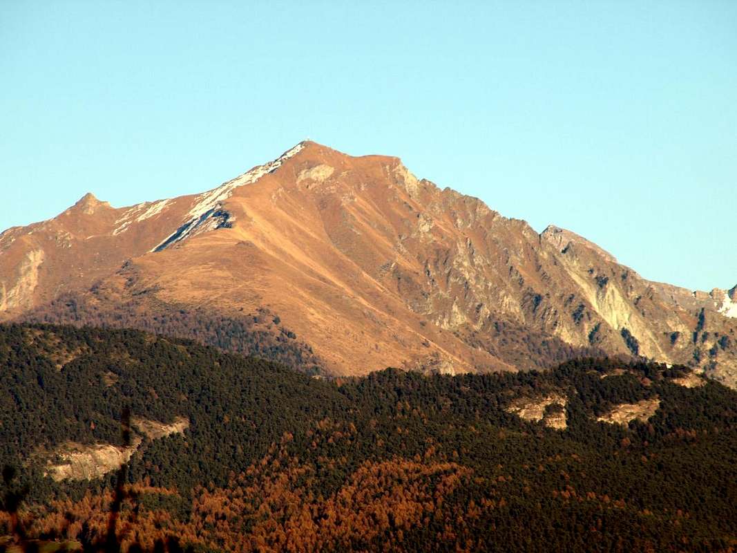
7/A) - Mont Zerbion (2.720 m)
Avvicinamento dal Villaggio di Nissod: dal Comune di Châtillon, tramite la Strada Municipale verso Nordest sull'Alta Collina di Châtillon in direzione dei Villaggi di Merlin, Cret Blanc, Chavod, Pissin, Albard, Closel, Domianaz fino a quello di Nissod (1.371 m); da questo, al termine della strada asfaltata, tramite la strada poderale privata in Nord-nordest verso l'Alpeggio di Nuarsaz (1.713 m; T/E; 0h'45/1h'15), sottostantemente al Versante Meridionale del Monte Zerbion (2.720 m). Da quest'alpe, sempre con strada poderale ma verso Ovest e concomitante al sentiero n° 12, agli Alpeggi di Chesalet (1.735 m) e Jacquémin-Giacomet (1.777 m); quindi, sempre con sentiero n° 12 ma adesso verso Settentrione, allo Spallone (1.991 metri panchine in legno sopra l'erboso promontorio) sito tra i Bois de Franquin e Varé all'inizio della facile ed erbosa Cresta Occidentale dello Zerbion. Attraverso un sentierucolo n° 7 o tracce detritiche e superando qualche roccetta alla Vetta (2.720m; F; 2h'30/3h'00 da Nuarsaz Alp; 4h'00/4h'15 da Nissod).
7/B) - Cima Botta (2.042m)
Approach from St. Vincent Town through the Regional Road towards Col de Joux: by Col de Joux (1.623m), reached by St. Vincent-Emarese or from Torgnon, head North with the path n° 12 that passes just above the Alpe Fromy is directed towards that of Nuarsaz below Monte Zerbion. Where this turn to the West, leave the same and go for traces quite steep on the other side to reach the Collar Botta, located between Mont Jetire (2.146m) and Cima Botta and both on the Southeast Ridge that descends from Zerbion; seventy metres fairly steep between blocks whitish and easy rocks in the forest and flexing more towards East leading to the Summit (EE/F; 1h'30/2h'00).
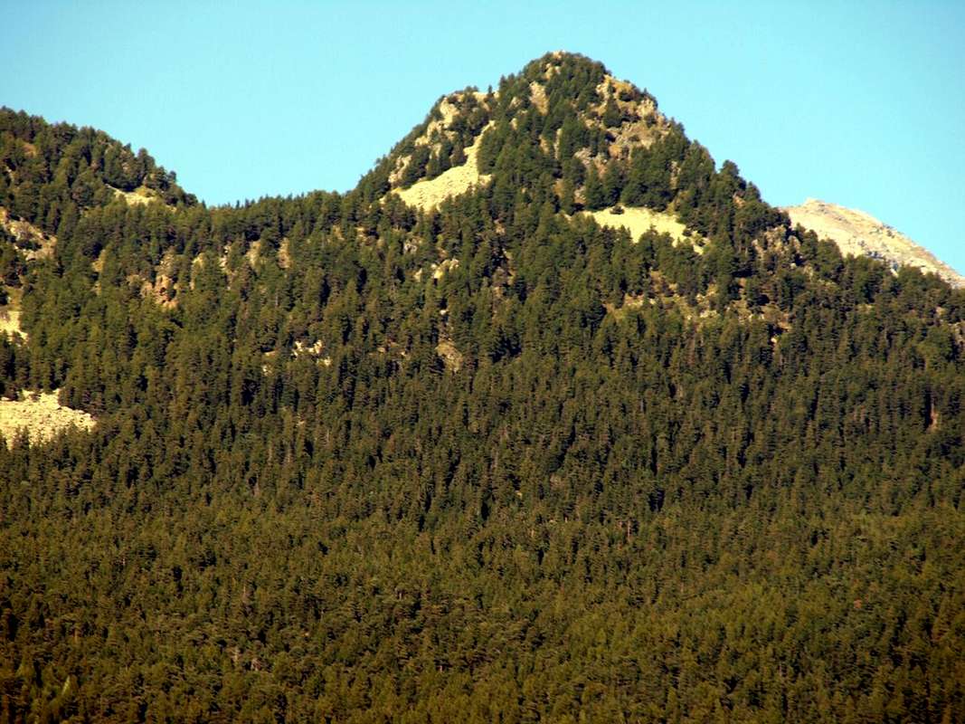
7/B) - Cima Botta (2.042 m)
Avvicinamento da St. Vincent con la Strada Regionale verso il Col di Joux: Dal colle (1.623 m), raggiungibile sia da St. Vincent-Emarese che da Torgnon, dirigersi verso Settentrione con il sentiero n° 12, che passando appena sopra l'Alpe Fromy s'indirizza verso quella di Nuarsaz sotto al Monte Zerbion. Là dove questa piega ad Ovest, abbandonare il medesimo e salire per tracce abbastanza ripide sul lato opposto raggiungendo il Colletto Botta, collocato tra Mont Jetire (2.146 m) e Cima Botta ed entrambi sulla Cresta Sudest che scende dallo Zerbion; una settantina di metri abbastanza ripidi tra blocchi biancastri e facili rocce nella foresta conduce alla Sommità (EE/F; 1h'30/2h'00).
7/C) - Testa di Comagna (2.106m)
Approach from Emarese Common towards the Hills of Joux or Zuccore or Tzecore with Regional Road: from Saint Vincent Municipality, with Regional Road to Brusson in Val d'Ayas, towards the Joux Hill (1.635m); from this in ascent through small path n° 6 into rhe forest on Northern Slope to Western Shoulder (around 1.930m) and following traverse, through West Crest, to Tête de Comagne (2.106m; great cairn with altar and Cross in Summit; E; 1h'30/1h'45). Or, through the opposite slope, from Col Zuccore (1.607m), reached with Regional Road by Emarese Common (1.048 m), on North Crest into forest and crossing Monte Zuccore (1.882m) with path n° 5 (E/F; 1h'00/1h'15).
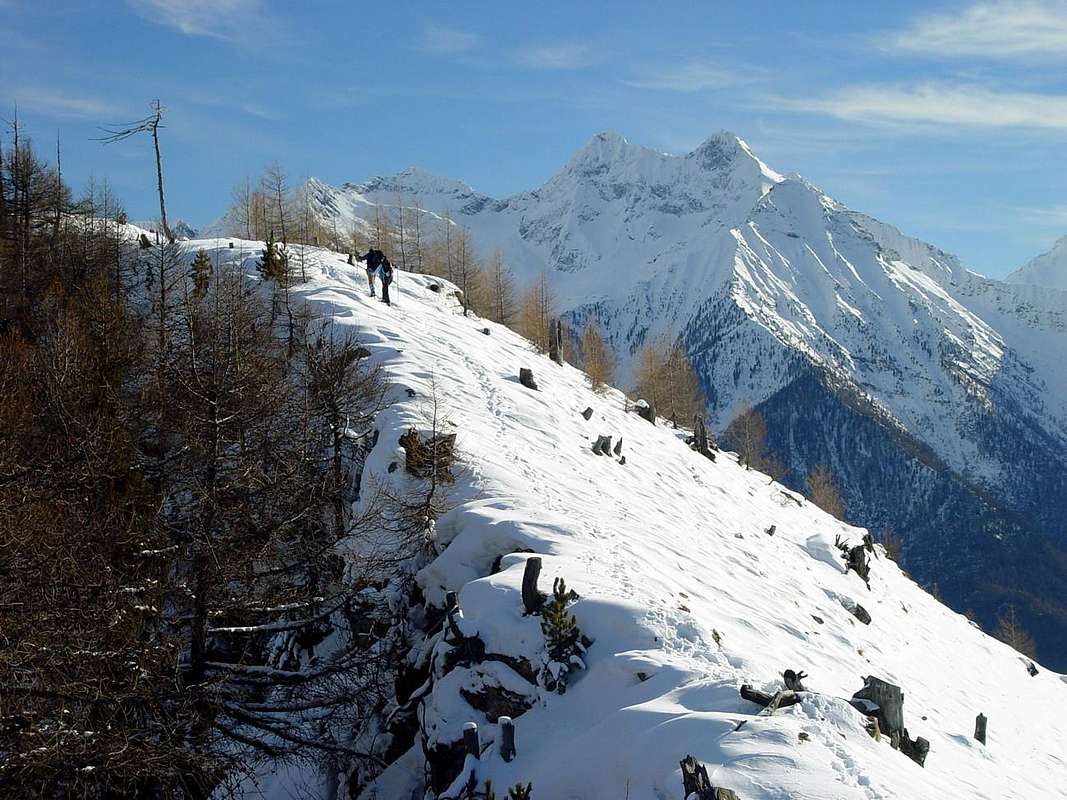
7/C) - Testa di Comagna (2.608 m)
Avvicinamento dal Comune di Emarese con la Strada Regionale verso i Colli di Joux oppure Zuccore o Tzecore: dal Comune di Saint Vincent, tramite la Strada Regionale verso Brusson in Val d'Ayas sino al Col di Joux (1.635 m); da questo in salita con il sentierino n° 6 attraverso la foresta sul Versante Settentrionale dello Spallone Occidentale (circa 1.930 metri) e successiva traversata sulla Cresta Ovest verso la Tête de Comagne (2.106 m; grande ometto con altare votivo e Croce sulla Cima; E; 1h'30/1h'45). Oppure dall'opposto versante tramite il Col Zuccore (1.607 m), raggiungibile con la Strada Regionale da e per il Comune di Emarese (1.048 m), per mezzo della Cresta Meridionale ed attraversando il Monte Zuccore (1.882 m) tramite il sentiero n° 5 sul filo della cresta spartiacque e per brevi tratti di bosco alla Cima (E/F; 1h'00/1h'15).
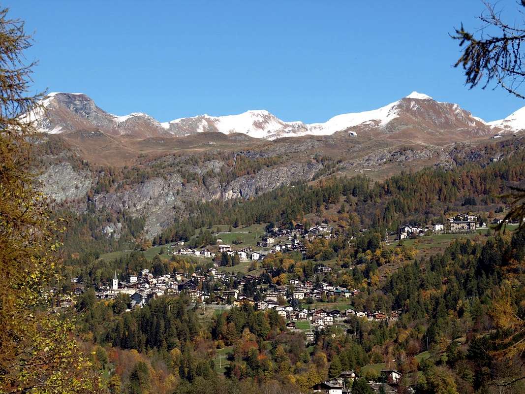
8/A) - Motta or Motte de Pleté and Gran Sometta (2.840m, 2.870m, 3.018m, 3.166m)
Approach from Valtournanche Common towards Cime Bianche Hill: from Regional Road nearby the locality of Varvoyes (1.844m) and, through the private dirt farms road, towards Promindoz de Meitin and Damon (1.932m, 2.026m), Mandaz, Mandaz Dèsott and Damon (2.113m, 2.315m)), Molar (2.315m), Cleyva Groussa (2.253m), Illiaz Perron (2.249m), Gran Plan (2.510m) Pastures and Alps with path n° 19/21; from this to cross 2.599 meters and with path n° 21 in Northwest, crossing Cleyva Groussa Torrent, to Motte de Pleté Western Summit (2.840m), through Southeast easy Slope. Easily traverse on watershed to Central (2870m), Eastern (3.018m) Summits towards the Gran Sometta, through the easy Western Crest (3.166m; E/F; 3h'30/4h '00), between Northeast (2.985m) and Southwest (2.894m) Hills of Cime Bianche. Descent by South Crest.
Valtournanche
8/A) - Motta o Motte de Pleté e Gran Sometta (2.840 m, 2.870 m, 3.018 m, 3.166 m)
Avvicinamento dal Comune di Valtournanche verso il Colle delle Cime Bianche: dalla Strada Regionale presso la località Varvoyes (1.844 m) e, tramite la poderale, verso le Alpi di Promindoz de Meitin e Damon (1.932 m, 2.026 m), Mandaz, Mandaz Dèsott e Damon (2.113 m, 2.315 m), Molar (2.315 m), Cleyva Groussa (2.253 m), Illiaz Perron (2.249 m), Gran Plan (2.510m) con sentieri n° 19/21; da qui al bivio 2.599 metri e sempre con sentiero n° 21 verso Nordovest, guadando il Torrent Cleyva Groussa, alla Motte de Pleté Cima Occidentale (2.840 m), tramite l'elementare Versante Sudest. Facilmente artraversare sullo spartiacque alla Motta Centrale (2.870 m), all'Orientale (3018 m) ed insino alla Vetta della Gran Sometta, per mezzo della facile Cresta Ovest (3.166 m; E/F; 3h'30/4h '00), sita tra i Colli Nordest (2.985 m) e Sudovest (2.894 m) delle Cime Bianche.
![]()
8/B) - Mont Tantané (2.734m)
8/B) - Mont Tantané (2.734 m)
Avvicinamento dalla Strada Regionale verso il Comune di La Magdeleine: da Antey Saint André-Petit Antey (1.092 m) con la Strada Municipale verso i Villaggetti di Chaillein, Noussan (1.509/1.474 m), bivio 1.307 metri, presso il Dalai Lama Camping (1.499 m) ed all'importante Villaggio di Promiod (+; 1.505 m). Da questo, tramite poderale-sentiero n°12 a Nordest, in direzione dei pascoli di Boettes (1.722 m) Pasture nonché dei successivi Alpeggi di Supplin (1.914 m), Brovié (1.908 m), Renard (2.046 m) e delle deviazioni 2.118, 2.165, 2.252 and 2.354 metri verso il Col Portola tramite il Versante Occidentale (2.414 m; E/F; 2h'45/3h'15), collocato tra Mont Tantané e Zerbion (2.720 m) sullo spartiacque Valtournanche/Ayas Valleys. Dal colle seguire la Cresta Sud con il sentiero n°9 che, sotto cresta oppure sul filo e superando le quote rocciose 2.474, 2.488, 2.509, 2.541, 2.628 metri, raggiunge lo Spallone Est (2.682 m); una breve discesa porta alla larga sella 2.637 metri e subito dopo alla Cima (EEA/F/F+; 3h'30/4h'00 da Promiod).
![]()
8/C) - Becca d'Aran (2.953m) and Mont Roisetta (3.332m)
8/C) - Becca d'Aran (2.953 m) e Mont Roisetta (3.332 m)
![]()
Ayas Valley
8/Cbis) - Mont Roisetta (3.332m)
8/A) - Motta o Motte de Pleté e Gran Sometta (2.840 m, 2.870 m, 3.018 m, 3.166 m)
Avvicinamento dal Comune di Valtournanche verso il Colle delle Cime Bianche: dalla Strada Regionale presso la località Varvoyes (1.844 m) e, tramite la poderale, verso le Alpi di Promindoz de Meitin e Damon (1.932 m, 2.026 m), Mandaz, Mandaz Dèsott e Damon (2.113 m, 2.315 m), Molar (2.315 m), Cleyva Groussa (2.253 m), Illiaz Perron (2.249 m), Gran Plan (2.510m) con sentieri n° 19/21; da qui al bivio 2.599 metri e sempre con sentiero n° 21 verso Nordovest, guadando il Torrent Cleyva Groussa, alla Motte de Pleté Cima Occidentale (2.840 m), tramite l'elementare Versante Sudest. Facilmente artraversare sullo spartiacque alla Motta Centrale (2.870 m), all'Orientale (3018 m) ed insino alla Vetta della Gran Sometta, per mezzo della facile Cresta Ovest (3.166 m; E/F; 3h'30/4h '00), sita tra i Colli Nordest (2.985 m) e Sudovest (2.894 m) delle Cime Bianche.

8/B) - Mont Tantané (2.734m)
Approach from regional Road towards La Magdeleine Commune: from Antey Saint André-Petit Antey (1.092m) with Municipal Road towards Chaillein, Noussan (1.509/1.474m) Villages, alternative 1.307 meters, neighbor Dalai Lama Camping (1.499m) to Promiod important Hamlet (+; 1.505m). From this, through dirt road concomitant with the trail n°12 in Northeast, towards Boettes (1.722m) Pasture, Supplin (1.914m), Brovié (1.908m), Renard (2.046m) Alpages, forks 2.118, 2.165, 2.252 and 2.354 meters to Portola Hill through Western slopes (2.414m; E/F; 2h'45/3h'15), between Mont Tantané and Mont Zerbion (2.720m) on watershed Valtournanche/Ayas Valleys. From the pass follow the Ridge South by the route n°9, which, under the crest or on the wire bypassing some steps to West and overcoming the odds rocky 2474, 2.488, 2.509, 2.541, 2.628 meters, reaches the great Eastern Shoulder (2.682m); a short descent leads to the large saddle 2.637 meters and after the Summit (EEA/F/F+; 3h'30/4h'00 from Promiod).
8/B) - Mont Tantané (2.734 m)
Avvicinamento dalla Strada Regionale verso il Comune di La Magdeleine: da Antey Saint André-Petit Antey (1.092 m) con la Strada Municipale verso i Villaggetti di Chaillein, Noussan (1.509/1.474 m), bivio 1.307 metri, presso il Dalai Lama Camping (1.499 m) ed all'importante Villaggio di Promiod (+; 1.505 m). Da questo, tramite poderale-sentiero n°12 a Nordest, in direzione dei pascoli di Boettes (1.722 m) Pasture nonché dei successivi Alpeggi di Supplin (1.914 m), Brovié (1.908 m), Renard (2.046 m) e delle deviazioni 2.118, 2.165, 2.252 and 2.354 metri verso il Col Portola tramite il Versante Occidentale (2.414 m; E/F; 2h'45/3h'15), collocato tra Mont Tantané e Zerbion (2.720 m) sullo spartiacque Valtournanche/Ayas Valleys. Dal colle seguire la Cresta Sud con il sentiero n°9 che, sotto cresta oppure sul filo e superando le quote rocciose 2.474, 2.488, 2.509, 2.541, 2.628 metri, raggiunge lo Spallone Est (2.682 m); una breve discesa porta alla larga sella 2.637 metri e subito dopo alla Cima (EEA/F/F+; 3h'30/4h'00 da Promiod).
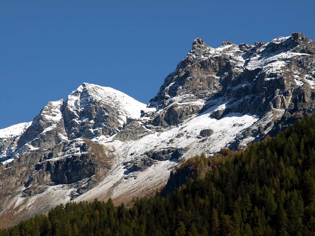
8/C) - Becca d'Aran (2.953m) and Mont Roisetta (3.332m)
Approach from Cheneil: from Cheneil small Hamlet (2.097m) with trail n°29/30/31/Alta Via n° 1 towards Southeast up to the junction 2.300 meters into the Comba de Cheneil; after decisively changing to the Norheast with path n°29 on valley floor always of the same basin towards the following fork 2.650 meters. From this point 1) - to the West yhrough the path n°26 over the easy grassy Western and Northeastern Slopes with some small rocks in terminal part to Becca d'Aran (+; 2.953m; EE/F; 2h'30/3h'00). 2) - Or always continuing with path n°29 along the rather boring and tiring scree Southwestern Face quite easily to Mont Roisetta (+; 3.332m; EEA/F+; 3h'45/4h'15).
8/C) - Becca d'Aran (2.953 m) e Mont Roisetta (3.332 m)
Avvicinamento da Cheneil: dal Villaggetto di Cheneil (2.097 m) con il sentiero n°29/30/31/Alta Via n° 1 verso Sudest fino al bivio 2.300 metri nella Comba de Cheneil; poi cambiando direzione decisamente verso Nordest con sentiero n°29 sul fondovallone sempre della stessa comba insino al successivo 2.650 metri. Da questo punto 1) - verso Ovest con sentiero n°26 sui facili pendii erbosi Occidentali e di Nordest con qualche facile roccetta nella parte terminale alla Becca d'Aran (+; 2.953 m; EE/F; 2h'30/3h'00).
2) - Oppure continuando sul sentiero n°29 lungo il piuttosto noioso, detritico nonché faticoso Versante Sudovest al Mont Roisetta (+; 3.332 m; EEA/F+; 3h'45/4h'15).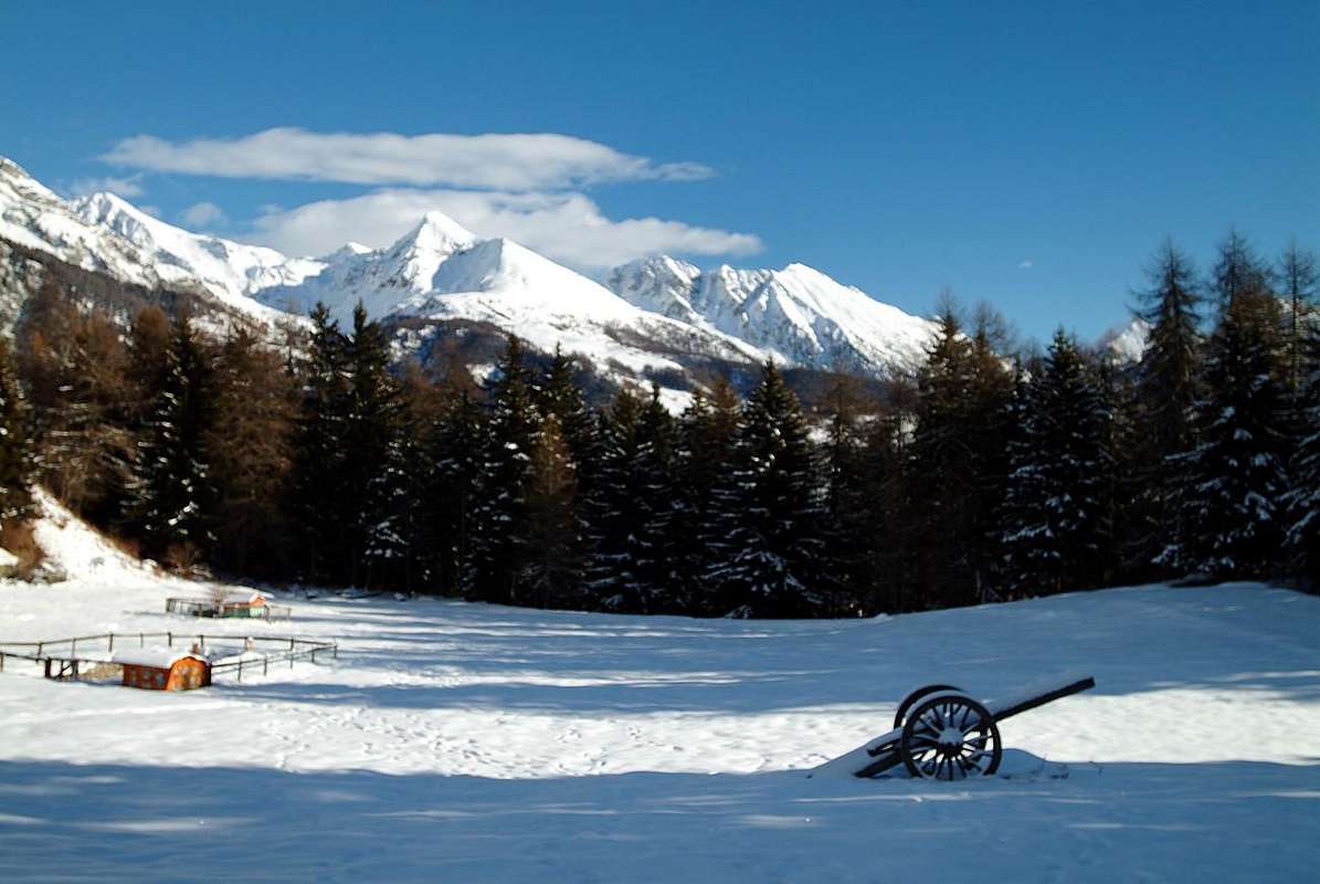
8/Cbis) - Mont Roisetta (3.332m)
Approaches from St. Jacques (+; 1.697m) or by Antagnod (1.685m), through the private dirt road: a) - from St. Jacques (+; 1.697m) toward Fusine (1.713m), Blanchard/Bernosin-Armaz (1.721m) Villages to fork 1.804 meters (signal no transit); from this, through dirt road or path Haute Route n° 1 (by St. Jacques), toward fhe cross 1.838 meters, Croués (1.870m), Nannaz Dèsott and Damon (2.049m, 2.193m) Pastures, cross 2.289 meters near Tournalin Dèsott Alp (2.278m) to Grand Tournalin Refuge (2.544m), nearby Tournalin Damon Alp (2.535m), below Grand (Northern Summit 3.379m, +; Southern 3.371m) and Petit Tournalin (+; 3.207m). From refuge in West-southwest to a) - Nana or Nannaz Hill (2.772m); in North to b) - saddle 2.800 meters, Mont Brun or Monte Croce (2.895 m; EE/F; 1h'15/1h'30 refuge), always through path n° 4 on slightly sloping but long Slope Southeastern passing above the Lac de Tournalin or Verde and Crest South in final part (2721 m; 4h '00/5h 00 from St. Jacques). b)- Or from Antagnod-Ayas Common, Barmasc Village (1.896m), through the long dirt road to North connecting with previous route (EE/F+; 2h'15/2h'45 refuge; 5h'30/6h'30 in total).
8/Cbis) - Mont Roisetta (3.332 m)
9/A) - Testa Grigia (3.316m)
![]()
Val d'Ayas
9/A) - Testa Grigia (3.316 m)
![]()
9/B) - Corno Bussola (3.023m)
9/B) - Corno Bussola (3.023 m)
Avvicinamento dal Vallone dal Vallone di Palasina: da Brusson salire al Villaggio di Estoul (+; 1.818 m; ampio parcheggio con pannelli e varie segnalazioni) tramite la Strada Regionale; da qui, verso Settentrione con la poderale dapprima concomitante ai sentieri n° 5/4/105, verso i vari Alpeggi di Fenillettaz (1.840 m), il successivo bivio (1.882 m; segnale di divieto per i mezzi), Fontaine (1.903 m), Chanlochère (2.012m), bivio 2029 metri, Chavanne (2.107m), le due alternative (2.103 m, 2.209 m) viciniori al Lago Litteran (2.226 m), bivio 2.231 metri. Da questo punto A) - : a Nordovest in direzione delle Alpi Chavanne (2.347 m) e Palasinaz (2.402 m) verso la 1) - "Baita Dino" (circa 2.435 metri; casa privata); dalla stessa, dapprima con sentiero n° 4/105 in un valloncello e lungo l'emissario e quindi presso la sponda Nord del Lago della Battaglia verso i Laghi Pocia e Lungo. Con sentiero n° 3C ad Ovest-nordovest al di sopra d'un promontorio detritico raggiungere il largo Colle Bussola (2.807 m); continuare a Nordovest sulla facile Cresta Sudest con sentierucolo sino al 2) - Corno Bussola (+; 3.023m; EE/F+, breve passaggio attrezzato con catene; 3h'30/4h'00 da Estoul; 1h'45/2h'15 dalla "Baita Dino").
![]()
9/C) - Becca Torché (3.016m)
b) - Through Southwestern Slope from the more in bottom Chalex Alpages (1.780m) (EE/A/PD-; about 02h'30/03h'00 from upper rocky base; 07h'00/08h'00 Isollaz).
c) - Through Northwestern Ridge from le Tron Alp. This long ridge coming down from the Northwest to the Tip Meriaoù can also be reached from the Vallon of the same Dondeuil reaching from the Alp le Tron to the saddle of 2.700 meters after Becca Mortens and proceeding fairly smoothly on wire of the same (A; from PD- to PD+; about 03h'00/03h'15 from le Tron Alpahe; 07h'30/08h'30 from Isollaz Hamlet). Better to walk away from this with ascent through the Chasten Vallon from Tollegnaz Village, because the search for the via forward is simpler and requires less knowledge of the area being more visible. But even this route is as a way little known and rarely traveled.
9/C) - Becca Torché (3.016 m)
Avvicinamento dal per il Vallone Occidentale del Dondeuil: questa Cima risulta come la più elevata dell'intero vallone che simbolicamente rappresenta, poi connettendosi verso Oriente con la "gemella" Becca di Vlou (+ 3.032 m). Un elegante connubio, ma mentre la Torché "si distende" verso il Vallone del Dondeuil, l'altra é completamente collocata nella Valle di Gressoney o del Lys dominando le piccole Valli di Scheity ed Issime. Insieme, formano le cosiddette "Dames de Challand", grazie all'esposizione che mostrano verso questo lato con le loro due magnifiche Pareti Nord, sempre ben in vista passando per la Valle d'Ayas medio-alta; mentre sul versante opposto s'evidenziano con minor risalto. La Torché dal versante Dondeuil non offre alcun particolare tipo di scalata, ma propone una piacevole passeggiata attraverso la sua Via Normale percorrente la Via Alpina verso Gressoney. Pur evidenziandone la facilità si deve sottolineare la presenza d'una delicata traversata d'una cinquantina di metri sulla destra appena oltre il colle, tramite una cengia erbosa da affrontarsi con cautela perché molto esposta a Sudest. Devesi inoltre differenziare come l'escursioni cambi aspetto completamente in partenza dalle Alpi Dondeuil (avendo il permesso di prendere la strada privata in auto), o, a partire dal Isollaz, con il percorso completo di tutto il Vallone del Dondeuil; in questo caso, "riemerge" un vecchio modo di andare in montagna con una bella "sfacchinata", richiedente più che buoni garretti ed una buona dose di pazienza. In ogni caso, è bello, piacevole e panoramico viaggio.
a) - Tramite la facile Cresta Meridionale o Via Standard dal Col Dondeuil (2.338 m). Dopo la traversata di cui sopra, seguire facilmente il sentiero non numerato né segnalato risalente sullo spartiacque o ad Est appena sotto al medesimo (EE/F; 01h'30/02h'15 dal colle; 03h'45/04h'15 dall'Alpe Dondeuil; 07h'15/07h'45 dal Villaggio di Isollaz).
b) - A mezzo del Versante Sudovest partendo dagli Alpeggi di Chalex (1.780 m) (EE/A/PD-; 02h'30/03h'00 circa dalla base superiore; dalle 07h'00 alle 08h'00 da Isollaz).
c) - Con la Cresta Nordovest dall'Alpe le Tron. Questa lunga cresta discende a Nordovest in direzione della Punta di Meriaoù ma é inoltre raggiungibile dallo stesso Vallone del Dondeuil raggiungendo dall'Alpe le Tron la sella a quota 2.700 metri dopo la Becca Mortens e procedendo abbastanza agevolmente sul filo dello stesso (A; da PD- a PD+; 03h'00/03h'15 circa da le Tron; 07h'30/08h'30 da Isollaz). Risulta meglio non procedere con questo vallone utilizzando quello di Tollegnaz Chasten, perché la ricerca della via di salita è più semplice e richiede meno conoscenza del territorio ed é facilmente più individuabile. Anche questa risulta come via poco conosciuta e assai raramente percorsa.
![]()
9/D) - Punta di Valfredda (2.947m)
9/D) - Punta di Valfredda (2.947 m)
Avvicinamento dal Vallone dal Vallone di Palasina: dal Villaggio di Estoul (1.818 m; grande parcheggio con pannelli e segnalazioni varie) dapprima verso Nordovest poi Nord tramite la Streda Regionale; dal villaggio, con direzione a Settentrione per mezzo della poderale concomitante al sentiero n° 5, verso gli Alpeggi di Fenillettaz (1.840 m), successivo bivio (1.882 m; segnale di divieto al transito per i mezzi non autorizzati), Fontaine (1.903 m), Chanlochère (2.012 m), bivio 2.029 metri, Chavanne (2.107 m), biforcazioni 2.103, 2.209 metri nelle vicinanze del Lago Litteran (2.226 m), successivo bivio 2.231 metri. Da quest'ultimo, lasciata a sinistra la poderale che prosegue verso il soprastante Rifugio Arp (2.446 m), seguire invece una piccola traccia presso il torrentello verso Est-nordest fino al sentiero n° 5D/105 che raggiunge il Colle di Valnera o Valdònierfòrkò (2.673/6 m); da questo, tramite la facile Cresta Sudest con percorso semicircolare e qualche roccetta finale, raggiungere la Cima (EE/F; 3h'15/3h'45 da Estoul).
![]()
Lys or Gressoney Valley
8/Cbis) - Mont Roisetta (3.332 m)
Avvicinamento da St. Jacques (+; 1.697 m) o da Antagnod (1685m), tramite la strada poderale: a) - da St. Jacques (+; 1.697 m) verso i Villaggi di Fusine (1.713 m), Blanchard/Bernosin-Armaz (1.721 m) sino al bivio 1.804 metri (segnale di divieto); da qui, con la poderale od il sentiero Alta Via n° 1 (da Saint Jacques), verso l'incrocio 1.838 metri e le Alpi di Croués (1.870 m), Nannaz Dèsott e Damon (2.049m, 2.193m), successivo bivio 2.289 metri all'Alpe Tournalin Dèsott (2.278 m) in direzione del Rifugio Grand Tournalin (2.544 m), presso l'Alpe Tournalin Damon (2.535 m), al di sotto di Grand (Nord 3.379 m, +; Sud 3.371 m) e Petit Tournalin (+; 3.207 m). Dal rifugio in Ovest-sudovest al a) - Col di Nana o Nannaz (2.772 m); a Nord alla b) - sella 2.800 metri vicino al Mont Brun o Monte Croce (2.895 m; EE/F; 1h'15/1h'30 dal rifugio), sempre con sentiero n° 4 sul poco inclinato ma lungo Versante Sudest passando al di sopra del Lac de Tournalin o Verde e Crestina Sud nel finale (2.721 m; 4h'00/5h'00 da Saint Jacques). b)- Oppure dal Villaggetto di Barmasc (1.896 m) con la lunga poderale verso Settentrione che si collega al precedente itinerario (EE/F+; 2h'15/2h'45 dal refugio; 5h'30/6h'30 in totale).
9/A) - Testa Grigia (3.316m)
Approach by Champoluc Hamlet (1579m) through Crest's Vallon: from Champoluc (+; 1.579m), with good path n° 11A/11B/13/GSW/Alta Via N° 1 in East, towards Cunéaz Village (+; 2.062m). From this to a) - Pinter Pass or Péentecoll (2.776m; E/F; 3h'00/3h '30 with trail 11A/11B/GSW/Alta Via N° 1; from fork immediately under the pass in Southeast to three b) - Pinter Lochs (2.689m through unnumbered path; same difficulty and time), between Testa Grigia or Groabhopt (+; 3.316m) and Monte Pinter (3.137m, neighbor the Lateltin Bivouac at the end of the great Southern Shoulder) and Corno Vitello also Chalberhòre (+; 3.057m). From the junction 2.776 meters continue towards the Northeast with the trail n° 6/11A/11B reaching Lateltin Bivouac (3.113m) and from this with the path to the West just below or bypassing Mont Pinter (3.137m) continue through the Southern Ridge meeting a short passage with chain at an altitude of 3.213 meters. The last stretch more to the North-northwest and with a passage rather exposed over Gressoney la Trinité (I°+/ II°-, no longer equipped) reach the Summit (EEA/F/F+/PD-; 3h'45/4h'15 from the arrival of Cable-way). c) - Or from Station 1.989/1.975 meters continue with the stub rail that reaches to Ostafaz Damon (2.416m). On this side of the trail n° 12 with a long crossing to Southeast, passing near the pond in altitude 2.638 meters at the foot of the Southwestern Slope of Testa Grigia (Head Gray), to the fork 2.715 meters and previous routes (calculate 1h'15/1h'30 in less).
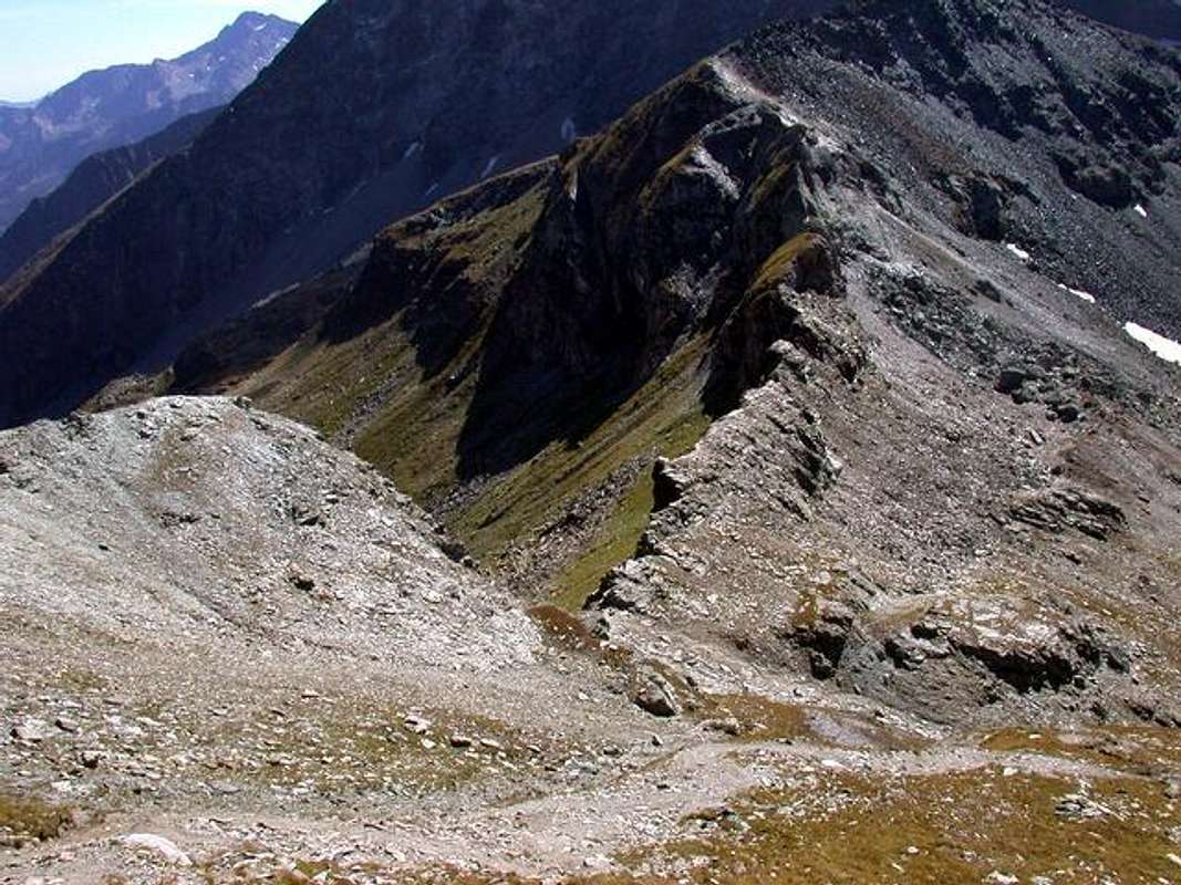
9/A) - Testa Grigia (3.316 m)
Avvicinamento dalla Frazione di Champoluc (1579 m) per il Vallone del Crest: da Champoluc (+; 1.579 m), tramite un buon sentiero n° 11A/11B/13/GSW/Alta Via N° 1 verso Oriente, in direzione del Villaggio di Cunéaz (+; 2.062 m). Da questi al a) - Colle Pinter o Péentecoll (2.776 m; E/F; 3h'00/3h'30 con sentiero 11A/11B/GSW/Alta Via N° 1; dal bivio immediatamente al di sotto del passo e verso Sudest ai tre b) - Laghi Pinter (2.689 m tramite sentiero non numerato; stessa difficoltà e tempo), sotto la Testa Grigia o Groabhopt (+; 3.316 m) ed il Monte Pinter (3.137 m, nelle vicinanze del Bivacco Lateltin al termine dello Spallone Meridionale della Testa Grigia) e Corno Vitello o Chalberhòre (+; 3.057 m). Dal bivio 2.776 metri continuare verso Nordest con il sentierino n° 6/11A/11B raggiungendo il Bivacco Lateltin (3.113 m) e da questo con sentiero appena al di sotto ad Ovest oppure scavalcando sullo spartiacque il Monte Pinter (3.137 m) continuare tramite la Cresta Meridionale incontrando un breve passaggio con catena a quota 3.213 m. Un ultimo tratto più verso Nord-nordovest e con un passaggio piuttosto esposto sopra Gressoney la Trinité (I°+/II°-, questo non é più attrezzato con catene come lo era nei tempi passati) raggiungere la Sommità (EEA/F/F+/PD-; 3h'45/4h'15 dall'arrivo della Stazione del Crest). c) - Oppure dalla Stazione 1.989/1.975 metri continuare con il troncone che raggiunge quella di Ostafaz Damon (2.416 m). Da questa parte il sentiero n° 12 che con una lunga traversata verso Sudest, passando presso il laghetto 2.638 metri alle pendici del Versante Sudovest della Testa Grigia, raggiunge il bivio 2.715 metri e le precedenti due vie (in questo caso calcolare1h'15/1h'30 in meno).
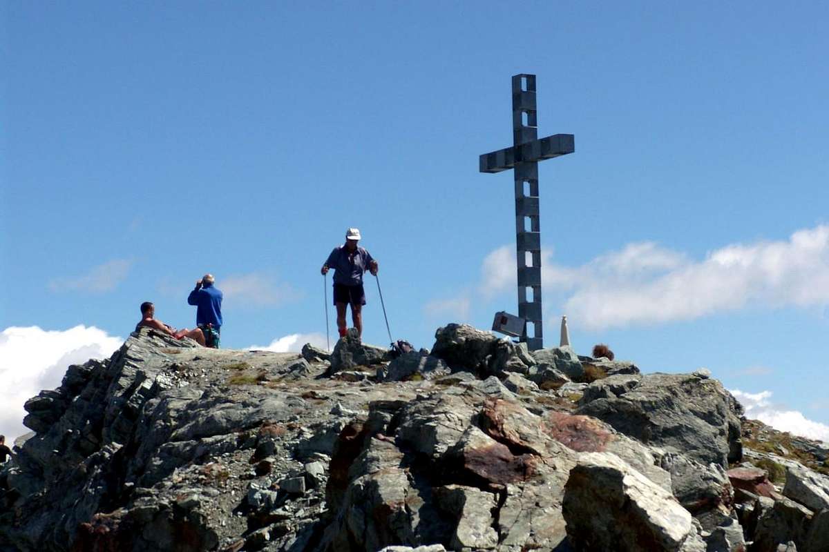
9/B) - Corno Bussola (3.023m)
Approach through Palasinaz Vallon: from Brusson to Estoul Village (+; 1.818m; great parking; variaous signals) with Regional Road; from this, in North through dirt road and paths n° 5/4/105, towards Fenillettaz (1.840m), following alternative (1.882m; signal no transit), Fontaine (1.903m), Chanlochère (2.012m), junction 2.029 meters, Chavanne (2.107m) Pastures, alternatives (2.103m, 2.209m) nearby Litteran Lake (2.226m), fork 2.231 meters. From this A) - : in Northwest towards Chavanne (2.347m), Palasinaz (2.402m) Pastures, to 1) - "Baita Dino" (about 2.435 meters; private house); from the same, with path n° 4/105 before along an effluent into a small vallon and after North shore of Battaglia (Battle) Lake, to Pocia and Long Lakes. Through path n° 3C in West-northwest over a debris promontory to Bussola Hill (2.807m); from tyhis in Northwest on Southeast Crest to 2) - Corno Bussola (+; 3.023m; EE/F+, a shorth passage equipped with chain; 3h'30/4h'00 from Estoul; 1h'45/2h'15 from "Baita Dino").
9/B) - Corno Bussola (3.023 m)
Avvicinamento dal Vallone dal Vallone di Palasina: da Brusson salire al Villaggio di Estoul (+; 1.818 m; ampio parcheggio con pannelli e varie segnalazioni) tramite la Strada Regionale; da qui, verso Settentrione con la poderale dapprima concomitante ai sentieri n° 5/4/105, verso i vari Alpeggi di Fenillettaz (1.840 m), il successivo bivio (1.882 m; segnale di divieto per i mezzi), Fontaine (1.903 m), Chanlochère (2.012m), bivio 2029 metri, Chavanne (2.107m), le due alternative (2.103 m, 2.209 m) viciniori al Lago Litteran (2.226 m), bivio 2.231 metri. Da questo punto A) - : a Nordovest in direzione delle Alpi Chavanne (2.347 m) e Palasinaz (2.402 m) verso la 1) - "Baita Dino" (circa 2.435 metri; casa privata); dalla stessa, dapprima con sentiero n° 4/105 in un valloncello e lungo l'emissario e quindi presso la sponda Nord del Lago della Battaglia verso i Laghi Pocia e Lungo. Con sentiero n° 3C ad Ovest-nordovest al di sopra d'un promontorio detritico raggiungere il largo Colle Bussola (2.807 m); continuare a Nordovest sulla facile Cresta Sudest con sentierucolo sino al 2) - Corno Bussola (+; 3.023m; EE/F+, breve passaggio attrezzato con catene; 3h'30/4h'00 da Estoul; 1h'45/2h'15 dalla "Baita Dino").
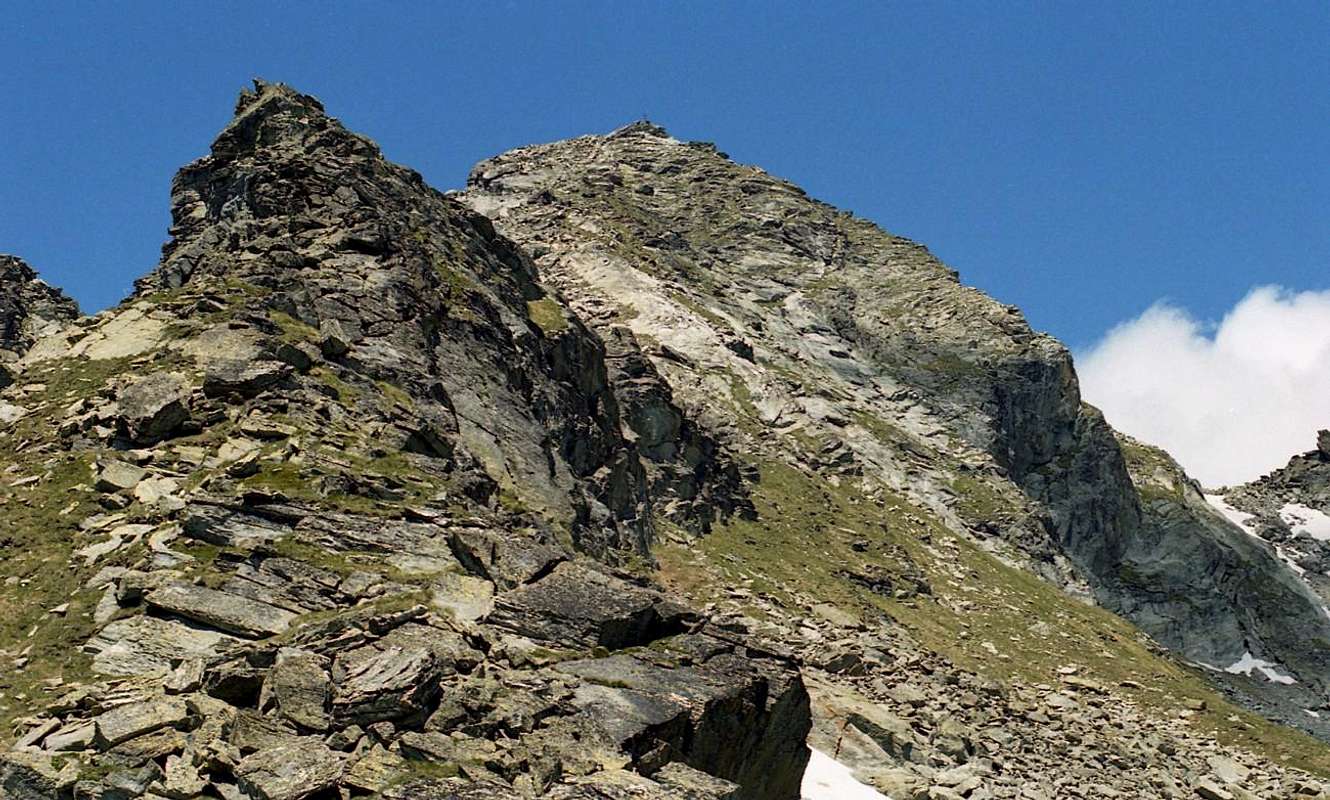
9/C) - Becca Torché (3.016m)
Approach through Dondeuil Western Vallon: this Summit is the highest of the entire vallon that symbolically represents, then connecting the East with the "twin" Becca Vlou (+ 3.032m). An elegant combination, but while Torché "belongs" to the Valley of Dondeuil, the other is located entirely in the Gressoney or Lys Valley overlooking the small Valleys of Scheity and Issime. Together, they form the so-called "Ladies of Challand", thanks to the exposure that are on this side of their two magnificent North Walls, always in sight going by the Media High Ayas Valley; while the opposite slope are highlighted with less prominence. The Torché from the face Dondeuil does not offer any particular type of climbing, but, going through the Alpine Via, it does offer a pleasant hike through its Normal Via; the same we must highlight the ease stressing that a crossing of about fifty metres to the right and just over the hill, through a grassy ledge with caution because very exposed in the Southeast. It should also differentiate like hiking appearance changes completely departing from the Alps Dondeuil (having permission to take the private road by car), or, starting from Isollaz, with the full path of entire vallon; in this case, "resurfaces" an old way of going to the mountains with a nice "grind" that requires good hocks and a good dose of patience. In any case, it is beautiful, pleasant and scenic trip.
a) - Through the easy Southern Crest or Standard Route from Dondeuil Hill (2.338m). After crossing above easily follow the small path unnumbered and not reported that will run along the edge or below the ridge to the right (East) (EE/F; 01h'30/02h'15 from hill; 03h'45/04h'15 from Dondeuil Alpage; 07h'15/07h'45 from Isollaz Village). b) - Through Southwestern Slope from the more in bottom Chalex Alpages (1.780m) (EE/A/PD-; about 02h'30/03h'00 from upper rocky base; 07h'00/08h'00 Isollaz).
c) - Through Northwestern Ridge from le Tron Alp. This long ridge coming down from the Northwest to the Tip Meriaoù can also be reached from the Vallon of the same Dondeuil reaching from the Alp le Tron to the saddle of 2.700 meters after Becca Mortens and proceeding fairly smoothly on wire of the same (A; from PD- to PD+; about 03h'00/03h'15 from le Tron Alpahe; 07h'30/08h'30 from Isollaz Hamlet). Better to walk away from this with ascent through the Chasten Vallon from Tollegnaz Village, because the search for the via forward is simpler and requires less knowledge of the area being more visible. But even this route is as a way little known and rarely traveled.
9/C) - Becca Torché (3.016 m)
Avvicinamento dal per il Vallone Occidentale del Dondeuil: questa Cima risulta come la più elevata dell'intero vallone che simbolicamente rappresenta, poi connettendosi verso Oriente con la "gemella" Becca di Vlou (+ 3.032 m). Un elegante connubio, ma mentre la Torché "si distende" verso il Vallone del Dondeuil, l'altra é completamente collocata nella Valle di Gressoney o del Lys dominando le piccole Valli di Scheity ed Issime. Insieme, formano le cosiddette "Dames de Challand", grazie all'esposizione che mostrano verso questo lato con le loro due magnifiche Pareti Nord, sempre ben in vista passando per la Valle d'Ayas medio-alta; mentre sul versante opposto s'evidenziano con minor risalto. La Torché dal versante Dondeuil non offre alcun particolare tipo di scalata, ma propone una piacevole passeggiata attraverso la sua Via Normale percorrente la Via Alpina verso Gressoney. Pur evidenziandone la facilità si deve sottolineare la presenza d'una delicata traversata d'una cinquantina di metri sulla destra appena oltre il colle, tramite una cengia erbosa da affrontarsi con cautela perché molto esposta a Sudest. Devesi inoltre differenziare come l'escursioni cambi aspetto completamente in partenza dalle Alpi Dondeuil (avendo il permesso di prendere la strada privata in auto), o, a partire dal Isollaz, con il percorso completo di tutto il Vallone del Dondeuil; in questo caso, "riemerge" un vecchio modo di andare in montagna con una bella "sfacchinata", richiedente più che buoni garretti ed una buona dose di pazienza. In ogni caso, è bello, piacevole e panoramico viaggio.
a) - Tramite la facile Cresta Meridionale o Via Standard dal Col Dondeuil (2.338 m). Dopo la traversata di cui sopra, seguire facilmente il sentiero non numerato né segnalato risalente sullo spartiacque o ad Est appena sotto al medesimo (EE/F; 01h'30/02h'15 dal colle; 03h'45/04h'15 dall'Alpe Dondeuil; 07h'15/07h'45 dal Villaggio di Isollaz).
b) - A mezzo del Versante Sudovest partendo dagli Alpeggi di Chalex (1.780 m) (EE/A/PD-; 02h'30/03h'00 circa dalla base superiore; dalle 07h'00 alle 08h'00 da Isollaz).
c) - Con la Cresta Nordovest dall'Alpe le Tron. Questa lunga cresta discende a Nordovest in direzione della Punta di Meriaoù ma é inoltre raggiungibile dallo stesso Vallone del Dondeuil raggiungendo dall'Alpe le Tron la sella a quota 2.700 metri dopo la Becca Mortens e procedendo abbastanza agevolmente sul filo dello stesso (A; da PD- a PD+; 03h'00/03h'15 circa da le Tron; 07h'30/08h'30 da Isollaz). Risulta meglio non procedere con questo vallone utilizzando quello di Tollegnaz Chasten, perché la ricerca della via di salita è più semplice e richiede meno conoscenza del territorio ed é facilmente più individuabile. Anche questa risulta come via poco conosciuta e assai raramente percorsa.
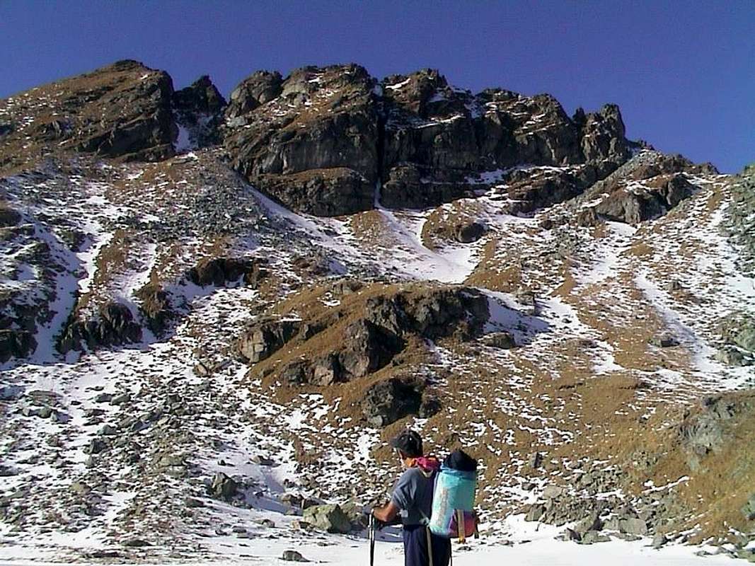
9/D) - Punta di Valfredda (2.947m)
Approach through Palasinaz Vallon: from Brusson to Estoul Village (+; 1.818m; great parking; panels and variaous signals) with the Regional Road; from this, in North through dirt road concomitant with the trail n° 5, towards Fenillettaz (1.840m), following alternative (1.882m; signal no transit for unauthorized means), Fontaine (1.903m), Chanlochère (2.012m), fork 2.029 meters, Chavanne (2.107m) Pastures, alternatives 2.103, 2.209 meters nearby Litteran Lake (2.226m), fork 2.231 meters. From the latter, rleaving left the farm dirt road that goes towards the above Arp Refuge (2.446m), to the East-northeast instead follow the trail n° 5D/105 that reaches the Colle Valnera or Valdònierfòrkò (2.673/6m); this, via the Southeast Ridge easy with some small rocks in the final, reaching the Summit (EE/F; 3h'15/3h'45 from the beginning of dirt road).
9/D) - Punta di Valfredda (2.947 m)
Avvicinamento dal Vallone dal Vallone di Palasina: dal Villaggio di Estoul (1.818 m; grande parcheggio con pannelli e segnalazioni varie) dapprima verso Nordovest poi Nord tramite la Streda Regionale; dal villaggio, con direzione a Settentrione per mezzo della poderale concomitante al sentiero n° 5, verso gli Alpeggi di Fenillettaz (1.840 m), successivo bivio (1.882 m; segnale di divieto al transito per i mezzi non autorizzati), Fontaine (1.903 m), Chanlochère (2.012 m), bivio 2.029 metri, Chavanne (2.107 m), biforcazioni 2.103, 2.209 metri nelle vicinanze del Lago Litteran (2.226 m), successivo bivio 2.231 metri. Da quest'ultimo, lasciata a sinistra la poderale che prosegue verso il soprastante Rifugio Arp (2.446 m), seguire invece una piccola traccia presso il torrentello verso Est-nordest fino al sentiero n° 5D/105 che raggiunge il Colle di Valnera o Valdònierfòrkò (2.673/6 m); da questo, tramite la facile Cresta Sudest con percorso semicircolare e qualche roccetta finale, raggiungere la Cima (EE/F; 3h'15/3h'45 da Estoul).
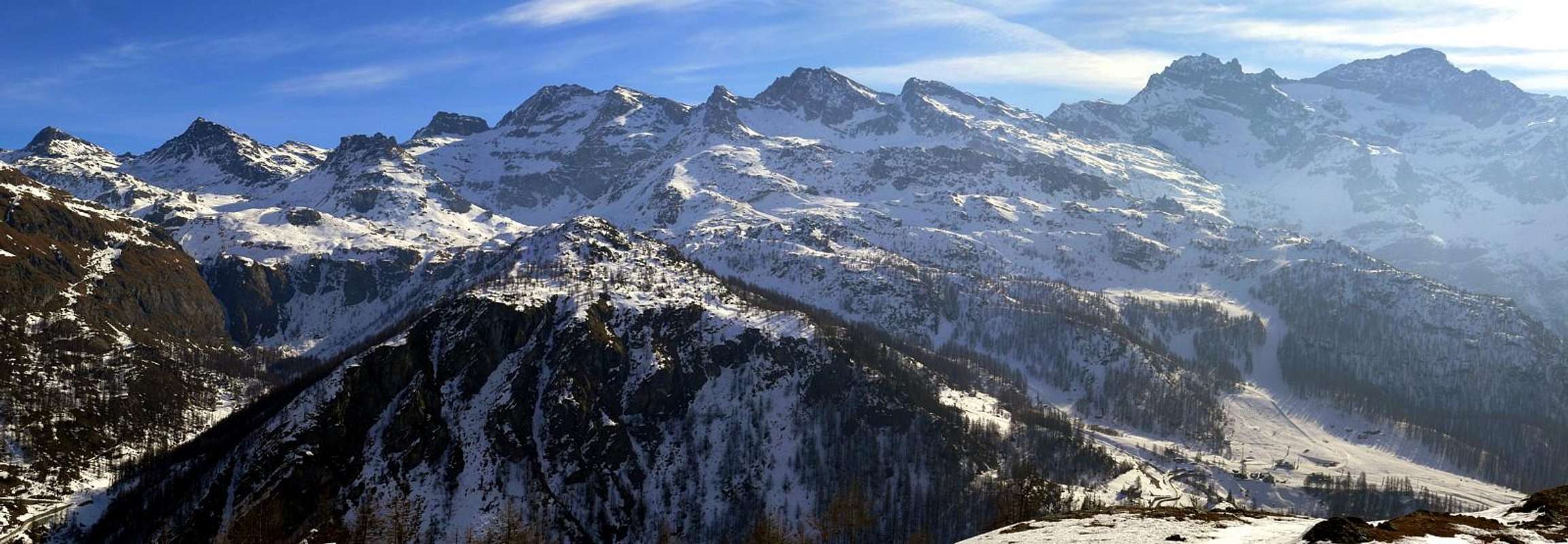
10/A) - Corno del Camoscio (3026m) from Gabiet Loch (2.363m)
Approach from dirt road towards the lake: from Gressoney La Trinité, at the end of the Gressoney Valley, to Parking between Fòhré/Enge (1.798m) small Villages (* Departure of a first Chair Lift to alp 1.910 meters and from this an other chair to dirt road immediately below Gabiet Loch), with Main Road; also to Obrò de Jòlò (1.837m). From alternative (+; 1.801m; signal no transit and parking) just before, through dirt road in Southeast, towards Montery, Tschòcke (1.926m) Pastures, alternatives 1941m, 1.989m, Recka (2.131m), Shéttò Alpages, near Lys Refuge (2.339m; **arrival Cableway from Staffal). From this briefly to a) - Gabiet Refuge and Loch (2.370m, 2.363m; T; 0h'10); from Lys Refuge, through dirt road in North, to neighbor Ponte Shelter (2.388m) and, doubling West the Schwoarzehòre (2.710m), through path on moraines in East, to b) - Zube Pass (2.871m), between Corno Rosso or Rothòre (3.023m) and Punta Straling (3.115m). Also continue in North-northeast, always through dirt road, to c) - Salati Pass (2.931m), between Stoleberg (3.202m) and Corno del Camoscio (+; 3.026m). You and still, through dirt road in Northeast, towards the d) - pond 2.721 meters and d'Olen Hill (2.880m), above Guglielmina and Città di Vigevano Refuges (2.863m), now immediately but completely in Piedmont Region. From the both hills eaily to Corno del Camoscio (E/F; 4h'00/4h'30 from Fòhré/Enge or from Obrò de Jòlò Villages; 1h'45/2h'15 from Gabiet Loch or from the Gabiet, Lys, Ponte Shelters, all three in the same vicinity of the lake).
Val del Lys o di Gressoney
10/A) - Corno del Camoscio (3026 m) dal Lago Gabiet (2.363 m)
Avvicinamento dalla poderale per il lago: da Gressoney La Trinité, al termine della Valle di Gressoney, al Parking tra i Villaggetti di Fòhré ed Enge (1.798 m) (* Partenza del primo troncone della Funivia verso l'alpeggio a 1.910 metri e da questo tramite il successivo verso la poderale immediatamente al di sotto del Lago Gabiet), per mezzo della Strada Principale; oppure in direzione di Obrò de Jòlò (1.837 m). Dal bivio (+; 1.801 m; divieto di transito e parcheggio) appena prima, con poderale a Sudest, verso le Alpi Montery e Tschòcke (1.926 m), biforcazioni 1.941 metri e 1.989 metri e gli Alpeggi di Recka (2.131 m) e Shéttò, presso il Rifugio del Lys (2.339 m; **arrivo della Funivia da Staffal). Da questo in breve tempo con diverse possibilità verso il a) - Rifugio del Gabiet e Lago (2.370 m, 2.363 m; T; 0h'10); dal Rifugio del Lys, tramite poderale verso Nord, verso il vicino Rifugio Ponte (2.388 m) e, doppiando ad Ovest il Schwoarzehòre (2.710 m), tramite sentiero ad Est nelle morene, al b) - Passo di Zube (2.871 m), posto tra Corno Rosso o Rothòre (3.023 m) e Punta Straling (3.115 m). Oppure continuare verso Nord-nordest, sempre a mezzo di poderale, verso il c) - Colle dei Salati (2.931 m), collocato tra lo Stoleberg (3.202 m) ed il Corno del Camoscio (+; 3.026 m). Od ancora, con poderale in Nordest, verso il d) - laghetto 2.721 metri ed il Col d'Olen (2.880 m), al di sopra dei Rifugi Guglielmina e Città di Vigevano (2.863 m), adesso immediatamente ma completamente in Regione Piemonte. Da entrambi i colli e facilmente al viciniore Corno del Camoscio (E/F; 4h'00/4h'30 dai Villaggi di Fòhré/Enge o da Obrò de Jòlò; 1h'45/2h'15 dal Lago del Gabiet oppure dai Rifugi Gabiet, Lys e Ponte, tutti e tre nelle vicinanze del lago).
![]()
10/B) - Mont Ciosé or Stallenhorn (2.664m)
10/B) - Mont Ciosé o Stallenhorn (2.664 m)
Avvicinamento dal Comprensorio d'Estoul tramite il Colle della Ranzola: da Estoul, per mezzo della poderale concomitante con il sentiero n° 7 verso Oriente, verso gli Alpeggi di Fenillettaz, Murassaz (1.883 m), Praz Barmasse Dèsott (1.928m; segnale di divieto al transito dei mezzi), bivio 2.014 metri, Alpe Fenêtre (2.083 m) in direzione del Colle della Ranzola o Arescoll (2.171 m; T; 1h'20/1h'40), sito tra il Mont Ciosé o Stallerhòre (2.647 m) e la Punta della Regina (+; 2.387 m). Da questo verso Nord-nordovest al Mont Ciosé, per mezzo della Cresta Sud-sudest superando con qualche roccetta le varie quote 2.401, 2.403, 2.473, 2.559, 2.621, l'esposto a Nordest intaglio 2.611 (I°+/II°-), 2.629 metri (EEA/F+/PD-; 3h'00/3h'15). Conviene effettuare la discesa tramite una costola del Versante Sud in direzione dell'Alpeggio Praz-Barmasse Damon (2.038 m; I°).
![]()
Approach from dirt road towards the lake: from Gressoney La Trinité, at the end of the Gressoney Valley, to Parking between Fòhré/Enge (1.798m) small Villages (* Departure of a first Chair Lift to alp 1.910 meters and from this an other chair to dirt road immediately below Gabiet Loch), with Main Road; also to Obrò de Jòlò (1.837m). From alternative (+; 1.801m; signal no transit and parking) just before, through dirt road in Southeast, towards Montery, Tschòcke (1.926m) Pastures, alternatives 1941m, 1.989m, Recka (2.131m), Shéttò Alpages, near Lys Refuge (2.339m; **arrival Cableway from Staffal). From this briefly to a) - Gabiet Refuge and Loch (2.370m, 2.363m; T; 0h'10); from Lys Refuge, through dirt road in North, to neighbor Ponte Shelter (2.388m) and, doubling West the Schwoarzehòre (2.710m), through path on moraines in East, to b) - Zube Pass (2.871m), between Corno Rosso or Rothòre (3.023m) and Punta Straling (3.115m). Also continue in North-northeast, always through dirt road, to c) - Salati Pass (2.931m), between Stoleberg (3.202m) and Corno del Camoscio (+; 3.026m). You and still, through dirt road in Northeast, towards the d) - pond 2.721 meters and d'Olen Hill (2.880m), above Guglielmina and Città di Vigevano Refuges (2.863m), now immediately but completely in Piedmont Region. From the both hills eaily to Corno del Camoscio (E/F; 4h'00/4h'30 from Fòhré/Enge or from Obrò de Jòlò Villages; 1h'45/2h'15 from Gabiet Loch or from the Gabiet, Lys, Ponte Shelters, all three in the same vicinity of the lake).
10/A) - Corno del Camoscio (3026 m) dal Lago Gabiet (2.363 m)
Avvicinamento dalla poderale per il lago: da Gressoney La Trinité, al termine della Valle di Gressoney, al Parking tra i Villaggetti di Fòhré ed Enge (1.798 m) (* Partenza del primo troncone della Funivia verso l'alpeggio a 1.910 metri e da questo tramite il successivo verso la poderale immediatamente al di sotto del Lago Gabiet), per mezzo della Strada Principale; oppure in direzione di Obrò de Jòlò (1.837 m). Dal bivio (+; 1.801 m; divieto di transito e parcheggio) appena prima, con poderale a Sudest, verso le Alpi Montery e Tschòcke (1.926 m), biforcazioni 1.941 metri e 1.989 metri e gli Alpeggi di Recka (2.131 m) e Shéttò, presso il Rifugio del Lys (2.339 m; **arrivo della Funivia da Staffal). Da questo in breve tempo con diverse possibilità verso il a) - Rifugio del Gabiet e Lago (2.370 m, 2.363 m; T; 0h'10); dal Rifugio del Lys, tramite poderale verso Nord, verso il vicino Rifugio Ponte (2.388 m) e, doppiando ad Ovest il Schwoarzehòre (2.710 m), tramite sentiero ad Est nelle morene, al b) - Passo di Zube (2.871 m), posto tra Corno Rosso o Rothòre (3.023 m) e Punta Straling (3.115 m). Oppure continuare verso Nord-nordest, sempre a mezzo di poderale, verso il c) - Colle dei Salati (2.931 m), collocato tra lo Stoleberg (3.202 m) ed il Corno del Camoscio (+; 3.026 m). Od ancora, con poderale in Nordest, verso il d) - laghetto 2.721 metri ed il Col d'Olen (2.880 m), al di sopra dei Rifugi Guglielmina e Città di Vigevano (2.863 m), adesso immediatamente ma completamente in Regione Piemonte. Da entrambi i colli e facilmente al viciniore Corno del Camoscio (E/F; 4h'00/4h'30 dai Villaggi di Fòhré/Enge o da Obrò de Jòlò; 1h'45/2h'15 dal Lago del Gabiet oppure dai Rifugi Gabiet, Lys e Ponte, tutti e tre nelle vicinanze del lago).
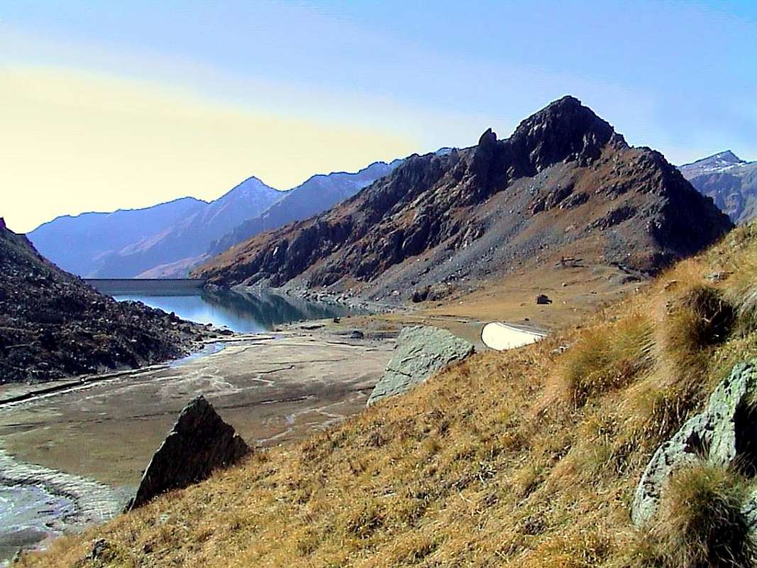
10/B) - Mont Ciosé or Stallenhorn (2.664m)
Approach Estoul Resort through Ranzola Hill: from Estoul, through dirt road concomitant with the trail n° 7 in East, towards Fenillettaz, Murassaz (1.883m), Praz Barmasse Dèsott (1.928m; not transit signal) Pastures, alternative 2.014 meters, Fenêtre Alp (2.083m) towards the Ranzola Hill or Arescoll (2.171m; T; 1h'20/1h'40), between Mont Ciosé or Stallerhòre (2.647m) Punta della Regina (+; 2.387m). From Hill in North-northwest to Mont Ciosé, by South-southeast Crest overcoming with some little rock the various altitudes 2.401, 2.403, 2.473, 2.559, 2.621, an exposed to Northeast carving 2.611 (I°+/II°-), 2.629 meters. Down on South Slope (I°; EEA/F+/PD-; 3h'00/3h'15).
10/B) - Mont Ciosé o Stallenhorn (2.664 m)
Avvicinamento dal Comprensorio d'Estoul tramite il Colle della Ranzola: da Estoul, per mezzo della poderale concomitante con il sentiero n° 7 verso Oriente, verso gli Alpeggi di Fenillettaz, Murassaz (1.883 m), Praz Barmasse Dèsott (1.928m; segnale di divieto al transito dei mezzi), bivio 2.014 metri, Alpe Fenêtre (2.083 m) in direzione del Colle della Ranzola o Arescoll (2.171 m; T; 1h'20/1h'40), sito tra il Mont Ciosé o Stallerhòre (2.647 m) e la Punta della Regina (+; 2.387 m). Da questo verso Nord-nordovest al Mont Ciosé, per mezzo della Cresta Sud-sudest superando con qualche roccetta le varie quote 2.401, 2.403, 2.473, 2.559, 2.621, l'esposto a Nordest intaglio 2.611 (I°+/II°-), 2.629 metri (EEA/F+/PD-; 3h'00/3h'15). Conviene effettuare la discesa tramite una costola del Versante Sud in direzione dell'Alpeggio Praz-Barmasse Damon (2.038 m; I°).
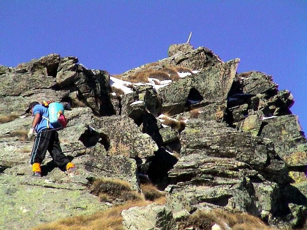
Campings
Remember that free camping is forbidden (except for emergency reasons, over 2.500m, from darkness until dawn).Mountain Condition
- Meteo: you can find all the needed informations at the official site of the Valle d'Aosta Region:
- Valle d'Aosta Meteo
Important Information
- REGIONE AUTONOMA VALLE D'AOSTA the official site.
- FONDAZIONE MONTAGNA SICURA Villa Cameron, località Villard de la Palud n° 1 Courmayeur (AO) Tel: 39 0165 897602 - Fax: 39 0165 897647.
- A.I.NE.VA. (Associazione Interregionale Neve e Valanghe).
Useful numbers
- Protezione Civile Valdostana località Aeroporto n° 7/A Saint Christophe (Ao) Tel. 0165-238222.
- Bollettino Meteo (weather info) Tel. 0165-44113.
- Unità Operativa di Soccorso Sanitario Tel. 118.