


-
 2341 Hits
-
 81.84% Score
-
 14 Votes
|
|
Route |
|---|---|
|
|
45.74944°N / 7.56035°E |
|
|
Hiking |
|
|
Spring, Summer, Fall, Winter |
|
|
Half a day |
|
|
Note
|
La montagna chiama i suoi figli, ed essi rispondono fedelmente al suo appello… Osvaldo Cardellina, Diario alpinistico, 1964-65 Page texts: @ OsvaldoCardellina "Osva", passed away on May 2, 2022. Page owners: Christian Cardellina e Osvaldo Cardellina. Any updates from September 12, 2022: Antonio Giani, page administrator, friend and climbing companion. Testi della pagina: @ OsvaldoCardellina "Osva", scomparso il 2 maggio 2022. Proprietari pagina: Christian Cardellina e Osvaldo Cardellina. Eventuali aggiornamenti dal 12 settembre 2022: Antonio Giani, amministratore della pagina, amico e compagno di salite. |
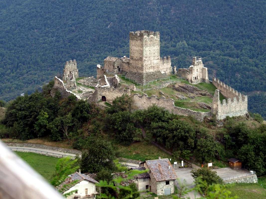
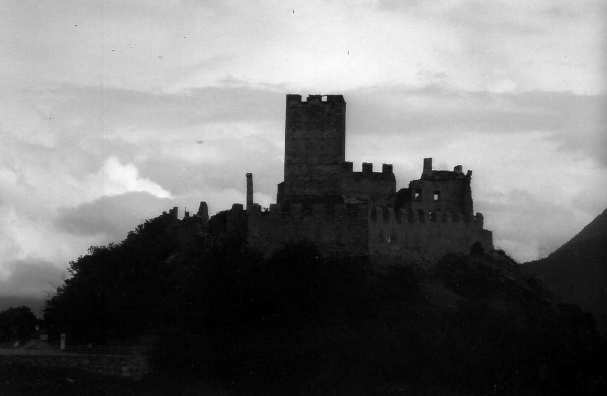
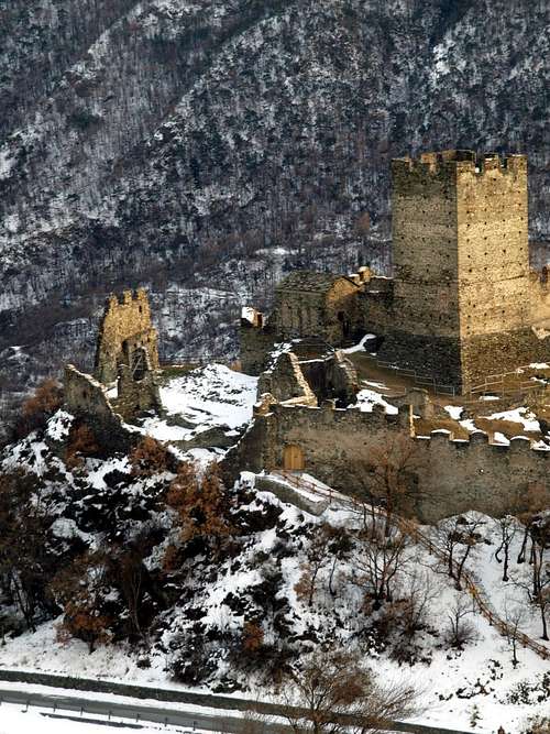
Castle Overview Fortress
Ancient Cly castle is placed just above the valley floor (Chambave Commune, 496m) and more precisely in the Municipality of Saint Denis (803m) which is bordered to the West with that of adjacent Verrayes Common (1.026m). Built in 1351 by Boniface of Challant, the eldest son of Count Bosone, with the aim of inheriting from his father the entire area below. But things turned out very differently, since the Savoys who intervened, through the Conte Verde, presented the confiscation of goods, including castle. The massive stone building was annexed to the Feudi Savoy, more powerful of the Counts of Challant in the Valley of Aosta. Finally it became the property of Baron Roncas Chatel Argent, become in turn owner of this feud, going to the dynasty of the Lords of St. Pierre since 1100 as Baroni (their lords came from the near Town of Aosta) in 1605 in Villeneuve. Consists of a large and high squared tower surrounded by a rectangular perimeter of walls, appears, when seen from Baltea as tricky fortress. Definitely it belonged to that line of reports with segnalations by the smoke of the fires set along the main river axis of the whole Aosta Valley. A series of Fiefdoms pleasant to visit that may, in addition to the cultural aspect, offering opportunity for a lovely stroll outdoors through connection paths.
Il Castello di Cly é collocato appena sopra al fondovalle (Chambave) e più precisamente nel Comune di Saint Denis confinante ad Ovest con quello di Verrayes (1.026m). Costruito nel 1351 dal valdostano Conte Bonifacio di Challant (Maresciallo di Casa Savoia in guerra per tutta l'Europa per 70 anni), primogenito del Conte Bosone di Challant, con l'obiettivo di ereditare dal padre l'intero territorio sottostante tra i Comuni di Chambave e di Saint Denis. Ma le cose per lui andarono ben diversamente, poiché intervennero i Savoia che, tramite il Conte Verde, presentarono la confisca totale dei beni, castello compreso. La massiccia costruzione in pietra venne aggregata ai Feudi Sabaudi, ancora più potenti dei Conti di Challant in Valle di Aosta. Infine diventò proprietà del Barone Roncas di Chatel Argent, divenuto a sua volta padrone di codesto feudo, succedendo alla dinastia dei Signori di St. Pierre dal 1100 come Baroni (provenivano dal viciniore Borgo di Aosta) nel 1605 in quel di Villeneuve Comune medioevale. Costituito da una grande ed alta torre squadrata e circondata da perimetro rettangolare di mura ormai piuttosto deteriorato a causa di crolli parziali lungo l'intera cinta, appare, se visto dal fondovalle lungo la Dora Baltea, qual ostica fortezza. Sicuramente apparteneva alla linea di segnalazioni tramite il fumo dei fuochi disposti lungo l'asse del principale fiume dell'intero territorio valdostano. Una serie di Feudi piacevoli da visitare che possono, oltre all'aspetto culturale, offrire occasione per bella passaggiata all'aperto tramite sentieri di collegamento.
 |
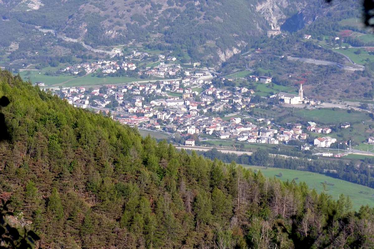
Getting There towards Verrayes & Saint Denis
BY CAR:- From TORINO, MILANO, etc: Motorway A5. Exit at IVREA or Quincinetto (PIEDMONT).
- From IVREA Town: in West towards Pont Saint Martin, Donnas, Arnad, Verrès, Bard, St. Vincent, Châtillon, Chambave, Nus, Quart, St. Christophe and Aosta Municipalities. From Courmayeur Resort: in East to Morgex, La Salle, Saint Pierre, Sarre, Aosta, Saint Chistophe, Quart, Nus, Chambave, Verrayes, Saint-Denis Municipalities.
- From Aosta Town towards St. Christophe, Quart, Nus and Chambave Municipalities From SS.26, nearby Chambave, to Regional Road; towards Ollières, Marseiller (801m) to Verrayes (991m). With Municipal Road towards Tessellaz, Marquis, Dorinaz (1.323m), Charrière Villages to Grand-Villa Hamlet (1.423m), in Verrayes/Saint Denis Basin and to Aver-Longhede Area. From A)- Verrayes, with Regional Road, towards Del (1.260m), Plau (1.305m), Semon to Cheresoulaz (1.487m) Villages. Also from B)- Saint Denis (803m; reached from Chambave, Marseiller) with Regional Road towards Gubioche, Etrobleyaz, Petit Bruson, to Del Villages. C*** Road Connection towards Roves, Lozon (1.520m), Clavon, Fontane Villages, Pastures to Bornes Alp). From Cheresoulaz, through Municipal/Regional Roads, to Saint Pantaléon Hill (1.650m).
- From FRANCE: through the Mont Blanc Tunnel to Entrèves-crossroads to Vény/Ferret Valleys - Mountain Guides of Courmayeur - La Saxe Rock Gym - Courmayeur. By Little Saint Bernard Pass, closed since November until half May to La Thuile Valley - Pré Saint Didier - Courmayeur. It is not necessary to take Motorway A5: you can drive on SS.26, in the direction of AOSTA - IVREA - TURIN.
- Aeroporto "Corrado Gex" Saint Christophe (Aosta).
Routes Description
From the valley floor or from various intermediate positions on the hill above the Chambave Municipality to reach the castle, starting from the below Hamlets of: 1) - Chambave; 2) - Cuignon; 3) - Chandianaz; 4) - Parleaz; 5) - Fayrs; 6) - Orsières.
 |
 |
 |
Dal fondovalle o dalle varie posizioni intermedie sulla collina sopra il Comune di Chambave raggiungere il castello partendo dai sottostanti Villaggetti di:
1) - Chambave; 2) - Cuignon; 3) - Chandianaz; 4) - Parleaz; 5) - Fayrs; 6) - Orsières.
 |
 |
 |
Essential Gear
Difficulty This route can be considered T/E or Tourist and Easy.L'itinerario è classificato T/E ovvero Turistico e Facile. ![]()
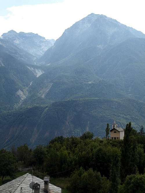
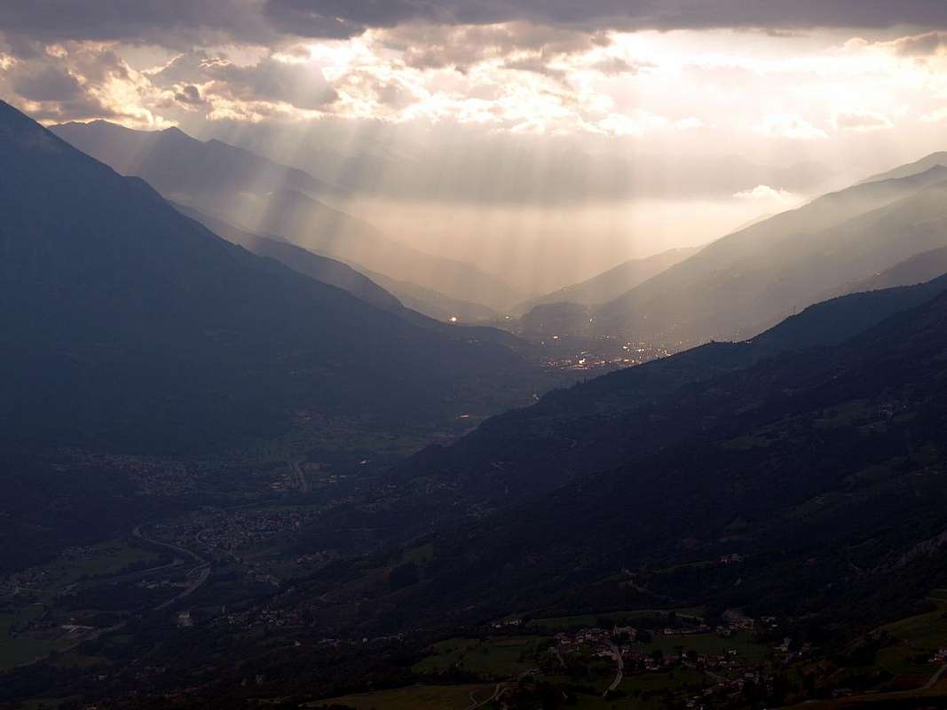
From Saint Denis to the Aosta Town or West
Equipment
Hiking gear or in winter with snowshoes.
Da Escursionismo oppure in inverno tramite Racchette da neve.
Campings
Remember that free camping is forbidden (except for emergency reasons, over 2.500m, from darkness until dawn).Mountain Condition
- Meteo: you can find all the needed informations at the official site of the Valle d'Aosta Region:
- Valle d'Aosta Meteo
Important Information
- REGIONE AUTONOMA VALLE D'AOSTA the official site.
- FONDAZIONE MONTAGNA SICURA Villa Cameron, località Villard de la Palud n° 1 Courmayeur (AO) Tel: 39 0165 897602 - Fax: 39 0165 897647.
- A.I.NE.VA. (Associazione Interregionale Neve e Valanghe).
Useful numbers
- Protezione Civile Valdostana località Aeroporto n° 7/A Saint Christophe (Ao) Tel. 0165-238222.
- Bollettino Meteo (weather info) Tel. 0165-44113.
- Unità Operativa di Soccorso Sanitario Tel. 118.