da Lovignana). This excursion is done by the Village of Lovignana (
; no entry for unauthorized means) and, following the main Clavalitè through the Pastures of Robbio, Maisonnasse, Bioley Damon, Crin, Beneyte and Meney, reaches Grand-Alpe
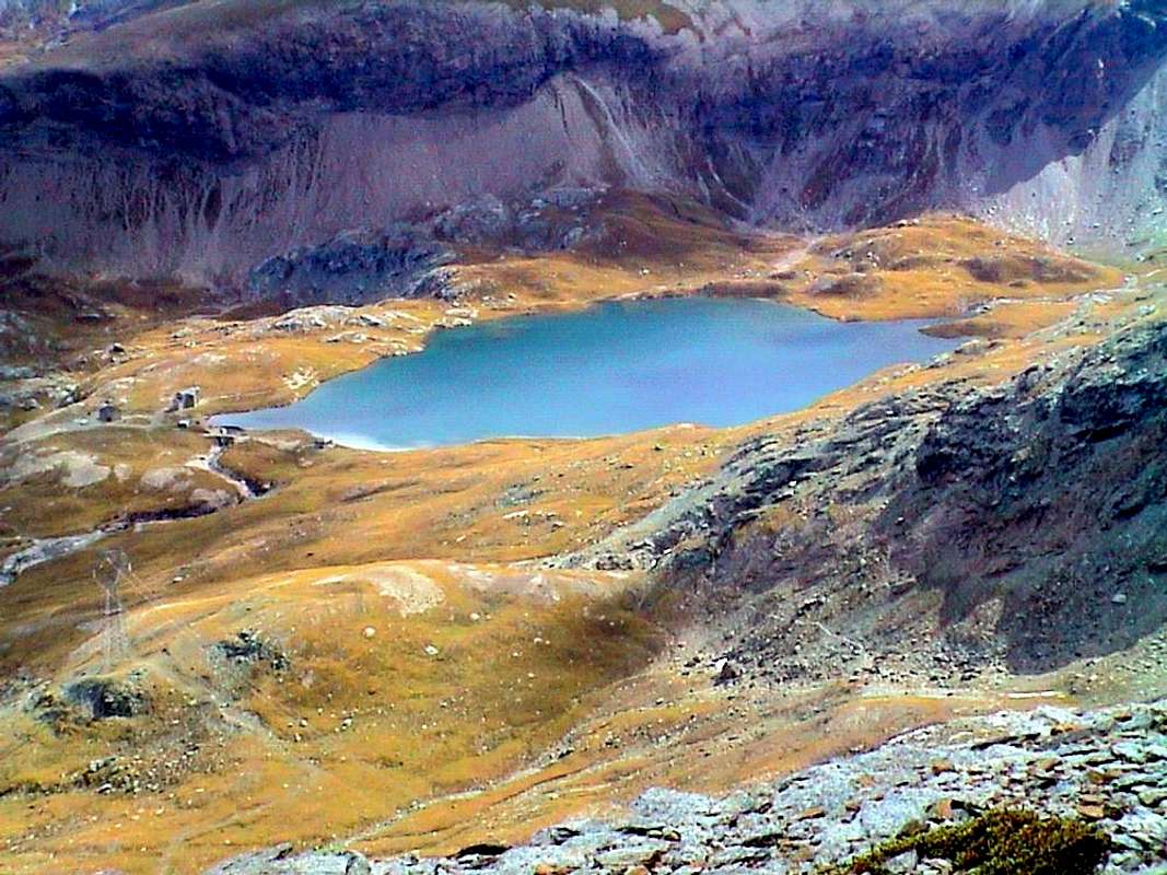
, reaches the lake. Possibility of achieving the same name Hill (
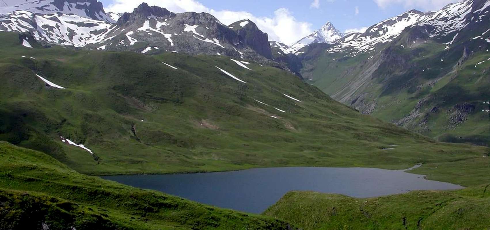
from the lake). Long hike that leads to two-thirds of the below valley, where it splits sending a branch in Southeast into the Savoney Walloon and the other to the South towards the High Comba Tersiva the foot of Punta Tersiva
. Already from Lake you see all the Top of the Valley of St. Marcel, excluding the two Towers of Tessonet.
da Les Druges Picnic Area). From the parking area continue after the first West then South with the private dirt road rounding the Mont Roux with the Mines of Chuc-Servette
; leaving at the top right of the Alp Praborna with manganese mines, you reach the House Hunting Mulàc-St. Louis (
; fountain with ibex wood). Also on the valley floor, passing through the Pastures of Plan Rué, Emonin Dessous and Dessus, Layet and namesake lake
, is reached, after leaving in Southeast deviation for Petite Chaux Alp, that of Grande Chaux, starting point for the Hills Terre Bleue, Tessonet, Coronas or St. Marcel
Note: With regard to the City of Aosta and surroundings has seen fit to give you only two views diametrically opposed, or from the North and from the South relative to the position of the City. In fact, in the work we have done up to here already widely spoken in this area that serves as a hinge. Also for what concerns the historical and cultural news is it limited the "digression" because for the same, which bears the date of construction by the Romans 25 BC, the same is not enough to list a whole book.
second the various departures).
towards the Rongachet Bridge up the Torrent de Comboé and nearby homonim Village
second departures on Regional Road towards Le Pointer, Les Gorres-St. Salò Villages or by the valley floor or Roulaz, Felina and Pont-Suaz).
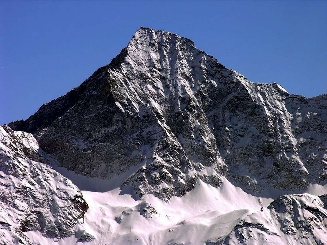
"Monte Emilius (3559m) above Aosta City", by Antonio
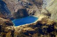
Bacino di Aosta
Nota: Per quanto concerne la Città di Aosta e dintorni s'é pensato bene di dar esclusivamente due punti di vista diametralmente opposti, cioé dal Nord e dal Sud; infatti nei lavori sin qui eseguiti abbiamo di già largamente parlato di questo settore fungente da cardine. Anche per quello che riguarda le notizie storico-culturali si é limitato l'
"excursus" poiché per la medesima, che porta la data di costruzione da parte dei Romani del 25 avanti Cristo, per elencarne le stesse non sarebbe stato sufficiente un intero libro.
Itinerario di Base n° 6: da Aosta
(583 m, 791 m) con il sentiero
n° 6, oppure dal bivio subito prima della Frazione di Senin
(791 m) ed ancora da quella di Porossan
(771 m), più ad Ovest, sempre con una variante del sentiero
n° 6 fino alla Quota Baden Powell
(792 m;
T; 0h'30/1h'15 a seconda dai vari punti di partenza).
Itinerario di Base n° 7: da Charvensod-Reverier Dessous (746m, 1042m) col sentiero n° 14/2A fino al Ponte di Rongachet sul Torrent Comboé ed al vicino omonimo Villaggio (1100 m; T; da 0h'40 fino a 2h'15 a seconda delle partenze sulla Strada Regionale per Pointer, Gorres-St. Salò o dal fondovalle cioé Roulaz, Felina e Pont-Suaz).
8)- Cinta di Mura Romane: iniziata un'approssimativa costruzione nel 41 a.C. come eredità del "Castrum" Romano da parte del Console Aulo Terenzio Varrone Murena per quella ch'era la "Roma delle Alpi", sulla via che da Eporedia (Ivrea) conduceva alla "Alpis Graja" (Piccolo San Bernardo). La cinta muraria con torri quadrate a due piani e quattro porte d'ingresso, ancora oggi esistente in discreto stato, porta la data del 23/25 a.C. Sull'allineamento dell'asse Sud/Nord, il "Cardo Maximus" conduceva al "Summus Poenninus" (Gran San Bernardo). La "Porta Praetoria" o Est, opposta alla "Decumana", formata da tre ingressi. A quella Sud statue in bronzo di Giulio Cesare e di Augusto, nonché monumento a Re Umberto I° presso la "Tour Pailleron"; nei vicini Giardini pubblici statue del Re Vittorio Emanuele II° in costume da caccia e del Dottor Laurent Cerise.
9)- Arco di Augusto: eretto nel 24/25 a.C ha un'arcata 8,89 metri ed é alto 11,50 metri, celebra la vittoria di Terenzio Varrone sul Popolo locale dei Salassi, fondatori con il loro Capo Cordelus nel 1158 a. C. dell'antica Città di Cordelia o Cordella. Sotto l'arco Crocefisso in legno del 1449 detto il "Saint-Voult o Saint-Voeu" (Santo Volto o Santo Voto).
10)- Teatro ed Anfiteatro Romano: la prima delle due costruzion con quattro piani nonché alta 22 metri ospitante fino a 4.000 spettatori, ancora esistente e di recente completamente restaurata; la seconda, terminata nel 729 d.C, era di forma ellittica (assi di 86.41 e 76.86 metri con arena d'asse maggiore di 60 metri e minore di 47 metri) per 20.000 spettatori con colonne con capitelli Dorici in marmo grigio di Aymavilles e 60 arcate, delle quali ne restan ormai sol alcune. Nel Medio Evo era denominato "Palatium rotundum". Inoltre resti d'un "Forum" del 11 a.C, due templi d'incerta datazione nonché un "Emporium" (granaio romano) lungo 30 metri e con una larghezza di 10.
11)- Ponte Romano: oltre ai vari acquedotti sul Buthier (Balteus pei Romani), rimane ancora un'arcata delle quattro esistenti del Ponte Romano sopra lo stesso; le continue inondazioni han fatto sì che il corso del torrente si sia naturalmente spostato più verso Ovest, ove esiste l'attuale ponte più vicino all'Arco, probabilmente allora raggiunto.
12)- Torri Medioevali e Chiese: dopo il passaggio dei Goti nel 410 d.C., tra la fine del IV° e l'inizio del V° secola la Città e la Valle iniziarono ad essere evangelizzate; subìto anche il dominio di Longobardi e Franchi, divenne parte del Regno di Borgogna, mentre nello XI° Secolo passò a Umberto di Biancamano col titolo di Conte. Nel 1302 diventò un Ducato della Savoia, ma i veri padroni erano i vari Vescovi nonché le potenti Famiglie Feudali dei Signori di Prez, Bard, Valeise e Challant. In questo enorme lasso di tempo furono costruiti torri e castelli un pò dappertutto ed ad Aosta e dintorni troviamo l'imponente e cilindrica "Torre di Bramafam" con il suo castello del XII° Secolo, abitato dai Conti di Challant, la "Torre dei Balivi o Torre dei Signori Palatio", sempre dello stesso secolo, che, dopo un'aggiunta del 1537, diventò prima Corte di Giustizia e poi dal 1702 prigione fino ad una trentina d'anni orsono, prima della recente ristrutturazione. Ancora, la famosa "Torre del Lebbroso", torre quadrata romana, rimaneggiata nel XII° secolo, che rinchiuse per 30 anni il lebbroso Bernardo Guasco con la sorella Maria Lucia; lo Storico Romantico Xavier de Maistre narrò la patetica vicenda in un celebre romanzo. Inoltre nei dintorni il "Castello di St. Christophe" con torre quadrata del XII° Secolo, attualmente di proprietà dei Conti Passerin d'Entrèves, il "Castello di Brissogne", eretto nel XIII° Secolo da Enrico di Quart, mentre nel vicino Comune di Sarre troviamo nell'antica sacrestia affreschi del medesimo secolo. Presso, Campanile dello XI° Secolo, mentre in località Chesalet uno del XII°. Sempre a riguardo delle antichità religiose rapidamente segnaliamo la "Cattedrale" d'Aosta dello XI° Secolo (ma recenti scavi archeologici mostran d'un esistenza antecedente) con due Campanili Romanici e le statue di Sant'Ansemo (poi Arcivescovo a Canterbury ov'é sepolto), San Giocondo, San Giovanni Battista, dell'Immacolata e di Sant'Orso; la forma attuale a tre navate risale tra il Quattrocento ed il Cinquecento. Inoltre vetrate colorate dei Secoli XV° e XVI° ed un Crocefisso in legno del '300, il più antico dell'intera Valle. Mosaici pavimentali del XII° con i "Quattro Fiumi del Paradiso" ed in quello superiore del XIII° il "Tigri e l'Eufrate"; ancora all'interno lo splendido Coro Gotico del 1469 con trenta stalli ed il monumento sepolcrale di Tommaso II° di Savoia di fine '300. La Cripta, con capitelli Longobardi e Carolingi, é del IX° Secolo, il Chiostro del XV° e nella "Sagrestia del Tesoro" troviamo un immagine dell'Imperatore Onorio con l'iscrizione 406. Dalla Piazza Centrale con il Municipio con forma neo-classica del 1839 ed uscendo dalla Porta Praetoria verso Oriente in direzione dell'Arco d'Augusto, arriviamo al Borgo di Sant'Orso con la sua omonima e Medioevale Chiesa, costruita sopra la primitiva Cattedrale d'Aosta; il suo enorme e squadrato Campanile in pietra (ricavata dalle mura) con stile Romanico, alto 46 metri, é del 1131. Di fronte si trova la "Collegiata" con facciata del '400 e portale Gotico, il tutto inserito in un Campanile preromanico; qui esisteva la Chiesetta di San Pietro, dove Sant'Orso effettuava Messa; importanti restauri furono effettuati con la cripta e le pitture sottotetto con Sant'Anselmo (1033-1109) Vescovo. Tra il 1468 ed il 1509 il Priore Giorgio di Challant arricchì la Chiesa, di tre navate con presbiterio ed abside con dipinti del '400, con il Coro di legno intagliato, opera di Jeninus Braye. Crocefisso ed altare sono del '700, mentre la statua in argento con le reliquie di Sant'Orso é del 1359. A fianco alla medesima trovasi un "Chiostro" rettangolare del 1133 con scene dell'Antico e del Nuovo Testamento; inoltre "Priorato di Sant'Orso", fatto costruire da Giorgio di Challant tra il 1494 ed il 1506. Chiesa antichissima quella di "Saint Etien o Santo Stefano" a Nord del Centro Città.
Cogne Valley
Basic Itinerary n° 8: from Gimillan Hamlet
(1788m) through the path
n° 3/TVC towards the Arpisson Alpage
(2328m;
E/F; 2h'00/2h'15). Beautiful excursion which, if desired, you can add the stretch of promenade from Cogne-Moline
(1539m), through the path
n° 6 passing through the Village of Miners and the next of Montroz
(1702m), reaches Gimillan or Dzimillan, in local parlance (
T; 0h'40). From Gimillan climb above the small Village of Pian di Teppe
(1923m) and then, advancing to the Northwest in the forest, to reach the small saddle
2317 metres; a short descent, crossed the Torrent Arpisson, leads to the eponymous mountain pasture, with great views of Gran Paradiso, Grivola and Grand Nomenon front, Cogne and fractions in low and Pic Garin behind. Ability to continue North to the bivouac Franco Nebbia
(2740m), Lake
(2854m) and Garin Hill
(2815m) to the Refuge Arbolle
(2516m); Northwest towards Col Tsa Setze
(2815m), gateway to the Pila Basin through the Walloon of Plan de l'Eyve (Water Tableland).
Basic Itinerary n° 9/9bis and other: "into the National Park Gran Paradiso" from Valnontey Hamlet
(1674m) with the path-muletrack
n° 18/Alta Via 2 up to the Lauson two Ponds
(2655m, 2636m) near Vittorio Sella Refuge
(2579m;
E/F; 3h'00/3h'30). From the bridge over the Torrent Grand Eyvia climb towards the Southwest through comodoa but dusty trail that, after passing the
"Botanical Garden Paradisia", reaches a waterfall in sight before Alp Troules
(2111m); from here a series of wide turns next to the Torrent Lauson leads to Refuge Vittorio Sella, placed on a green plateau and at the beginning of the path to the Colle Lauson or Lauzon. From the hut towards Southeast path
n° 18/TVC quickly reaches the small lakes in an area full of herds of ibex who come to man up to 3/4 metres. From these, wanting to continue, you can make the long journey that leads to the Herbetet Cottages (
2441m; detour to the
Bivouac Lucio and Lionello Leonessa;
2910m;
2h'00) and, again with magnificent panorama, with a descent diagonally with trail
n° 22C/TVC reach the Torrent de Valnontey to the head of the valley; the route
n° 22 along the same reports, from Pont des Erfaulets
(1826m) and from Alp Vermiana(z)
(1729m), in Valnontey closing a wonderful tour (
EE/F; 7/8h'00). Sella Hut also have the opportunity to do other trips in West or North:
Col Lauson (3296 m): from refuge continue West through the trail
n° 18/TVC/Alta Via 2 and by a short diagonal Southwest (exposed) to the hill (
E/F; 2h'00/2h'30).
Nera Pass (3509m): with previous itinerary, just above the Torrent of Lauson, towards the crossroads
2815 metres, after by the trail
n° 18C/TVC up to the fork
3094 metres and finally through traces, progressively more steep, into the stony ground with a small and enough easy rocky earthy gully in final part (
EE/A/F+; 2h'30/3h'00).
Rossa or Plan Tsalende Hill (3190m): from preceding alternative
3094 metres continue more North by the path
n° 18C/TVC easily up to the hill (
E/F; 1h'45/2h'15).
13)- Cogne, the ancient "Conia" Roman is famous for its fine and renowned iron ore (magnetite or loadstone), useful to form one of the best steel in the world (working in the Steel Mill Cogne in Aosta). The same, coming from the three lode mining "Larsinaz, Costa del Pino, Colonna" was transported to Piedmont by mule tracks and roads for carts via the Côte Piemont and through the various hills Arietta, Scaletta, Acque Rosse. Aosta until the Seventies, the date of closure of the mines, down through an underground railway tunnel from Monte Creya (3015m) until Eaux-Froides Village (1512m), under the Pila-Resort, and from there by cable car. The Factory instead is still functional today.
14)- At the entrance to the Val de Cogne, just after Aymavilles Common (splendid Castle fourteenth century, newly renovated, with four cylindrical towers and lacework; Saint-Lèger Church of the XI° Century, rebuilt in '700) is the Roman Bridge Pondel or Pont d' Ael; built by two Patricians settlers of Padua, "Aimus et Avilius", in 3 BC or during the 13th Consulate of Gaius Octavian Caesar Augustus is 50 metres long, 2.40 wide and 52 meters high above the Grand'Eyvia. At the interior flowed an aqueduct.
15)- In the next Village Vieyes (1132m) very very ancient Church dedicated to St. Grato with Bell Tower and frescoes in the front; erected at the Rectory in 1788 and in 1845.
16)- A Cogne, in the locality "Dessous Villa" Square Tower called "House of the Plague" with graffiti inside; during the plague of 1630 was in fact used for home quarantine.
17)- In Center, called "La Voella", Parish Church of 1202, with Bell Tower rebuilt in 1822 and the interior features Baroque with altars and polychrome statues and a beautiful Chorus of '600. But that was even older upward towards the Cret, in what was called the "Vieille Cogne", along the way "du Chemin des Morts", so still called nowadays.
18)- A Valnontey little Village (1678m) are from the year 1955 the "Alpine Garden Paradisia" with rare species as "Aethionema thomasianum", exclusive of this valley.
Valle di Cogne
Itinerario di Base n° 8: dal Villaggio di Gimillan (1788m) con il sentiero n° 3/TVC fino all'Alpe di Arpisson (2328 m; E/F; 2h'00/2h'15). Bell'escursione alla quale, volendo, si può aggiungere il tratto di passeggiata che da Cogne-Moline (1539 m), tramite il sentiero n° 6 che passa per il Villaggio dei Minatori ed il successivo di Montroz (1702 m), raggiunge Gimillan o Dzimillan, in gergo locale (T; 0h'40). Da Gimillan salire al soprastante Villaggetto di Pian di Teppe (1923 m) e poi, inoltrandosi a Nordovest nella foresta, raggiungere la selletta 2317 metri; una breve discesa, attraversato il Torrent Arpisson, conduce all'omonimo alpeggio, con grande vista su Gran Paradiso, Grivola e Grand Nomenon di fronte, Cogne e frazioni in basso ed il Pic Garin alle spalle. Possibilità di proseguire a Nord verso il Bivacco Franco Nebbia (2740 m), Lago (2854 m) e Col Garin (2815 m) verso il Rifugio di Arbolle (2516 m); a Nordovest verso il Col Tsa Setze (2815 m), porta di ingresso al Bacino di Pila tramite il sottostante Vallone di Plan de l'Eyve.
Itinerario di Base n° 9/9bis ed altri: "nel Parco Nazionale Gran Paradiso" dal Villaggio di Valnontey
(1674m) con il sentiero-mulattiera
n° 18/TVC/Alta Via 2 fino ai Laghetti del Lauson
(2655 m, 2636 m) presso il Rifugio Vittorio Sella
(2579 m;
E/F; 3h'00/3h'30). Dal ponte sopra il Torrent Grand'Eyvia salire verso Sudovest tramite la comoda ma polverosa mulattiera che, dopo avere oltrepassato il
"Giardino Botanico Paradisia", raggiunge una cascata in vista prima dell'Alpe Troules
(2111 m); da qui una serie di larghi tornanti a fianco del Torrent Lauson conduce al Rifugio Vittorio Sella, posto su di un verde altipiano ed allo inizio del sentiero per il Colle Lauson o Lauzon. Dal rifugio verso Sudest il sentiero
n° 18/TVC in breve tempo raggiunge i piccoli laghi in una zona ricca di branchi di stambecchi che si avvicinano allo uomo fino a 3/4 metri. Da questi, volendo continuare, si può effettuare la lunga traversata che conduce ai Casolari dello Herbetet (
2441 m; deviazione per il
Bivacco Lionello e Lucio Leonessa;
2910 m;
2h'00) e, sempre con magnifico panorama, con una discesa in diagonale con sentiero
n° 22C/TVC raggiungere il Torrent de Valnontey alla testata della valle; il sentiero
n° 22 lungo il corso del medesimo riporta, passando dal Pont des Erfaulets
(1826 m) e dall'Alpe Vermiana(z)
(1729 m), a Valnontey chiudendo uno splendido giro circolare (
EE/F; 7/8h'00). Inoltre dal Rifugio Sella, volendo allungare i percorsi, abbiamo l'opportunità di compiere altre belle escursioni verso Occidente e Settentrione. In breve vediamole:
Col Lauson (3296 m): proseguire ad Ovest con il sentiero
n° 18/TVC/Alta Via 2 e con un breve diagonale verso Sudovest (esposto) nel finale al colle (
E/F; 2h'00/2h'30).
Colle della Nera (3509 m): con il precedente itinerario, appena al di sopra del Torrent de Lauson, insino al bivio
2815 metri, quindi col sentiero
n° 18C/TVC sino al biforcazione
3094 metri ed infine per tracce, sempre più ripide, nella pietraia ed uscita tramite un abbastanza facile canalino roccioso con terriccio (
EE/A/F+; 2h'30/3h'00).
Colle della Rossa o di Plan Tsalende (3190 m): dal precedente bivio
3094 metri continuare più a Nord col sentiero
n° 18C/TVC facilmente sin al colle (
E/F; 1h'45/2h'15).
13)- Cogne, l'antica "Conia" dei Romani é famosa per il suo pregiato nonché rinomato minerale di ferro (magnetite), utile a formare uno dei migliori acciai nel mondo (lavorazione nella Acciaieria Cogne ad Aosta). Lo stesso, con provenienza dai tre filoni "Larsinaz, Costa del Pino, Colonna" veniva trasportato in Piemonte tramite mulattiere e strade carraie passando per la Côte Piemont ed i vari Colli della Arietta, Scaletta ed Acque Rosse. Ad Aosta fino agli anni Settanta, data della chiusura delle miniere, scendeva tramita una galleria sotterranea fino ad Eaux-Froides (1512 m), sotto la Stazione Turistica di Pila, e da qui tramite teleferica. La Fabbrica invece é funzionale ancora oggigiorno.
14)- All'ingresso della Val de Cogne, dopo Aymavilles (splendido Castello trecentesco, di recente completamente ristrutturato, con quattro torri cilindriche e merlettatura; Chiesa di St. Léger del Secolo XI°, ricostruita nel '700) si trova il Ponte Romano di Pondel o Pont d'Ael; costruito da due coloni Patrizi di Padova, "Aimus et Avilius", nel 3 avanti Cristo, cioé durante il 13° Consolato di Caio Ottaviano Cesare Augusto, é lungo 50 metri, largo 2,40 ed alto 52 metri sopra la Grand'Eyvia. All'interno scorreva un acquedotto.
15)- Nel successivo di Vieyes (1132 m) Chiesetta antichissima dedicata a San Grato con Campanile; affreschi nella facciata anteriore. Eretta a Rettoria nel 1788 e nel 1845.
16)- A Cogne, in località "Dessous Villa", Torre Quadrata detta "Casa della Peste" con graffitto interno; nella pestilenza del 1630 era infatti adibita dimora per la quarantena.
17)- Nel Centro, detto "La Vella", Chiesa Parrocchiale del 1202, con Campanile rifatto nel 1822 ed allo interno dotata di altari barocchi con statue policrome ed un bel Coro del '600. Ma quella ancora più antica stava sù al Cret, in quella che era detta "Vieille Cogne" e lungo la strada "du Chemin des Morts", così ancora denominata al giorno d'oggi.
18)- Al Villaggio di Valnontey (1678 m) troviamo dal 1955 il "Giardino Alpino Paradisia" con specie alquanto rare come "Aethionema thomasianum", esclusive della vallata.
Valsavarenche Valley
Basic Itinerary 10/10bis and ter: from Pont Valsavarenche
(1946m) through the path-mule track
n° 1 towards the Vittorio Emanuele II° Shelter
(2734m;
E/F; 2h'00/2h'30).
"Historical" excursion to one of the oldest refuges in the Aosta Valley, which in reality are two with the oldest stone, built in 1884, just above and the new one of 1932 in a small plain below. Da Pont, crossed the Torrent Savara on a large bridge at the wide parking in earth (panels, reports and cabin of Tourist Guides Valsavarenche), proceed south along the East bank of the same; reached unnamed alpage
1991 metres, the path, with greater slope, turned decidedly to the East and, after passing by the high Alp Chanté
(2372m), continuing on the eponymous torrent with a long diagonal to the refuge. The alternative to arrive at the foot of the Gran Paradiso
(4061m), but this time not from the Southwest but Northwest, is to go up to the most recent and
"wild" Refuge Federico and Renato Chabod
(2710m): from the junction
1829 metres, before of Praviou Dèsott on the Regional Road, leave the car in a small parking lot next to the Torrent Savara. After crossing over the bridge climb Eastward with the route
n° 5/5A/10A reaching the Alp Lavassey
(2194m). Left to the North deviation
n° 5A towards the Alp Montandayné
(2463m), continue East between Côte de Savatère and namesake Torrent reaching the refuge, at the foot of Becca Montandayné and across of the great Northwest Wall of
"Granpa". The other alternative is to go to visit the Chain of Gran Paradiso from a perspective completely opposite: a parking from West to take the route
n° 3/3A/3D, just behind the Hôtel
"Gran Paradiso", which comes in a small walloon topped by a beautiful waterfall; one last ramp leads to the Croix de la Roley
(+; 2313m), at the beginning of the Plan of Nivolé and across the whole
"Granpa" from the Gr. Nomenon and from this, to the Southwest, and the Denti (Jags) of Broglio the two Hills Gr. Etret. Wanting to continue and cross the long tableland (over 6 km.) Is reached, after the Alps Grand Collet Nivolet
(2409m, 2407m), Hôtel Savoia
(2533m) Refuge Città di Chivasso
(2600m) at the Nivolé Hill
(2633m). Three great tours to everyone.
19)- A Villeneuve (670m), entrance to the valley, the ruins of the "Châtel Argent", a name derived from the minting of coins; built in Century X°/XI° with the materials that came from the Roman road to Petit Saint Bernard and the demolition of an old bridge over the Baltea, belonged to Ugo il Giovane (Hugh the Young) Lords of Bard. Later it became the property of the Lords of St Pierre and in 1605 the two Lordships passed to Baron Leonardo Roncas; abandoned in the XVIII° Century to not pay the cost of restoration, the materials served to the residents on site for the reconstruction of the houses after a terrible hurricane. In this area there is the ancient cemetery over a remote necropolis with burials in a strange sitting position (5000/6000 years ago?), and that the oral tradition handed down also to hypothetical commercial-cultural links with Judea Bethlehem with the statement that St. Joseph was born in Villeneuve. Incidentally in the past the high "Via of the Alps" between Amsterdam and Venice passed right here.
20)- Between the Commons of St. Pierre and Villeneuve exists the "Tour Colin" XIII° Century, while the Parish of San Biagio (1782) is a reliquary in gilded copper enamel always part of the same century. Faced bronze in memory of the Abbot Petigat. The Old Church, accompanied by a beautiful Romanesque Bell Tower, is instead of 1400.
Valle di Valsavarenche
Itinerario di Base n° 10/10bis e ter: "Al Gran Paradiso" da Pont di Valsavarenche (1946m) con il sentiero-mulattiera n° 1 fino al Rifugio Vittorio Emanuele II° (2734 m; E/F; 2h'00/2h'30). "Storica" escursione ad uno dei più vecchi rifugi della Valle di Aosta, che poi in realtà son due con il più vecchio in pietra, costruito nel 1884, appena al di sopra e quello nuovo del 1932 in una piccola spianata sottostante. Da Pont, attraversato il Torrent Savara su d'un largo ponte presso l'esteso parcheggio in terra (pannelli, segnalazioni e Cabina Turistica delle Guide di Valsavarenche), procedere verso Sud lungo la sponda Orientale del medesimo; raggiunta l'alpe innominata 1991 metri, il sentiero, con maggiore pendenza, volge decisamente ad Est e, dopo aver superato dall'alto l'Alpe Chanté (2372 m), proseguendo sopra l'omonimo torrente con un lungo diagonale raggiunge il rifugio. L'alternativa per arrivare ai piedi del Gran Paradiso (4061 m), ma questa volta non da Sudovest bensì Nordovest, consiste nel salire al più recente e "selvaggio" Rifugio Federico e Renato Chabod (2710 m): dal bivio 1829 metri, prima di Praviou Dèsott sulla Strada Regionale, lasciare l'auto in un piccolo parcheggio a lato del Torrent Savara. Dopo aver attraversato sopra il ponte salire verso Est con il sentiero n° 5/5A/10A raggiungente l'Alpe di Lavassey (2194 m). Lasciata a Settentrione la deviazione n° 5A per l'Alpe di Montandayné (2463 m), continuare ad Oriente tra la Côte de Savatère e l'omonimo Torrent raggiungendo il rifugio, ai piedi della Becca di Montandayné e con di fronte la grande Parete Nordovest del "Granpa". L'altra alternativa consiste nell'andare a visitare la Catena del Gran Paradiso da un ottica completamente opposta: dal percheggio prendere ad Ovest il sentiero n° 3/3A/3D, subito appresso l'Hôtel "Gran Paradiso", che entra in un valloncello sormontato da una bella cascata; un'ultima rampa porta alla Croix de la Roley (+; 2313 m), all'inizio del Plan del Nivolé e con di fronte l'intera catena dal Grand Nomenon al "Granpa" e da questo, verso Sudovest, ai Denti del Broglio ed ai due Colli del Grand Etret. Continuando attraverso il lungo pianoro (oltre 6 Km.) si raggiungon, dopo le Alpi Grand Collet e Nivolet (2409 m, 2407 m), l'Albergo Savoia (2533 m) ed il Rifugio Città di Chivasso (2600 m) presso il Colle del Nivolé (2633 m). Tre splendide escursioni d'alta montagna alla portata di tutti.
19)- A Villeneuve (670 m), ingresso della valle, ruderi del "Châtel Argent", nome derivato dalla coniazione delle monete; costruito nel Secolo X°/XI° coi materiali romani provenienti dalla strada del Piccolo San Bernardo e dalla demolizione d'un vecchio ponte sulla Dora, apparteneva ad Ugo il Giovane dei Signori di Bard. Successivamente divenne proprietà dei Signori di St: Pierre e nel 1605 le due Signorie passarono al Barone Leonardo Roncas; abbandonato nel XVIII° Secolo per non sostenerne le spese di restauro, i materiali servirono agli abitanti in loco per la ricostruzione delle case dopo un terribile uragano. In quest'antica area sorge il cimitero sopra a remote necropoli con sepolture in alquanto strana posizione seduta (5.000/6.000 anni orsono?) e che la tradizione locale orale tramanda anche ad ipotetici collegamenti commerciali nonché culturali con la Giudea e Betlemme con l'affermazione che San Giuseppe fosse originario di Villeneuve. Daltronde nel passato l'alta "Via delle Alpi" tra Amsterdam e Venezia passava proprio da qui.
20)- Tra i Comuni di St. Pierre e Villeneuve esiste la "Tour Colin" del XIII° Secolo, mentre nella Parrocchiale di San Biagio (1782) si trova un reliquiario in rame dorato con smalti sempre appartenente allo stesso secolo. Di fronte bronzo in memoria dell'Abbé Petigat. La vecchia Chiesa, accompagnata da un bel Campanile Romanico, invece é del 1400.
The "High" Valley (Rhêmes Valgrisa Arpy La Thuile & Little St. Bernard)
Getting There
By car:
- From TORINO, MILANO, etc: Motorway A5. Exit at IVREA or Quincinetto (PIEDMONT) also Pont Saint Martin, Verrès, Chatillon, AOSTA East (Nus) and West (Aymavilles) Municipalities (AOSTA Valley).
From IVREA Town to Hône-Bard, Pont Bozet, Champorcher, Aymavilles, Villeneuve.
From Villeneuve to Rhêmes, from Leverogne to Valgrisa Valleys & from Morgex towards Arpy Basin
From Villeneuve (670m) to Rhêmes Valley: Introd (880m), Rhêmes Saint Georges (1171m), Notre Dame (1725m) Communes, through Regional Main Road, up to the Thumel Village (1887m) with Municipal Road and to Gian Federico Benevolo Refuge (2280m), through dirt farms road or underlying path.
From Villeneuve (620m), Martignon (823m), San Bernardo through dirt road in Southeast, towards Prorayé Alp to Upper Champlong in Poignon Walloon.
From Introd (873m), with Municipal or dirt road towards Buillet (1030m)/Biolay (1042m) small Villages to Montagne.
From Arvier (776m), with Regional Road, towards Crête, Verney, Petit Haury, Scierie, Grand Haury with Municipal Road, to Combes Basin.
From Avise-Runaz (786m), with Municipal Road, to forks 956, 998, 1115 metres, Marbrière Pasture, Faveroy Alp to Monte Colombo.
From Derby-Chez Les Gontiers (839m) Village, with short Municipal Road through path in South towards Créton (1523m), Dailley (1621m) Alpages. Through two parallel secondaries small paths, to fork 1823 metres with dirt road and Tillac Alp (1848m) to Faveroy Area.
From Morgex (920m), with Regional Road in South, towards Liarey, Pre Villair, Mont Rotie, alternative around 1275m just before Tirecagne Pasture (1532m), with dirt road in Southeast, towards Costablinaz de Meitin Pasture (1420m), after through path, towards Damon (1445m), Champex (1519m) Pastures, Plan Rançon Alp (2098m) to Becca Pouignenta Northern Area.
From Morgex (920m), crossing the bridge above Baltea with Regional Road in South, towards Liarey, Pre Villair, Mont Rotie small Villages, alternative around 1275m) just before Tirecagne Pasture (1532m) and the Main Roads to Arpy Basin.
From Pré Saint Didier to La Thuile & Little Saint Bernard Valleys
From Pré Saint Didier (1010m), with State Road, to La Thuile Valley: Elévaz, Balme Villages, La Thuile Commune, 1441m; from this to Little Saint Bernard Walloon towards the Little Saint Bernard Hill (2188m), through State Road. To Albert Deffeyes Refuge with muletrack from La Joux Fraction.
![]()
"From here the Valleys royally domains ... / Da qui regalmente domini le Valli ..."
It is not necessary to take Motorway A5: you can drive on State Road n° 26, in the direction of AOSTA - IVREA - TURIN.
By plane:
- Aeroporto Internazionale "Corrado Gex" Saint Christophe (Aosta)
Rhêmes Valley
Basic Itinerary 11 with three variants: from Thumel Village
(1887m), just after Pellaud Hamlet
(1811m), through the path
n° 13 or by the above private farm dirt road, passing through the Barmaverain Pastures
(2037m) just after the St. Pantaléon Chapel
(2010m), the Waterfalls
(2051m), Roman Bridge above the Doire of Rhêmes and Lavassey Alp
(2227m) towards the
Gian Federico Benevolo Refuge (2285m;
E/F; 1h'45/2h'15). From the shelter
triple chance to proceed to the next destinations:
a)- Southeast with the trail
n° 13B, towards the Nivoletta (in North from Basei Hill) and Basei (going to the East) Passes
(3130m, 3176m;
EE/F+; 2h'45/3h'15).
b)- In South-southwest, before through the path
n° 13C, before to the little Granta Parei Lake (
2576m;
E/F; 1h'15/1h'30); after, pahless but with small track on steep moraine, towards the overhanging Tsantelèina Loch below the East Wall of Granta Parei and at the foot of Sauches/Tsantelèina Glaciers (
2696m;
EE/F; 0h'30/0h'45).
c)- Southwest, by the path
n° 13D/HRG, towards the Lac de Golette
(2699m;
E/F; 1h'45/2h'15) and to the above Col Bassac Déré (
3082m;
E/F+; 1h'30/1h'45).
21)- For Introd (670m), in a characteristic narrow, high stone bridge before the dual inlet and at the junction between the Dora Valsavara and that of Rhêmes, "Castello" built in 1260 by Pietro Sarriod Bard then became Count Sarriod of Introd; cylindrical in shape with a central traditional square tower and a traditional Roman barn restored in the fifteenth Century with the big old kitchen with hood conical dome, that was used for cooking whole animals. Also on the walls of beautiful "quadrifore" (windows with four holes), while the central part of that is destroyed, along with the furniture and the archive, by fire around in the 1850s; was restored in 1910 by the Architect Chevalley.
22)- A Rhêmes-Saint-Georges on a promontory is the Church, built over a very old Chapel then rebuilt in the twelfth century and dedicated to St. George and transformed into Parish Church and Rectory in 1500; altars, gorgeous, are of 1700, while the beautiful painting on display on the wall of the right represents the death of St. Joseph.
23)- A Rhêmes-Notre-Dame Church with old "Campanile" with famous bells (the most blaring of the entire Valley of Aosta) and adjoining ancient Cemetery; front plate with epitaph for Casimire Thérisod, the first Alpine Guide of the Rhêmes Valley, with a dedication of the friend adventures with Giovanni Bobba of C.A.I. and even foreigners.
24)- Exists Seat of P.N.G.P. with small "Museum" addressed to visitors; the surface of the same, established in December of 1922 by Royal Decree, is 56,000 hectares, 200,000 with the mountainous part, and also holds the Cogne Valley, the Valsavarenche and part of Canavese in the North of the Torrent Orco (Valprato Soana, Ronco, Ribordone, Locana , Noasca and Ceresole Reale). Twinned since July 08th, 1972 with the adjacent Vanoise National Park, affects 13 Municipalities, including 7 in the Valley of Aosta (Aymavilles, Cogne, Villeneuve, Valsavarenche, Introd, Rhêmes-Saint-Georges and Rhêmes-Notre-Dame, on the side of Rhêmes only covers the Eastern sector.
Valle di Rhêmes
Itinerario di Base n° 11 con tre varianti: dal Villaggio di Thumel (1887m), dopo quello del Pellaud (1811 m), col sentiero n° 13 oppure con la soprastante strada poderale, passando dall'Alpe Barmaverain (2037 m) subito dopo la Cappella di St. Pantaléon (2010 m), le Cascate (2051 m), Ponte Romano al di sopra della Doire de Rhêmes e l'Alpe di Lavassey (2227 m) fino al Rifugio Gian Federico Benevolo (2285 m; E/F; 1h'45/2h'15). Dal rifugio triplice possibilità di proseguire verso successive mete:
a)- Verso Sudest, tramite il sentiero n° 13B, ai Colli di Nivoletta (a Nord del Col Basei) o, verso Oriente, al Colle Basei (3130 m, 3176 m; EE/F+; 2h'45/3h'15).
b)- Verso Sud-sudovest, per mezzo del sentiero n° 13C, dapprima al piccolo Lago della Granta Parei (2576 m; E/F; 1h'15/1h'30) e quindi, senza sentiero ma su d'un esile e ripida traccia, a quello superiore di Tsantelèina sotto la Parete Est della Granta Parei nonché ai piedi dei Ghiacciai di Sauches/Tsantelèina (2696 m; EE/F; 0h'30/0h'45).
c)- Verso Sudovest, con il sentiero n° 13D/HRG, al Lac de Golette (2699 m; E/F; 1h'45/2h'15) ed al soprastante Col Bassac Déré (3082 m); E/F+; 1h'30/1h'45).
21)- Ad Introd (670 m), presso un caratteristico stretto ed alto ponte in pietra prima del duplice ingresso ed alla congiunzione tra la Dora di Valsavara e quella di Rhêmes, "Castello" del 1260 costruito da Pietro Sarriod di Bard poi diventato Conte Sarriod di Introd. Di forma cilindrica con al centro la tradizionale torre quadrata e granaio romano restaurato nel XV° Secolo con la grande vecchia cucina con cappa a cupola conica, che serviva per la cottura di animali interi. Inoltre sulle mura di cinta splendide quadrifore, mentre la parte centrale del medesimo é andata distrutta, insieme ai mobili ed all'archivio, da un incendio intorno al 1850; venne restaurato nel 1910 dall'Architetto Chevalley.
22)- A Rhêmes-Saint-Georges su d'un promontorio si trova la Chiesa, costruita sopr'una antichissima Cappella poi ricostruita nel XII° Secolo e dedicata a San Giorgio e quindi trasformata in Parrocchiale e Rettoria nel 1500; gli altari, splendidi, son del 1700, mentre la bella tela esposta sul muro di destra rappresenta la morte di San Giuseppe.
23)- A Rhêmes-Notre-Dame Chiesa con vecchio Campanile con famose campane (le più squillanti dell'intera Val d'Aosta) ed attiguo antico Cimitero; di fronte targa-epitaffio per Casimire Thérisod, la prima Guida Alpina della Valle di Rhêmes, con dedica dell'amico alpinista Giovanni Bobba e compagni di avventure del C.A.I. ed anche stranieri.
24)- esiste sede del P.N.G.P. con piccolo "Museo" rivolto ai visitatori; la superficie del medesimo, inaugurato nel Dicembre del 1922, é di 56.000 ettari, 200.000 con la parte montana, e ricopre anche parte della Valle di Cogne, la Valsavarenche e del Canavese a Nord del Torrente Orco (Valprato Soana, Ronco, Ribordone, Locana, Noasca e Ceresole Reale). Gemellato dal Luglio 1972 con il Parco Nazionale della Vanoise, interessa 13 Comuni, tra i quali 7 in Val d'Aosta, sul lato di Rhêmes ricopre solo il settore Orientale.
Valgrisenche Valley
Basic Itinerary 12 with the variations 12bis and ter: from Valgrisenche-Surrier
(1785m) through the path
n° 12 along the Eastern shore of Doire de Valgrisenche, passing through the Alpages of Tsalé
(1931m) and immediately thereafter of Saxe Savoie
(2036m) towards
Mario Bezzi Shelter (2284m;
E/F; 2h'00/2h'30), at Vaudet Alp.
Two alternatives to continuation of the trail:
a)- Towards Southeast uo to the Col Bassac Déré
(3082m) through the path
n° 12C/HRG with a long diagonal way that, bypassing numerous small torrents now semi dried towards a rocky-grassy promontory and fletting more to the Southeast, reachs the same with a final stretch just steeper in the margin of the glacier(
EE/F+; 2h'30/3h'00).
b)- Towards Northwest to Vaudet Hill
(2836m) through the trail
n° 12D/12E that, reached the Torrent Grapillon within the namesake walloon and leaving right the deviation
n° 12E towards the Comba du Rocher Blanc, reach the hill (
E/F; 1h'45/2h'15). Unusual, beautiful views in front of the Mont Pourrì
(3779m), already on French (Tarentaise).
25)- Arvier (776m), or better from Li(e)verogne Fraction at the entrance in the Valgrisa, we reach, between big chestnut woods, beneath the rocky promontory with a view to the small Chapel of Rochefort. Reached the plateau of Ravoire (936m, small climbing wall) you get to the "Gorge des Grands Ezelles or Grands Escaliers" dominated by the grim and gloomy "Château de Montmaj (y) eur or Tour d'Arboe also Tour d'Haury" (1150m), famous for his dark and sinister legends of oral tradition since the XIII Century. The same only ruins remain of the cylindrical tower with lacework and the walls decadent and wrapped in a thick and wild forest, located immediately to the West of the Villages of Petit and Grand Haury (1081m, 1177m). From the first a small path through the dense vegetation reaches the remains of the castle that seems to "fall" in the Northwest.
26)- Shortly after, over the Village of Chamençon (1241m), you reach the deviation of the Regional Road Westward in the direction of the nearby Hamlet of Planaval (1580m), where the remains of the "Castle Planaval"; built by a local Country Gentleman in XIII° Century and which is now only a square tower in progressive unfailing ruin.
Valle di Valgrisenche
Itinerario di Base n° 12 con le varianti 12bis e ter: da Valgrisenche-Surrier (1785 m) con il sentiero n° 12 lungo la sponda Orientale della Doire de Valgrisenche, transitando per gli Alpeggi di Tsalé (1931 m) e l'immediatamente successivo di Saxe Savoie (2036 m) fino al Rifugio Mario Bezzi (2284 m;E/F; 2h'00/2h'30), all'Alpe Vaudet.
Due alternative di proseguimento di percorso:
a)- Verso Sud-sudest al Col Bassac Déré (3082 m) per mezzo del sentiero sentiero n° 12C/HRG con un lungo diagonale che, oltrepassati diversi solchi torrentizi semi prosciugati, dopo un promontorio erboso-roccioso e flettendo più a Sudest lo raggiunge con tratto finale appena più ripido a margine del ghiacciaio (EE/F+; 2h'30/3h'00).
b)- Verso Nordovest al Col Vaudet (2836 m) tramite il sentiero n° 12D/12E che, raggiunto il Torrent Grapillon all'interno dell'omonimo vallone e lasciata a destra la deviazione n° 12E per la Comba du Rocher Blanc, lo raggiunge (E/F; 1h'45/2h'15). Inusuali e belle vedute in fronte sul Mont Pourrì (3779 m), ormai in terra di Francia (Tarentaise).
25)- da Arvier (776 m), o meglio dalla Frazione di Li(e)verogne all'ingresso della Valgrisa, si giunge, tra grandi boschi di castagne, sotto il promontorio roccioso con in vista la piccola Cappella di Rochefort. Raggiunto il pianoro della Ravoire (936 m; piccola palestra di roccia) si arriva alla "Gola des Grands Ezelles o Grands Escaliers" dominata dallo arcigno e lugubre "Château de Montmaj(y)eur o Tour d'Arboé o Tour d'Haury" (1150 m), famoso per le sue oscure e sinistre leggende di tradizione orale sin dal XIII° Secolo. Dello stesso rimangono solo le rovine della torre cilindrica con merlettatura e mura ormai decadenti ed avvolte da fitta e selvaggia foresta, posta subito ad Occidente dei Villaggi di Petit e Grand Haury (1081 m, 1177 m). Dal primo un sentierucolo attraverso la densa vegetazione raggiunge i resti del Castello che par "precipitare" a Nordovest.
26)- Poco dopo, oltre il Villaggio di Chamençon (1241 m), si raggiunge la deviazione della Strada Regionale verso Ovest in direzione della vicina Frazione di Planaval (1580 m), ove permangono i resti del "Castello di Planaval"; costruito da un Signorotto locale nel XIII° Secolo e del quale rimane ormai soltanto torre squadrata in progressiva rovina.
Arpy Basin
Basic Itinerary 13 and variants 13bis and ter: from San Carlo Hill
(1971m), nearby the parking of Hôtel
"La Genzianella", through the path concomitant with the private dirt road
n° 15 towards the Arpy Loch
(2063m;
T; 0h'50/1h'10). You can vary the path extending to above Lake Pietra Rossa, or change it completely going up on the watershed opposite to the fortifications nearby the Hill of the Cross, at the foot of Crest North-northwest of Northern Summit Mont Colmet (signaled and partially equipped):
a)- Towards South-southeast Lake Pietra Rossa
(2553m) by means of the path
n° 15 with a trail on the right bank (West) of Lake Arpy that reached the following Plan d'Arpy, turn to the East next to a beautiful waterfall, reaching a plateau above. From here two possibilities:
1)- climb directly through the easy
"Via Ferrata" coming out at the outlet on the West bank (
EEA/F+; 1h'30);
2)- or with wider around Southeast towards the Northern Mont Colmet reach the lake at its end South
(EE/F+; 1h'50/2h'10).
b)- By dirt road to Arpy Lake to the fork
2050 metres around after St. Maurice and then Southwest towards Hill of the Cross
(2381m) with route
n° 16 (E/F; 1h'40).
27)- A Morgex, the ancient Roman "Moracium", "Castle Archet" built by Noble Lords Archet, in which the Savoy held their "General Audiences".
Bacino di Arpy
Itinerario di Base n° 13 con le varianti 13bis e ter: dal Colle San Carlo (1971 m), presso l'Hôtel "La Genzianella", con il sentiero concomitante con la poderale n° 15 fino al Lago d'Arpy con passeggiata del tutto Turistica (attenzione in inverno) (2063 m; T; 0h'50/1h'10). Si può variare il percorso prolungandolo fino al soprastante Lago di Pietra Rossa, oppure cambiarlo del tutto salendo sullo spartiacque opposto verso le fortificazioni del Colle della Croce, ai piedi dell'attrezzata Cresta Nord-nordovest del Mont Colmet:
a)- Verso Sud-sudest al Lago di Pietra Rossa (2553 m) per mezzo del sentiero n° 15 con un percorso sulla sponda destra (Ovest) del Lago d'Arpy che, raggiunto il Plan d'Arpy, volta ad Est a fianco d'una bella cascata, raggiungendo un pianoro. Da qui due possibilità: 1)- salire direttamente tramite la facile "Via Ferrata" uscendo presso l'emissario sulla sponda Ovest (EEA/F+; 1h'30); 2)- oppure con più largo giro a Sudest verso il Mont Colmet Settentrionale raggiungere il lago all'estremità Sud (EE/F+; 1h'50/2h'10).
b)- Con la poderale pel Lago d'Arpy fino al bivio 2050 metri circa dopo St. Maurice e quindi verso Sudovest al Colle della Croce (2381 m) col sentiero n° 16 (E/F; 1h'40).
27)- A Morgex, l'antica "Moracium" romana, "Castello d'Archet" costruito dai Nobili Signori Archet, nel quale i Savoia tenevano le loro "Udienze Generali".
La Thuile Valley
Basic Itinerary 14: from La Thuile-La Joux
(1624m) with the path-mule
n° 3/Alta Via 2 towards the Albert Deffeyes Shelter
(2500m;
E/F; 3h'00/3h'15).
28)- La Thuile, the "Ariolica" Roman, was until about fifty years ago important center mining for coal mining, which fed the "Steelworks Cogne" of Aosta.
29)- The construction of the parish is 800, dedicated to the worship of San Defendente, Protector avalanche; the current Church, dedicated to St. Nicholas, is of 1732 and in 1794 underwent a fire caused by French troops. The great Crucifix on the lintel, which was saved from the same, while on the outside wall plaque exists for Count Girolamo Ricci of Andonno, Commander of the Grenadiers and died in La Thuile after the Battle of Traverset in June 1793. At the entrance of the Valley there "Ravine Pré St. Didier".
Valle di La Thuile
Itinerario di Base n° 14: da La Thuile-La Joux (1624m) con il sentiero-mulattiera n° 3/Alta Via 2 fino al Rifugio Albert Deffeyes (2500 m; E/F; 3h'00/3h'15).
28)- La Thuile, l'"Ariolica" romana, era fino ad una cinquantina di anni orsono importante centro minerario per l'estrazione del carbone, che alimentava le "Acciaierie Cogne".
29)- La costruzione della Parrocchia é del '800, dedicata al culto di San Defendente, Protettore dalle valanghe; l'attuale Chiesa, dedicata a San Nicola, é del 1732 e nel 1794 subì un incendio provocato dalle truppe francesi. Di notevole il Crocefisso sull'architrave, che si salvò dal medesimo, mentre sul muro esterno esiste lapide per il Conte Gerolamo Ricci d'Andonno, Comandante dei granatieri e morto a La Thuile dopo la Battaglia del Traverset nel Giugno 1793. All'ingresso della Valle esiste l'"Orrido di Pré St. Didier".
Little Saint Bernard Vallon
Basic Itinerary 15: Pont Serrand
(1635m) with the trail
n° 9 towards Lower Verney Lake
(2088m) and up to the Little Saint Bernard Pass
(2185m;
T/E/F; 2h'15/2'30). Or is even along stretches of the
"Old Salassians Route", which basically coincides with the path and, through the Plan Abondance, reaches the
"Roman Mansio" on the hill.
30)- Pont-Serrand (1635m; fountain), first and last village between La Thuile and the Little St. Bernard Pass, there's oldest bridge across the Valley of Aosta, on the Torrent de Verney (from the homonym loch). The same holds significant value "historic" being used "ab immemorabilis" in the passage between Italy and France. A "Roman Road", which traces remain considerable and is still viable, salt reaching the same who was known to the fall of the Empire as "Columnae Jovis" and constituted the "Alpis Graia" (in honor of Consul Ercole Graio) on "Via of Gaul". In addition to the hill there is a "Mansio Romana" useful in the shelter of men and horses, who were staying there even in winter up to 313 AD ( Edict of Constantine) with replacing of "Milites" with the Priests; 700-943 (invasion of the Saracens up to the 990) were supervised by "Benedictine Fathers", who departed after the destruction of the "Chapel", built in 448 by St. Germanus of Auxerre. Then he fell into the hands of "Banditry" with robbers who robbed and killed travelers, so to the Great St. Bernard. Bernard of Mentone that belonged to the Canons of the Cathedral of Aosta, along with an expedition by volunteers, released in 1039 both hills of this scourge, sharing personally to "clean-up", after which began the design and construction of the two "Hospices". The project was completed in 1040 for the Little and in 1049 for the Great, but in 1113, on the insistence of the Bishop of Aosta Boson II°, the property was donated to the Canons of Verrès, due to the cessation of the monastic life of the first and interest on rents by the second. With St. Peter II°, Bishop of the Diocese of Tarentaise, the traffic to the hill shooting regularly, indeed increased considerably, but being insufficient space, the same thought it well to erect another Hospice with larger spaces and receptiveness in full French territory at 1 Km. from the hill and 28 Km. from Bourg St. Maurice. This decision by its construction marked the demolition of the first, which took place in 1145. In 1170 it was divided and made autonomous from the Convent of Verrès by order of the Counts of Savoy; intervention confirmed in 1221 by Pope Honorius III°. In 1176 the Bishop of Ivrea gave to the Hospice the Church of St. Eusebius in Feletto, while in 1227 were donated the annuities of other four churches of the Tarentaise as well as those of Arvier at the "Gouffre" of St. Nicolas, followed in 1245 by that of La Thuile with the sale of all goods from Pré St. Didier at Bourg St. Maurice in exchange of the Churches of Arvier and Feletto. In later times the Spanish troops demolished the Chapel stealing everything in September 1587, while in July 1691 the French, retreating from the Valley of Aosta, destroyed almost the entire Hospice. In 1864 a road was opened on the French side, while in 1873 it was built the Italian until it joins on the hill. Is crossed by many Military Leaders, including Hannibal, Julius Caesar, Gundikar, Godfrey of Boglione, Duke Carlo Emanuele I°, by Prince Thomas of Savoy and others, as well as by the Emperors Vitellius, Septimius Severus and Caligula and also from San Pietro II°, Tarentaise's Bishop in 1444. In this connection is reported the "Circle of Hannibal", the popular tradition have been built by General Carthaginian: in reality it is a "Cromlech" consists of forty blocks shaped tip, places with a range that ranges from 2 to 4 metres in a circular arrangement; is dated back to "Bronze Age" and, most likely, had functions of worship and ritual. In France there are in fact the ruins of the "Sanctuary of Jupiter", dedicated to the ancient god of the Greeks and Romans, while the name of San Bernardo is only since 1881 with "Domus Sancti Bernardi Montis Jovis", but the name is hard to take root if true that in 1466 is still named as the Priory Columnae Jovis Pass, who in 1500, in order to differentiate itself from the Great St. Bernard, became Mont Jouvet, with the French fashion and with due respect for all as it happens in the mid '800 from the first "Guide Murray" with distinction between Little and Great. But the real character of the Hill remains him, the Abbot Pierre Chanoux, mountaineer, botanist, writer, poet and Rector of the Hospice through a half Century, where he died on February 9, 1909, after being born in Champorcher April 3 1828.A he must the creation of the "Astronomical Observatory" and "Chanousia Garden", destroyed in the last war and now restored as "Chanousia Jardin Botanique". From September 6th, 1964 a statue on his grave near the hill handed down the memory, in the small Chapel, in practice a miserable cave where he loved to take refuge and live. Currently the pass, closed in winter for almost six months because of the big snow, still has many transits, but more for tourism that commercial; after the opening of the Mont Blanc Tunnel in fact the traffic has taken that direction. As had happened in 1560, when the same had been intentionally diverted to the Mont Cenis with transfer, decided by Prince Emanuele Filiberto, the Capital of Savoy from Chambery to Turin with consequent collapse of the economy throughout the Valley of Aosta.
Vallone del Piccolo San Bernardo
Itinerario di Base n° 15: da Pont Serrand (1635 m) con il sentiero n° 9 fino al Lago Verney (2088 m) ed al Colle del Piccolo San Bernardo (2185 m; T/E/F; 2h'15/2'30). Oppure risulta anche percorrere tratti della "Antica Strada sei Salassi" che in pratica coincide con il sentiero e, attraversando il Plan Abondance, raggiunge la "Mansio" al colle.
30)- A Pont-Serrand, primo ed ultimo villaggetto tra La Thuile ed il Colle del Piccolo San Bernardo, esiste il ponte più antico di tutta la Valle di Aosta, sopra il Torrent de Verney; lo stesso possiede un notevole valore "storico" essendo stato utilizzato "ab immemorabilis" nel passaggio tra l'Italia e la Francia. Una "Strada Romana", della quale rimangono notevoli tracce ed é tutt'ora percorribile, sale raggiungendo il medesimo che era conosciuto alla caduta dell'Impero come "Columnae Jovis" e costituiva l'"Alpis Graia" (in onore del Console Ercole Graio) sulla "Via delle Gallie". Inoltre al colle troviamo una "Mansio Romana" utile al riparo di uomini e cavalli, che lì soggiornavano anche in inverno fino al 313 d.C /Editto di Costantino) con sostutuzione dei "Milites" con i Sacerdoti; dal 700 al 943 (invasione dei Saraceni fino al 990) furono vigilati dai "Padri Benedettini", che si allontanarono con la distruzione della "Cappella" eretta nel 448 da San Germano di Auxerre. Poi cadde in mano al "Brigantaggio" coi predoni che derubavano ed uccidevano i viandanti, come al Passo del Gran San Bernardo. Bernardo di Mentone che apparteneva a Canonici della Cattedrale di Aosta, insieme ad una spedizione divolontari, nel 1039 liberò entrambi i colli da questo flagello, pertecipando personalmente al "repulisti", dopo di che diede inizio alla progettazione e costruzione dei due "Ospizi". I lavori terminarono nel 1040 per il Piccolo e nel 1049 per il Grande, ma nel 1113, su insistenze del Vescovo di Aosta Bosone II°, la proprietà fù devoluta ai Canonici di Verrès, causa la cessazione dalla vita monastica dei primi e per interessi sulle rendite del secondo. Con San Pietro II°, Vescovo della Diocesi di Tarentaise, il traffico al colle riprese regolarmente, anzi s'incrementò notevolmente, ma, essendo insufficiente lo spazio, lo stesso pensò bene di erigere un altro Ospizio con più grandi spazi nonché ricettibilità in completo territorio francese ad 1 Km. dal colle ed a 28 Km. da Bourg St. Maurice. Questa decisione con relativa costruzione segnò la demolizione del primo, avvenuta nel 1145. Nel 1170 venne diviso e reso autonomo dal Convento di Verrès per ordine dei Conti di Savoia; intervento confermato nel 1221 da parte del Papa Onorio III°. Nel 1176 il Vescovo d'Ivrea diede all'Ospizio la Chiesa di San Eusebio a Feletto, mentre nel 1227 furono donate le rendite di altre quattro Chiese della Tarentaise nonché quelle di Arvier presso il "Gouffre" di St. Nicolas, seguite nel 1245 da quella di La Thuile con la cessione di tutti i beni da Pré St. Didier a Bourg St. Maurice in cambio delle Chiese d'Arvier e Feletto. Nei tempi successivi truppe Spagnole demolirono la Cappella rubando tutto nel Settembre 1587, mentre nel Luglio del 1691 i Francesi, in ritirata dalla Valle di Aosta, distrussero quasi del tutto l'Ospizio. Nel 1864 venne aperta una strada sul versante francese, mentre nel 1873 fu costruita quella italiana fino alla congiunzione sul colle. Risulta attraversato da molti Condottieri, tra i quali Annibale, Giulio Cesare, Gundikar, Goffredo di Buglione, il Duca Carlo Emanuele I°, dal Principe Tommaso di Savoia ed altri, nonché dagli Imperatori Vitellio, Settimo Severo e Caligola e pure da San Pietro II°, Vescovo di Tarantasia, nel 1444. A tal proposito viene segnalato il "Cerchio di Annibale", che la tradizione popolare vuol essere stato costruito dal Generale Cartaginese: in realtà trattasi d'un "Cromlech" formato da una quarantina di blocchi a forma di punta, posti con un intervallo variante da 2 a 4 metri in una disposizione circolare; é databile all'"Età del Bronzo" e, molto probabilmente, aveva funzioni di culto e rituali. In territorio francese esiston infatti le rovine del Santuario di Giove", dedicato all'antico dio dei Greci e dei Romani, mentre il nome di San Bernardo appare solo dal 1881 con "Domus Sancti Bernardi Montis Jovis", ma il toponimo fatica ad attecchire se é vero che nel 1466 viene ancor nominato come Colle del Priorato Columnae Jovis; nel 1500, onde differenziarlo dal Gran San Bernardo, divenne Mont Jouvet, alla francese e con buona pace per tutti. Come avviene a metà '800 dalla prima "Guida Murray" con distinzione tra Little e Great. Ma il vero personaggio del Colle rimane lui, l'Abbé Pierre Chanoux, alpinista, botanico, letterato, poeta e Rettore dell'Ospizio per mezzo Secolo, dove morì il 9 Febbraio 1909, dopo essere nato in Champorcher il 3 Aprile 1828.A lui si deve la creazione di "Osservatorio Astronomico e Chanousia", questa distrutta nell'ultima guerra ed oggi ripristinata come "Chanousia Jardin Botanique". Dal 1964 una statua sulla sua tomba al colle ne tramanda la memoria, in una Cappelletta, in pratica una miserabile spelonca, ove amava rifugiarsi e vivere. Attualmente il valico, chiuso in inverno per quasi sei mesi, registra ancora numerosi transiti, ma più a scopo turistico che commerciale; dopo l'apertura del Tunnel del Monte Bianco infatti il traffico ha preso quella direzione. Come era accaduto nel 1560, quando il medesimo era stato volutamente dirottato verso il Moncenisio con trasferimento, deciso da Emanuele Filiberto, della Capitale Savoiarda da Chambery a Torino con conseguente crollo dell'economia per tutta la Val d'Aosta.
Comments
No comments posted yet.