
|
|
Mountain/Rock |
|---|---|
|
|
39.79537°N / 119.76691°W |
|
|
Washoe |
|
|
Hiking, Scrambling |
|
|
Spring, Fall, Winter |
|
|
6032 ft / 1839 m |
|
|
Overview
Warm Springs Mountain is located 15 miles southwest of Pyramid Lake in Washoe County. It got its name from the various warm springs in the vicinity of the mountain which is located in Warm Springs Valley.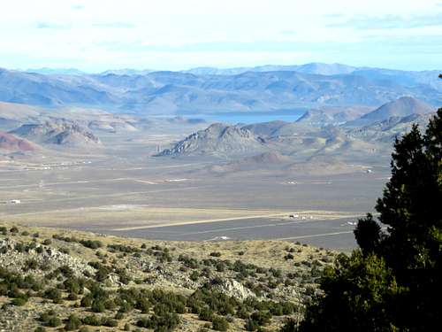
Pyramid Lake from the summit
Standing only 6,032’ high, it isn’t a major mountain overall, but is high enough to provide for sweeping views of the surrounding landscape and prominent enough to provide for a decent day hike during cold weather months. It has a prominence of over 700’.
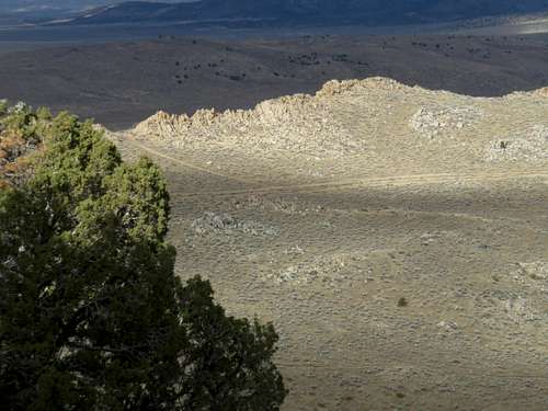
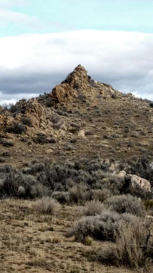
One of the attractions of Warm Springs Mountain is actually the rocky ridge going north from the summit. Numerous rock formations can be scrambled in a long loop that can be accessed via the summit road. This loop adds only about 2 miles total to the western approach and is well worth it. It is also the best descent route from the eastern approach.
Sawteeth formation on the rocky ridge
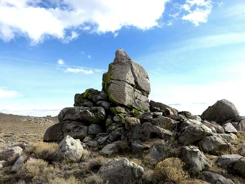
From the summit, you will see the nearby Dogskin Mountains with its two summits 7,464' and 7,486'. The base of the Dogskin Mountains is not far from the parking area in the east. Further north on Winnemucca Ranch Road is the Moon Rocks, a popular tourist destination. Frankly, the rocks along the rocky ridge are just as cool as the Moon Rocks.
Warm Springs Mountain is best approached from the west or the east. The western approach being the shortest, but the eastern approach more scenic given you can approach via a nice canyon from the east or over the rocky ridge to the northeast. Warm Springs Mountain is easily accessible from either approach. The mountain is located 25 miles north of Reno, Nevada.
Warm Springs Mountain is best hiked during late fall, winter, or early spring, as long as isn’t too muddy or snow covered. Snow cover is periodic, usually during December, January, and February.
Getting There
This page will discuss the primary approaches to the summit, from the west and from the east. A longer, less scenic approach is available from the south via Big Dog Road, but is not recommended.The west approach is the shortest. You can drive to the summit from the west, but a good starting point is to park at the end of Prospect Hill Road, and hike 2 ½ miles up the summit road. Prospect Hill Road is where the well maintained dirt road ends, so it is a good spot to park for 2WD cars.
To get there from Reno, NV take US 395 North to Red Rock Road and take for a little over 7 miles to Antelope Valley Road. Take a right on Antelope Valley Road and continue on the well graded dirt road for 9 miles. Then take a right and follow another dirt road for just under a mile and park at 39.816, -119.79060. This is about 45 minutes from downtown Reno.
From the east take I-80 to the Pyramid Highway and follow past Spanish Springs for 9 miles to Winnemucca Ranch Road. Drive north for about 4 miles. You will see Two Forty Road on your right. Just past it is the turn-off for the road to public lands. Follow past the sign to a parking area located at roughly 39.8242, -119.718. This is about 35 minutes from downtown Reno.
Route
From the west, head southeast on the road towards the mountain for about 1 ¾ miles. You reach a crest, and then a lesser dirt road descends to the summit road. You can take the summit road around, but it is three times as long. Once back on the main road via the shortcut, the summit is only about ½ mile away. The total one-way distance to the summit is just about 2.5 miles with an elevation gain of about 820’. You can add on the a loop around the rocky ridge for a 7 mile round trip hike.From the east, there are multiple options. The best way is probably a loop via the canyon on the way up and the rocky ridge on the descent. I will explain this route as it identifies both primary routes from the east, although there are a few ways to get there.
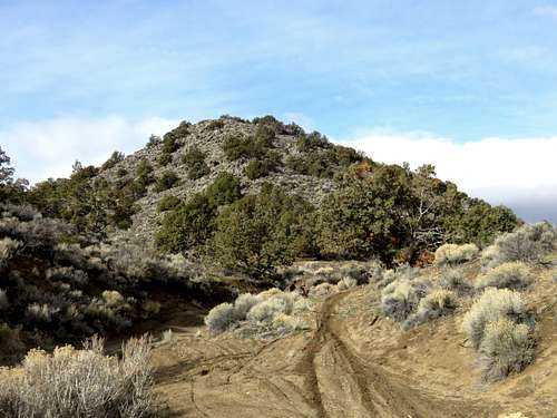
At the trailhead parking, there is a road going directly south. It later curves to the base of a ridge. It reaches the base of the ridge in about 1.3 miles. Take the steep hill up the ridge, gaining 450’ in less than half a mile. At the top of the ridge, another road descends on the left side (south) to a power line road. Take this road as it descends over 100’ to the power line road. Take the power line road for about ½ mile and there is a good spot to drop into the canyon. Once in the canyon, take it for nearly a mile until you reach a Y Junction. I recommend taking the left trail from the Y Junction which is a fun steep trail leading up the south side of Warm Springs Mountain.
The Y Junction
Once you reach a point on the trail where you can see the electric tower, get off the trail and head to the tower. From the parking area it is about 4.5 miles to the summit with an elevation gain of roughly 2,050’.
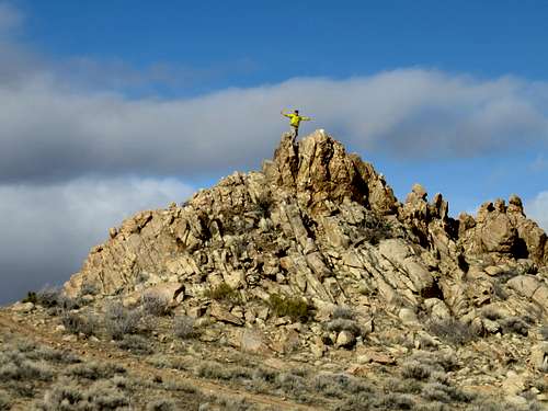
To descend, take the main road west past the electric tower and head towards a road below on the rocky ridge. Take the road below the rocky ridge as it heads north. This is a good spot to do some rock scrambling. There are lots of fun Class 2/Class 3 little scrambles along the way. Eventually you reach a rock pile at the edge of the ridge. Get off the main road to reach it. On the other side of it on the right is a road on the north side of the ridge that heads east. Take this road which descends back to the valley.
On top of sawtooth formation
Pyramid rock along the rocky ridge
Cool rock formation along the road
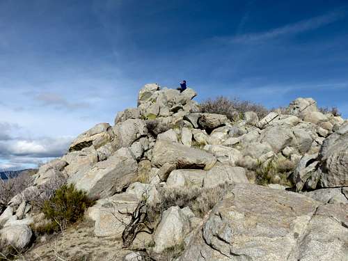
Rocky summit on north edge of rocky ridge
The round trip distance is about 9 ¼ miles for this loop.