Where does the Ayasse down to the Dora Baltea

Where does the Ayasse down to the Dora Baltea

Page Type Page Type: Trip Report
Location Lat/Lon: 45.59748°N / 7.54221°E
Date Date Climbed/Hiked: Jun 26, 2016
Activities Activities: Hiking, Mountaineering, Trad Climbing, Sport Climbing, Toprope, Bouldering, Ice Climbing, Aid Climbing, Big Wall, Mixed, Scrambling, Via Ferrata, Canyoneering, Skiing
Seasons Season: Spring, Summer, Fall, Winter

Pouring Overview Ayasse

All pictures of this torrential page are by Emilio Bertona aka emilius, Antonio Giani aka Antonio, marco87 & Osw.


Ayasse, the most important waterway in Champorcher Valley, as Grand'Eyvia in Val de Cogne are torrents oblique and not perpendicular to the course of Baltea.
A "revenue" of wild waters that collects, in addition to the main streams that we see below, a cluster of secondary torrents often broken into by beautiful waterfalls in splendid race shows above vertiginous rock faces. These courses aqcua form a crown around Champorcher and its villages starting from the North with the small valleys of Val d'Amont/Arcomy/Vernouille/Val Peuson/Raty/Giasset and Gelé continue in the West with the Pontonnet and Finestra at the border with the Urtier and "close" to the South with Miserin, Bantse, Larìs, Vercoche, Legna, Manda and Brenve. In addition to these many other streams flowing into small secondary valleys that then are inserted on the main mentioned above, where often the name is unknown or forgotten for a long time and often reminded almost exclusively by the old inhabitants of the territory. Or not reported correctly toponymically from various topographic maps in vogue, even here, as a bit for all the valleys. This opens up a whole series of questions, including the origin of the same.
But amongst all streams wherein it originates the main or Ayasse that, passing through Champorcher and Pontboset, reaches between Hone & Bard the Baltea?


L'Ayasse, corso d'acqua più importante nella Valle di Champorcher, come la Grand'Eyvia a Cogne son torrenti obliqui e non perpendicolari al corso della Baltea.
Un "gettito" d'acque selvagge che raccoglie, oltre ai torrenti principali che vediamo qui sotto, un nugolo di rivi secondari spesso interrotti nella loro corsa da belle cascate in splendida mostra sopra a vertiginose pareti rocciose. Questi corsi d'acqua formano corona circondante Champorcher e villaggi iniziando da Nord con i Valloni di Val d'Amont/Arcomy/Vernouille/Val Peuson/Raty/Giasset e Gelé per continuare ad Occidente con il Pontonnet e Finestra al confine con l'Urtier e "chiudere" a Sud con Miserin, Bantse, Larìs, Vercoche, Legna, Manda e Brenve. Oltre a questi molti altri scorrono in valloncelli secondari andando poi ad inserirsi sui principali sopra citati, dove spesso il nome risulta sconosciuto oppure dimenticato ormai da molto tempo e spesso ricordato quasi esclusivamente dai vecchi abitanti del territorio. O non riportato in modo toponomasticamente corretto dalle mappe cartografiche, anche qui, come succede un pò dovunque in tutte le vallate. Si apre così tutta una serie di interrogativi, compresa la provenienza dei medesimi.
Ma tra tutti questi torrenti dove si origina quello principale o Torrent Ayasse che, passando Champorcher e Pontboset, raggiunge tra Hône e Bard la Dora Baltea?


The torrents and streams begin when "die" glaciers, giving form to any hint of life with their fresh and still unspoiled waters, as willed by the Mother Nature.
The same quench the Mountaineer and Hikers returning from the goal achieved by giving him a first signal of peace, safety and contentment. After so much hard work ...

I torrenti iniziano là dove "muoiono" i ghiacciai, dando forma a qualsiasi spunto di vita con l'acque fresche ed ancora incontaminate, come sol in Madre Natura.
Le stesse dissetano l'Alpinista e l'Escursionista al rientro dalla meta raggiunta donandogli un primo segnale di riposo, sicurezza ed appagamento. Dopo tante dure fatiche ...


After all together down to the middle course of Baltea coming from Glacier and Rosa dei Banchi to the Communes Champorcher Pontboset & Hône. Then to Po.
But many of them by scrolling lose their identity, especially in the higher or original parts, falling almost into oblivion and, passing to another life by the old mountain inhabitant, they become totally unknown for new generations. For this reason, organizing research trips, it is important to go to their progressive sistematic rediscovery ...


Tutti insieme giù verso il corso centrale della Dora arrivando dal Glacier e dalla Rosa dei Banchi fino ai Comuni di Champorcher, Pont - Bozet ed Hône. Poi al Po.
Ma molti di loro scorrendo perdono la propria identità, soprattutto nelle parti più elevate od originarie, cadendo quasi del tutto nel dimenticatoio e, passando ad altra vita da parte dei vecchi montanari, diventano del tutto sconosciuti per le nuove generazioni. Per sto motivo, organizzando dei viaggi di ricerca, é bene andare alla loro riscoperta ...


Getting There from Bard towards Pontboset & Champorcher-Chardonney-Dondena

By car:

  • From TORINO, MILANO, etc: Motorway A5. Exit at IVREA or Quincinetto (PIEDMONT)

    From IVREA Town: in West (Northern side) towards Pont Saint Martin, Donnas, Bard, Arnad, Bard and Hône Municipalities.

    From Courmayeur Resort: in East and in Norhern side respect to Baltea towards: Morgex, La Salle, Saint Pierre, Sarre, Aosta, Saint Chistophe; Quart, Nus, Chambave, Verrayes, Saint Denis, Châtillon, Saint Vincent, Bard and Hône.


    Southeastern, Southern and Southwestern Sides:

    From Hône-Bard towards Pontboset, Champorcher, Chardonney and Dondena

    From Hône-Bard towards Pont Bozet (775m) and from this to Champorcher Valley: a)- (Château 1427m), Petit, Grand Mont Blanc, La Cort Villages, towards Dondena Village (2092m), Dondena & Miserin Refuges, through Royal Road and dirt roads; Barbustel Refuge, through Royal Road and path towards Champdepraz Vallon. Or b)- continue West on valley floor reaching the Hamlets of Chardonney (1455m), Ronchas (1464m), nearby the same and just to the North, after the Cascade of Echellettes.


  • From FRANCE: through the Mont Blanc Tunnel to Entrèves-crossroads to Vény/Ferret Valleys - Mountain Guides of Courmayeur - La Saxe Rock Gym - Courmayeur. By Little Saint Bernard Pass, closed since November until half May to La Thuile Valley - Pré Saint Didier - Courmayeur.

  • From FRANCE: through the Mont Blanc Tunnel to Entrèves-crossroads to Vény/Ferret Valleys - Mountain Guides of Courmayeur - La Saxe Rock Gym - Courmayeur. By Little Saint Bernard Pass, closed since November until half May to La Thuile Valley - Pré Saint Didier - Courmayeur.

    It is not necessary to take Motorway A5: you can drive on State Road n° 26, in the direction of AOSTA - IVREA - TURIN.


By plane:
  • Aeroporto Internazionale "Corrado Gex" Saint Christophe (Aosta)


You have to go down and look further ...


Punta dell Asgelas
Monte Rascias
Punta dell Asgelas
Punta dell Asgelas
Punta dell Asgelas


So where does this Torrent Ayasse. Everyone says between the Rosa dei Banchi (3164m) and Lake Miserin (2577m). Almost true, but not entirely accurate.
If you ask the question to this gentleman above, who lives in Champorcher behind the Tower-Castle and the Church, he knows accurately answer:
"He was born at the foot of the Rosa dei Banchi, where her namesake glacier die every day "freeing" large slabs of dark, polished rock that, with some lake wedged between them, form the source of the Torrent de la Roèse. But it is not yet Ayasse. It also springs in the adjacent Miserin Vallon, where at the foot of Punta dell'Asgelas, among the Hills of the Rose and Balma, eyeing the tiny Lac Gelé (2767m), below which originate a dozen small torrents that, after forming a delta flow into Miserin Lake, just below the Mont Rasciàs (2783m). From this and towards the North down the Torrent Miserin to the Royal Route Dondena where it meets the Ayasse". As he met the Ayasse? But then it is already born? "Yes but by another" mom ", from a source that originates from the Lacs Noir, Blanc, Pontonnet, between the Fenêtre de Champorcher and Col Pontonnet. Others say the lakes under the Col Moussaillon, from Lac Gelé under Mont Glacier and also from Lacs Giasset, Raty, Vernoille, Muffé. But they are fools and they make just a big mess. Do not believe them, they want only to confuse the people, that they do not know where to go. Staying well away from the other side lakes, ie Larissa, Vercoche, Mulère, Chilet, Cornouy, Chenessy, Vassoline, Noir, Champas, Sec, Dondogna. So they do not go fishing, even if that side is already the distance with hours of march towards making selection. There, in old times, was his friend Antonio, that of St. Christophe, but when he was young, then for a long long time we have not seen him go ... ".
Thank you Lord for his total precision. But where does Ayasse? "Montanari" are a real open book. They tell you everything and you do not they say anything ...

Near Chardonney Ayasse Torrent towards Baltea 2016
Heaven ... Echellettes Cascade above Chardonney 2016
Pastures of ...  /1 Echellettes Fall below Bec Raty 2016
Ayasse from Chardonney towards Champorcher 2016
Vertiginous Ayasse nearby Chardonney Village 2016


Ma allora dove nasce questo Torrent Ayasse. Tutti dicono tra la Rosa dei Banchi (3164 m) ed il Lago Miserin (2577 m). Quasi vero, ma non del tutto preciso.
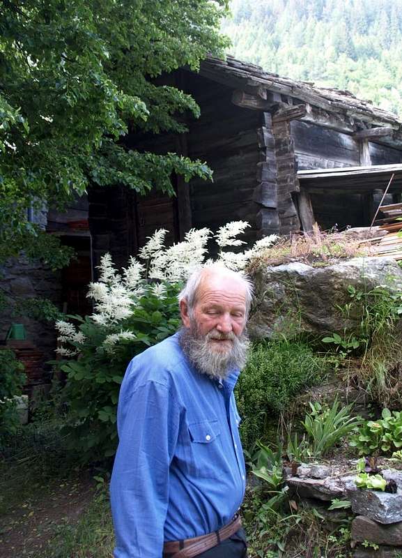
Se fate la domanda a questo signore qui sopra, che abita a Champorcher dietro la Torre-Castello e la Chiesa, vi sà rispondere con precisione:
"Nasce ai piedi della Rosa dei Banchi, là dove il suo omonimo ghiacciaio muore ogni giorno di più "liberando" grandi lastroni di roccia scura e levigata che, con qualche laghetto incastrato tra gli stessi, origina il Torrent de la Roèse. Ma non é ancora Ayasse. Nasce anche nell'attiguo Vallone del Miserin, dove ai piedi della Punta dell'Asgelas, tra i Colli della Rosa e della Balma, occhieggia il minuscolo Lac Gelé (2767 m), al di sotto del quale si originano una dozzina di torrentelli che, dopo aver costituito un delta, sfociano nel Lago Miserin, appena al di sotto del Mont Rasciàs (2783 m). Da questo e verso Settentrione scende il Torrent Miserin fino alla Strada Reale di Dondena dove incontra l'Ayasse". Come dove incontra l'Ayasse? Ma allora é già nato? "Si da un'altra "mamma", da una fonte che si origina ai Lacs Noir, Blanc, Pontonnet, tra la Fenêtre de Champorcher ed il Col Pontonnet. Altri dicono dai laghetti sotto il Col Moussaillon, dal Lac Gelé sotto il Mont Glacier ed anche dai Lacs Giasset, Raty, Vernoille, Muffé. Ma son dei balordi e fan sol un gran casino. Non credeteci, voglion confonder gente, che non sà più dove andare. Restando lontana anche dai laghi dell'altra parte, cioé Larìssa, Vercoche, Mulère, Chilet, Cornouy, Chenessy, Vassoline, Noir, Champas, Sec e Dondogna. Così non van a pescare, anche se da quella parte é già la distanza con ore di marcia d'avvicinamento a far selezione. Lì, 'na volta, andava il suo amico Antonio, quello di St. Christophe ma quand'era giovane, perché da un bel pò di tempo non s'é più visto ...".
La ringrazio Signore per la sua somma precisione. Ma dove nasce l'Ayasse? Questi Montanari sono un vero libro aperto. Ti dicono tutto e non ti dicon niente ...


Pont Bozet grazed & lapped by Ayasse Torrent  2016
Temple ... Ayasse Torrent by Miserin to Pontboset 2016
Re Tempio just above Pont - Bozet or Pontboset 2016
Plan of the Work Ayasse arriving near Pontboset 2016
Pontboset Hamlet suspended over the Ayasse 2016


Whole course of Ayasse is fascinating already from the bottom with a series of small dizzying streams that, in front of Mount Charvatton and dense forests, to attract the dispute of Canyoneering, as in the next Vallone del Rio Fer which flows to Outrefer, including Bard and Donnas, however, now out of the Ayasse area. This area is between the 
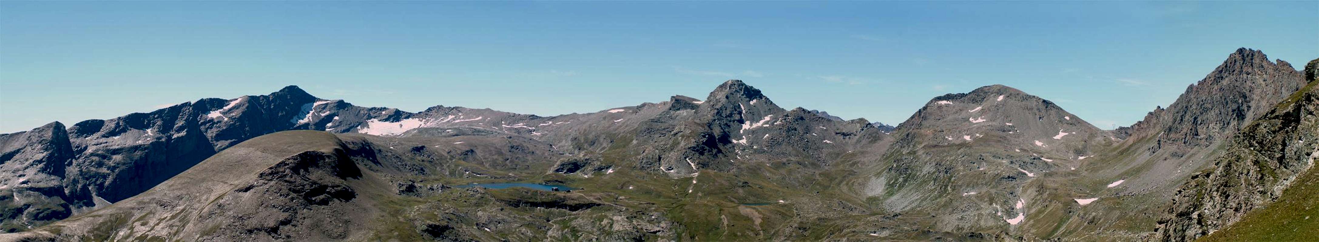
Testa (Head) Tome (1694m), the Bec Saint Jean (1847m), Cima Cocor (2142 m), the Mont Pussuy (2218m) and the 
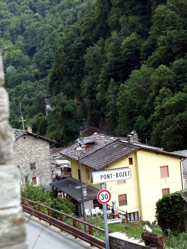
Mombrignon (2360m) before reaching Pont Bozet, famous for the "Gorge of Ratus" below the Crest and to the Sanctuary of Re temple along the Torrent Brenve. Then goes up until 
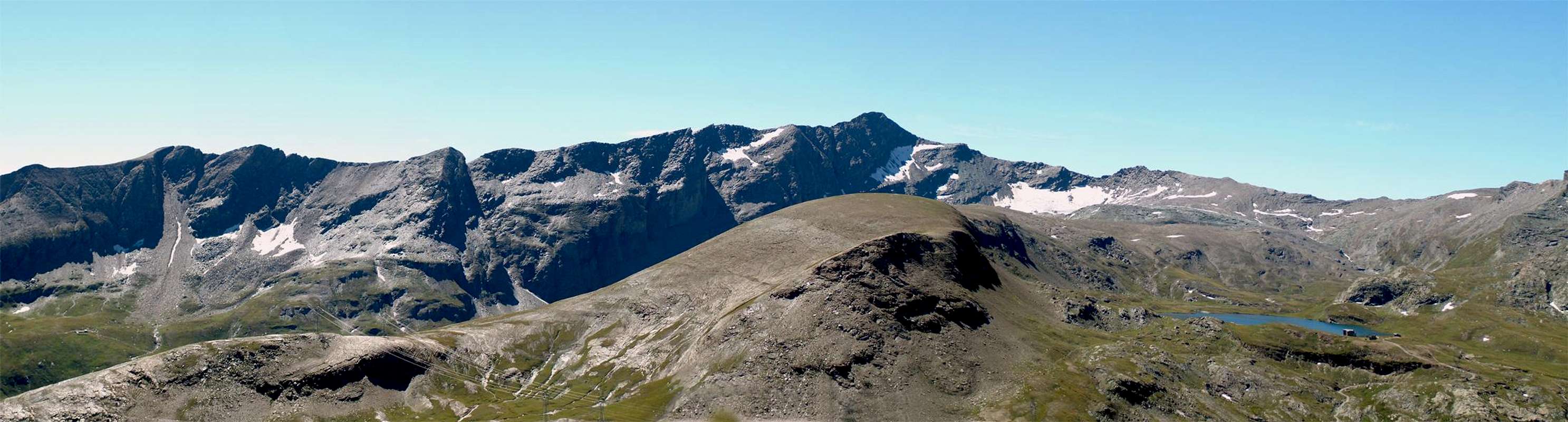
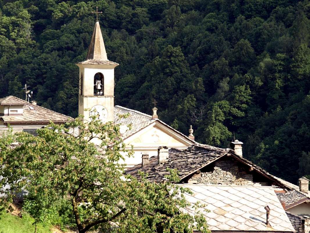
Chaporcher-Chateau (1427m) Chief-town of the entire Valley. More in High, after the wild Echellettes's Waterfall into a cliffs above the Village of Chardonney, stretches the "Toio" Royal Road to Dondena reaching the homonymous refuge placed at the slopes Bec Pendant in the Vallone dei Banchi and at the start of the private road for Miserin, Lake, Shelter and Sanctuary.
If you want to follow Ayasse, you choose which branch. But if you are not convinced to locate the source, climbs Tersiva, such as "Roby". Made your control ...


Ayasse Torrent near Pontboset to Dora Baltea 2016
Torrent Ayasse from Champorcher to Pontboset 2016
Pontboset ... Ancient bridge to  Ratus Gorge  2016
Ayasse Torrent near Pont - Bozet Municipality 2016
Pont Bozet bridges on Ayasse Torrent to  Ratus  2016


Tutto il corso dell'Ayasse risulta affascinante già partendo dal basso con una serie di torrentelli vertiginosi che, di fronte al Monte Charvatton ed in dense foreste, attraggono per la disputa del Canyoneering, come nel successivo Vallone del Rio Fer che sfocia ad Outrefer, tra Bard e Donnas, ormai però fuori della zona dell'Ayasse medesimo. Quest'area é compresa tra la Testa Tomé (1694 m), il Bec Saint Jean (1847 m), la Cima Cocor (2142 m), il Mont Pussuy (2218 m) ed il Mombrignon (2360 m) prima di arrivare a Pont - Bozet, famoso per l'"Orrido del Ratus" sottostante al Crest ed al Santuario di Re tempio lungo il corso del Torrent Brenve. Poi si risale a Champorcher-Château (1427m), Capoluogo dell'intera valle. Più in alto, dopo la Cascata dell'Echellettes soprastante il Villaggio di Chardonney, s'allunga la Strada Reale per Dondena raggiungendo l'omonimo rifugio posto ai piedi del Bec Pendant nel Vallone dei Banchi ed alla partenza della poderale per il Miserin con Lago, Rifugio e Santuario.
Se volete seguire l'Ayasse, scegliete voi qual ramo prendere. Ma se non siete convinti d'individuar la sorgente, salite come fà il "Roby" alla Tersiva e controllate ...


Comments

Post a Comment
Viewing: 1-2 of 2

adriespo - Dec 28, 2017 11:59 am - Voted 10/10

Bello!

Molto bello questo articolo, e anche utile per chi come me ha intenzione di farsi dei giretti da quelle parti!

OsvaldoCardellina

OsvaldoCardellina - Dec 28, 2017 12:34 pm - Hasn't voted

Ayasse

OK opseirda,
CIAO TURIN & GRAZIE!
osv

Viewing: 1-2 of 2