

SawtoothSean - Feb 9, 2007 12:29 am - Voted 10/10
NiceReally good overview map

Super Dave - Feb 10, 2007 1:35 am - Hasn't voted
Re: NiceThanks Sean. The most time consuming part of putting together the list was panning around in TOPO and calculating what did and did not meet the 300' criteria. The map is a nice by-product of that exercise.
SawtoothSean - Feb 10, 2007 1:58 am - Voted 10/10
Re: NiceHave you ever used Maptech's Terrain Navigator? That's what I use, and what I like best about it is they use real USGS quads (1:24000 and 1:100000) digitized. The down side is it's fairly expensive.
Super Dave - Feb 10, 2007 11:02 pm - Hasn't voted
Re: NiceNope, never tried that one. I got TOPO from a friend, and liked it from the start. It has 5 zoom levels, the tightest three of them being 500k, 100k, and 7.5'. The 7.5' is the USGS quad, so probably similar capabilities the one you mention in that respect, but likely much more basic than yours.
SawtoothSean - Feb 11, 2007 1:05 am - Voted 10/10
Re: NiceTOPO does a better job with overview maps than Terrain Navigator does, from what I've seen. Each has it's strengths and weaknesses. The last I saw TOPO at USGS quad level, it was a representation of it (it's not the original digitized USGS quad)- is that still the case? Ideally, I could use both (TOPO for Range overviews and Terrain Nav for traced routes etc.), but I'd rather spend the money on climbing equipment!
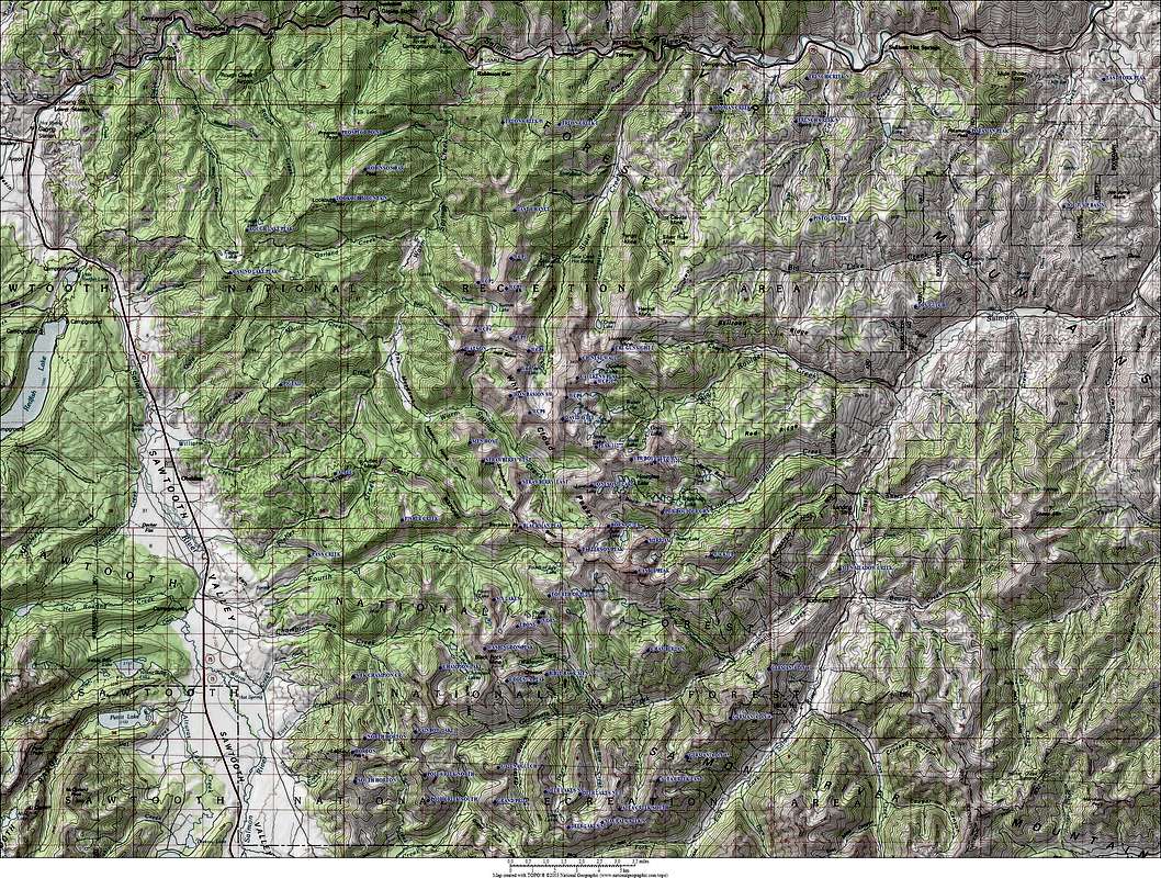
Super Dave - Feb 11, 2007 3:17 am - Hasn't voted
Re: NiceI think its the actual quad. Here's an example.
SawtoothSean - Feb 11, 2007 3:43 am - Voted 10/10
Re: NiceThat looks to be a digitized actual quad, so TOPO has improved since my last viewing of the product (2000). I used to work as a Geographer / GIS guy, so I was up on those types of things a few years back.


Comments
Post a Comment