
|
|
Mountain/Rock |
|---|---|
|
|
37.60722°N / 112.90222°W |
|
|
Iron |
|
|
Hiking, Scrambling |
|
|
Spring, Summer, Fall, Winter |
|
|
9416 ft / 2870 m |
|
|
Overview
Wood Knoll is a wooded summit on the north side of the Cedar Canyon road about 10 miles to the southeast of downtown Cedar City, Utah. Although it stands 9,416 feet above sea level and has a prominence of 315', it is inconspicuous compared with surrounding mountains that stand higher and are more impressive.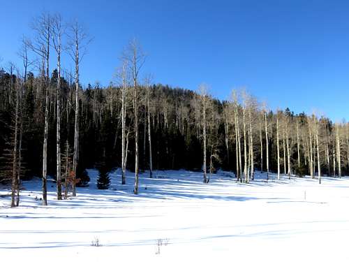
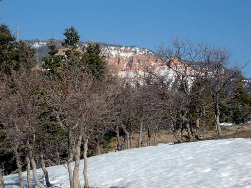
Wood Knoll from the Crystal Springs trailhead meadow
Wood Knoll is rather accessible from Cedar City. Also, for a high-elevation summit, it is relatively close to the Cedar Canyon road. The summit can be reached within 30 minutes walk via the shortest route. This is good for a workout or warm-up hike if you are spending time in Cedar City, and want a taste of the canyon, but aren't able to take in the whole area. The summit rises above the Crystal Springs Trailhead and the road to Wood Knoll can also be used to reach Blowhard Mountain 10,700', which is about 2.5 miles hike from the start of the road and 2 miles hike from the Crystal Springs Trailhead; albeit pretty steep. If wanting to reach the Crystal Springs Trailhead, a 4WD is recommended to head up the road for about 3/4 miles. The trailhead is at 8,986'. But you wouldn't hike Wood Knoll from here and if you wanted to hike Blowhard Mountain it is best to park 1/2 mile up the access road near the transmission lines.
If just hiking Wood Knoll, a more scenic hike is available starting at the Southern Utah University Mountain Center, which is described in more detail below.
Fall is the best time to hike Wood Knoll due to the beautiful colors. In summer, it can get very hot, even at this elevation. In the early springtime, during snowmelt, the mountain gets very muddy. Creeks cut through the mountain and drain into the creek below. For this reason, it is not the best idea to follow the creek up the mountain if you hike during the early springtime. Therefore the best months to hike here are early October through the end of November, late April through late May.
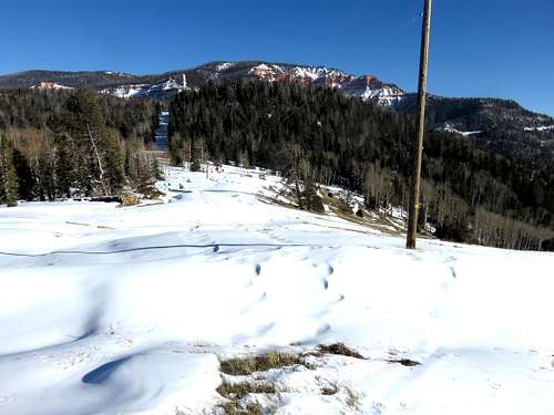
The route to Blowhard Mountain - January 2015
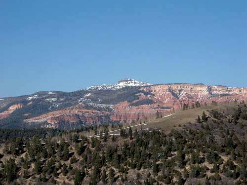
Brian's Head Peak 11,307 from the ridge - April 2008
Getting There
From Cedar City, get onto Route 14, which is the road up the Cedar Canyon. Take the road as it heads towards Cedar Breaks. For the shortest route, head past MP 13 where the road switchbacks. There is a turn off heading north up the slope of Wood Knoll after the first major switchback (less than 1/2 mile past it). Park there at about 8,830'.A longer, more scenic route can be done from the Southern Utah University Mountain Center. This is about 10 miles up the road and there is a building on the right and you may park your car here, on the dirt lot, which has room for about 10 cars. The parking lot is at 8,040 feet.
Route Information
For the shorter route, simply head of the dirt road for a little over 1/2 mile. A lesser road on the left heads directly towards the summit of Wood Knoll (while a steep road on the right leads towards Blowhard Mountain). The road roughly follows power lines heading to the left from the main road. The road peters out, and you need to enter the woods and continue up. But eventually you come out of the woods and the slope is open as it heads towards the summit. 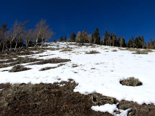
Heading up the slope to the summit
The final 100 yards and 45' to the summit is all in thick woods. There is no summit marker, but it is clear what is the highest ground. The elevation gain is only about 600' with 1.5 miles of distance to the summit.
From SUU Mountain Center, cross the Cedar Canyon road where a dirt jeep road heads back in the direction of Cedar City. You can either take the road all the way around, or take one of the faint use trails that emanates from the road. If you take the road all the way around, you will end up in a meadow, with a large cut in the middle. Walk up the left-hand side of the large cut until you reach an easy cross over point. At this point, there are a few faint trails (mostly animal trails) heading up the mountain. At some points you can bushwhack up the trail rather easily. The problem is that during snowmelt, water runs through the open dirt that could otherwise be used as a trail. In this case, the ground is muddy, and difficult to traverse. In this case, you can still bushwhack.
View of Blowhard Mountain 10,700' while walking up the mountain from SUU.
From the cut in the middle, there are ridges on either side. Both lead to Wood Knoll. If you take one of the side trails from the road, you can follow a few trails up to these ridges.
Bring a map with you to guide your route, but it is pretty straightforward, since you are heading east. If you take the road all the way around and then up to either ridge, it is about 3 3/4 miles to the summit, gaining about 1,450'. You can cut it down to less than 2 miles to the summit with some bushwhacking straight up to the southern ridge from the start of the road, instead of going all the way around. But I recommend the longer route for the scenery.
Red Tape
There are no permits or restrictions to climb Wood Knoll. Just park your car and hike up the road. When there is heavy snow, the Cedar Canyon Road may be closed.Nearby Attractions
As you can probably tell, Wood Knoll is not the main attraction in this part of Utah. Okay, it isn't an attraction at all. However, there are a number key attractions nearby.Further up Cedar Canyon is the Cedar Breaks National Monument.
More Information can be found here and here
Brian's Head Peak is another attraction. It is the highest mountain in Iron County, and a gorgeous summit that is easy to reach.
More information can be found here
Further south of Cedar City is Zion National Park.
More Information can be found here and here