Toggle navigation
Mountains
Routes
Images
Trip Reports
Forum
What's New
People
Areas & Ranges
Articles
Trailheads
Canyons
Huts & Campgrounds
Albums
Logistical Centers
Fact Sheets
Lists
Custom Objects
Gear
Plans & Partners
WELCOME TO SUMMITPOST
SIGN IN
REGISTER
Charleston Peak
Additional Parents
Image
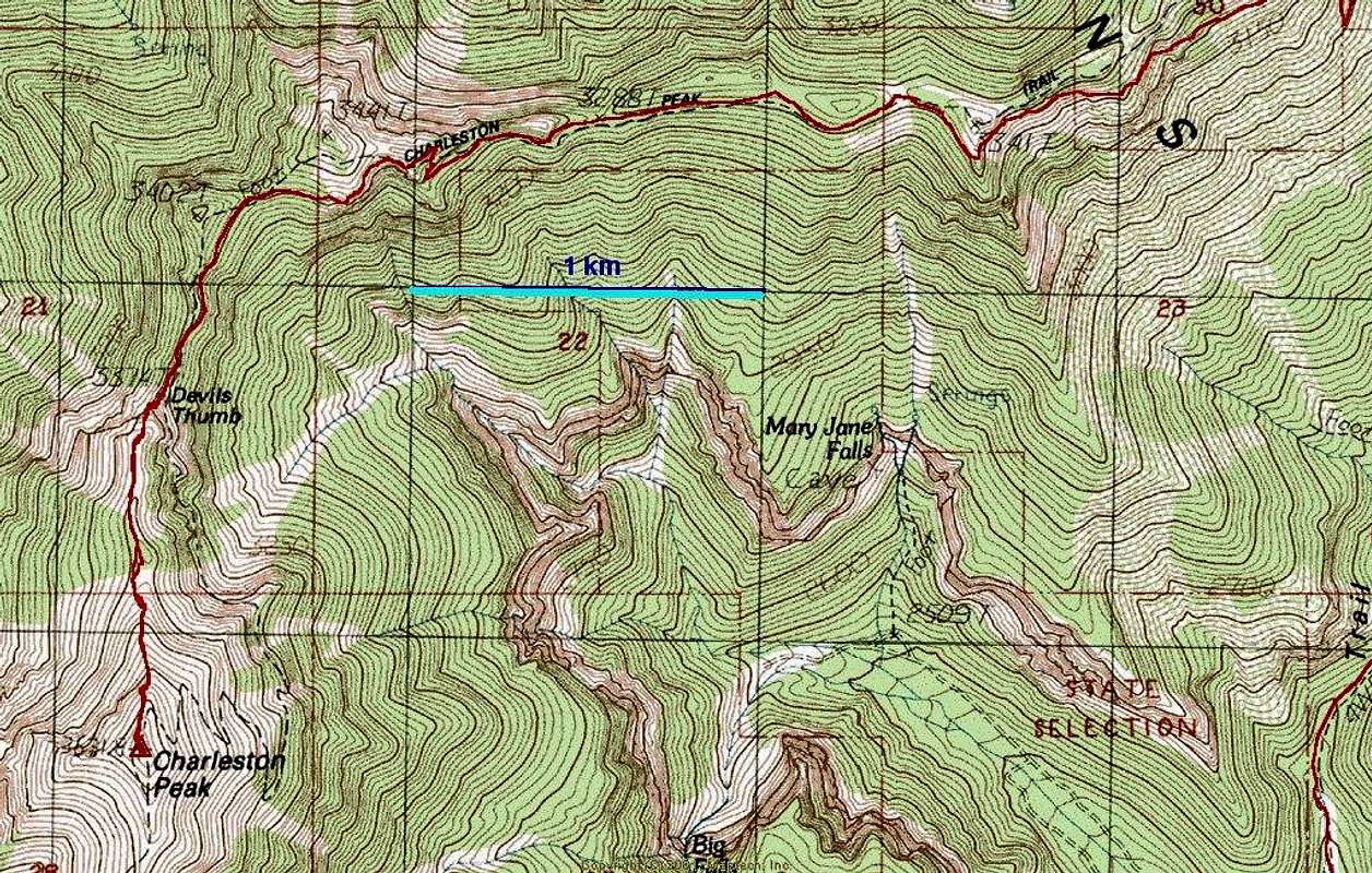
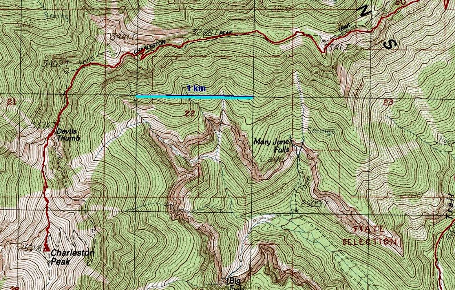
00: 24k map of routes
View High-Resolution Image
00: 24k map of routes
00: this map (USGS 1:24k) shows the the direct Devil's Thumb route (red), and the traditional North Loop Trail route (black dotted line that travels south and east of the Thumb, then switchbacks up the peak).
« PREV
NEXT »
MoapaPk
on
May 23, 2006 5:26 am
Comments & voting
Other parents
Image Type(s):
Bouldering
Image ID:
195641
4983 Hits
74.01
% Score
4
Votes
Log in to vote
Comments
No comments posted yet.
to post!
Don't have an account?
Charleston Peak
(Mountain/Rock)
« PREV
Viewing
#99 of 302
GALLERY
NEXT »
MoapaPk's Image Gallery
« PREV
Viewing
#249 of 537
GALLERY
NEXT »
×
You need to login in order to vote!
User Name
Password
Remember me
Forgot your password?
Log me out when I close my browser.
Keep me logged in all the time.
sign in as a user
Don't have an account?
Register now for FREE
Rating available
Suggested routes for you
People who climb the same things as you
Comments Available
Create Albums
Register Here


