

Viewing: 1-5 of 5

Michael Hoyt - Aug 1, 2007 7:39 pm - Voted 10/10
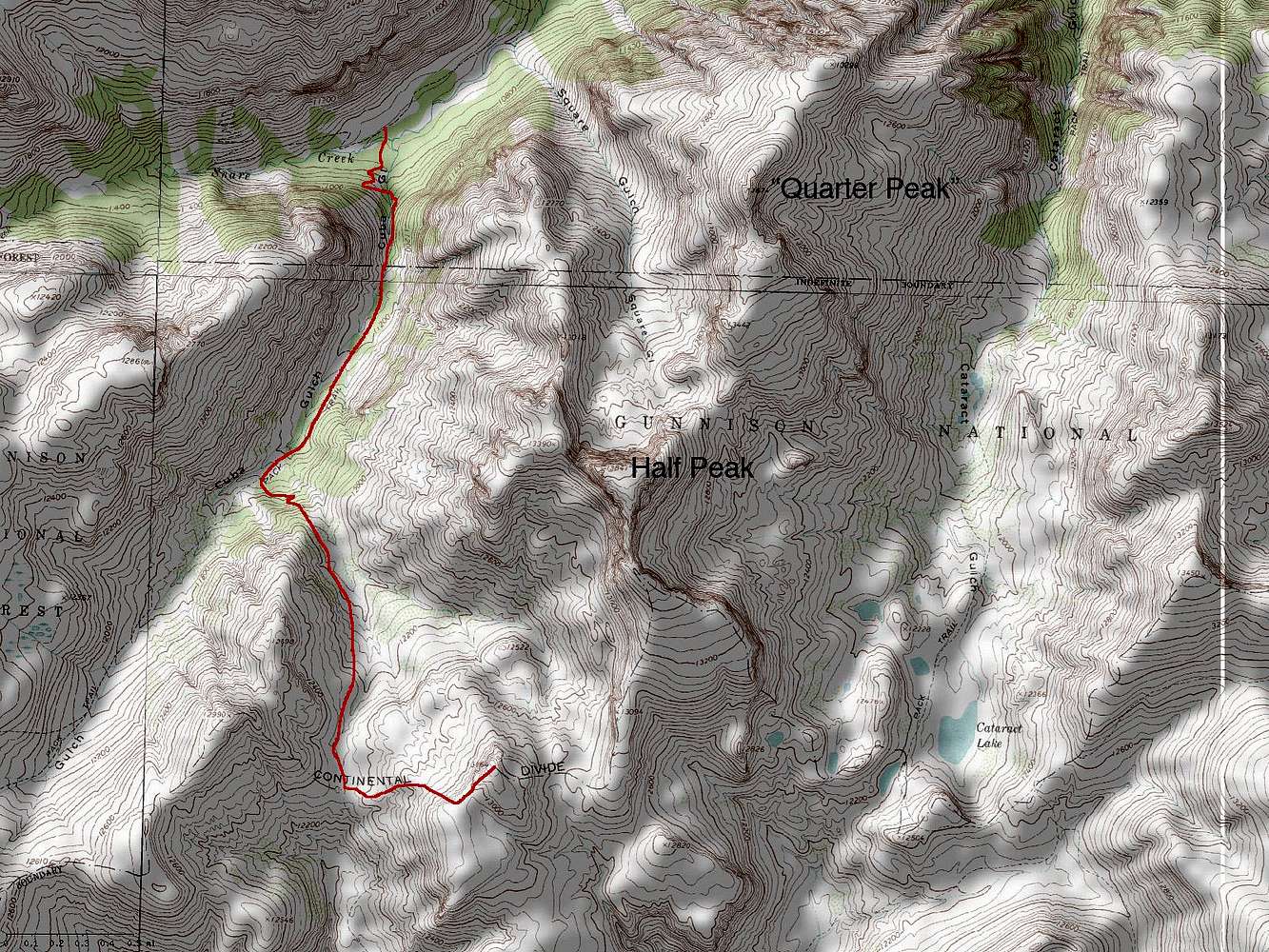
WhatSoftware did you use to produce this topo map? I really like the output.

Brian Kalet - Aug 1, 2007 7:49 pm - Hasn't voted
Re: WhatAdobe Photoshop CS Version 8.0
Michael Hoyt - Aug 2, 2007 12:24 pm - Voted 10/10
Re: WhatI didn't realize Photoshop had topo maps build-in, or do you just mean you used Photoshop to add the track. What I'm interested in is the topo software.
Thanks
Brian Kalet - Aug 2, 2007 1:57 pm - Hasn't voted
Re: WhatI use photoshop to annoatate the map.
I don't use any topo software.
I download the map from trails.com.
Michael Hoyt - Aug 2, 2007 5:43 pm - Voted 10/10
Re: WhatThanks. Trails.com - that's the info I was look for.
Viewing: 1-5 of 5


Comments
Post a Comment