The English Lake District
Our planned annual trip was originally to visit Scotland, camp in Glen Nevis and do Tower Ridge on the Ben. However, 2016 was proving to be a weird year weather wise with excessive snow and rainfall. Having been rained on heavily on our last Scottish trip we were not too keen on our camping plan and all the hut accommodation in the Fort William area appeared to be fully booked. Also, our plan to do Tower Ridge seemed to be a non-starter as with all the fresh snowfall, what would have been a mainly reasonably graded rock climb had become a much more serious winter route. After some deliberation, Ken and I agreed that an alternative venue would be more suitable so we decided that the Lake District would be our target. Having had a previous enjoyable stay in Great Langdale in May 1997 with Colin at the
National Trust campsite we decide to head there.
Day 1 - May 15th - Heading to the Lakes
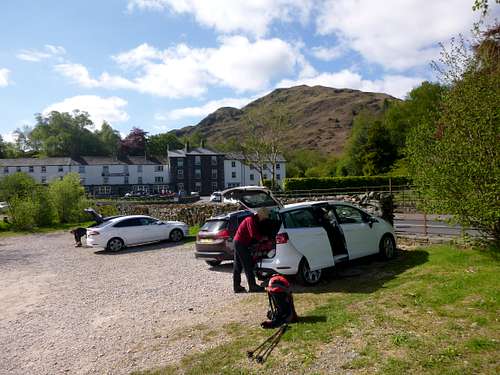
Unlike myself, a resident of Essex, Ken lives in Liverpool which is very close to the Lake District. We drove up there on Sunday morning, stopping in Kendal for supplies and arrived at the campsite around 12:00pm. We paid for our pitch up until the next Saturday and swiftly put up Ken’s big tent in a choice position close to the facility block.
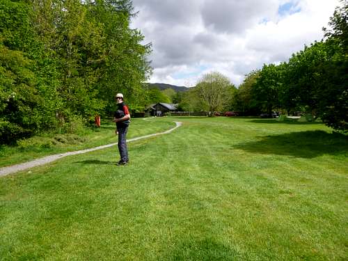
![Great Langdale NT campsite]() Great Langdale NT campsite
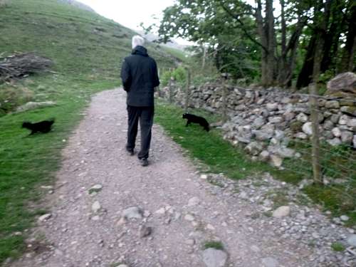
Great Langdale NT campsiteOur pitch was on a good flat section of the field with no close neighbours apart from the avian ones. A rookery behind the facilities block was particularly active. Even later in the week when there was heavy overnight rain, we stayed bone dry and the field was very well drained. Another advantage over the Glen Nevis option that we discovered was the virtual absence of biting midges. After sorting out our accommodation, we walked up to the head of the dale below Pike O Sickle.
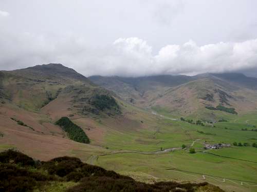
![Great Langdale towards Bow fell]() Great Langdale towards Bow fell
Great Langdale towards Bow fell
![Stiff test for cyclists]() Stiff test for cyclists
Stiff test for cyclists
As we passed down the dale, we spied to our left the wandering zig zags of the road rising out of the dale to the south. The last time we were here with Colin, we had taken our bicycles with us as I had a Ford Transit courier van which had stacks of room inside. We had puffed our way up the hill and rode away south to Hawkshead. This is a fine run apart from the perspiration inducing start. However there is an excellent hostelry on the route that we took full advantage of on the way back to the campsite later in the day.
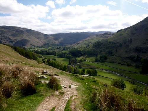
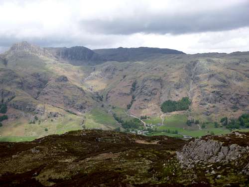
As we strolled up the dale, we admired the stunning views of the Langdale Pikes to our right hand side and the imposing bulk of Bowfell ahead.
![The trail below Langdale Fell]() The trail below Langdale Fell
The trail below Langdale Fell![Looking towards Scafell over Bowfell]() Looking towards Scafell over Bowfell
Looking towards Scafell over Bowfell
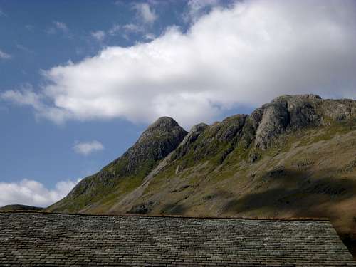
![The Pikes]() The Pikes
The Pikes![Leaving the Cumbria Way]() Leaving the Cumbria Way and looking back down Great Langdale
Leaving the Cumbria Way and looking back down Great Langdale
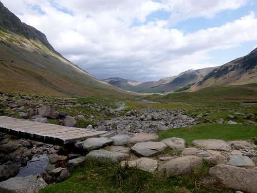
At the head of the dale we paused at a small bridge that marked a crossing with a long distance path called The Cumbria Way before deciding to return to the campsite for dinner. After we’d returned to our campsite and cooked up a hearty meal, we felt the need for some more liquid refreshment. Just across the road from the campsite is the traditional hostelry of the Old Dungeon Ghyll hotel, which had been our former target for a few evening beers. We went across hoping for a pleasant drink in a convivial atmosphere. Sadly this was not to be. As we entered we found a long queue at the bar with no bar staff in attendance. When a barman finally showed up it took ages for Ken to get served and service with a smile was not on that guys agenda. We were sadly disappointed in the whole experience. I even had to visit the public telephone many times to try and get a call in to my darling wife as the mobile ‘phone signal reception was non-existent. Sadly it didn’t happen either as the line was always unavailable. As soon as our beers were finished, we voted with our feet and headed off towards alternative venues. This was not entirely successful as when we arrived at the Sticklebarn (owned by National Trust), a notice at the entrance informed us that due to a lack of water (In the Lakes ????) the premises was temporarily closed. This mystery was solved when we entered our last resort, i.e. The New Dungeon Ghyll hotel, where the barman told us that the Sticklebarn gets its water from upstream and this had gone dry. There were a few other customers in the NDG but they soon left after our arrival leaving behind a somewhat gloomy atmosphere. Although the beer was good, unfortunately the ambience wasn’t so we supped up and headed back to the tent.
As we strolled back along the lane to the campsite Ken and I had a flashback to our earlier visit with Colin. The three of us had been strolling along the same lane when Colin decided he needed to get back to base camp for something he had forgotten and wafted off for a few minutes. Then Ken and I had a wicked idea! Colin had left his rucsac with us, so we loaded a large boulder into it, probably weighing 3 or 4 kilos. Later on after all three of us had resumed our stroll down the lane Colin started complaining about tiredness and having to lug a heavy sac around. Ken and I were trying hard to supress our giggles and Colin must have noticed that we were not our normal dour selves. Suddenly suspicious he opened his sac to find the unwelcome extra load, "you bastards" he cried as we collasped in merriment. I'm sure he won't mind me mentioning this.
Reflecting on our poor experience in the ODG, I recalled another unpleasant incident during our ’97 visit. The three of us were enjoying a few beers in the climbers bar after a hard days exercise. As was usual in that pub, music was being provided and some punters were singing along to a typical folk song that Colin recalls was called “no man’s land, a poignant song about WW1, it’s a song I sing from time to time at the folk club”
This was being played by a rather weird looking guy on an acoustic guitar when for some obscure reason he noticed that Ken was not singing along to his somewhat rudimentary playing. Ken was not in the mood I guess and being a mean guitarist himself, probably wasn’t impressed with the weirdo’s technique. The guy then got up and stuck his face a few inches from Ken’s and demanded to know why he was not getting involved and told him he should be singing along with the rest.
As Ken recalls it, “ I seem to remember after walking into the pub, the resident arsehole took an instant dislike to me and made disparaging comments about my parenthood, general demeanour and sundry other defects in my personality that he found offensive. In hindsight you would have to say he was a bloody good judge of character. After about half an hour of this I told him in the politest of terms to fuck off, to which he took exceeding umbrage. Without further ado he grabbed me around the neck held me under his arm (for he was a big bastard) and proceeded to spin me round the room several times. On release I beat an ignominious retreat back to the tent to lick my wounds. Not my finest hour I think”.
Colin and I were stood by to hold Ken’s coat, but after a bit of huffing and puffing the guy gave up and so ended the “Battle of the Old Dungeon Ghyll”.
This altercation put a bit of a damper on what had up until then been a pleasant evening so we upped and left the bar too. Thinking back over nearly 50 years going into the hills, this was the only time I’d seen anything but mutual fun and joviality in the climbing community, not a bad average I suppose.
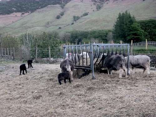
![Hardy Herdwick sheep get an easy feed after lambing]() Hardy Herdwick sheep get an easy feed after lambing
Hardy Herdwick sheep get an easy feed after lambing![Going to the pub]() Going to the pub
Going to the pub
Day 2 – May 16th– Helvellyn
My experiences in the Lakes although stretching back to 1954 were quite sparse whilst Ken is very accomplished and has done most of the tops. For my side, I really wanted to do the important summits missing from my list. Ken being a very obliging friend was happy to lead me along the right trails, so when I suggested Helvellyn, Ken immediately agreed.
After cooking and devouring a hearty breakfast ( enabled by Ken's magnificent new gas BBQ ) and making up our sandwiches for lunch, we drove over to Patterdale, arriving at the Hotel car park at 10:00am (Alpine starts not required!), We geared up in the car park and strolled down the main road until the road up into Grisedale appeared. We followed the road uphill through the verdant springtime greenery until reaching an old stone road bridge over the river. We paused there looking down into the sparkling waters hoping to catch sight of any brown trout, but none were evident so we turned our faces upwards looking along the distinctive trail climbing towards our target, Helvellyn via Striding Edge.
![Patterdale parking.]() Patterdale parking.
Patterdale parking.![Grisedale]() Grisedale
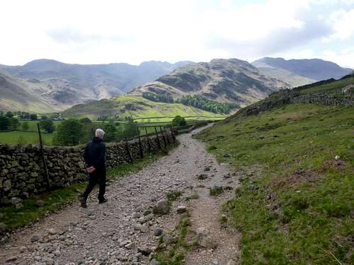
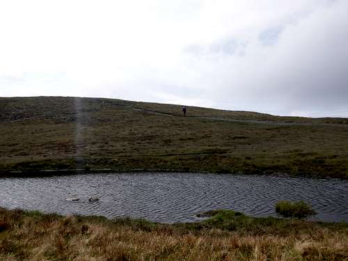
GrisedaleA steep pull across a pasture led us to a gate and style giving access to the trail towards the curiously named “Hole in the Wall” feature which tops a depression in the ridge between Helvellyn and the subsidiary slopes of Birkhouse Moor to the east; curious because there is neither a hole or a wall in evidence. The well-defined trail, almost straight as an arrow led with a steady slope to the low point on the ridge between the two tops giving splendid views across towards Glenridding Common as well as back down into Grisedale.
![The trail to the Hole in the Wall]() The trail to the Hole in the Wall
The trail to the Hole in the Wall![On the ridge towards Helvelyn]() On the ridge towards Helvellyn
On the ridge towards Helvellyn
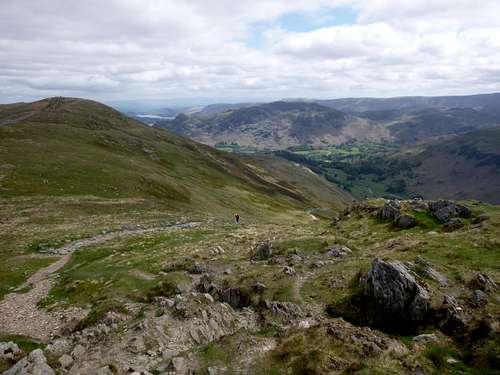
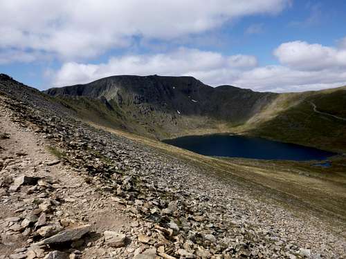
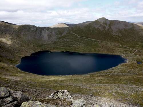
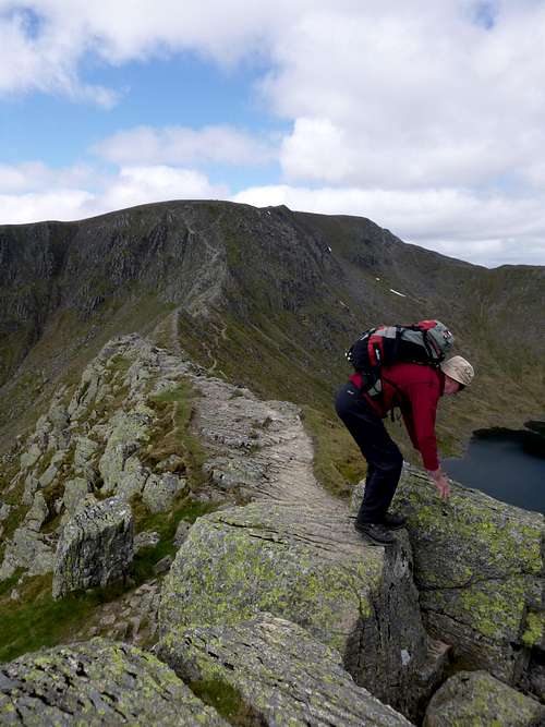
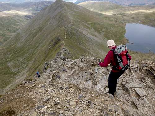
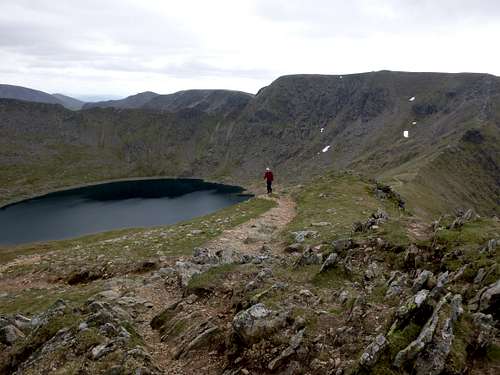
After a short stroll along the steepening ridge with views down to Red Tarn on our right hand side we approached the key section of the route known as Striding Edge.
![Red Tarn]() Red Tarn
Red Tarn![Striding Edge]() Striding Edge
Striding Edge
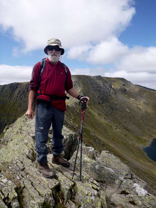
![Johnnie strides up Striding Edge]() Johnnie strides up Striding Edge
Johnnie strides up Striding Edge
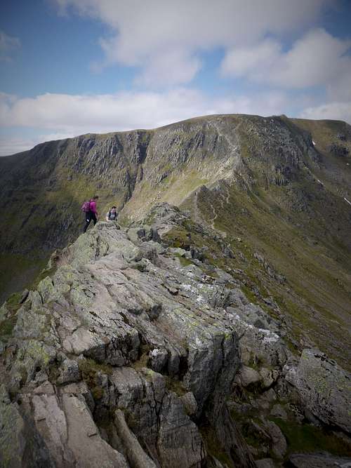
We found that the edge was bone dry and in spite of thousands of previous footsteps, the rock was not polished too much or slippery, thus making the expedition relatively easy and handsfree. Crampon scratches all along the line demonstrated how popular the route is in winter too.
Being a fine day, there were many parties on the route but not to the extent of overcrowding so we were able to stroll along at our own pace. In a few places it was necessary to use the hands or poles to change levels as we preferred to stick to the top of the ridge and here and there were gaps or small drops.
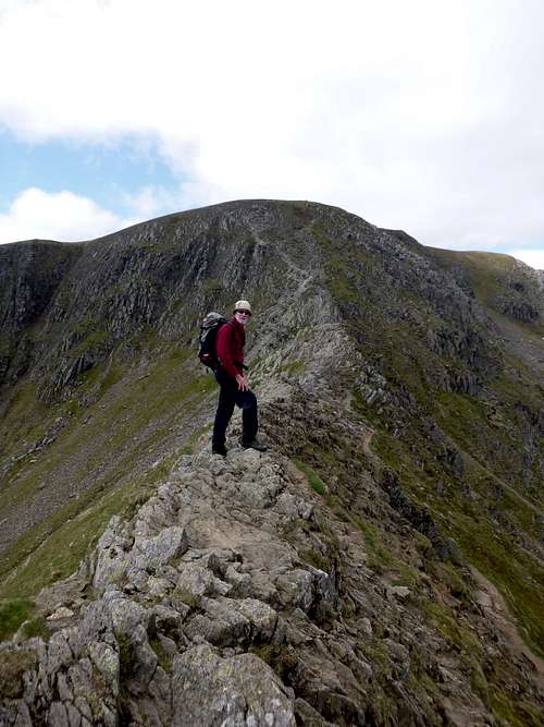
![Ken finds a tricky bit]() Ken finds a tricky bit
Ken finds a tricky bit![Johnnie on Striding Edge]() Johnnie on Striding Edge
Johnnie on Striding Edge
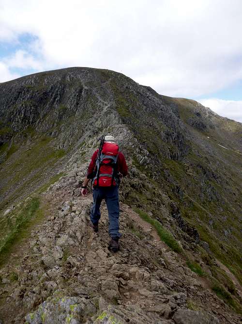
![A walking section of the Striding Edge to Helvelyn]() A walking section of the Striding Edge to Helvelyn
A walking section of the Striding Edge to Helvelyn![Helvelyn summit in view]() Helvelyn summit in view
Helvelyn summit in view
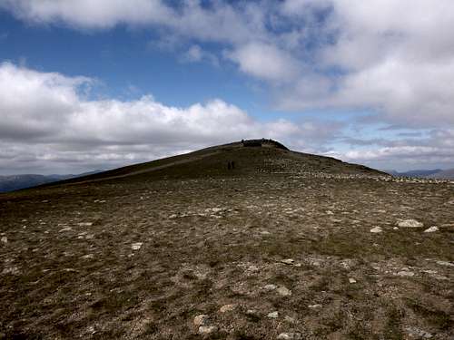
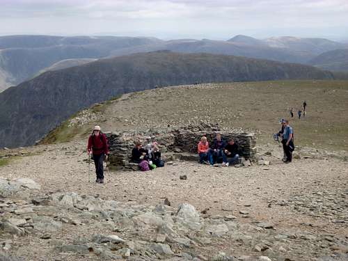
Barren slopes greet the hiker on approach to the summit of Helellyn where there is established a cross shaped shelter that provides a respite from a wind blowing from any direction.
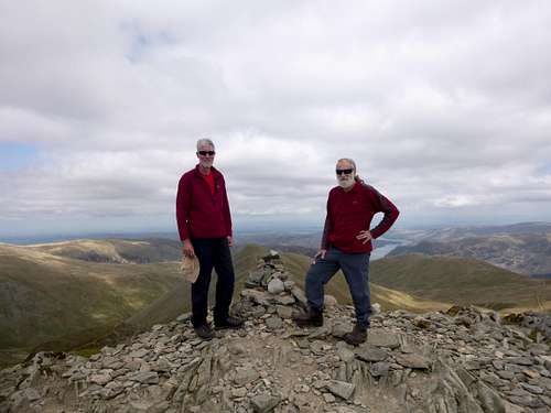
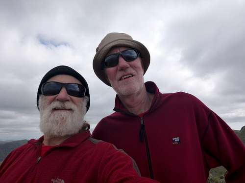
As well as the shelter area just below the summit, Helvellyn boasts a cairn marking the top and a Trig point, here we swopped photography duties with a couple of fellow hikers to record our first mountain of the week. We had taken about 2 hours 10 minutes from the bridge to reach the top, at a nice steady pace.
![Summit shelter on Helvelyn]() Summit shelter on Helvellyn
Summit shelter on Helvellyn![Ken and Johnnie enjoy the view from Helvelyn]() Ken and Johnnie enjoy the view from Helvellyn summit.
Ken and Johnnie enjoy the view from Helvellyn summit.
We managed to squeeze into a couple of spare seating spaces at the shelter which was a very popular spot on the day. Eating our sandwiches and admiring the views we had to scooch up a bit to allow a couple of other hikers seating space on the stone bench. After sustenance we headed off down another of Helvellyn’s ridges as we wanted to avoid repeating our ascent line. Initially steep and a bit loose, this was Swirral Edge.
![Swirral Edge off Helvelyn]() Swirral Edge off the summit of Helvellyn
Swirral Edge off the summit of HelvellynThis ridge continues east until the summit of Catstye Cam which we decided to ascend too.
After carefully getting down the initial few metres of Swirral Edge we soon arrived at the lowest point on the ridge that connects the two aforementioned tops.
We dropped our sacs below the steepening slopes of the Cam and strolled up to enjoy some more views of the stunning surroundings.We took our own summit selfie as we were alone on the top unlike previously on top of Helvellyn.
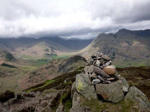
![Catstye Cam 890m.]() Catstye Cam 890m.
Catstye Cam 890m.
![Celebration selfie on Catstye Cam]() Celebration selfie on Catstye Cam
Celebration selfie on Catstye Cam
From the top of this elegant hill we could get a good view south to our ascent line along Striding Edge and to the north east towards Ullswater.
![Ullswater from Catstye Cam]() Ullswater from Catstye Cam
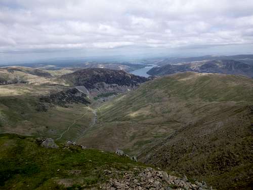
Ullswater from Catstye CamHeading back down to collect our sacs we could see the trail west of Red Tarn that would lead us back to our starting point. We soon reached our kit and then descended the clear trail down to the edge of Red Tarn.
![Route view]() Our route view
Our route view
A slight climb up from Red Tarn and then it was downhill all the way back to the bridge. From there we soon arrived back at the car, pulled our mountain boots off and took a short stroll across the road to the Patterdale Hotel for a celebratory beer. That night after cooking and devouring one of our famous stews we headed down the valley to the famous Wainwrights Bar and there we were able to sample from its fine range of real ales. The bar was crowded with likeminded souls but we managed to find a corner table where we could sup our ale and enjoy the ambience.
Day 3 – May 17th– Skiddaw
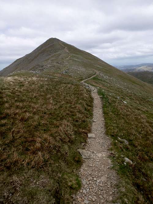
After our successful day yesterday and with fine weather still benefitting us I asked Ken if he would show me the way up Skiddaw, another of the fine tops on my list of wants. Ken had done it before and from the northern slopes which made for along and exhausting distance.
Being a crustie (oldage pensioner) that didn’t sound to jolly. Therefore Ken suggested an approach from the shores of Bassenthwaite Lake where a previously working mill has been converted to a visitor centre and parking could be had. We drove up there via Keswick, paid for our parking and went into the visitor centre for a fine cup of coffee and a chat with the friendly staff. A proliferation of trails lead away from the visitor centre and we chose one that led us through pine woods reputedly the home of a red squirrel colony until we emerged on the bare hillsides alongside a small hill called Dodd which has its own trail from the ex mill and overlooks Bassenthwaite Lake.
![Trail to Skiddaw]() The trail up to Skiddaw with Dodd below on the left side of the picture.
The trail up to Skiddaw with Dodd below on the left side of the picture.
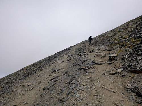
The Skiddaw trail climbed up at a reasonable angle and led to a coll with a small tarn from where the route to the top was clearly seen. Once above the tarn, the trail is over loose scree and requires some care to avoid slipping down.
![A small tarn below Skiddaw]() A small tarn below Skiddaw
A small tarn below Skiddaw
![Scree trail to Skiddaw]() Scree trail to Skiddaw
Scree trail to SkiddawAs we neared the top the wind was increasing so we donned our mountain jackets and battled on until we reached the top.
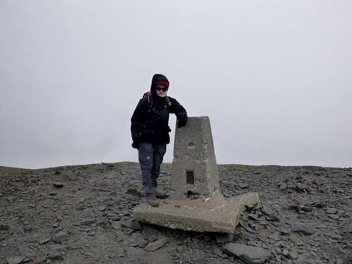
![Skiddaw summit]() Skiddaw summit
Skiddaw summit
A quick stop alongside a shelter wall allowed us to tuck into our sandwiches and admire the views but it was a bit too chilly to hang about so we headed off down again and reached a sheltered bay below Dodd where we got the bivvy stove out and brewed our jasmine tea. True to our previous form, we’d forgotten our mugs and so had to share our drinks out of the saucepan.
![Keswick by Derwent Water]() Keswick by Derwent Water
Keswick by Derwent WaterOnce we had returned to the car, we drove into Keswick for a look around and to buy some stamps for the postcards that we send to the families. After a brief stroll, a developing thirst drove us into an excellent traditional pub called the Bank Tavern where we selected our choice of ales from a fine range of local brews.
On the way back to our campsite we called into Ambleside to seek out a suitable venue for the Football match occurring on the following evening. This was an important date for us as our team Liverpool were playing Seville in the Europa Cup.
After a visit to the supermarket to stock up on grub for breakfast the next day we found out that the nearby Churchill Inn was showing the match on TV at 7:30 pm if I recall correctly.
We went into the Churchill and after confirming that TV screens were available and that the programme would be showing, we downed an ale before we returned to the campsite to clean up and change our gear before heading back down the dale to Wainwrights bar for dinner.
Day 4 - May 18th - Low level walk.
Rain being forecast, we decided to stick to a low level walk for the day. So after breakfast we strolled along the public footpath from the road to the ODG and headed towards Chapel Style in the east. The trail crosses the Great Langdale Beck river on farmers bridges and nearer to Chapel Style follows the river until it reaches Elterwater where we stopped for our sandwich break under a sheltering Maple tree in the village square. We popped into the adjacent Brittania Inn for ales which we supped outside the pub and did some people watching before crossing the bridge over the River Brathay and heading back along the trail to the campsite.
Although we didn’t go onto the tops, our 12 kilometer round trip was very pleasant.
After a shower and tog up we headed into Ambleside and the Churchill Inn where we ordered our dinner and sat in the corner where we could see the match on the telly. The match started well and the team went in one goal ahead at half time. But! in the second half, the spirit of Istanbul was totally absent and our side collapsed to a 3 nil drubbing from Seville. What a disappointment!
Once we had left Brown Howe and crossed over the grassy paths of Lingmoor Fell, we arrived at the old quarry workings that overlook Chapel Style below. A few of the buildings were still standing at least in part and one of these made for a ideally sheltered lunch spot. Once out of the breeze we were able to get the bivvy stove going for a brew which we supped whilst eating our sandwiches. At least this time we had our full complement of stove, lighter, water, teabags, and mugs.
!! Somewhat depressed we slunk back to the campsite.
Day 5 - May 19th - Over Lingmoor Fell.
After another day of unpromissing weather reports, we decided to take a circular walk over Lingmoor Fell to Elterwater.
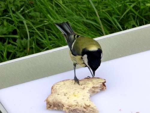
![Great Tit's breakfast]() Great Tit's breakfast
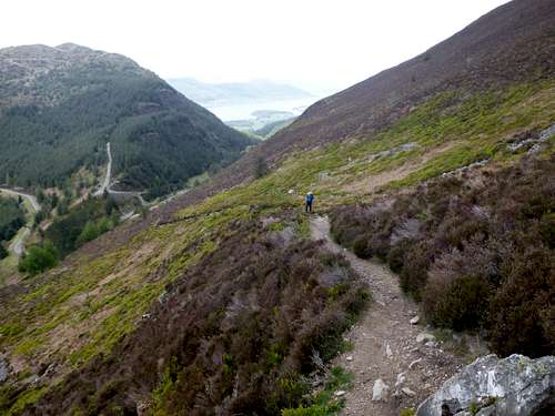
Great Tit's breakfastOur choosen route for the day actually started right inside the campsite. A small gate in the southside of the site allowed through passage for a public footpath. Following this up the hill we climbed up Side Pike and gained an excellent view of Great Langdale from the top.
![Great Langdale]() Great Langdale from Side Pike.
Great Langdale from Side Pike.![Side Pike squeeze]() Side Pike squeeze
Side Pike squeeze
Crossing Side Pike, Ken told me about a curious feature that he remembered from a previous visit which he referred to as a sqeeze. Dropping down to the far side of the pike we spied a large square block leaning agains the parent crag. On approching it we found a narrow gap behind it that would allow passage for those of modest proportions. As both Ken and I qualified on that score, we soon sqeezed through the tight space and followed the enclosed path behind it away up the hill.
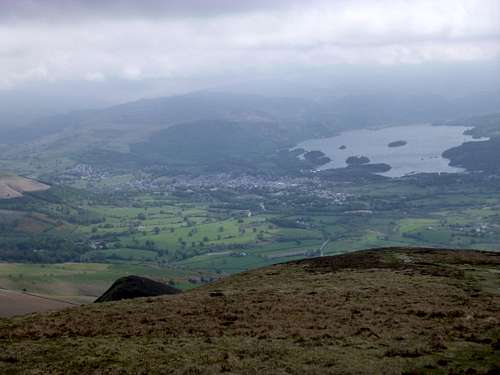
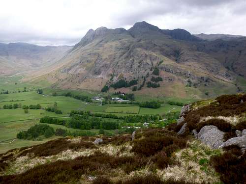
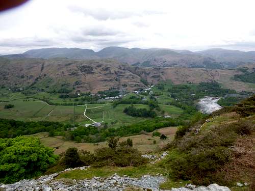
Above Side Pike, lies Brown Howe, the highest point on Lingmoor Fell which we soon reached and enjoyed the stunning views from there back down into Great Langdale and across the dale to the imposing bulk of Pavey Ark with Stickle Tarn below it on the opposite side of the dale.
![Top of Side Pike]() Top of Side Pike
Top of Side Pike![Pavey Arc from Side Pike]() Pavey Arc from Side Pike
Pavey Arc from Side Pike
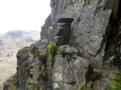
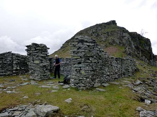
![Abandoned quarry building]() Abandoned quarry building
Abandoned quarry buildingOur high level viewing platform gave us of sight of Elterwater below close to the turnaround point of our previous days tour. However after lunch we decided not to drop down to the village but instead to follow a trail through the woods below.
![Elterwater below Lingmoor Fell]() Elterwater and Chapel Style below Lingmoor Fell
Elterwater and Chapel Style below Lingmoor Fell![A Walk in the woods]() A Walk in the woods
A Walk in the woods
A farmers road through the woods led back up the dale towards our campsite, connecting with the circular walk that we had done the previous day so navigating was a no brainer. A steady stroll along level gound soon saw us back at out tent where we cooked up our dinner before heading over to the Sticklebarn for a couple of beers and a few games of dominoes to round off the day.
Day 6 – May 20th – At the campsite.
Weather on the Friday was quite wet so we couldn’t get any enthusiasm for going on the hills, instead we had a lazy day at the campsite cooking breakfast and sorting out our kit for packing up the following day which was only interrupted by having a pub lunch over at the Sticklebarn. Back to the campsite, we finished sorting kit, explored around the site some and remembered to collect our once soggy clothing from the excellent tropically heated drying room.
In the evening we were back at the Sticklebarn again for our last evening meal and although we enjoyed the food, we definitely slipped up, as we had selected our grub from the bar snack menu and had completely missed out on the daily specials. Some of these looked quite attractive as they were being consumed by fellow diners. Ah well, hopefully readers will benefit from our experience.
A few more games of Dominos and also a word game similar to Scrabble but without the points were played whilst quaffing down a few pints of local ales and that finished our last evening in Langdale.
Day 7 – May 21st – Going home.
As we had organised our stuf on Friday it didn’t take too long to drop the tent and pack the car before heading into Ambleside for breakfast. We found Bilbo’s café open and ordered two all day breakfasts which were very nourishing.
We then returned to Liverpool and offloaded Ken’s kit before I drove back home to Essex topping around 845 miles of road for the week holiday.
A most enjoyable week.


Comments
Post a Comment