Toggle navigation
Mountains
Routes
Images
Trip Reports
Forum
What's New
People
Areas & Ranges
Articles
Trailheads
Canyons
Huts & Campgrounds
Albums
Logistical Centers
Fact Sheets
Lists
Custom Objects
Gear
Plans & Partners
WELCOME TO SUMMITPOST
SIGN IN
REGISTER
Maps of South America
Additional Parents
Image
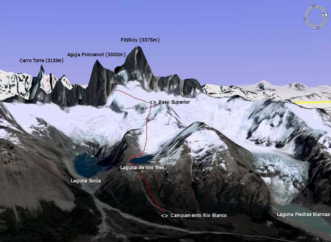
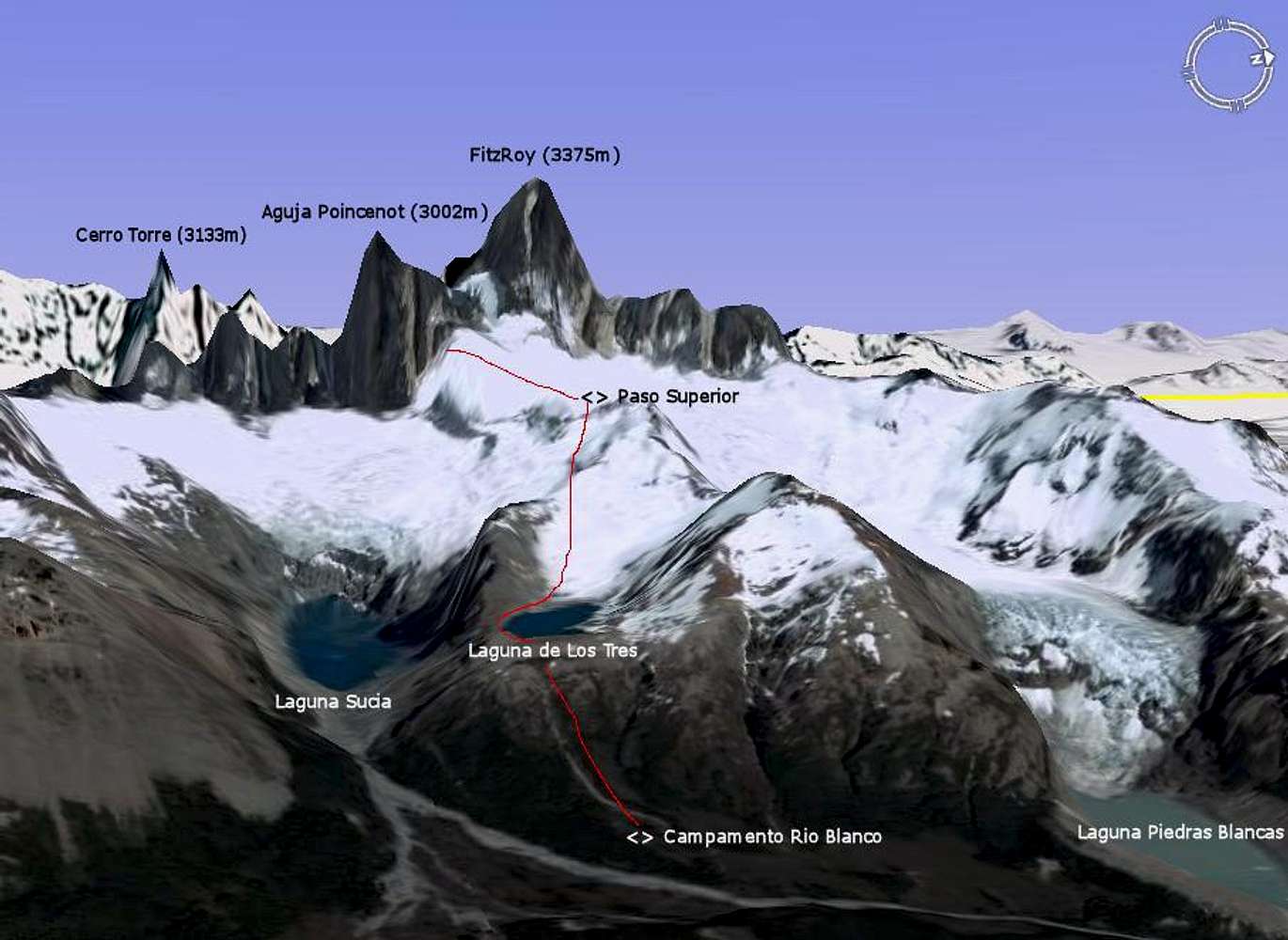
3D map - Access to Aguja Poincenot
View High-Resolution Image
3D map - Access to Aguja Poincenot
The red line indicates the path to take from the
Rio Blanco
base camp to the start of the normal route. A higher camp is usually made at the Paso Superior.
Parque Nacional Los Glaciares - Argentina
« PREV
NEXT »
Andino
on
Oct 16, 2007 12:02 pm
Comments & voting
Other parents
Lat/Lon:
49.27195°S / 73.04406°W
Image Type(s):
Informational
Image ID:
348143
9416 Hits
86.37
% Score
22
Votes
Log in to vote
Comments
No comments posted yet.
to post!
Don't have an account?
Maps of South America
(Album)
You are at
the First
Image
Viewing
#1 of 30
GALLERY
NEXT »
Andino's Image Gallery
« PREV
Viewing
#118 of 597
GALLERY
NEXT »
Aguja Poincenot (Patagonia)
(Mountain/Rock)
Loading....
×
You need to login in order to vote!
User Name
Password
Remember me
Forgot your password?
Log me out when I close my browser.
Keep me logged in all the time.
sign in as a user
Don't have an account?
Register now for FREE
Rating available
Suggested routes for you
People who climb the same things as you
Comments Available
Create Albums
Register Here


