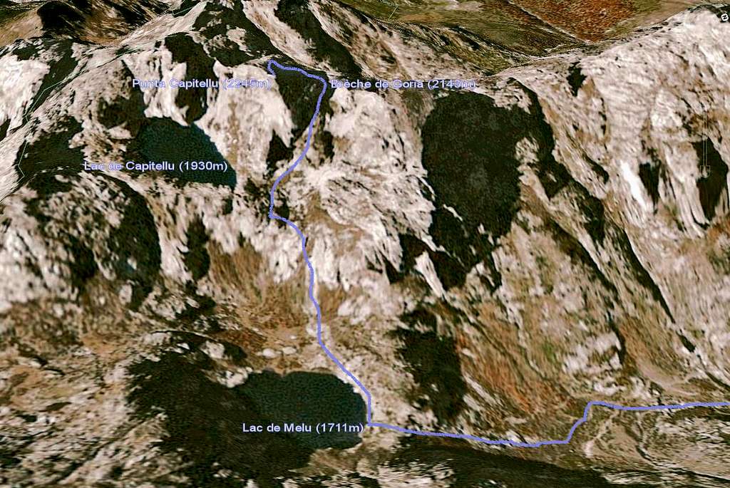
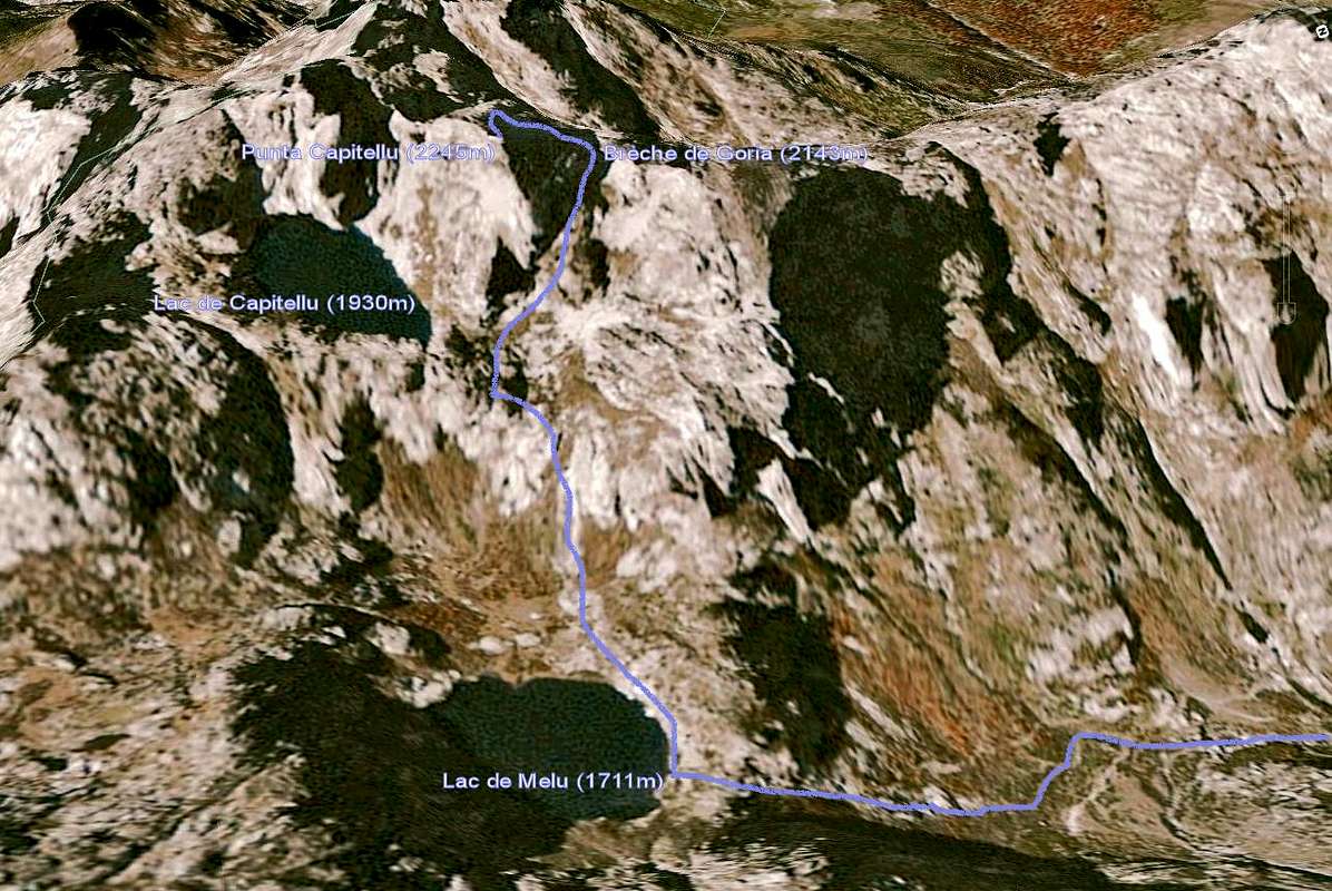
3D Map of Punta Capitellu
3D map of the ascent of Punta Capitellu, from the Restonica Valley on the right, by the Lac de Melu (1711m), through the Brèche de Goria (2143m) and to the top at 2245m. A few grade II steps on the final ridge. 3h30 in total.
Corsica - France


