Toggle navigation
Mountains
Routes
Images
Trip Reports
Forum
What's New
People
Areas & Ranges
Articles
Trailheads
Canyons
Huts & Campgrounds
Albums
Logistical Centers
Fact Sheets
Lists
Custom Objects
Gear
Plans & Partners
WELCOME TO SUMMITPOST
SIGN IN
REGISTER
Mount Tyndall
Additional Parents
Image
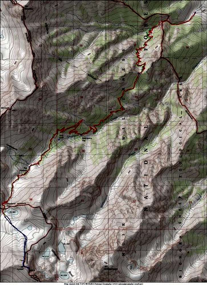
6/27/04 - Topo map showing...
View High-Resolution Image
6/27/04 - Topo map showing...
6/27/04 - Topo map showing the Shepherd's Pass approach hike (red) and the North Rib Route and summit ridge traverse (blue) to Tyndall's summit. Round trip distance was 22 miles. Only 1.5 miles to Tyndall's summit from the first lake.
« PREV
NEXT »
blmcclain
on
Jul 2, 2004 9:52 pm
Comments & voting
Other parents
Lat/Lon:
36.65560°N / 118.3361°W
Image ID:
59063
10429 Hits
76.66
% Score
7
Votes
Log in to vote
Comments
No comments posted yet.
to post!
Don't have an account?
Mount Tyndall
(Mountain/Rock)
« PREV
Viewing
#42 of 142
GALLERY
NEXT »
blmcclain's Image Gallery
« PREV
Viewing
#27 of 98
GALLERY
NEXT »
×
You need to login in order to vote!
User Name
Password
Remember me
Forgot your password?
Log me out when I close my browser.
Keep me logged in all the time.
sign in as a user
Don't have an account?
Register now for FREE
Rating available
Suggested routes for you
People who climb the same things as you
Comments Available
Create Albums
Register Here


