Toggle navigation
Mountains
Routes
Images
Trip Reports
Forum
What's New
People
Areas & Ranges
Articles
Trailheads
Canyons
Huts & Campgrounds
Albums
Logistical Centers
Fact Sheets
Lists
Custom Objects
Gear
Plans & Partners
WELCOME TO SUMMITPOST
SIGN IN
REGISTER
Logan MASSIF
Additional Parents
Image
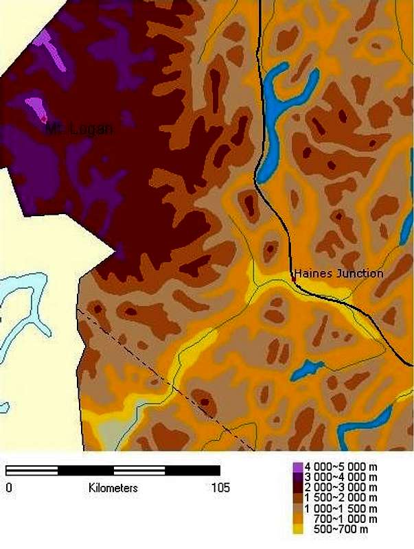
A generalized relief map of...
View High-Resolution Image
A generalized relief map of...
A generalized relief map of the South East corner of the Yukon. On which I have added the Logan Massif, the Alaska Highway and Haines Junction. As one can see it is quite the hike to get to the peak.
« PREV
NEXT »
JScoles
on
Feb 15, 2002 11:15 am
Comments & voting
Other parents
Lat/Lon:
60.56670°N / 140.39999°W
Image ID:
5007
8189 Hits
72.64
% Score
5
Votes
Log in to vote
Comments
No comments posted yet.
to post!
Don't have an account?
Logan MASSIF
(Mountain/Rock)
« PREV
Viewing
#17 of 18
GALLERY
NEXT »
JScoles's Image Gallery
« PREV
Viewing
#64 of 154
GALLERY
NEXT »
×
You need to login in order to vote!
User Name
Password
Remember me
Forgot your password?
Log me out when I close my browser.
Keep me logged in all the time.
sign in as a user
Don't have an account?
Register now for FREE
Rating available
Suggested routes for you
People who climb the same things as you
Comments Available
Create Albums
Register Here


