
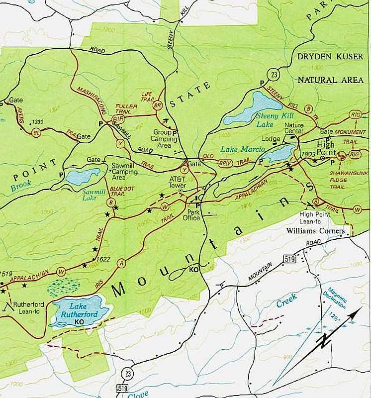
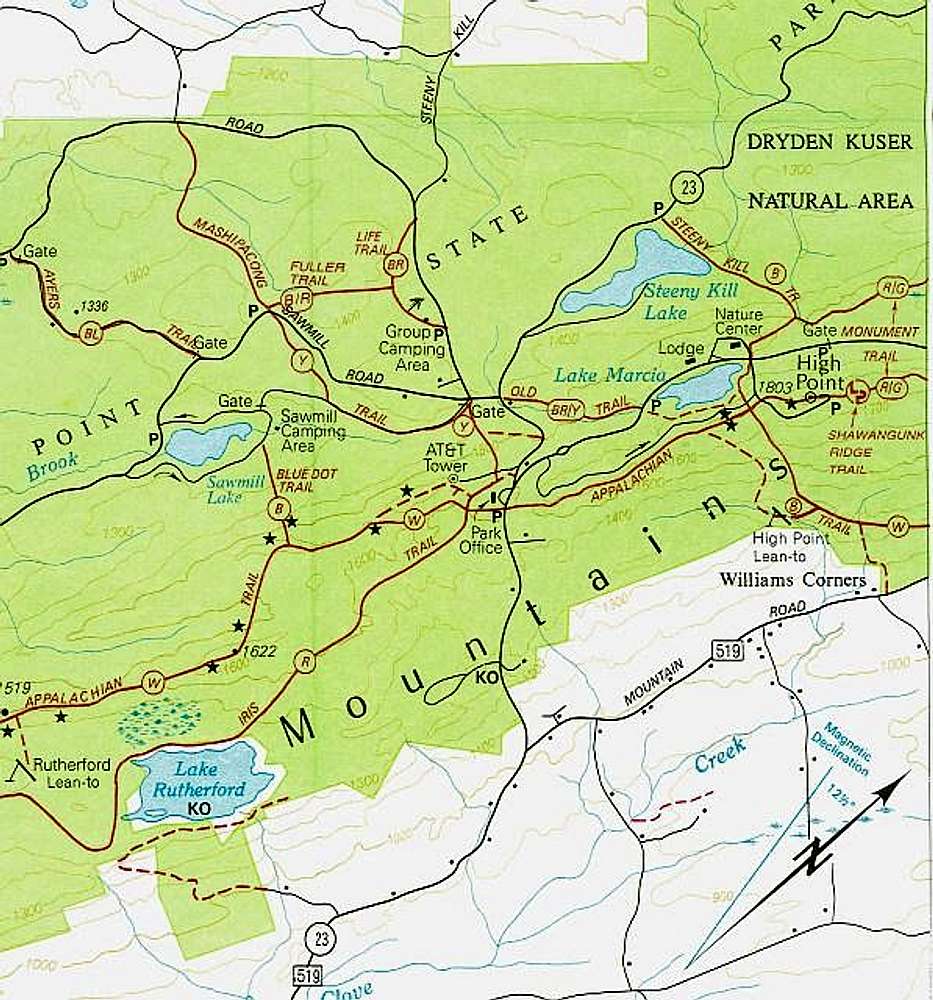
A scan of the NYNJTC map of...
A scan of the NYNJTC map of the High Point State Park area. North is to the upper right. Circled letters on trails refer to blaze color (W=white, B=blue, etc). There are two backpacker shelters on this map as well as various camping areas. Stars mark notable viewpoints. KO stands for Keep Out. Trailheads are marked with P (parking).


