A Topo! map depicting routes...

A Topo! map depicting routes...

A Topo! map depicting routes on the Deluge Lake Group of Gore Range summits. The red route on Snow Peak is 4.72 miles one way. The two side trips up Grand Traverse Peak (Green) and Mount Valhalla are three quarters of a mile each. The ridges might be runnable but they look rough. Software by National Geographic. Notations by Jon Bradford.
JonBradford
on Jun 23, 2004 10:36 pm
Image ID: 58104

Comments

Post a Comment
Viewing: 1-1 of 1
JonBradford

JonBradford - Jun 25, 2004 10:25 am - Hasn't voted
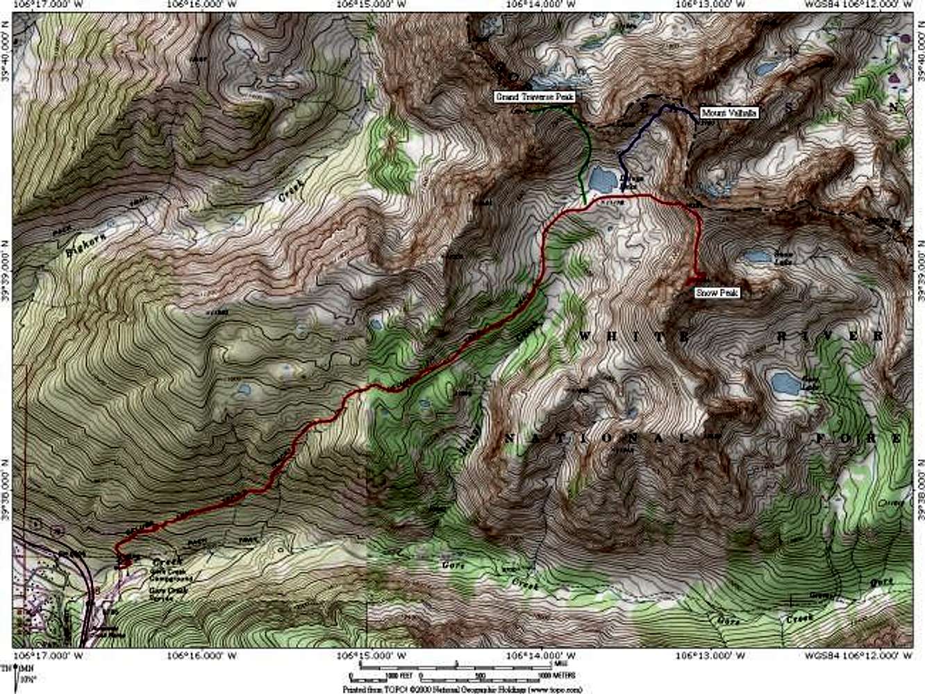
Re: I-70

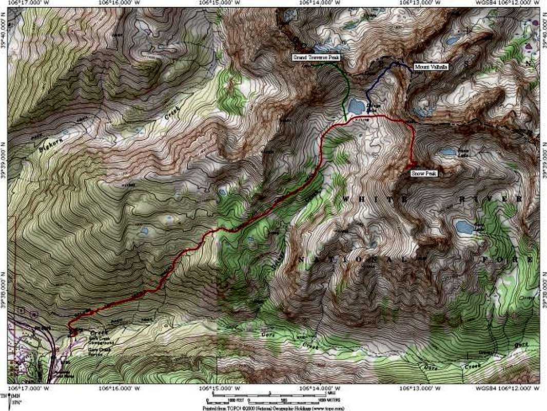
Yes. I-70 is the purple highway in the left corner. This point is also the eastern edge of Vail.

Jon

Viewing: 1-1 of 1