Toggle navigation
Mountains
Routes
Images
Trip Reports
Forum
What's New
People
Areas & Ranges
Articles
Trailheads
Canyons
Huts & Campgrounds
Albums
Logistical Centers
Fact Sheets
Lists
Custom Objects
Gear
Plans & Partners
WELCOME TO SUMMITPOST
SIGN IN
REGISTER
Kenosha Mountains
Additional Parents
Image
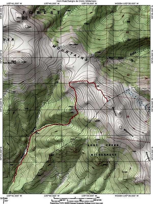
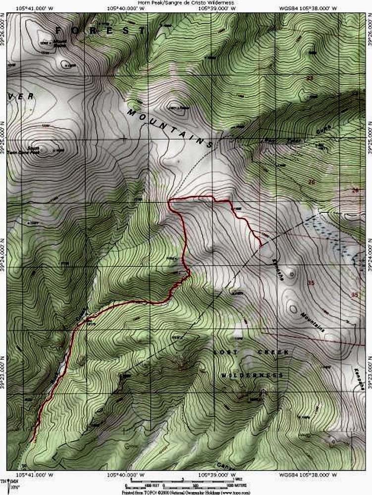
A topo map of the "Platosha"...
View High-Resolution Image
A topo map of the "Platosha"...
A topo map of the "Platosha" Route on "Kenosha Peak". The route begins at the South Ben Tyler Trailhead. Map created with National Geographics Topo! software.
Jon Bradford
« PREV
NEXT »
JonBradford
on
Nov 15, 2003 2:07 pm
Comments & voting
Other parents
Lat/Lon:
39.36800°N / 105.605°W
Image ID:
33252
2988 Hits
73.06
% Score
3
Votes
Log in to vote
Comments
No comments posted yet.
to post!
Don't have an account?
Kenosha Mountains
(Area/Range)
« PREV
Viewing
#47 of 90
GALLERY
NEXT »
JonBradford's Image Gallery
« PREV
Viewing
#1022 of 1444
GALLERY
NEXT »
×
You need to login in order to vote!
User Name
Password
Remember me
Forgot your password?
Log me out when I close my browser.
Keep me logged in all the time.
sign in as a user
Don't have an account?
Register now for FREE
Rating available
Suggested routes for you
People who climb the same things as you
Comments Available
Create Albums
Register Here


