
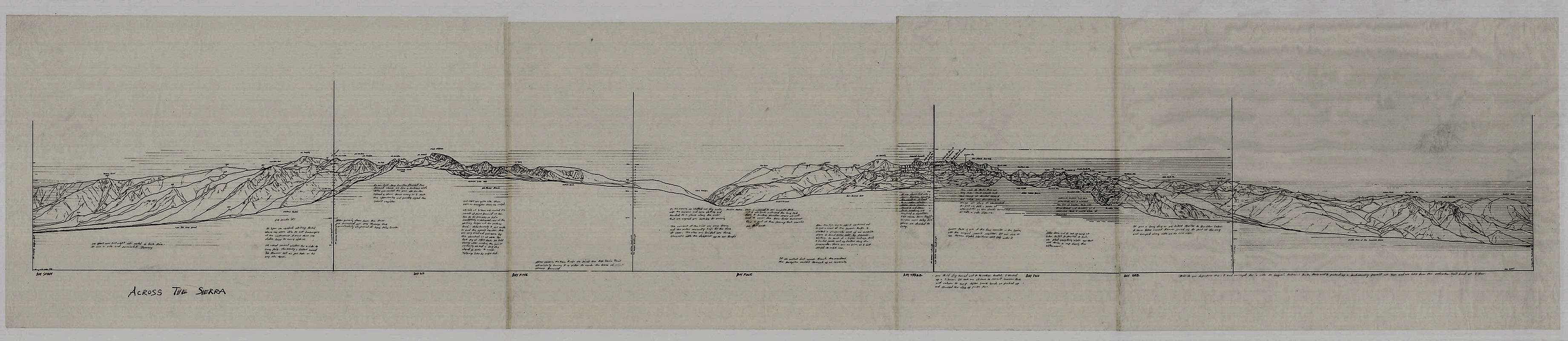
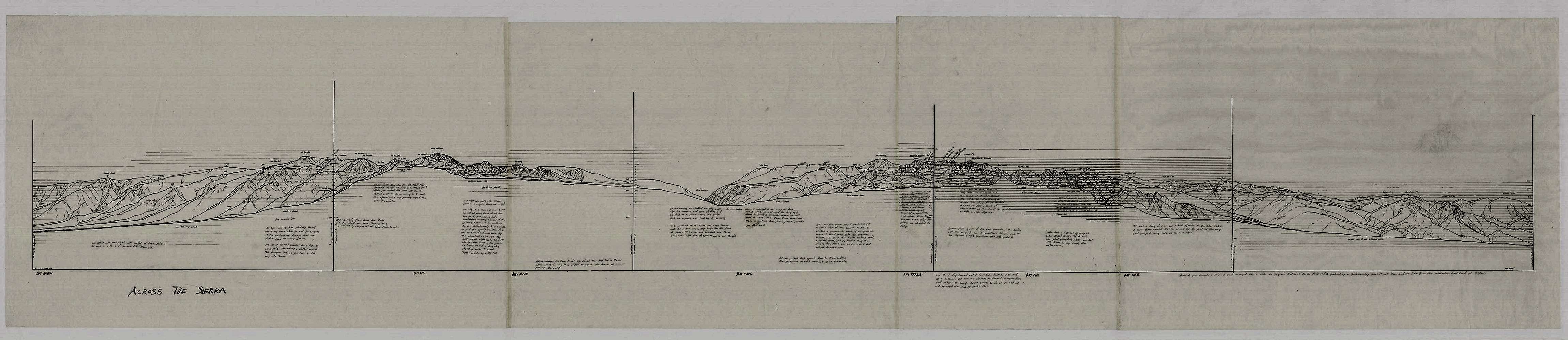
"Across the Sierra" updated
Please click on the image for a more detailed look. If you use the scroll bar, the drawing should be viewed from right to left in accordance with my West to East travel through the Sierra. Some points of interest are the Nine Lake Basin, the entire Kaweah Peaks range, Kern River Canyon, and Mount Whitney.
This is a printed version of a drawing that I have been working on for some time now. It was printed from four lithographic plates. It is the main piece in my portfolio titled "Across The Sierra." The actual width of this drawing is 8 feet. It is on the same scale with the USGS 1:24,000 topo maps which I used as a guide in order make the cross section accurate. The drawing represents a seven day Journey and to my knowledge is the most accurate of its type.


