Welcome to SP!  -   
 
 New features are here! - Read More... 
Areas & Ranges·Mountains & Rocks·Routes·Images·Articles·Trip Reports·Gear·Other·People·Plans & Partners·What's New·Forum

Aiguille de la Grande Sassiere, Petite Sassiere, Pointe Plattes des Chamois and Becca di Suessa

 
[ Sizes: Orig | Large | Med | Small | Thumb ]
Aiguille de la Grande Sassiere,  Petite Sassiere, Pointe Plattes des Chamois and Becca di Suessa
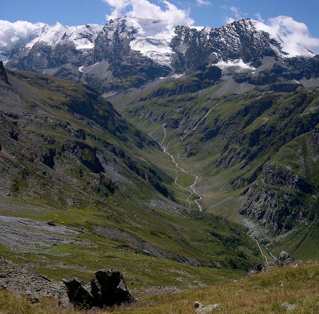
From the neighbourhood of Becca Refreita 2612m, view of the ridge running the French-Italian border and including (from left):
  • Aiguille de la Grande Sassiere 3751m
  • Petite Sassiere 3672m
  • Pointe de Nantcruet 3510m
  • Pointe Plattes des Chamois 3610m and the namesake vast glacier
  • Becca di Suessa (or Pointe des Mines) 3420m
  • On the bottom the Dora river (of Valgrisenche) and the endless unpaved road leading to Bezzi Hut
    Aug 21st, 2006


    Comments

    No comments posted yet.


    Sign in to post!

    Don't have an account? Register now.


    Rate This Image
    Current Score: 88.63

    Log In To Vote
     3) Gr. Traversiere and Gr. Rousse tour (Route)


    You are at
    the First
    Image

    Viewing
    #1 of 13
    GALLERY
    Lago di San Martino
    NEXT »

     livioz's Image Gallery

     Route to Monzino Hut <br> seen  from the opposite side of Val Veny
    « PREV

    Viewing
    #24 of 903
    GALLERY
    Pano view of the italian side <br>of the Mont Blanc  group
    NEXT »


     Aiguille de la Grande Sassière (Mountain/Rock)


     Mountains of Valgrisenche (Album)


    Image Data

    liviozSubmitted by livioz
    on Nov 12, 2006 12:05 am

    Image ID: 243273
    Hits: 3543 

    Lat/Lon: 32.84000°N / 113.91°W

    Image Type(s): Hiking


    "Gravity is a harsh mistress."   --The Tick   

    © 2006-2012 SummitPost.org. All Rights Reserved.