


-
 11610 Hits
-
 87.76% Score
-
 25 Votes
|
|
Route |
|---|---|
|
|
45.65540°N / 7.37749°E |
|
|
Mountaineering |
|
|
PD-/AD+ |
|
|
Note
|
La montagna chiama i suoi figli, ed essi rispondono fedelmente al suo appello… Osvaldo Cardellina, Diario alpinistico, 1964-65 Page texts: @ OsvaldoCardellina "Osva", passed away on May 2, 2022. Page owners: Christian Cardellina e Osvaldo Cardellina. Any updates from September 12, 2022: Antonio Giani, page administrator, friend and climbing companion. Testi della pagina: @ OsvaldoCardellina "Osva", scomparso il 2 maggio 2022. Proprietari pagina: Christian Cardellina e Osvaldo Cardellina. Eventuali aggiornamenti dal 12 settembre 2022: Antonio Giani, amministratore della pagina, amico e compagno di salite. |
Overview
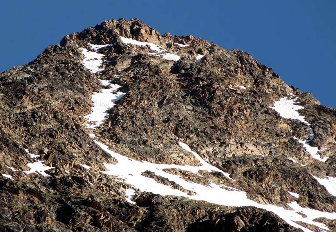
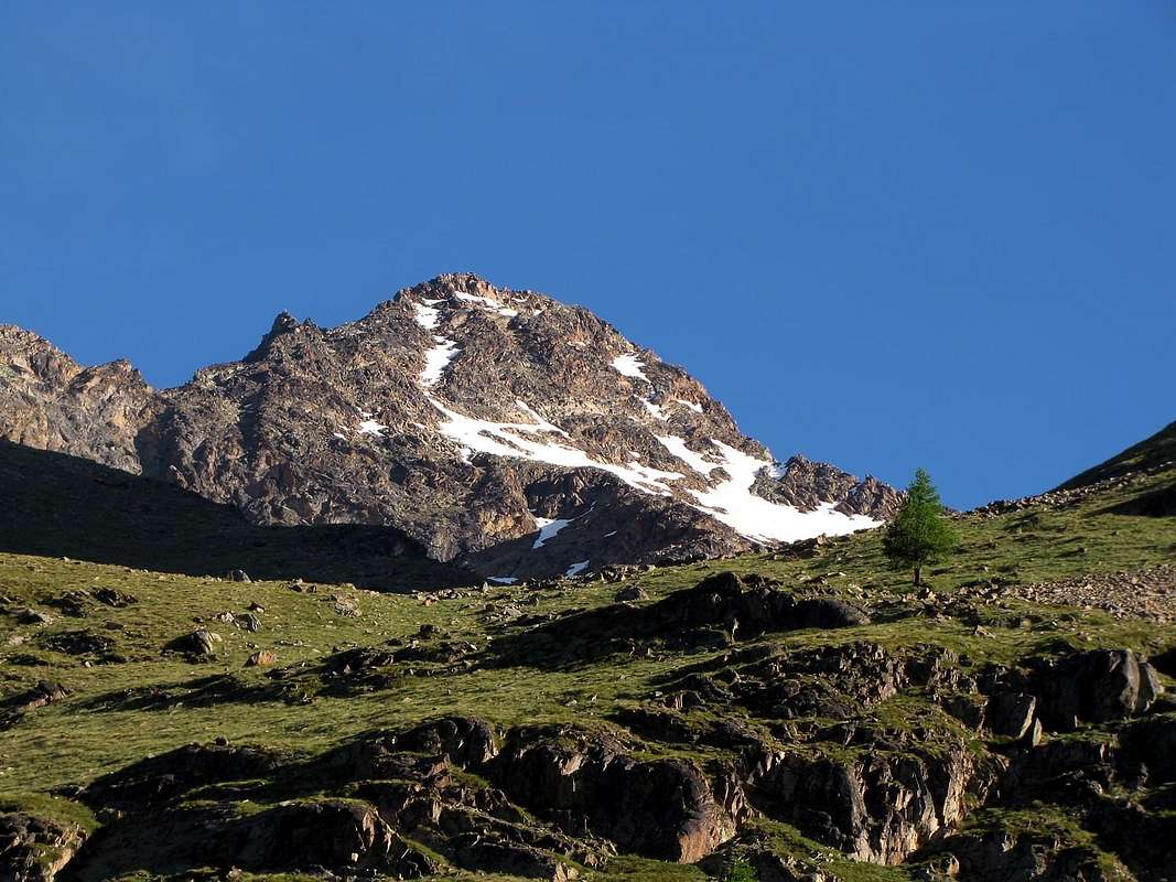
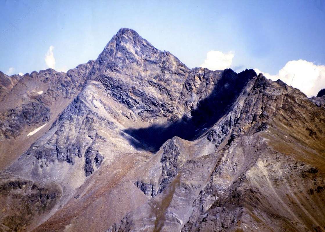
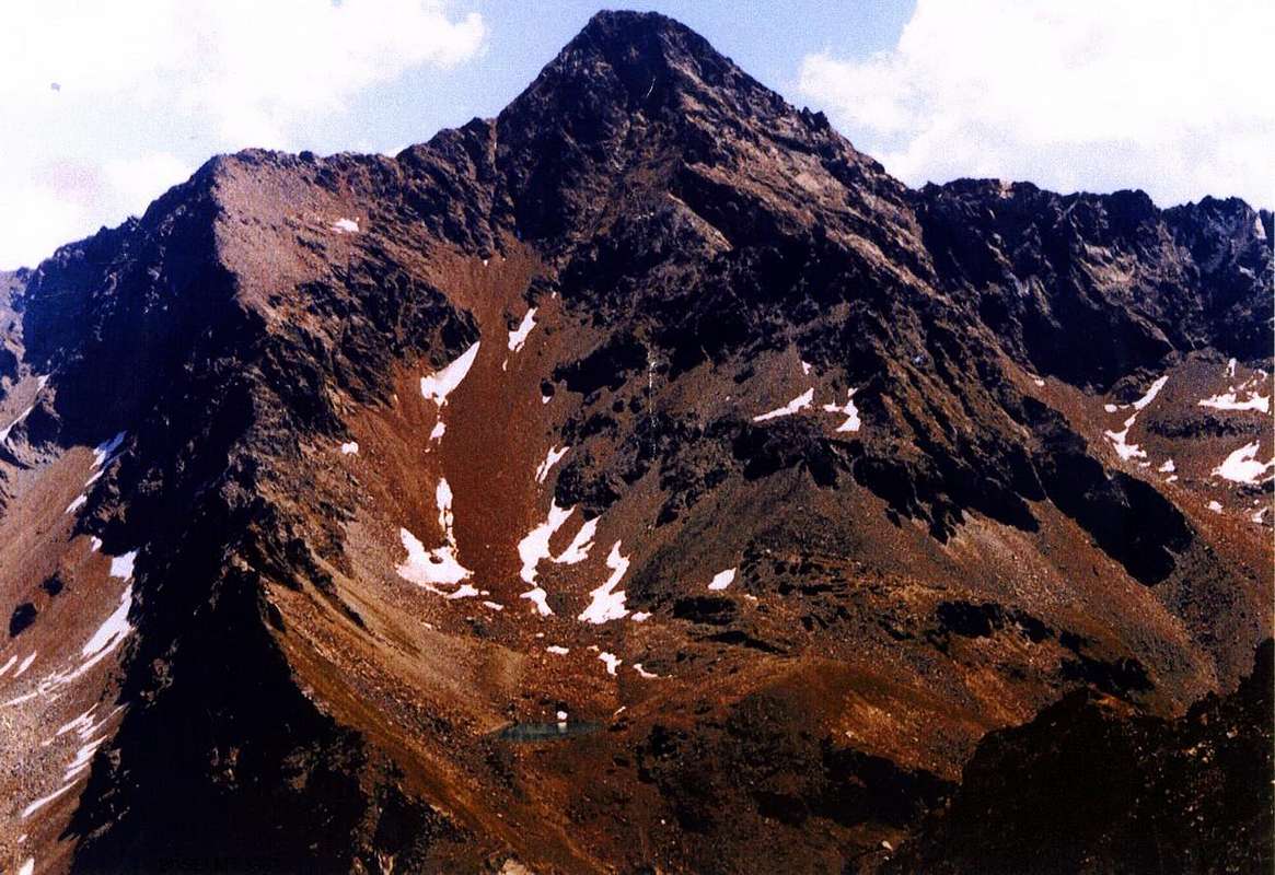
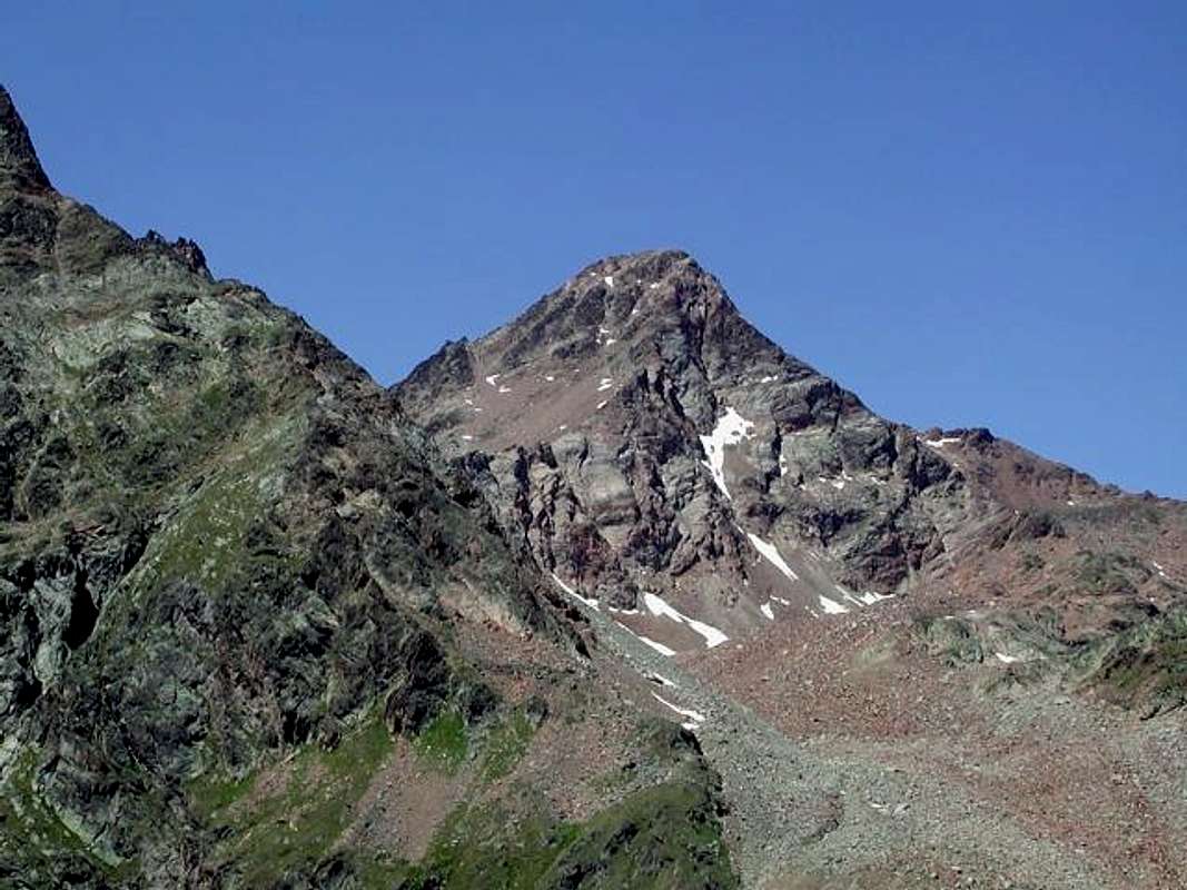
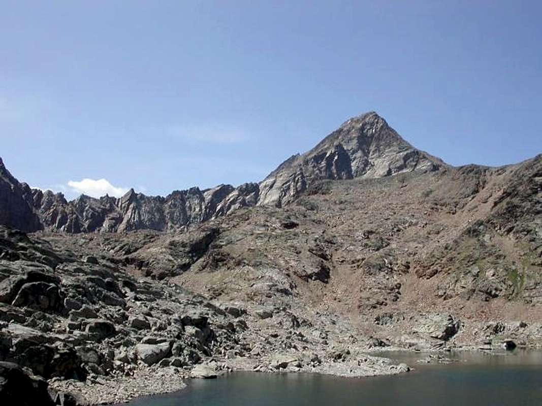
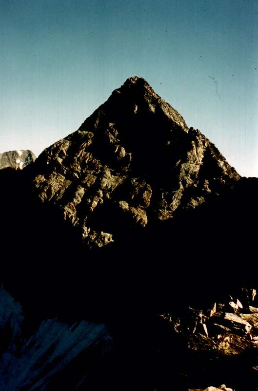
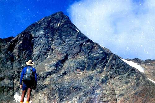
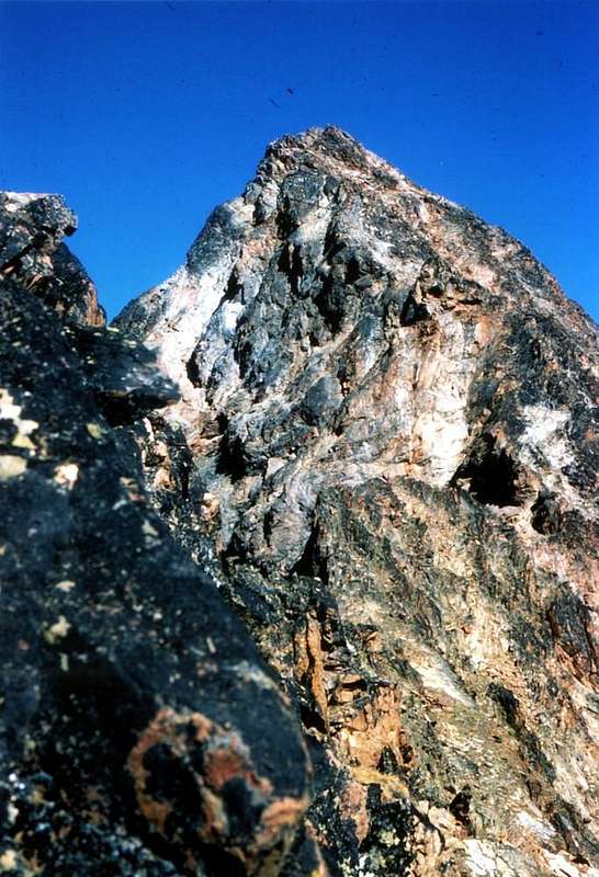
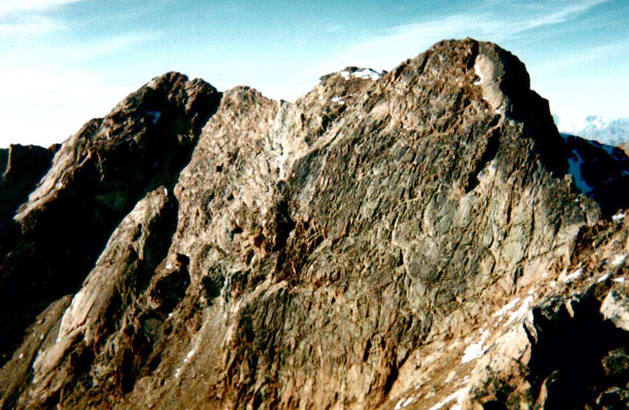
Peak Garin or Pic Garin also Punta Garin is a slender pyramid if you face it north or south, whereas it appears truncated and grimmer in the east and in the west. It has five crest lines and five rock faces. The south - west spur starts just above Gimillan (1.787m) and after reaching the peak it goes down to Mount Valaisan (3.296m) forming an important topographic junction, here it splits in two different branches, the one goes towards Col Garin, Peak of Pian Bessey and Peak of Valletta above the basin of Pila, the other goes up Punta Rossa, it crosses the three peaks then it goes down to Col d'Arbolle, it climbs over Punta dei Tre Cappuccini and the homonymous pass and it reaches the top of Mount Emilius which is the highest of the group. From here one ridge moves towards Becca di Nona, which is above the town of Aosta, another goes down north - north east towards Col Blantsette, Peak Blantsette, Col Peckoz, Becca di Seneva and Mount Père Laurent above Grand Pollein and Brissogne. We don't want to expand upon this theme but we turn our mind to the first alpinists of the eighteenth century and to the first wintry ascent of the 1930 with jealousy and envy. Peak Garin is fascinating for the fact that it is next to two famous areas (Aosta and Cogne) and at the same time it is isolated and nearly crabby. Its routes are neither very difficult nor banal. Its rock is not one of the best and it requires practise and caution. The routes described refer to those made over nearly two centuries. The starts of the routes are characterized by total drops that are intermediate if they have a foothold, if they refer to the last part of the route they are considered final drops (for example from a hill, from the base of a rock face). You need to take into account that the building of "Rifugio Arbolle" (2.516m) and that of "Bivacco Franco Nebbia" (2.740m ex Luseney) in the deep Valley of Arpisson make your efforts easy, whereas in the deep Valley of Grauson - Lussert, Bivacco Tentori, gone up in flames, has been replaced by the Alpine Buildings of Grauson Superiore (2.540m). You can enjoy a beautiful view of Gran Paradiso and wonderful glances at the nearest Becca di Nona, Mount Emilius, Roises Group, Punta Rossa of Emilius, Grauson Tower and Peak or Pointe Tersiva.
![]()
La Punta Garin o Pic Garin è una piramide slanciata se vista da N o da S, mentre da E e da W appare tronca e più arcigna. Presenta 5 creste e 5 pareti. Il contrafforte SW, partendo da sopra Gimillan (1.787 m.), risalito alla punta, scende, quale nodo topografico importante, al Mont Valaisan (3.296 m.), ove si sdoppia con un ramo verso il Col Garin, la Punta di Pian Bessey e la Punta della Valletta sopra la Conca di Pila; L’altro, risalito alla Punta Rossa e traversatene le tre cime, scende al Col d’Arbolle, scavalca la Punta dei Tre Cappuccini e l’omonimo passo e sale alla vetta dell’Emilius, massima elevazione del gruppo. Da questo una cresta si indirizza alla Becca di Nona sopra la Città di Aosta ed un’altra scende a N-NE verso il Col Blantsette, la Punta Blantsette, il Col Peckoz, la Becca di Seneva ed il Mont Père Laurent, sopra Grand Pollein e Brissogne. Ma non è su questo che vogliamo dilungarci. Piuttosto il nostro pensiero va all’800 ai primi alpinisti di questa montagna e ancora con invidia e gelosia agli anni 30 del ‘900 per la salita della prima invernale. Già affascinante per il suo modo di essere vicina a due centri famosi(Aosta e Cogne), e nello stesso tempo appartata e quasi scontrosa, la Garin non presenta itinerari difficilissimi ma, nello stesso tempo, nessuno banale. La sua roccia non è delle migliori e richiede esperienza e prudenza. I percorsi descritti sono quelli effettuati in quasi due secoli; le partenze risultano quelle effettive con relativi dislivelli totali, intermedi se da un punto di appoggio e finali per la parte terminale del percorso (ad es. da un colle, dalla base di una parete ecc.). Da tenere presente che la costruzione del Rifugio di Arbolle (2.516 m.) ed il posizionamento del Bivacco Franco Nebbia (2.740 m, ex Luseney) nel Vallone dell’Arpisson agevolano le fatiche, mentre nel Vallone Grauson-Lussert il Bivacco Tentori, andato a fuoco, è sostituito dalle Baite del Grauson Superiore (2.540 m). Bella vista sul Gran Paradiso e colpi d’occhio splendidi sui più vicini: Becca di Nona, Monte Emilius, Gruppo delle Roèses, Punta Rossa dell'Emilius, Tour Grauson e Punta Tersiva.
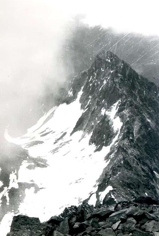
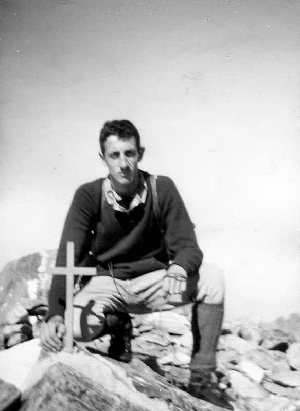
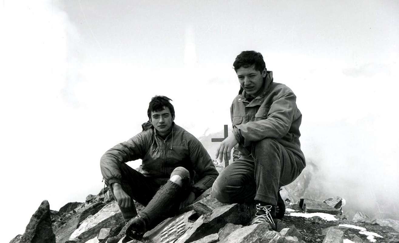
ANCIENT GARIN PEAK OLD B & W
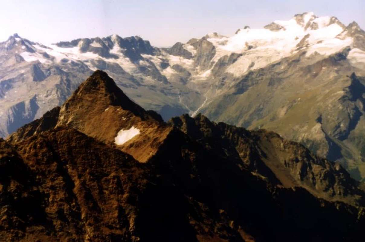
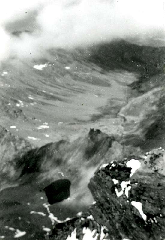
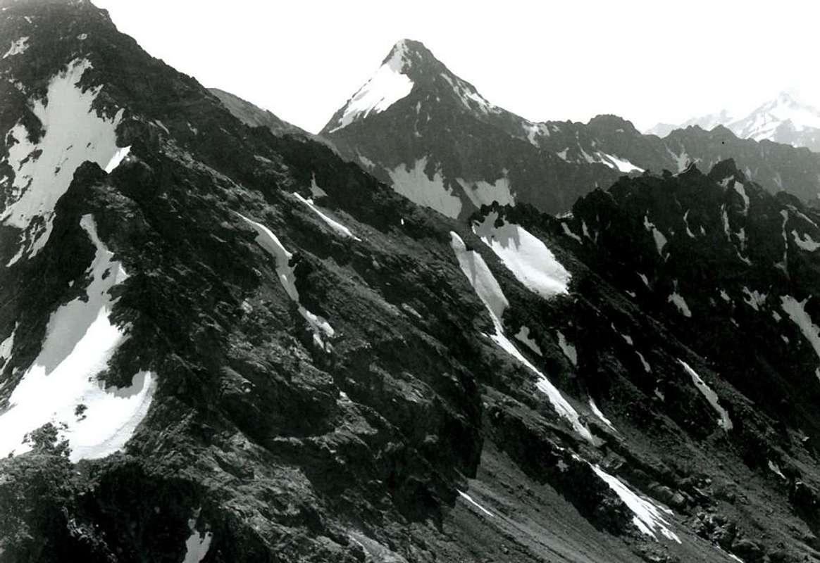
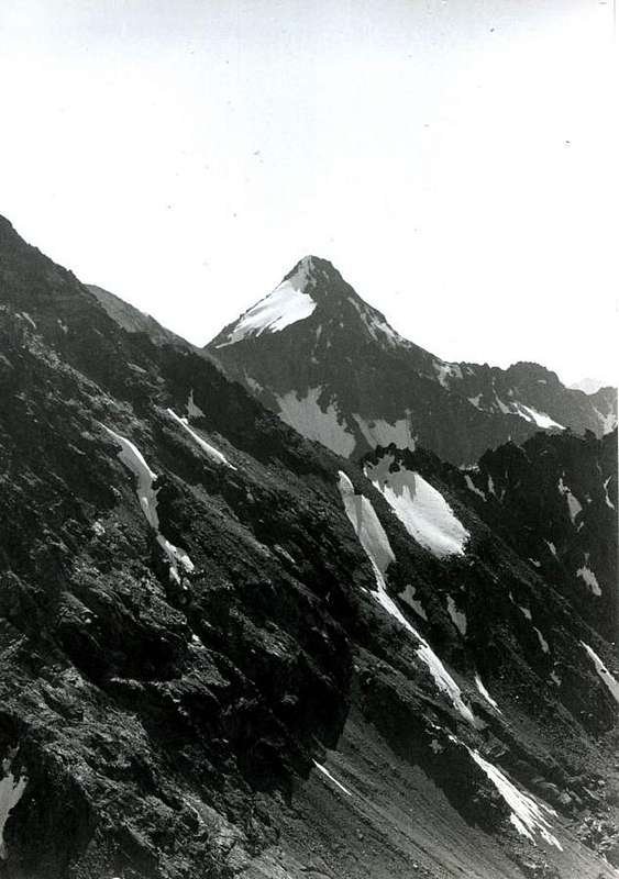
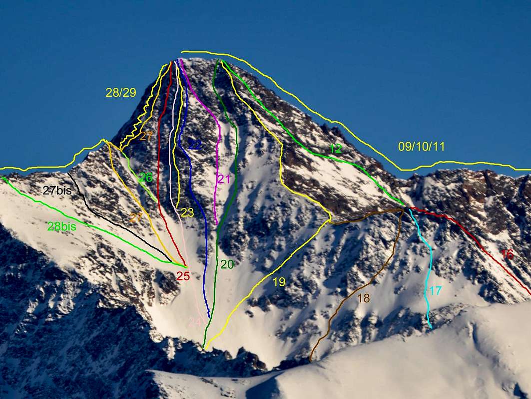
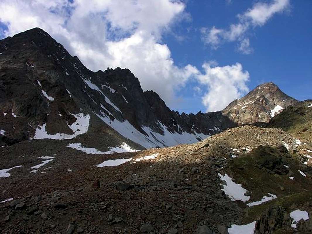
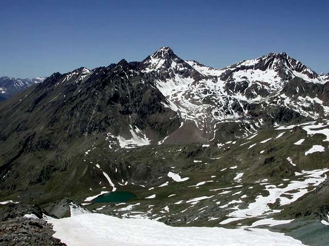
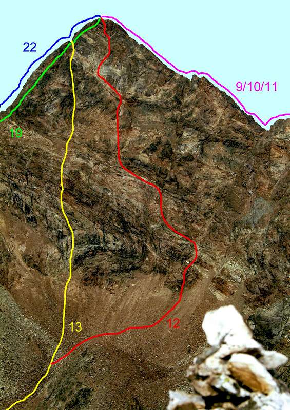
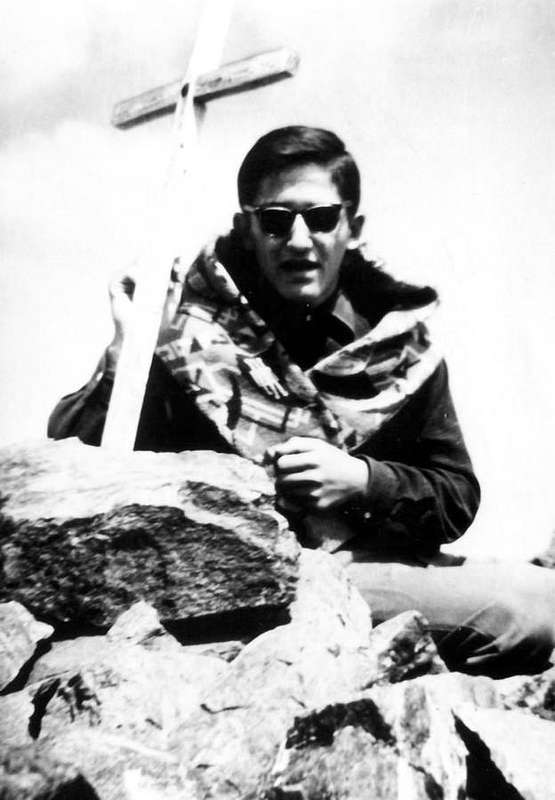
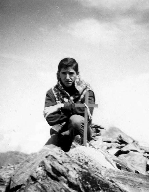
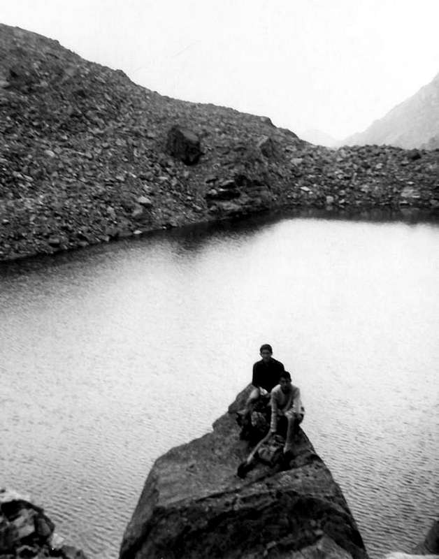
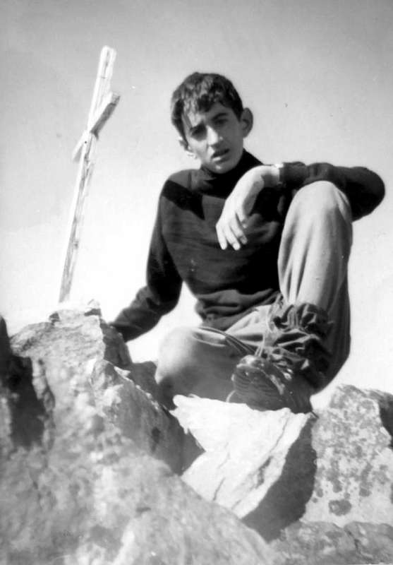
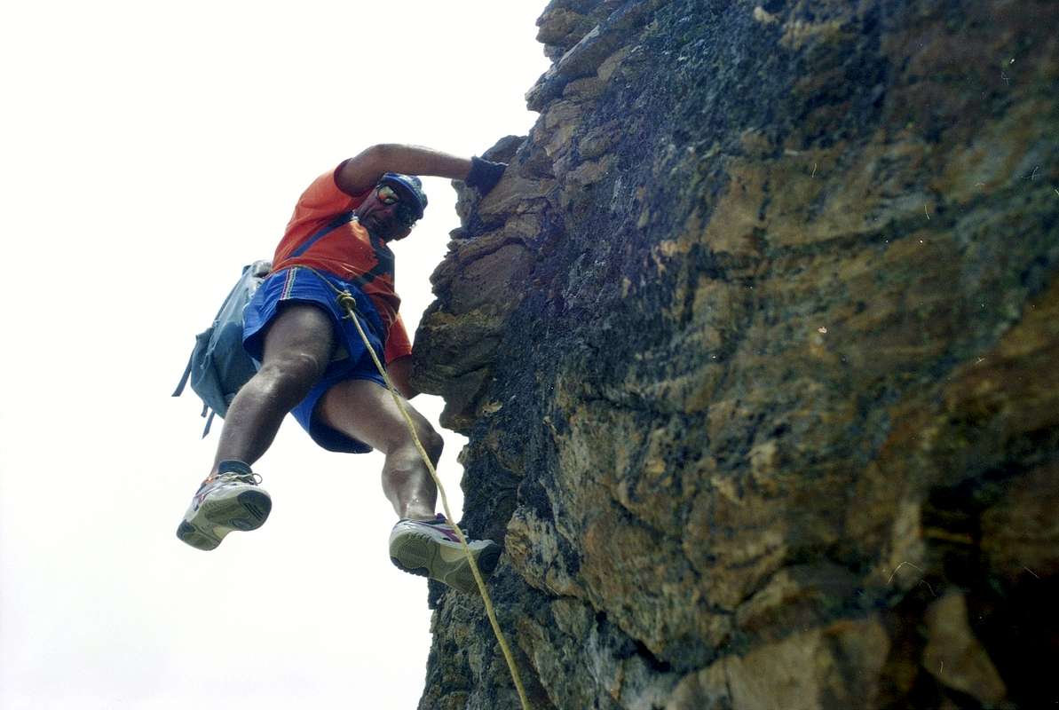
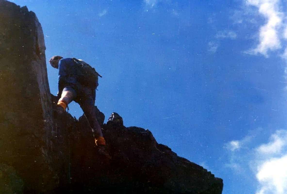
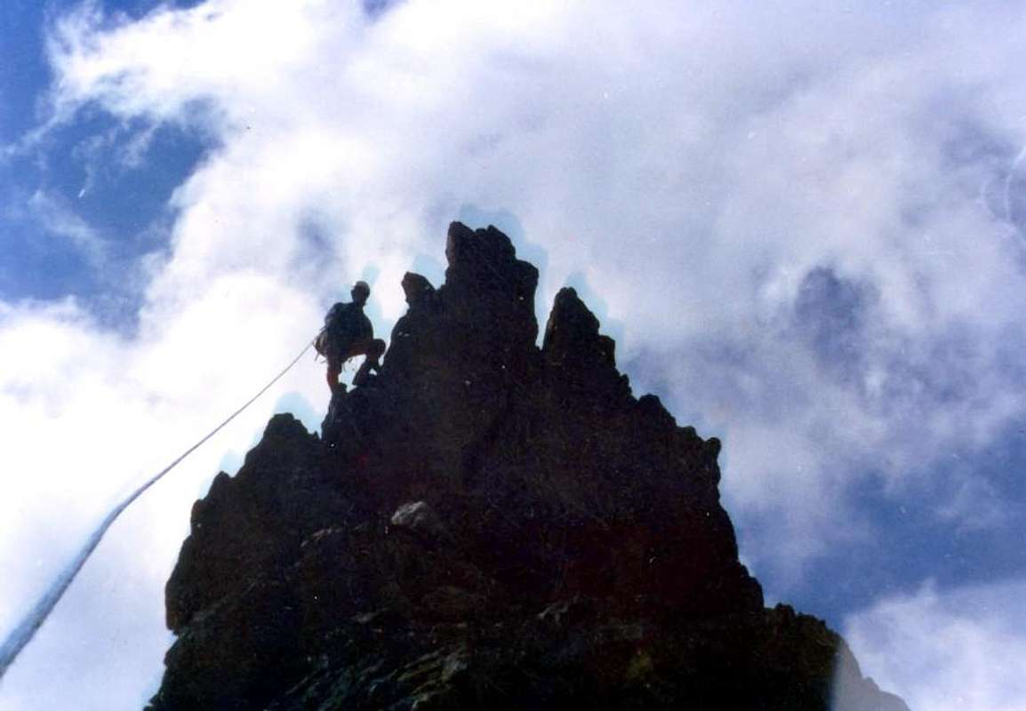
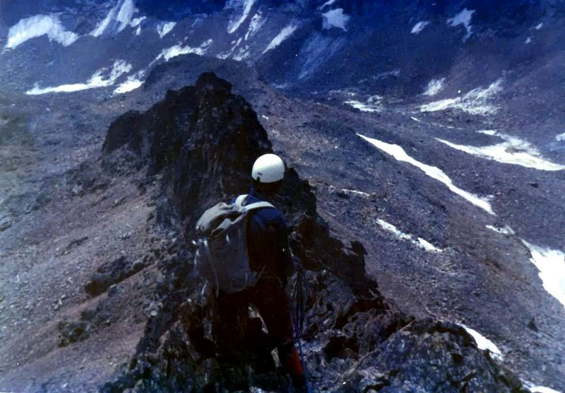
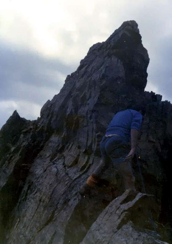
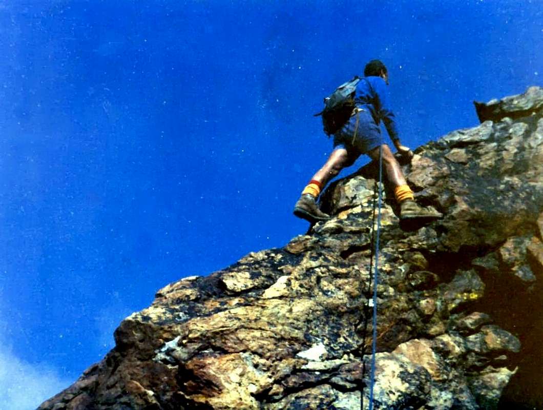
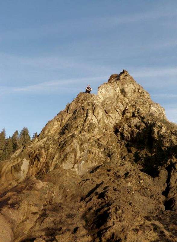
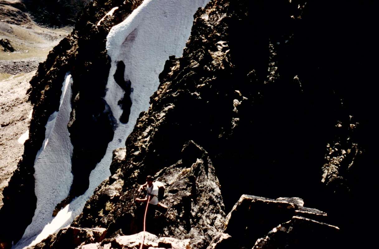
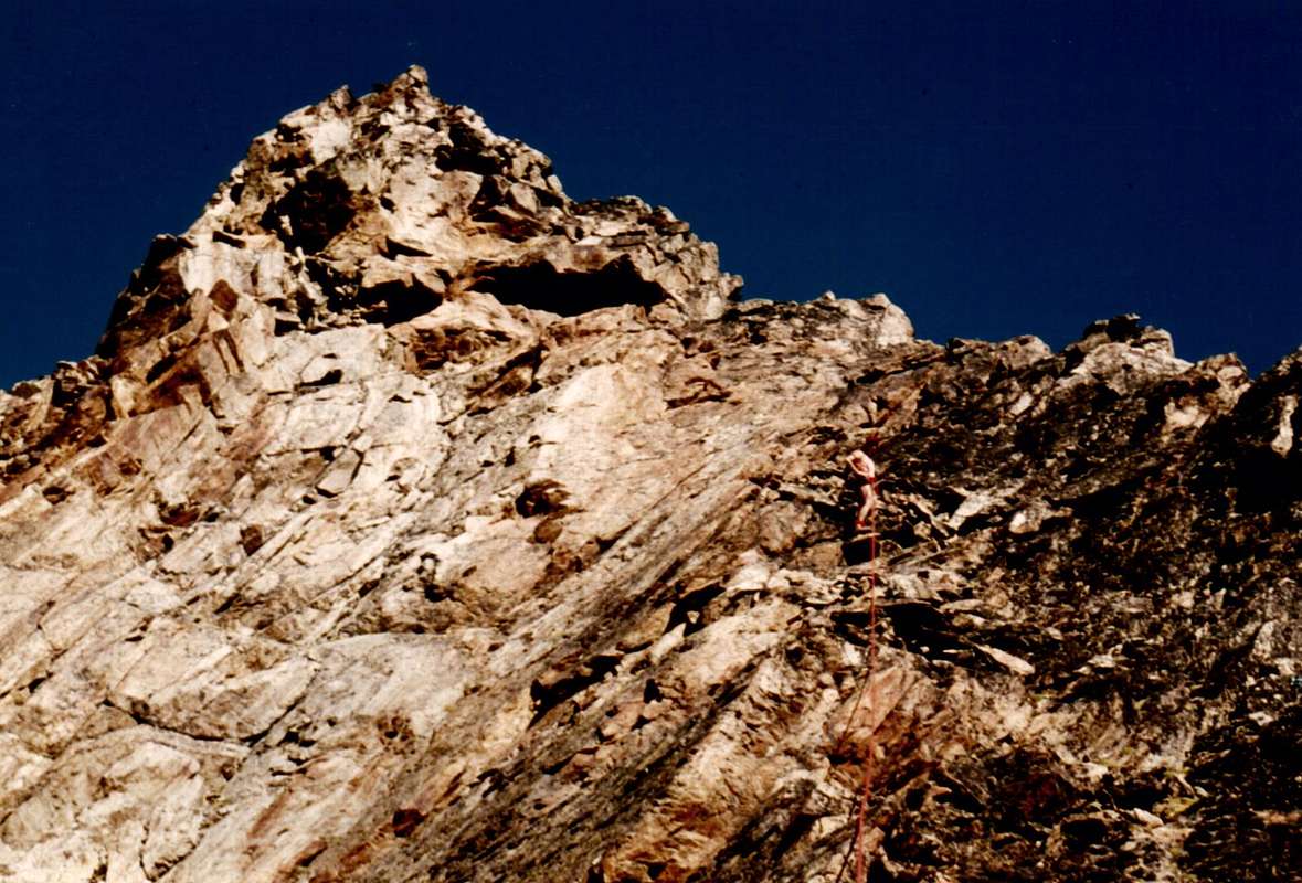
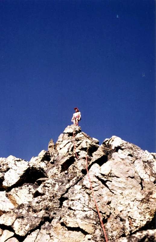
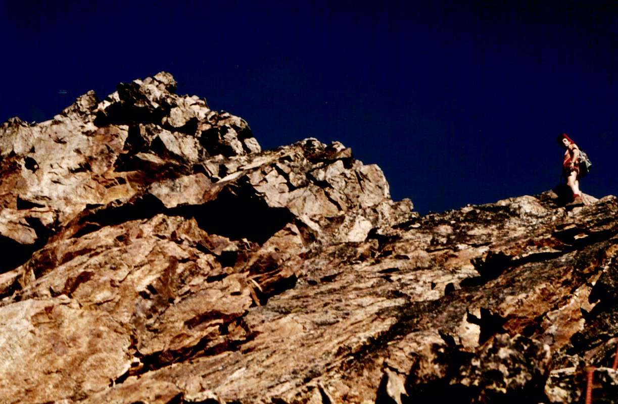
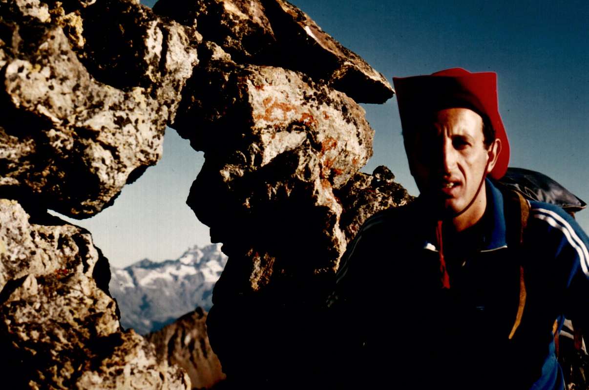
In Pictures: 1) - from Summit to Garin Pass & Loch in Superior Arpisson's Vallon and Arbolle's Valley, in distance; 2) - Northern Faces from Red Point, West Summit; 3/4) - from Nona's Becca to Carrel & Ròss Hills, of Frozen Lake Points and Peak Garin Northwestern Slopes; 5) - from Garin's Top to Grauson Tower, over High Lussert's Vallon.
La Punta Garin o Pic Garin è una piramide slanciata se vista da N o da S, mentre da E e da W appare tronca e più arcigna. Presenta 5 creste e 5 pareti. Il contrafforte SW, partendo da sopra Gimillan (1.787 m.), risalito alla punta, scende, quale nodo topografico importante, al Mont Valaisan (3.296 m.), ove si sdoppia con un ramo verso il Col Garin, la Punta di Pian Bessey e la Punta della Valletta sopra la Conca di Pila; L’altro, risalito alla Punta Rossa e traversatene le tre cime, scende al Col d’Arbolle, scavalca la Punta dei Tre Cappuccini e l’omonimo passo e sale alla vetta dell’Emilius, massima elevazione del gruppo. Da questo una cresta si indirizza alla Becca di Nona sopra la Città di Aosta ed un’altra scende a N-NE verso il Col Blantsette, la Punta Blantsette, il Col Peckoz, la Becca di Seneva ed il Mont Père Laurent, sopra Grand Pollein e Brissogne. Ma non è su questo che vogliamo dilungarci. Piuttosto il nostro pensiero va all’800 ai primi alpinisti di questa montagna e ancora con invidia e gelosia agli anni 30 del ‘900 per la salita della prima invernale. Già affascinante per il suo modo di essere vicina a due centri famosi(Aosta e Cogne), e nello stesso tempo appartata e quasi scontrosa, la Garin non presenta itinerari difficilissimi ma, nello stesso tempo, nessuno banale. La sua roccia non è delle migliori e richiede esperienza e prudenza. I percorsi descritti sono quelli effettuati in quasi due secoli; le partenze risultano quelle effettive con relativi dislivelli totali, intermedi se da un punto di appoggio e finali per la parte terminale del percorso (ad es. da un colle, dalla base di una parete ecc.). Da tenere presente che la costruzione del Rifugio di Arbolle (2.516 m.) ed il posizionamento del Bivacco Franco Nebbia (2.740 m, ex Luseney) nel Vallone dell’Arpisson agevolano le fatiche, mentre nel Vallone Grauson-Lussert il Bivacco Tentori, andato a fuoco, è sostituito dalle Baite del Grauson Superiore (2.540 m). Bella vista sul Gran Paradiso e colpi d’occhio splendidi sui più vicini: Becca di Nona, Monte Emilius, Gruppo delle Roèses, Punta Rossa dell'Emilius, Tour Grauson e Punta Tersiva.
 |
 |
 |
 |
 |
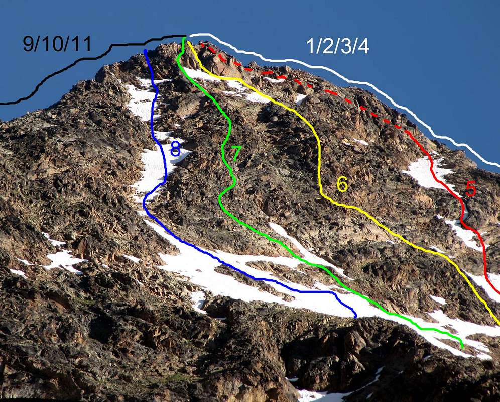
Fundamental routes or basis (10)
To and from:
1° Picture of series, E-SE Slope, near Grauson Vieux Pastures;
2° S-SE Slope, from and near Créuzet Alp;
3° S Wall, from Arpisson's Point;
4° S-SW Spur Wall and S Wall, from Pousset Point;
5° S and W Faces, from Pian's Bessey Point.
|
|
|
|
|
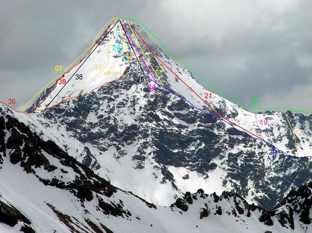
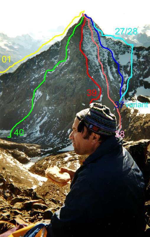
From left or Southern line: in pictures n° 1/2) - S Crest, with relative S-SW Buttress; in photo n° 3) - the integral S-SW Buttress; in n° 4) - South Wall and S Crest (right) and SW Ridge (left); outline of W Wall, SW Ridge (right) and N-NW Edge (left). In foreground n° 5) - from the N-NW Crest and -NW Edge (final part) to S-SW Buttress in the extreme right.
A) - E-SE Arête: from Cogne little Town old departure of the 1886 and 1998 - Montroz Village -Tarabouc Alp (little church) and - Révènti Alp - crossroads 1.895m - Tzecheu Lower Alps - Ecloseur's little bridge upon Gru Torrent (= Great Torrent) (Lavà's/Lussert's/Tsezéire's/Coronas's/Erveillères/Doreire's/Grauson's/Tzte and Money's reuniteds Torrents) and Alps - Pila's Pastures and splendids Waterfalls - Grauson's Vieux Alps (2.273m) ("Pré-Vaudan" Source in tableland near minibridge up Corona's/Doreire's/Money's uniteds Torrents, 25 meters to S-SE) in Grauson's Valley - Crôt Fleurie's Little Valley - Chaz Fleurie, (ruins) and (sources to Southwest in rocky strip or, seldom and now and then, in Northeast) - higher little "comba" (= little valley, generally semicircular or round shape) at base of the Grauson's Tower) - "carving" 3200m about in E-SE Crest.
Giovanni Bobba, Edoardo Bérard and Anselmo Perret; Sep. 06th, 1886, in descent (E-SE Slope, in ascent). First replay by Agostino Ferrari and Cogne's Mountain Carrier Glarey; Sep. 14th, 1898, in descent (E-SE Slope, in ascent). Starting from Gimillan, little bridge 1.840m about Integral on Crest by Osvaldo Cardellina, lone, Jun. 17th, 1990, in descent on thread up to Grauson's Pass and Chaz's Fleurie-Grauson's Vallons to Gimillan Village, after ascent by North Face Direct Route.
F+/PD or, in integral on crest, PD+. (r. 01 and 01bis).
(route's signals 6 from Saint Anthony (little Chapel); 6A from Montroz Village ; 9A from crossroads 1.800m Tarabouc's/Révènti's Alps (left) and Larsinaz's Veins; 8/TVC (= Cogne's Valley Tour) from Gimillan Village, little bridge 1.840m around up Gimillan's Torrent; without signals from Grauson's Vieux Alps. (r. 01/01bis).
*** At present starting from Gimillan Village (1.787m), little bridge 1.840m around upon Gimillan' Torrent, to NE from village - joining, with preceding route, in crossroads 1.895m (Cross and Révènti's/Ecloseur's mini Chapel 1.910m around) to Grauson's Valley and Grauson's Vieux Village and Alps (2.273m) - little bridge up Lussert's Torrent in North of the village to Val Crot and Chaz Fleurie.
(Without signals in terminal part from Grauson's Vieux Alps). (r. 01/01bis).
B)- SE Slope: from Cogne Great Village to Montroz Village, old departures - Tarabouc's and Révèntis Alps ((ruins) - Tzecheu's/Ecloseur's Alps, near Gru Torrent; source in little wood upper the little bridge, 30 meters to SE - Pila's Pastures and in canyon waterfalls - Grauson's Vieux Village and Alps (2.273m) (source) in Grauson's/Lussert's Valley - Crôt Fleurie Little Valley - Chaz Fleurie, (ruins) and (sources to SW in rocky band also in NE) - higher little valley at Grauson's Tower base.
Abbots Aimé Gorret, J. P. Carrel and four unknowns boys; Aug. 23th, 1866, in ascent and in descent.
F/F+/PD-. (r. 02).
(route's signals 6; 6A; 9A; 8/TVC; without signals in terminal part from Grauson' Vieux Alps).). (r. 02)).
*** At present for the starting and route's signals See route A.
C) - South Arête and Garin's South-southwest Spur: from Cogne Old Village - Ecloseur's little Bridge - Grauson's Vieux Alps - Grauson Valley - East Face Arpisson's Tower and crossing in crest to Garin's Peak (the first mountaineers from Summit in descent route to Grauson' Vieux Alps and Cogne Village.
(r. signals 6; 6A; 9A; 8/TVC; without sign. in term. part from Grauson's Vieux Alps)). (route 09).
*** Also: from Gimillan Village, to North Parking 1.840m around, near Games Area - Arpisson's little saddle 2264m - Arpisson' s "Cornass" - SW Crest of Arpisson's Point and crossing to Garin's Peak, in integral.
(r. sign. 3/TVC; without sign. in term. part from saddle 2.264m). (route 10).
*** Or: from Gimillan Village, Parking 1.840m about - Arpisson's little saddle 2.264m - Arpisson's Pastures - Pian Bessey Tableland - West Slope Pila's NE Pass - Arpisson's Tower and crossing to Fleurie Pass - Lavà Points (in the top of three littles summits? ) - Fleurie or Fiorito Point (Summit? ) - “Carving Garin Peak's” and Garin's Peak South Ridge in term. part.
(r. sign. 3; 2/TVC; without signals in term. part from Plan Bessey 2.550m around). (route 11).
Three VARIEDS routes by Garin's S-SW BUTTRESS or SPUR.
C1) - ARPISSON's TOWER route (route or basis).
Rev. W. C. Compton, A. V. Valentine - Richards, Alois Burgener and Siegfried Burgener, famous Mountain Guides of Switzerland; Aug. 20th, 1897, in descent from Garin's Peak to Arpisson's Tower - Grauson's Vieux Alps in Grauson's Valley - Pila's Pastures - Ecloseur's Alps and Cogne Village.
PD+. (r. 09).
C2) - INTEGRAL from ARPISSON's POINT route (ROUTE or BASIS).
Osvaldo Cardellina and Camillo Roberto Ferronato, in integral from Gimillan Village - Arpisson's Points - Pila's SW Pass - Coupées Points (three summits) - Pila's NE Pass - Arpisson's Tower (eight littles summits) - Fleurie's Pass - Lavà Points (three summits) and Fleurie or Fiorito Point (in First Ascent Absolute) - Garin's "Carving" and South Crest in terminal part; Sep. 17th, 1978, in integral ascent from Arpisson's Point. PD+/AD+. (r. 10).
C3) - PILA's NE PASS route (route or basis).
Franco Brevini and Companions, from Gimillan Village - little saddle 2.264m - Arpisson's Pastures (Arpisson's Torrent and sources) in Arpisson's Valley and couloir of the West Slope of the NE Pila's Pass - Arpisson's Tower and crossing in ridge to Summit Garin's Peak; ? th?, 1981 ? .
PD+/AD-. (r. 11).
|
|

|
|

|
D) - S-SW Wall: from Gimillan Village - little saddle 2.264m - Arpisson's Valley - Arpisson's Pastures (torrent and to east variaous sources) - Plan Bessey Tableland ( one sole source - ancient South Garin's Glacier; extint and in permafrost effect) and little Comba South at base Face's).
Osvaldo Cardellina and Camillo Roberto Ferronato; Aug. 27th, 1978.
PD+/AD+ .
(r. sign. 3; 2/TVC; without sign. in term. part from Plan Bessey Tableland 2.550 around). (r. 12).
E) - SW Arête: from Cogne little Town - Montroz Village - Ecloseur's/Pila's Alps and Waterfall in Grauson's Valley - Grauson's Vieux Alp - crossing upon Gru Torrent - Val Crot Fleurie - Chaz Fleurie (ruins - crossing E/W Slopes Fleurie's Pass - Arpisson's little "comba" South - East Slope of the Quota 3.208m and SW Ridge in terminal part (old, "eternally" long and illogical route, deserted and never, maybe, repeated).
(r. sign. 6; 6A; 9A; 8/TVC; without sign. in term. part from Grauson' Vieux Alps). (r. 19).
*** Or: from Gimillan Village (logic route) - little saddle 2.264m - Arpisson's Valley and Pastures ( Arpisson's Torrent, source in Pian Bessey Tableland, source under SW shore of the Garin's Lake) to Franco Nebbia Bivouac (2.741m), near the lake.
(r. sign. 3; 2/TVC; without sig, in term. part from bivouac). (r. 19).
**** Also: from Pila Tourist/Station Gorraz's Parking (1.845m) or from Chair-lift Higher Station (2.309m) - Chamolé's Lake and Pass (2.641m) - Arbolle's Refuge (2.516m), two Lakes West and East and Arbolle's Torrent and Valley - crossing W/E Slopes of Garin's Pass to Garin's Lake (2.864m) (more long route).
(r. sign. 14 or 19A or 19B; 18/TVC; 14/TVC/102 IHR = INTERVALLEYS HIGH ROUTE; 18/TVC; without signals from pass). (r. 19).
*** Or, better, : from Arbolle's Refuge, (2.516m) - two Arbolle's Lakes, Torrent and splendid source at base West Slope Garin's Pass (2.815m). From Pass to Garin's Lake ( source to SW) in Arpisson's Valley.
(r. sign. See above "Or, better").
In FIRST ASCENT ABSOLUTE of MOUNTAIN. SW Ridge route?
Abbots Balthazar Chamonin and Pierre Chanoux; ? th?, 1856.
Certainly, but partial in final part W. Oliver, C. Hiatt, C. Baker and Alexander Burgener, famous Mountain Guide of Switzerland; Sep. 01th, 1894
FIRST in WINTER and absolute in winter of mountain, by SW Ridge: Anselme "Ansel" Falcoz and Pierluigi "Piero" Falcoz; Dec. 25/26th, 1936.
PD/PD+. (r. 19).
F) - W-NW Wall: from Pila Village Tourist/Station - Chamolé's Lake and Pass (2.641m) - Arbolle's Refuge (2.516m), near two Lakes in Arbolle's Valley - Arpisson's Valley by Garin's Pass (2.818m) and Garin's Lake.
(r. sign. 14 or 19A or 19 B; 18; TVC; 102 IHR; without signals from pass).
*** Or: from Gimillan Village - Arpisson's Valley and Pastures - Pian Bessey's Tableland (sole source) to Franco Nebbia Bivouac and Garin's Lake, with source.
Anselme Falcoz, solo; ? th?, 1936 and several times (3/4) in years ‘30/40; (in The Thirties).
PD/PD+ .
(r. signals 3; 2/TVC; without signals from Franco Nebbia Bivouac. (r. 20).
G) - NW Arête and W-NW Edge: from Pila Village Tourist/Station - Chamolé's Lake and Pass - Arbolle's Refuge, Lakes and Valley - Arpisson's Valley by Garin's Pass to Garin's Lake.
(r. sign. 14 or 19A or 19B/TVC; 14/102 IHR; 18/TVC; without signals from pass). (r. 28).
*** Or: from Gimillan Village - Ecloseur's Alps - Pila's Pastures -Grauson's Vieux and Nuove Alps in Grauson's/Lussert's Valley (various torrents and mervellaous lakes, innumerable sources) and higher little "comba" between Reds Points and Garin's Peak.
(r. sign. 8; 8A/TVC/102 IHR; without signals from Lussert's Higher Lake (2.906m) to little "comba"). (r. 28).
*** Also called: from Gimillan Village - little saddle 2.264m - Arpisson's Valley and Pastures - Pian Bessey's Tableland (source) - Franco Nebbia Bivouac - (source to NE, under the Garin's Lake.
In FIRST ASCENT ABSOLUTE of MOUNTAIN. N-NW Ridge? (almost certainly)
Abbots Balthazar Chamonin and Pierre Chanoux; ? th ? (Summer), 1856.
Certainly Officer Cesare Pavese and two soldiers of 9° Company Alpine Troups, believing to be the first; Aug 09th, 1875.
First in winter, in descent; Carlo Lucianaz, Remo Chabod ,of Charvensod, and Lorenzo Gorret, of Verrayes; Jan. 01th, 1995.
F+/PD-/PD.
(r. signals 3; 2/TVC/102 IHR; without signals from Lussert's Higher Lake (2.906m). (r. 28).
H) - N Slope: from Gimillan Village little bridge 1.840m - Ecloseur's/Pila's and Grauson's Vieux Alps in Grauson's/Lussert's Valley and three greats Lakes and various littles - higher little "comba" between Garin's Peak and Reds Points. (See under item I).
(r. sign. 8; 8A/TVC/102 IHR; without sign. from Lussert's Higher Lake (2.906m to little "comba"). (r. 37).
*** Or: from Pila Tourist/Village (illogic departure; the first mountaineer in 1936, for to Pila return) - Arbolle's Valley by Valaisan's Pass also Garin Pass by crossing Valaisan's Mount.
Anselme "Ansel" Falcoz and Pierluigi "Piero" Falcoz; Dec. 26th, 1936), in the occasion of the First in Winter Absolute, in descent for the return in Pila's Alps and Aosta Town.
PD.
(r. signals 14 or 19a also 19B/TVC; 14/102 IHR and without signals in term. part from quota 2.550m. Or 18/TVC to Garin's Pass and without signals from pass). (r. 37).
I) - N-NE Edge: from Gimillan Village - Ecloseur's little bridge up Gru Torrent (Lussert's/Corona's/Doreire's/Grauson's/Doreire's/Money's uniteds Torrents) and Alps - Pila's Pastures and mervellaous Waterfall - Créuzet Alp - Grauson Vieux Alps (2.273m) and Nuove (2.540m), in Grauson's/Lussert's Valley and Three Lakes (Lower, of Middle and Higher) and various others littles lakes, remainings of the ancient glacier in glacial cirque. between Grauson's Tower and Garin Peak.
(r. sign. 8/TVC/102 IHR; without signals from Higher Lake (2.906m)). (r. 39).
*** Also: from Pila Tourist Village or from of the Chamolé Chair-lift's Station - Chamolé's Lake and Pass - Arbolle's Refuge, Lakes and Valley - crossroads 2.586m around (routes to Garin Pass in right and to Emilius in left, near Pouleins and Modzon Ancients Barracks (= of the colts and steers; at present perimeters ruins, with outsides walls) - easy descent in mini Lake 2.838m and, by ground stone, to SE route - by crossing W/E Slopes of the Valaisan's Pass (long route and dangerous, for rocks fall from higher steep and friable rocky band).
(r. sign. 14; 19A; 19B/TVC; 14/TVC/102 IHR and without signals in term. part from quota 2.550m). (r. 39).
*** Or: from Pila Village - Chamolés Lake and Pass - Arbolle's Valley - Arpisson's Valley by Garin Pass and crossing South/North of the Valaisan's Mount (illogic and unscheduled route, of the first mountaineers for return to Pila Village).
Osvaldo Cardellina, Gianni Junod, Giorgio Boglione and Giovanni De Paoli; Jul. 18th, 1968, in ascent from Pila Village - Chamolés Lake and Pass - Arbolle's Alps, Lakes and Valley - Arpisson's Valley by crossing W/E of the Garin's Pass - Garin's Lake - Little Gully SW (27bis Variant) and N-NW Edge. In descent from Summit to Valaisan's Pass and crossing to Reds Points, West Summit, round trip. Descent by West Slope Valaisan's Pass in Arbolle's Valley, for the return in Pila's Village.
PD/PD+.
(14 or 19A or 19B; 18/TVC; without signals in term. part from pass). (r. 39).
L) - NE Wall: from Gimillan Village, little bridge 1.840m. - Lower Tzecheu's/Ecloseur's Alps - Grauson Vieux and Nuove Alps in Grauson's/Lussert's Valley and various Lakes, "North route".
(r. sign. 8; 8A/TVC/102 IHR; without sign. from Lussert's Higher Lake (2.906m)). (r. 40).
*** Also: by Lussert's Glacier (extint and in permafrost effect), in crossing East/West to Face's base, "South route".
Osvaldo Cardellina, solo, in day from Gimillan - Ecloseur's/Pila's/Grauson's Vieux and Nuove Alps - Lower Lussert's Lake - Old Lussert's Glacier in crossing from East to West; Sep. 09th, 2007.
AD+.
(8; 8/TVC/102 IHR and without signals in term. part from Lussert' Lower Lake (2.713m), also of the Middle Lake (2.790m) to, by East/West direction, to Old Lussert's Glacier. (r. 40).
To and from: 6° Picture, NE Wall, near Laures's Pass; 7°, NE Wall, E-SE Slope, near Corona's Pass; 8°, NE Wall, from Higher Lussert's Lake; 9°, W Spur Grauson's Tower, E-SE Crest, near Middle Lussert's Lake; 10°, E-SE, NE Faces, from Laval's Point.

|
|
|
|
|
40 routes from and to Punta or Pic Garin also GARIN PEAK
A - ROUTES FROM CHAZ OR VAL CROT FLEURIE - GRAUSON - LUSSERT VALLEYS (1/8 + 37/40).(01) - (ROUTE or BASIS) E-SE Arête (from Cogne Great Village old departure of the 1886/1998). Montroz Village (1.702m) (route's signals 6 and 6A) - Tarabouc Alps (1.831m) (little church) - Révènti Alp (1.906m) - Tzecheu Lower Alps - Ecloseur's little bridge 1.742m upon Gru Torrent - Pila's Pasture and in canyon splendids Waterfalls - Créuzet Alp (2.244m) - Cross's "Passage" (2.296m) between the routes to Money's Lake and Grauson Vieux Ancient Village and Alps (2.273m) (Pré Vaudan Source, near little bridge to alps) in Grauson's Valley (route's signals 9A/8 and TVC = of the Cogne Valley's Tour) - Crôt Fleurie Valley or Chaz Fleurie and Ancient Alp (ruins) - higher little valley at Grauson's Tower base - "carving" 3.200m about in E-SE Crest (without road signs).
ooo At present starting from Gimillan little bridge 1.840m about up Gimillan's Torrent (at starting and joining in crossroads 1.895m, with previous route).
(Signal 8/TVC) - (Cross and Révènti's/Ecloseur's mini Chapel).
Giovanni Bobba, Edoardo Bérard and Anselmo Perret; Sep. 06th, 1886 (SE Slope, in ascent), in descent to Grauson's Pass and from pass, by North Slope, descent on Lussert's Glacier (first replay descent of 1866); first replay Agostino Ferrari and B. Glarey, after ascent by N-NW Ridge; Sep. 14 th, 1898. With Departure from Gimillan's, little bridge 1.840m around Integral on Crest: Osvaldo Cardellina, solo, Jun 17th, 1990, in descent on thread up to Grauson's Pass and Chaz's Fleurie/Grauson's Vallons/Gimillan's Village, after ascent by North Face Direct Route.
Difference in level: from Gimillan 1.700m; from Grauson Vieux 1.200m; from Chaz Fleurie 1.000m; terminal part 350m; (I°/II°; integral on thread II°+/brief passages of III°-); F+/PD or PD+.
(01bis) - (ROUTE or BASIS) E-SE Arête Integral on the thread Osvaldo Cardellina, lone, Jun 17th, 1990, in descent on thread up to Grauson's Pass and Chaz's Fleurie/Grauson's Walloons/Gimillan's Village, after ascent by North Face Direct Route.
Difference in level: from Gimillan 1.700m; from Grauson Vieux 1.200m; from Chaz Fleurie 1.000m; terminal part 350m; integral on thread II°/II°+/brief passages of III°-); PD/PD+.
(02) - E-SE Slope (also VARIANT, with descent by N Slope of the Grauson's Pass) . At present, starting from Gimillan, little bridge 1.840m about upon Gimillan's Torrent, to NE from village). Révènti's/Tzecheu's/Ecloseur's/Pila's Alps - Grauson Vieux Village and Alp - little bridge 2.290m in N-NW to Chaz Fleurie Little Valley, in ascent).
Abbot Aimé Gorret; J. P. Carrel and four boys Aug. 23th, 1866, in ascent and descent to Grauson's Pass and to Lussert's Glacier (by North Slope of Grauson's Pass); replay by North Slope descent Agostino Ferrari and B. Glarey; Sep. 14 th, 1898; Abbot Aimé Gorret; J. P. Carrel Sep. 14th, 1866, in ascent and descent for, by barometer, to measure of peak height above sea level.
Differ. in level: from Gimillan 1.700m; from Grauson Vieux 1.200m; from Grauson Nuove 940m; t. p. from Grauson Pass 370m; (I°/II° terminal part and II° in descent, 110m, from Grauson Pass to Lussert Valley); F/F+/PD-.
ooo For signals routes (SEE) Or basis routes A and B, in ascent; G, H, I, L, in descent.
(03) - E-SE Arête (North Wall of “Gendarme Rosso” - “Red Gendarme”). Starting from Gimillan, little bridge 1.840m). Ecloseur's Alps - Pila's Alps and waterfalls - Grauson Vieux Alps - Grauson Nuove or Dessus also Higher /2.540m) - Old Lussert's Glacier, extint and in permafrost effect in crossing from east to west at base of the Grauson's Red Gendarme.
Aldo Cambiolo and Luciano Ratto (and crossing W Arête of Tour Grauson); ? th?, 1996 ? Aldo Cambiolo and Luciano Ratto (and descent S Slope in Chaz Fleurie Valley); ? th?, 1997? Aldo Cambiolo, Enrico Barbero, Paola Grasso and Luciano Ratto (and crossing E-SE Arête to Garin Peak); Sep. th?, 1998; in ascent from Lussert Glacier.
Diff. in lev.: from Gimillan 1.700m; from Grauson Vieux 1.200m; from Grauson Nuove 940m; t.p. from Lussert Glacier to Little Saddle of “Gendarme Rosso” - "Red Gendarme" 130m; t. p. from Little Saddle to Garin Peak 350m; (III°/IV°/V°/V°+); AD+/D/TD.
ooo For route's signals SEE Or basis routes G, H, I and L, in ascent; A and B, in descent
(04) - E-SE Arête (crossing from Grauson's Tower - Great Gendarme - Indented Tower - Bifide Tower - Red Gendarme - E-SE Crest. Starting from Gimillan). Ecloseur's, Pila's, Grauson's Vieux - Grauson's Nuove Alps (2.540m), (variaous sources).
Cogne's Mountain Guide Vincenzo Perruchon and Jacques Serres; ? th?; 1972?; the superior part from Garin Peak to Grauson's Pass by groups of 1866, 1886, 1898 in descent and other a group of rope climbers in ascent and descent. Replay partially on Feb. 06th, 1939, by "Ansel" Falcoz, solo, after ascent on of Mount's Grauson North Face, W Side, and exit out near Great Gendarme whith course to Mount Grauson in ridge; again same replay, with route more in right (East) and exit out near West Grauson's Summit, on July 1983, by of Cogne's Mountain Guide Elmo Glarey, dead on 2010, with an unknown client.
Diff. in lev.: from Gimillan 1.700m; from Grauson Vieux 1.200m; from Grauson Nuove 940m; from Grauson Tower 500m; t. p. 350m; (II°/III°/IV°/II°); D-.
ooo For route's signals SEE Or basis routes A, B, H, I and L; without signals from Grauson's Nuove Pastures (2540m).
(05) - (ROUTE or BASIS) E-SE Slope (from Gimillan Village, little bridge 1.840m - Ecloseur's/Pila's Alps in Grauson's Valley and Grauson Vieux Alps (2.273m) - Crôt Fleurie Valley - Chaz Fleurie. Starting from Gimillan).
Abbot Aimé Gorret, J. P. Carrel and three schoolboys and of Aosta Town the young Lorenzo (?); Aug. 23th, 1866, in ascent and descent.
Diff. in lev.: from Gimillan 1.700m; from Grauson Vieux 1.200m; from Chaz Fleurie 1.000m; t. p. 350m; (I°/II°); F+/PD-.
ooo For route's signals (i>SEE) Or basis routes A and B.
(06) - E-SE Wall (from Gimillan Village - Grauson's Valley - Crôt Fleurie Valley - Chaz Fleurie's little "comba" - E-SE Face Direct route. Starting from Gimillan).
Osvaldo Cardellina, solo; Jul. 24th, 1988; in day from Gimillan.
Diff. in lev.: from Gimillan 1.700m; from Grauson Vieux 1.200m; from Chaz Fleurie 1.000m; t. p. 450m; final - conclusive part 180m: (II°/II°+/III°-); PD+/AD-.
ooo For route's signals (SEE) Or basis routes A and B.
(07) - S Arête and SE “Rib Winding” (from Gimillan Village -Ecloseur's/Pila's/Grauson's Vieux's Alps in Grauson Valley - Crôt Fleurie Valley - Chaz Fleurie - SE Face's "Rib Winding". Starting from Gimillan).
Osvaldo Cardellina, lone; Jul. 24th, 1988, in descent; in day from Gimillan.
Diff. in lev.: from Gimillan 1.700m; from Grauson Vieux 1.200m; from Chaz Fleurie 1.000m; t. p. 450m; final-conclusive part 150m; (I°/II°/II°+); PD/PD+.
ooo For route's signals (SEE) Or basis routes A and B.
(08) - S-SE Couloir (from Gimillan little bridge 1.840m in NE of the village Ecloseur's/Pila's/Grauson's Vieux's Alps in Grauson Valley - Crôt Fleurie Valley - Chaz Fleurie - S-SE Little Gully. Starting from Gimillan).
Osvaldo Cardellina, solo; in descent; Sep. 09th, 2007; in day from Gimillan.
Diff. in lev.: from Gimillan 1.700m; from Grauson Vieux 1.200m; from Chaz Fleurie 1.000m; t. p. 450m; final - conclusive part 150m; (I°/I°+); (30°/35°); F+/PD-.
OOO For route's signals (SEE) Or basis routes A and B.
B - CROSSINGS SW BUTTRESS OF PUNTA GARIN (09/11).
(09) - Crossing S Arête and SW Buttress (from Garin Peak in descent - “Carving” of Garin - Fleurie Pass to Arpisson Tower's (eight little summits) - starting from Gimillan).
Rev. W. C. Compton, A. V. Valentine Richards, Alois and Siegfried Burgener, Mountain Guides of Switzerland; Aug. 20th, 1897, in descent.
Diff. in lev.: from Gimillan 1.850m; from Arpisson Tower 370m; t. p. from “Carving” of Garin Peak 220m; (I°/II°/II°+); PD+.
ooo For route's signals (SEE) Or basis routes C in ascent; A and B, in descent.
(10) - (ROUTE or BASIS) Crossing SW Buttress and S Arête (from Gimillan - Punta of Arpisson in ascent - SW Pila Pass - Pointes Coupées (three) - NE Pila Pass - Arpisson Tower (eigtht little summits) - Fleurie Pass - Punte of Lavà (three) - Punta Fleurie - “Carving” of Garin by South Arête to S Summit - starting from Gimillan).
Osvaldo Cardellina and Camillo Roberto Ferronato; Sep. 17th, 1978; integral in ascent and in day from Gimillan Village.
Diff. in lev.: from Gimillan 2.180m; from Punta di Arpisson 700m from Arpisson Tower 370m; t. p. 220m; (I°/II°/III°-/III, in integral); PD+/AD+.
ooo For route's signals SEE Or basis routes C, in ascent; A and B, in descent.
(11) - Crossing half SW Buttress and S Arête (from Gimillan - West Slope of Pila NE Pass - of Arpisson Tower (eight little summits) - Fleurie Pass- Lavà's ? Points (on the top ?) - Fleurie Point ? (on the top ? ) - Carving of Garin - South Arête to S Summit - starting from Gimillan).
Franco Brevini and Companions; ? th?, 1981 ?.
Diff. in lev.: from Gimillan 1.890m; from Pila NE Pass 410m; t. p. 220m; (I°/II°/III°-); PD+/ AD.
ooo For route's signals (SEE) Or basis routes C, in ascent; A and B, in descent.
C - ROUTES OF SOUTH WALL (12/13).
(12) - (ROUTE or BASIS S-SW Wall (route of Right - starting from Gimillan - Arpisson's Alp - Pian Bessey - Little "Comba" South).
Osvaldo Cardellina and Camillo Roberto Ferronato; Aug. 27th, 1978; in day from Gimillan.
Diff. in lev.: from Gimillan 1.700m; from Franco Nebbia Bivouac 720m; t. p. 350m; (I°/II°/III°/III°+); PD+/AD+.
*** For route's signals SEE Or basis routes C2, C3, D, E, F and G in ascent and in descent; also G, H, I, L, A and B in descent .

|
|
|

|
|
(13) - S-SW Wall and SW Arête, terminal part integral (route of Left - starting from Pila - Arbolle's Valley - Garin's Pass and Lake also from Gimillan).
Osvaldo Cardellina and Giuseppe Lamazzi; Aug. 26th, 1973; in day from Pila.
Diff. in lev.: from Pila 1.850m; from Chamolé Station and Lake 1.350m; from Arbolle Hut 1.000m; from Garin Pass 650m; from Gimillan 1.700m - from Franco Nebbia Bivouac 720m; t. p. 350m; (IV°+/III+°/III°); AD+/PD+.
ooo For route's signals (SEE) Or basis routes E, F, G, H and I.
D - CROSSINGS FROM QUOTA 3.207/8m TO PUNTA GARIN (14/19).
(14) - SW Arête and NW terminal Couloir (Grauson Valley - crossing E/W Fleurie Pass - E-SE Slope of Quota 3.208m to SW Ridge - starting from Gimillan).
F. W. Oliver, C. Hiatt, C. Baker and Switzerland's Mountain GuideAlexander Burgener; Sep. 01th, 1894; in day from Cogne.
Diff. in lev.: from Cogne 1.970m; from Gimillan 2.000m; from Grauson Vieux 940m; from Fiorito also Fleurie Pass 950m; t. p. 320m; (I°/II°); PD/PD+.
ooo For route's signals SEE) Or basis routes A, B and D in ascent; G, H, I, L, A and B the 1894 Company/Group. Or basis routes C2, C3, D, E, F and G in ascent; A and B in descent the 1897 a Group of rope mountaineers.
|
|
|

|
|
|
(15) - SW Arête (from Pila - Arbolle's Valley - Garin Pass and Lake - S-SE Edge, between E-SE and S-SW Slopes of the Quota 3.208m to SW Crest - starting from Pila or Gimillan).
Osvaldo Cardellina, Walter Bianquin and Ilario Antonio Garzotto; Aug. 21 th, 1965; in day from Grande Cerise (Pila) - Arbolle - Garin Pass and Lake.
Diff. in lev.: from Grand Cerise 2.100m; from Pila 1.850m; from Chamolé Station and Lake 1.350m; from Arbolle Alp 1.000m; from Garin Pass 650m; from Garin Lake 660m; from Gimillan 1.700m; from Franco Nebbia Bivouac 720m; t. p. 320m; (I°/II°/II°+); F+/PD/PD+.
(16) - SW Arête (from Pila - Arbolle's Valley - Garin's Pass - S-SW Face, Integral, of Quota 3.208m - starting from Pila or Gimillan).
Osvaldo Cardellina, Alessandro Cardellina, Christian Gianni Ilario Cardellina, Domenico Demichelis, Giuseppe Lamazzi, Danilo Blanc and Giorgio Pinna; Aug. 31th, 1986; in day from Chamolé Station.
Diff. in lev.: from Pila 1.850m; from Chamolé Station and Lake 1.350m; from Arbolle Alp 1.000m; from Garin Pass 650m; from Gimillan 1.700m; from Franco Nebbia Bivouac 720m; t. p. 510m; from Quota 3.208m 270m; (I°/II°/II°+); PD+.
(17) - SW Arête (from Gimillan - Arpisson Valley and Alp - Edge between S-SW Slope and W-SW Face of Quota 3.208m - starting from Gimillan or Pila).; from Franco Nebbia's Bivouac construction on 2004
Unknown, or probably W. C. Compton, A. V. Valentine Richard, with Swiss Mountain Guides Alexander Burgener and Siegfried Burgener, (Aug 08th, 1897), surely the Cogne's Mountain Guides, since 2004?.
Difference in level: from Gimillan 1.700m; from Franco Nebbia Bivouac 720m; from Pila 1.850m; from Arbolle Hut 1.000m; from Garin Pass 650m; t. p. 400m; from Quota 3.208m 270m. (I°/II°/II°+); F+/PD+.

|

|

|
|
|

|
(18) - SW Arête (from Pila - Arbolle's Valley - Garin Pass and Lake (or starting from Gimillan Village - Arpisson's Valley) - W Slope of Quota 3.208m, direct ascent - starting from Pila or Gimillan).
Osvaldo Cardellina and Dario Sergio Cardellina; Sep. 22 th, 1966; in day from Pila.
Diff. in lev.: from Pila 1.850m; from Chamolé Station and Lake 1.350m; from Arbolle Hut 1.000m; from Garin Pass 650m; from Garin Lake 610m; t. p. 500m; from Quota 3.208m 270m; (I°/II °/II°+); PD/PD+.
(19) - (ROUTE or BASIS) SW Arête (from Pila - Arbolle's Valley (or starting from Gimillan Village Arpisson's Valley) - Arbolle's Alp and Lakes - Garin Pass and Lake - NW Slope of Quota 3.208m - starting from Pila or Gimillan).
In FIRST ASCENT ABSOLUTE of MOUNTAIN? Abbots Balthazar Chamonin and Pierre Chanoux;? th?, 1856; from Aosta Town and rthough unknown route.
Replay or first ascent? Abbot Joseph Henry and Charvensod's Mountain Guide Gregorio Comé; Sep. 18th, 1902.
Winter try from Aosta Town/Pila Alps from up to the top quota 2.700m Garin Pass's:
Anselme Falcoz and Damiano Jorrioz, skiing; Dec. 31th, 1934. In winter try Aosta Town/Pila Alps up to the top Quota 3.208m Anselme Falcoz and Lino Binel, skiing; Jan. 15th, 1935. In winter thry Aosta Town/Pila Alps up to the top Garin Pass ?: Lino Binel and Damiano Jorrioz, skiing; Dec. th ?, 1936.
FIRST ABSOLUTE in WINTER Anselme "Ansel" Falcoz and Pierluigi "Piero" Falcoz; Dec. 25/26th, 1936; from Fernier Alp (Pila's Basin),skiing and descent to Aosta.
Second in winter Carlo Lucianaz, Remo Comé and Lorenzo Gorret; Jan. 01th, 1995; in day from Chamolé's Alp,skiing.
Diff. in lev.: from Pila 1.850m; from Chamolé Station and Lake 1.350m; from Arbolle Hut 1.000m; from Garin Pass 650m; from Garin Lake 610m; from Aosta 3.000m; from Gimillan 1.700m; from Franco Nebbia Bivouac 720m; t. p. 420m; from Little Saddle Northward of Quota 3.208m 250m; (I°/II°/II°+); PD/PD+.
ooo For route's signals (SEE) Or basis routes C1, C2, C3, D, E, F, G in ascent and in descent; or H, I, L, A and B in descent to Grauson's/Lussert's Valley .
E - ROUTES OF WEST WALL (20/25).
(20) - (ROUTE or BASIS) W - NW Wall (Right Couloir - starting from Pila Alps or Gimillan little Village).
Anselme "Ansel" Falcoz, solo; Aug. th?, 1936; replays Anselme Falcoz, solo; in several times (3/4) in years ‘30/40 (in The Thirties), in ascent and in descent.
Diff. in lev.: from Pila 1.850m; from Chamolé Station and Lake 1.350m; from Arbolle Alp 1.000m; from Garin Pass 650m; from Garin Lake 610m; from Gimillan 1.700m; from Franco Nebbia Bivouac 720m; t. p. 380m; ( I°/II°/II°+); PD/PD+.
ooo For route's signals (SEE) Or basis route F.
(21) - W - NW Wall (Right Couloir, Central Pillar and Left Gully in terminal part - starting from Pila or Gimillan Village).
Osvaldo Cardellina ans Sandrino "Lupetto" Casalegno, in day from Pila.
Diff. in lev.: from Pila 1.850m; from Chamolé Station 1.350m; from Arbolle Alp 1.000m; from Garin Pass 650m; from Garin Lake 610m; from Gimillan 1.700m; from Franco Nebbia Bivouac 720m; t. p. 400; (II°+/III°/IV°/V°); PD/D-.
ooo For route's signals SEE Or basis routes F from Pila also C2, C3, D, E, F and G from Gimillan.
(22) - W - NW Wall (Central Pillar, South Side - starting from Pila or Gimillan Village).
Ezio Savin and Silvano Grisoni; ? th?, 1979 ? ; 1° replay Ezio Savin and an boy unknown of Genova; th? th?, 1984?.
Diff. in lev.: from Gimillan 1.700m; from Franco Nebbia Bivouac 720m; from Garin Lake 610m; from Pila 1.850m; from Arbolle Hut 1.000m; t. p. 400m; (II°/III°/III°-IV°/V°); D-.
ooo For route's signals (SEE) Or basis routes C2, C3, D, E, F and G.
(23) - W - NW Wall (Central Pillar, North Side - starting from Pila or Gimillan Village).
Osvaldo Cardellina, solo; Aug. 09 th, 1992, in day from Pila.
Diff. in lev.: from Pila 1.850m; from Arbolle Alp 1.000m; from Garin Pass 650m; from Garin Lake 610m; from Gimillan 1.700m; from Franco Nebbia Bivouac 720m; t. p. 360m; (II°/III°/III°+); AD+.
(24) - W - NW Wall (Left Couloir, Branch of Right - starting from Pila or Gimillan Village).
Osvaldo Cardellina and Giuseppe Lamazzi, Sep. 02th, 1984; in ascent, in day from Pila.
Diff. in lev.: from Pila 1.850m; from Chamolé Station and Lake 1.350m; from Arbolle Alp 1.000m; from Garin Pass 650m; from Garin Lake 610m; from Gimillan 1.700m; t. p. 340m; (I°/II°/II°+); PD+.
(25) - W-NW Wall (Left Couloir, Branch of Left - starting from Pila or Gimillan Village).
Osvaldo Cardellina and Dario Franco Sergio Cardellina; Sep. 22th, 1966; in descent, in day from Grande Cerise little Village of Pila).
Diff. in lev.: from Grande Cerise 2.100m; from Pila 1.850m; from Station and Lake 1.350m; from Arbolle's Alp 1.000m; from Garin Pass 650m; from Garin Lake 610m; from Gimillan Village 1.700m; from Franco Nebbia Bivouac 720m; t. p. 330m; (I°/II°/II+); PD+.
F - VARIANTS OF OPENING OF N - NW EDGE (26/27).

|
|

|
|

|
(26) - W - NW Edge (VARIANT of Opening) (S-SW Little Gully 120 meters to N-NW Edge - starting from Pila or from Gimillan Village).
Osvaldo Cardellina, Gianni Junod, Giorgio Boglione and Giovanni De Paoli; Jul. 18th, 1968; in ascent and N-NE Edge in descent, in day from Pila and crossing Punta Rossa West Summit.
Diff. in lev.: from Pila 1.850m; from Chamolé Station 1.350m and Lake; from Arbolle's Alp 1.000m; from Garin Pass 650m; from Garin Lake 620/30m; from Gimillan Village 1.700m; from Nebbia Bivouac 720m; t. p. 300m; (I°/II°/III°-); PD+/AD-.

|
|
|
(27) - W - NW Edge (VARIANT of Opening) (S-SW Slope of the Garin's “Cornass” to Garin's Peak by N-NW Edge, Integral and Direct - starting from Pila or Gimillan Village).
Osvaldo Cardellina and Emilio Bertona; Jul. 30th, 1998, in day from Pila.
Diff. in lev.: from Pila 1.850m; from Chamolé Station and Lake 1.350m; from Arbolle's Hut 1.000m; from Garin Pass 650m; from Garin Lake 620/30m; from Gimillan Village 1.700m; from Franco Nebbia Bivouac 720m; t. p. 360m; final part 125/30m (II°+/III°-/III°/II°); AD-.
(27bis) - VARIANT (of Right or of East) ROUTE or BASIS.
Unknown also called the first mountaineers in first ascent ?.
Diff. in lev.: from Pila 1.850m; from Chamolé's Station and Lake 1.350m; from Arbolle's Refuge 1.000m; from Gimillan Village 1.700m; from Franco Nebbia Bivouac 720m; from Garin Lake 620/30m; t.part 165/70m; (I°/II°-); F+.
ooo For route's signals SEE Or basis route G.
G - CROSSINGS FROM AND TO PUNTA OR MONT VALAISAN (3.307m) (28/31).
(28) - Crossing from Punta of Valaisan (South Slope of the Valaisan's Point, Left route or of the West-northwest) and NW Arête and N-NW Edge - starting from Pila or Gimillan Village).
In FIRST ASCENT ABSOLUTE of MOUNTAIN? Abbots Balthazar Chamonin and Pierre Chanoux; ? th?, 1856; from Aosta Town.
Certainly Officer Cesare Pavese and two Soldiers of 9° Company Alpine; Aug. 09th, 1875.
First In winter, in descent; Carlo Lucianaz, Remo Comé and Lorenzo Gorret, in day from Chamolé's Alp; (Jan. 01th, 1995), skiing.
Diff. in lev.: from Pila 1.850m; from Chamolè's Station and Lake 1.350m; from Arbolle Alp 1.000m; from Garin Pass 650m; from Garin Lake 620/30m; from Valaisan's Point 170/90m; (t. part 145m); from Gimillan 1.700m; from Franco Nebbia Bivouac 730m; t. p. 420m; final part in edge 145/150m (I°/II°-/II°). PD.
(28bis) - VARIANT (of Left or of the West) (South Slope N-NW Arête's of Valaisan's Mount, Right route).
Unknown, or first mountaineers on the summit? 1856; d. in lev. from Garin Lake 620/30m; from Franco Nebbia Bivouac 730m; final part 145/150m(I°+/II°/II°-); F+/PD-/PD.
(29) - Crossing from Garin Pass (Pinnacles Arbolle's - Bell Tower Arbolle's - West Arête of Mont Valaisan's, NW Arête and N-NW Edge - starting from Pila or Gimillan Village).
Toni Ortelli and Nando Quagliolo; ? th?, years '40 (in The Forties); from Pila.
Diff. in lev.: from Pila 1.950m; from Chamolé Station and Lake 1.450m; from Abolle Alp 1.100m; from Garin Pass 750m; from Gimillan 1.800m; from Franco Nebbia Hut 830m; from Valaisan's Point or Mount 170/90m; t. p. 145/150m; (I°/II°/III°/III°+?); AD+?.
(30) - Crossing from Valaisan Pass - Lussert Valley (East Slope of Pass and NE Arête of Mont Valaisan to Garin's Peak by NW Arête and N-NW Edge - starting from Gimillan Village - Grauson/Lussert Valleys).
F. W. Oliver, C. Baker, C. Hiatt and Alexander Burgener, renowned Mountain Guide of Switzerland; Sep. 01th, 1894, in descent.
Diff. in lev.: t. p. 145m; from Valaisan' Mount 170/90m; from Valaisan Pass 280m; from Grauson Nuove Alp 940m; from Gimillan 1.700m; (I°/II°/II°+); F+/PD-/PD.
(31) - Crossing from Valaisan Pass-Arbolle Valley (West Slope of Valaisan Pass - NE Arête of Mont Valaisan to Garin' Peak by NW Arête and N-NW Edge - starting from Pila Alps- Arbolle Hut).
Agostino Ferrari and B. Glarey, Mountain Carrier of Cogne; Sep. 14th, 1898, in ascent from West Slope of Valaisan Pass - crossing for S - SW Arête of Punta Rossa W Summit in ascent and in descent; NE Arête of Punta of Valaisan; NW Arête and N - NW Edge of Garin Peak in ascent.
Diff. in lev.: from Pila 2.250m; from Chamolé Station and Lake 1.750m; from Arbolle Alp 1.400m; from Valaisan Pass and Punta Rossa W, in ascent and in descent 680m; from Valaisan Pass 280m; from Valaisan's Point 170/90m; t. p. 145/50m; (II°+/I°/II°); PD+.
|
|
|

|
|
H - CROSSINGS FROM PUNTA OF LAURES (32/33).
(32) - Crossing from Punta of Laures (from Gimillan - Three Lussert's Lakes - South Eperon Laures's Point and crossing to Three Emilius's Reds Points - Valaisan's Pass and Mount – NW Arête and N-NW Edge Garin's Peak - starting from Gimillan Village).
Osvaldo Cardellina and Camillo Roberto Ferronato; Jul. 25 th, 1976, in day from Gimillan Village.
Diff. in lev.: from Gimillan 2.220m; from Grauson Nuove 1.200m; from Lussert Higher Lake 1.040m; from Punta of Laures 600m; from Valaisan Pass 280m; t. p. 145/50m; (I°/II°/II°+/III°); PD+/AD-.
|

|
|
|
|
(33) - Crossing from Laures Pass (East Arête Laures's Point and crossing to Punte Rossa (three summit) - Valaisan's Pass and Mount - Garin's Peak - starting from Gimillan Village or Ménabreaz Hut in Les Laures's Valley).
Osvaldo Cardellina, Danilo Garzotto and Natalino Massoni; Oct. 09th, 1994, in ascent and in descent; in day from Gimillan.
Diff. in lev.: from Gimillan 2.170m; from Lussert's Sup. Lake 1.020m; from Ménabreaz Hut 1.270m - from Laures Pass 970m; from Laures's Point 600m; from Punta Rossa 450m; from Valaisan Pass 280m; t. p. 145/50m; (I°/II°/ III°-/III°); PD+.
I - CROSSINGS TO AND FROM PUNTA ROSSA OF EMILIUS (3.401m) OR ARBOLLE PASS (34/35).
(34) - Crossing from Garin Peak to Arbolle's Pass - Arbolle's Valley (starting in descent from Garin's Peak to Mont or Punta di Valaisan and Pass and crossing to Punte Rossa (three summit) - Arbolle's Pass West Slope to Gelato Lake and Arbolle's Valley .
Anselme Falcoz, solo; Aug. th?, 1936, in descent; 1° replay "Ansel" Falcoz, solo; ? th?, 1947, in descent.
First replay Osvaldo Cardellina, Gianni Junod, Giorgio Boglione and Giovanni De Paoli; Jul. 18 th, 1968; starting from Pila in ascent and ascent by Little Gully SW and N-NW Edge Garin's Peak. In descent from Summit, by N-NE Edge, crossing to Valaisan Pass and S - SW Arête of Punta Rossa of Emilius W Summit, in ascent and in descent; descent by W Slope Valaisan's Pass; in day from Pila.
Replay Osvaldo Cardellina, solo, in descent; Jun. 30 th, 1988; in day from Pila.
Diff. in lev.: from Pila 2.220m; t. p. 145/50m; from Punta of Valaisan 170m; from Valaisan Pass 280m; t. p. of Punta Rossa 190m; t. p. to Arbolle Pass 260m; (I°/II°/II°+); PD.
(35) - Crossing from Les Laures Valley - Arbolle Pass (Grand Brissogne Village - Larp - La Vieille - Tramouail. Also starting from Ménabreaz Hut, near Les Laures's Lower Lake - Les Laures's Lakes (three, Lower, Middlle or Long and Higher) - East Slope Arbolle's Pass and crossing to Punte Rossa (three) - Valaisan Pass and Mount - Garin's Peak).
Agostino Ferrari and B. Glarey, Mountain Carrier of Cogne; Sep. 14th, 1898, in ascent from Cogne Village, Grauson'/Lussert's Valley and and crossing S/N, by Laures's Pass.
Diff. in lev.: from Grand Brissogne 2.900m; from Menabreaz Hut and Laures's Lower Lake 1.300m; from Arbolle Pass 630m; from Punte Rossa 450m; from Valaisan Pass 280m; from Punta Valaisan's 170m; t. p. 145/50m; (I°/II°/II°+); PD.
L - GREAT CROSSING FROM PUNTA GARIN TO MONTE EMILIUS (36).

(36) - Great Crossing GARIN PEAK-MONTE EMILIUS (starting from Garin's Peak in descent by N-NW Edge and NW Ridge to Mount Valaisan and Pass - Punte (three) Rossa of Emilius - Punta of the Three Capuchins and Pass - Emilius's S-SE Arête).
Anselme Falcoz, solo; Aug. th?, 1936, in day from Fernier Alp.
Replay try up to the top Three Capuchins Pass: Anselme Falcoz, solo; ? th?, 1947, in day from Fernier Alp. First replay and first in Integral Ridge Osvaldo Cardellina, Marco Cossard and Giuseppe Lamazzi; Jun. 29 th, 1976 (Integral from Punta Garin to Monte Emilius, in day from Pila).
Diff. in lev.: from Pila Tourist Village 3.060m; from Chamolé's Chair-lift's Station and Lake 2.550m; from Arbolle's Refuge (2.516m) and Lakes 2.300m; from Garin Pass (2.815 m) 2.000m; from Franco Nebbia Bivouac (2.741m) 2.075/80m; from Garin's Lake (2.854m) 1.980m; from Punta Garin 1.210/20m; from Valaisan's Mount (3.307m) 1.040/50m; from Valaisan's Pass (3.210m) 940/50m; from Punte Rossa West Summit 740/50m; from Arbolle's Pass (3.154m) 490/500m (t. p. from Three Capuchins Pass (3.242m) 320m; (I°/II°/II°+); PD+.
M - ROUTES GRAUSON - LUSSERT NORTH SLOPES (37/40+2/3).
(37) - (ROUTE or BASIS) N Slope (Right route, Indirect - starting from Pila Alps - Arbolle's Valley by Garin's Pass also Valaisan's Pass (the first mountainners in winter starting in descent from Summit to Pila). Or Gimillan - Lussert' Valley and Lussert's three Lakes).
Anselme Falcoz and Pierluigi "Piero" Falcoz in winter; Dec. 26th, 1936, in descent.
First? replay Osvaldo Cardellina, solo; Aug. 25th, 1971, starting from Summit in descent; in day: from Pila to Pila.
Diff. in lev: from Gimillan 1.700m; from Grauson Vieux Alp 1.200m; From Grauson Nuove Alp 940m; from Higher Lussert's Lake 570m; from Pila to the Summit 2.270m; from Arbolle's Alp 1.420m; t. part 350m; (I°/II°-); (30°/35°/40°); PD-/PD.
ooo For route's signals SEE Or basis route H.
(37bis) - VARIANT of Right (West) in ascent.
Unknown or Mountain Guide Riccardo Borney, certainly, and Mountain Guides of Cogne? ;? th?, ?. From Gimillan Village or from ex Tentori Bivouac (by fire or arson destroyed on Juny 2004) construction (in The Nineties).
Diff. in lev.: from Gimillan 1.700m; from Grauson Vieux Alp 1.200m; from Grauson Nuove Alp 940m; from Lussert's Sup. Lake 570m; t. p. 330m; (I°/II°-); (30°/35°); F+/PD-.
ooo For route's signals (SEE) Or basis route H.
(38) - N Slope (Left Route and Direct - starting from Gimillan Village - Lussert' Valley and Lakes).
Osvaldo Cardellina, solo; Jun. 17th, 1990, in ascent; in day from Gimillan.
Diff. in lev.: from Gimillan 1.700m; from Grauson Vieux Alp 1.200m; from Grauson Nuove Alp 940m; from Lussert's Higher Lake 570m; from Pila 2.270m; from Arbolle Alp 1.420m; t. p. 420m; (I°/II°); (35°/40°/45°); PD/PD+.
ooo For route's signals (SEE) Or basis route H.
(39) - (ROUTE or BASIS) N-NE Edge(starting from Gimillan - Lussert's Valley and three Lakes. Or from Pila Village - Arbolle's Valley (the first, in descent) Garin's Pass and Lake).
(Osvaldo Cardellina, Gianni Junod, Giorgio Boglione and Giovanni De Paoli; Jul. 18th, 1968; in descent from the Summit, in day from Pila.
Diff. in lev.: from Pila 2.270m; from Arbolle Alp 1.420m; from Gimillan 1.700m; from Grauson Nuove Alp 940m; from Lussert's Higher Lake 570m; t. p. 420m; (I°/II°/II°+); PD/PD+.
ooo For route's signals (SEE) Or basis route I.
(40) - (ROUTE or BASIS) NE Wall(starting from Gimillan Village - Grauson's Valley and Lussert's Lower Lake - Ancient Lussert's Glaciers).
Osvaldo Cardellina, lone; Sep. 09th, 2007; in day from Gimillan.
Diff. in lev.: from Gimillan 1.700m; from Grauson Vieux Alp 1.200m; from Grauson Nuove Alp 940m; t. p. from Old Lussert's Glacier 460m; (II°/III°-/III/III°+/IV°-); AD+.
ooo For route's signals SEE Or basis route L.
Summary to Groups of Routes
A - ROUTES FROM CHAZ OR VAL CROT FLEURIE-GRAUSON-LUSSERT VALLEYS (1/8+ 37/40)B - CROSSINGS BUTTRESS SW OF PUNTA GARIN (9/11)
C - ROUTES OF SOUTH WALL (12/13)
D - CROSSINGS FROM QUOTA 3.208m TO PUNTA GARIN (14/19)
E - ROUTES OF WEST WALL (20/25)
F - VARIANTS OF OPENING OF N-NW EDGE (26/27)
G - CROSSINGS FROM AND TO PUNTA OR MONT VALAISAN (3.307m) (28/31)
H - CROSSINGS FROM PUNTA OF LAURES (32/33)
I - CROSSINGS TO AND FROM PUNTA ROSSA OF EMILIUS (3.401m) (34/35)
L - CROSSING FROM PUNTA GARIN TO MONTE EMILIUS (36)
M - ROUTES GRAUSON-LUSSERT NORTH SLOPES (37/40+2/3)
Synthesis in cronological order of more main point ASCENTS since 1856 until 2010 GARIN's PEAK
1856 (Summer): GARIN PEAK or PIC GARIN also called PUNTA GARIN: FIRST ABSOLUTE of the MOUNTAIN , by SW Arête? or N-NW Arête? Certainly starting from Aosta Town, (therefore nearly of course by the second) Abbots Balthazar CHAMONIN and Pierre CHANOUX: routes 19 and 28.
1866 (Aug. 23th): first of SE Slope in ascent and descent to Grauson's Pass and from pass, by North Slope, to Lussert's Glacier; (Abbots Aimé Gorret, J. P. Carrel and three schoolboys unknown and, of Aosta Town, the young Lorenzo (?)): r. 02 and 05.
1866 (Sep. 14th): N Slope Grauson Pass's,in ascent and descent; (Abbots Aimé Gorret, J. P. Carrel for, by barometer, to measure of peak height above sea level ): r. 02.
1875 (Aug. 09th): N-NW Ridge (between W and N Faces), in ascent; (Officer Cesare Pavese and two soldiers 9° Alpine Company's): r. 28.
1886 (Sep. 06th): E-SE Arête (Chaz's Fleurie Crest), in descent (Giovanni Bobba, Edoardo Bérard and Anselmo Perret): r. 01.
1894 (Sep. 01th): Crossing E/W Fleurie Pass and E Slope of Quota 3208m, Arête SW and Little Couloir terminal of W-NW Wall and descent to Mount and Valaisan Pass; E Slope in descent; (F. W. Oliver, C. Hiatt, C. Baker and Alexander Burgener, Swiss famous mountain guide ): r. 14.
1897 (Aug. 20th): S-SW Buttres: SW Arête and descent S Arête to “Carving” Garin's/Fleurie Pass - Arpisson Tower's (eight littles summits); E Slope in descent; (W. C. Compton, A. V. Valentine Richards, Alois and Siegfried Burgener, Mountain Guide of Switzerland): r. 09.
1898 (Sep. 14th): E-SE Arête (Chaz Fleurie), in descent and N Slope by Grauson's Pass to Lussert's Glacier, (always in descent), 2° replay in descent; (Agostino Ferrari and B. Glarey, Mountain Carrier of Cogne) : r. 01 and 02.
1902 (Sep. 01th): SW Arête First? (or 1856?) from Arbolle's Valley; (Maria Joseph Henry and Grégoire Comé, Mountain guide of Charvensod: r. 19.
1934 (Dec. 31th): In winter, try up to the top quota 2.700m(?) of Garin Pass; Anselme Falcoz and Damiano Jorrioz,skiing); skiing: r. 19.
1935 (Jan. 13/14th): In winter, try up to the top Quota 3.208m; (Lino Binel and Anselme Falcoz); skiing to base of Quota 3208m: r. 19.
1936: Winter, try up to the top Garin Pass; (Lino Binel and Damiano Jorrioz); skiing to Garin Pass): r. 19.
1936 (Dec. 25/26th): FIRST WINTER (Dec. 25/26th): Garin Peak or Pic Garin also Punta Garin from SW Arête; (Anselme "Ansel" FALCOZ and Pierluigi "Piero" FALCOZ); skiing at base W Slope of Quota 3.208m: r. 19.
1936 (Dec. 25/26th): N Slope (Indirect Route), in descent, first in winter and of Face absolute; (Anselme Falcoz and Pierluigi "Piero" Falcoz): r. 37.
1936 (Summer): first of W-NW Wall (Couloir of Right) ; Anselme Falcoz,solo : r. 20.
‘36/’40 years (Summers in the end of Thirties and beginning of Forties):W-NW Wall (Couloir of Right), in several times (3/4) in ascent and in descent; Anselme Falcoz, solo: r. 20.
1936 (Summer): first Crossing from Garin Peak, (by SW Arête in ascent; N-NW Edge, in descent) - Mount Valaisan and Pass - Red Points (West, Central, East) - Arbolle's/Three's Capuchins Passes - S-SE Arête Mount's Emilius; (Anselme Falcoz, solo): r. 36.
YEARS '4O (Summer in the Forties): first Crossing from Garin Pass - Pinnacles and Arbolle's Tower - W-SW Arête Mount's Valaisan - NW Arête and N-NW Edge Garin Peak's; (Toni Ortelli and Nando Quagliolo): r. 29.
1947 (Summer): Try up to the top Three's Capuchins Pass (Great Crossing Garin Peak - Red (three) Points - Arbolle's/Three's Capuchins Passes - Mount Emilius; ending as far as and near to Arbolle's/Three's Capuchins Passes ); (Anselme Falcoz, solo): r. 36.
1965 (Aug. 21th): E Slope of Quota 3.208m and SW Arête; (Ilario Antonio Garzotto, Walter Bianquin and Osvaldo Cardellina): r. 15.
1966 (Sep. 22th):W Slope of Quota 3.208m (direct ascent) and SW Arête Garin Peak's; (Osvaldo Cardellina and Dario Franco Sergio Cardellina),14 years!: r. 18.
1966 (Sep. 22th): W-NW Wall (Couloir of Left, Branch of Left) in descent; (Osvaldo Cardellina and Dario Franco Sergio Cardellina): r. 25.
1968 (Jul. 18th): SW Little Couloir and N-NW Edge, in ascent and N-NE Edge, in descent and crossing to Reds Points, W Summit, in ascent and in descent; (Osvaldo Cardellina, Gianni Junod, Giorgio Boglione and Giovanni De Paoli): r. 26.
1971 (Aug. 25th): SW Arête and N Slope (Indirect Route), in descent; 1° replay; (Osvaldo Cardellina, solo): r. 37.
1972? (Summer): Integral crossing from Grauson's Tower to Grauson's Pass and, by E-SE Ridge, to Garin Peak; ( Vincenzo Perruchon and Jacques Serres): r. 04.
1973 (Aug. 26th): S-SW Wall and SW Arête (integral, of Crest terminal part); (Osvaldo Cardellina and Giuseppe Lamazzi): r. 13.
1976 (Jun 29th): Crossing (first replay, Integral Arête) from Garin Peak- Reds Points (three) - Three's Capuchins's Point - Mount Emilius; (Osvaldo Cardellina, Marco Cossard and Giuseppe Lamazzi): r. 36.
1976 (Jul. 25th): Crossing S Eperon Laures's Point - Red Points (three) - Punta or Mount Valaisan - Garin Peak; (Osvaldo Cardellina and Camillo Roberto Ferronato): r. 32.
|
|
|
|
|
1978 (Jan. 08th): Try up to the top Pila NE Pass's, by SW Buttress and S Arête (from Gimillan Village (1.778m) and winter first ascent absolute of Testa Tsaplana or Tĭta Tsaplanne, Arpisson's Point, Pila's SW Pass, Pointes Coupées (SW,Central and NE) to Pila NE Pass and descent through Pila Waterfull and Alp (2.021m) (1.000m in pitch dark!); (Osvaldo Cardellina, Giuseppe Lamazzi and Marco Cossard, up to Arpisson's Point); excluding skiing and snowshoes: r. 10.
1978 (Sep. 17th):Crossing SW Buttress (Spur) from Gimillan Village (1.778m), by "Arpisson's "Cornass" - Arpisson's Point, by SW Ridge - Three Pointes Coupées (SW, Central and NE) - Arpisson's Tower (height small elevations) - Three Pointes Laval's (South, Central and North) - Punta Fleurie or Fiorito (first absolute of mountain) S Arête Garin Peak's (Integral Crossing). E-SE Slope (standard Route) in descent to Chaz Fleurie Valley and Old Grauson's Pastures (2.273m), Pila's Alp (2.021m) and Waterfall to E'closeur's Pastures (1.903m) and Gimillan;(Osvaldo Cardellina and Camillo Roberto Ferronato): r. 10.
1978 (Aug. 27th): S-SW Wall (Integral and Direct); (Osvaldo Cardellina and Camillo Roberto Ferronato): r. 12.
1979? (Summer): W-NW Face (Pillar Central, South Side); (Ezio Savin and Silvano Grisoni): r. 22.
1981 (Summer): S-SW Buttress: W Slope Pila's NE Pass and Arpisson's Tower - Laval's Points (three) - Punta Fleurie? (on the top?) - Garin's “Carving” and S Arête Garin Peak's; (Franco Brevini and Companions): r. 11.
1984 (Aug. 05th): W-NW Wall (Couloir of Right and diagonal to Couloir of Left); (Osvaldo Cardellina and Sandrino "Lupetto" Casalegno): r. 21.
1984 (Sep. 02th): W-NW Wall (Couloir of Left, Branch of Right), in ascent; (Osvaldo Cardellina and Giuseppe Lamazzi): r. 24.
1984? (Summer): W-NW Face first replay (Central Pillar, South Side); (Ezio Savin and an boy unknown of Genova): r. 22.
1986 (Aug. 31th): SW Arête (integral, by S-SW Slope of Quota 3.208m and SW Arête Garin Peak's); (Osvaldo Cardellina, Alessandro Cardellina, Christian Gianni Ilario Cardellina, Domenico Demichelis, Giuseppe Lamazzi, Danilo Blanc and Giorgio Pinna): r. 16.
1988 (Jul. 24th): SE Wall (Route of Left, Direct to South Summit, in ascent; (Osvaldo Cardellina, solo): r. 06.
1988 (Jul. 24th): S Ridge and SE “Rib Winding” , in descent; (Osvaldo Cardellina, lone): r. 07.
1990 (Jun. 17th): N Slope (Left Route, Direct), in ascent; (Osvaldo Cardellina, lone): r. 38.
1990 (Jun. 17th): East Crest (Integral on thread), in descent; (Osvaldo Cardellina, solo): r. 01bis.
1992 (Aug. 09th): W-NW Wall (Side North of Central Pillar); (Osvaldo Cardellina, solo): r. 23.
1994 (Oct. 09th)): Crossing from Laures's Pass - E Arête Punta Laures's - Red Points (three) - Mount or Punta Valaisan's, NW Arête and N-NW Edge Garin Peak's; (Osvaldo Cardellina, Danilo Garzotto and Natalino Massoni): r. 33.
1995 (Jan. 01th): Second in winter Garin Peak's, by SW Arête; (Carlo Lucianaz, Remo Comé and Lorenzo Gorret); skiing: r. 19.
1995 (Jan. 01th): First Winter of N-NW Edge and N-NW Arête, in descent; (Carlo Lucianaz, Remo Comé and Lorenzo Gorret): r. 28.
1998 (Jul. 30th): S-SW Wall Garin's “Cornass” and N-NW Edge (VARIANT of opening direct and N-NW Edge Integral); Osvaldo Cardellina and Emilio Bertona): r. 27.
20..? (? ?th): First winter of S-SW Spur and S Ridge and first winter absolute of Arpisson's Tower, Lavà's Points and Fleurie or Fiorito Point from Pila's NE Pass; (Erik Rosazza and Company): r. 10 .
2007 (Sep. 09th): NE Wall; (Osvaldo Cardellina, solo): r. 40.
2007 (Sep. 09th): S-SE Couloir, in descent; (Osvaldo Cardellina, solo): r. 08.
Synthesis WINTER FIRST ASCENTS and ATTEMPS since 1934 until 2010
1934 (Dec. 31th): In winter, try up to the top quota 2.700m (?) Garin's Pass; (Anselme "Ansel" Falcoz and Damiano Jorrioz); skiing: r. 19.
1935 (Jan. 13/14th): In winter, try up to the top Quota 3.208m; (Lino Binel and Anselme "Ansel" Falcoz); skiing at base Quota 3208: r. 19.
1936 ('36/'37): In winter (1936/37), try up to the top Garin Pass; (Lino Binel and Damiano Jorrioz); skiing to Garin Pass: r. 19.
1936 (Dec. 25/26th): FIRST WINTER of Garin Peak from SW Arête; (Anselme "Ansel" FALCOZ and Pierluigi "Piero" FALCOZ); skiing at base W Slope of Quota 3.208m: r. 19.
1936 (Dec. 25/26th): N Slope (Indirect Route and first winter), in descent; (Anselme "Ansel" Falcoz and Pierluigi "Piero" Falcoz): r. 37.
1978 (Jan. 08th): Try up to the top of Pila NE Pass, by SW Buttress and S Arête (from Gimillan and winter first ascent absolute of Testa Tsaplana or Tĭta Tsaplanne, Punta Arpisson's, Pointes Coupées (SW,Central and NE) to Pila NE Pass and descent through Pila Waterfull and Alp (1.000m in pitch dark!); (Osvaldo Cardellina, Giuseppe Lamazzi and Marco Cossard, up to Arpisson's Point); excluding skiing and snowshoes: r. 10.
1980 (Dec 28th): Try up to the top Chamolé Pass and Arbolle's Alp (interrupted for avalanche); (Osvaldo Cardellina, Camillo Roberto Ferronato (sweep away and buried), Giuseppe Lamazzi, Sandrino "Lupetto" Casalegno and Ivo Ferronato, surviving an accident unharmed); excluding skiing and snowshoes: r. 19 or 28.
1995 (Jan. 01th): SECOND ( first replay in winter) of Garin Peak, by SW Arête; (Carlo Lucianaz, Remo Comé and Lorenzo Gorret); skiing: r. 19.
1995: (Jan. 01th): First winter of N-NW Edge and NW Arête, in descent; (Carlo Lucianaz, Remo Comé and Lorenzo Gorret): r. 28.
20..? (? ?th): First winter of S-SW Spur and S Ridge and first winter absolute of Arpisson's Tower, Lavà's Points and Fleurie or Fiorito Point from Pila's NE Pass; (Erik Rosazza and Company): r. 10 .
Information
- REGIONE AUTONOMA VALLE D'AOSTA the official site.
- FONDAZIONE MONTAGNA SICURA Villa Cameron, località Villard de la Palud 1 Courmayeur (AO) Tel: 39 0165 897602 - Fax: 39 0165 897647.
- A.I.NE.VA. (Associazione Interregionale Neve e Valanghe).
Books and Maps (Det. Bibl.), Priv. inf., remarks, reports, connections, Pictures, Colourphotos, Action photos, Snaps and B&W photos
BOOKS:(Twentyone essentials books and two unpublisheds documents)
- "GUIDA delle ALPI OCCIDENTALI VOL. II. Graie e Pennine PARTE seconda Le Valli di AOSTA, di Biella, della Sesia e dell'Ossola", page 65 , by Giovanni Bobba and Luigi Vaccarone. Edit. C.A.I. Section Turin's in Turin, May 25th, 1896.Reprint in Bologna, Jan. 1974.
- "Guida della Valle di Champorcher" and "Guida della Valle di Cogne", by Mario Aldrovandi . Edit. Lattes in Turin, 1930/1932.
- "GUIDA della REGIONE AUTONOMA della VALLE D'AOSTA", pages 150,195 and 289, by Mario Aldrovandi. Edit. S.P.E. di Carlo Fanton in Turin, Dec. 31th, 1964.
- "Diario Alpinistico 1964/69" - "Mountain's Diary 1964/69", by Ilario Antonio Garzotto (unpublished).
- "Diari Alpinistici 1964/69, Vol. I° and II°" - "Mountain's Diarys 1964/69, Vol. I° and II°", by Gianni Junod (unpublisheds).
- "Diari Alpinistici 1964/2010" - "Mountain's Diarys 1964/2010", by Osvaldo Cardellina and "General Index with Card-Index 1964/2010" (unpublisheds).
- "80 itinerari di escursionismo alpinismo e sci alpinismo in valle d'aosta", by Osvaldo Cardellina, pages 90/1" A 45 Traversata del Picco Garin (m 3.448)". B&W Map in page 88 "P. Tersiva - M. Glacier", by Marco Cossard. Edit. Musumeci in Aosta, Juny 1977. Reprint July 1981; Third Edit. July 1984.
- "80 itineraires de escursionisme alpinisme et ski alpinisme en Vallée d'Aoste", by Osvaldo Cardellina, pages 90/1"Traversée du Pic Garin".B&W Map in page 88, by Marco Cossard. Edit. Musumeci in Aosta, Feb. 1978. Edit. in French February 1980 and Reprint March 1980.
- "Guida del Monte Emilius", by Osvaldo Cardellina. Pages 69/71 " 32. - COLLE GARIN 2.875 m IGM (2.868 m BeV)". Pages 72/84" 36. - PUNTA o PICCO GARIN 3.451 m IGM". In page 85 B&W photograph from Fleurie Point (in S-SW Spur) to South Face Garin Peak's. Pages 86/96 "CONTRAFFORTE SUDOVEST DELLA PUNTA GARIN" (SW Buttress). B&W pictures in pages 1 (from Summit Becca di Nona's to Garin Peak), 85, 89 (from Summit to S-SW Buttress), 99 (from Summit to Grauson Tower),179 (from Leppe Point to Garin Peak). Colorpictures n° 7, n° 13 (climbing in E-SE Slope), n° 29 (from Summit to Laures's Point), n°30 (to three Reds Points Summits), n°31 (Garin Peak from Greats Stones's Little Lake). B&W Maps 1:25.000 by Marco Cossard 1978 in pages 67 and 110. Edit. by Osvaldo Cardellina with Section Aosta's of the C.A.I., Dec. 1978.
- "Sci-alpinismo in Valle d'Aosta", by Pietro Giglio and Emile Noussan. Edit. Zanichelli in Bologna, 1981.
- "La Valléè d'Aoste dans votre poche", by Giuseppe Lucca. Version (translation in French) by M.me Lucienne Landi. Pages 45/7 "Cogne" and 51/4 "Gressan Charvensod". B&W n°1 picture extant. Edit. Musumeci in Aosta, 1982.
- "Gran Paradiso itinerari alpinistici e sci-alpinistici", by Franco Brevini, pages 58/61 "P. Garin m 3.448 3 Versante sud-est Via normale"; " 4 Cresta sud-ovest Traversata Arpisson-Fleurie-Garin"; " 5 Parete nord".Colorphotos and tracks in red in pages 59 and 62/3. "Ascensioni di maggior interesse"-"Intersting's routes". "Classificazione delle difficoltà" - "Difficultys's classification", in pages 19 and 24. In Second part "Itinerari sci-alpinistici"-"Mountaineering ski routes" in page 194" 3 Punta Garin m 3.451" and in page 191 "Difficultys's classification". Edit. Musumeci in Aosta, Juny 1982.
- "Gran Paradiso itinerari escursionistici", by Franco Brevini, pages 34/5 "Gimillan m 1.787 Alpe Pila m 2.025" and in Card-Index of routes sorting " 4 Un'ora". Page 42 "Gimillan m 1.787 Alpe di Arpisson m 2.294" and in Index " 9 Due ore". Pages 78/9 "Traversata Gimillan m 1.787 Colle Garin m 2.815 Pila m 1.814" and in Index " 33 Quattro ore" . Pages 97/8 "Gimillan m 1.787 Laghi Lussert m 2.721, 2.800, 2.907, 2.925"; B&W n°1 action's photo. In Card-Index " 44 Cinque ore". Page 116/ "Traversata Gimillan m 1.787 Vallone del Grauson Passo di Invergneux m 2.905 Vallone dell'Urtier Lillaz m 1.617" and in Index " 55 Sei ore". Great colorpictures from Emilius's Summit in pages 118/9. Edit. Musumeci in Aosta, July 1982.
- "Il Parco Nazionale del Gran Paradiso (Valli di Champorcher-Clavalitè-Saint Marcel-Laures-Cogne-Valsavarenche-Conca di Pila- n° 3 Vol. II°), by Giulio Berutto ", pages 33;103/4; 116/8; 148/51; 156/7. In page 33 "Bivacco Grauson - Carlo Tentori 2.540 m"; in page 103/4 " C6 Traversata da S. Marcel a Cogne per il Colle Coronas o di Saint Marcel 2.916 m". In pages 116/8 " D7 Traversata dal Vallone di Laures a Gimillan per il Colle di Laures 3.036 m" and " D8 Traversata dal Vallone di Laures a Pila per i Colli d'Arbole 3.154 m e di Chamolé". In pages 148/50 " F11 Bivacco Grauson-Tentori 2.540 m", (B&W picture in page 149: route from Ecloseur Bridge and Alps to Pila's Waterfulls and Alp) " F12 Traversata dal Bivacco Grauson al Vallone di Laures per il Colle di Laures 3.036 m"; in page 151 " F13 I Laghi di Lussert 2.721 m - 2.800 m - 2.907 m". Besides in of routes connection "Comba Tersiva" pages 21,84,95 and 278 and "Colletto" della Tersiva , pages 159,166 and 287. Edit. I.G.C. Turin's in Turin, 1981. Reprint and Second Edition, Juny 2000. (in Italian).
- "VALLE d'AOSTA oltre il sentiero", by Pietro Giglio - Matteo Giglio, pages 212/215 " 58 Punta Garin 3.448 m (per la cresta sud ovest)". B&W pictures in pages 212 and 214. Particular Map in page 196. Edit. CDA - Centro Documentazione Alpina in Turin, March 1993.
- "Diario Alpinistico Ascensioni in Valle d'Aosta 1921-1933"-"Mountain's Diary of Ascents in Aosta Valley 1921-1933", by Amilcare Crétier, page 23. Edit. Nuovi Sentieri,Section's C.A.I. of Verrès and Library Verrès's, Jul. 1993.
- Guide d'Italia De Agostini "Valle d'Aosta", by Various Writers . Texts by Ombretta Levati, Pietro Gigli and Franco Fini (FF). Pages 200/23 "La valle di Cogne"; n°11 colorpictures in existence. In particular in page 213 "Al Colle Garin" and "Al Colle di Laures". Enclosed Color Map 1:115.000. Edit. Istituto Geografico De Agostini - Novara in Novara, 1996.
- "Dove si specchia il cielo I LAGHI DELLA VALLE D'AOSTA 185 itinerari che conducono a oltre 220 laghi", by Sergio Piotti, pages 81/2; n° 1 colorpicture in page 82. Edit. Ferrari in Clusone (Bergamo). Reprint March 1997.
- "Rifugi e bivacchi in Valle d'Aosta", by Cosimo Zappelli, with revision by Pietro Giglio. Edit. Musumeci in Aosta, July 2002.
- "a piedi in Valle d'Aosta" by Stefano Ardito, pages 175/178; 221/223 and 224/6; itinerari (routes) 605/606/724/725/727/728 "L'anello del Lago di Arbole e di Comboé"; "Da Pila al Lago Gelato"; "Nel basso Vallone dell'Urtier"; "Nel Vallone dell'Urtier"; "Da Gimillan ai Laghi Lussert"; "Nel Vallone del Grauson". Particular Map B&W with tracks in green in page 184. Edit. GUIDE ITER in Subiaco (Rome), Juny 2004.
- Guida dei Monti d'Italia "Emilius Rosa dei Banchi Parco del M. Avic", by Giulio Berutto and Lino Fornelli, pages 82/89 " 27. Punta Garin 3.451 m IGM"; pages 89" 28. Intaglio della Garin 3.245 m about" . Page 91/4 S-SW Buttress Garin's "Punta Fleurie,Punta di Lavà,Torre di Arpisson,Col di Pila NE,Punte Coppi,Col di Pila SW and Punta di Arpisson". Sketch-draft B&W n° 3 in page 90. Colorphotos n°3,4,5,6,11 and 13 between pages 144/45. Color General Map 1:400.000 inter pages 16/7. Particular Color Map 2,5cm: 2km "Punta Tersiva". Edit. C.A.I./T.C.I. in Milan, March 2005.
- "Gran Paradiso Gebietsfuhrer fur Wanderer, Bergsteiger und Kletter", by Gerd Klotz, pages 126 " 262 Rif. d'Arbole, 2507 m - Col Garin, 2.815 m - Gimillan, 1.787 m" and in pages 222/4 "610 Punta Garin, 3.451 m" and " 611 Nordgrat". Edit. Bergverlag Rother GmbH in Munchen, Auflage 2005.Bad Orb, im Fruhjahr 2005.
- Le Nuove Guide Monti "Alte Vie delle Alpi", by Various Writers. In pages 34/103 Capitolo 1 - ALTE VIE DELLE ALPI "ALTE VIE VALDOSTANE". In particular in page 60 "ALTA VIA N. 2 Naturalistica"; in page 61/63 "TAPPA N. 1 Da Champorcher a Dondena". Two colorpictures (To Refuge Dondena and Dondena's Hut)". In pages 63/4 "TAPPA N. 2 Dal Rifugio Dondena al Rifugio Sogno di Berzé"; in pages 65/6 "TAPPA N. 3 Dal Rifugio Sogno di Berzé a Cogne". Colorpicture (Cogne) in page 65. Colorgeneral Map in pages 0 and 01. Edit. Touring Club Italiano (in Milan), with collaboration by Club Alpino Italiano in China, May 2007.
- Le Nuove Guide Monti "Monte Bianco Monte Rosa e Alpi Pennine", by Various Writers, pages 168/201 "Monte Emilius e Mont Avic" and in particular, in pages 174/7 " 1 - Rifugio Arbòle"; colorpicture in page 174 (The Arbòle Refuge) and action's photo in page 174 (from Pila to Refuge). Edit Touring Srl, with club Alpino Italiano in Monza, May 2007.
- "Variazioni Glaciali nel Gruppo del Monte Emilius" ( e della Tersiva ), by Alessandro Giusto Cardellina, pages 138/148 "Ghiacciaio del Lussert". Graduation Thesis care of Studys's University of Turin, of Mathematicals, Phisics and Naturals Sciences Faculty; in Naturals Sciences Course-Degree, Supervisor Prof. Michele Motta. In Turin (unpublished) Apr. 24th, 2009.
PRIVATES INFORMATIONS, REMARKS, REPORTS and CONNECTIONS.
Various Authors/Writers and mountaineers, ski-mountaineers, climbers, trippers-hikers and ski-runners):
Alessandro Giusto CARDELLINA,mountaineer of Pian Felina (Charvensod) / Coutateppaz (Saint Christophe). Author/Writer of the Thesis Course/Degree "Variazioni Glaciali nel Gruppo del Monte Emilius" ( e della Tersiva ); Naturals Sciences's Faculty of the Turin's University, Apr. 24th, 2009. Priv. inf., connections, reports and remarks various years since The Eighties until 2010;
Dario Franco Sergio CARDELLINA, mountaineer of Pian Felina/Etolin (Quart): priv. inf., remarks, reports and connections 1965/66;
Remo COME', mountainer, mountaineer-ski and sky-runner of Charvensod d'en Haut: priv. inf. Nov. and Dec. 2009.
Anselme FALCOZ, mountaineer and mountaineer-ski of Aosta: priv. inf.,remarks, reports and connections 1977/78.
Camillo Roberto FERRONATO, mountaineer of Pian Felina (Charvensod): priv. inf., remarks, reports and connections 1977/78.
Danilo GARZOTTO, mountaineer and tripper-hiker of Pian Felina (Charvensod): priv. inf.1965/94.
Ilario Antonio GARZOTTO, mountaineer and mountaineer-ski (dead in Aig. J.J. Croux Sep. 29th, 1969) of Pian Felina (Charvensod): priv. inf., reports, remarks and connections 1964/69; "Mountain's Diary of Ascents 1964/69" and variaous unpublisheds handwriting scripts 1964/69.
Gianni JUNOD, mountaineer (dead in Aig. J.J. Croux Sep. 29th, 1969) of Aosta: priv. inf., remarks, reports and connections 1967/69; "Mountain's Diarys", Vol. I° and II° 1964/69.
Carlo LUCIANAZ, mountaineer and instructor of mountaineering, climb and mountaineer-ski Section's of the C.A.I. Aosta's: priv. inf. Oct. 2009
Ezio SAVIN, mountaineer and mountaineer-ski of Cogne: priv. inf., remarks, reports and connections 2009 and Jan 14th, 2010.
Gianfranco VICENTINI, mountaineer and tripper-hiker of Aosta: priv. inf. and connections 1997/2004.
LIST ARCHIVE PHOTOGRAPHIC by:
Emilio BERTONA, mountaineer and alpine photographer of Aosta;
Walter BIANQUIN, mountaineer of Pian Felina/Aosta;
Giorgio BOGLIONE, mountaineer of Aosta;
Alessandro Giusto CARDELLINA, mountaineer of Pian Felina / Coutateppaz (Charvensod / Saint Christophe);
Dario Franco Sergio CARDELLINA, mountaineer of Pian Felina / Etolin (Quart);
Marco COSSARD, mountaineer of La Crete (Villeneuve);
Domenico DEMICHELIS, mountaineer of Aosta;
Giovanni DE PAOLI, mountaineer of Aosta;
Camillo Roberto FERRONATO, mountaineer of Pian Felina (Charvensod);
Danilo GARZOTTO, mountaineer and tripper-hiker of Pian Felina;
Ilario Antonio GARZOTTO, mountaineer and mountaineer-ski of Pian Felina (dead in Mont Blanc Sep. 29th, 1969); Photographic B&W and Colorpictures Collection Vol. I° and a collection of slides, since 1964 until 1969 (more than six hundred) ;
Antonio GIANI, mountaineer and alpine photographer of Saint Christophe;
Gianni JUNOD, mountaineer of Aosta (dead in Mont Blanc Sep. 29th, 1969); Photographic B&W and Colors Collection Vol. I° and II°, since 1964 until 1969;
Giuseppe LAMAZZI, mountaineer of Saint Christophe;
Natalino MASSONI, mountaineer and sky-runner of Gressan;
Raffaella PELLIZZARI, mountaineer and tripper-hiker of Aosta;
Sandro PLAT, mountaineer and tripper-hiker of Aosta.
Gianfranco VICENTINI, mountaineer and tripper-hiker of Aosta.
 |
 |
 |
 |
 |
 |
 |
 |
MAPS:
Kompass "Gran Paradiso Valle d'Aosta Sentieri e Rifugi"; Carta Turistica. 1:50.000.
Hapax 2008 Comunità Montana Mont-Emilius "Les Sentiers". 1:25.000.
Hapax-Comunità Montana del Monte Emilius,"Les Sentiers" Luglio 2000. 1:25.000.
L'Escursionista "Valle di Cogne-Carta dei Sentieri" (n° 10). 1:25.000.
L'Escursionista "Conca di Aosta-Pila-Monte Emilius" - Carta dei sentieri (n° 4). 1:25.000.
L'Escursionista "Tour de la Vallée de Cogne Grand Paradis" - Carta dei sentieri. 1:25.000.
Enrico Editore Ivrea-Aosta "Gruppo del Gran Paradiso". 1:50.000. I.G.C. di Torino "Carta delle Passeggiate ed Escursioni in V.D.A. Conca di Pila-Gressan". 1:20.000.
In addition I want to thank Prof. Liana FERRARI for the translation of the text (Overview) from italian.
Acknowledgements
The fundamental support given by my friend Antonio GIANI.In addition I want to thank Prof. Liana FERRARI for the translation of the text (Overview) from italian.