La montagna chiama i suoi figli, ed essi rispondono fedelmente al suo appello…
Osvaldo Cardellina, Diario alpinistico, 1964-65
Page texts: @ OsvaldoCardellina"Osva", passed away on May 2, 2022. Page owners: Christian Cardellina e Osvaldo Cardellina. Any updates from September 12, 2022: Antonio Giani, page administrator, friend and climbing companion.
Testi della pagina: @ OsvaldoCardellina "Osva", scomparso il 2 maggio 2022. Proprietari pagina:Christian Cardellina e Osvaldo Cardellina. Eventuali aggiornamenti dal 12 settembre 2022: Antonio Giani, amministratore della pagina, amico e compagno di salite.
Overview
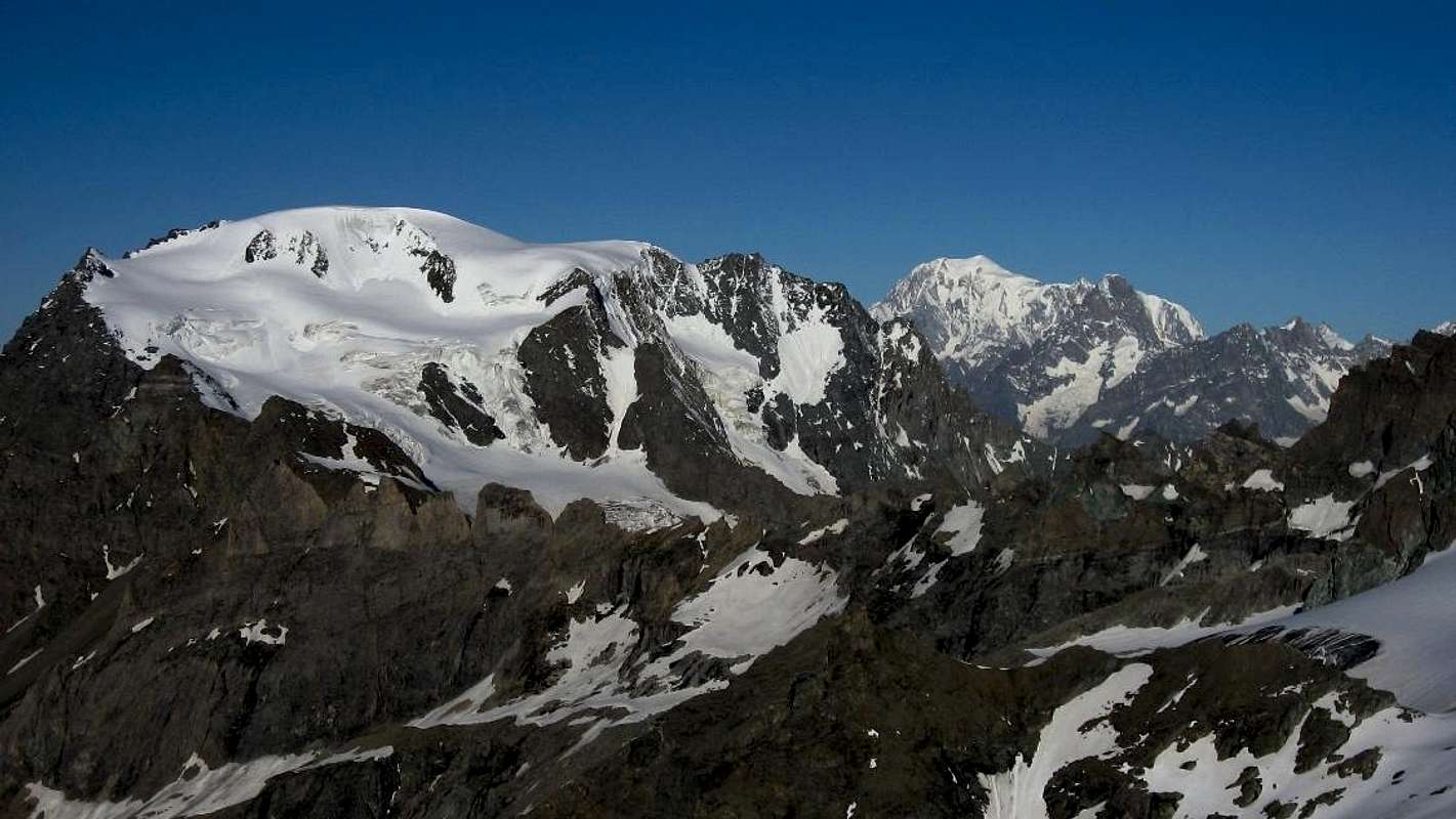
After the Italian side (verily double, with Vallone di Menouve / Molline or Moline and homologous in East Conca di By), beyond the Colle di Valsorey (3.107m), between Conca (Basin) di By and the opposite and adjacent Valsorey, expands the homonymous glacier that descends towards the North towards the promontory (just 600 meters above the Gran Plan, 2.501 meters, and below the Grand Combin du Meitin(3.622m) and Grand Combin de Valsorey(4.184m), more collocated in Northeast) on which la Cabane de Valsorey(3.650 meters) is located. Also from Valsorey, but previously and just from Cabane du Velan(2.569m), a secondary valley starts that stretches towards the South through the Teseudet Glacier; which, opening like a fan, reaches on the left the Col de la Gouille (3.149m), the base of the spectacular North Wall of Velan (520/30 meters) and to the right or Northwest goes to surround the Aiguille du Velan(3.635m), Les Dents de Proz(3.330m) and to the Northern margin the Petit Velan(3.223m). Finally, again from the Val d'Entremont at the foot of the Gran San Bernardo Pass(2.449/69m), and more precisely above the Municipality of Bourg - Saint - Bernard(1.914m) rises, crossed by the Torrent Perché, the Vallone di Proz; its glacier breaks against the North-northwest Crest and the West Wall (around 610/30 meters) which, from Les Dents de Proz, reaches the altitude of 3.678 meters, just before the ice cap that constitutes the true Top (3.734m). Also as far as the Swiss side is concerned, we find a series of levels surrounding the ice cap (3.734m), but the latter are easier to identify as they stand out clearly against the sky, even for those less evident altitudes on the Italian side. We will thus have from East to West, that is starting from the Mont de la Gouille(3.212m) and the underlying Col de la Gouille(3.149m), the Quotas3.252, 3.421, 3.580, 3.622 meters on its Northwest Ridge, also called "Arête de la Gouille". Among these in greater evidence for its importance the last of the same or Cupola Nordovest (Northwestern Ice Cup), since the two routes of the North Wall (July 1939) and North-northwest (August 1936) converge; two itineraries of great class, which resist even today today to a great valutation for the ice climbers. Still from this small glacial valley of the Tseudet, but to the right, the other three routes branch out (two on ice and one on the rocky edge) which respectively reach the 3.607 meters lttle saddle, located between the glacial altitude 3.670 meters and the Aiguille du Velan (July 1935), the diagonal via between this last and the Rocky Quota3.561 meters (Via Bianchi, 1970?) or the most direct way to reach the Velan starting from the homonymous Cabane and the road on the corner (in rock, snow and again rocky) of the East-Northeast Spur leading to the 3.561 meters rocky Quota, or Northern ante Summit of the same aiguille (date and first unknown climbers and probably first route traced on this side). Beyond this buttress goes to form the Denti di Proz (Southern 3.488m, Northern 3.330m, where it splits by sending to the west a secondary branch that reaches the Mont de Proz, 2.803m), the two summits of Petit Velan(3.223m, 3.201m) to go to the end on the right falling over the Cabane du Velan(2.569m), while to the left or Northwest it falls on the Mont Orge(2.880m) and the Croix de Tousse(2.822m), right above the Lac des Toules(1.810m), now just in the middle of Val d'Entremont. And right in the upper part of this last one, the one projected towards the Gran San Bernardo Pass(2.449/69m), which rises, above Bourg - Saint - Bernard(1.914m), the wide Western Slope of Mont Velan with the Glacier and the Proz Pasture at the foot of the "Plan du Jeu" (2.074m). A wider valley opposite to that of the Teseudet in Valsorey, and comprised between Les Dents de Proz in the north-northwest and the Colle of Hannibal to the South, this time dominated by the Summit ice sheet, with a series of gullies on the same that, starting from the left or North, are characterized by the narrow incision between the rocky ribs:
1) - the canal towards the Aiguille du Velan (1887 downhill and July 1966 uphill solitary);
2) - the second couloir initially snowy and then rocky at the altitude of 3.670 meters;
3) - the Y gully that flows between the aforementioned quota and the 3.678m altitude, an old goal of mine always postponed to then lost to do something else, since the Swiss for first have deservedly caught the same) and finally
4) - the "half channel" to the right or South, used by the first climbers (1799). This is the synthesis of the Swiss routes which, compared to those of the two Italian slopes, that are now almost completely stripped of ice, are characterized by the possibility of a considerable number of ice routes.As long as it lasts ...
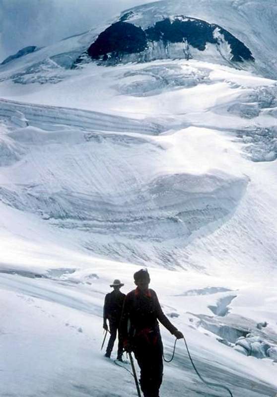
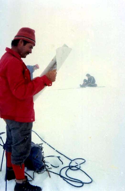
Return on Valsorey Glacier, by "Faustin" Savoye
Dopo il versante italiano (in realtà doppio, con Vallone di Menouve/Molline oppure Moline ed omologa ad Oriente Conca di By) , al di là del Colle di Valsorey (3.107 m), invece, s'espande il ghiacciaio omonimo che scende in direzione Nord verso il promontorio (giusto 600 metri al di sopra del Gran Plan, 2.501 metri, ed al di sotto dei Grand Combin du Meitin(3.622 m) e Grand Combin de Valsorey(4.184 m), collocato più a Nordest ) sul quale é collocata la Cabane de Valsorey(3.030 m). Sempre dalla Valsorey, ma precedentemente e giusto dalla Cabane du Velan(2.569 m), si diparte un valloncello secondario che si distende verso Meridione tramite il Ghiacciaio di Teseudet; il quale, aprendosi a ventaglio, raggiunge sulla sinistra il Col de la Gouille (3.149 m), la base della spettacolare Parete Nord del Velan (520/30 metri) e verso destra o Nordovest va a cingere l'Aiguille du Velan(3.635 m), Les Dents de Proz(3.330 m) ed al margine Settentrionale il Petit Velan(3.223 m). Infine, sempre dalla Val d'Entremont ai piedi del Colle del Gran San Bernardo(2.449/69 m), e più precisamente sopra il Comune di Bourg - Saint - Bernard(1.914 m) sale, solcato dal Torrent Perché, il Vallone di Proz; il suo ghiacciaio si infrange contro la Cresta Nord-nordovest e la Parete Ovest (circa 610/30 metri) che, da Les Dents de Proz, raggiunge la Quota 3.678 metri, subito prima della calotta glaciale formante la vera Vetta (3.734 m). Anche per quanto concerne il versante svizzero riscontriamo una serie di quote che circondano la calotta glaciale (3.734 m), però le medesime sono più facili da individuare poiché si stagliano nettamente sulle creste contro il cielo, anche per quelle altitudini meno evidenti sul versante italiano. Avremo così da Est ad Ovest, ovvero partendo dal Mont de la Gouille(3.212 m) ed il sottostante Col de la Gouille(3.149 m), le Quote3.252, 3.421, 3.580, 3.622 metri sulla sua Cresta Nordovest, detta anche "Arête de la Gouille". Tra queste in maggior evidenza per la sua importanza l'ultima delle medesime o Cupola Nordovest, poiché vi confluiscono le due vie della Parete Nord (Luglio 1939) e Nord-nordovest (Agosto 1936); due itinerari di grande classe, che resistono nel tempo ancora oggigiorno nelle valutazioni da parte degli "ice climbers" ovvero ghiacciatori esperti. Sempre da questo valloncello glaciale del Tseudet, ma verso destra, si diraman le altre tre vie (due in ghiaccio ed una sull'orlo roccioso) che rispettivamente raggiungono la selletta 3.607 metri, posta tra la Quota glaciale 3.670 metri e l'Aiguille du Velan (Luglio 1935), la via in diagonale tra questa ultima e la Quota rocciosa 3.561 metri (Via Bianchi, 1970?) ovvero la via più diretta per raggiungere il Velan partendo dall'omonima Cabane (2.569m) e la via sullo spigolo (in roccia, nevoso ed ancora roccioso) dello Sperone Est-nordest conducente alla Quota rocciosa 3.561 metri, od Antecima Settentrionale della medesima aiguille (datazione e primi salitori sconosciuti e probabilmente primo itinerario tracciato da questo lato). Oltre questo contrafforte va a formare i Denti di Proz(3.488 m, 3.330 m, dove si sdoppia inviando verso Ovest un ramo secondario che raggiunge il Mont de Proz, 2.803 m), le due sommità del Petit Velan(3.223 m, 3.201 m) per andare ad esaurirsi a destra sopra la Cabane du Velan(2569 m) mentre a sinistra o Nordovest cala sul Mont Orge(2.880 m) e la Croix de Tousse(2.822 m), proprio al di sopra del Lac des Toules(1.810 m), giust'addesso in piena Val d'Entremont. E proprio nella parte superiore di questa ultima, quella proiettata verso il Colle del Gran San Bernardo(2.449/69 m), che si eleva, ( al di sopra di Bourg - Saint - Bernard (1.914 m), l'ampio Versante Occidentale del Mont Velan con ai piedi il Ghiacciaio e la Montagna di Proz presso il "Plan du Jeu" (2.074 m). Un più largo vallone opposto a quello del Teseudet in Valsorey, nonché rappreso tra Les Dents de Proz a Nord-nordovest ed il Colle di Annibale a Sud, questa volta dominato proprio dalla calotta glaciale della Vetta. Sul medesimo si snodano una serie di canaloni che, partendo da sinistra o Nord, si contraddistinguono per la stretta incisione tra le costole rocciose:
1) - il canale verso l'Aiguille du Velan (1887 in discesa e Luglio1966 in salita solitaria);
2) - il secondo couloir inizialmente nevoso e poi roccioso alla Quota3.670 metri;
3) - il canalone ad Y che sfocia tra la suddetta quota e la Quota3.678 m, un mio vecchio obiettivo sempre rinviato a poi perso per far qualcos'altro, poiché gli svizzeri se lo sono meritatamente acchiappato) ed infine
4) - il "mezzo canale" verso destra o Sud, utilizzato dai primi salitori (1799). Questa la sintesi delle vie svizzere che, rispetto a quelle dei due versanti italiani ormai quasi del tutto spogli dai ghiacci, si contraddistinguono per la possibilità di un notevole numero di vie in ghiaccio. Finché dura ...
Getting There from
Val d'Entremont
From Orsières Town(879m) towards the main Val d'Entremont and secondary to the left or West Valsorey
From Orsières towards Fontaine Dessous-Rive Haute(1.223m), Liddes(1.346m) and Bourg St. Pierre(1.346m) in Entremont Valley and at the beginning of Valsorey to the Southeast.
Access for the swiss routes from Aosta Valley and in particular to North.northwestern Ridge, Western Face and Crest (of Annibale): go up towards the Gran San Bernardo and enter Switzerland with the tunnel; immediately after exiting the tunnel take the detour to Super St. Bernard reaching the plant square.
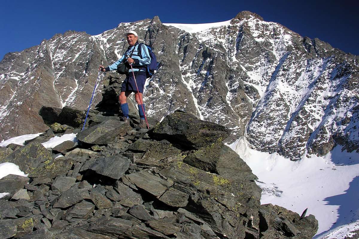
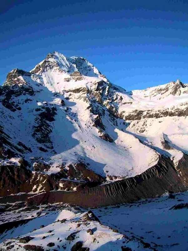
Mont V'lan Southern (to the left in profile), East-northeastern & Northern Slopes from Grande Tête de By, by archiloco
From Great Saint Bernard Hill (2.473m) towards the principal Val d'Entremont and secondary to the right or East Valsorey Great Saint Bernard Pass(2.449m), by Swiss State Road, with descent towards Le Tronchet, Plan des Dames, Hospitalet(2.113m), Bourg Saint Bernard(1.927m) up to Bourg Saint Pierre and previous route.
All Swiss Routes description from Valsorey and Val d'Entremont
SWISS SIDE
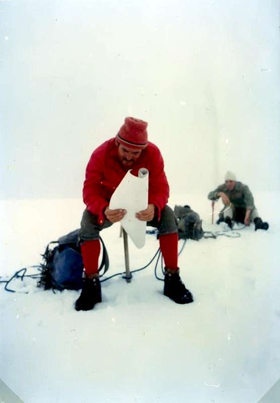
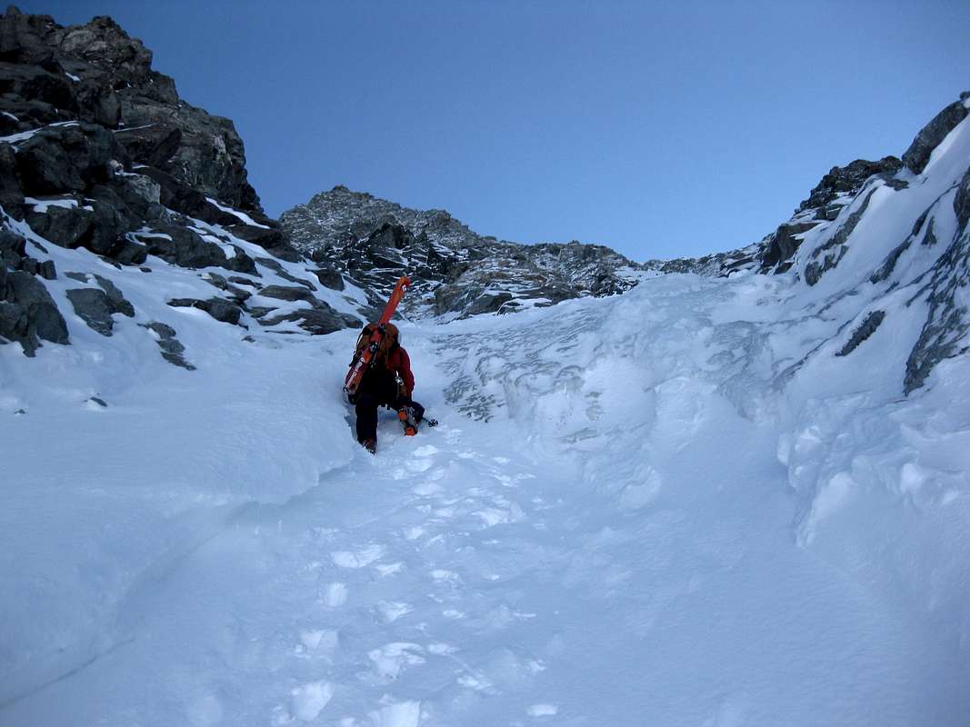
Along the Standard Via (E-NE Ridge or Face) between Italy and Switzerland looking for the right way in the fog , Pictures by Marco Cossard "Crevassino" & Osw
VELAN Northeastern Face (Valsorey Valley) from left (East): Important note: let's go back for a moment, referring to the analysis of the Normal Via or East-northeast Ridge from the Italian side and starting from Colle di Valsorey(3.107m). It is immediately evident that even the two Swiss roads that date back to the Valsorey Glacier (the ancient from the bottom or at the end of the same and the current through the lateral West Col de la Gouille from Vlan's Cabane) can flow into the first at different points along the route: generally this can happen in the two "liaisons" between the Mont Cordine and the next Col des Chamois or immediately after under the Doigt du Velan; but certainly much more often, as per logic, just after and at the base of the three Horns of Velan. From these points the ascent becomes common to the two sides, but nothing prevents you from making further variations.
Italian Standard Via & Variants
* * East-northeast Ridge or Normal Route from Bivouac Rosazza at Savoie (2.651m) through Valsorey Pass (3.107m) and homonym glacier: the first climbers unknown but probably by Italian smugglers. From F/F+ to PD-, from bivouac in the neighbor of Boégno Bà or Bas Pass (2.674m) to address him towards Northeast along a trace (numbered 3 in yellow) that with a long diagonal in "light" ascent with small cairns, overcoming some small vallons in grass and debris, it brings him in direction of a small torrent that comes out of an area of large boulders in the midst of which you have to find the traces of the passage; exceeded the same, leave the bottom of the valley and climb to the left (West) up the steep scree slope that leads to the Valsorey Pass (3.107m). On a track, which often disappears, go up in the direction of achieving the same end of a broken route and debris immediately to his left; overcome it, taking care not to drop the stones on those who follow. Once up the hill to the right cross in the same direction, passing some small balconies with easy but exposed rocks; the frame of the hill, in general, it always passes to the left against the start of the Northeast Crest of Cordine. From the pass you do not continue with this, but, leaning to the right on a clear track, climb through the shattered Northeast Slope; progressively move, always following the trail on the ridge, reaching an inclined shoulder before stony after snowy at an altitude of 3.221 meters, called "Plateau de Cordine". Leaving on a rocky spur that goes right up to plunge into the glacier through broken rocks and debris, but easily reach the Cordine's Top (3.329m)2h'00/2h'30. Variants:
a) - from the Plateau de Cordine (Cordine's, before rocky after snowy, Tableland, 3.221m), before starting the final ascent on the ridge, descend diagonally to the base of the small spur(very continuous and dangerous cracked area, because presents many crevasses) and then continue to the base of the North Face of Mont Cordine with almost flat path and, via away, with less and less crevasses until, after a short ascent, reach the Col des Chamois:
b) - continue on the border ridge until the ridge becomes steep towards the pass; at this point descend along broken and easy rocks and mixed with debris reaching the previous route on the glacier;
c) - before reaching the Cordine descend with a diagonal towards the Northwest on its small snowy Northern Wall (approximately 100/120 meters) rejoining the previous variants.
d) - from the top of Mont Cordine(3329m) continue on the edge of the ridge with brief and direct descent to Col des Chamois(3.259m), with partial path through a white fixed rope (exactly 70 meters, II°-/II°/II°+). From the col, or better a much narrow pass, continue on and along the Italian/Swiss border and go up the ridge which leads to the inclined (an unique and short pitch of about 30 meters) to the South Doigt du Velan(V'lan's Finger; 3.314m) through traces and passages of II°-/II° on enough solid plates and cracks (1 old nail with small cord). Always follow the ridge until you reach the rocks (II °) that lead to the Summit of Mont Capucin(3.395m). With route on small easy rocks and debris just at the limit of glacier reach the reddish Capucin and next homonym pass (3.376m); from this last to continue through brief stretch up to the crest, where it is more steep. After a brief but challancing icy passage, on the remains of an old serac, below the Testa d'Ariondet(3.485m) above a small icy wall (about 40/50 meters, with slope up to 45° and dangeraous ascent in presence of verglass). Skarting the same Testa d'Ariondet also Riondet just to the right to cross along the entire glacier, leaving left even various (more precisely six in number)V'lan's Teeth, the three Velan's Horns to go up and along the highest part reaching in succession a little rounded and glacial "conca" (basin) preceding the small rocks of small but important Quota 3.672 meters and, by circular route to the North, the Ice Cup(3.734m). From Valsorey Col (3.107m)3h'15/3h'45; from Rosazza at Savoie Bivouac(2.679m)4h'15/4h'45; from By's Alps6h'00'/6h'30; from Glacier Hamlet(1.549m). Remark: sometimes this final glacial stretch requires, if in bad conditions with large open crevasses or in the presence of verglass, to pass towards the adjacent ridge that from the altitude 3.650 meters leads to the Summit. This tour on the left or orographic right is increasingly used, given the slow retreat of the glacier. Almost certainly this was the reason why the Monks D'Allèves and Marquis of the Gran San Bernardo Hospice, starting from the latter and with a large lap able to go down the Val d'Entremont down to Bourg Saint - Pierre(1.632m ) first and then the Valsorey up to the Gran Plan(2.501m), in 1826 during the third absolute ascent, they concluded in the "upper part" by leaning towards the ridge. Although the route was described along the entire Valsorey Glacier. It was probably the very last stretch from the Quota3.650 meters; which still happens today when, when the final ascent under the large ice cap is too crevassed or covered with verglass, it deviates to the final part of the South Ridge which comes from the Sella di Faceballa on the Italian side. The descent to return to the hospice took place along the Western Ridge to Colle di Annibale, partially retracing the itinerary of the first climbers of 1799 and the second of 1824. * * East-northeast Ridge or Standard Via with variant integral from and towards the Valsorey Pass (3.107m): August 17th, 1975, Osvaldo Cardellina, Marco Cossard, Camillo Roberto Ferronato, Giuseppe Lamazzi and Roberto Meneghini in ascent and in descent (with, during the descent, by Osvaldo Cardellina, lone, the second absolute ascent of Doigt du Velan(Finger); 3.314m); in day from the Pastures of By's Conca; first entire and integral. Repeated by Osvaldo Cardellina, "Gigi" Gadin and Faustin Savoye, July 15th, 1976 second complete and integral, in descent, after the "Diagonal Gully" in ascent Southwest/Northeast, starting from Faceballa Saddle(2.880m) and connection in the highest part, just below the Quota3.650 meters, with Southeastern Couloir from Comba Berruard always into By's Basin. From PD- to PD/PD+/AD-, same route but always remaining on the edge of the ridge along the entire Italian/Swiss border, then with ascent even of six V'lan's Teeth, three V'lan's Horns, the next Broken Horn, Mini Horn up to the Quotas 3.650 and 3.672 meters, just preceding the Iice Cup (3.734m). From Rosazza at Savoie Bivouac (2.651m), nearby the Boégno Bà or Bas Pass(2.674m) into By's Conca, in total from 7h'00 to 8h'00 in ascent; the half in descent, always with ascent of Testa d'Ariondet, Little Tooth and five Teeth, three Horns. Half an hour more for the ascent and subsequent descent on "Dente" del Velan.
Swiss Normal Routes & Variants
DOUBLE CONNECTION between the Rosazza at Savoie Bivouac and the Cabane du Velan via Col de Valsorey, the homonymous glacier, Col de la Gouille and Glacier de Tseudet Logically there is also the possibility of connecting the two huts with departure from both Italy near Bivacco Rosazza-Savoie on Boègno Bàs(2.651m, 2.674m) through the Col di Valsorey(3.107m) and from Switzerland from the Cabane du Velan(2.569m), below the Northeast Edge of Petit Velan(3.223m), and via the Col de la Gouille(3.149m) through the middle part of the Glacier de Valsorey and the entire Glacier de Tseudet. Reached the Col de Valsorey (yellow signs with small path numbered 3 and little cairns) do not go down directly on the Glacier de Valsorey (crevasses and danger of falling rocks) but go up towards Mont Cordine(3.229m) with the possibility of descending on it from its before rocky after snowy "Plateau de Cordine" (about 2.215/25 meters) through an easy snowy slope or with the variants from the above, therefore including the descent of 70 meters with fixed rope to the underlying Col des Chamois(3.259m). From each of these points and with descent on a modest glacial slope, connect with the Swiss Normal Route(just below the islet that contains the upper seracs fall) and then continue to the Northwest with a modest ascent first and with a steeper descent after passing the lower seraccata of the Glacier de Valsorey. With a convex path on the right (West), go down along the basal rocks of the ridge that from Mont de la Gouille(3.212m) goes up towards the Arête of the same name with its various altitudes. Still following the left orographic edge of the glacier, go below the Col de la Gouille to less than 3.100 meters , identifying the area of ascent to the same by means of red signs; go up the small wall using fixed ropes (3h'00/3h'15 from the Rosazza-Savoie Bivouac, 2h'00/2h'15 from the Colle di Valsorey). From the same, descend rapidly on the underlying Glacier de Tseudet and with a semi-circular route in the Northwest reach the base of the North-Eastern side of the Petit Velan; with a slightly steeper descent on the western edge of the glacier reach the Cabane du Velan (2.659m), located at the base of the Nordeast Edge of the same (1h'20/1h'30 from the col and 4h'30/5h'00 from the departure). For the reverse route, calculate 1h'00 /1h'30 more' with the partial times of 2h'00/2h'30 at the Col de la Gouille and descent on the Glacier de Valsorey, 2h'00/2h'30 to Colle di Valsorey and 'another hour' to reach the Rosazza at Savoie Bivouac. This crossing can also vary over time both for the conditions of the glaciers and for those of the weather. In the absence of appropriate knowledge of the area, do not undertake with poor visibility. * * East-northeast Ridge with route from Bourg - Saint - Pierre (1.632m): towards Chalets d'en Bas(1.976m) and Chalets d'Amont(2.198m) at Cabane du Velan(2.569m) or from a very ancient track of path on the route to and from Gran Plan(2.501m, connection with the trail from V'lan's Cabane to the Southwest in altitude 2.449 meters), just preceding Valsorey Cabane(3.030m), and through Valsorey Pass(3.107m): A. Adams-Reilly and C.E. Mathews with the guides Emmanuel and Daniel Balleys on July 14th, 1866, in occasion of the first traverse of the pass (North/South); without, however, reaching the summit of Mont Velan, while the first ascent to the hill is to be dated "ab immemorabilis" (probably by hunters before and smugglers later, who called the same as Cordine or "passer Cordine" and also "passer le Capucin ". From F+ to PD-. From this point, before easily after with caution for crevasses presence and doubling the same in right (West), to continue South-southeast along the Valsorey Glacier (in the center or in the right side narby a Western lateral moraine) reaching a highest part of the same below the pass. The last stretch (about 200/30 meters) is more steep, after a flat zone in altitude of around 2.470/90 meters, arrive, leaving to the right (West) an area of great seracs, wit much exposition to falling stones.The last stretch (about 200/30 meters) is more steep, after an almost flat zone in altitude of around 2.470/90 meters, arrives, leaving to the right (West) an area of great seracs, much exposed to falling stones. From the col continue on Italian/Swiss border, passing under the Doigt du Velan(V'lan's Finger; 3.314m), with route on small easy rocks and debris just at the limit of glacier reach Mont Capucin(3.395m) and next homonym pass (3.376m); from this last to continue through brief stretch up to the crest, where it is more steep. After a brief but challancing passage just below the Testa d'Ariondet or Testa de Riondet on a small icy wall (about 40/50 meter, with slope up to 45° and dangeraous ascent in presence of verglass; better an ice screw in complete climbing on green ice), skarting the same just to the right to cross along the entire glacier, leaving left even the various V'lan's Teeth and the three Velan's Horns to go up along the highest part reaching in succession a little rounded and glacial "conca" (basin) preceding the small rocks of Quota 3.672 meters and, with circular route to the North, the Ice Cup(3.734m) or the true Summit. From Valsorey Col(3.107m)3h'15/3h'45(but see ln Italian side the various and numerous variants on Mont Cordine); from Cabane du Velan(2.569m)5h'30/6h'15; from Bourg - Saint - Pierre(1.632m)9h'30/10h'30'. * * Tallest Variant: East-northeast Ridge with route in the highest final part of border by Valsorey Pass (3.107m): two Monks of Great Saint Bernard D'Allèves and Marquis on Summer 1826, in occasion of the third absolute of the Mont Velan, reaching the terminal part around, nearby and in right to the Velan's Horns. Always from F+ to PD- or PD in respect to the variations and more or less same times
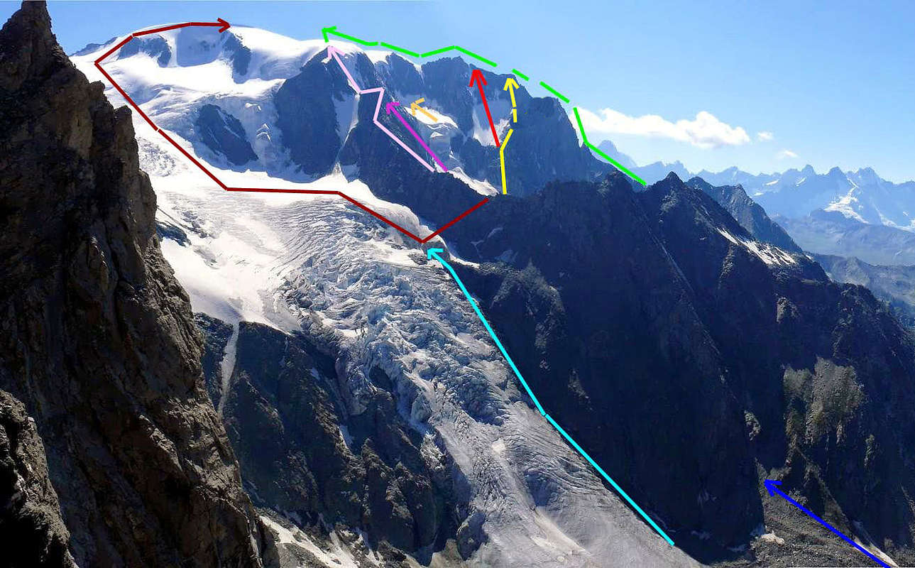
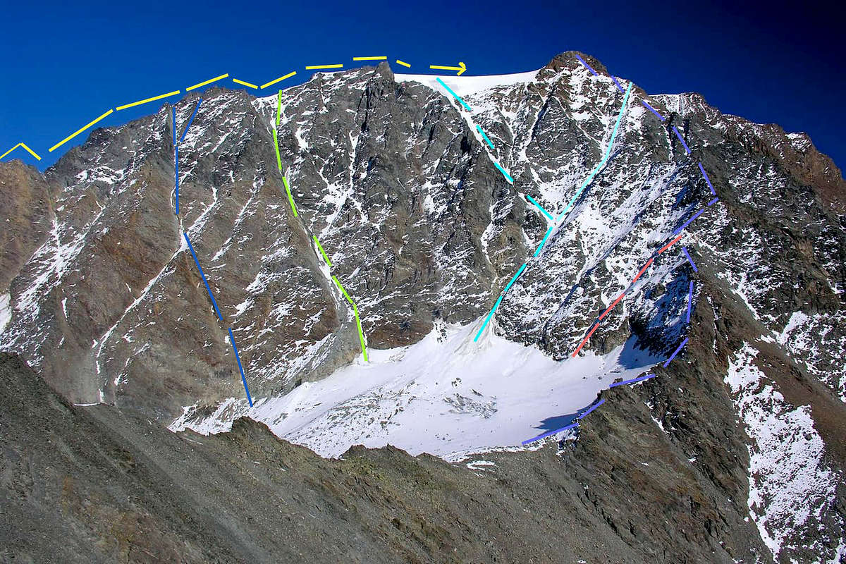
Between North-northwest Ridge (right) East-northeast Ridge (in high to the left) or Italian/Swiss Stanrdard routes above Valsorey and Tseudet Glaciers, by emilius and traced by Osw
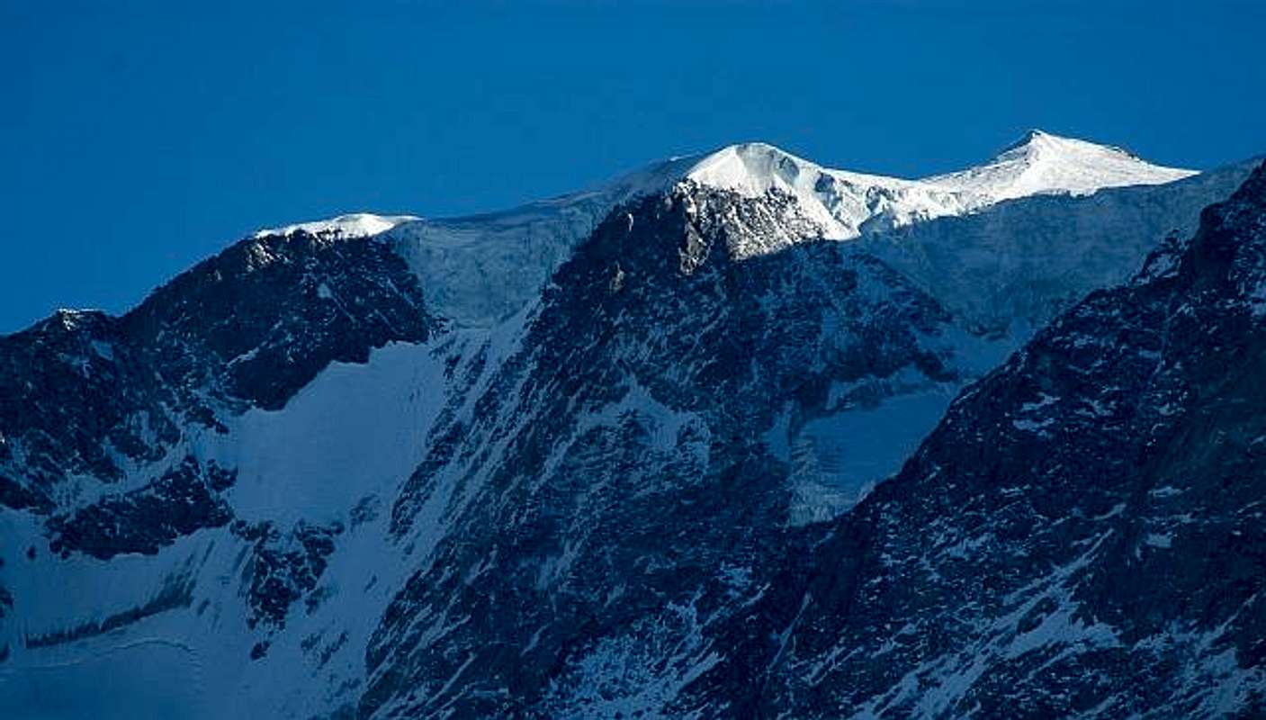
* * Northeast Crest from Col de la Gouille(3.149m): September 03th, 1872, H.J. and Walter Leaf with Mountain Guides Hans Baumann and Daniele Bich; in ascent from Velan's Cabane with route on Glacier de Valsorey and through the ridge up to the "Rock Hump 3.622 meters" and towards the Ice Cup in the highest final part. Very panoramic climb on the entire Northern slope and in a very wild environment. From F+ to PD-. From Col de la Gouille(3.149m), reached through the Valsorey's Glacier (in East-northeast) or from Velan's Cabane towards Tseudet's Glaciers (in North-northwest), go up on Northeast Ridge bypassing the Quotas3.252, 3.421, 3.580 meters on Arête de la Gouille, reaching before the Dôme3.622 meters (or with deviation to the South just before) and from this easily to the Summit Ice Cup(3.734m). Ascent scarcely frequented, with path that can also be easily made downhill to the col (3h'00 uphill and 5h'00 from Cabane du Velan); moreover it can be tackled starting from Italy, that is from the Rosazza Savoie Bivouac with the crossing of the Glacier de Valsorey (see above the "Double Connection"). Ascension worthy of greater attention by climbers also because this is certainly the most scenic route in comparison of the two glaciers of Valsorey's Tseudet's. In any case, it is preferable to departure from Switzerland, which eliminates the crossing of the glacier and is certainly more direct and with less time. It should not be forgotten that the first ascent of September 03th, 1872 (during the first North / South crossing of Mont Velan with descent of the rocky/snowy gully on the Southwestern Face) took place from the Valsorey and through the homonymous glacier, in order to reach the col. But this remains exclusively a historical note because otherwise the ascension on this side would become very anachronistic. * * East Slope from Valsorey's Glacier: summer 1826, the two Monks of Gran San Bernardo Pass or the swiss D'Allèves and Marquis; in ascent from Saint Bernard Hospice and the next Valsorey, with route on Glacier de Valsorey with descend through the Western Crest to Hannibal 's Pass and Great Sain Bernard. In day (!). This route is the most used for the ascent to Mont Velan, not only starting from Switzerland, and far exceeds that starting from the Rosazza-Savoie Bivouac at Colle del Boègno Bàs(2.674m) from the Italian side; not to mention the "historic" one through the Glacier de Valsorey in the first case, or the "mystical" ones that took place in other eras starting from the Champillon's Plain(2.050m) at the beggining of mouth of the Conca di By or even from the Village Glacier also Glassier(1.562m) in Ollomont Valley. * * Eastern Slope from Col de la Gouille (3.149m): unknown; in ascent from Velan's Cabane (in ancient times from Valsorey 's Cabane with an initial descent of 600 meters!!) with route on Glacier de Valsorey and connection up to the Standard Route near the Testa d'Ariondet (3.485m) or just behind the five Dents du Velan (3.495 meters the tallest) and with this itinerary, common to Italian Via from Valsorey Pass, towards the Ice Cup in the highest and always glacial final part. Climb less scenic than those on the ridge, as it is "occluded" first by the ramparts that rise from Col de la Gouille, after by the Dôme of Mont V'lan. From F+ to PD-/PD: starting by the Cabane du Velan(2.569m) look for the most convenient point to get to the Teseudet Glacier (generally following the water pipeline) and keep going against the basal debris slopes of the Eastern side of the Petit Velan(3.223m, Kurz Map), where they "sink" into the same glacier : having reached an altitude of about 2.830/70 meters turn left and, passing an area with many crevasses, head towards the Col de la Gouille keeping a safe distance from the rocks of the South-southwest slope of the Mont de la Gouille(3.212, 3.209m). Reached the wide upper glacial basin it "points" decidedly to the hill, which here opens opposite; a last section (25/30 meters, red markings in general with fixed rope) formed by detrital and broken rocks leads to the same, immediately on the right of two characteristic gendarmes (1h'45/2h'00). The descent on the opposite or East verant takes place through a small wall of about 60/65 meters formed by quite steep but broken and unstable rocks, on which fixed ropes have been installed. In short you are on the glacier rejoining with the street of 1826 (departure from the Ospizio del Gran San Bernardo!); go up the snows on the right (orographic and hydrographic left), as well as between the large left-hand serac and the base of the shoulder rocks 3.321 meters and the altitude of 3.622 meters. With a winding path, you will go around a rocky island on your left (East) reaching the large serac next to the Testa d'Ariondet After an icy passage (40°/45°, delicate) to go up along the highest part reaching in succession a little rounded and glacial "conca" (basin) preceding the small rocks of Quota 3.672 meters and, with circular route to the North, the Ice Cup (3.734m). From Col de la Gouille (3.149m)2h'45/3h'15; by Velan's Cabane(2.569m)4h'45/5h'15; from Bourg-Saint-Pierre(1.632m)8h'30'/9h'30.
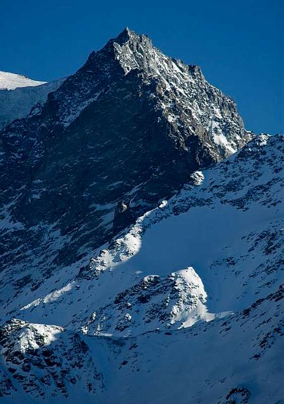
VELAN Northern and Northeastern Faces (Valsorey Valley) from left (East): * * North-northwestern Slope of Mont de la Gouille 3.212 meters: unknown; from Cabane du Velan crossing on middle part of Tseudet's with deviation to the right or Southeast to a first rocky couloir up to the small and higher Gouille's Glacier and through this to double Summit(SE 3.209m, NW 3.212m), with successive traverse to Col de la Gouille(3.149m) and traverse towards the Summit by the Northwest Ridge. From F+ to PD-/PD:. This itinerary can serve as a descent route, after short ascent from Col de la Gouille to Mont(about sixty meters in altitude and about 330 meters in distance from it); in any case it constitutes a variant making the trip "more complete". Thus for the adjacent routes along Northwest Ridge, after crossing Glacier de Tseudet at an altitude of about 2.620/30 meters2h'30; or with a climb on the Eastern Side starting by Valsorey Glacier reaching a rocky Shoulder3.028 meters with an uncomfortable climb on mobile debris and not difficult but very broken rocks (pay attention to who is behind); 2h'00'. * * NorthWall (Central Eperon of North-northeast Ice Cup 3.622 meters): July 29th, 1939, Loulou Boulaz with Mountain Guide Pierre Bonnant; from Cabane du Velan through the lower Tseudet 's Glacier with "Direct Route" up to the "Icy Hump"3.622 meters and traverse towards the Vlan's Summit(3.734m). First in winter: January 26th, 1964, François Beth, Jean Délère, André Praz and Jean-Jacques Saudan. From D to D+: a classy itinerary aimed at very strong and experienced mountaineers, such as those of the two group of climbers of July 1939 and the first winter ascent, January 1964; directly exceeds a mixed wall along its central spur, with more than 500 meters high starting from the double crevasse at the base at about 3.100/3.120 meters (3.167 meters the lowest rocky point). Path exposed to the ice fall from the altitude of 3.622 meters (ovever still less than those of the parallel via on the Northwestern Face, August 1936), which requires a lot of attention and adequate equipment (rope, carabiners, rock pitons and ice screws) with glacial slopes of 60 ° and over; small wall of ice (2/3 meters) in the final part just before the exit on the summit hump. By this last easily on the Top. From base 5h'30/6h'00, Cabane 7h'15'/7h'30. * * Northwestern Face of North-northeast Ice Cup 3.622 meters: August 27th, 1936, Joseph Cheseaux and Etienne Max; from Cabane du Velan through the Tseudet Glacier and subsequent Hanging Tseudet's Glacier with deviation to the left or East at the altitude of about 3.420/30 meters in respect the successive Route 1935 up to the "Icy Hump"3.622 meters and traverse towards the V'lan's Summit(3.734m). From AD+ to D-/D/ D+: a difficult route, even this for experienced mountaineers, as the two climbers of August 1936; directly exceeds a mixed more Western wall along its narrow face and with prevalent glacial route, of more than about 220/40 meters in high; starting from the crevasse at the base at about 3.390/3.400 meters. Path exposed to the ice fall from the altitude of 3.622 meters (ovever still less than those of the parallel via on the North Face, July 1939), which requires a lot of attention and adequate equipment (rope, carabiners, rock pitons and ice screws) with glacial slopes of %°/60°50° in the final part just before the exit on the summit hump on the Northeast Ridge. From this last easily on the Summit. Keep in mind that the slope decreases in the terminal stretch, but that in case of poor snow (as for the first ascent) the difficulties certainly tend to increase due to the apparition of a outcrop of rocks that are certainly difficult and very likely covered by verglass. From base 5h'00'/5h'30, from Velan's Cabane 6h'45'/7h'15. * * Northern Face from Tseudet's Glacier, "Hanging Tseudet's Glacier ad in final part to the right or West towards the Little Saddle3.607 meters and Northwest Ice Cup3.670 meters on North-northwest Ridge: July 21th, 1935, Georges de Rham and Rodolphe Tissières; from Cabane du Velan to the V'lan's Summit(3.734m) , through the "Hump"3.670 meters and in final part crossing towards the true Mont Velan's Top.
Key remark: this last two routes are conditioned by the situation of the fall of seracs (about 110/20 meters) below the tallest glacial basin (around 3.380/3.420 meters): the route can be made on the right(West, not easy via) or in the center through rounded seracs (certainly more difficult). And in any case the same can vary from year to year and is never simple. Furthermore, the road on the left (August 1936) towards the snowy hump or Ice Quota 3.622 meters appears to be quite dangerous because it is very exposed to falling ice and seracs. Most likely, also for this reason these two almost twin routes do not result repeated. * * Northeast Wall from Tseudet's Glacier to Aiguille du Velan (3.635m): summer 1970, Jean Bianchi with its wife; from Cabane du Velan through Tseudet's Glacier towards Aiguille du Velan (3.635m). From AD+ to D-: if not a difficult route, surely not simple and exclusively this for experienced mountaineers, as the two climbers of Summer 1970 (?); directly exceeds a mixed more Western wall along its before narrow rocky face and after with complete in diagonal right/left glacial route, of more than about 535/45 meters in high; starting from the crevasse at the base at about 3.090/3.100 meters. Path exposed to the rocks falling in the first sector before the entrance on snowy slope, which requires a lot of caution and adequate equipment (rope, carabiners, ice screws) with glacial slopes of 45°/50°/55°; in the final part just before the exit on the North-northwest Ridge, in distance of around 50 meters by the Top Aiguille du Velan. From this last easily on the Summit. From base 4h'00/4h'30, from Velan's Cabane 6h'45/7h'15. * * East-northeast Eperon of Quota 3.561 meters: Years'60?, unknown montaineers; from Cabane du Velan through the Tseudet's Glacier towards Aiguille du Velan(3.635m).From AD- to AD+: less difficult route in respect to the previous, even more simple but exclusively always for enough experienced mountaineers; equally to the preceding via directly exceeds a mixed more West wall always along its before narrow rocky East-northeast Edge with route of more than about 500/10 meters in high; starting from crevasse at the base at about 3.090/3.100 meters. Path probably exposed to the falls of rocks in the first sector nearby a couple of gendarmes (turn the second to the left or South), which requires a lot of patience, much attention and adequate equipment (rope, carabiners, some rock pitons) with exit in the North-northwest Ridge on Quota3.561 meters; this last to reach, by North-northwest Ridge, Aiguille du Velan. Again this last easily on the Summit. From base 2h'45'/3h'15, from Cabane 4h'00'/4h'45.
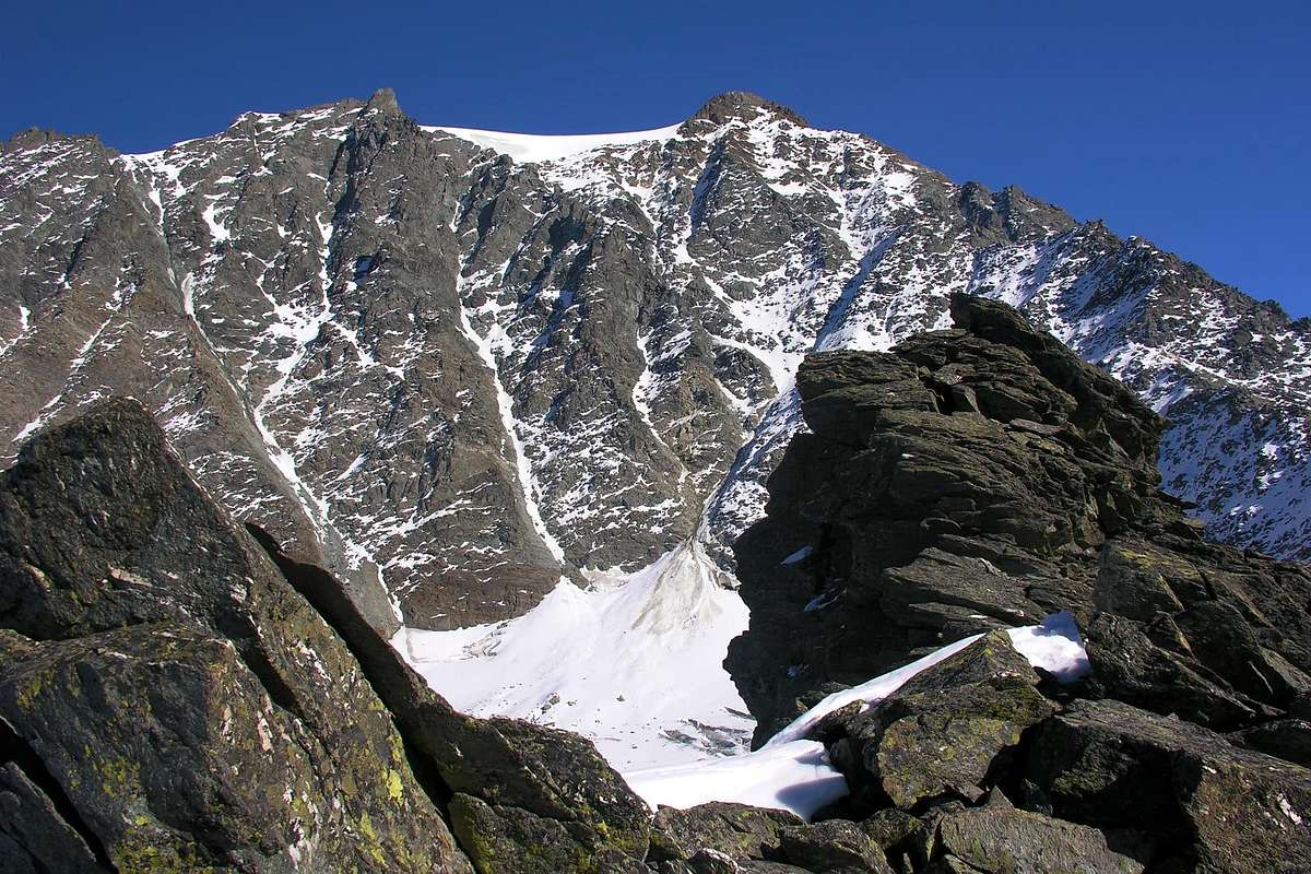
Testa Grisa & Velan West Face 2005
Western Routes on North-northwestern Crest, Western Face or along West Ridge from Hannibal's Pass (2.922m), pictures by Emilio Bertona aka emilius, Jurgen & Osw
VELAN from North-northwestern Ridge to Western or Hannibal's Crest with Western Face (Valsorey Valley) from left (East): * * North-northwest Ridge from Col Tseudet (3.167m) through the Dents de Proz (3.330 meters, CNS), Quota 3.488 meters, Quota 3.561 meters up to the Aiguille du Velan (3.635m): August 18th, 1897, W.B. Anderson, T. Ashby and Tom G. Longstaff with Mountain Guides Joseph Georges, Jean Maitre and Pierre Maurys; with start from Cabane du Velan towards Tseudet's Glacier to Carving (3.288m). From PD-/PD+ to AD-/AD+: enough difficult but exclusively in the final part with route of more than about 570/600 meters in lenght; starting from Col Tseudet up to the Mont Velan, bypassing the two summit gendarmes of Dents de Proz, the Quotas3.488, 3.561 meters, the Aiguille du Velan, the Dome du Velan or Quota3.670 meters and finally the Summit Ice Cup; 4h'30/5h'15 from the second od Dents de Proz; 3h'15'/3h'30 from the Aiguille du Velan, 5h'30/6h'30 entirely from the col. Easy route in the first part up to the Carving3.288 meters, after the two Proz 's Gendarmes (1h'00); from this point go up on the edge of the ridge through not difficult rocks of schist enough flat and rich by numerous handholds and footholds; avoiding on the right (West) some gendarmes to reach the first Spire3.488 meters (about 2h'00 from 'Tsaudet Col'). Through a brief and easy descent reach a subsequent notch, just before the Quota3.561 meters, reached by a climbing more difficult and steep (II°) on sharpened rock. Amusing and very panoramic ascent in wild environnement, which requires a lot of patience, much attention and adequate equipment (rope, carabiners, some rock pitons) with exit on North-northwest Ridge in Quota3.561 meters. Variant: departure from Bourg-Saint-Bernard (1.914m) in Val d'Entremont or from the small Col de Proz (2.777m), in East just after the Mont de Proz (2.803 meters, CNS, 2.807 meters in I.G.M.), with diagonal route through Glacier de Proz at the base of West-southwest rock rib (2.960m); 1h'45/2h'15 from Proz 's Glacier. To climb following this rib that more in high become more sharpened and with difficult to overcome a serie of six gendarmes up to the last tooth or the highest. Dangerous route because formed by very broken rocks. Unknown and rarely made. Even from Hannibal's Col. Probably 7h'00/8h'00 to Velan's Cup.
Between North-northwest Ridge (left) and Western "Hannibal 's Crest" the Western Face with its gullies above Proz Glacier, by emilius and traced by Osw
* * First (from North) Western, Couloir directly to Summit of Aiguille du Velan, even named in old times "Northern Couloir", while now by the ski-mountaineers even as "Ypsilon Couloir" (3.635m): August 25th, 1887, Charles Bioche with Mountain Guides François Biselx and Jean-Michel Genoud; in descent towards Glacier de Proz; July 03th, 1966, Jean Sanseverino, in lonely ascent. Besides, apparently, this gully was not effectued, or more simply its realization is unknown, on ski with relative descent; at this to regard see various "Considerations" just below. However, it is much less popular than the opposite "Annibal Couloir" and also of second Central or "Asdrubal Couloir". In any case the difficulties are of 4.3/E2; with an overall length from attack to direct exit of 600meters 40°/42°/45°/50°; to the right branch or South 43°/45°. From PD-/PD to PD+: this was the last route effectued on the Western Face of Mont Velan through the more Northerly of its couloirs; not difficult via, but very dangerous in not good conditios or with increasing of temperature because much exposed to the falls of stones or, with great quantity of snow, to snowslides. In these situations It requires a lot of caution up to the renonce at the ascent. The same goes up with few diagonal via right/left to the less large saddle just preceding on the left or North the Aiguille du Velan (3h'45/4h'15, from Proz's Glacier; from Municipality of Bourg - Saint - Bernard 6h'45/7h'15). * * Second (idem) Western Couloir directly to Quota 3.670 meters, also known as "Central Couloir" and even as "Asdrubal Couloir", unknown, with ascent probably by the Monks of Great Saint Bernard. From PD-/PD to PD+: go East along the lifts and then to the plateau 2.786 meters, then head southeast along the Proz Glacier. Three main canals are visible from the glacier (the one on the right or South or "Hannibal 's Couloir" is only partially visible).The one indicated here is the :"Central Couloir" (also said as "Asdrubal Couloir", but it is not known which Asdrubal refers to, since there are several among the Carthaginians) one that emerges on the ridge between the Aiguille du Velan(3.635m) and the Tip 3.670 meters, from here along the snowy ridge and then the cap up to the Top of Mont Velan. This was the last route effectued on the Western Face of Mont Velan through the Central Couloir. Climbing before by a scarce inclination to the left or North, after with more direct route to the Western rocky Face of Quota3.670 meters; or continuing through the gully up to the its end and reaching a small snowy saddle in North of the same. Then with the double possibility to exit out on the left on the Aiguille du Velan or on the right towards the altitude 3.670 meters. In any case with the same remarks of the previous route into the first or more Northern couloir. (3h'15/3h'45, from Proz's Glacier; from Bourg - Saint - Bernard 6h'30'/7h'00). * * Third (idem, in reality Fourth Couloir) West Couloir (also known as Ypsilon Couloir", by the mountaineers of Years 60/70 and as "Couloir d'Annibal", by the ski-mountaineers) directly to Icy Cup between Quotas3.670/3.678 meters in final part of North-northwestern Ridge: at the end of Years '80, an unknown swiss rope. Nowadays, he is ascended and descended very frequently, especially on skis. * * From PD-/PD to PD+/AD-; same times: this was the last route effectued on Western Face of Mont Velan through the more Meridional of its couloirs, which splits into a rocky islet after about 250 meters, with the right or more Southern branch to the Quota3.678 meters know by the Swiss mountaineers as the "Virgule" (i.e. "Comma Couloir also Comma Route) and very rarely made (in this regard there is no precise information, even if it appears logical enough that the same has already been done or realized). In the total 600 meters in lenght or, better, in high of the entire snowy or icy climbing; probably one of the few ways to climb the Velan in day with "reasonable" times and gradients. Follow the famous steep ski route. Trip to be made in spring (max just at the end of June). Foresee the use of skis or rackets for the approach.Go back east following the skilift route. After the last pilon go up again in the same direction but more steeply until you reach a place at an altitude of about 2.800 meters; from this turn towards Southeast following the Western slope of the mountain in the direction of the Proz Glacier and subsequent Col d'Annibal (2.922m), which leaves on the right taking the most obvious conoid often crossed by a crevasse. Channel has a 600 meters of drop with slopes between 40°/42°/45°; and is characterized by a large rocky island that divides the lower part into two branches (possibility of verglass surface after a scarce snowfalls). From the rocky islet, which wanders on the North, the channel bends to the left and becomes straight and evident until the exit out. Near the samet the slope also reaches about 48°/50° a final little (3 meters) wall of 70°(with scarce or low snow there may be emerging ice). Reached the "Dôme" (glacier tableland, presence of some dangerous crevasses), it points towards the right (Southeast) to the little evident Summit. CONSIDERATIONS in this regard:, until the 1970s these slopes with respective channels, couloirs and gullies were reserved exclusively for mountaineers. The evolution of the construction of the tools and the improvement of the relative techniques have meant that they have become a field of action also, if not mainly, for ski-mountaineering. It being understood that the same return to being exclusively mountaineering in particular conditions, ie with the presence of live ice or "verglass". In this case, an ice ax and crampons and some ice screws become indispensable again. The indication of the first skiers taken from the guide by Francois Labande (Edizioni Olizane Sport) refers to the first (to the left or North) channel which immediately emerges North of the Aiguille du Velan; instead of reading C.A.S. mountaineering it appears that the "Central Couloir", also "Asdrubal Couloir", was first descended the same year (March 28th, 1986) by Patrick Vuilleumier himself together with Jean-Marie Bettems. Furthermore, it must be remembered that in the case of ski-mountaineering, as it is not advisable to return via the same route, the descents often become long and sometimes problematic. Finally, last but not least, the advice to always have the helmet because it is true that the climbing technique and the tools have evolved, but it is equally true that the stones and the boulders do not care about progress. Always continuing to fall... * * West Crest or Hannibal's Ridge in descent and in integral: summer 1826 (as above, the two Monks of Gr. St. Bernard Pass or the Swiss D'Allèves Marquis, with large tour by Great Saint Bernard Hospice). From F to PD- (rocky steps of I°/I°+): from Hannibal's Col (2.992m) climb before on easy crest with broken rocks, then crossing in North (Swiss slope) some asperities reaching an evident rocky shoulder named Aiguille du Dèjeuner (3.346m); from this point to reach (in corrispondence with an Italian couloir from Molline Valley) the Southwestern Ridge from Faceballa Saddle(2.880m) and, just after the Quota3.678 meters, the Summit Ice Cup(3.734m); 3h'00/3h'30 from Hannibal Pass; from Molline Bivouac(2.415m)5h'00/5h'30; from the ban of transit into Menouve lower Valley at Quaye Alps(1.614m)7h'00/8h'00.
Northern Routes on Northwest Crest, North Northwest Walls and Northeast Face of Aiguille du Velan (3.635m) all from Tseudet, pictures by alpinerunner, mac & om
Difficulties
From PD-/PD with short stretches to PD+AD-/AD/AD+/D/D+ for all the routes described above.
Da PD-/PD con brevi tratti di PD+/AD-/AD/AD+/D/D+ per tutte le vie descritte.
Swiss Western Routes on Western Face, by Osw
Essential Gear
Rope, ice axe and crampons; helmet, carabiners, rock and ice nails for the more or less demanding or most challenging and difficult routes.
Corda, piccozza e ramponi; casco, moschettoni, chiodi da roccia e da ghiaccio per le vie più o meno impegnative oppure per quelle più difficili.
L'Escursionista "Valpelline, Saint Barthélemy" (carta n° 6) 1:25.000.


 2944 Hits
 79.78% Score
 11 Votes