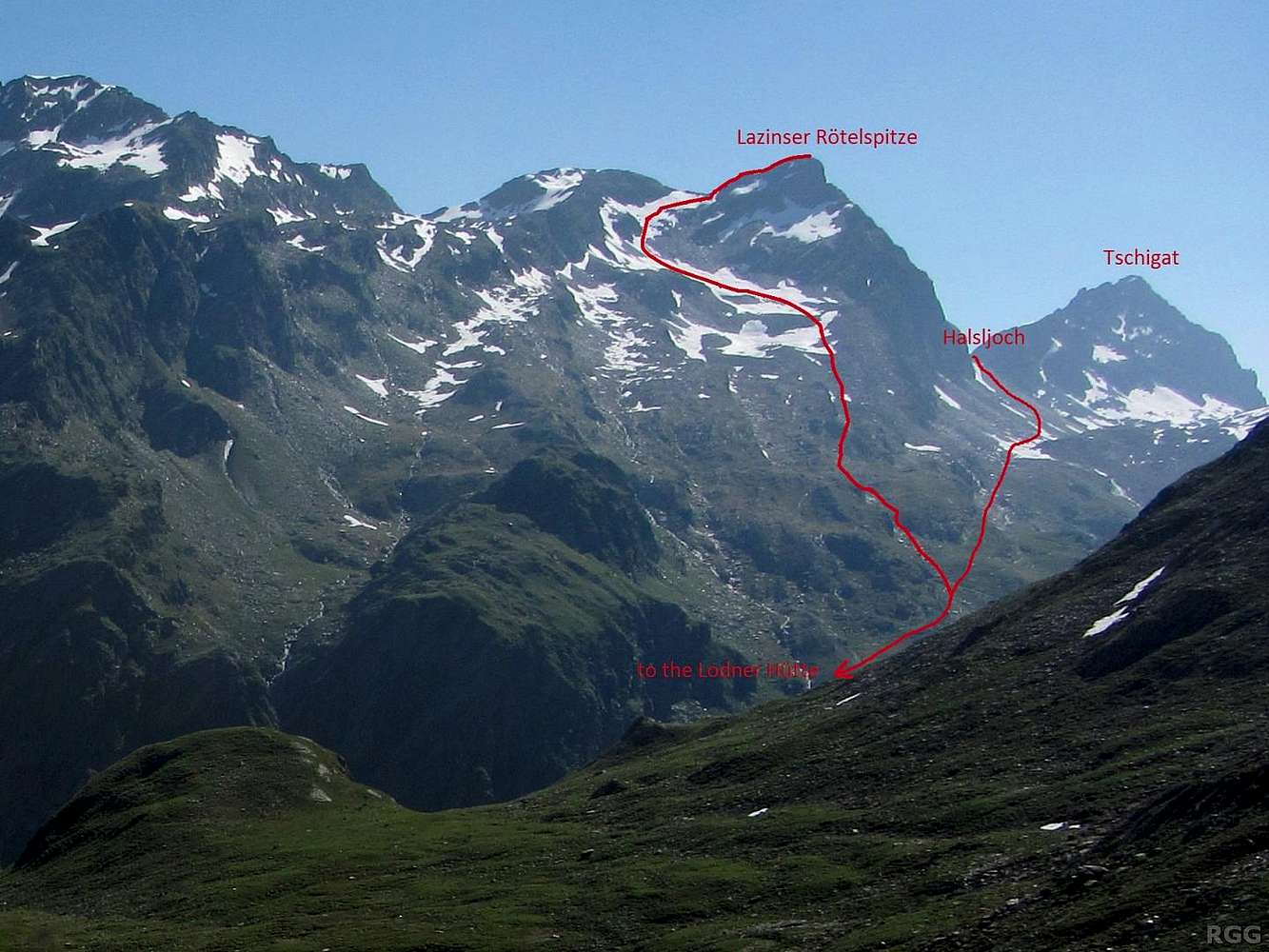
The normal route of Lazinser Rötelspitze (3037m) follows the SE ridge from the Halsljoch (2808m), the saddle with Tschigat. A steep hiking trail leads up to the Halsljoch from the Lodner Hütte (2259m), deep down below in the Zieltal. The trail on the other side of the saddle, down Andelsboden to the Lazinser Alm, is easier. Neither the SE ridge nor the saddle itself are visible in this photo, but it's right around the corner.
Yesterday I got to the Halsljoch from the other side, and since the Lazinser Rötelspitze wasn't all that much higher anyway, I went up. The night before I had slept at the Lodner Hütte and I was expected back there, but as I was in an experimental mood, instead of returning to the saddle and hiking down the trail I thought I would try to find a more direct way down.
That idea had actually been born the day before, when I saw the slopes of the mountain during my hike up in Zieltal:
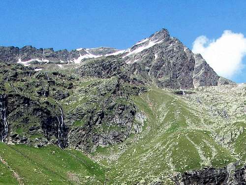 Lazinser Rötelspitze from the SW, from the hiking trail up the Zieltal valley
It was too far away to be sure, but it didn't look too difficult. And, sure enough, it wasn't. Only on the summit ridge did I need my hands.
As I'm hiking up the Lafaistal one day later, further west, I have a good look back at the mountain. The Lodner Hütte isn't visible, but my descent route is, all the way down to where I rejoined the hiking trail.
16 July 2013.


