Welcome to SP!  -   
 
  MbPost.com -- It's SP for Mountain Biking!
Areas & Ranges·Mountains & Rocks·Routes·Images·Articles·Trip Reports·Gear·Other·People·Plans & Partners·What's New·Forum

Alternative map

 
[ Sizes: Orig | Large | Med | Small | Thumb ]
Alternative map
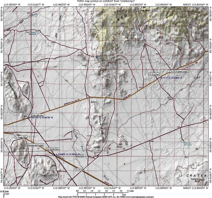
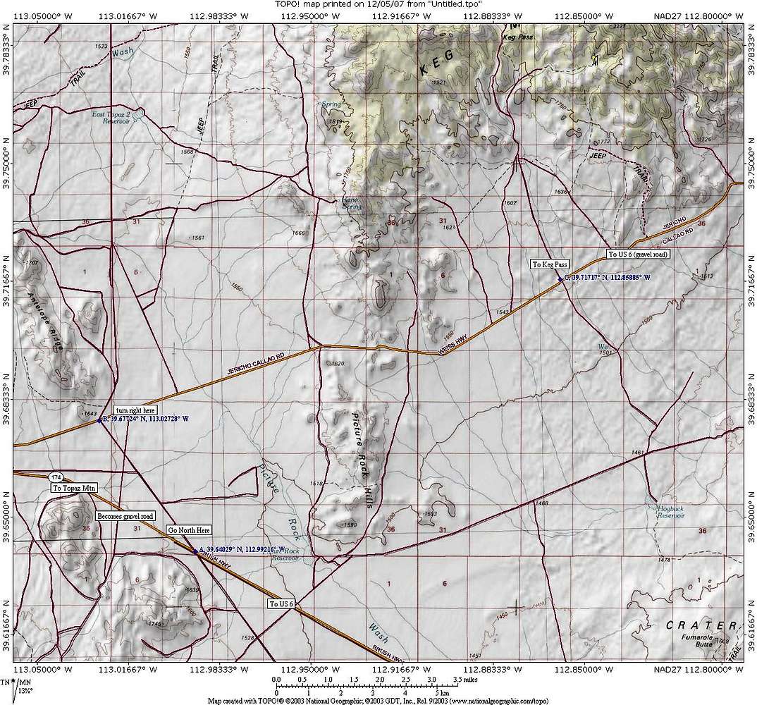
From Lynndyl on US 6, head towards Delta until Milepost 100 and watch for the turnoff for highway 174. It goes past the steam plant and heads towards Topaz Mountain. At point A, turn north onto a dirt road which will hook into another dirt/gravel road at point B. Turn east until you reach the road heading north that is signed for Keg Pass. Follow instructions provided on the "getting there" portion of the Keg Mtn page. Not necessary to vote on this picture as it is for information only


Comments

No comments posted yet.


Sign in to post!

Don't have an account? Register now.


Rate This Image
Current Score: 86.71

Log In To Vote
 Keg Mountain (UT) (Mountain/Rock)

The road heads
« PREV

Viewing
#20 of 23
GALLERY
South of the Peak
NEXT »

 Dean's Image Gallery

Looking at Latour Peak and Twin Crags
« PREV

Viewing
#4844 of 6117
GALLERY
Tintic Mountain Benchmark
NEXT »
Image Data

DeanSubmitted by Dean
on Dec 5, 2007 7:26 am

Image ID: 362872
Hits: 523 

Lat/Lon: 39.78890°N / 112.8406°W


"Gravity is a harsh mistress."   --The Tick   

© 2006-2012 SummitPost.org. All Rights Reserved.