Welcome to SP!  -   
 
  MbPost.com -- It's SP for Mountain Biking!
Areas & Ranges·Mountains & Rocks·Routes·Images·Articles·Trip Reports·Gear·Other·People·Plans & Partners·What's New·Forum

Annotated topo map of Smith...

 
[ Sizes: Orig | Med | Small | Thumb ]
Annotated topo map of Smith...
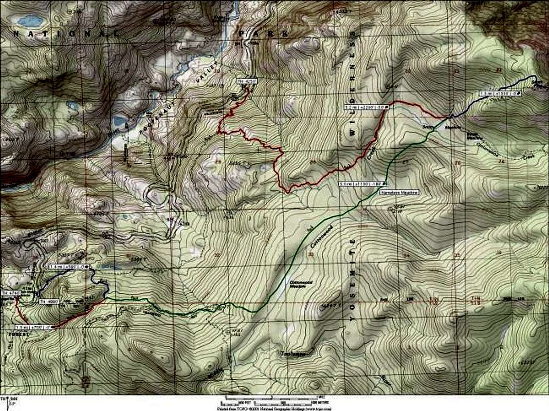
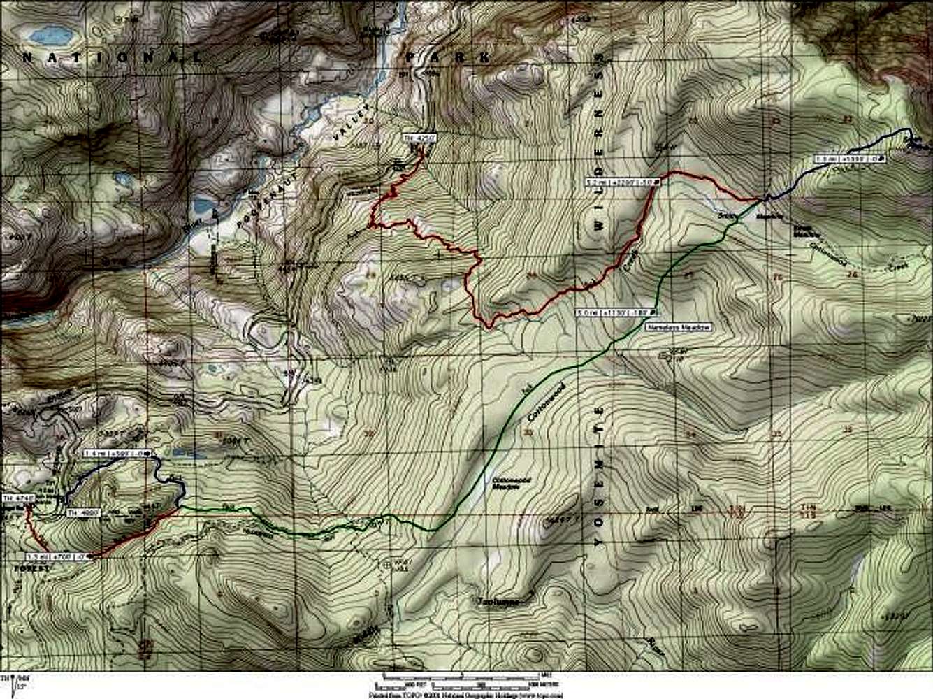
Annotated topo map of Smith Peak climb. Route described in text is the route from Mather Ranger Station (red-green-blue), which climbs around 3200 feet over 7.3 miles, with nearly half of the elevation gain coming on the final push to the summit. My apologies for the (un)readability of the map; go here for a large version


Comments

No comments posted yet.


Sign in to post!

Don't have an account? Register now.


Rate This Image
Current Score: 80.36

Log In To Vote
 Smith Peak Trail (Route)


You are at
the First
Image

Viewing
#1 of 3
GALLERY
Descending snowfield on Smith...
NEXT »

 mpbro's Image Gallery

Blue Lakes Basin and Dallas...
« PREV

Viewing
#160 of 304
GALLERY
Morgan near the top of the...
NEXT »


 Smith Peak (Mountain/Rock)


Image Data

mpbroSubmitted by mpbro
on May 26, 2003 12:38 am

Image ID: 20871
Hits: 1482 

Lat/Lon: 37.92670°N / 119.7342°W


"When our memories outweigh our dreams, we have grown old."

© 2006-2012 SummitPost.org. All Rights Reserved.